

Free Jackson County Mountains Travel Guide & Mobile App
Explore Jackson County Mountains with free travel guides. Discover regional history, expert tips, proposed trips, and audio guides on web or mobile app.


Explore Jackson County Mountains in Alabama for Appalachian scenery, cave archaeology, Lake Guntersville, hiking and small-town history.
Read more about Jackson County Mountains
Getting to and around Jackson County Mountains
How to get there
Transportation
Best landmarks in Jackson County Mountains
Russell Cave is the region's most significant archaeological landmark: its vast natural shelter preserves evidence of repeated human occupation and gives physical form to the deep history of the Tennessee River valley. The cave's limestone entrance and wooded setting matter as much as the interpretation inside the monument. Sauta Cave is another important natural landmark, recognised not simply for its geology but for the protected bat habitat associated with its underground chambers. The Tennessee River and the reservoir landscapes connected with Lake Guntersville form the region's broadest geographical landmark, changing from a defined channel into open water between forested shores and ridges. In the eastern county, the rugged ravines and limestone walls of the Walls of Jericho area create a striking Appalachian landscape shared across the Alabama–Tennessee border; the Alabama access and wilderness portion are within Jackson County, while the wider preserve continues into Tennessee. Scottsboro's civic and historic sites also carry significance because the town name is inseparable from the Scottsboro Boys case and its place in American legal history.
-
Museum
Burritt on the Mountain
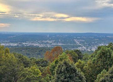
Explore history, nature, and breathtaking views at Huntsville's unique open-air museum on Round Top Mountain. A treasure for all ages.
-
Historical landmark
Tennessee/Alabama/Georgia Stateline Marker
Discover the point where Tennessee, Alabama, and Georgia meet, offering a unique photo opportunity and a glimpse into surveying history.

Explore Jackson County Mountains on the map
Plan your trip on one map. See where the top cities, national parks and sights are, and book hotels and experiences in a few clicks.
Best hotels in Jackson County Mountains
Best restaurants in Jackson County Mountains
Dining in the Jackson County Mountains reflects north-eastern Alabama's Southern foodways, with barbecue, fried catfish, burgers, biscuits, vegetables, sandwiches and homestyle plates common in locally oriented restaurants and cafés. Scottsboro has the county's broadest choice, from casual independent eateries to familiar American dining, while smaller communities tend to centre on cafés, diners and family-run establishments. Lake and river locations make freshwater fish a natural part of the regional food landscape, although menus and availability vary. Country stores and farm stands may offer seasonal produce, baked goods or locally made pantry items, and farmers' markets are useful places to look for Alabama-grown fruit and vegetables when operating. Sweet tea, pecan-based desserts and other Southern staples are widespread national-regional crossover foods rather than exclusive Jackson County specialities. Visitors should expect early closing times in rural areas and plan provisions before heading to remote trailheads or cave sites.
-
American
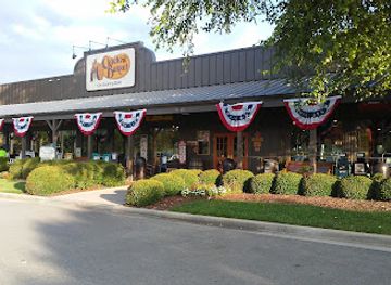
Cracker Barrel Old Country Store
Experience authentic Southern flavors at Cracker Barrel Old Country Store in Madison – where comfort food meets warm hospitality.
-
Restaurant
Cook Out
Experience the best of American fast food at Cook Out in Jacksonville - delicious burgers, barbecue delights, and irresistible milkshakes await!
-
Fast Food
McDonald's
Experience the classic fast-food charm at McDonald's in Stevenson - perfect for breakfast lovers and late-night snackers alike.
-
Pizza
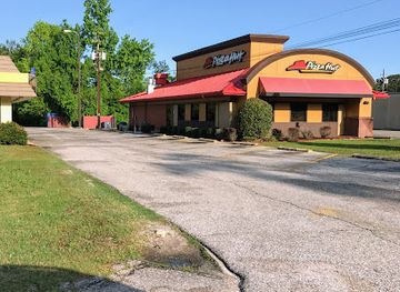
Pizza Hut
Savor the delicious flavors of Pizza Hut in Jackson, Alabama - where every slice brings joy to your taste buds!

Best shops in Jackson County Mountains
Shopping is practical and small-scale, with Scottsboro serving as the main centre for everyday retail, outdoor supplies, antiques, local services and independent businesses. Traditional high-street shopping is complemented by roadside produce stands, seasonal farm sales and markets where available, especially for fruit, vegetables, preserves, baked goods and other Alabama products. Visitors interested in regional souvenirs can look for locally made crafts, artwork, pottery, books on Appalachian and civil-rights history, and food products that travel well. Smaller communities such as Bridgeport and Stevenson offer a slower browsing experience with fewer shops and more limited opening patterns. The area's best purchases are generally useful or locally connected rather than luxury goods: outdoor equipment for the mountains, regional produce, handmade items and books or interpretive material connected with Russell Cave, the Tennessee River and Jackson County history.
-
Craft store
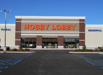
Hobby Lobby
Discover a world of creativity at Hobby Lobby, your ultimate destination for art supplies, fabrics, and home decor in Albertville, Alabama.
-
Souvenir store
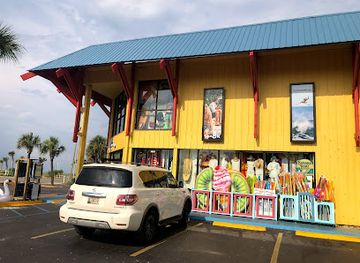
Alvin's Island - Gulf Shores #19
Discover the spirit of Gulf Shores at Alvin's Island, your ultimate destination for beachwear, souvenirs, and gifts!
-
Discount store
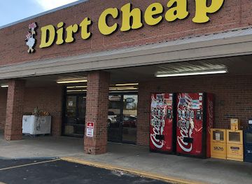
Dirt Cheap
Experience unbeatable discounts at Dirt Cheap in Jackson, Alabama, where every visit reveals new treasures at budget-friendly prices.
-
Outdoor clothing and equipment shop
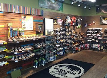
Mountain High Outfitters
Your ultimate destination for outdoor gear in Huntsville, Alabama, offering a wide range of equipment, clothing, and expert advice for every adventure.
Get your free copy of our complete guide to Jackson County Mountains, delivered straight to you.
Everything on this page, from attractions and restaurants to essentials and local phrases, in one PDF you can read offline, print or share.
Already have an account? Sign in
Your Jackson County Mountains guide is ready.
We'll send it to · Not you? Sign out

Getting your guide ready…
We are putting together a fresh copy of the Jackson County Mountains guide. This can take up to a minute.
This can take a few moments. If your browser asks, choose Allow so the download can start. You'll find the guide in your Downloads folder.
Nothing happened? Download it again
Sorry, the guide is taking longer than usual. Please try again in a minute, or get it by email instead.
Jackson County Mountains essentials
Currency and Payment
Safety
Emergency Situations
Do's and Don'ts
Local Tips
From Eve
Local phrases worth knowing
You don't need to get them perfect. A few words go a long way, and locals appreciate the effort.
Basics
| English | Local | Say it |
|---|---|---|
| Hello | Howdy | [Hau-dee] |
| Goodbye | See ya | [See yah] |
| Yes | Yep | [Yep] |
| No | Nope | [Nope] |
| Please/You're welcome | Please/No problem | [Please/No prob-lem] |
| Thank you | Thank ya | [Thank yah] |
| Excuse me/Sorry | Excuse me/Sorry 'bout that | [Ex-cuse me/Sorry 'bout that] |
| How are you? | How ya doin'? | [How yah doin'?] |
| Fine. And you? | Good. How 'bout you? | [Good. How 'bout you?] |
| Do you speak English? | Ya speakin' English? | [Ya speakin' Ing-lish?] |
| I don't understand | I don't get it | [I don't get it] |
Eating & Drinking
| English | Local | Say it |
|---|---|---|
| I'd like to see the menu, please | Can I see the menu, please? | [Can I see the men-u, please?] |
| I don't eat meat | I ain't eatin' meat | [I ain't eatin' meat] |
| Cheers! | Cheers! | [Cheers!] |
| I would like to pay, please | I wanna pay, please | [I wanna pay, please] |
Emergencies
| English | Local | Say it |
|---|---|---|
| Help! | Help! | [Help!] |
| Go away! | Get on outta here! | [Get on outta here!] |
| Call the Police! | Call the cops! | [Call the cops!] |
| Call a doctor! | Get a doctor! | [Get a doc-tor!] |
| I'm lost | I’m turned around | [I’m turned a-round] |
| I'm ill | I ain't feelin' good | [I ain't feelin' good] |
Shopping
| English | Local | Say it |
|---|---|---|
| I'd like to buy... | I wanna buy... | [I wanna buy...] |
| I'm just looking | Just lookin' | [Just look-in'] |
| How much is it? | How much fer that? | [How much fer that?] |
| That's too expensive | That’s too rich | [That’s too rich] |
| Can you lower the price? | Can ya bring the price down? | [Can ya bring the price down?] |
Time & Numbers
| English | Local | Say it |
|---|---|---|
| What time is it? | What time ya got? | [What time ya got?] |
| It's one o'clock | It's one o'clock | [It's one o'clock] |
| Half past (10) | Half past ten | [Half past ten] |
| Morning | Mornin' | [Mornin'] |
| Afternoon | Afternoon | [Afternoon] |
| Evening | Evenin' | [Evenin'] |
| Yesterday | Yesterday | [Yesterday] |
| Today | Today | [Today] |
| Tomorrow | Tomorrow | [Tomorrow] |
| 1 | One | [One] |
| 2 | Two | [Two] |
| 3 | Three | [Three] |
| 4 | Four | [Four] |
| 5 | Five | [Five] |
| 6 | Six | [Six] |
| 7 | Seven | [Seven] |
| 8 | Eight | [Eight] |
| 9 | Nine | [Nine] |
| 10 | Ten | [Ten] |
Transport & Directions
| English | Local | Say it |
|---|---|---|
| Where's a/the...? | Where's a...? | [Where's a...?] |
| What's the address? | What’s the address? | [What’s the ad-dress?] |
| Can you show me (on the map)? | Can ya show me on the map? | [Can ya show me on the map?] |
| When's the next (bus)? | When's the next bus? | [When's the next bus?] |
| A ticket (to ....) | A ticket to ... | [A ticket to ...] |
History of Jackson County Mountains
Russell Cave and Indigenous Occupation
Russell Cave, near Bridgeport, contains evidence of human occupation extending for thousands of years, making it one of the region's clearest records of prehistoric life in the south-eastern United States. The cave's sheltered entrance, dependable water and situation near the Tennessee River helped successive communities live, hunt and make tools in the area. The archaeological deposits illustrate changing technologies and foodways long before European settlement. Today, Russell Cave National Monument presents this deep history within its geological setting, while the wider cave-rich landscape shows why the river valleys and plateau margins were enduring routes through the Appalachian South.
Cherokee Country and Forced Removal
Before Alabama statehood and the expansion of American settlement, the wider Jackson County area formed part of the homeland and travel geography of the Cherokee. Communities, farms and established routes existed across north-eastern Alabama and neighbouring Tennessee and Georgia. During the 1830s, United States removal policy forced Cherokee people westward along routes remembered as the Trail of Tears. The county's later towns and farms were built within this contested transformation. Interpreting the region's history therefore requires recognising both the long Indigenous presence and the profound disruption caused by land cession and removal.
River Trade, Railways and County Settlement
The Tennessee River was a major geographical influence on Jackson County settlement, offering transport, fishing and access to markets, while the surrounding ridges and valleys shaped farming and road building. Communities such as Bridgeport and Stevenson developed in connection with river commerce and railway construction in the nineteenth century. Rail links helped move agricultural goods, timber and manufactured products beyond the mountain region, and Scottsboro grew as a county centre. Much of the modern landscape still reflects this relationship between water routes, rail corridors, plateau resources and dispersed rural settlement.
Industrial and Agricultural Development
During the nineteenth and twentieth centuries, Jackson County combined agriculture with small-scale industry, timber work, quarrying, transport and manufacturing. The fertile valleys and river margins supported farms, while the plateau supplied forests, stone and challenging terrain that influenced where communities could expand. Industrial employment and changing transport networks gradually drew residents towards the larger towns, though farming remained important. This mixed economy helps explain the region's settlement pattern: modest town centres separated by wooded ridges, working landscapes and long stretches of countryside rather than a continuous urban area.
The Scottsboro Boys Case, 1931
In 1931, nine Black teenagers were arrested in Scottsboro after an accusation arising from a freight-train journey through northern Alabama. Their trials, convictions and appeals exposed racial injustice, inadequate legal representation and the influence of public pressure on the judicial system. The case attracted national and international attention, involved the United States Supreme Court in landmark decisions concerning the right to counsel and fair trials, and became a defining episode in the history of American civil rights. Museums and historical interpretation in Scottsboro place the events within the county's social and legal landscape.
The Tennessee River Transformed
Twentieth-century dam building and water-management projects altered the Tennessee River valley, changing navigation, flood control, electricity generation and local economies. The resulting reservoirs broadened parts of the river into lake landscapes that now support fishing, boating, wildlife habitat and tourism. The transformation also changed shorelines, transport patterns and some established communities. In Jackson County, the relationship between mountain ridges and the wide waters associated with Lake Guntersville remains one of the clearest modern expressions of how engineering reshaped the region's geography.
Conservation and Outdoor Recreation
As agriculture and industry changed, conservation efforts increasingly protected caves, forests, wetlands and river habitats. Russell Cave became a national monument, Sauta Cave received refuge protection for its bat colony, and the Walls of Jericho area gained recognition for its rugged watershed and biodiversity. These places represent a modern shift from using the mountains chiefly for extraction and transport towards interpretation, habitat protection and carefully managed recreation. Hiking, wildlife observation, paddling and heritage tourism now complement the region's long-standing farming and working-landscape traditions.
Jackson County Mountains in Photos
Browse through our photo collection highlighting the charm and character of the destination.
Neighbouring regions of Jackson County Mountains
The closest regions to Jackson County Mountains, if you have time for more than one.
-

-

-

-

-


Swipe for more regions
Explore more

Explore more of Alabama
Discover Alabama: A Southern state rich in history, culture, and natural beauty, offering unforgettable experiences from vibrant cities to serene beaches and majestic mountains.
Explore Alabama