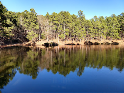
Ouachita National Recreation Trail: A Backcountry Gem
Hike through the Ouachita Mountains on this 223-mile trail, offering solitude, scenic views, and a diverse landscape in Arkansas and Oklahoma.
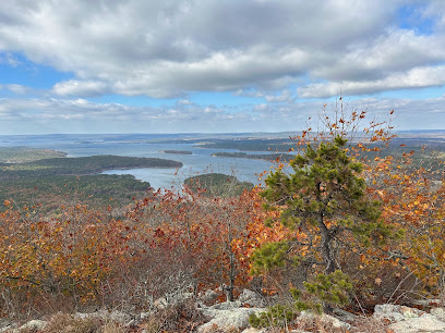
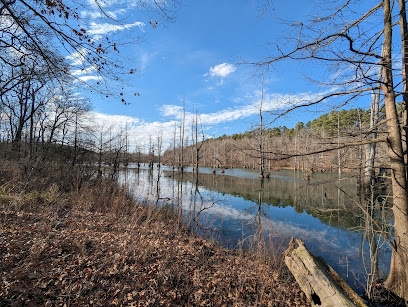
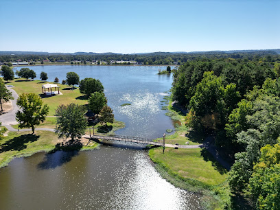
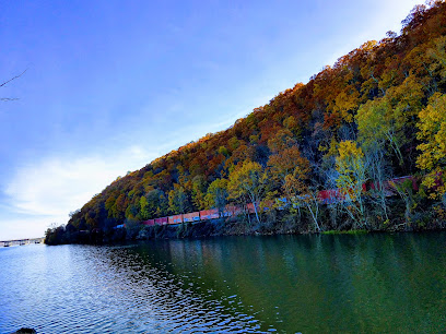
The Ouachita National Recreation Trail is a 223-mile-long hiking trail that traverses the Ouachita Mountains of Arkansas and Oklahoma. Known for its solitude and scenic views, the trail offers a diverse landscape of forested mountains, valleys, and clear streams.
A brief summary to Ouachita National Recreation Trail
- Little Rock, Arkansas, 72223, US
- Visit website
Local tips
- Water sources can be scarce, especially during dry periods, so be sure to carry enough water and a way to treat it.
- The best times to hike the trail are early spring and late autumn due to milder temperatures.
- Check the Friends of the Ouachita Trail (FoOT) website for current trail conditions and updates.
Getting There
-
Driving
The Ouachita Trail has multiple access points along its 223-mile length. To access the western terminus from Talihina, OK, take Highway 271 to Talimena State Park. Parking is available for a day-use fee of $5. For the eastern terminus, drive to Pinnacle Mountain State Park west of Little Rock. Follow the signs to the park's visitor center.
-
Walking
Once you reach a trailhead, the Ouachita Trail is marked with blue blazes. These markers indicate the path to follow. Be prepared for a variety of terrains, from rocky inclines to stream crossings. Ensure you have appropriate footwear and gear for hiking.
Discover more about Ouachita National Recreation Trail
Iconic landmarks you can’t miss
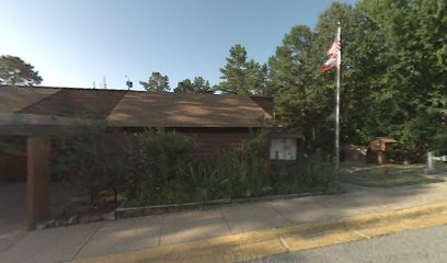
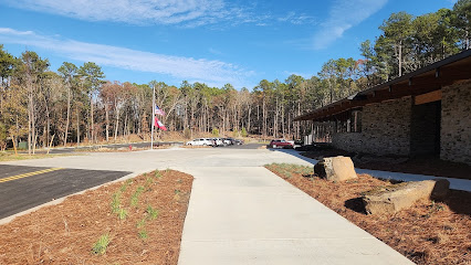
Pinnacle Mountain State Park Old Visitor Center
0.1 km
Explore the Pinnacle Mountain State Park Old Visitor Center, your gateway to breathtaking views and outdoor adventures in Little Rock, Arkansas.
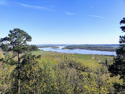
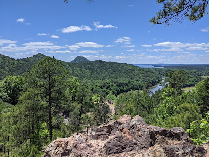
Pinnacle Mountain State Park Scenic Overlook
0.2 km
Experience the breathtaking beauty of Pinnacle Mountain State Park Scenic Overlook, where nature meets stunning views of the Arkansas River and beyond.
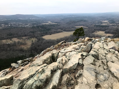
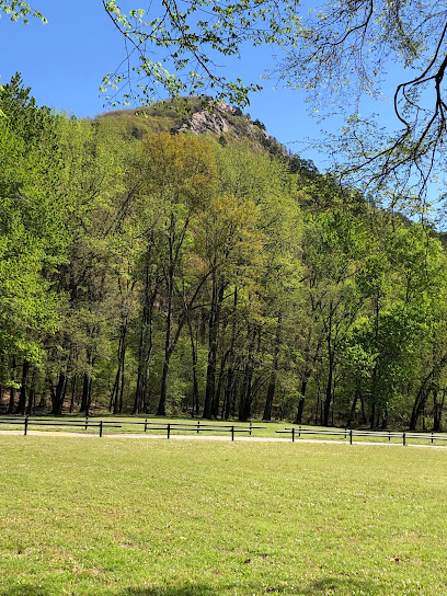
Pinnacle Mountain
2.1 km
Explore Pinnacle Mountain, a breathtaking peak in Arkansas offering stunning views, diverse wildlife, and exhilarating hiking trails for every adventurer.
Pinnacle Mountain State Park Visitor Center
2.8 km
Explore the natural beauty and diverse ecosystems at Pinnacle Mountain State Park Visitor Center, your gateway to outdoor adventures in Arkansas.
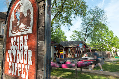
Ozark Outdoor Supply
14.3 km
Gear up for your next adventure at Ozark Outdoor Supply, Arkansas's oldest and most experienced outdoor outfitter, since 1972!
Cherry-Luter Estate
17.2 km
Discover the enchanting Cherry-Luter Estate, a historical landmark in North Little Rock, Arkansas, showcasing timeless architecture and serene gardens.
St. Joseph Center of Arkansas
17.8 km
Explore a historic farm blending agriculture, arts, and community. Visit St. Joseph Center for local produce, events, and a touch of history.
City tree of North Little Rock
18.9 km
Discover the City Tree of North Little Rock, a historic landmark that embodies the spirit and heritage of this charming Arkansas community.
Arkansas Parks & Tourism
19.1 km
Discover the charm of Arkansas at the Parks & Tourism Center, your essential stop for travel tips and local insights in Little Rock.
Arkansas American Revolution Bicentennial Memorial
19.2 km
Explore the Arkansas American Revolution Bicentennial Memorial, a serene historical landmark that honors the state's contributions to America's fight for independence.
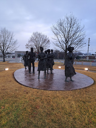
The Monument to the Little Rock Nine
19.2 km
Explore the Monument to the Little Rock Nine, a significant historical landmark in Arkansas commemorating the courage of civil rights pioneers.
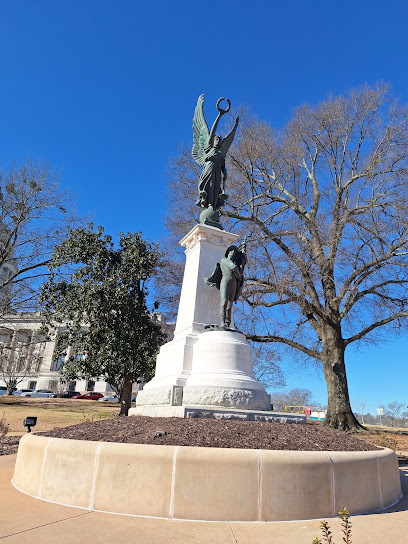
Confederate Soldiers Monument (Little Rock, Arkansas)
19.3 km
Explore the Confederate Soldiers Monument in Little Rock, Arkansas, a poignant tribute reflecting the state's rich and complex history amidst a vibrant downtown atmosphere.
Historic Terminal Hotel
19.4 km
Explore Little Rock's railroad history at the Historic Terminal Hotel, a Classical Revival landmark near Union Station.

Monument to Confederate Women
19.4 km
Explore the Monument to Confederate Women in Little Rock, a poignant tribute to the sacrifices of women during the Civil War, surrounded by vibrant downtown culture.

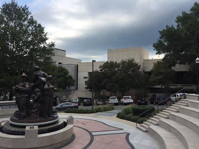
Arkansas Heritage
19.5 km
Discover Arkansas Heritage in Little Rock, a cultural hub celebrating the state's rich history and vibrant traditions, perfect for tourists and history enthusiasts.

Unmissable attractions to see
Pinnacle Mountain State Park
1.1 km
Discover Arkansas' natural beauty and outdoor adventure at Pinnacle Mountain State Park, a short drive from Little Rock.
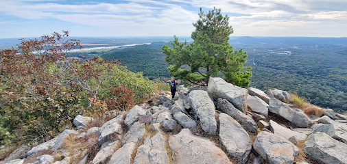
Pinnacle West Summit Trails
1.1 km
Hike the popular West Summit Trail at Pinnacle Mountain for stunning views and a challenging climb in a beautiful state park setting.

Pinnacle Mountain East Summit Trailhead
1.4 km
Challenge yourself with a hike up Pinnacle Mountain's East Summit Trail for unmatched views of the Arkansas River Valley in Pinnacle Mountain State Park.
Arkansas Arboretum
1.6 km
Explore Arkansas's diverse ecosystems along an accessible trail at the Arkansas Arboretum in Pinnacle Mountain State Park.
Pinnacle Mountain West Summit Trail
2.8 km
Hike the West Summit Trail for panoramic views from Pinnacle Mountain, a must-see natural landmark near Little Rock, Arkansas.
Kingfisher Trail
2.9 km
An accessible and scenic paved trail through a unique bottomland forest at Pinnacle Mountain State Park, perfect for a relaxing nature walk.
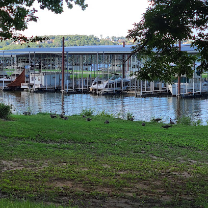
Maumelle Park
3.0 km
Riverside camping and outdoor adventures await at Maumelle Park, a scenic retreat near Little Rock with hiking, fishing, and birdwatching.
William Kirsch Preserve within Ranch North Woods
3.4 km
Escape to nature in the heart of Little Rock: Hike, bike, and explore the scenic beauty of William Kirsch Preserve.
Pinnacle View Trail
3.8 km
Hike Pinnacle View Trail in Little Rock for stunning scenery, diverse trails, and an unforgettable outdoor adventure in Arkansas' natural beauty.

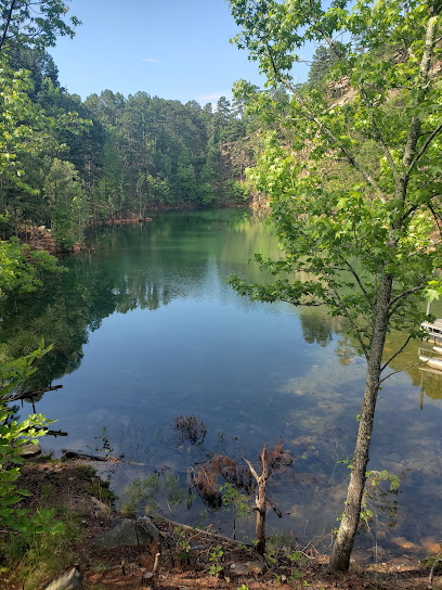
Lake Willastein Park
4.8 km
Discover natural beauty and recreation at Lake Willastein Park in Maumelle, Arkansas. Walking trails, fishing, playgrounds, and WWII history await!
Rattlesnake Ridge Natural Area
5.3 km
Explore scenic trails, rock climb, and witness unique species at Rattlesnake Ridge Natural Area, a conservation haven near Little Rock, Arkansas.

Chalamont Park & Pool
5.4 km
Discover a refreshing escape at Chalamont Park & Pool in Little Rock, offering recreation and relaxation for the whole family.
Golden Dunes
5.6 km
Escape to the serene beauty of Golden Dunes in Maumelle, Arkansas, for a peaceful retreat into nature and outdoor adventures.
River Mountain
6.3 km
Explore Little Rock's natural side with scenic trails, thrilling bike routes, and tranquil hiking paths at River Mountain Park.
Conner Park
6.4 km
Escape to nature in Little Rock at Conner Park, offering fishing, walking trails, and a tranquil lake setting for a perfect outdoor experience.
Essential places to dine
Subway
4.1 km
Discover fresh flavors at Subway in Little Rock – your go-to destination for customizable sandwiches and quick bites.
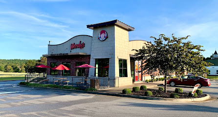
Wendy's
4.1 km
Discover delicious fast food at Wendy's in Little Rock - home of fresh ingredients and iconic burgers.
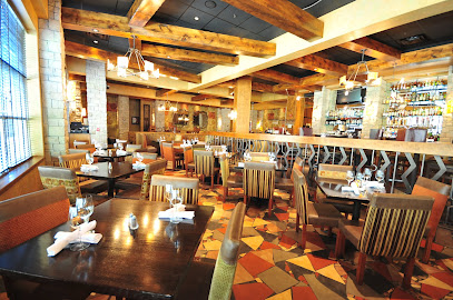
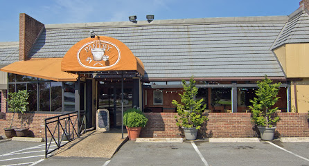
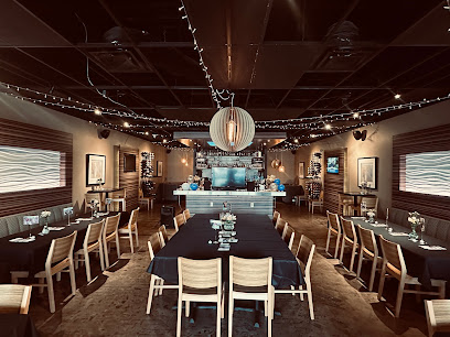
Capers Restaurant
5.4 km
Experience exquisite American cuisine at Capers Restaurant in Little Rock—where every dish tells a story of flavor and creativity.
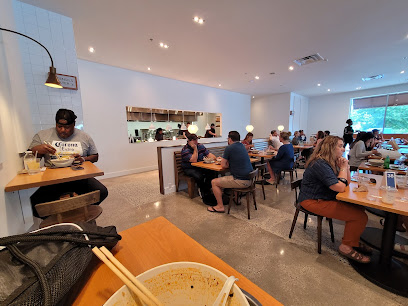
Three Fold Noodles + Dumpling Co. at Pleasant Ridge
7.9 km
Experience authentic Asian flavors at Three Fold Noodles + Dumpling Co., where every dish tells a delicious story.
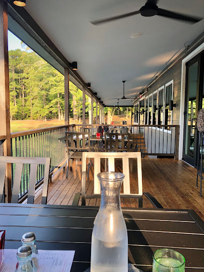
Cypress Social
8.0 km
Experience the best of Arkansas dining at Cypress Social – where culinary creativity meets lively social gatherings.
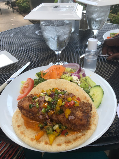
Local Lime : Little Rock
8.5 km
Discover Local Lime in Little Rock - where authentic Mexican flavors meet Tex-Mex flair in a vibrant dining atmosphere.
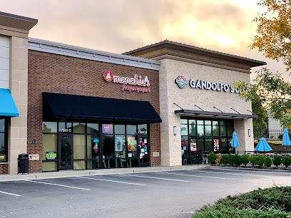
Gandolfo's Delicatessen
8.6 km
Discover Gandolfo's Delicatessen in Little Rock: A delightful destination for scrumptious deli sandwiches and hearty breakfasts.
YaYas Euro Bistro in Little Rock
8.8 km
Experience the best of modern European and American cuisine at YaYas Euro Bistro in Little Rock – where flavor meets elegance.
The Terrace - Mediterreanean Kitchen
9.7 km
Discover authentic Mediterranean flavors at The Terrace - Mediterranean Kitchen in Little Rock for an unforgettable dining experience.
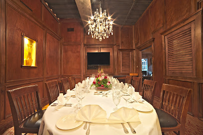
Arthur's Prime Steakhouse
9.7 km
Experience exquisite steaks and fine dining at Arthur's Prime Steakhouse in Little Rock – where every meal is a celebration of flavor.
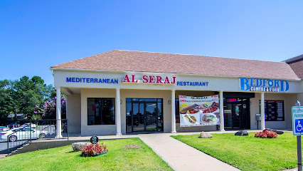
Al Seraj Mediterranean Restaurant & Market
9.9 km
Experience authentic Mediterranean cuisine at Al Seraj Mediterranean Restaurant & Market in Little Rock - where flavors meet tradition.
The Pantry Restaurant
9.9 km
Experience authentic European cuisine at The Pantry Restaurant in Little Rock, where every dish tells a delicious story.
Petit & Keet
10.3 km
Discover the flavors of Petit & Keet in Little Rock - where delicious food meets warm hospitality in a vibrant atmosphere.
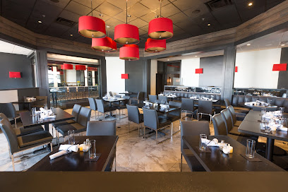
Table 28
10.5 km
Experience the finest American cuisine at Table 28 in Little Rock - where unique flavors meet elegant dining.
Five Guys
10.8 km
Savor the essence of American fast food at Five Guys in Little Rock – where quality meets customization in every burger.
Markets, malls and hidden boutiques
Garlene's Garden
2.0 km
Explore Garlene's Garden in Roland, Arkansas, where floral artistry meets nature's beauty for unforgettable arrangements and experiences.
Connie At Natural Steps
2.1 km
Explore the artistry of dressmaking at Connie At Natural Steps, where custom fashion meets personalized service in beautiful Roland, Arkansas.
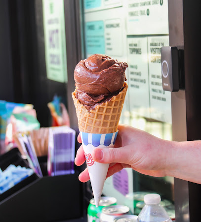
Loblolly Outpost
2.9 km
Experience the joy of artisanal ice cream at Loblolly Outpost, where local flavors meet sweet indulgence in the heart of Arkansas.
Tammy's Simple Designs
3.9 km
Explore your creativity at Tammy's Simple Designs, the premier custom t-shirt store in Maumelle, Arkansas, for unique and personalized apparel.

Pinnacle Valley Liquor
4.0 km
Discover a premier liquor store in Little Rock, offering a vast selection of spirits, wines, and craft beers with friendly service.
Agate Stripping Guides
5.2 km
Discover the art of agate stripping in Little Rock, Arkansas, at Agate Stripping Guides, where nature meets creativity and adventure.

Blissful Kreations
5.3 km
Discover unique handcrafted gifts at Blissful Kreations in Maumelle, Arkansas - a charming destination for memorable souvenirs and local artistry.

Pure Infinite
5.3 km
Explore Pure Infinite in Maumelle, Arkansas—your ultimate destination for trendy clothing and unique styles that elevate your wardrobe.
Paradise Christian Clothing
5.4 km
Explore a unique blend of contemporary and classic fashion at Paradise Christian Clothing in Maumelle, Arkansas.

June's Hallmark Shop
5.4 km
Delve into a world of gifts and greetings at June's Hallmark Shop in Maumelle, AR, perfect for every occasion and celebration.

Mickey's Gifts
5.7 km
Explore the charm of Arkansas at Mickey's Gifts, your ultimate destination for unique souvenirs and delightful treasures.
Essential Frills
5.8 km
Explore Essential Frills in Maumelle, Arkansas for unique gifts, custom t-shirts, and vibrant fashion accessories that capture local charm.
Powder & Smoke
7.9 km
Explore the unique offerings of Powder & Smoke, a Little Rock gift shop showcasing local craftsmanship and one-of-a-kind treasures.
Pleasant Ridge Town Center
8.1 km
Discover the charm of Pleasant Ridge Town Center, Little Rock's premier shopping destination featuring boutiques, dining, and a vibrant atmosphere for all.
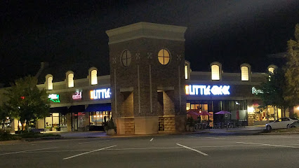
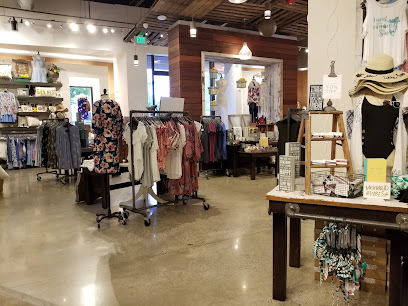
Altar'd State Promenade at Chenal
8.6 km
Explore Altar'd State Promenade at Chenal for trendy women's fashion and a commitment to charitable causes in Little Rock, Arkansas.
Essential bars & hidden hideouts
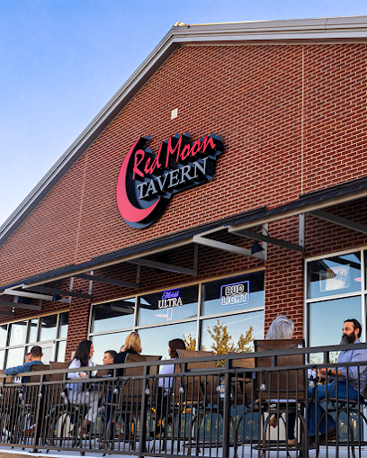
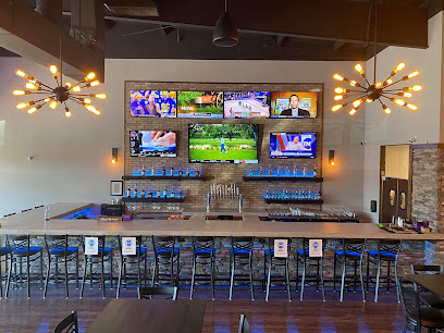
Red Moon Tavern
4.2 km
Experience the essence of Southern cuisine at Red Moon Tavern in Little Rock, where delicious flavors meet a cozy atmosphere.
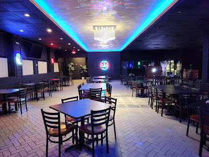
Overtime Lounge
5.5 km
Discover the vibrant atmosphere and delectable menu at Overtime Lounge in Maumelle, Arkansas - the perfect spot for food and fun.
THE PUB
5.9 km
Experience the lively atmosphere and extensive drink menu at The Pub in Maumelle, your go-to spot for local nightlife and entertainment.

Blue Court Grill at Little Rock Athletic Club
7.1 km
Experience the vibrant flavors of Blue Court Grill in Little Rock, where culinary creativity meets a welcoming atmosphere.

Bar Louie - Pleasant Ridge Town Center
8.0 km
Experience vibrant dining at Bar Louie in Pleasant Ridge, offering American grill favorites and innovative cocktails in a lively atmosphere.
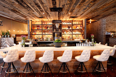
WXYZ Bar
8.5 km
Discover WXYZ Bar in Little Rock, a lively bar offering a diverse drink menu and an inviting atmosphere perfect for socializing or unwinding after a day of exploring.

Ton's Place
9.3 km
Discover Ton's Place in North Little Rock, a lively bar with a welcoming atmosphere and an extensive drink selection perfect for relaxation and socializing.
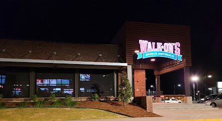
Walk-On's Sports Bistreaux - Little Rock, AR
9.9 km
Experience the perfect blend of delicious food and lively sports at Walk-On's Sports Bistreaux in Little Rock, where every meal is a celebration.
Grumpy's Too Neighborhood Bar & Grill
10.0 km
Savor the heart of Little Rock at Grumpy's Too Neighborhood Bar & Grill – where comfort food meets local charm.
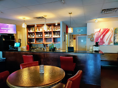
ZIN Wine Bar - Little Rock
10.2 km
Discover the sophisticated charm of ZIN Wine Bar in Little Rock, where exquisite wines and delectable small plates create an unforgettable dining experience.
Infusion Resto-Bar-Lounge
10.5 km
Discover a blend of gourmet dining and exquisite cocktails at Infusion Resto-Bar-Lounge in Little Rock, Arkansas.
Jimmy Ray's Karaoke and Dance Club
11.7 km
Experience vibrant nightlife, sing your heart out, and dance till dawn at Jimmy Ray's Karaoke and Dance Club in North Little Rock.

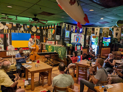
Hibernia Irish Tavern
11.9 km
Discover the heart of Irish culture at Hibernia Irish Tavern in Little Rock, where delightful cuisine and a vibrant atmosphere await you.
Rocks
12.1 km
Experience the vibrant nightlife at Rocks, a top bar in Little Rock, Arkansas, offering fantastic drinks and entertainment in a lively atmosphere.

By the Glass
14.2 km
Discover the charm of By the Glass, a Little Rock wine bar where exquisite wines and a cozy atmosphere create unforgettable experiences.
Nightclubs & after hour spots
Loony Bin Comedy Club
11.1 km
Discover the hilarity and vibrant nightlife at Loony Bin Comedy Club in Little Rock, Arkansas, where laughter and great drinks await.
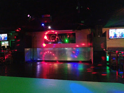
ENVY PRIVATE CLUB
17.1 km
Discover the pulse of Little Rock's nightlife at Envy Private Club, where great music and vibrant energy await every night.
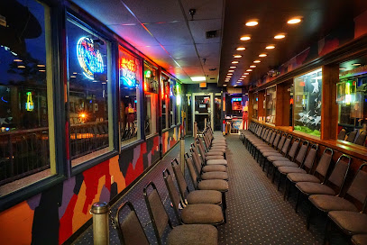
TABU Night Club
17.2 km
TABU Night Club in Little Rock offers an electrifying nightlife experience with vibrant music, stunning visuals, and a lively atmosphere for unforgettable nights.
Triniti Nightclub
17.7 km
Discover the electrifying atmosphere of Triniti Nightclub in Little Rock, where diversity and vibrant nightlife come together for an unforgettable experience.

Discovery Night Club
17.8 km
Experience the vibrant nightlife of Little Rock at Discovery Night Club, where music and energy come together for an unforgettable party.

New Developments Inc.
19.2 km
Experience the vibrant nightlife at New Developments Inc., Little Rock's top destination for dancing and entertainment in a lively atmosphere.

Club Empire
19.2 km
Experience the electrifying nightlife at Club Empire, Little Rock's premier night club, where music and fun come alive every weekend.

Club Sway
20.7 km
Discover the heart of nightlife at Club Sway, a top gay night club in Little Rock that offers an inclusive atmosphere and electrifying entertainment.

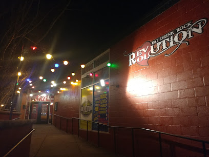
Revolution Music Room (The Rev Room)
20.9 km
Discover the heart of Little Rock's music scene at Revolution Music Room, where live performances create unforgettable memories.
Electric Cowboy
21.0 km
Discover the energetic nightlife at Electric Cowboy, a top night club and bar in Little Rock, offering themed events and a lively atmosphere.

Midtown Billiards
21.2 km
Discover the lively atmosphere of Midtown Billiards in Little Rock, where great food, live music, and fun pool games await you.
Club 27
21.2 km
Discover the vibrant nightlife of Little Rock at Club 27, the ultimate destination for dancing, events, and unforgettable experiences.
Neighbors/Area 51
24.0 km
Discover the delicious grilled dishes and vibrant pub atmosphere at Neighbors/Area 51 in Sherwood, Arkansas, a perfect stop for food lovers.
Alibi's
24.0 km
Experience the vibrant nightlife at Alibi's, a top bar in Sherwood, Arkansas, offering great drinks and an inviting atmosphere.
Walk-On's Sports Bistreaux - Conway Restaurant
25.1 km
Experience the vibrant atmosphere of Walk-On's Sports Bistreaux in Conway, where great food meets exciting sports in a family-friendly environment.