Background

Mount San Jacinto: A Sky-High Wilderness Escape

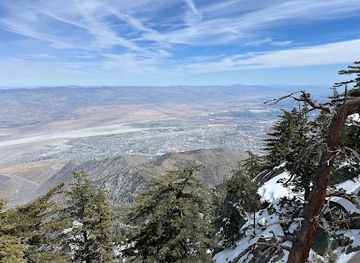
Experience breathtaking views and alpine wilderness atop Mount San Jacinto, easily accessible by tram or challenging hiking trails.

★★★★★4.8 (342)

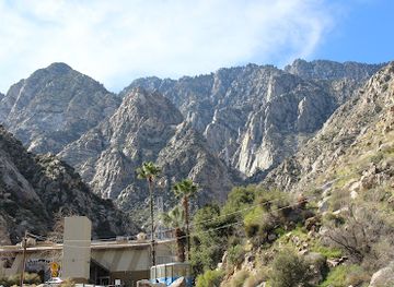
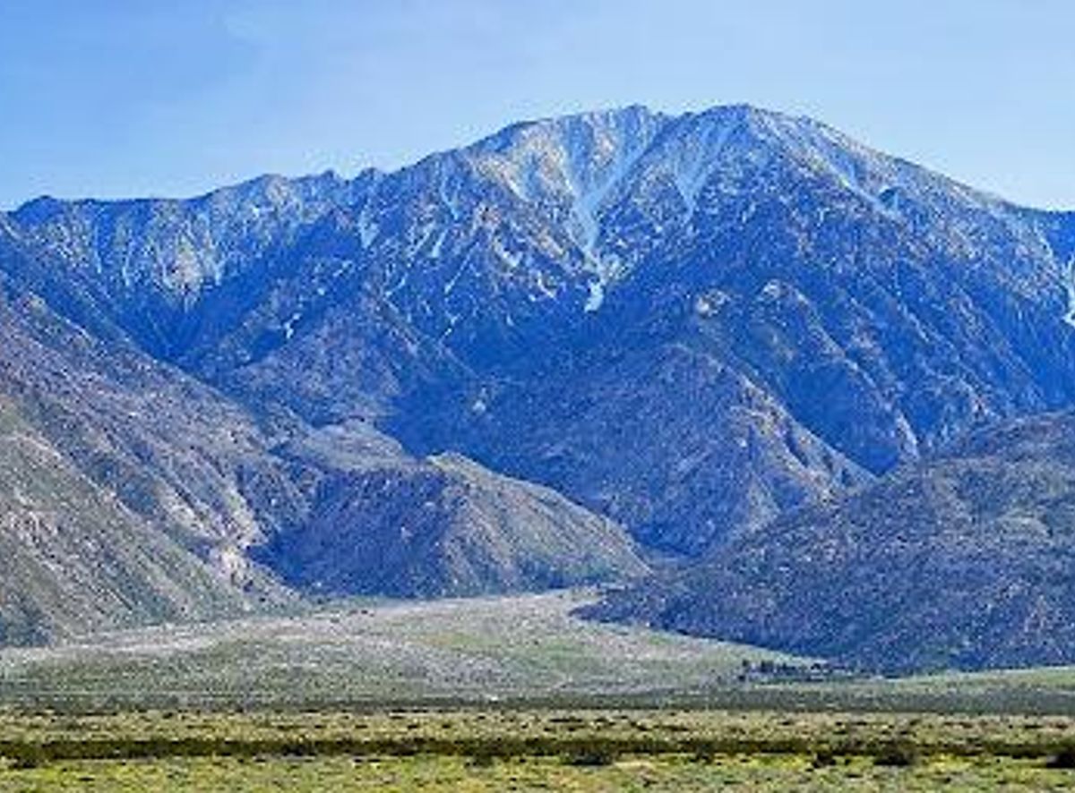
Mount San Jacinto, the highest peak in the San Jacinto Mountains and Riverside County, offers a stunning alpine escape from the desert below. Reachable via challenging hikes or a scenic tram ride, the mountain boasts panoramic views, diverse ecosystems, and a rich history shaped by indigenous cultures and early explorers.

Plan your visit

A brief summary to Mount San Jacinto

Opening times, essentials, and a few local tips gathered into one calmer, easier-to-scan planning section.

Plan your visit

📍
California, US

Explore places near Mount San Jacinto

    See all →

    Unlock the Best of Mount San Jacinto

    Find tickets, tours with entry, and experiences available for this location.

    Buy tickets

    No tickets available

    Book tours with entry

    No tours with entry available

    Book tours without entry

    No tours without entry available

    Getting There

    Tram

    The most popular way to reach Mount San Jacinto State Park is via the Palm Springs Aerial Tramway. From Palm Springs, follow Tramway Road north to the Valley Station. Purchase tickets online or at the station. The tramway operates from 10:00 AM Monday through Friday, and 8:00 AM on Saturday, Sunday, and Holidays, with the last tram up at 8:00 PM and the last tram down at 9:45 PM. Typical costs: * Adults: $25.95 * Seniors (65+): $23.95 * Children (ages 3-10): $16.95 * Parking: $15

    Hiking

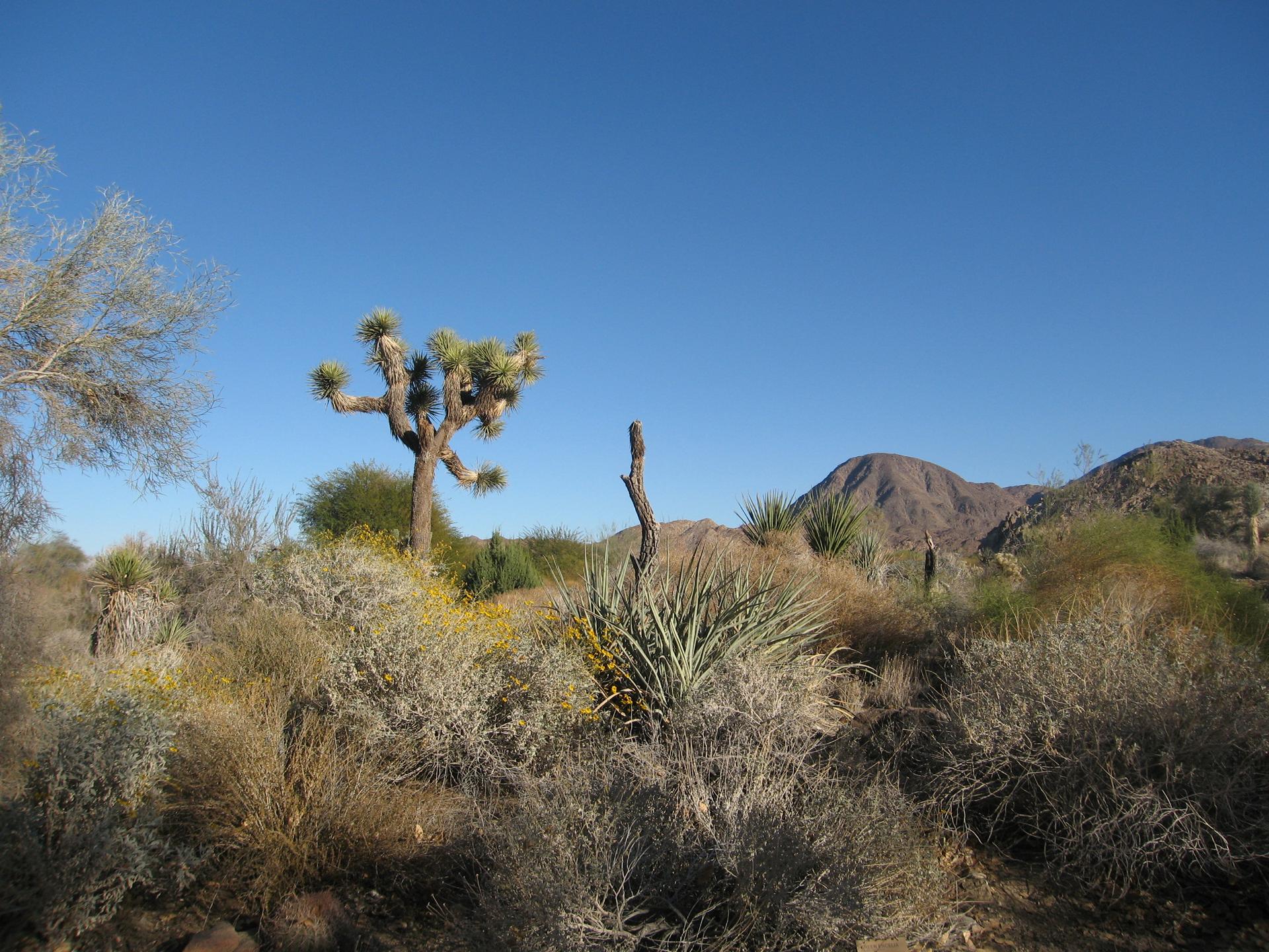
    For hikers, access to Mount San Jacinto is primarily from the town of Idyllwild. From Idyllwild, follow Highway 243 to various trailheads, such as Marion Mountain Campground. Parking is available at trailheads, but can be limited. A day-use parking pass may be required; these can be purchased in person (credit card and cash) at the Park Headquarters at the Idyllwild Campground or with the LAZ parking app. Typical costs: * Day Use Parking: $10

    Local tips

    Check the weather forecast before you go, as conditions on the mountain can change rapidly. Pack layers, even in summer.
    Purchase tram tickets in advance, especially during peak season, to avoid long lines.
    Bring plenty of water and snacks, especially if you plan to hike. There are limited water sources on the trails.
    Obtain the necessary permits for hiking in the wilderness area at the Long Valley Ranger Station.
    Wear sturdy hiking shoes and be prepared for uneven terrain. Trekking poles are recommended, especially if there is snow or ice.

    Discover more about Mount San Jacinto

    Mount San Jacinto, known to the Cahuilla people as I a kitch meaning 'smooth cliffs,' rises to 10,834 feet (3,302 m), offering a dramatic contrast to the surrounding Coachella Valley. The mountain holds cultural significance as the home of Dakush, the legendary founder of the Cahuilla. Named after Saint Hyacinth, it's part of the 'Four Saints' peaks in Southern California. Visitors can ascend via the Palm Springs Aerial Tramway, a remarkable engineering feat completed in 1963, which whisks you from the desert floor to an alpine forest in about 10 minutes. The tramway climbs over 2.5 miles, rotating to offer 360-degree views of Chino Canyon and the valley. At the Mountain Station, you'll find restaurants, observation decks, a natural history museum, and access to over 50 miles of hiking trails. For the adventurous, numerous hiking trails lead to the summit. Popular routes include the Marion Mountain Trail, a strenuous 13.2-mile round trip, and the San Jacinto Peak Trail, accessible from the tram's Mountain Station. Permits are required for wilderness hiking. Be prepared for variable weather conditions, including high winds, sub-freezing temperatures, and snow, especially during winter. The mountain's diverse ecosystems range from desert scrub to mixed conifer forests, providing habitat for various plant and animal species. From the summit, the views extend across the Coachella Valley to the Salton Sea and beyond. The dramatic north escarpment plunges 9,000 feet in less than four miles, creating one of North America's steepest and most spectacular faces.
    Mobile App
    Get the app

    Your all‑in‑one travel companion app

    Explore expert travel guides, compare and book tours, experiences, hotels, and more—all from the palm of your hand. Download now for seamless trip planning wherever your wanderlust takes you.

    File:Living desert.JPG - Wikimedia Commons

    More about Palm Desert

    Discover Palm Desert, California: A vibrant blend of natural beauty, cultural richness, and outdoor adventure in the heart of the Coachella Valley.

    Tell me more about Palm Desert

    Select Currency

    Choose the currency you want prices to display in.