Mols Bjerge National Park
Rolling Ice Age hills, wide sea views and ancient burial mounds combine in one of Denmark’s most varied national parks on the Djursland peninsula.
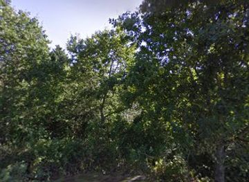
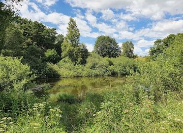
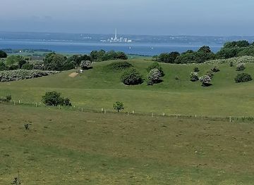
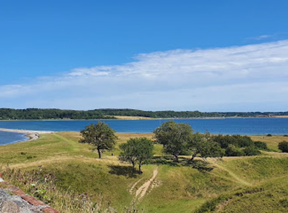
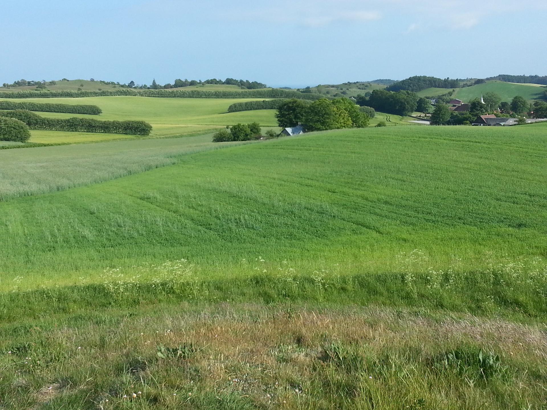
Ice Age Hills Shaping a Danish Wildland
Mols Bjerge National Park spreads over roughly 180 square kilometres of headland on Djursland, where the landscape rises and falls in a series of surprisingly steep hills and valleys. Formed by powerful glaciers at the end of the last Ice Age, the terrain is etched with ridges, kettle holes and dry valleys that feel almost mountainous by Danish standards. At its heart lie the Mols Hills, with summits over 120 metres and sweeping views to multiple bays. The character of the park is remarkably varied for its size. Open heath and grassland dominate the higher ground, while lower pockets hide bogs, meadows and small lakes. Patches of old broadleaf forest and former conifer plantations create cool, shaded contrasts to the sun‑baked slopes. Along the coast, pale sandy beaches and low sea cliffs frame the blue waters of the Kattegat, giving the park a strong sense of connection between land and sea.Wildlife, Rare Habitats and Grazing Horses
The mosaic of habitats in Mols Bjerge supports an impressive range of plants and animals. A significant share of Denmark’s wild plant species can be encountered in the national park, from dry‑loving herbs on south‑facing slopes to moisture‑loving species in marshy hollows. Sunny grasslands buzz with butterflies and insects, and sand lizards and other heat‑loving creatures bask on exposed banks. Traditional grazing by cattle, sheep and in some areas semi‑wild horses helps keep the hillsides open and prevents the land from reverting entirely to forest. This low‑intensity management is part of wider restoration efforts that have removed large stands of conifers to bring back the light, flower‑rich grasslands once typical of the region. Birdlife is another highlight, especially around lakes and wetlands, where towers and viewpoints allow quiet observation of waterfowl and raptors hunting over the slopes.Layers of History in the Open Landscape
Human presence in Mols Bjerge stretches back thousands of years, and traces of that long story are scattered across the hills. Bronze Age burial mounds crown several ridges, forming unmistakable silhouettes against the sky and offering panoramic viewpoints over bays and farmland. Stone Age dolmens and megalithic graves add an even older layer, hinting at ritual landscapes tied to the contours of the terrain. Medieval and later history is written into the park as well. The ruins of Kalø Castle stand on a low headland at the park’s edge, once guarding approaches to the bay and now serving as a dramatic lookout over water and woodland. Manor houses and their structured fields show how the land was shaped by agriculture, while the cobbled streets and half‑timbered houses of nearby Ebeltoft illustrate the trading and maritime life that flourished just beyond the hills.Exploring on Foot, Two Wheels and From the Water
For visitors, Mols Bjerge is first and foremost a landscape to move through. A dense network of marked hiking paths ranges from short family‑friendly circuits to demanding, hilly routes that link summits and viewpoints. The long‑distance Mols Bjerge Trail threads together coastal sections, inland ridges and cultural sites, offering multi‑day immersion in the park’s changing scenery. Many routes use old farm tracks and sandy paths, so sturdy footwear is advisable even on easier stages. Cyclists find both quiet paved lanes and more challenging off‑road sections, with particular areas set aside for mountain biking. Picnic spots and simple shelters are dotted around, making it easy to plan leisurely days out. Anglers and sea kayakers can access stretches of relatively unspoilt coastline, while gentle beaches at the edge of the park invite summer swimming. Throughout, information boards and occasional guided activities help interpret both the natural processes and the human stories that shaped the hills.Atmosphere, Seasons and Practical Impressions
Despite lying close to towns and villages, Mols Bjerge often feels strikingly remote once you are among the hills. Wind in the grasses, skylarks overhead and long views to glittering bays create a distinctly open, airy atmosphere. On clear days, light plays across the slopes and sea, while misty mornings can leave only the tops of burial mounds and ridges visible above drifting fog. In summer, heather and wildflowers colour the ground; in autumn, low sun and rust‑toned vegetation give the park a softer, more melancholic beauty. Facilities are relatively low‑key but practical: car parks at main access points, simple toilets in selected areas, and visitor centres and staffed information points on the edges of the park itself. Waymarking on official routes is generally clear, though a detailed map or offline navigation is useful in the more intricate areas of hills and forest. The national park is open year‑round with no entrance fee, making it easy to drop in for a short walk or to dedicate several days to exploring its quieter corners.Local tips
- Bring sturdy shoes and windproof layers; the hills are steeper than most Danish terrain and the weather can change quickly on exposed ridges.
- Pick up a detailed trail map at a visitor centre before heading into the hills to link shorter marked routes into a longer loop.
- Carry water and snacks, as facilities inside the park are sparse and many of the best viewpoints are far from cafés or shops.
- Check local guidance on grazing areas, keep distance from horses and cattle, and always close gates behind you.
- Aim for early morning or late afternoon for softer light and quieter trails, especially around popular viewpoints and burial mounds.
A brief summary to Mols Bjerge
- Syddjurs Municipality, DK
Getting There
-
Regional bus from Aarhus
From Aarhus, take a regional bus towards Rønde or Ebeltoft; services typically run at least hourly during the day and reach the edge of Mols Bjerge in about 45–70 minutes depending on route. A single adult ticket usually costs around 30–60 DKK. Buses can be busy at commuter times and some rural stops are request‑only, so check the stop name and signal clearly when you wish to get off.
-
Car from Aarhus region
Driving from central Aarhus into the main hill areas of Mols Bjerge typically takes 30–45 minutes, depending on traffic. There is no entrance fee for the national park and parking at trailheads is generally free, but car parks closest to popular viewpoints and castle ruins can fill during sunny weekends and school holidays. Roads are paved and suitable for all standard vehicles, with some narrow lanes where you share space with cyclists and farm traffic.
-
Cycling from nearby towns
From nearby towns such as Rønde or Ebeltoft you can cycle into Mols Bjerge in roughly 30–60 minutes using regional cycle routes and quieter backroads. The approach is generally on good tarmac, but once inside the park expect short, steep hills and some gravel stretches that are better suited to touring or gravel bikes than narrow‑tyred road bikes. There is no charge for access, yet strong winds and exposed sections mean this option is best for confident cyclists prepared for changing weather.