From Eve
Know before you go
Hi, I'm Eve. Here are a few practical things to know before exploring Rte des Crêtes.
Local know-how to help you travel smarter and make the most of every moment.
Discover the panoramic beauty and rich history of the Rte des Crêtes, a scenic mountain road through the heart of the Vosges, offering breathtaking views and outdoor adventures.
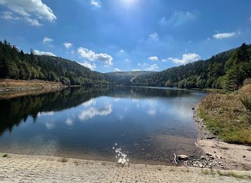
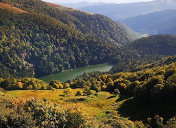
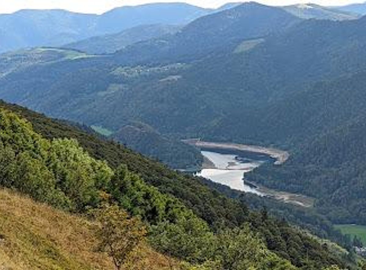
The Rte des Crêtes, or Route des Crêtes, is a breathtaking scenic road that winds through the heart of the Vosges Mountains in France. This historic route, established during World War I for strategic military purposes, now offers visitors stunning panoramic views, fresh mountain air, and a chance to explore the natural beauty of the Parc naturel régional des Ballons des Vosges. Stretching for 88 kilometers, the road traverses high peaks, including the Grand Ballon, the highest point in the Vosges, and passes by iconic landmarks like the Hohneck and the Col de la Schlucht. Whether you're driving, cycling, or hiking, the Rte des Crêtes promises an unforgettable journey through a landscape of lakes, valleys, and forests, with glimpses of the Black Forest and the Alps on clear days. It's a must-see destination for nature lovers and history enthusiasts alike.
Opening times, essentials, and a few local tips gathered into one calmer, easier-to-scan planning section.
Hi, I'm Eve. Here are a few practical things to know before exploring Rte des Crêtes.
Local know-how to help you travel smarter and make the most of every moment.
Driving
From La Bresse town center, follow the D34 towards the Rte des Crêtes. The drive is approximately 10-15 minutes, depending on the specific point you wish to access along the route. Parking is available at various viewpoints and trailheads along the Rte des Crêtes. Be aware that parking can be limited during peak season. During the winter season, ensure your vehicle is equipped for snowy conditions, and check road closures before departing.
Public Transport
While public transport directly along the Rte des Crêtes is limited, you can take a bus from La Bresse to nearby towns like Gérardmer or Colmar, and then connect to hiking trails or access points along the route. From Remiremont train station, a bus connection to La Bresse is available. From La Bresse, local bus lines may offer access to trailheads closer to the Route des Crêtes, but walking or cycling may still be required for the final approach. Check local bus schedules for accurate timings and connections. A single bus fare from Remiremont to La Bresse is approximately €3-5.
Taxi/Ride-Share
Taxis are available in La Bresse, but ride-sharing services are less common. A taxi from La Bresse town center to a specific point on the Rte des Crêtes, such as the Col de la Schlucht, would cost approximately €25-€40, depending on the distance and time of day. Pre-booking is recommended, especially during peak season.
Use Tower Bridge as your starting point for nearby food, family ideas, nightlife, and more local discoveries.

Explore expert travel guides, compare and book tours, experiences, hotels, and more—all from the palm of your hand. Download now for seamless trip planning wherever your wanderlust takes you.
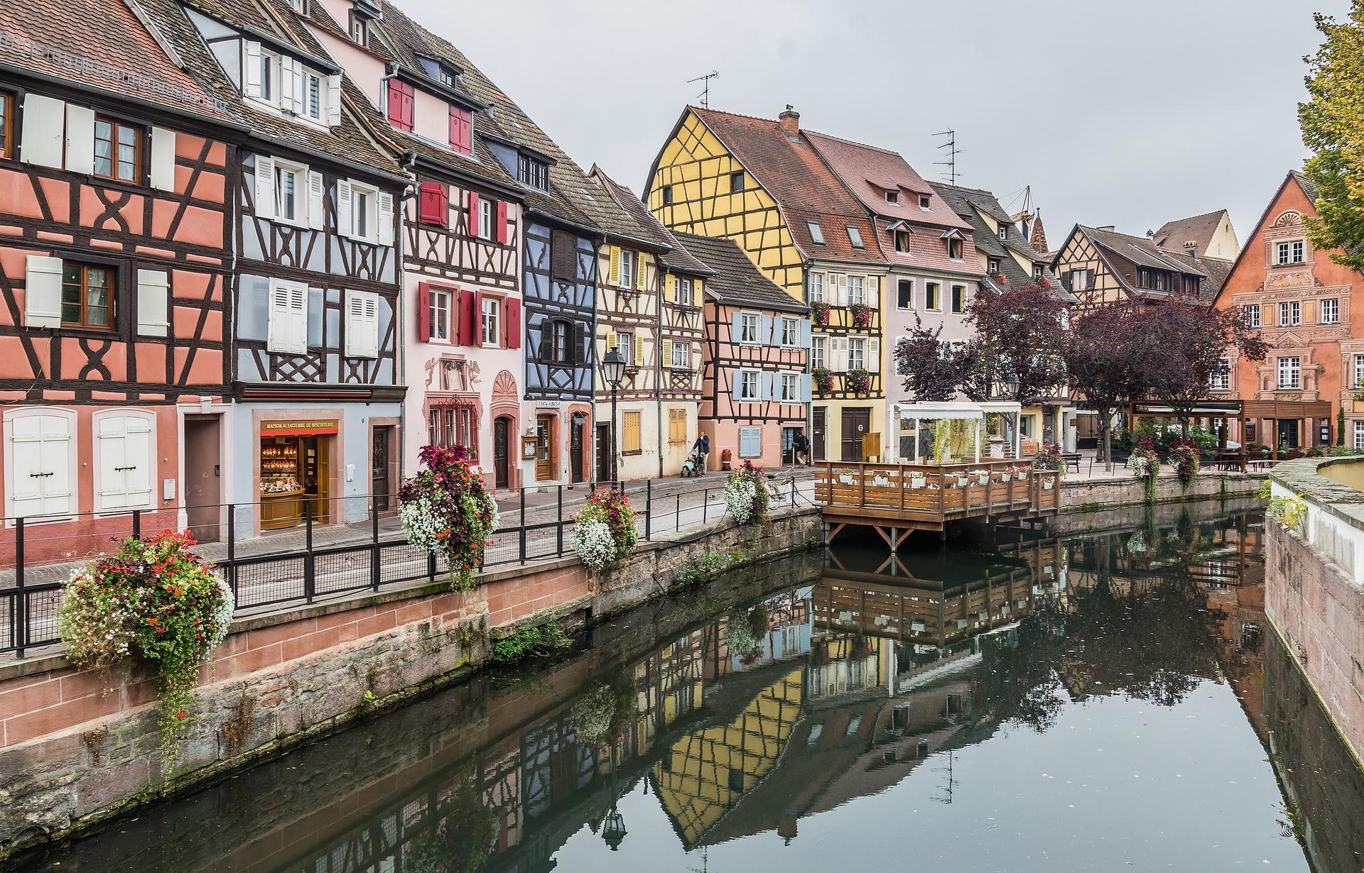
Discover the fairytale charm of Colmar, a picturesque town in France's Alsace region, known for its medieval architecture, colorful houses, scenic canals, and exceptional wines.
Tell me more about Colmar