La Carte de France: A Pinnacle of Natural Beauty
Discover the breathtaking vistas and serene beauty of La Carte de France, a mountain peak in Châtel-Censoir, perfect for nature lovers and adventurers.
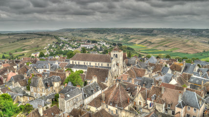
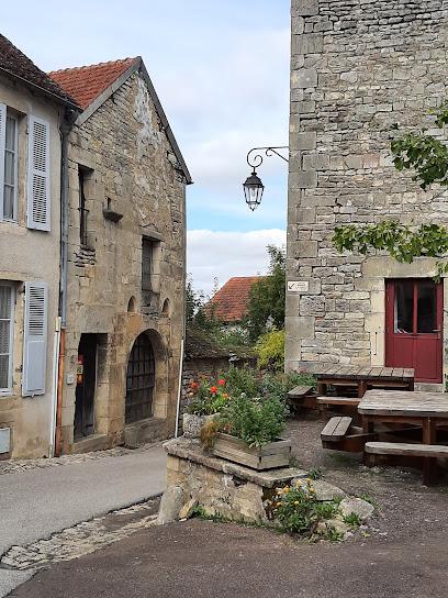
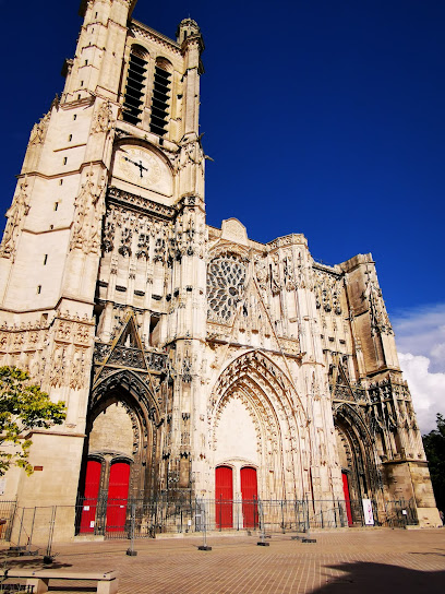
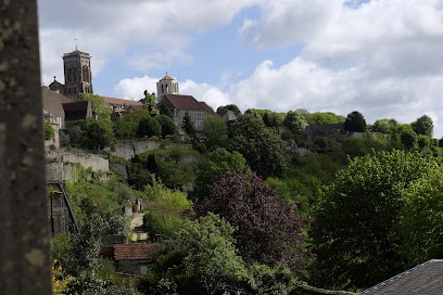
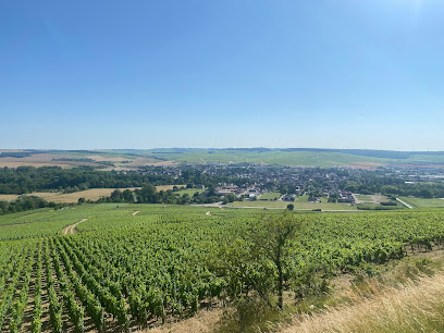
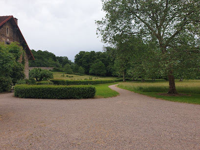
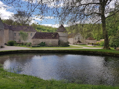
La Carte de France, located in the picturesque village of Châtel-Censoir, is a breathtaking mountain peak that offers stunning panoramic views of the surrounding landscapes. Nestled in the heart of nature, this location is perfect for tourists looking to immerse themselves in the serene beauty of the French countryside. Hikers and nature enthusiasts will find this peak a rewarding experience, with trails that lead to unforgettable vistas and a chance to connect with the great outdoors.
A brief summary to La Carte de France
- Châtel-Censoir, FR
Local tips
- Visit during sunrise or sunset for the most stunning views and photo opportunities.
- Wear comfortable hiking shoes, as the trails can be steep and rocky.
- Bring plenty of water and snacks, especially if you plan to hike the longer trails.
- Check the weather forecast before your visit to ensure the best hiking conditions.
- Consider visiting during the off-peak season to enjoy a quieter experience.
Getting There
-
Car
If you're driving from Besançon, take the A36 highway towards Montbéliard. Continue on the A36 for about 90 kilometers until you reach the exit for D67 towards Ornans. Follow D67 and then take D57 towards Châtel-Censoir. Once you reach Châtel-Censoir, navigate to the coordinates 47.524245, 3.656106, where La Carte de France is located. Parking is usually available nearby.
-
Train and Bus
If you're travelling by public transport, take a train from Dijon to Montbard. From Montbard, you can catch a local bus to Châtel-Censoir. Make sure to check the local schedule as bus services may be limited. Upon arriving in Châtel-Censoir, use the coordinates 47.524245, 3.656106 to find La Carte de France, which is approximately a 15-minute walk from the bus stop.
-
Local Taxi
For a more direct option, consider taking a taxi from your current location in Franche-Comté to La Carte de France. You can book a taxi through local services or use ride-sharing apps if available. Ensure to confirm the fare beforehand, as it may vary depending on the distance and time of day.
Discover more about La Carte de France
Iconic landmarks you can’t miss
The house of Colette
35.9 km
Explore The House of Colette, a museum celebrating the life and works of the iconic French author in the picturesque setting of Saint-Sauveur-en-Puisaye.
Castle of Saint-Fargeau
45.6 km
Discover the grandeur of the Castle of Saint-Fargeau, a stunning 17th-century gem in Burgundy, steeped in history and surrounded by picturesque gardens.
Tour des Fiefs
65.0 km
Discover the majestic Tour des Fiefs in Sancerre, a historic castle offering stunning views and a glimpse into the region's rich cultural heritage.
Flavigny-sur-Ozerain
65.6 km
Experience the enchanting beauty and rich history of Flavigny-sur-Ozerain, a hidden gem in the heart of Burgundy, France.
Food Mood Tour
66.4 km
Discover the flavors of the region with Food Mood Tour—an unforgettable culinary journey through local cuisine and culture.
Castle of Meauce
82.4 km
Explore the captivating history and stunning architecture of the Castle of Meauce, a hidden gem in the heart of France's picturesque landscapes.
Le Coeur de Troyes
91.7 km
Discover the artistic elegance of Le Coeur de Troyes, a stunning sculpture celebrating love and unity in the charming city of Troyes, France.
Unmissable attractions to see
Musée Zervos - Maison Romain Rolland
9.4 km
Discover the cultural treasures at Musée Zervos - Maison Romain Rolland in Vézelay, a must-visit museum for art and literature enthusiasts.
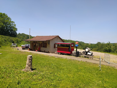
Petit train de l'yonne
26.1 km
Experience the charm of the Petit Train de l'Yonne, a scenic ride through the historic landscapes of Massangis, perfect for family adventures.
Prieuré Saint Cosme
33.5 km
Explore the historic Prieuré Saint Cosme in Chablis, a tranquil priory steeped in heritage, surrounded by lush vineyards and scenic beauty.
Cité des Climats et vins de Bourgogne
33.8 km
Explore the rich history and exquisite flavors of Burgundy at the Cité des Climats et Vins de Bourgogne, the ultimate wine experience.
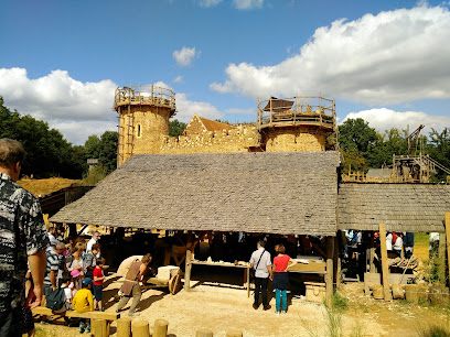
Guédelon Castle
38.1 km
Explore Guédelon Castle: a living museum of medieval architecture in France, where history comes alive through active construction and skilled craftsmanship.
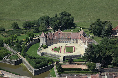
Château d'Époisses
38.8 km
Explore the enchanting Château d'Époisses, a historical landmark in Burgundy, France, renowned for its beautiful gardens and engaging reenactments.
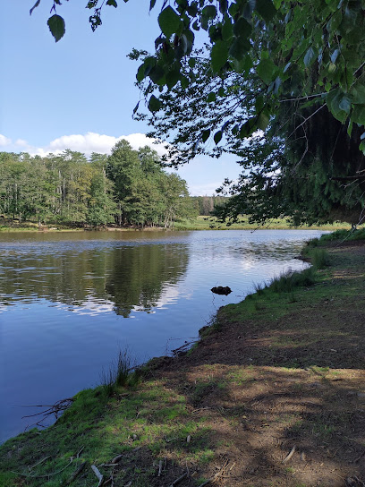
Boutissaint Natural Park
40.5 km
Explore the serene beauty of Boutissaint Natural Park in Treigny, a haven for wildlife enthusiasts and nature lovers alike.
Château De Bourbilly
44.1 km
Experience the enchanting Château de Bourbilly, a historic castle in Burgundy, surrounded by stunning gardens and rich cultural heritage.
Château d'Ancy-le-Franc
47.1 km
Explore the stunning Château d'Ancy-le-Franc, a Renaissance gem in Burgundy, showcasing exquisite architecture and beautiful gardens.
Château de Tanlay
48.3 km
Explore Château de Tanlay, a breathtaking castle in Burgundy with stunning architecture, beautiful gardens, and a rich historical narrative waiting to be discovered.
Musée François Pompon
51.0 km
Explore the artistic legacy of François Pompon at Musée François Pompon, a cultural gem in the heart of Saulieu, France, showcasing exquisite sculptures and art.
Fontenay Abbey
56.5 km
Explore the tranquil beauty and rich history of Fontenay Abbey, a UNESCO World Heritage site in Montbard, France, perfect for culture enthusiasts.
Loire Museum
56.5 km
Explore the rich heritage of the Loire Valley at the Loire Museum in Cosne-Cours-sur-Loire, a cultural hub for history enthusiasts and families alike.
Château de Maulnes
58.3 km
Explore the stunning Château de Maulnes, a Renaissance treasure in Cruzy-le-Châtel, France, rich in history and architectural beauty.
Château de Buranlure
59.1 km
Explore the captivating Château de Buranlure, a historic castle and winery in Boulleret, France, where beauty meets rich heritage.
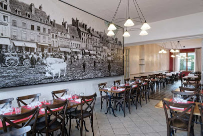
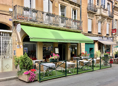
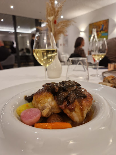
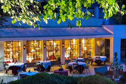
Essential places to dine
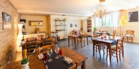
Le Relais Bernard Loiseau
51.1 km
Experience exquisite French cuisine at Le Relais Bernard Loiseau – a Michelin-starred restaurant offering luxury accommodations and a serene spa retreat.

Restaurant Côte À Côte
79.6 km
Discover exquisite French dining at Restaurant Côte À Côte in Autun - where tradition meets taste.
Restaurant Le Chateaubriant
80.1 km
Experience authentic French and Mediterranean cuisine at Restaurant Le Chateaubriant in Autun - a true culinary gem.
Château Sainte Sabine
81.8 km
Experience luxury at Château Sainte Sabine - a castle hotel with exquisite French dining amidst picturesque landscapes.
Le Quai de Champagne | Restaurant | Chef Jean-Paul Braga
91.9 km
Discover exquisite flavors at Le Quai de Champagne in Troyes – where culinary artistry meets riverside elegance.
Restaurant Château de Courban
92.1 km
Experience culinary excellence at Château de Courban - where traditional French cuisine meets modern elegance in a picturesque setting.
Restaurant La Bouzerotte
99.6 km
Experience exquisite Haute French cuisine at Restaurant La Bouzerotte in Bouze-lès-Beaune—where every meal is a celebration of local flavors.
Markets, malls and hidden boutiques
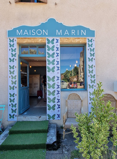
Maison Marin
66.3 km
Discover exquisite leather craftsmanship at Maison Marin in Lucenay-l'Évêque, where each product tells a unique story of French artistry.
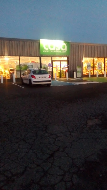
Casa Nevers
71.5 km
Explore Casa Nevers, a charming gift shop offering unique home goods, furniture, and kitchen supplies, perfect for memorable souvenirs.
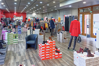
Version Privée
76.0 km
Explore the essence of French men’s fashion at Version Privée in Arnay-le-Duc, where style meets sophistication.
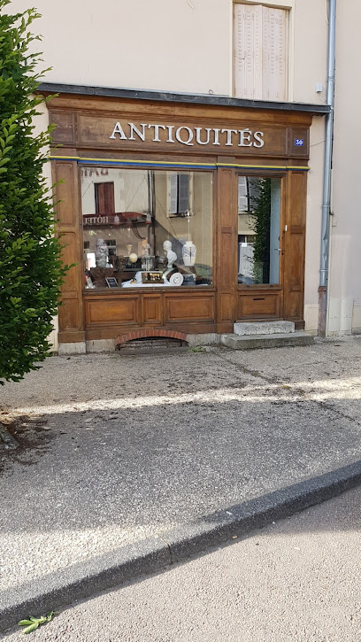
comptoir antique de bourgogne
76.5 km
Explore a unique collection of antique furniture and collectibles in Arnay-le-Duc, where history meets charm at Comptoir Antique de Bourgogne.
Dim (Sa)
78.8 km
Explore Dim (Sa), an exquisite lingerie store in Autun, offering a diverse selection of intimate apparel for every taste and occasion.
DIM
78.9 km
Explore DIM in Autun for a captivating lingerie shopping experience that combines elegance, comfort, and French fashion.
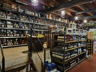
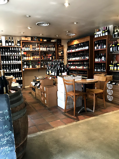
Cave Laly
79.7 km
Discover the exquisite world of fine wines and spirits at Cave Laly in Autun, where local heritage meets exceptional taste.
Jardin D Interieur
80.1 km
Explore Jardin D Interieur in Autun for unique gifts and local craftsmanship that capture the spirit of France.
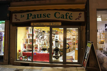
La Pause Café - Sarl Autun Torréfaction
80.3 km
Discover La Pause Café, a cozy coffee shop in Autun, offering exquisite coffee, tea, and unique gifts in a charming atmosphere.
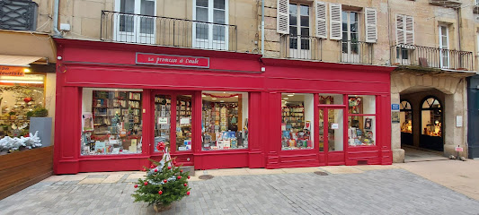
La promesse de l'aube
80.3 km
Discover the literary charm of La Promesse de l'Aube in Autun, where every book tells a story and every visit is a new adventure in reading.
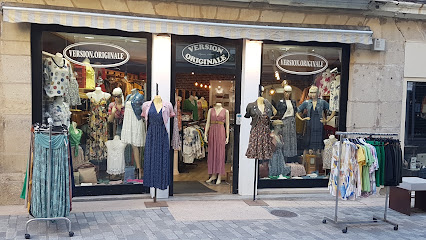
VERSION ORIGINALE
80.3 km
Discover unique women's fashion at VERSION ORIGINALE in Autun, where style meets exceptional customer service.
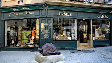
Armurerie Coutellerie James
80.3 km
Experience the charm of Armurerie Coutellerie James in Autun, your go-to destination for firearms, hunting gear, and expert advice.
Pastel Candle
81.4 km
Discover the enchanting world of handcrafted candles at Pastel Candle, where each creation tells a story through exquisite design and captivating scents.

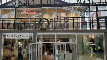
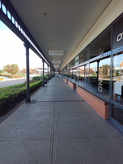
Marques Avenue Troyes
89.3 km
Discover unbeatable deals and a wide selection of stores at Marques Avenue Troyes, the ultimate outlet shopping experience in Saint-Julien-les-Villas, France.
Marques City
95.4 km
Discover unbeatable deals and a diverse shopping experience at Marques City, the ultimate outlet mall in Pont-Sainte-Marie, France.
Essential bars & hidden hideouts
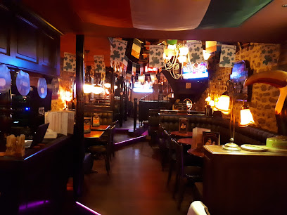
Irish Pub Autun
80.0 km
Discover the charm of Ireland at Irish Pub Autun, a vibrant bar offering delicious cuisine and a warm atmosphere for unforgettable experiences.
Aux Crieurs de Vin
91.1 km
Discover the enchanting flavors of Troyes at Aux Crieurs de Vin, where exquisite wines and delightful bistro cuisine come together.
Bougnat des Pouilles
91.4 km
Discover the cozy ambiance and local flavors at Bougnat des Pouilles, a delightful bar in the heart of Troyes, France.
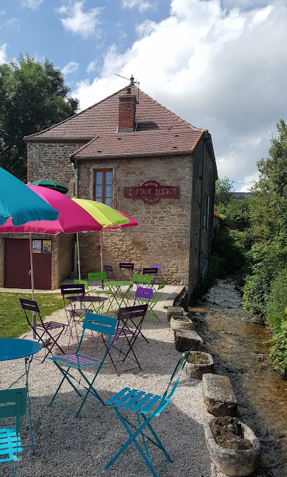
Le P'tiot Bistrot
97.0 km
Discover Le P'tiot Bistrot: A cozy live music bar and cafe in Cormot-Vauchignon offering delightful performances and a vibrant atmosphere.