From Eve
Know before you go
Hi, I'm Eve. Here are a few practical things to know before exploring Mount Lamlam Summit.
Local know-how to help you travel smarter and make the most of every moment.
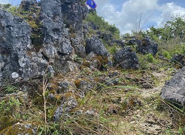
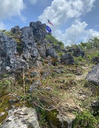
Hike to Guam's highest point for breathtaking panoramic views and a glimpse into the island's rich cultural and geological history.
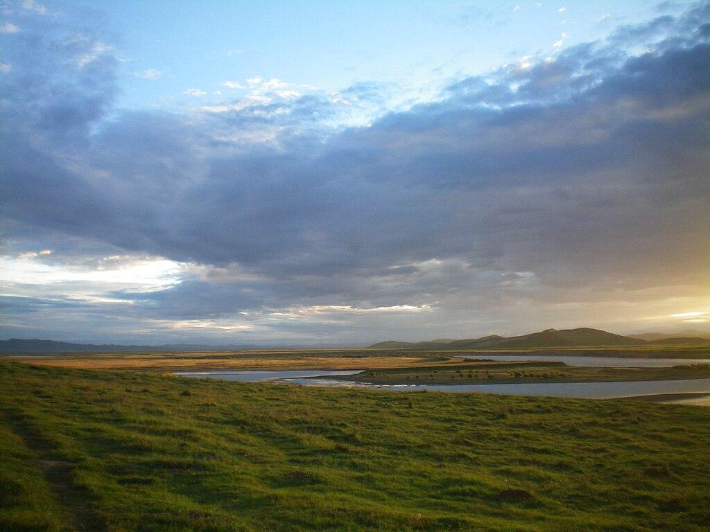
Mount Lamlam, meaning 'lightning' in Chamorro, is Guam's highest peak, offering panoramic views and a rewarding hike. Despite its modest height of 406 meters (1,332 feet), it's known as the world's tallest mountain when measured from the nearby Mariana Trench, the deepest part of the ocean.
Opening times, essentials, and a few local tips gathered into one calmer, easier-to-scan planning section.
Hi, I'm Eve. Here are a few practical things to know before exploring Mount Lamlam Summit.
Local know-how to help you travel smarter and make the most of every moment.
Driving
From Hagåtña, take Route 1 (Marine Corps Drive) south. Turn left onto Route 2A, then continue onto Route 2. Follow Route 2 until you reach a red wall on the right side of the road. The Mount Lamlam trailhead is across the street on the left. Parking is available across the street from the trailhead at the Cetti Bay Overlook. Parking is free.
Taxi/Rideshare
From Antonio B. Won Pat International Airport (GUM), a taxi or rideshare to the Mount Lamlam trailhead will take approximately 45-60 minutes, depending on traffic. Provide the driver with the address: 8MQ8+5JW, Mount Lamlam Summit, Humåtak, Guam. Typical taxi fares from the airport to this area range from €50-€60. Rideshare costs may vary. Confirm the fare before starting your trip.
Public Transport
From the Yigo Bus Terminal, take a bus heading south on Route 1 (Marine Corps Drive) towards Humåtak. Get off the bus at the stop closest to Mount Lamlam, around the Route 15 intersection. From there, it's about a 30-minute walk to the trailhead. Follow Route 15 until you reach the signs for Mount Lamlam and continue towards the trailhead. Bus fare from the airport to the city center is approximately €1-€5.
Use Mount Lamlam Summit as your starting point for nearby food, family ideas, nightlife, and more local discoveries.

Explore expert travel guides, compare and book tours, experiences, hotels, and more—all from the palm of your hand. Download now for seamless trip planning wherever your wanderlust takes you.
Discover the serene and culturally rich Mount Jumullong Manglo, offering stunning views and an immersive experience into Guam's natural and cultural heritage.
Tell me more about Mount Jumullong Manglo