

Mount Jumullong Manglo Travel Guide - Free Web & App
Your ultimate guide to Mount Jumullong Manglo. Discover top landmarks, proposed trips, and local tips. Free on the web or via the Evendo companion app.


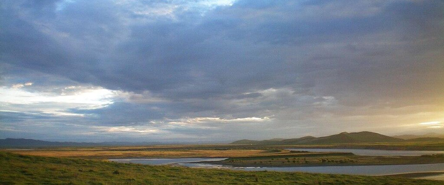


Mount Jumullong Manglo in Guam offers southern-island mountain scenery, Chamorro heritage, rugged hiking terrain and wide views across the island.
A Rugged Southern Guam Summit
Mount Jumullong Manglo is a prominent mountain in southern Guam, an area where steep green ridges, wooded slopes and deeply incised valleys form a marked contrast with the island’s more developed northern plateau. It belongs to Guam’s rugged southern uplands and is associated with the landscape around the villages of Umatac, Merizo and nearby inland areas. The mountain is often identified as one of Guam’s higher peaks, although Mount Lamlam, farther south-west, is generally regarded as the island’s highest point.Read more about Mount Jumullong Manglo
Landscape and Access
Culture and the Southern Interior
When is the best time to visit Mount Jumullong Manglo?
Best: June–August · 32–33°C| Month | High (°C) | Rainfall (mm) |
|---|---|---|
| January | 31 | 100 |
| February | 31 | 90 |
| March | 32 | 80 |
| April | 32 | 70 |
| May | 32 | 60 |
| June (best) | 32 | 50 |
| July (best) | 32 | 40 |
| August (best) | 33 | 40 |
| September | 33 | 50 |
| October | 33 | 60 |
| November | 33 | 70 |
| December | 34 | 80 |
Getting to and around Mount Jumullong Manglo
How to get there
Transportation
Best attractions in Mount Jumullong Manglo
The principal attraction at Mount Jumullong Manglo is the mountain landscape itself: wooded slopes, uneven ridges and the sense of entering Guam’s less-developed southern interior. It is best approached as a natural feature within the wider south rather than as a fully equipped hiking attraction, since routes and access may depend on current land permissions. The surrounding area offers a useful geographical contrast between inland uplands and the coastal villages of Umatac and Merizo. Visitors travelling through southern Guam can also explore nearby public roads, coastal scenery and historic community settings, provided each site is treated according to its own access rules. Views towards the island’s ridgelines and coast may be rewarding in clear weather, although vegetation, cloud and terrain can limit visibility. There are no grounds for assuming a visitor centre, marked summit trail, café or formal recreational facilities at the mountain itself.
-
Tourist attraction
Fish Eye Marine Park - Visitor Center
Explore Guam's underwater beauty at Fish Eye Marine Park: Micronesia's only underwater observatory in the vibrant Piti Bay Marine Preserve.
-
Tourist attraction
Ypao Beach
Discover Ypao Beach Park in Guam: a tropical paradise with pristine beaches, clear waters, and a rich cultural history, perfect for relaxation and recreation.
-
Tourist attraction
Valle Esmeralda De Flores
Escape to Guam's Valle Esmeralda De Flores: A floral paradise with turquoise waters, perfect for nature walks and serene relaxation.
-
Tourist attraction
Ritidian Point
Discover Guam's northernmost point: a serene wildlife refuge with stunning views, diverse ecosystems, and a rich history waiting to be explored.


Best landmarks in Mount Jumullong Manglo
Mount Jumullong Manglo is primarily a geographical landmark, forming part of the elevated southern interior rather than presenting a single built monument or engineered viewpoint. Its significance lies in the way its wooded slopes and ridgelines help define southern Guam’s transition from inland high ground to the coast. Nearby Umatac is an important historical setting associated with Spanish-era contact and enduring Chamorro community life, while Merizo provides another southern base for understanding the region’s villages and maritime connections. Mount Lamlam, often described as Guam’s highest point, is a separate nearby mountain and should not be confused with Jumullong Manglo. The surrounding landscape also reflects Guam’s complex land history, including areas affected by private ownership, conservation interests and military use. These overlapping contexts are part of the landmark’s character and explain why access should be checked rather than presumed.
-
Tourist attraction
Two Lover’s Point
Discover Guam's legendary Two Lover's Point: breathtaking views, romantic history, and a cultural landmark you won't want to miss.
-
Historical place
Fort Nuestra Señora de la Soledad
Explore Fort Soledad in Guam: a historic Spanish fort offering stunning views of Umatac Bay and a glimpse into the island's colonial past.
-
Park
Merizo Pier Park
Discover Guam's coastal beauty and cultural heritage at Merizo Pier Park, a tranquil oasis in Malesso' offering recreation and relaxation.
-
Hiking area
Cetti Bay Overlook
Discover panoramic views of Guam's volcanic coastline and ancient Chamorro history at this accessible and scenic overlook.


Explore Mount Jumullong Manglo on the map
Plan your trip on one map. See where the top attractions, landmarks, restaurants and hotels are, and book hotels and experiences in a few clicks.
Best hotels in Mount Jumullong Manglo
Best restaurants in Mount Jumullong Manglo
There is no established dining district or restaurant infrastructure on Mount Jumullong Manglo itself, so visitors should eat before setting out or use the surrounding southern settlements and Guam’s larger roadside commercial areas. Umatac and Merizo are useful places to look for local food and refreshments, although the selection and opening arrangements of small businesses can vary. Guam’s cuisine reflects Chamorro traditions alongside Spanish, Filipino, Japanese, Korean and American influences, with dishes and ingredients commonly including rice, seafood, barbecue, coconut and spicy finadene-style sauces. Visitors should not expect mountain cafés, food stalls or dependable services at an informal route entrance. Carrying water and suitable food is particularly important for walks, while a meal in a village or coastal community provides a more appropriate way to connect the mountain visit with southern Guam’s living culture.
-
American
King's Restaurant
Discover delicious American breakfast and local fusion dishes at King's Restaurant in Guam's vibrant Chalan Premier Outlets.
-
Restaurant
Proa Restaurant
Experience authentic Chamorro cuisine at Proa Restaurant in Tumon - where local flavors meet modern dining.
-
Hamburger
Mosa's Joint
Experience the best hamburgers in Guam at Mosa's Joint—where local flavors meet casual dining.
-
Family-friendly
Shirley's Restaurant
Discover the heart of Guam’s cuisine at Shirley’s Restaurant—where family-friendly dining meets authentic local flavors.


Best bars in Mount Jumullong Manglo
Mount Jumullong Manglo has no nightlife infrastructure, and evenings in the surrounding southern countryside are generally quiet rather than centred on bars or clubs. Visitors may find local hospitality venues and occasional evening dining in Guam’s villages, but the island’s concentrated entertainment scene is around the developed areas of Tumon, Tamuning and Hagåtña, outside the mountain’s immediate setting. Southern Guam is better suited to an early start, a quiet meal, sunset views from permitted coastal locations and an evening based at accommodation elsewhere on the island. Any visit to a village venue should respect residential surroundings and local customs. Visitors should also avoid assuming that a remote road or summit area is suitable for evening exploration, particularly where lighting, mobile coverage and clear public access are limited.
-
Bar
Jimmy Dee's Paradise Beach Resort & Bar
Experience the vibrant atmosphere and stunning beachfront views at Jimmy Dee's Paradise Beach Resort & Bar in Apotgan, Guam.
-
Bar
Tree Bar
Discover the vibrant atmosphere and tropical flavors of Tree Bar in Tumon, Guam - your perfect retreat for relaxation and enjoyment.
-
Bar
Bernie's Bar
Discover the vibrant atmosphere of Bernie's Bar, a must-visit spot in Apotgan, Guam, for refreshing drinks and tropical nightlife.
-
Bar
The Venue
Experience the vibrant nightlife at The Venue in Hagåtña, Guam, where delicious drinks and a lively atmosphere await every visitor.


Best nightclubs in Mount Jumullong Manglo
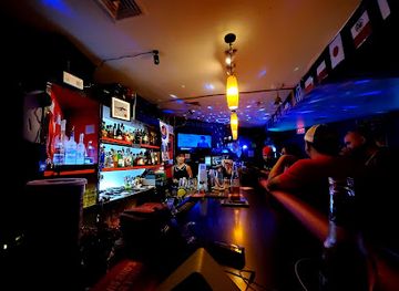
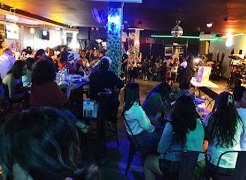
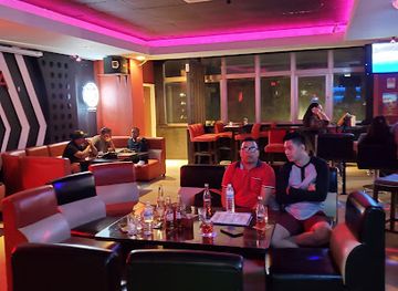
Mount Jumullong Manglo has no nightlife infrastructure, and evenings in the surrounding southern countryside are generally quiet rather than centred on bars or clubs. Visitors may find local hospitality venues and occasional evening dining in Guam’s villages, but the island’s concentrated entertainment scene is around the developed areas of Tumon, Tamuning and Hagåtña, outside the mountain’s immediate setting. Southern Guam is better suited to an early start, a quiet meal, sunset views from permitted coastal locations and an evening based at accommodation elsewhere on the island. Any visit to a village venue should respect residential surroundings and local customs. Visitors should also avoid assuming that a remote road or summit area is suitable for evening exploration, particularly where lighting, mobile coverage and clear public access are limited.
-
Lounge
Drop
Discover Drop, the ultimate lounge in Tumon, Guam, where unforgettable nightlife, great music, and exquisite drinks await.
-
Karaoke bar
Mins Bar Guam | Music Karaoke Box and Shot Bar | Tumon Guam
Experience Guam's vibrant nightlife at Mins Bar, the ultimate karaoke and shot bar in Tumon, where every night is a celebration of music and fun.
-
Lounge
Gudtaym Lounge
Unwind at Gudtaym Lounge in Guam, where vibrant nightlife meets exceptional karaoke and live music experiences.
-
Karaoke bar
Lava Lounge
Experience the vibrant nightlife of Guam at Lava Lounge, where karaoke meets a lively lounge atmosphere for unforgettable moments.

Best shops in Mount Jumullong Manglo
Shopping at Mount Jumullong Manglo is limited to what visitors can obtain before entering the southern countryside; the mountain has no shops, market or craft centre. Supplies are more readily found in Guam’s larger commercial districts, while village stores and small businesses in the south may provide basic refreshments and everyday goods without the range of a major shopping area. Visitors interested in regional products can look for Chamorro food specialities, locally made crafts, artwork, woven items and packaged island products in established shops and cultural outlets elsewhere in Guam. Availability varies, and not every item described as local is produced near the mountain. Buying from legitimate local businesses and respecting cultural ownership is preferable to collecting plants, stones or archaeological material from the landscape.
-
General store
Shop 4 Less
Discover a diverse range of products at Shop 4 Less in Guam, from crafts to office supplies. A must-visit for unique souvenirs and essentials!
-
Hiking area
Mount Jumullong Summit
Experience the breathtaking beauty of Mount Jumullong Summit in Guam, a premier hiking destination with stunning panoramic views and lush landscapes.
-
Store
eagles market
Discover the vibrant local culture and flavors at Eagle's Market in Mangilao, Guam – your go-to spot for fresh produce and authentic snacks.
-
Grocery store
World Mart
Explore the diverse offerings at World Mart, Guam's premier grocery store for all your local and international shopping needs.


Get your free copy of our complete guide to Mount Jumullong Manglo, delivered straight to you.
Everything on this page, from attractions and restaurants to essentials and local phrases, in one PDF you can read offline, print or share.
Already have an account? Sign in
Your Mount Jumullong Manglo guide is ready.
We'll send it to · Not you? Sign out

Getting your guide ready…
We are putting together a fresh copy of the Mount Jumullong Manglo guide. This can take up to a minute.
This can take a few moments. If your browser asks, choose Allow so the download can start. You'll find the guide in your Downloads folder.
Nothing happened? Download it again
Sorry, the guide is taking longer than usual. Please try again in a minute, or get it by email instead.
Mount Jumullong Manglo essentials
Currency and Payment
Safety
Emergency Situations
Do's and Don'ts
Local Tips
From Eve
Local phrases worth knowing
You don't need to get them perfect. A few words go a long way, and locals appreciate the effort.
Basics
| English | Local | Say it |
|---|---|---|
| Hello | Håfa Adai | [HA-fa A-dai] |
| Goodbye | Adios | [A-di-os] |
| Yes | Hao | [HAO] |
| No | Ti | [TI] |
| Please/You're welcome | Por fabor | [POR fa-bor] |
| Thank you | Si Yu'us Ma'åse | [SEE yoo-OOS ma-AH-se] |
| Excuse me/Sorry | Dispensa yo' | [di-SPE-nyu yo'] |
| How are you? | Cómo estás? | [KO-mo es-TAS] |
| Fine. And you? | Maolek. Ya ti un na'an-mu? | [ma-O-lek. ya ti un na-AN-mu] |
| Do you speak English? | Kao un na'an-hu i Ingles? | [KAO un na-AN-hu i IN-gles] |
| I don't understand | Ti hu tungo' iyo' | [TI hu TUNG-go i-YO] |
Eating & Drinking
| English | Local | Say it |
|---|---|---|
| I'd like to see the menu, please | Kao hu na'ån-mu i menyu, por fabor | [KAO hu na-AN-mu i MEN-yu, por fa-BOR] |
| I don't eat meat | Ti hu ma'åhao na gollai | [TI hu ma-A-hao na gol-LAI] |
| Cheers! | Biba! | [BI-ba] |
| I would like to pay, please | Kao hu na'ån-mu i pago, por fabor | [KAO hu na-AN-mu i PA-go, por fa-BOR] |
Emergencies
| English | Local | Say it |
|---|---|---|
| Help! | Ayuda! | [a-YU-da] |
| Go away! | Uti! | [U-ti] |
| Call the Police! | Llama i Polisia! | [YA-ma i po-LI-si-a] |
| Call a doctor! | Llama i manmaga'! | [YA-ma i man-ma-GA] |
| I'm lost | Tåya hu hu tungo' | [TA-ya hu hu TUNG-go] |
| I'm ill | Tåya hu hu tungo' | [TA-ya hu hu TUNG-go] |
Shopping
| English | Local | Say it |
|---|---|---|
| I'd like to buy... | Kao hu na'ån-mu i... | [KAO hu na-AN-mu i...] |
| I'm just looking | Tåya hu hu tungo' | [TA-ya hu hu TUNG-go] |
| How much is it? | Ki ha'åni? | [KI ha-A-ni] |
| That's too expensive | Esti ti ha'ani | [es-TI ti ha-A-ni] |
| Can you lower the price? | Mungga' ha'åni? | [MUNG-ga ha-A-ni] |
Time & Numbers
| English | Local | Say it |
|---|---|---|
| What time is it? | Ki tiempo? | [KI ti-em-po] |
| It's one o'clock | Munga' un na'åra | [MUNG-ga un na-AR-a] |
| Half past (10) | Munga' na (10) | [MUNG-ga na (10)] |
| Morning | Gof ma'åse | [gof ma-AH-se] |
| Afternoon | Gof ma'åtodi | [gof ma-AH-to-di] |
| Evening | Gof ma'åtodi | [gof ma-AH-to-di] |
| Yesterday | Ñan kalan | [nyan ka-LAN] |
| Today | Håna | [HA-na] |
| Tomorrow | Aban | [a-BAN] |
| 1 | Munga' | [MUNG-ga] |
| 2 | Dos | [DOS] |
| 3 | Tres | [TRES] |
| 4 | Kuåtro | [kwa-TRO] |
| 5 | Sinko | [SIN-ko] |
| 6 | Sais | [sa-IS] |
| 7 | Siete | [SYE-te] |
| 8 | Ocho | [O-cho] |
| 9 | Nueve | [NWE-ve] |
| 10 | Dies | [dyes] |
Transport & Directions
| English | Local | Say it |
|---|---|---|
| Where's a/the...? | Månu i... | [MA-nu i...] |
| What's the address? | Kao i direksion? | [KAO i di-rek-syon] |
| Can you show me (on the map)? | Mungga' iyo' (sångan i mapå)? | [MUNG-ga i-YO (SANG-gan i ma-PA)] |
| When's the next (bus)? | Ki ora i siguiente (bus)? | [KI O-ra i sig-WI-en-te (bus)] |
| A ticket (to ....) | Un tikey (para i....) | [un ti-KEY (pa-ra i...)] |
History of Mount Jumullong Manglo
A Volcanic and Limestone Island
Mount Jumullong Manglo forms part of Guam’s varied southern highlands, where volcanic rocks and uplifted limestone contribute to a rugged topography of ridges, gullies and coastal slopes. Guam’s landforms developed over long geological timescales through volcanic activity, reef growth, uplift and erosion. The mountain’s present appearance is therefore the product of natural processes rather than a historical construction or a single dramatic event. This physical setting has influenced where settlements, roads and cultivated areas could develop, while the steep interior has remained more heavily wooded and less intensively urbanised than much of northern Guam.
Chamorro Settlement and Land Use
The mountain lies within the wider homeland of the Chamorro people, whose relationship with Guam predates European contact by many centuries. Chamorro communities used the island’s coastal and inland environments for settlement, cultivation, fishing and movement between villages. Southern Guam’s hills and valleys formed part of this broader lived landscape, even where dense vegetation and difficult terrain limited permanent occupation. Traditional knowledge of plants, water, weather and routes helped communities make use of the island’s varied environments. The mountain should consequently be understood within a cultural landscape, rather than as an isolated natural feature detached from human history.
Spanish Colonial Transformation
Spanish rule began in the seventeenth century and brought major changes to Guam’s settlement patterns, religion, administration and landholding. Southern villages such as Umatac and Merizo acquired enduring importance within the island’s colonial network, while Catholic missions and churches became prominent features of community life. The mountain itself was not transformed into a formal colonial monument, but the surrounding countryside was affected by new routes, agricultural practices and systems of authority. Umatac’s historic associations with Spanish maritime contact remain especially relevant to understanding how Guam’s southern coast connected local communities with wider Pacific traffic.
War, Military Land and Modern Conservation
Guam’s strategic position made the island central to military campaigns during the Second World War, including the Japanese occupation and the American recapture of Guam in 1944. Southern uplands and valleys were influenced by wartime movement, defence requirements and the subsequent expansion of military landholdings. In the modern period, access across parts of Guam has continued to reflect a mixture of public, private, conservation and military interests. These overlapping responsibilities help explain why routes in the Mount Jumullong Manglo area may not function like fully developed public hiking trails and why local guidance is important before visiting.
Mount Jumullong Manglo in Photos
Browse through our photo collection highlighting the charm and character of the destination.
Cities in Mount Jumullong Manglo
The towns and cities of Mount Jumullong Manglo, and the easiest places to base yourself.
-
-

-
-

-

-


Swipe for more cities
Neighbouring destination travel guides
The closest destinations to Mount Jumullong Manglo, if you have time for more than one.
-

-
-

-

-


Swipe for more destinations
Explore more

Explore more of Mount Lamlam
Explore Mount Lamlam in Guam, the island's highest peak with stunning views, rich cultural significance, and a unique claim as the world's tallest mountain from base to summit.
Explore Mount Lamlam
Explore more of Guam
Discover Guam: A tropical paradise offering pristine beaches, rich Chamorro culture, and diverse marine life, perfect for adventure seekers and relaxation enthusiasts alike.
Explore Guam