

MG Road (Bengaluru) Travel Guide - Free
Explore MG Road in Bengaluru with Evendo's free guide. Find the best shops, historic streets, restaurants, and gems on web or mobile.


MG Road in Bengaluru blends Cantonment history, Bengaluru Metro access, landmark churches, cafés, shopping streets and lively evenings in central India.
A Central Bengaluru Thoroughfare
MG Road runs through the centre of Bengaluru from Anil Kumble Circle towards Trinity Circle, linking the commercial core with the former cantonment districts to the east. It is less a self-contained residential quarter than a major urban corridor, with broad pavements, office buildings, hotels, retail arcades and several busy side streets. The Bengaluru Metro’s Purple Line gives the road a particularly useful connection with destinations across the city, while Church Street and Brigade Road branch away towards cafés, bookshops, restaurants and late-evening venues.Read more about MG Road
Colonial Road, Contemporary City
Shopping, Culture and Everyday Movement
Best attractions in MG Road
MG Road’s attractions are best understood as a connected central-Bengaluru circuit rather than a single enclosed sightseeing zone. The Cauvery Handicrafts Emporium introduces visitors to sandalwood work, silk, metalware and other craft traditions associated with Karnataka, while the road’s commercial façades and side streets reveal the area’s continuing role as a shopping corridor. Church Street, immediately off the western end, adds bookshops, cafés, galleries and independent retail, and Brigade Road provides another lively pedestrian-oriented extension. St Mark’s Cathedral and the green spaces and institutions around Cubbon Road are close enough to combine with an MG Road walk, although they should be treated as nearby rather than as attractions on the road itself. Towards Trinity, the streets connect with the older cantonment landscape and routes towards Ulsoor. The Purple Line metro stations also offer a practical way to explore further parts of Bengaluru without returning to road traffic.
-
Tourist attraction
Mahatma Gandhi Park
A peaceful urban oasis in Bengaluru dedicated to Mahatma Gandhi, offering lush gardens, monuments, and a tranquil escape from city life.
3 min walk · 0.3 km from neighbourhood centre

Best landmarks in MG Road
MG Road’s landmarks reflect the meeting of Bengaluru’s former cantonment and present-day commercial centre. The road’s historic name, South Parade, survives in the urban memory of the cantonment landscape that shaped its alignment, while the present name commemorates Mahatma Gandhi. The Cauvery Handicrafts Emporium is significant as a public-facing showcase for Karnataka’s craft traditions, rather than simply a retail outlet. St Mark’s Cathedral, near the western side of the corridor, is an important Anglican church associated with the colonial-era cantonment and remains a prominent architectural reference point, although it stands just off MG Road. The road also leads towards Mayo Hall and the civic and commercial buildings around Residency Road, while Trinity Metro Station marks the modern transport infrastructure that now structures movement through the area. Together, these places show how military planning, religious institutions, state-supported craft culture and metropolitan commerce coexist in central Bengaluru.
-
Tourist attraction
Church Street Banglore
Discover Bengaluru's vibrant Church Street, a blend of culture, cuisine, and shopping in the heart of the city.
9 min walk · 0.7 km from neighbourhood centre
-
Subway station
Mahatma Gandhi Road
Discover the vibrant pulse of Bengaluru at Mahatma Gandhi Road, where shopping, dining, and culture converge in an unforgettable experience.
7 min walk · 0.6 km from neighbourhood centre
-
Playground
Manekshaw Parade Ground
Explore the vibrant Manekshaw Parade Ground, a cultural and recreational oasis in Bengaluru, perfect for picnics, events, and community gatherings.
6 min walk · 0.5 km from neighbourhood centre
-
Park
Mahatma Gandhi Park
Explore Mahatma Gandhi Park in Bengaluru, a picturesque green space honoring India's independence leader with lush gardens and historic monuments.
3 min walk · 0.3 km from neighbourhood centre


Explore MG Road on the map
A handpicked selection of must-see spots in MG Road, mapped for you.
Best hotels in MG Road
Best restaurants in MG Road
MG Road itself has a broad commercial dining mix, ranging from hotel restaurants and established South Indian eateries to coffee shops, bakeries and contemporary casual venues. The strongest concentration of independent dining is on adjoining Church Street and Brigade Road, where visitors can find Karnataka dishes alongside North Indian, pan-Asian, continental and modern café menus; these neighbouring streets should not be confused with the road’s own businesses. For a more local breakfast or quick meal, look beyond the polished central corridor towards smaller establishments serving idli, dosa, vada, meals and filter coffee, though individual premises change frequently. Karnataka specialities such as bisi bele bath, ragi-based dishes and Mysuru-style snacks appear across the wider city, while the commercial centre caters particularly well to mixed groups and late-working office crowds. Hotel dining provides a quieter option, and food delivery has further widened the range available around MG Road.
-
Restaurant
The 13th Floor
Experience breathtaking city views at The 13th Floor Lounge Bar in Bengaluru - where exquisite cocktails meet an unforgettable atmosphere.
5 min walk · 0.4 km from neighbourhood centre
-
Indian
Ebony
Discover the exquisite flavors of India at Ebony Restaurant while enjoying breathtaking views of Bengaluru's skyline from the 13th floor.
5 min walk · 0.4 km from neighbourhood centre
-
Indian
Tandoor | A Heritage Indian Restaurant & Bar
Indulge in authentic Indian flavors at Tandoor, Bengaluru's premier fine dining destination blending tradition with modern elegance.
16 min walk · 1.3 km from neighbourhood centre
-
Vegetarian
Paakashala @ MG Road
Experience the essence of vegetarian cuisine at Paakashala on MG Road – where tradition meets modern dining in Bengaluru.
9 min walk · 0.8 km from neighbourhood centre


Best bars in MG Road
After dark, MG Road functions as an access point to one of central Bengaluru’s best-known evening areas, though much of the concentrated nightlife is on nearby Church Street, Brigade Road and around the wider Central Business District. The scene includes hotel bars, modern pubs, cocktail-led venues, casual beer halls, live-music spaces and restaurants that remain active into the evening, with the exact mix changing as businesses open, close or relocate. MG Road itself can feel more commercial and traffic-oriented than its side streets, while the stretch towards Trinity is generally quieter outside hotel and office properties. Weekends and major events can make the adjoining entertainment streets crowded, so visitors should plan their return journey before settling in. For a calmer evening, choose a hotel lounge, café or restaurant rather than expecting the whole length of MG Road to operate as a continuous nightlife district.
-
Bar
Church Street Social
Discover the vibrant nightlife and culinary delights at Church Street Social, Bengaluru's premier bar and restaurant destination.
3 min walk · 0.2 km from neighbourhood centre
-
Bar
The 13th Floor
Experience breathtaking views and exquisite cocktails at The 13th Floor Lounge Bar in Bengaluru, a top destination for nightlife enthusiasts.
5 min walk · 0.4 km from neighbourhood centre
-
Pub
SkyDeck by Sherlock's
Experience Bengaluru’s nightlife at SkyDeck by Sherlock's, a rooftop pub offering stunning views, delicious food, and vibrant ambiance for every visitor.
8 min walk · 0.7 km from neighbourhood centre
-
Pub
Easy Tiger
Discover the vibrant nightlife of Bengaluru at Easy Tiger, a lively pub known for its delicious drinks and mouthwatering food.
8 min walk · 0.7 km from neighbourhood centre


Best nightclubs in MG Road
After dark, MG Road functions as an access point to one of central Bengaluru’s best-known evening areas, though much of the concentrated nightlife is on nearby Church Street, Brigade Road and around the wider Central Business District. The scene includes hotel bars, modern pubs, cocktail-led venues, casual beer halls, live-music spaces and restaurants that remain active into the evening, with the exact mix changing as businesses open, close or relocate. MG Road itself can feel more commercial and traffic-oriented than its side streets, while the stretch towards Trinity is generally quieter outside hotel and office properties. Weekends and major events can make the adjoining entertainment streets crowded, so visitors should plan their return journey before settling in. For a calmer evening, choose a hotel lounge, café or restaurant rather than expecting the whole length of MG Road to operate as a continuous nightlife district.
-
Night club
Nolimmits Lounge & Club
Discover the electrifying vibe of Nolimmits Lounge & Club, where Bengaluru's nightlife comes alive with music, dancing, and exquisite drinks.
16 min walk · 1.3 km from neighbourhood centre
-
Lounge
Aqua & iBAR, THE Park Bangalore
Discover the vibrant nightlife of Bengaluru at Aqua & iBAR, where chic atmosphere meets exquisite cocktails for an unforgettable experience.
6 min drive · 1.9 km from neighbourhood centre
-
Night club
JB Arena
Dive into Bengaluru's vibrant nightlife at JB Arena, where electrifying music and a lively atmosphere promise unforgettable nights.
10 min walk · 0.8 km from neighbourhood centre
-
Bar
FLO Church Street
Discover the vibrant nightlife and innovative cocktails at FLO Church Street, the ultimate bar destination in Bengaluru.
8 min walk · 0.6 km from neighbourhood centre


Best shops in MG Road
Shopping on MG Road combines established commercial premises with access to some of Bengaluru’s most familiar retail streets. The Cauvery Handicrafts Emporium is the clearest destination for Karnataka-made goods, including sandalwood products, silk, metalware and other traditional crafts, with provenance and presentation differing from generic souvenir stalls. Modern shopping centres, jewellers, fashion retailers, beauty businesses and bookstores occupy the central corridor and its adjoining lanes, while Church Street offers a more independent and leisure-oriented retail experience. Brigade Road, immediately nearby, is known for a denser mix of fashion, footwear, cafés and youth-focused shops. Commercial Street is another important shopping area within the wider central city but lies beyond MG Road and should be visited separately. The road is consequently better suited to combining a specific craft purchase with browsing nearby streets than to an uninterrupted market-style shopping experience.
-
Shopping mall
1 MG - Lido Mall
Discover the ultimate shopping and dining experience at 1 MG - Lido Mall in Bengaluru, where luxury meets leisure in a vibrant atmosphere.
6 min drive · 2.0 km from neighbourhood centre
-
Clothing store
Manyavar & Mohey
Explore the finest ethnic wear at Manyavar & Mohey, offering exquisite bridal, men's, and women's clothing in Bengaluru's vibrant shopping scene.
8 min walk · 0.6 km from neighbourhood centre
-
Handicraft
Cauvery Handicrafts Emporium (KSHDCL)
Explore the heart of Indian craftsmanship at Cauvery Handicrafts Emporium, where every piece tells a story of tradition and artistry.
9 min walk · 0.7 km from neighbourhood centre
-
Gift shop
The Entertainment Store
Discover unique gifts and collectibles at The Entertainment Store in Bengaluru, a paradise for pop culture enthusiasts and gift seekers alike.
3 min walk · 0.3 km from neighbourhood centre


MG Road essentials
Getting There
Getting Around
Safety
Emergency Situations
Do's and Don'ts
Local Tips

From Eve
Local phrases worth knowing
You don't need to get them perfect. A few words go a long way, and locals appreciate the effort.
Basics
| English | Local | Say it |
|---|---|---|
| Hello | नमस्ते | [Namaste] |
| Goodbye | अलविदा | [Alvida] |
| Yes | हाँ | [Haan] |
| No | नहीं | [Nahi] |
| Please/You're welcome | कृपया/स्वागत है | [Kripya/Swagat hai] |
| Thank you | धन्यवाद | [Dhanyavad] |
| Excuse me/Sorry | क्षमा करें/माफ़ कीजिए | [Kshama karein/Maaf kijiye] |
| How are you? | आप कैसे हैं? | [Aap kaise hain?] |
| Fine. And you? | ठीक हूँ। और आप? | [Theek hoon. Aur aap?] |
| Do you speak English? | क्या आप अंग्रेज़ी बोलते हैं? | [Kya aap Angrezi bolte hain?] |
| I don't understand | मुझे समझ में नहीं आया | [Mujhe samajh mein nahi aaya] |
Eating & Drinking
| English | Local | Say it |
|---|---|---|
| I'd like to see the menu, please | कृपया मेनू देखना चाहूँ | [Kripya menu dekhna chahoon] |
| I don't eat meat | मैं मांस नहीं खाता/खाती | [Main maans nahi khaata/khaati] |
| Cheers! | चियर्स! | [Cheers!] |
| I would like to pay, please | कृपया मैं भुगतान करना चाहूँ | [Kripya main bhugtan karna chahoon] |
Emergencies
| English | Local | Say it |
|---|---|---|
| Help! | बचाओ! | [Bachao!] |
| Go away! | चले जाओ! | [Chale jao!] |
| Call the Police! | पुलिस को बुलाओ! | [Police ko bulao!] |
| Call a doctor! | डॉक्टर को बुलाओ! | [Doctor ko bulao!] |
| I'm lost | मैं खो गया/गई हूँ | [Main kho gaya/gayi hoon] |
| I'm ill | मुझे बीमारी है | [Mujhe bimari hai] |
Shopping
| English | Local | Say it |
|---|---|---|
| I'd like to buy... | मैं खरीदना चाहूँ... | [Main khareedna chahoon...] |
| I'm just looking | मैं बस देख रहा/रही हूँ | [Main bas dekh raha/rahi hoon] |
| How much is it? | यह कितना है? | [Yeh kitna hai?] |
| That's too expensive | यह बहुत महंगा है | [Yeh bahut mehnga hai] |
| Can you lower the price? | क्या आप कीमत कम कर सकते हैं? | [Kya aap keemat kam kar sakte hain?] |
Time & Numbers
| English | Local | Say it |
|---|---|---|
| What time is it? | वक्त क्या है? | [Vakt kya hai?] |
| It's one o'clock | एक बजे हैं | [Ek baje hain] |
| Half past (10) | दस बजे बीस मिनट हो रहे हैं | [Das baje bees minute ho rahe hain] |
| Morning | सुबह | [Subah] |
| Afternoon | दोपहर | [Dopahar] |
| Evening | शाम | [Shaam] |
| Yesterday | कल | [Kal] |
| Today | आज | [Aaj] |
| Tomorrow | कल | [Kal] |
| 1 | एक | [Ek] |
| 2 | दो | [Do] |
| 3 | तीन | [Teen] |
| 4 | चार | [Char] |
| 5 | पाँच | [Paanch] |
| 6 | छह | [Chhah] |
| 7 | सात | [Saath] |
| 8 | आठ | [Aath] |
| 9 | नौ | [Nau] |
| 10 | दस | [Das] |
Transport & Directions
| English | Local | Say it |
|---|---|---|
| Where's a/the...? | ...कहाँ है? | [...Kahan hai?] |
| What's the address? | पता क्या है? | [Pata kya hai?] |
| Can you show me (on the map)? | क्या आप मुझे दिखा सकते हैं (नक्शे पर)? | [Kya aap mujhe dikha sakte hain (naksha par)?] |
| When's the next (bus)? | अगली (बस) कब आएगी? | [Agli (bus) kab aayegi?] |
| A ticket (to ....) | एक टिकट (....के लिए) | [Ek ticket (....ke liye)] |
History of MG Road
The Cantonment’s South Parade
MG Road developed within the orbit of Bengaluru Cantonment, the military settlement established east of the older city under British rule. It was known as South Parade, a name reflecting its relationship to the parade grounds and cantonment layout rather than to the traditional markets of the pete, or old city. The road formed part of a more spacious, tree-lined urban environment associated with military institutions, European commercial activity and expanding residential areas. Its alignment helped connect the cantonment’s central spaces with roads leading towards Ulsoor and the eastern edge of the growing city.
A Commercial Cantonment Corridor
During the late nineteenth and early twentieth centuries, South Parade became increasingly commercial as Bengaluru’s cantonment expanded. Shops, hotels, offices and services grew around the road, serving military personnel, civil officials and the wider population. Churches and civic buildings in the surrounding area added a strong institutional presence, while the road’s links to Cubbon Road, Residency Road and Ulsoor supported movement between distinct parts of the city. This combination of commerce, transport and public institutions established the corridor’s long-lasting role in central Bengaluru.
Renamed After Independence
After Indian independence, South Parade was renamed Mahatma Gandhi Road, generally shortened to MG Road. The new name placed a nationally significant figure over a road whose earlier identity had been tied to colonial military geography. In the decades that followed, the corridor became one of Bengaluru’s best-known commercial addresses, with banks, offices, department stores, hotels and restaurants joining the older cantonment institutions. The renaming was therefore accompanied by a broader shift in the road’s public meaning, from a colonial parade route to a central avenue of an expanding Indian metropolis.
Modernisation and Metro Access
Late twentieth- and early twenty-first-century Bengaluru brought substantial redevelopment to MG Road and its surroundings. Older low-rise commercial premises were joined or replaced by shopping centres, office blocks and contemporary hospitality businesses, while adjoining Church Street and Brigade Road developed their own distinctive retail and entertainment identities. The opening of Bengaluru’s Purple Line metro connection gave the corridor a more efficient link with the city centre, eastern Bengaluru and other major districts. Today, MG Road retains traces of the cantonment landscape while functioning primarily as a commercial, transport and meeting corridor.
MG Road in Photos
Browse through our photo collection highlighting the charm and character of the destination.
Neighbourhoods near MG Road
The closest neighbourhoods to MG Road, if you have time for more than one stop.
-

-

-

-

-


Swipe for more neighbourhoods
Explore more
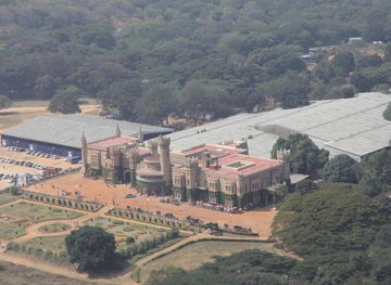
Explore more of Bengaluru
Bengaluru blends palace heritage, South Indian cuisine, leafy avenues and India’s technology culture with museums, markets and lively neighbourhoods to explore.
Explore Bengaluru