From Eve
Know before you go
Hi, I'm Eve. Here are a few practical things to know before exploring Glanteenassig Forest Park.
Local know-how to help you travel smarter and make the most of every moment.

Discover Glanteenassig Forest Park: A secluded haven of woodlands, lakes, and mountains on the Dingle Peninsula, offering tranquil trails and scenic beauty.
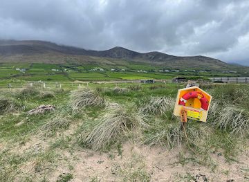
Glanteenassig Forest Park, nestled in the Slieve Mish Mountains on the Dingle Peninsula, is a haven of natural beauty. This secluded park boasts diverse landscapes, including woodlands, mountains, lakes, and waterfalls, offering visitors a tranquil escape into the Irish countryside.
Opening times, essentials, and a few local tips gathered into one calmer, easier-to-scan planning section.
Hi, I'm Eve. Here are a few practical things to know before exploring Glanteenassig Forest Park.
Local know-how to help you travel smarter and make the most of every moment.
Car
If driving from Tralee, head southwest on the N86 towards Castlemaine. After approximately 10 km, turn right onto the R561 and continue for about 12 km. Look for signs for Glanteenassig Forest Park along the way. From Dingle, take the R550 towards Tralee, then turn onto the R560 and follow signs for Glanteenassig. The park is approximately 4.5 km off the R560. Parking is available at the park in designated areas. Parking is free. Be aware that the car park can be busy on good weather days.
Public Transport
To reach Glanteenassig Forest Park via public transport, take a Bus Éireann bus from Tralee to Castlemaine. From Castlemaine, you will need to take a taxi to the park, as public transport options are limited. The taxi ride is approximately 10 km and costs between €15-€20.
Walking
If you are in the nearby village of Camp, you can walk to Glanteenassig Forest Park. The walk is approximately 6 km and takes about 1.5 hours. Follow the R561 road towards the park, ensuring to stay on the side of the road for safety.
Use Tower Bridge as your starting point for nearby food, family ideas, nightlife, and more local discoveries.

Explore expert travel guides, compare and book tours, experiences, hotels, and more—all from the palm of your hand. Download now for seamless trip planning wherever your wanderlust takes you.
Explore the breathtaking landscapes, rich history, and vibrant culture of County Kerry, Ireland's jewel of natural beauty and charm.
Tell me more about County Kerry