Discover the Heart of Selangor: The Geographical Center
Explore the Geographical Center of Selangor, a tranquil historical landmark surrounded by nature and steeped in cultural significance.
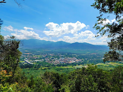
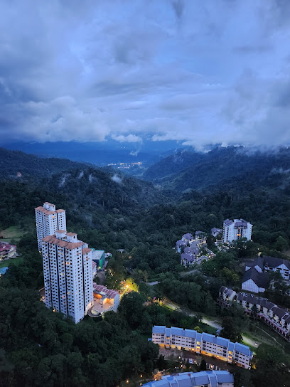
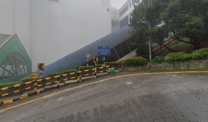
The Geographical Center of Selangor is a remarkable historical landmark that represents the heart of Selangor. This unique location offers tourists a blend of natural beauty, cultural significance, and a chance to reflect on the state's rich heritage. Visitors can enjoy the serenity of the surrounding landscapes while appreciating its importance in the region.
A brief summary to Geographical Center of State of Selangor
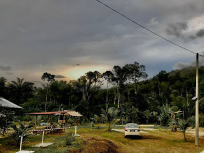
- GG5F+MW, Bukit Tagar, Selangor, MY
Local tips
- Visit early in the morning for a peaceful experience and stunning sunrise views.
- Bring a picnic to enjoy in the serene surroundings.
- Take plenty of photos, especially of the beautiful landscapes.
- Check local weather conditions before your visit for the best experience.
- Consider combining your visit with nearby attractions for a fuller experience.
Getting There
-
Car
If you're driving from Kuala Lumpur, take the North-South Expressway (E1) heading south. Continue on the E1 for about 40 km. Take the exit toward Jalan Tanjung Malim/Bukit Tagar (exit 123). Follow the signs to Bukit Tagar and head east on Route 1. Continue on this road until you reach GG5F+MW, 45500 Bukit Tagar, Selangor. The journey should take around 50 minutes depending on traffic.
-
Public Transportation
From Kuala Lumpur, take the KTM Komuter train (Sentul Line) towards Tanjung Malim. Get off at the Tanjung Malim station. From there, you can take a taxi or a ride-sharing service (like Grab) to reach GG5F+MW, 45500 Bukit Tagar, Selangor. The taxi ride will take approximately 20-30 minutes and may cost around RM15-20.
-
Taxi/Ride-Sharing
If you are in Petaling Jaya or Shah Alam, you can book a taxi or use a ride-sharing app like Grab to reach the Geographical Center of Selangor. Simply enter the destination as GG5F+MW, 45500 Bukit Tagar, Selangor. The travel time will depend on your starting location but expect it to take about 30-50 minutes, with costs ranging from RM30 to RM60.
Discover more about Geographical Center of State of Selangor
Iconic landmarks you can’t miss
Geographical Center of State of Selangor
0.0 km
Discover the serene beauty and historical significance of the Geographical Center of Selangor, a must-visit landmark in Bukit Tagar.

Hotel Seri Malaysia Genting
29.8 km
Discover comfort and convenience at Hotel Seri Malaysia Genting, your ideal base for exploring the stunning Genting Highlands.
MagTree Genting Highlands
30.3 km
Discover the serene beauty of MagTree Genting Highlands, a perfect retreat for nature lovers and adventure seekers in Malaysia's picturesque mountains.
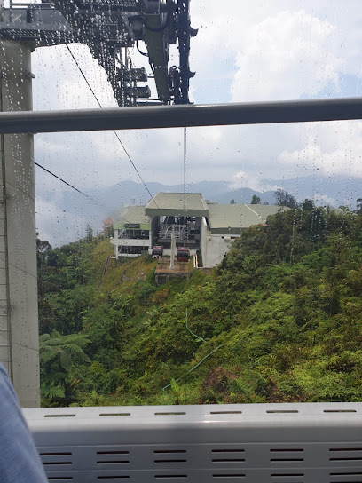
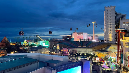
Awana SkyWay, Genting Highlands, Pahang.
31.0 km
Discover the stunning views and exhilarating ride of Awana SkyWay in Genting Highlands, the ultimate mountain cable car experience in Malaysia.
Awana SkyWay (Chin Swee Station)
31.0 km
Discover breathtaking views and adventure at Awana SkyWay, a stunning mountain cable car experience in Genting Highlands, Malaysia.
The Horse Statue
31.0 km
Discover the breathtaking Horse Statue in Genting Highlands, a symbol of cultural heritage surrounded by stunning natural landscapes.
Happy Bee Farm & Insect World
31.1 km
Explore the buzzing world of insects and the charm of farm life at Happy Bee Farm & Insect World in Genting Highlands.
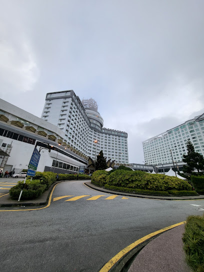
Resorts World Awana
31.1 km
Experience the perfect blend of luxury and nature at Resorts World Awana in the breathtaking Genting Highlands, Malaysia.
Swiss-Garden Hotel & Residences Genting Highlands
31.1 km
Experience luxury and nature at Swiss-Garden Hotel & Residences, a premier retreat in Genting Highlands, offering stunning views and exceptional amenities.
Cradle Rock Genting Highlands
31.1 km
Discover the breathtaking artistry of Cradle Rock, a unique stone carving in the heart of Genting Highlands, surrounded by nature’s beauty.
Genting Palace
31.1 km
Discover the rich flavors of authentic Chinese cuisine at Genting Palace, nestled in the picturesque Genting Highlands.
Genting Secret Garden Hotpot
31.1 km
Experience the art of hot pot dining amidst the breathtaking backdrop of Genting Highlands at Genting Secret Garden Hotpot.
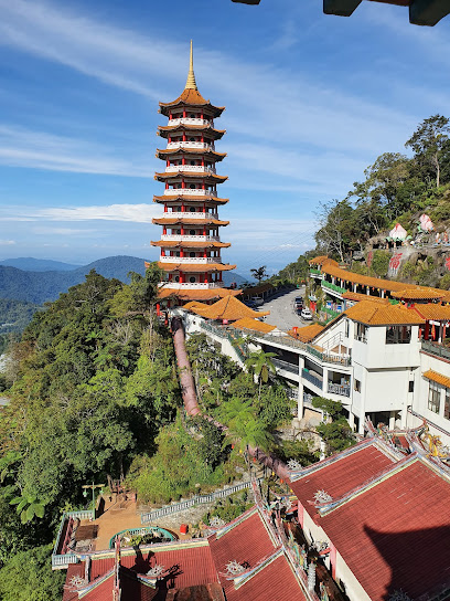
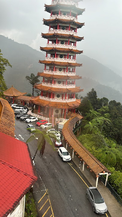
Chin Swee Caves Temple
31.1 km
Discover the serene beauty and cultural richness of Chin Swee Caves Temple, a stunning Buddhist sanctuary nestled in the lush highlands of Pahang, Malaysia.
Casino De Genting
31.2 km
Explore the vibrant Casino De Genting, a premier gaming destination in the stunning Genting Highlands, offering endless entertainment and exquisite dining experiences.
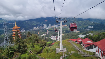
Chair Lift
31.3 km
Discover breathtaking views and the cool mountain breeze at the Genting Highlands Chair Lift, a scenic adventure in Malaysia.
Unmissable attractions to see
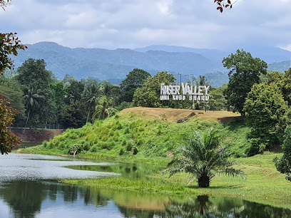
Fraser Valley Kuala Kubu Bharu
14.0 km
Experience the breathtaking natural beauty and serene landscapes of Fraser Valley in Kuala Kubu Bharu, a perfect getaway for nature lovers and adventure seekers.
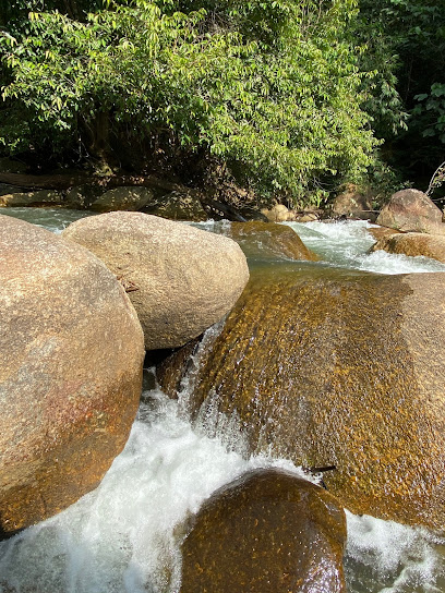
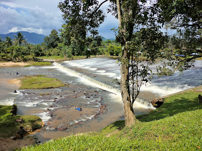
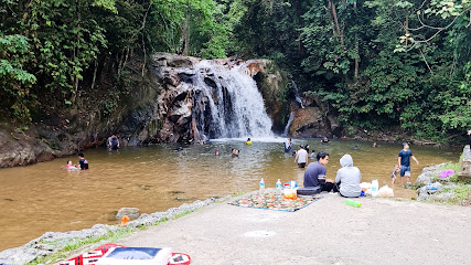
Stone Waterfall
14.7 km
Experience the tranquility of nature at Stone Waterfall, a serene escape in Selangor, perfect for relaxation and exploration.
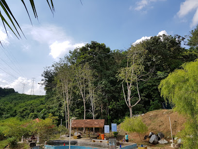
Kolam Air Panas Kuala Kubu Baru
14.8 km
Experience the healing waters and natural beauty of Kolam Air Panas Kuala Kubu Baru, a serene hot springs destination in Selangor.
Alor Lempah
15.4 km
Experience the beauty of nature at Alor Lempah, a serene park in Kuala Kubu Bharu, where adventure meets tranquility in Malaysia.
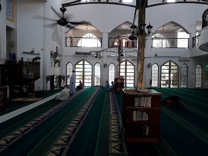
Masjid Bandar Utama Batang Kali
15.6 km
Explore the tranquility of Masjid Bandar Utama Batang Kali, a stunning mosque that embodies the spirit of local Islamic culture and architecture.
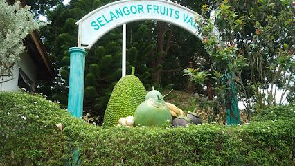
Selangor Fruit Valley (SFV)
15.7 km
Experience the lush beauty and vibrant flavors of Selangor Fruit Valley, where tropical fruits and nature come together for a delightful adventure.
Kuala Kubu Bharu Back Lane Art Gallery
16.1 km
Experience the vibrant local art scene at Kuala Kubu Bharu Back Lane Art Gallery, a creative oasis in Selangor, Malaysia, showcasing diverse artistic talents.

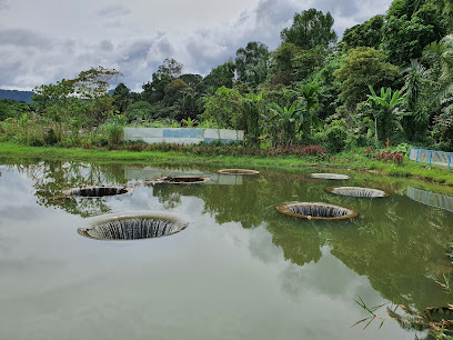
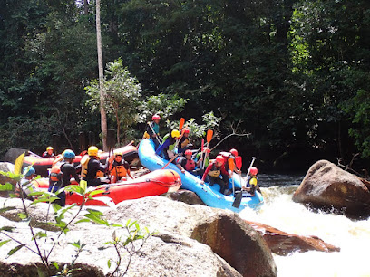
PieRose Swiftwater Sdn Bhd
17.2 km
Discover the thrill of rafting at PieRose Swiftwater in Kuala Kubu Baru, where adventure meets breathtaking natural beauty.

World of Phalaenopsis | Ulu Yam
17.8 km
Explore the vibrant orchid paradise at the World of Phalaenopsis in Ulu Yam, a stunning destination for nature lovers and photography enthusiasts.

Taman Rekreasi Perigi Tujuh
18.9 km
Explore Taman Rekreasi Perigi Tujuh, a serene park in Serendah, Selangor, where nature meets tranquility for an unforgettable outdoor experience.
Bukit Asa
19.1 km
Explore Bukit Asa in Hulu Bernam, Selangor, a stunning natural attraction offering breathtaking views and serene hiking trails amidst lush landscapes.
Dusoon U Wan Den
19.2 km
Discover the serene beauty and cultural richness of Dusoon U Wan Den, a hidden gem in the stunning Genting Highlands of Malaysia.
Water Rafting Kuala Kubu Bahru by PROJEK OUTDOOR
20.1 km
Experience the thrill of water rafting in Kuala Kubu Bahru, Selangor, with PROJEK OUTDOOR – an adventure like no other amidst stunning natural beauty.
Serendah Recreational Waterfall
20.2 km
Explore the serene beauty of Serendah Recreational Waterfall, a tranquil retreat surrounded by lush nature in Selangor, Malaysia.
Lookout Point Sungai Selangor Dam
21.2 km
Discover the serene beauty and stunning views of Lookout Point Sungai Selangor Dam, a perfect escape for nature lovers in Selangor, Malaysia.

Essential places to dine
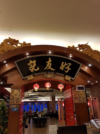
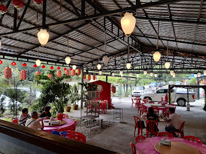
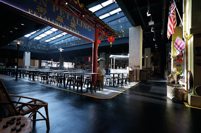
restauran ayu 66
0.0 km
Experience the authentic tastes of Thailand at Restaurant Ayu 66 in Selangor - a culinary delight for every visitor.
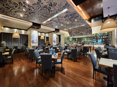
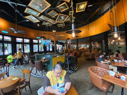
Dai Guan Hill Restaurant
29.7 km
Experience authentic Chinese cuisine with stunning hilltop views at Dai Guan Hill Restaurant in Genting Highlands.
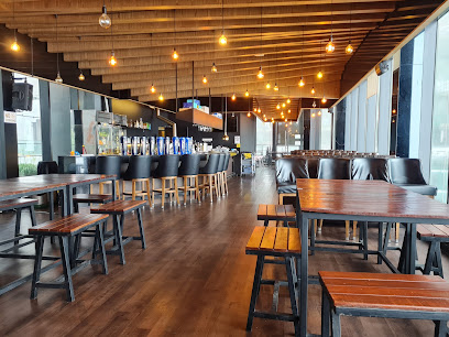
Tavern in the Sky
30.3 km
Discover culinary excellence at Tavern in the Sky – where exquisite Thai flavors meet breathtaking mountain views in Genting Highlands.
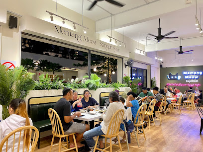
Memang Meow - Genting Permai
31.0 km
Discover the flavors of Malaysia at Memang Meow in Genting Permai - where delicious food meets warm hospitality.
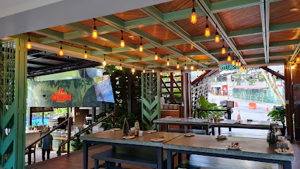
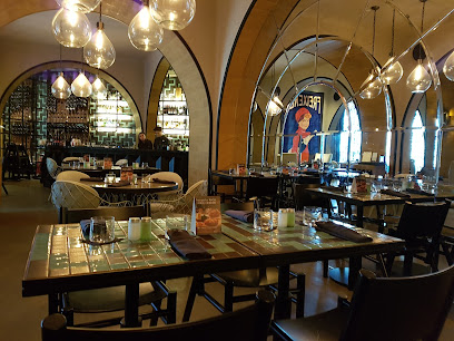
Ayu Awana
31.1 km
Discover exquisite flavors at Ayu Awana in Genting Highlands - where culinary excellence meets breathtaking views.
Garden Terrace @ Swiss-Garden Genting Highlands
31.1 km
Discover delightful cuisine and breathtaking views at Garden Terrace in Swiss-Garden Genting Highlands – your serene dining oasis.
The Olive
31.3 km
Experience exquisite Malaysian cuisine in a luxurious setting at The Olive in Genting Highlands.
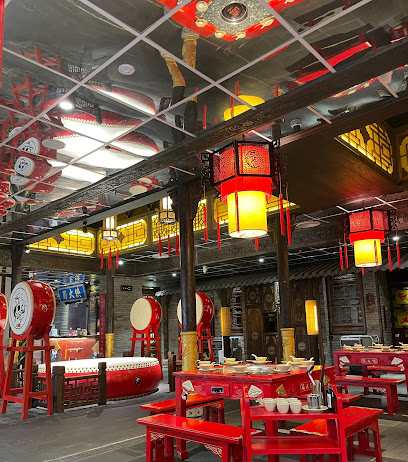
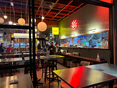
蜀大侠火锅 Shu Da Xia Hot Pot Genting @ Resort Hotel
31.3 km
Indulge in authentic hot pot flavors surrounded by breathtaking views at Shu Da Xia Hot Pot Genting - a culinary gem in Pahang's highlands.
阿广羊腩煲 Ah Guang Lamb Pot (GENTING HIGHLAND)
31.3 km
Experience exquisite lamb dishes at Ah Guang Lamb Pot in Genting Highlands - a culinary delight amidst stunning highland views.
Malaysian Food Street
31.3 km
Experience the vibrant flavors of Malaysia at Malaysian Food Street in Genting Highlands - a paradise for food lovers!
Nicsmann 1940s
31.3 km
Experience nostalgic dining at Nicsmann 1940s in Genting Highlands - where culinary delight meets vintage charm amidst breathtaking mountain views.
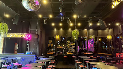
Rockafellers Genting
31.3 km
Experience delectable cuisine and vibrant sports entertainment at Rockafellers Genting in the heart of Malaysia's breathtaking highlands.
Harry Ramsden @ SkyAvenue Genting Highlands
31.3 km
Savor authentic English fish and chips at Harry Ramsden in SkyAvenue Genting Highlands—an unforgettable dining experience amidst breathtaking scenery.
La Fiesta by Marta's Kitchen
31.3 km
Savor authentic Spanish cuisine in the heart of Genting Highlands at La Fiesta by Marta's Kitchen.
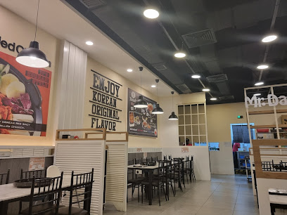
Mr.Dakgalbi @ SkyAvenue (in Genting HighLands)
31.4 km
Savor authentic Korean cuisine at Mr.Dakgalbi in Genting Highlands – where flavor meets excitement in every bite.
Markets, malls and hidden boutiques
Special Gift Net Shop
29.1 km
Explore a stunning collection of handbags at Special Gift Net Shop in Genting Highlands, where style meets quality craftsmanship.

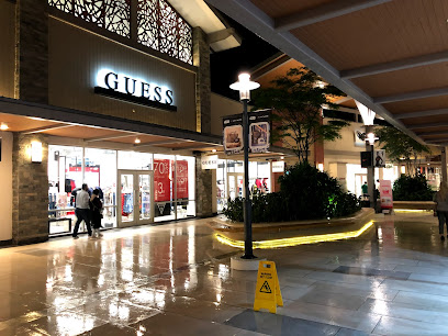
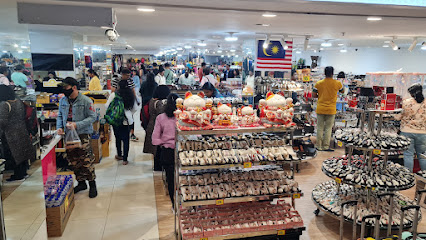
Typo - Genting Premium Outlet
30.8 km
Explore Typo at Genting Premium Outlet for unique Australian gifts, fashion accessories, and quirky stationery amidst the scenic beauty of Genting Highlands.
XIXILI Boutique Genting Highlands Premium Outlets GHPO
31.0 km
Explore the elegance of XIXILI Boutique in Genting Highlands, where luxurious lingerie meets exceptional service in a stunning shopping environment.

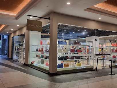
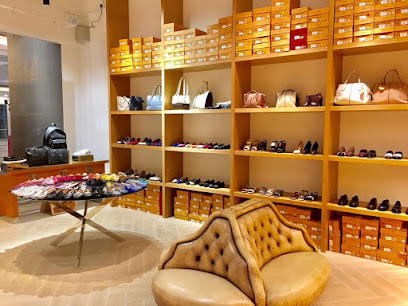
Longchamp
31.0 km
Explore Longchamp in Genting Highlands for exquisite leather goods and fashionable accessories amidst a stunning mountain backdrop.
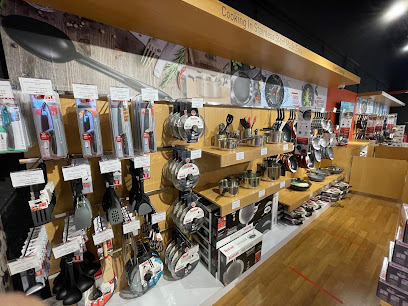
Tefal Official Store (Genting Highlands Premium Outlets)
31.0 km
Discover premium kitchen appliances and homewares at Tefal Official Store, Genting Highlands Premium Outlets - a paradise for cooking enthusiasts.
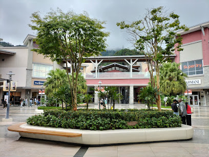
Genting Highlands Premium Outlets
31.0 km
Discover unbeatable deals and breathtaking views at Genting Highlands Premium Outlets, your ultimate shopping getaway in Malaysia.
Melium Designer Outlet (Genting Highlands Premium Outlets)
31.0 km
Discover luxury shopping amidst the stunning peaks of Genting Highlands at Melium Designer Outlet, where style meets affordability.
Coach @ Genting Highlands Premium Outlets
31.0 km
Experience luxury shopping amidst the scenic beauty of Genting Highlands at Coach Premium Outlets, where style meets elegance.
Rico Galleria Genting Highland
31.1 km
Discover the latest trends and unique accessories at Rico Galleria in Genting Highlands, where style meets sophistication in a stunning mountain setting.
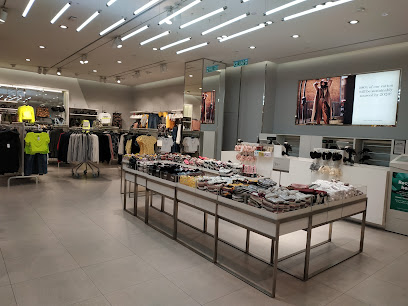
H&M
31.1 km
Explore the latest fashion trends for men, women, and children at H&M in Genting Highlands' Sky Avenue Complex—a shopper's paradise!
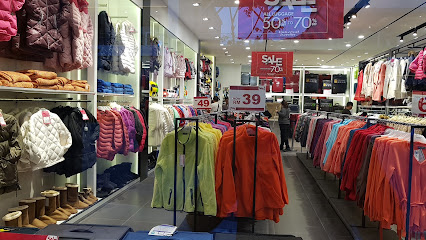
Universal Traveller - Genting Highlands Premium Outlets
31.1 km
Discover unbeatable deals at Genting Highlands Premium Outlets, surrounded by stunning mountain views and a vibrant shopping atmosphere.
Genting outlet
31.3 km
Discover great deals and a delightful shopping experience at Genting Outlet in the scenic Genting Highlands, where retail therapy meets breathtaking views.
Levi's
31.3 km
Discover the latest in denim fashion at Levi's in Genting Highlands, where style meets the stunning mountain backdrop.

Cath Kidston
31.3 km
Explore the whimsical world of Cath Kidston in Genting Highlands, where vintage charm meets modern fashion in a picturesque shopping experience.
Famous Amos @ First World Plaza
31.3 km
Discover the sweet side of Genting Highlands at Famous Amos, where delicious cookies and unique gifts await every visitor.
Essential bars & hidden hideouts
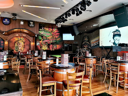
AXE Bar & Kitchen Genting
30.9 km
Experience the vibrant nightlife and delicious dining at AXE Bar & Kitchen, a must-visit destination in Genting, Pahang.
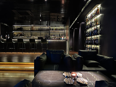
Lobby Lounge
31.2 km
Experience the sophistication of Lobby Lounge at Genting Hotel, a premier bar in Genting Highlands, perfect for relaxation and exquisite refreshments.
Cloud 9
31.2 km
Experience the vibrant nightlife at Cloud 9, the premier bar and nightclub in Genting Highlands, offering exquisite drinks and stunning highland views.
Studio K Karaoke
31.3 km
Experience the ultimate karaoke fun at Studio K in Genting Highlands, where you can sing your favorite songs in a vibrant atmosphere.
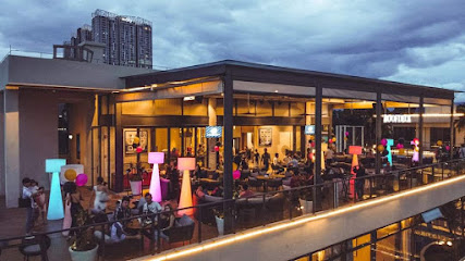
High Line Roof Top Market
31.4 km
Discover the High Line Roof Top Market, a vibrant dining experience in Genting Highlands with breathtaking views and diverse culinary delights.
唐潮
31.4 km
Experience the vibrant nightlife of Genting Highlands at 唐潮, a contemporary bar offering a unique blend of drinks and entertainment.

Alps Bar Genting SkyAvenue
31.4 km
Discover the unique blend of Austrian flavors and vibrant atmosphere at Alps Bar in Genting SkyAvenue, your perfect retreat in the Highlands.
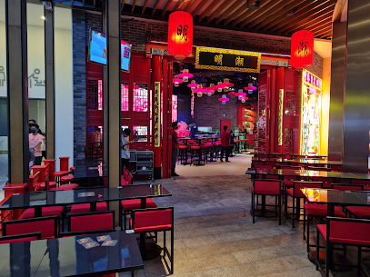
Ming Chao 明潮 @ SkyAvenue
31.4 km
Discover the lively atmosphere and exquisite dining at Ming Chao @ SkyAvenue, a premier bar and restaurant in Genting Highlands, Malaysia.
YáN @ Sky Avenue
31.4 km
Experience authentic Thai cuisine in the vibrant ambiance of YáN @ Sky Avenue, a culinary gem in Genting Highlands.
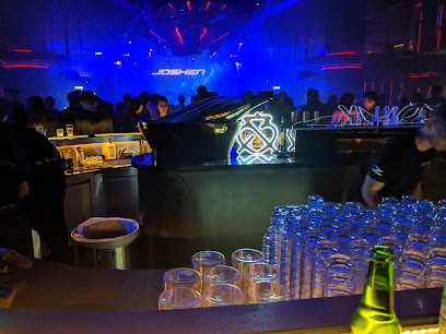
Zouk Genting
31.5 km
Discover the electrifying nightlife of Zouk Genting, where music, dance, and unforgettable experiences await in the heart of Genting Highlands.
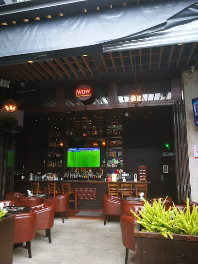
WOW Whiskey 'or' Whites
31.6 km
Discover the ultimate nightlife experience at WOW Whiskey 'or' Whites, a vibrant bar in Genting Highlands with stunning views and an extensive drink menu.
TAP TAP - Sky Avenue
31.7 km
Discover a lively cocktail experience at TAP TAP - Sky Avenue, where exquisite drinks meet breathtaking views in Genting Highlands.
ROOFDECK AT LAKE CITY
36.5 km
Discover the ultimate rooftop experience in Kuala Lumpur at the Roofdeck at Lake City, where spectacular views meet a vibrant nightlife scene.
Sprout by SoTipsy
40.1 km
Experience innovative cocktails and vibrant nightlife at Sprout by SoTipsy, Kuala Lumpur's top cocktail bar in Mont Kiara.
The Barn @ 1 Mont Kiara
40.7 km
Discover a culinary oasis at The Barn @ 1 Mont Kiara, where exquisite flavors meet an extensive wine selection in Kuala Lumpur's vibrant dining scene.