

Tanjung Aru (Kota Kinabalu) Travel Guide - Free
Explore Tanjung Aru in Kota Kinabalu with Evendo's free guide. Find the best shops, historic streets, restaurants, and gems on web or mobile.


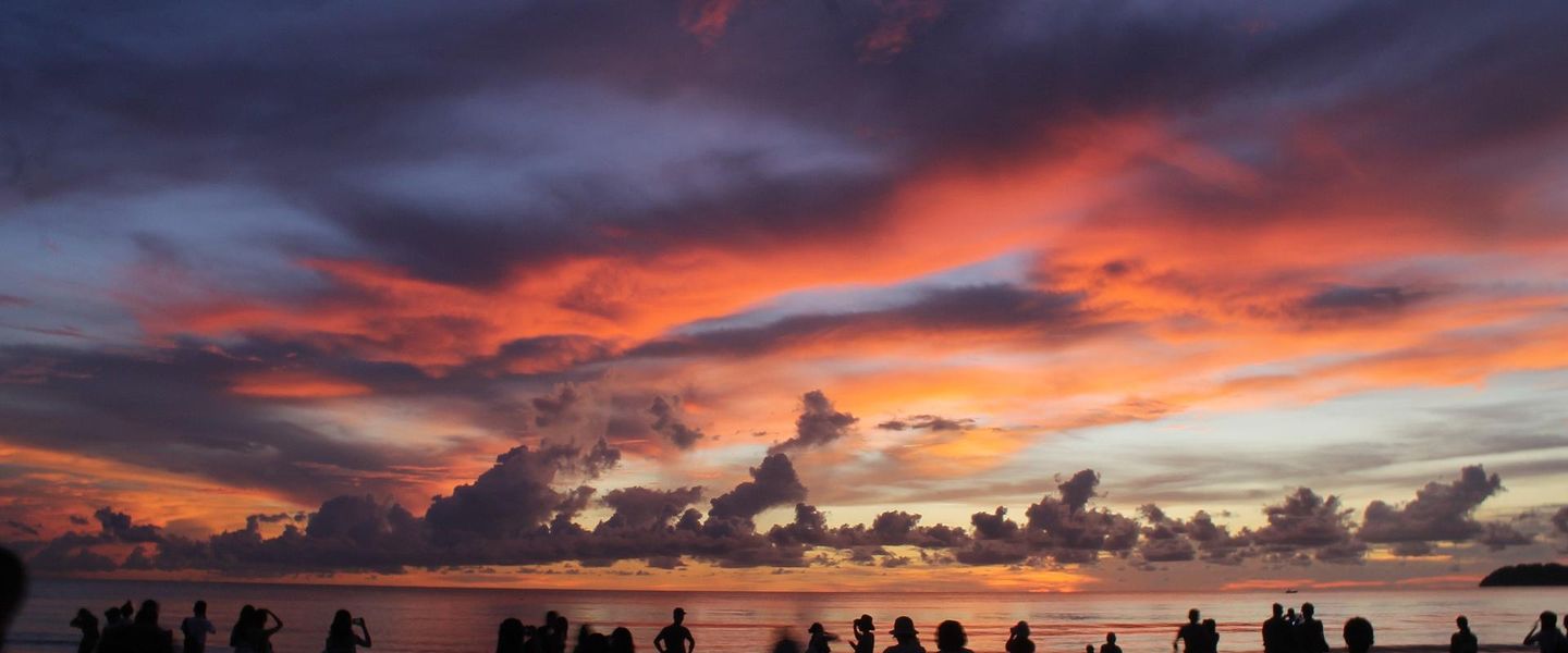


Tanjung Aru in Kota Kinabalu pairs casuarina-fringed beaches, sunset views, Perdana Park, local cafés and easy access to Sabah's nearby capital.
Coastal Setting and Local Character
Tanjung Aru occupies a low-lying coastal stretch just south-west of Kota Kinabalu's commercial centre, where a broad beach, stands of casuarina trees and a small railway community create a markedly different atmosphere from the city's busier waterfront. Its name refers to the aru, or casuarina, trees that shape the shoreline. The neighbourhood is best known for Tanjung Aru Beach, whose islands and sea horizon become particularly atmospheric as the sun descends, although the beach is also a lived-in public space used for walking, informal gatherings and family outings.Read more about Tanjung Aru
Beach, Park and Everyday Life
Resorts and the Southern Shore
Explore Tanjung Aru on the map
A handpicked selection of must-see spots in Tanjung Aru, mapped for you.
Best hotels in Tanjung Aru
Tanjung Aru essentials
Getting There
Getting Around
Safety
Emergency Situations
Do's and Don'ts
Local Tips

From Eve
Local phrases worth knowing
You don't need to get them perfect. A few words go a long way, and locals appreciate the effort.
Basics
| English | Local | Say it |
|---|---|---|
| Hello | Halo | [ha-lo] |
| Goodbye | Selamat tinggal | [se-la-mat ting-gal] |
| Yes | Ya | [ya] |
| No | Tidak | [ti-dak] |
| Please/You're welcome | Sila | [si-la] |
| Thank you | Terima kasih | [te-ri-ma ka-sih] |
| Excuse me/Sorry | Maaf | [ma-af] |
| How are you? | Apa khabar? | [a-pa kha-bar] |
| Fine. And you? | Baik. Dan kamu? | [ba-ik. dan ka-mu] |
| Do you speak English? | Boleh cakap Bahasa Inggeris? | [bo-leh cha-kap ba-ha-sa ing-ge-ris] |
| I don't understand | Saya tidak faham | [sa-ya ti-dak fa-ham] |
Eating & Drinking
| English | Local | Say it |
|---|---|---|
| I'd like to see the menu, please | Saya ingin lihat menu, sila | [sa-ya in-gin li-hat me-nu, si-la] |
| I don't eat meat | Saya tidak makan daging | [sa-ya ti-dak ma-kan da-ging] |
| Cheers! | Yam seng! | [yam seng] |
| I would like to pay, please | Saya ingin bayar, sila | [sa-ya in-gin ba-yar, si-la] |
Emergencies
| English | Local | Say it |
|---|---|---|
| Help! | Tolong! | [to-long] |
| Go away! | Pergi jauh-jauh! | [per-gi jauh-jauh] |
| Call the Police! | Panggil polis! | [pang-gil po-lis] |
| Call a doctor! | Panggil doktor! | [pang-gil dok-tor] |
| I'm lost | Saya sesat | [sa-ya se-sat] |
| I'm ill | Saya sakit | [sa-ya sa-kit] |
Shopping
| English | Local | Say it |
|---|---|---|
| I'd like to buy... | Saya ingin beli... | [sa-ya in-gin be-li] |
| I'm just looking | Saya hanya tengok-tengok | [sa-ya ha-nya ten-gok-ten-gok] |
| How much is it? | Berapa harganya? | [be-ra-pa har-ga-nya] |
| That's too expensive | Itu terlalu mahal | [i-tu ter-la-lu ma-hal] |
| Can you lower the price? | Boleh kurangkan harga? | [bo-leh kur-ang-kan har-ga] |
Time & Numbers
| English | Local | Say it |
|---|---|---|
| What time is it? | Pukul berapa sekarang? | [pu-kul be-ra-pa se-ka-rang] |
| It's one o'clock | Pukul satu | [pu-kul sa-tu] |
| Half past (10) | Setengah (10) | [se-ten-gah (10)] |
| Morning | Pagi | [pa-gi] |
| Afternoon | Petang | [pe-tang] |
| Evening | Malam | [ma-lam] |
| Yesterday | Semalam | [se-ma-lam] |
| Today | Hari ini | [ha-ri i-ni] |
| Tomorrow | Esok | [e-sok] |
| 1 | Satu | [sa-tu] |
| 2 | Dua | [du-a] |
| 3 | Tiga | [ti-ga] |
| 4 | Empat | [em-pat] |
| 5 | Lima | [li-ma] |
| 6 | Enam | [e-nam] |
| 7 | Tujuh | [tu-juh] |
| 8 | Lapan | [la-pan] |
| 9 | Sembilan | [sem-bi-lan] |
| 10 | Sepuluh | [se-pu-luh] |
Transport & Directions
| English | Local | Say it |
|---|---|---|
| Where's a/the...? | Di mana... | [di ma-na] |
| What's the address? | Apa alamatnya? | [a-pa a-la-mat-nya] |
| Can you show me (on the map)? | Boleh tunjukkan saya (pada peta)? | [bo-leh tun-juk-kan sa-ya (pa-da pe-ta)] |
| When's the next (bus)? | Bila bas seterusnya? | [bi-la bas se-te-rus-nya] |
| A ticket (to ....) | Sebuah tiket (ke ....) | [se-buah ti-ket (ke)] |
History of Tanjung Aru
The Casuarina Coast
Tanjung Aru's name reflects the casuarina trees that historically lined this coastal headland. Before the area became associated with resorts and sunset visits, it was a shoreline landscape of beach, vegetation and village settlement connected to the maritime life of the west coast of North Borneo. The coastal setting shaped the neighbourhood's identity: the sea was part of everyday life rather than merely a scenic backdrop, while the trees offered shade in an exposed tropical environment. Although modern development has altered sections of the shore, the surviving casuarinas remain an important visual link with the landscape that gave Tanjung Aru its name.
Railway and Settlement
Tanjung Aru became more closely connected to the wider settlement around Jesselton, now Kota Kinabalu, through the construction of Sabah's railway in the early twentieth century. The line was developed during the British North Borneo period to connect the west-coast corridor with agricultural and trading areas farther south, and Tanjung Aru's station became a local point of arrival and departure. The railway did not turn the neighbourhood into an industrial district; instead, it reinforced its relationship with the city, nearby villages and the southern coastal plain. The station and remaining railway infrastructure preserve a tangible trace of that regional transport history.
From Village Coast to Resort Shore
As Kota Kinabalu expanded after the formation of Malaysia in 1963, Tanjung Aru's beaches gained importance for recreation, hospitality and urban expansion. Resort development introduced larger landscaped properties along parts of the coast, while established residential areas retained a more local scale. This created the mixed character visible today: a public beach and railway community alongside hotels, open parkland and airport-related development. The neighbourhood's appeal has remained tied to its shoreline rather than to dense commercial construction, and debates about coastal planning have highlighted the need to balance public access, environmental value and development pressures.
A Contemporary Public Landscape
In recent decades, Tanjung Aru has continued to function as both a leisure district and an ordinary residential area within Kota Kinabalu. The beach attracts residents and visitors for evening views, while facilities such as Perdana Park add a landscaped public space away from the sand. Prince Philip Park and the casuarina-fringed coastline retain ecological and scenic importance, even as road traffic, airport activity and changing development plans affect the southern edge of the city. Tanjung Aru's contemporary significance therefore lies in the coexistence of public shoreline, local settlement, railway heritage, tourism and valued coastal vegetation.
Tanjung Aru in Photos
Browse through our photo collection highlighting the charm and character of the destination.
Neighbourhoods near Tanjung Aru
The closest neighbourhoods to Tanjung Aru, if you have time for more than one stop.
-

-

-

-


Swipe for more neighbourhoods
Explore more

Explore more of Kota Kinabalu
Kota Kinabalu combines Sabah’s island-fringed coastline, markets, seafood, cultural heritage and Mount Kinabalu access for memorable city sightseeing.
Explore Kota Kinabalu