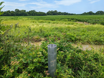
Mississippi River Basin Model: A Concrete History of Flood Control
Explore a unique piece of engineering history: a massive, open-air concrete model of the Mississippi River Basin used for flood control research.
Explore a massive, derelict hydraulic model of the Mississippi River Basin, built in the mid-20th century to study flood control. Covering 200 acres, this unique landmark offers a glimpse into the engineering ingenuity of the past.
A brief summary to Mississippi River Basin Model
- 6180 McRaven Rd, Jackson, Mississippi, 39209, US
- +1205-529-4231
- Visit website
Local tips
- Wear comfortable shoes, as you'll be walking on uneven concrete surfaces and possibly overgrown paths.
- Bring water and insect repellent, especially during warmer months.
- Check the Friends of the Mississippi River Basin Model website for information on volunteer days or guided tours.
- Be aware that the site is not fully maintained, so expect some overgrown areas and potentially slippery surfaces.
Getting There
-
Driving
The Mississippi River Basin Model is located within Buddy Butts Park at 6180 McRaven Rd, Jackson, MS 39209. From I-20, take the Clinton/Jackson exit onto US-80 E/MS-18 E. Continue on US-80 E/MS-18 E, then turn left onto McRaven Rd. The park entrance will be on your right. Parking is free within the park. Be aware that parking may be limited during peak times.
-
Public Transport
From downtown Jackson, head to the nearest bus stop on Capitol Street. Take the Jackson Transit Authority bus route that heads toward McRaven Road. Check the schedule for the bus number and departure times. Once on the bus, ask the driver to notify you when you reach McRaven Road. After getting off the bus, walk approximately 0.5 miles west on McRaven Road to reach the Mississippi River Basin Model at 6180 McRaven Rd. A single ride on JTA is $1.25.
Discover more about Mississippi River Basin Model
Iconic landmarks you can’t miss
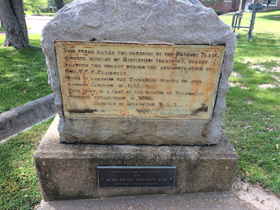
Stone Marking Old Natchez Trace
3.6 km
Discover the Stone Marking Old Natchez Trace, a historical landmark in Mississippi that tells the rich story of the ancient paths connecting cultures and communities.
Natchez Trace Parkway Sign
5.0 km
Discover history and scenic beauty at the Natchez Trace Parkway Sign in Clinton, Mississippi, a gateway to a 444-mile historic byway.

Mississippi Blues Trail – Charley Patton's Birthplace
9.9 km
Discover the birthplace of blues legend Charley Patton on the Mississippi Blues Trail, and immerse yourself in a rich musical heritage.
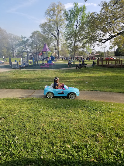
Battlefield Park
11.3 km
Explore Civil War history and enjoy outdoor recreation at Jackson's Battlefield Park, a unique blend of past and present.
Ice House
12.0 km
A unique and historic event venue in downtown Jackson, perfect for weddings, corporate events, and special celebrations.
201 Capitol
12.2 km
Elegant event venue in Jackson's historic district, perfect for unforgettable gatherings and celebrations.

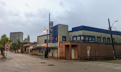
Alamo Theatre
12.2 km
Discover the Alamo Theatre in Jackson, MS - a historic venue showcasing vibrant theater productions in a charming setting.
Jackson Convention Complex Center
12.4 km
Experience world-class events and Southern hospitality at the Jackson Convention Complex, the premier meeting and event destination in downtown Jackson.
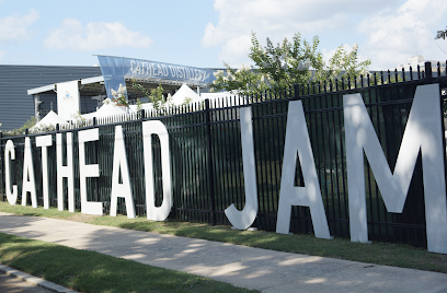
Cathead Distillery
12.4 km
Experience Mississippi's first legal distillery since Prohibition, offering award-winning spirits, tours, and a taste of Southern culture.
One Jackson Place
12.5 km
Discover One Jackson Place, a striking legal landmark in downtown Jackson, Mississippi, showcasing modern architecture and vibrant urban life.
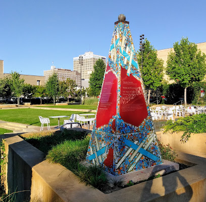
The Art Garden at the Mississippi Museum of Art
12.6 km
Discover a vibrant blend of art and nature in downtown Jackson at the Art Garden, a 1.2-acre park featuring art installations and green spaces.
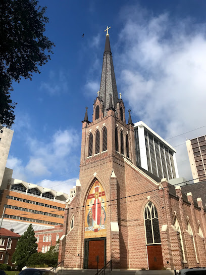
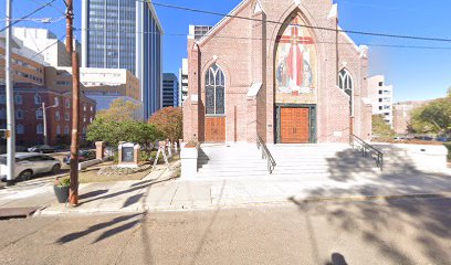
Cathedral of St. Peter The Apostle
12.7 km
A historic Catholic cathedral in downtown Jackson, Mississippi, featuring Gothic Revival architecture and beautiful stained glass windows.
Jackson Ghosts
12.7 km
Explore Jackson's haunted history on a thrilling ghost tour, uncovering chilling tales and paranormal mysteries in Mississippi's capital city.
Visit Mississippi
12.7 km
Discover Mississippi's soul: history, music, culture, and Southern hospitality await at the official tourism information center in Jackson.
Visit Jackson
12.7 km
Discover Jackson, Mississippi: Your official guide to the City With Soul, offering insights into attractions, history, music, and culture.
Unmissable attractions to see
Clinton Visitor Center
5.8 km
Explore Mississippi's rich history and vibrant culture at the Clinton Visitor Center, a hub for art, events, and local heritage.

Mynelle Gardens Arboretum & Botanical Center
6.8 km
Explore the tranquil beauty of Mynelle Gardens Arboretum & Botanical Center in Jackson, Mississippi—a lush paradise for nature lovers and botanical enthusiasts.
Presidential Hills Park
8.3 km
Discover Presidential Hills Park, a serene oasis in Jackson, MS, perfect for picnics, walks, and family fun amidst beautiful landscapes.
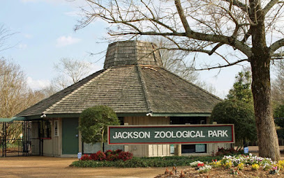
The Jackson Zoo
9.1 km
Discover The Jackson Zoo, a captivating family-friendly attraction featuring diverse wildlife, engaging exhibits, and lush park surroundings in Mississippi.
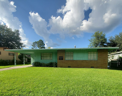
Medgar and Myrlie Evers Home National Monument
10.7 km
Explore the Medgar and Myrlie Evers Home National Monument and delve into the rich history of the civil rights movement in Jackson, Mississippi.
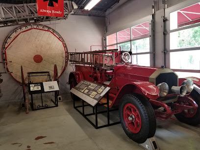
City of Jackson Fire Museum
11.8 km
Explore the City of Jackson Fire Museum, a unique attraction showcasing the rich history and evolution of firefighting in Mississippi.
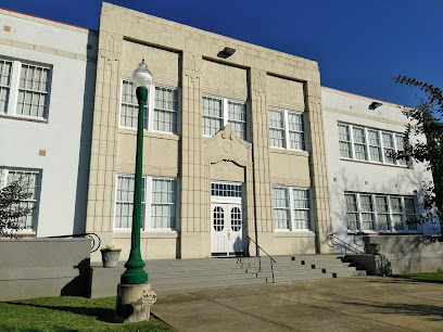
Smith Robertson Museum
12.4 km
Explore the Smith Robertson Museum, a cultural gem in Jackson, Mississippi, dedicated to the rich history and contributions of African Americans.
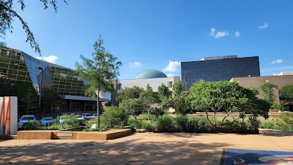
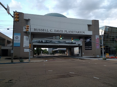
Russell C Davis Planetarium
12.5 km
Discover the cosmos at Russell C Davis Planetarium in Jackson, Mississippi – an immersive experience for astronomy enthusiasts and families alike.
International Museum of Muslim Cultures
12.5 km
Explore the first museum in the U.S. dedicated to Muslim cultures in Jackson, Mississippi, and engage with diverse, enriching exhibits.

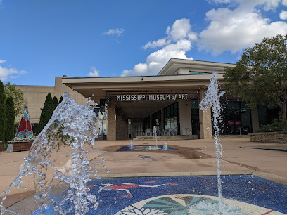
Mississippi Museum of Art
12.5 km
Explore the Mississippi Museum of Art: A cultural haven showcasing the artistic legacy and contemporary creativity of Mississippi in a stunning setting.
Governor's Mansion
12.8 km
Discover the elegance of the Mississippi Governor's Mansion, a historical landmark showcasing the state's political heritage and architectural beauty.
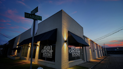
601 Escape Rooms
13.0 km
Experience thrilling adventures and solve captivating puzzles at 601 Escape Rooms in Jackson, Mississippi, where fun and teamwork collide.
Welcome To Jackson Sign
13.0 km
Discover the charm of Jackson, Mississippi, at the iconic Welcome to Jackson Sign – a vibrant symbol of Southern hospitality and culture.
Old Capitol Museum
13.1 km
Explore Mississippi's rich heritage at the Old Capitol Museum, a historic gem showcasing stunning architecture and engaging exhibits.

Two Mississippi Museums
13.3 km
Discover Mississippi's Legacy at Two Mississippi Museums: A Journey Through History and Culture in Jackson.
Essential places to dine
Crechale's
8.1 km
Discover Crechale's in Jackson, MS – where exquisite steaks meet cozy ambiance for an unforgettable dining experience.
Moms & Pops Smokehouse
11.0 km
Savor the rich flavors of authentic Southern cuisine at Moms & Pops Smokehouse in Jackson, Mississippi - a must-visit for comfort food lovers.
Fred's Soul Food Restaurant
11.6 km
Discover authentic Southern flavors at Fred's Soul Food Restaurant in Jackson - where every meal tells a story.
Natchez Trace Smokehouse
11.6 km
Discover authentic Southern barbecue at Natchez Trace Smokehouse in Mississippi, where every bite tells a story of flavor and tradition.
Bettina's Soulfood Kitchen
11.9 km
Experience authentic Southern soul food at Bettina's Kitchen in Jackson—where every dish tells a story of tradition and flavor.
The Iron Horse Grill
11.9 km
Discover the heart of Jackson at The Iron Horse Grill - where American comfort food meets Southern charm.
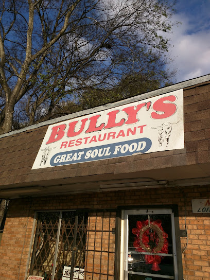
Bully's Soul Food Restaurant
12.0 km
Discover the heartwarming flavors of Southern soul food at Bully's Soul Food Restaurant in Jackson, MS – a true culinary delight.
Lizzie's House
12.2 km
Discover authentic Southern flavors at Lizzie's House in Jackson, MS - where tradition meets taste in a charming setting.

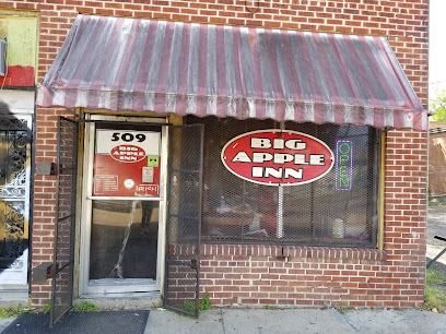
Big Apple Inn
12.2 km
Discover authentic Southern flavors at Big Apple Inn in Jackson, MS – famous for its smoked sausage sandwiches and friendly atmosphere.
Johnny T's Bistro & Blues
12.3 km
Discover the vibrant flavors and soulful sounds at Johnny T's Bistro & Blues in Jackson’s historic Farish Street district.
Spot
12.4 km
Experience culinary excellence at Spot in Jackson, where Southern flavors meet modern dining in a welcoming atmosphere.

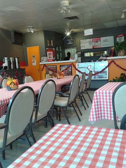
Sugar's Place
12.4 km
Experience authentic Southern comfort food at Sugar's Place - where every dish tells a story of local tradition.
Skinny's aka 123 Depot
12.5 km
Discover Southern flavors at Skinny's aka 123 Depot in Jackson - where great food meets vibrant atmosphere.
Chick-fil-A
12.6 km
Experience Southern charm at Chick-fil-A in Jackson - renowned for its delicious chicken sandwiches and warm hospitality.
Ms D Cousine
12.6 km
Discover authentic Southern cuisine at Ms D Cousine in Jackson - where local flavors meet warm hospitality.

Markets, malls and hidden boutiques
Visions Of Beautiful
7.5 km
Explore the latest women's fashion trends at Visions Of Beautiful in Jackson, Mississippi, where style meets individuality and confidence.

Westland Plaza
8.4 km
Explore Westland Plaza, Jackson's bustling shopping mall, featuring a variety of stores, dining options, and local services for an unforgettable shopping experience.
Haus Of Fashion
8.7 km
Discover the latest trends and timeless styles at Haus Of Fashion, Jackson's premier women's clothing store for every occasion.

Carmelite Gift Shop
10.2 km
Explore unique handcrafted items and religious gifts at Carmelite Gift Shop, a must-visit destination in Jackson, Mississippi.
Born Again Goods
10.5 km
Uncover hidden gems and vintage treasures at Born Again Goods, Jackson's premier antique store for unique finds and nostalgic collectibles.
Delta Mart Shopping Center
10.9 km
Explore the best of Jackson shopping at Delta Mart Shopping Center, your go-to destination for groceries and unique retail finds.
Little Big Store
11.0 km
Explore Little Big Store in Raymond, a treasured music shop featuring vinyl, instruments, and a vibrant community atmosphere.
New York Southern Style, LLC - Fashion Stylist
11.8 km
Discover chic women's fashion in Jackson, MS at Worth New York – where Southern style meets modern trends.
Kolors
11.9 km
Explore Kolors in Jackson, MS for a unique selection of authentic African goods, celebrating culture through craftsmanship and creativity.
First Lady Inc Boutique
11.9 km
Explore First Lady Inc Boutique in Jackson, Mississippi, for unique fashion finds and expert clothing alterations that enhance your travel experience.

Marshall's Music & Book Store
12.3 km
Explore Marshall's Music & Book Store in Jackson, MS for a unique collection of books, sheet music, and church supplies, embodying local culture and creativity.
Afrikan Art Gallery & Bookstore
12.3 km
Explore the rich cultural heritage at Afrikan Art Gallery & Bookstore, where art, literature, and unique gifts come together in Jackson, Mississippi.
N.U.T.S.- Neat Used Things for Sale
12.5 km
Explore unique finds and vintage treasures at N.U.T.S. - Neat Used Things for Sale in Jackson, Mississippi - A thrift store for every treasure hunter!
Lavish lifestyle boutique
12.5 km
Explore Lavish Lifestyle Boutique in Jackson, MS, where fashion meets creativity, offering unique styles and a personalized shopping experience.
Talia & Rose
12.6 km
Explore Talia & Rose, a boutique gem in Jackson, Mississippi, offering unique apparel and accessories for a stylish shopping experience.

Essential bars & hidden hideouts
The Froghead Grill
2.4 km
Experience the flavors of the South at The Froghead Grill, a culinary gem in Clinton, MS, offering a diverse menu and warm hospitality.
Debo's Lounge
10.4 km
Experience the lively atmosphere and diverse drink selection at Debo's Lounge, Jackson's go-to bar for a fun night out.
Play-The Day Sinatra Bar
10.5 km
Discover the lively ambiance of Play-The Day Sinatra Bar in Jackson, MS, where sports, drinks, and live music come together for an unforgettable night out.
KE Bar
12.1 km
Discover the vibrant nightlife at KE Bar, a premier destination in Jackson, MS, offering craft cocktails and a welcoming atmosphere.
Midtown Sports Bar
12.2 km
Discover Midtown Sports Bar in Jackson, where sports, great food, and a unique hookah experience come together for an unforgettable night out.
F. Jones Corner
12.2 km
Experience the vibrant nightlife of Jackson, MS at F. Jones Corner, where live music meets delicious Southern cuisine in a lively bar atmosphere.
Lavish Lounge
12.3 km
Discover Lavish Lounge in Jackson, MS - an upscale lounge featuring fine cigars and a vibrant hookah bar for a perfect night out.
4th Avenue Lounge
12.5 km
Discover the lively atmosphere of 4th Avenue Lounge in Jackson, MS - a perfect blend of cocktails, music, and vibrant nightlife.
Pop's Saloon
12.5 km
Experience the vibrant nightlife at Pop's Saloon, Jackson's lively bar known for live music, pool games, and a friendly atmosphere.
Names and Faces Lounge
12.6 km
Experience Southern charm and vibrant nightlife at Names and Faces Lounge in Jackson, MS, where delicious drinks and live music await.
Ole Tavern on George Street
12.9 km
Experience Southern hospitality at Ole Tavern on George Street, where delicious food meets a vibrant bar atmosphere in Jackson, Mississippi.
One Block East
13.1 km
Discover the vibrant fusion of Southern cuisine and live music at One Block East, Jackson's premier grill and entertainment venue.
King Rider's Clubhouse
13.2 km
Experience the vibrant nightlife at King Rider's Clubhouse, Jackson's premier bar for locals and tourists alike, featuring creative cocktails and live music.
Good Bar
13.5 km
Discover Good Bar in Jackson, MS - a vibrant nightlife destination offering exceptional drinks, friendly atmosphere, and local entertainment.
Library Lounge
13.5 km
Experience the unique Southern charm and cozy atmosphere of Jackson's Library Lounge, where literature meets leisure.
Nightclubs & after hour spots
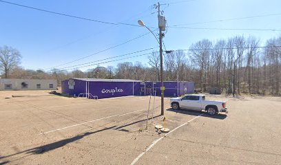
Couples
7.5 km
Discover the vibrant nightlife at Couples Night Club in Jackson, MS, where music, dancing, and romance come together for an unforgettable experience.
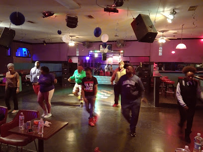
Soops The Ultimate
8.0 km
Experience the best of Jackson, MS at Soops The Ultimate – a grill and nightlife hotspot with live music and vibrant energy.
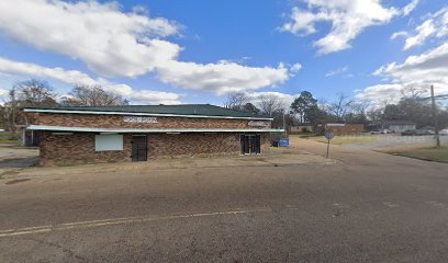
Club Anonymous
10.6 km
Dive into the lively atmosphere of Club Anonymous, a premier night club in Jackson, Mississippi, offering affordable fun and unforgettable nights.

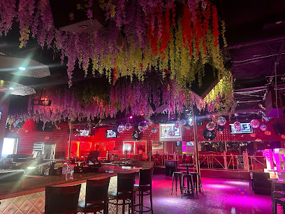
CLUB TWILIGHT
12.0 km
Discover the vibrant nightlife at Club Twilight, Jackson's ultimate destination for music, dancing, and unforgettable experiences.
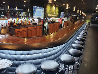
440 Restaurant, Rendezvous(loungr), Relax (cigar Lounge), Reminisce (Event Center)
12.1 km
Experience the vibrant nightlife of Jackson, Mississippi at 440 Restaurant & Lounge, featuring dining, cocktails, and a relaxed cigar lounge.
440jxn
12.1 km
Experience the best of Southern grilling at 440 N Mill St, Jackson, where local flavors and a lively atmosphere unite for an unforgettable dining experience.
Club City Lights
12.1 km
Discover the vibrant nightlife of Jackson, MS at Club City Lights, a premier gay nightclub celebrating diversity and inclusivity.
Kisha's Lounge
12.2 km
Discover Kisha's Lounge in Jackson, MS - a vibrant lounge with live music, refreshing cocktails, and a perfect atmosphere for socializing.
Hideaway Club
12.3 km
Experience the vibrant nightlife of Jackson, MS at Hideaway Club, where karaoke and great drinks create unforgettable memories.
Lounge 114
12.3 km
Experience the vibrant nightlife of Jackson at Lounge 114, where the beats are infectious and the atmosphere is electrifying.

Club 110
12.4 km
Discover the energetic nightlife and live music scene at Club 110, Jackson's top destination for unforgettable evenings filled with fun and excitement.
Danny's Downtown
12.6 km
Discover the heartbeat of Jackson's nightlife at Danny's Downtown, a vibrant night club offering engaging entertainment and a lively atmosphere.
Club Mirage
12.6 km
Unleash your night at Club Mirage, Jackson's premier nightclub where vibrant music and electrifying atmosphere meet for an unforgettable experience.

MikeTown Comedy Club
14.3 km
Experience the best of laughter and entertainment at MikeTown Comedy Club, Jackson's premier comedy destination for unforgettable nights.

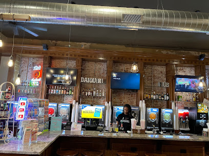
Daiquiri Hub
53.2 km
Experience the vibrant nightlife at Daiquiri Hub in Vicksburg, MS, where delicious frozen daiquiris and a lively atmosphere await every visitor.