

Imlil Region Travel Guide - Free Web & App
Your ultimate guide to Imlil Region. Discover top landmarks, proposed trips, and local tips. Free on the web or via the Evendo companion app.


Imlil Region, Morocco, is the High Atlas gateway to Mount Toubkal, with Amazigh villages, mountain trails, valleys and memorable trekking experiences.
Mountain Gateway
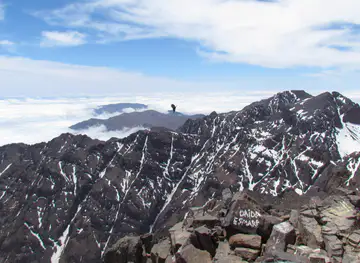
The Imlil Region lies in Morocco’s High Atlas, south of Marrakech, where the cultivated upper valleys rise towards Mount Toubkal, North Africa’s highest mountain at 4,167 metres. Imlil village, set at roughly 1,740 metres, is the principal gateway for treks into Toubkal National Park and a practical base for exploring the surrounding Amazigh communities, mountain slopes and valleys. The destination is not a single compact attraction but a network of settlements and trails extending through the upper Mizane Valley and neighbouring passes.Read more about Imlil Region
Villages and Landscapes
Amazigh Heritage and Outdoor Travel
When is the best time to visit Imlil Region?
Best: April–May, October · 22–26°C| Month | High (°C) | Rainfall (mm) |
|---|---|---|
| January | 13 | 40 |
| February | 14 | 40 |
| March | 18 | 40 |
| April (best) | 22 | 20 |
| May (best) | 26 | 10 |
| June | 31 | 2 |
| July | 35 | 2 |
| August | 35 | 4 |
| September | 30 | 10 |
| October (best) | 25 | 20 |
| November | 19 | 40 |
| December | 14 | 40 |
Getting to and around Imlil Region
How to get there
Transportation
Best attractions in Imlil Region
The principal attraction is the mountain landscape itself, extending from Imlil and Aroumd through the upper Mizane Valley towards the Toubkal Refuge and Mount Toubkal. Walks between the villages reveal terraced fields, walnut trees, streams and steep slopes shaped by generations of Amazigh farming. Higher routes lead into more austere terrain of ridges, scree and broad alpine horizons, with conditions varying markedly by season. The Tizi n'Tamatert pass, reached from the Imlil area, provides access to expansive views across the High Atlas and towards neighbouring valleys. Aroumd’s elevated position and traditional settlement pattern make it a natural stop on local walks, while the Toubkal National Park landscape offers opportunities for observing mountain vegetation and occasional wildlife without guaranteeing sightings. The Kasbah du Toubkal, in Aroumd, is both a prominent building and a base associated with trekking tourism. Nearby Asni provides a useful lower-valley contrast, particularly on market days, but it lies outside the immediate Imlil mountain area.
-
Tourist attraction
Lac Ifni
Discover Lac Ifni, a serene alpine lake in Morocco's Atlas Mountains, perfect for hiking, picnicking, and immersing yourself in nature's beauty.
-
Restaurant
La Rosa Agafay
Experience the magic of Moroccan cuisine in the breathtaking Agafay Desert at La Rosa Agafay, a must-visit culinary oasis near Marrakesh.
-
Tourist attraction
Mountain Sahara Treks
Discover the breathtaking beauty of Mountain Sahara Treks in Imlil, Morocco, where adventure meets stunning landscapes and rich culture.
-
Hiking area
DAR AMDAINE
Explore the stunning landscapes of Dar Amdaine, a premier hiking area in Imlil, Morocco, with breathtaking views of the Atlas Mountains and rich local culture.


Best landmarks in Imlil Region
Mount Toubkal is the defining natural landmark of the region, rising to 4,167 metres within the High Atlas and giving the surrounding trekking landscape its international profile. The upper Mizane Valley forms the principal approach from Imlil, while the Tizi n'Tamatert pass is an important high route with wide views across the mountain country. Aroumd, or Armed, is a notable cultural landmark in its own right: its dense settlement, terraced surroundings and position above the valley illustrate how Amazigh communities have adapted to steep terrain. The Kasbah du Toubkal stands above Aroumd as a prominent modern mountain building associated with local tourism and trekking. Across the region, stone homes, irrigation channels, cultivated terraces, walnut groves and mule paths are less monumental than a castle or monument but are vital elements of the historic landscape.
-
Tourist attraction
Cascade imlil
Experience the breathtaking beauty of Cascade Imlil, nestled in the Atlas Mountains, a perfect blend of adventure and serene nature.
-
Hiking area
Imlil Toubkal
Explore Imlil Toubkal, a stunning hiking area in the High Atlas Mountains, perfect for adventure seekers and nature lovers alike in the heart of Morocco.
-
Hiking area
IMLIL TREKS TOUBKAL
Experience the breathtaking beauty of Imlil Treks Toubkal, the gateway to Mount Toubkal and the heart of Morocco's Atlas Mountains.
-
Hiking area
Imlil Trekking Company - Trekking Mountains Atlas -Toubkal Trek
Discover the enchanting Imlil village, your gateway to the majestic Atlas Mountains and unforgettable trekking experiences.


Explore Imlil Region on the map
Plan your trip on one map. See where the top attractions, landmarks, restaurants and hotels are, and book hotels and experiences in a few clicks.
Best hotels in Imlil Region
Best restaurants in Imlil Region
Dining in the Imlil Region is centred on guesthouses, trekking lodges, small village cafés and establishments serving visitors in Imlil and Aroumd rather than on a large restaurant scene. Meals commonly reflect Moroccan home cooking, including tagines, couscous, soups, salads, fresh bread and mint tea, with simple breakfasts suited to walking days. In the High Atlas, walnuts, honey, seasonal fruit and locally produced amlou may appear alongside staple dishes, although menus vary between properties and seasons. Food is often arranged through accommodation, particularly for early starts or multi-day treks, so visitors should discuss meals ahead of departure. Asni and Marrakech offer a broader choice of restaurants, while the mountain villages provide a more limited and locally oriented dining experience. Alcohol is not a normal feature of village dining, and visitors should expect unhurried service shaped by rural logistics rather than an urban restaurant timetable.
-
Restaurant
Riad Jnane Imlil
Discover tranquility and authentic Moroccan hospitality at Riad Jnane Imlil, nestled in the breathtaking Atlas Mountains.
-
Restaurant
La table de tigmi Ait Mizane
Experience authentic Moroccan cuisine amidst stunning mountain views at La Table de Tigmi Ait Mizane in Imlil.
-
 Restaurant
Zaratoustra Auberge
Experience authentic Moroccan hospitality at Zaratoustra Auberge in Imlil—where exquisite cuisine meets breathtaking mountain views.
-
Restaurant
Targa Imoula imlil
Discover authentic Moroccan cuisine at Targa Imoula, nestled in the stunning Atlas Mountains of Imlil.


Best bars in Imlil Region
The Imlil Region has no developed nightlife district or established nightclub scene. Evenings are generally quiet and centred on guesthouse dining rooms, terraces and lounges, where visitors may share mint tea, talk with hosts or prepare for an early mountain departure. Some accommodation may serve other non-alcoholic drinks, but licensing and availability vary and should not be assumed. After dark, the surrounding valleys become markedly quieter than Marrakech, with limited street lighting and little reason to travel between villages without prior arrangements. For a wider choice of cafés, restaurants and evening entertainment, visitors need to return to Marrakech or another larger Moroccan town outside the destination. Seasonal festivals and local celebrations can add cultural activity, but their timing and public programme should be checked locally rather than presumed.
-
Tour agency
Trekking Morocco Mountains
Discover the breathtaking beauty and adventure of the High Atlas at Trekking Morocco Mountains, where every trek reveals the splendor of Moroccan culture.
-
Hotel
Dar Atlas
Discover the tranquility of Dar Atlas, a stunning hotel in the heart of Imlil Valley, perfect for nature lovers and adventurers alike.
-
Guest house
Atlas Prestige
Experience the beauty of Imlil at Atlas Prestige, a charming guest house surrounded by majestic mountains and rich Moroccan culture.
-
Hotel
Riad Jnane Imlil
Discover the enchanting beauty of the Atlas Mountains at Riad Jnane Imlil, your sanctuary for relaxation and adventure in Morocco.


Best nightclubs in Imlil Region
The Imlil Region has no developed nightlife district or established nightclub scene. Evenings are generally quiet and centred on guesthouse dining rooms, terraces and lounges, where visitors may share mint tea, talk with hosts or prepare for an early mountain departure. Some accommodation may serve other non-alcoholic drinks, but licensing and availability vary and should not be assumed. After dark, the surrounding valleys become markedly quieter than Marrakech, with limited street lighting and little reason to travel between villages without prior arrangements. For a wider choice of cafés, restaurants and evening entertainment, visitors need to return to Marrakech or another larger Moroccan town outside the destination. Seasonal festivals and local celebrations can add cultural activity, but their timing and public programme should be checked locally rather than presumed.
-
Hiking area
Imlil Toubkal
Discover the breathtaking beauty of Imlil Toubkal, the ultimate hiking destination in Morocco's majestic Atlas Mountains, rich in culture and adventure.
-
Cultural center
Imlil Day Trip
Experience the breathtaking beauty and rich culture of Imlil, the gateway to the majestic Atlas Mountains in Morocco.
-
Hiking area
IMLIL TREKS TOUBKAL
Discover breathtaking views and rich culture at Imlil Treks Toubkal, the gateway to North Africa's highest peak.
-
Outdoor activity organiser
Atlas morocco vertical
Explore the breathtaking Atlas Mountains with Atlas Morocco Vertical, your guide to unforgettable outdoor adventures in Imlil, Morocco.


Best shops in Imlil Region
Shopping in the Imlil Region is modest and practical, with small village shops and tourism-oriented stalls concentrated in Imlil and, to a lesser extent, Aroumd. Visitors may find woven textiles, woollen goods, simple jewellery, baskets and locally made souvenirs, although selection and quality vary and permanent retail collections should not be assumed. Regional food products such as walnuts, honey, dried fruit and amlou can reflect the agricultural character of the valleys, while larger purchases and a wider choice of Moroccan crafts are more easily found in Marrakech. Asni is known as a lower-valley market centre and may offer a more substantial local market experience on its market day, but it is outside the immediate Imlil settlement. Polite bargaining can be part of Moroccan market culture, provided it remains respectful and a price has not already been agreed.
-
Restaurant
La table de tigmi Ait Mizane
Experience the perfect blend of Moroccan and Western cuisine at La Table de Tigmi Ait Mizane in Imlil, where every meal is a culinary journey.
-
Grocery store
Coopérative féminine d'huile d'argan
Immerse yourself in the tradition of argan oil at Coopérative Féminine d'Huile d'Argan, where culture and community come together.
-
Shopping mall
Cooperative adrar
Explore the finest Moroccan rugs at Cooperative Adrar, where tradition meets craftsmanship in the heart of Marrakech.
-
Shopping mall
women cooperative of carpet Berber handcrafted in atlas of Morocco community
Explore the vibrant craftsmanship of Berber carpets at a women’s cooperative in the scenic Atlas Mountains of Morocco.


Get your free copy of our complete guide to Imlil Region, delivered straight to you.
Everything on this page, from attractions and restaurants to essentials and local phrases, in one PDF you can read offline, print or share.
Already have an account? Sign in
Your Imlil Region guide is ready.
We'll send it to · Not you? Sign out

Getting your guide ready…
We are putting together a fresh copy of the Imlil Region guide. This can take up to a minute.
This can take a few moments. If your browser asks, choose Allow so the download can start. You'll find the guide in your Downloads folder.
Nothing happened? Download it again
Sorry, the guide is taking longer than usual. Please try again in a minute, or get it by email instead.
Imlil Region essentials
Currency and Payment
Safety
Emergency Situations
Do's and Don'ts
Local Tips
From Eve
Local phrases worth knowing
You don't need to get them perfect. A few words go a long way, and locals appreciate the effort.
Basics
| English | Local | Say it |
|---|---|---|
| Hello | Salam | [sah-lahm] |
| Goodbye | Beslama | [bes-lah-mah] |
| Yes | Ih | [eeh] |
| No | Lla | [yah] |
| Please/You're welcome | Afak | [ah-fahk] |
| Thank you | Shukran | [shook-rahn] |
| Excuse me/Sorry | Samahani | [sah-mah-hah-nee] |
| How are you? | Labas? | [lah-bahs] |
| Fine. And you? | Zwin. O ntak? | [zween. oh en-tahk] |
| Do you speak English? | Tetkellam Englezi? | [tet-kell-lam en-gleh-zee] |
| I don't understand | Ma fhamtch | [mah fhamtsh] |
Eating & Drinking
| English | Local | Say it |
|---|---|---|
| I'd like to see the menu, please | Bghit nchouf la carte, afak | [buh-geet in-shoof la kar-tuh, ah-fahk] |
| I don't eat meat | Maakolch lkhodar | [mah-ah-kole-sh luh-kho-dar] |
| Cheers! | Bislama! | [bees-lah-mah] |
| I would like to pay, please | Bghit naddf, afak | [buh-geet nah-dif, ah-fahk] |
Emergencies
| English | Local | Say it |
|---|---|---|
| Help! | Aide! | [ayd] |
| Go away! | Dji! | [gee] |
| Call the Police! | Sifri l'michwar! | [see-free l'meesh-war] |
| Call a doctor! | Sifri l'doktor! | [see-free l'dok-tor] |
| I'm lost | Kont zayd | [kohnt zayd] |
| I'm ill | Ana malade | [ah-nah mah-lahd] |
Shopping
| English | Local | Say it |
|---|---|---|
| I'd like to buy... | Bghit nshri... | [buh-geet nesh-ree] |
| I'm just looking | Ana ghir nchouf | [ah-nah geer in-shoof] |
| How much is it? | Chhal kayn? | [sh-hal kine] |
| That's too expensive | Hadak ghal | [ha-dak ghal] |
| Can you lower the price? | Wach kaydir thamane? | [wach kay-deer tha-mah-neh] |
Time & Numbers
| English | Local | Say it |
|---|---|---|
| What time is it? | Chhal lwa9t? | [sh-hal l-waht] |
| It's one o'clock | Saa wa7da | [sah wah-dah] |
| Half past (10) | Nis f tlaata | [neess f tlaah-tah] |
| Morning | Sba7 | [s-bah] |
| Afternoon | Doha | [do-hah] |
| Evening | 3shiya | [a-shee-yah] |
| Yesterday | Kemla | [kem-lah] |
| Today | Daba | [da-bah] |
| Tomorrow | Ghadwa | [ghad-wah] |
| 1 | Wa7ed | [wah-hed] |
| 2 | Jouj | [jooj] |
| 3 | Tlaata | [tlaah-tah] |
| 4 | Arba3 | [ar-bah-tah] |
| 5 | Khamsa | [kham-sah] |
| 6 | Setta | [set-tah] |
| 7 | Sb3a | [sib-ah] |
| 8 | Tmnya | [tum-nee-yah] |
| 9 | Tissa | [tiss-sah] |
| 10 | 3shra | [a-she-rah] |
Transport & Directions
| English | Local | Say it |
|---|---|---|
| Where's a/the...? | Feen... | [feen] |
| What's the address? | Chnu l9i3a? | [sh-noo l-kih-ah] |
| Can you show me (on the map)? | Wach kaydir tzidni (3la lkhariita)? | [wach kay-deer tzeed-nee a-lah l-khah-ree-tah] |
| When's the next (bus)? | Ch7al fach? | [sh-hal faa-sh] |
| A ticket (to ....) | Billet (ila ....) | [bee-yet ee-lah] |
History of Imlil Region
An Atlas Landscape in Formation
The mountains around Imlil belong to the High Atlas, a range shaped by the continuing geological interaction between the African and Eurasian tectonic plates. Uplift, erosion, seasonal watercourses and glacial and periglacial processes at higher elevations have produced the region’s steep valleys, ridges and rugged summits. The visible landscape is therefore the result of deep geological change rather than a single historical event. In the Imlil area, cultivation occupies narrow terraces and valley floors where water and soil permit farming, while steeper slopes remain used for grazing or covered by hardy mountain vegetation.
Amazigh Settlement and Mountain Agriculture
The upper valleys of the High Atlas have long been inhabited by Amazigh communities whose settlements developed around limited arable land, springs and mountain routes. Around Imlil, villages such as Aroumd are associated with terraced cultivation, fruit trees, livestock keeping and seasonal movement between different grazing areas. Houses and lanes reflect adaptation to a steep environment in which cooperation over water, land and access has been important. The region’s cultural identity is expressed through Amazigh language, hospitality, agricultural knowledge, craft traditions and community life rather than through a single monumental centre.
Routes into the High Mountains
For centuries, the valleys and passes around Imlil connected local communities and provided routes between the plains and the high mountain interior. Pack animals remained important for moving people, food and equipment across terrain where roads were limited or absent. The same network of mule tracks later became the foundation for modern trekking routes. Imlil’s role expanded as travellers, mountaineers and researchers began using the village as an approach to Mount Toubkal and the surrounding peaks, bringing new economic links with Marrakech and the wider Moroccan tourism industry.
Mountaineering and Toubkal National Park
The recorded first ascent of Mount Toubkal took place in 1923, when a French expedition reached the summit, helping establish the mountain’s place in North African mountaineering. Toubkal National Park was created in 1942 to protect a substantial section of the High Atlas around the massif and its valleys. Its designation gave formal recognition to the importance of the area’s landscapes, wildlife and mountain environments. Trekking has since become the principal visitor activity, although the region remains a lived-in rural landscape rather than an empty wilderness.
Tourism, Conservation and Changing Livelihoods
During the late twentieth and early twenty-first centuries, guesthouses, mountain guides, mule services and locally run trekking businesses became increasingly important to the economies of Imlil and neighbouring villages. Tourism has provided new income while also increasing pressure on paths, water resources and waste management. The 2018 murder of two Scandinavian tourists near Imlil led to heightened international attention and a stronger emphasis on security and responsible travel, although the broader region continues to be visited for its mountain scenery and Amazigh cultural encounters. Today, conservation and tourism management sit alongside farming, grazing and village life.
Imlil Region in Photos
Browse through our photo collection highlighting the charm and character of the destination.
Neighbouring destination travel guides
The closest destinations to Imlil Region, if you have time for more than one.
-
-

-

-
-


Swipe for more destinations
Explore more

Explore more of High Atlas
Explore Morocco’s High Atlas through Toubkal treks, Amazigh villages, cedar valleys, high passes and dramatic mountain landscapes.
Explore High Atlas
Explore more of Morocco
Discover Morocco: A land of rich history, vibrant culture, and stunning landscapes, where ancient traditions meet modern allure.
Explore Morocco