

Free Esmeralda County Travel Guide & Mobile App
Explore Esmeralda County with free travel guides. Discover regional history, expert tips, proposed trips, and audio guides on web or mobile app.


Explore Esmeralda County for Goldfield’s mining heritage, open Great Basin landscapes, dark skies and remote Nevada mountain country.
Read more about Esmeralda County
Getting to and around Esmeralda County
How to get there
Transportation
Best attractions in Esmeralda County
Esmeralda County’s attractions are closely tied to its mining history and remote Great Basin setting. Goldfield provides the richest concentration of heritage, with its historic commercial streets, civic buildings, former mining landscape and the International Car Forest of the Last Church, an eccentric outdoor installation of painted vehicles embedded nose-first in the desert. The town is best approached as a surviving historic community, where access to individual buildings can vary. Gold Point, farther south, offers another view of a mining camp through its scattered historic structures and isolated setting. Silver Peak and Clayton Valley reveal the continuing importance of mineral extraction, although active industrial sites are working areas rather than conventional visitor attractions. In the countryside, travellers find broad valley views, desert vegetation, mountain geology and exceptionally dark night skies. Fish Lake Valley near Dyer is valued for open landscapes and views towards the Sierra Nevada and White Mountains. Experienced mountaineers may plan for Boundary Peak, but the summit requires serious navigation, fitness and weather preparation. Wildlife watching, landscape photography, scenic driving and stargazing are more realistic county-wide activities than a dense programme of organised attractions.
-
Sculpture
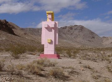
Lady Desert- The Venus of Nevada
Explore the Lady Desert, The Venus of Nevada, a stunning sculpture in Beatty that embodies artistic beauty amidst the serene desert landscape.
-
Historical landmark
Esmeralda Open Pit Mine
Discover the historic Esmeralda Open Pit Mine in Nevada, a remarkable landmark showcasing the state's rich mining heritage and stunning landscapes.

Explore Esmeralda County on the map
Plan your trip on one map. See where the top cities, national parks and sights are, and book hotels and experiences in a few clicks.
Best hotels in Esmeralda County
Best restaurants in Esmeralda County
Dining in Esmeralda County is limited by its small population and long distances, so visitors should plan meals rather than expect a choice of restaurants in every settlement. Goldfield is the principal place to look for casual food, basic provisions and a historic-town atmosphere, while Dyer and Silver Peak have only limited local services that may not operate every day. The region’s food identity is connected more to Great Basin ranching, practical road fare and small-town hospitality than to a distinctive restaurant tradition. Travellers commonly rely on packed lunches, purchased supplies and simple meals during excursions, with nearby Nevada communities providing a wider choice outside the county. Beef, beans, sandwiches, burgers, breakfast cooking and coffee are fitting examples of the informal food culture found in remote western communities, while local shops and markets, where available, are useful for water and provisions rather than specialist gourmet shopping. Check current availability locally and carry backup supplies before driving into the valleys.
-
Breakfast
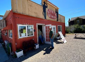
Dinky Diner
Discover delightful breakfasts at Dinky Diner in Goldfield – where every meal feels like home.
-
Diner
Strawberry Hill Diner
Experience classic American dining at Strawberry Hill Diner in Tonopah, NV – where comfort food meets friendly service.
-
Brewery
Tonopah Brewing Company
Explore Tonopah Brewing Company: A must-visit brewery offering exquisite craft beers and delicious comfort food in Nevada's historic heart.
-
Fast Food
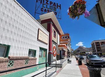
A&W Restaurant
Experience classic American fast food at A&W Restaurant in Tonopah – home of delicious burgers and iconic root beer.


Best bars in Esmeralda County
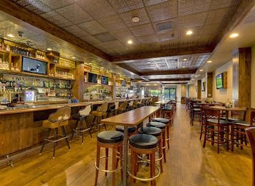
Esmeralda County does not have a conventional nightclub scene. Evening social life centres on small-town bars, historic saloons, casual restaurants and community gathering places, particularly in Goldfield, with the atmosphere shaped by local residents, travellers and the county’s mining heritage. Gold Point is associated with a historic mining-camp setting, but facilities are limited and should not be assumed to provide a full evening programme. Silver Peak and Dyer are quieter still. The county’s strongest after-dark attraction is the night sky: clear, low-light conditions make stargazing and landscape photography more meaningful than late-night entertainment. Visitors should arrange transport before drinking, avoid driving long remote roads at night when tired, and check current opening arrangements rather than relying on old travel accounts or assumptions about small-town businesses.
-
American
Peppermill and Fireside Lounge
Discover the iconic Peppermill and Fireside Lounge, where classic American cuisine meets vibrant nightlife on the Las Vegas Strip.
-
Sports bar
Lucky Beaver, Bar & Burger
Discover Lucky Beaver, Bar & Burger: Where mouthwatering burgers and a lively sports bar atmosphere meet in Stateline, NV.
-
Bar
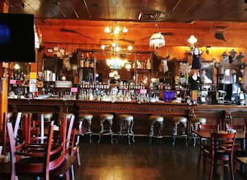
Bucket of Blood Saloon
Experience the Wild West at the Bucket of Blood Saloon, a historic bar and casino in Virginia City with hearty meals and lively entertainment.
-
Bar
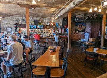
Red Dog Saloon
Discover the lively Red Dog Saloon in Virginia City; a unique blend of live music, delicious pizza, and a vibrant Old West atmosphere.

Best shops in Esmeralda County
Shopping in Esmeralda County is practical and small-scale rather than centred on large retail districts. Goldfield has the greatest concentration of visitor-oriented browsing, including historic-town souvenirs, locally themed artwork, books, antiques and objects associated with Nevada’s mining past, although individual businesses and opening arrangements can change. Gold Point may offer occasional heritage-related purchases, but it should not be relied upon for routine supplies. Silver Peak and Dyer are primarily service and community settlements, so visitors should buy fuel, food, water, medication and other essentials before leaving larger towns outside the county. Appropriate mementoes include locally made art, desert photography, mining-history books and Nevada-produced food products where available. Do not remove minerals, archaeological material or historic objects from public or private land. For broader retail choice, regional shopping is generally found outside Esmeralda County in places such as Tonopah or larger Nevada cities, rather than within the county itself.
-
Coffee shop
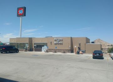
Beans & Brews Coffeehouse
Discover the heart of Tonopah at Beans & Brews Coffeehouse, where delicious coffee meets a cozy atmosphere, perfect for any time of day.
-
Grocery store
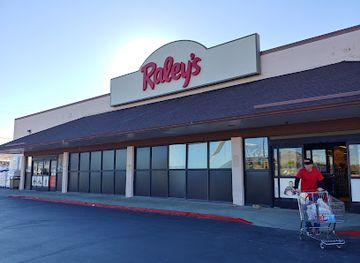
Raley's
Explore Raley's in Tonopah, Nevada for a delightful grocery experience offering fresh produce and local flavors in a welcoming atmosphere.
-
Visitor center
Goldfield Visitor Center
Explore the historic Goldfield Visitor Center for insights into Nevada's mining past and local attractions. Your gateway to the Old West awaits!
-
Candy store
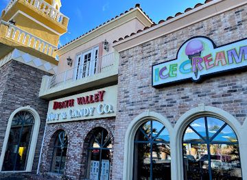
Death Valley Nut & Candy Co
Discover a delightful haven of candy and unique treats at Death Valley Nut & Candy Co, the ultimate stop for travelers in Nevada.
Get your free copy of our complete guide to Esmeralda County, delivered straight to you.
Everything on this page, from attractions and restaurants to essentials and local phrases, in one PDF you can read offline, print or share.
Already have an account? Sign in
Your Esmeralda County guide is ready.
We'll send it to · Not you? Sign out

Getting your guide ready…
We are putting together a fresh copy of the Esmeralda County guide. This can take up to a minute.
This can take a few moments. If your browser asks, choose Allow so the download can start. You'll find the guide in your Downloads folder.
Nothing happened? Download it again
Sorry, the guide is taking longer than usual. Please try again in a minute, or get it by email instead.
Esmeralda County essentials
Currency and Payment
Safety
Emergency Situations
Do's and Don'ts
Local Tips
From Eve
Local phrases worth knowing
You don't need to get them perfect. A few words go a long way, and locals appreciate the effort.
Basics
| English | Local | Say it |
|---|---|---|
| Hello | Howdy | [hau-dee] |
| Goodbye | See ya | [see ya] |
| Yes | Yep | [yepp] |
| No | Nope | [nohp] |
| Please/You're welcome | Sure thing | [shur thing] |
| Thank you | Thanks a lot | [thanks uh lot] |
| Excuse me/Sorry | Pardon me | [par-dun mee] |
| How are you? | How ya doin'? | [how ya doin'] |
| Fine. And you? | Good. And you? | [gud. an you?] |
| Do you speak English? | You speakin' English? | [you speakin' ing-lish?] |
| I don't understand | I ain't gettin' it | [I ain't gettin' it] |
Eating & Drinking
| English | Local | Say it |
|---|---|---|
| I'd like to see the menu, please | Can I see the menu, please? | [can I see the men-yoo, pleez?] |
| I don't eat meat | I ain't eatin' meat | [I ain't eatin' meet] |
| Cheers! | Cheers! | [cheers] |
| I would like to pay, please | Can I get the check, please? | [can I get the chek, pleez?] |
Emergencies
| English | Local | Say it |
|---|---|---|
| Help! | Help! | [help] |
| Go away! | Get lost! | [git lost] |
| Call the Police! | Call the cops! | [call the cops] |
| Call a doctor! | Get a doctor! | [get a dok-tor] |
| I'm lost | I'm lost | [I'm lost] |
| I'm ill | I'm sick | [I'm sik] |
Shopping
| English | Local | Say it |
|---|---|---|
| I'd like to buy... | I wanna buy... | [I wanna buy...] |
| I'm just looking | Just lookin' | [just lookin'] |
| How much is it? | What's the price? | [whats the pryz?] |
| That's too expensive | That's way too pricey | [thats way too pry-see] |
| Can you lower the price? | Can ya drop the price? | [can ya drop the pryz?] |
Time & Numbers
| English | Local | Say it |
|---|---|---|
| What time is it? | What time ya got? | [what time ya got?] |
| It's one o'clock | It's one | [its wun] |
| Half past (10) | Half past ten | [haf past ten] |
| Morning | Mornin' | [mornin'] |
| Afternoon | Afternoon | [af-ter-noon] |
| Evening | Evenin' | [ee-venin'] |
| Yesterday | Yesterday | [yes-ter-day] |
| Today | Today | [to-day] |
| Tomorrow | Tomorrow | [to-mor-row] |
| 1 | One | [wun] |
| 2 | Two | [too] |
| 3 | Three | [three] |
| 4 | Four | [for] |
| 5 | Five | [fiv] |
| 6 | Six | [siks] |
| 7 | Seven | [sev-en] |
| 8 | Eight | [ate] |
| 9 | Nine | [nin] |
| 10 | Ten | [ten] |
Transport & Directions
| English | Local | Say it |
|---|---|---|
| Where's a/the...? | Where's the...? | [wheres the...?] |
| What's the address? | What's the addy? | [whats the addy?] |
| Can you show me (on the map)? | Can ya show me on the map? | [can ya show me on the map?] |
| When's the next (bus)? | When's the next bus? | [whens the next bus?] |
| A ticket (to ....) | A ticket to... | [a tiket to...] |
History of Esmeralda County
Western Shoshone homelands
Long before Euro-American mining, the valleys and mountain ranges of what is now Esmeralda County formed part of the homelands of Western Shoshone and related Great Basin peoples. Communities adapted to an arid environment through detailed knowledge of seasonal plants, water sources and game, moving across a landscape that later newcomers described as empty. The region’s Indigenous history is less visibly represented in its surviving built heritage than its mining past, but it remains fundamental to understanding the county’s geography and the consequences of nineteenth-century settlement and resource development.
Surveying, ranching and early mineral prospecting
During the nineteenth century, routes through western Nevada connected military posts, settlements and mining districts, while ranchers used springs and valley margins for livestock. Prospectors searched the surrounding ranges for silver, gold, borax and other minerals. The creation of Esmeralda County in 1861 reflected Nevada’s early territorial and mining-era administration, although its boundaries and population centres changed as new discoveries shifted economic attention from one district to another.
Silver Peak and the mineral economy
Silver Peak developed as a mining settlement in the early twentieth century, building on earlier mineral activity in the surrounding Clayton Valley and Silver Peak Range. Borax and other minerals were extracted before lithium became increasingly important. Lithium production at Silver Peak began in the 1960s, making the area an early centre of brine-based lithium extraction. The operation illustrates how Esmeralda County’s economy has repeatedly been reshaped by changing mineral demand rather than by large, diversified population growth.
The Goldfield boom, early 1900s
Gold discoveries near Goldfield transformed the county at the beginning of the twentieth century. The settlement grew rapidly, attracting miners, investors, merchants, professionals and workers, and acquired hotels, theatres, banks, newspapers and substantial public buildings. Goldfield became one of Nevada’s most prominent mining towns, but its boom was relatively short-lived as the richest deposits declined and production costs rose. The remaining historic district and scattered mine structures provide tangible evidence of that abrupt expansion and contraction.
Gold Point and the smaller mining camps
Gold Point, formerly known as Lime Point, represents the smaller-scale mining communities that developed across the county’s ranges. Its surviving buildings and isolated setting convey the practical character of a camp created around prospecting, milling and transport rather than a permanent industrial city. Like Goldfield, it experienced fluctuating fortunes as mines opened, closed or changed ownership. Its legacy is part of a wider regional pattern in which roads, cemeteries, cabins and abandoned workings mark settlements that were once economically significant.
Modern resource development and rural continuity
After the major gold boom faded, Esmeralda County remained sparsely populated, with ranching, limited mining and public-land activity shaping everyday life. Silver Peak’s lithium operations gained renewed significance as lithium became central to battery technology and energy-storage systems. At the same time, communities such as Dyer continued to serve ranching and agricultural activity in Fish Lake Valley. Today the county’s identity reflects both historical preservation and an active resource economy, with land-use questions involving mining, water, conservation and access to remote public landscapes.
Esmeralda County in Photos
Browse through our photo collection highlighting the charm and character of the destination.
Neighbouring regions of Esmeralda County
The closest regions to Esmeralda County, if you have time for more than one.
-

-
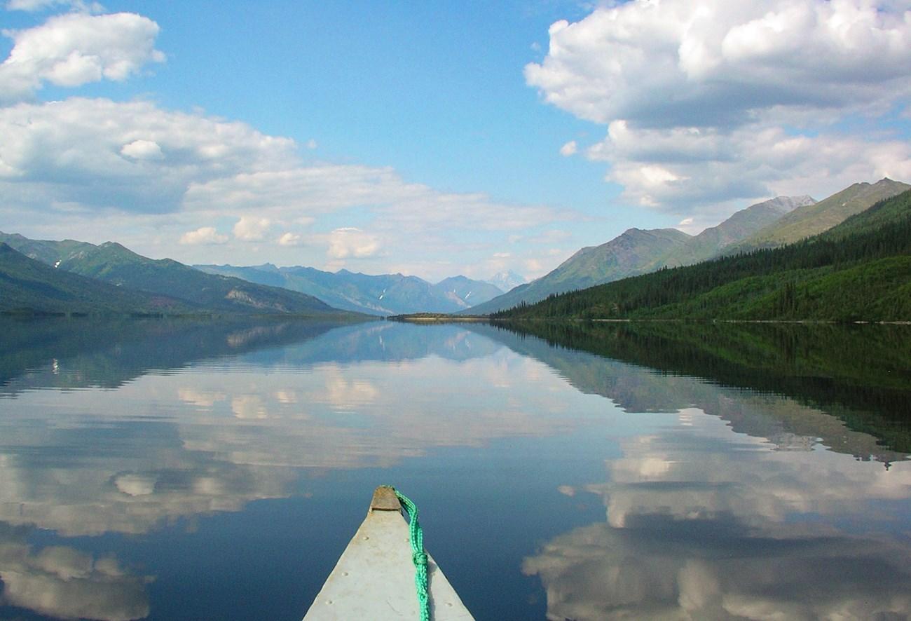 Mineral County
, Nevada, pairs saline Walker Lake, desert mountain scenery, mining history and quiet Great Basin roads for independent travellers.
-

-

-


Swipe for more regions
Explore more

Explore more of Nevada
Discover Nevada: From the bright lights of Las Vegas to the tranquil beauty of Lake Tahoe, Nevada offers a unique blend of excitement and natural wonder.
Explore Nevada