

Free Gilliam County Travel Guide & Mobile App
Explore Gilliam County with free travel guides. Discover regional history, expert tips, proposed trips, and audio guides on web or mobile app.


Gilliam County, Oregon offers open Columbia Plateau landscapes, historic Condon, riverfront Arlington and quiet journeys through wheat country.
Read more about Gilliam County
Getting to and around Gilliam County
How to get there
Transportation
Destinations in Gilliam County
Resorts, valleys and scenic spots worth a trip of their own.

Swipe for more destinations
Best attractions in Gilliam County
Gilliam County’s attractions are primarily landscape-based and cultural rather than built around large tourist complexes. In Condon, visitors can explore the compact historic town centre, local civic buildings and museums or heritage displays that interpret ranching, farming and community life. Arlington offers a different experience on the Columbia River, with riverfront recreation, boating, fishing and broad views across the water and surrounding hills. The county’s roads are attractions in their own right, crossing wheat fields, sagebrush slopes and open plateau country with little urban interruption. Birdwatching and wildlife observation are possible around river and grassland habitats, while the low population density makes the area suitable for quiet landscape photography and stargazing. Outdoor activities should be approached with preparation: shade, water and formal facilities can be scarce, and access may cross private agricultural land. Wind-energy infrastructure and modern agricultural operations also form part of the contemporary landscape, illustrating how rural Oregon combines historic land uses with newer energy development.
-
State park
White River Falls State Park
Explore the scenic beauty and rich history of White River Falls State Park, a must-visit destination in Oregon for nature lovers and adventurers alike.
-
State park
Cottonwood Canyon State Park
Explore Cottonwood Canyon State Park in Wasco, Oregon - a stunning green oasis with trails, wildlife, and spectacular stargazing in the heart of nature.
-
History museum
Gilliam County Historical Museum
Explore the captivating history of Gilliam County at the Gilliam County Historical Museum in Condon, Oregon, where local stories come alive through engaging exhibits.

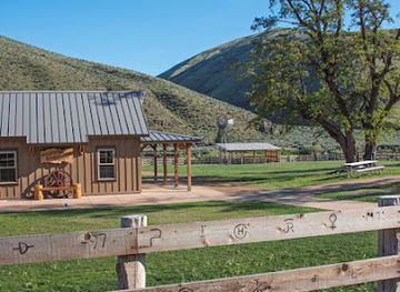

Best landmarks in Gilliam County
The Columbia River is Gilliam County’s most recognisable natural landmark, forming a broad northern boundary and giving Arlington its distinctive geographic setting. River views reveal the scale of the Mid-Columbia, where water, basalt country, rail infrastructure and cultivated plateau meet. In Condon, the Gilliam County Courthouse and the surrounding historic civic and commercial fabric express the county’s late-nineteenth- and early-twentieth-century development as an administrative and agricultural centre. Arlington’s townscape and riverfront reflect a different history, one shaped by shipping, transport and access to the water. Across the interior, the plateau itself is a defining landmark: immense wheat fields, dry grasslands and distant ridges create a visual landscape associated with north-central Oregon. Modern wind-energy installations are also prominent in some views, representing the county’s continuing role in regional infrastructure. These places are significant less for monumental scale than for the way they show how settlement, agriculture, river commerce and newer energy systems occupy the same open landscape.
-
History museum
Gilliam County Historical Museum
Discover the rich history of Gilliam County at the Historical Museum, a hidden gem in Condon, Oregon, showcasing local heritage and captivating stories.
-
Historical landmark
Oregon Trail Fourmile Canyon Historic Site
Discover the rich history of the Oregon Trail at Fourmile Canyon Historic Site, a serene landmark in Arlington, Oregon, perfect for history enthusiasts and nature lovers.
-
Historical landmark
The Old Oregon Trail
Explore the historic Old Oregon Trail in Arlington, Oregon, where adventure meets history amidst breathtaking landscapes.
-
Tourist attraction
Historical marker
Explore Oregon's Historical Marker in Condon: a captivating site that reveals the rich stories of the region's past amidst stunning desert landscapes.


Explore Gilliam County on the map
Plan your trip on one map. See where the top cities, national parks and sights are, and book hotels and experiences in a few clicks.
Best hotels in Gilliam County
Best restaurants in Gilliam County
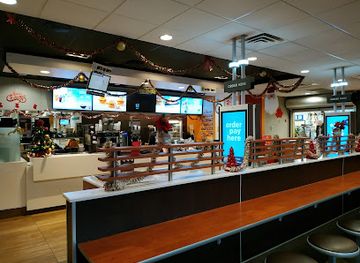
Dining in Gilliam County is small-scale and practical, centred on cafés, diners, family-run eateries and the kind of straightforward meals valued in working agricultural communities. Condon is the main inland place to look for everyday breakfasts, sandwiches, coffee and evening food, while Arlington serves travellers moving along the Columbia corridor and offers access to river-oriented recreation. Menus commonly reflect wider Oregon and American traditions rather than a narrowly defined county cuisine: burgers, steaks, soups, salads, baked goods and seasonal produce are typical choices. Wheat country gives bread, pastries and other grain-based foods a natural local context, and locally sourced products may appear seasonally rather than through a permanent specialist food scene. Dining options are widely spaced, so do not assume that another restaurant will be open nearby after leaving town. Farmers’ markets, roadside produce and small local outlets can vary by season; ask locally for current availability instead of relying on fixed schedules.
-
Hamburger
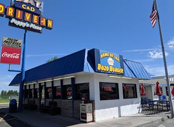
C & D Drive-In
Discover the charm of C & D Drive-In in Boardman, Oregon—where classic burgers meet irresistible ice cream delights.
-
American
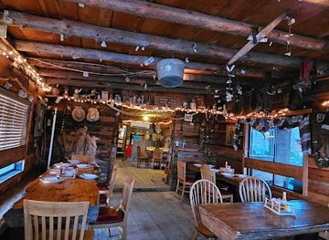
Cowboy Dinner Tree
Savor hearty American cuisine in a historic setting at Cowboy Dinner Tree – where every meal tells a story.
-
Restaurant
Riverside
Discover Riverside: A picturesque restaurant offering local flavors and stunning river views in Hood River, Oregon.
-
Breakfast
Broder Øst
Experience unique breakfast delights at Broder Øst in Hood River – where every bite is crafted with love and creativity.

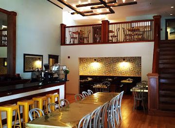
Best bars in Gilliam County
Gilliam County does not have a major nightclub scene. Evening life is concentrated in the pubs, taverns, restaurants and community-oriented establishments of Condon and Arlington, where the atmosphere is generally relaxed and local rather than built around late-night entertainment. Arlington’s position beside the Columbia makes it a natural stopping place for travellers, while Condon provides the principal inland social setting. Live music, community events and seasonal gatherings may occur, but programmes and opening arrangements change, so local noticeboards and businesses are more reliable than assuming a regular schedule. Visitors should plan transport carefully in this sparsely settled area, particularly if drinking, and should not expect frequent taxis or late public services. For many travellers, the most distinctive evening activity is outdoor: watching sunset over the river or open plateau and taking advantage of dark skies away from town lighting.
-
Truck stop
Pilot Travel Center
Discover the Pilot Travel Center in Wasco, Oregon: a convenient truck stop with food, fuel, and amenities for all travelers.
-
Grill
Skyway Bar & Grill
Experience the perfect blend of American cuisine and live music at Skyway Bar & Grill, Zigzag's beloved culinary destination.
-
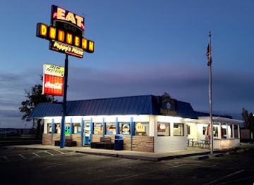
Hamburger
C & D Drive-In
Experience classic American fast food and delightful ice cream at C & D Drive-In in Boardman, Oregon, where nostalgia meets flavor.
-
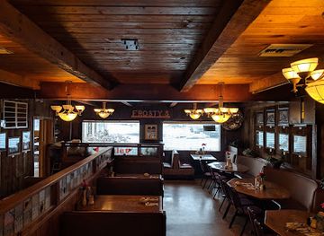
Steak
Bob's Texas T-Bone + Frosty's Lounge
Discover Bob's Texas T-Bone + Frosty's Lounge in Rufus, OR, where delicious steaks meet a welcoming atmosphere for an unforgettable dining experience.

Best shops in Gilliam County
-
Shopping mall
Columbia Gorge Outlets
Discover unbeatable deals on top brands at Columbia Gorge Outlets, where shopping meets the stunning beauty of Oregon's Columbia River Gorge.
-
Shopping mall
Gresham Station
Discover Gresham Station, Oregon's vibrant shopping mall filled with diverse retail stores, delicious dining, and exciting entertainment for all ages.
-
American
Eastwind Drive-In
Experience the perfect blend of classic American fast food and irresistible ice cream at Eastwind Drive-In in scenic Cascade Locks.
-
Bridge
Bridge of the Gods
Discover the breathtaking Bridge of the Gods, a historic landmark offering stunning views and rich cultural heritage in the heart of the Columbia River Gorge.


Get your free copy of our complete guide to Gilliam County, delivered straight to you.
Everything on this page, from attractions and restaurants to essentials and local phrases, in one PDF you can read offline, print or share.
Already have an account? Sign in
Your Gilliam County guide is ready.
We'll send it to · Not you? Sign out

Getting your guide ready…
We are putting together a fresh copy of the Gilliam County guide. This can take up to a minute.
This can take a few moments. If your browser asks, choose Allow so the download can start. You'll find the guide in your Downloads folder.
Nothing happened? Download it again
Sorry, the guide is taking longer than usual. Please try again in a minute, or get it by email instead.
Gilliam County essentials
Currency and Payment
Safety
Emergency Situations
Do's and Don'ts
Local Tips
From Eve
Local phrases worth knowing
You don't need to get them perfect. A few words go a long way, and locals appreciate the effort.
Basics
| English | Local | Say it |
|---|---|---|
| Hello | Howdy | [/ˈhaʊ.di/] |
| Goodbye | See ya | [/siː jə/] |
| Yes | Yep | [/jɛp/] |
| No | Nope | [/noʊp/] |
| Please/You're welcome | Sure thing | [/ʃʊr θɪŋ/] |
| Thank you | Thanks | [/θæŋks/] |
| Excuse me/Sorry | Pardon me | [/ˈpɑːr.dən mi/] |
| How are you? | How's it going? | [/haʊz ɪt ˈɡoʊ.ɪŋ/] |
| Fine. And you? | Good, you? | [/ɡʊd ju/] |
| Do you speak English? | You speakin' English? | [/ju ˈspiːkɪn ˈɪŋɡlɪʃ/] |
| I don't understand | I ain't gettin' it | [/aɪ eɪnt ˈɡɛtɪn ɪt/] |
Eating & Drinking
| English | Local | Say it |
|---|---|---|
| I'd like to see the menu, please | Can I see the menu? | [/kæn aɪ siː ðə ˈmɛn.juː/] |
| I don't eat meat | I don't eat meat | [/aɪ doʊnt iːt miːt/] |
| Cheers! | Cheers! | [/tʃɪrz/] |
| I would like to pay, please | Can I get the check? | [/kæn aɪ ɡɛt ðə tʃɛk/] |
Emergencies
| English | Local | Say it |
|---|---|---|
| Help! | Help! | [/hɛlp/] |
| Go away! | Get lost! | [/ɡɛt lɔst/] |
| Call the Police! | Call the cops! | [/kɔl ðə kɒps/] |
| Call a doctor! | Get a doctor! | [/ɡɛt ə ˈdɒk.tər/] |
| I'm lost | I'm lost | [/aɪm lɔst/] |
| I'm ill | I'm not feelin' well | [/aɪm nɒt ˈfiːlɪn wɛl/] |
Shopping
| English | Local | Say it |
|---|---|---|
| I'd like to buy... | I wanna buy... | [/aɪ ˈwɑːnə baɪ/] |
| I'm just looking | Just lookin' | [/dʒʌst ˈlʊkɪn/] |
| How much is it? | What's the price? | [/wɑːts ðə praɪs/] |
| That's too expensive | That's pricey | [/ðæts ˈpraɪ.si/] |
| Can you lower the price? | Can you drop the price? | [/kæn ju drɒp ðə praɪs/] |
Time & Numbers
| English | Local | Say it |
|---|---|---|
| What time is it? | What time is it? | [/wɑt taɪm ɪz ɪt/] |
| It's one o'clock | It's one o'clock | [/ɪts wʌn əˈklɒk/] |
| Half past (10) | Half past ten | [/hæf pæst tɛn/] |
| Morning | Morning | [/ˈmɔːrnɪŋ/] |
| Afternoon | Afternoon | [/ˌæf.tərˈnuːn/] |
| Evening | Evening | [/ˈiːv.nɪŋ/] |
| Yesterday | Yesterday | [/ˈjɛs.tər.deɪ/] |
| Today | Today | [/təˈdeɪ/] |
| Tomorrow | Tomorrow | [/təˈmɔː.roʊ/] |
| 1 | One | [/wʌn/] |
| 2 | Two | [/tuː/] |
| 3 | Three | [/θriː/] |
| 4 | Four | [/fɔːr/] |
| 5 | Five | [/faɪv/] |
| 6 | Six | [/sɪks/] |
| 7 | Seven | [/ˈsɛv.ən/] |
| 8 | Eight | [/eɪt/] |
| 9 | Nine | [/naɪn/] |
| 10 | Ten | [/tɛn/] |
Transport & Directions
| English | Local | Say it |
|---|---|---|
| Where's a/the...? | Where's the...? | [/wɛrz ðə/] |
| What's the address? | What's the address? | [/wɑts ði əˈdrɛs/] |
| Can you show me (on the map)? | Can you show me on the map? | [/kæn ju ʃoʊ mi ɑn ðə mæp/] |
| When's the next (bus)? | When's the next bus? | [/wɛn z ðə nɛkst bʌs/] |
| A ticket (to ....) | A ticket to... | [/ə ˈtɪk.ɪt tə/] |
History of Gilliam County
Columbia Plateau Indigenous Heritage
Long before county boundaries were drawn, the Columbia Plateau was home to Indigenous peoples whose economies and cultures were connected to the Columbia River, tributary valleys and upland grasslands. The region associated with present-day Gilliam County lies within the broader cultural world of peoples including the Wasco and other communities of the Mid-Columbia. Fishing, hunting, gathering and seasonal travel shaped relationships with the landscape. Visitors should understand that this history is living rather than merely archaeological, and that modern tribal communities continue to maintain cultural, political and spiritual connections across the region.
Early Euro-American Routes and Settlement
During the nineteenth century, explorers, missionaries, traders and emigrants travelled through the interior Columbia country, following river corridors and overland routes. Their arrival brought profound disruption through disease, land dispossession and changing control of resources. Later settlers established ranches, farms and small service communities on the plateau, where the relatively dry climate favoured livestock and, with suitable cultivation, cereal production. The broad distances and limited water supply ensured that settlement remained scattered, a pattern still evident in Gilliam County today.
The Creation of Gilliam County, 1885
Gilliam County was created in 1885 from part of the large territory then administered as Wasco County. It was named for Cornelius Gilliam, a pioneer-era militia leader associated with Oregon’s early settler government. Condon eventually became the county seat, while communities developed according to their relationship with ranching areas, transport routes and the Columbia River. The county’s formation reflects a wider late-nineteenth-century process in Oregon, as sparsely settled interior districts sought closer local administration and services.
Railways, River Transport and Grain
Rail transport and Columbia River shipping transformed the economic prospects of northern Gilliam County in the late nineteenth and early twentieth centuries. Railways connected plateau farms with river ports and wider markets, making the movement of wheat and other agricultural products more efficient. Arlington’s position on the Columbia gave it particular importance as a transport and shipping point, while inland communities such as Condon served surrounding ranches and farms. Although transport technology has changed, the county’s geography is still closely tied to the movement of grain from open country to regional markets.
Agricultural Consolidation and Rural Change
Twentieth-century farming brought mechanisation, larger fields and changes in rural settlement. Wheat production became a defining feature of the plateau, but it has always depended on variable rainfall, soil management and market conditions. Mechanised agriculture reduced the need for large rural workforces, contributing to population decline and the consolidation of services in places such as Condon and Arlington. The resulting landscape—large cultivated expanses interrupted by isolated homes, ranch buildings and transport infrastructure—is a central part of Gilliam County’s contemporary identity.
Modern Energy and Infrastructure Development
In recent decades, Gilliam County has become part of the wider Columbia Plateau conversation about wind power, transmission infrastructure, waste management and the future of rural economies. Large projects have brought new investment and employment while also raising questions about land use, views, wildlife and the distribution of benefits. These developments sit alongside long-established farming and ranching rather than replacing them. They help explain why this apparently quiet agricultural county is connected to major regional debates about energy, infrastructure and environmental change.
Gilliam County in Photos
Browse through our photo collection highlighting the charm and character of the destination.
Neighbouring regions of Gilliam County
The closest regions to Gilliam County, if you have time for more than one.
-

-
-

-
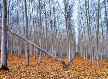
 Wasco County
Discover Wasco County, Oregon: A blend of natural beauty, rich history, and vibrant communities, perfect for outdoor adventures, cultural experiences, and wine tasting.
-


Swipe for more regions
Explore more

Explore more of Oregon
Discover Oregon's diverse landscapes, vibrant cities, and rich culture. From stunning coastlines to lush forests, this Pacific Northwest gem offers endless adventures.
Explore Oregon