

Free Sherman County Travel Guide & Mobile App
Explore Sherman County with free travel guides. Discover regional history, expert tips, proposed trips, and audio guides on web or mobile app.


Sherman County, Oregon offers Columbia River views, wheat-country drives, rural heritage and wide-open landscapes between the Gorge and central Oregon.
Read more about Sherman County
Getting to and around Sherman County
How to get there
Transportation
Top city travel guides in Sherman County
The cities of Sherman County, and the easiest places to base yourself.

Swipe for more cities
Destinations in Sherman County
Resorts, valleys and scenic spots worth a trip of their own.

Swipe for more destinations
Best attractions in Sherman County
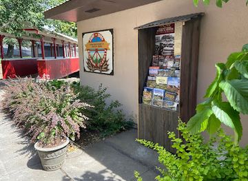
Sherman County's attractions are defined by landscape, working history and the Columbia River rather than by a large concentration of ticketed sights. In Moro, the Sherman County Historical Museum presents local stories through agricultural equipment, domestic objects, photographs and material associated with settlement and community life. The Sherman County Fairgrounds become a focus of local activity during the annual fair and other agricultural events. Rufus offers access to the broad river setting and views towards John Day Dam, while river pull-offs and established recreation areas provide opportunities for fishing, boating, birdwatching and photography. Across the plateau, quiet roads lead through wheat country, with changing light on basalt escarpments and distant mountain views. Biggs Junction is principally a transport interchange, but it is useful for understanding how the river corridor links the county with central Oregon. Visitors should distinguish these experiences from the waterfalls, forested trails and major viewpoints farther west in the Columbia River Gorge, which are outside Sherman County.
-
Scenic spot
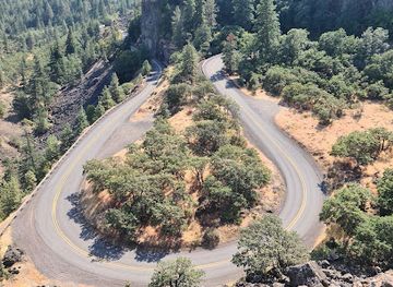
Rowena Crest Viewpoint
Experience the breathtaking beauty of Rowena Crest Viewpoint, a scenic spot offering stunning views of the Columbia River Gorge and nature trails.
-
State park
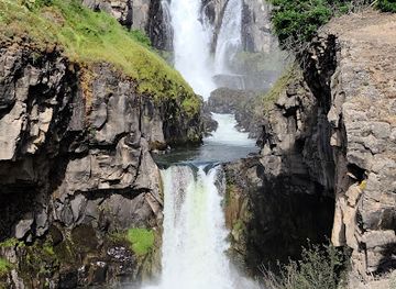
White River Falls State Park
Experience the breathtaking beauty and rich history of White River Falls State Park, a must-visit destination for nature enthusiasts and adventure seekers in Oregon.
-
State park
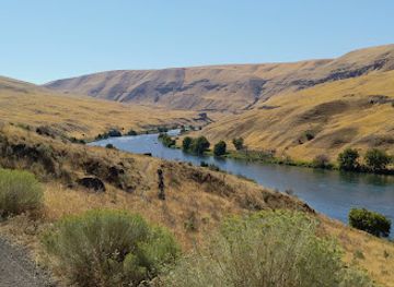
Deschutes River State Recreation Area
Experience the stunning scenery and diverse wildlife at Deschutes River State Recreation Area, a perfect getaway for outdoor enthusiasts in Oregon.
-
Tourist attraction
Celilo Park
Explore Celilo Park, a serene oasis along the Columbia River in Oregon, where stunning views and nature's beauty await every visitor.

Best landmarks in Sherman County
The Columbia River is Sherman County's principal natural landmark, forming a powerful northern edge to the open plateau and linking the county to the wider inland Northwest. John Day Dam, near Rufus, is the most conspicuous piece of modern infrastructure on the river and illustrates the importance of navigation and hydropower; public viewing and access arrangements should be checked locally because working dam facilities are not freely open in every area. The Dalles Bridge at Biggs Junction is a major crossing and transport landmark, connecting the Oregon highway network with Washington across the Columbia. Moro's civic centre and historic community buildings express the county-seat role established after the county's formation, while grain elevators and farm complexes across the plateau are functional landmarks of dryland wheat agriculture. Basalt breaks, river bluffs and the long horizon provide the county's most characteristic visual landmarks, although many are best appreciated from public roads or designated access points rather than entered directly.
-
Historical landmark
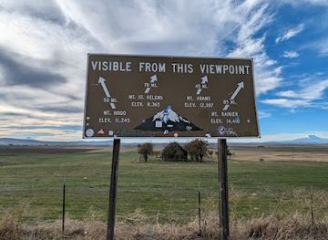
Goldendale Mountain Identifier
Explore Goldendale Mountain, where history meets breathtaking views of Mt. Hood and Mt. Rainier, offering an unforgettable experience in Washington's natural beauty.
-
Museum
Sherman County Historical Museum
Uncover the fascinating stories of Sherman County at the Sherman County Historical Museum, a captivating journey through Oregon's rich heritage.
-
Historical landmark
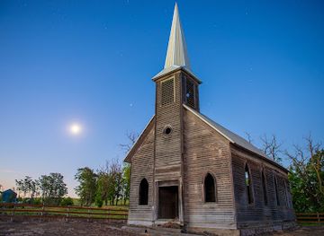
Locust Grove Church.
Experience the haunting beauty and rich history of Locust Grove Church, a serene landmark in Oregon perfect for exploration and photography.
-
Historical landmark
Oregon Trail Fourmile Canyon Historic Site
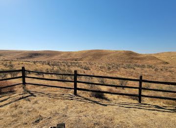
Explore the Oregon Trail Fourmile Canyon Historic Site, a historical landmark that embodies the spirit of American westward expansion amidst breathtaking landscapes.
Explore Sherman County on the map
Plan your trip on one map. See where the top cities, national parks and sights are, and book hotels and experiences in a few clicks.
Best hotels in Sherman County
Best restaurants in Sherman County
Dining in Sherman County is shaped by small-town services, highway travel and the agricultural character of the plateau. Moro, Wasco and Rufus provide the principal opportunities for straightforward meals, cafés and community-oriented eating, while Biggs Junction serves travellers moving along the interstate and US 97. Expect practical menus, familiar American cooking, breakfast food, sandwiches and casual fare rather than a concentrated fine-dining scene. Wheat farming is central to the regional identity, and grain, beef, seasonal produce and baking traditions are more representative of the area's food economy than a single signature dish. Rivers and reservoirs support fishing and recreation, although visitors should not assume that every local menu is built around Columbia River seafood. Because businesses are few and distances are considerable, check current opening arrangements, carry snacks for rural drives and avoid planning a remote outing around a late meal.
-
American
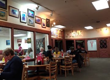
Bette's Place
Experience the heartwarming flavors of America at Bette's Place in Hood River - your ultimate breakfast destination!
-
Restaurant
Riverside
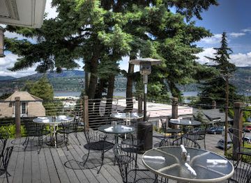
Discover Riverside in Hood River: A delightful restaurant offering exquisite cuisine and stunning waterfront views for an unforgettable dining experience.
-
Orchard
The Gorge White House
Experience local flavors and stunning views at The Gorge White House – an orchard oasis in Hood River's scenic landscape.
-
Restaurant
3 Rivers Grill
Experience exceptional American cuisine at 3 Rivers Grill in Hood River – where flavor meets breathtaking views.
Best bars in Sherman County
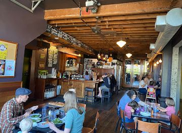
Sherman County does not have a substantial nightclub district, and evening life generally centres on local bars, taverns, casual restaurants and community events in Moro, Wasco and Rufus. These places serve residents, workers and passing travellers, with a more relaxed and practical atmosphere than the entertainment scenes of Portland or larger regional cities. The county fair and other agricultural gatherings can provide seasonal social activity, while the wider Columbia corridor offers additional dining and evening options outside the county. Travellers should not expect late-night transport or a wide choice of venues once they leave the interstate communities. A quiet evening, sunset drive or stargazing from a suitable legal location is often more realistic than a club-focused itinerary; never drink and drive on the long rural roads.
-
Brewpub
Ferment Brewing Company
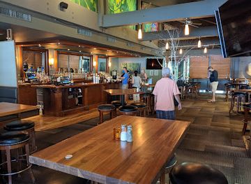
Experience the best of craft brewing and dining at Ferment Brewing Company in Hood River, Oregon, overlooking the stunning Columbia River Gorge.
-
Brewery
Double Mountain Brewery
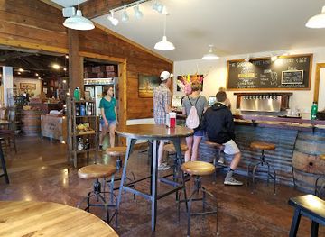
Discover the essence of craft brewing at Double Mountain Brewery in Hood River, where local flavors meet a relaxed, welcoming atmosphere.
-
Steak
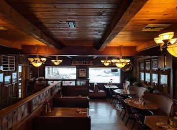
Bob's Texas T-Bone + Frosty's Lounge
Indulge in mouthwatering steaks and refreshing drinks at Bob's Texas T-Bone + Frosty's Lounge, the heart of Rufus, Oregon's dining scene.
-
Pub
Rivertap Restaurant and Pub
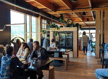
Discover Rivertap Restaurant and Pub in The Dalles, where delectable dishes meet live music in a family-friendly atmosphere.

Best nightclubs in Sherman County
-
Traditional American
Cousins' Restaurant & Saloon
Experience the essence of traditional American dining at Cousins' Restaurant & Saloon, a family-friendly gem in The Dalles, Oregon.
-
Pub
Rivertap Restaurant and Pub
Discover Rivertap Restaurant and Pub, where great food meets live music in the heart of The Dalles, Oregon.
-
Grill
Zim's Sports Bar and Grill
Discover the vibrant atmosphere and delicious offerings at Zim's Sports Bar and Grill in The Dalles, where every meal is a celebration of flavor.
-
Restaurant
Bargeway Pub
Experience the best of The Dalles at Bargeway Pub, where delicious meals and a welcoming atmosphere await every visitor.


Best shops in Sherman County
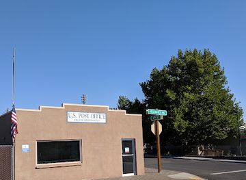
Shopping in Sherman County is limited but purposeful, with small-town businesses in Moro, Wasco and Rufus providing everyday supplies rather than extensive retail choice. The most distinctive purchases are likely to come from the county's agricultural and rural character: locally produced food, regional wheat products, preserves, handmade items and goods connected with community events when available. The annual fair can offer craft, produce and agricultural displays, although its vendors vary from year to year. The Sherman County Historical Museum shop, if operating during a visit, may provide locally relevant books or memorabilia. Biggs Junction is more useful for travel necessities than for destination shopping. Visitors seeking galleries, antiques, specialist outdoor equipment or a broader selection of regional produce will generally need to travel beyond the county to larger nearby communities, so it is sensible to buy fuel, provisions and practical supplies before taking a long plateau drive.
-
Grocery store
Maupin Market
Discover fresh produce and local delights at Maupin Market, the heart of grocery shopping in Maupin, Oregon.
-
Department store
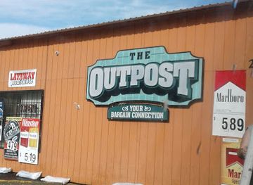
Outpost
Explore Outpost in The Dalles, Oregon, where incredible discounts meet unique treasures in a charming shopping experience.
-
Grocery store
Grass Valley Country Market
Explore local flavors and fresh produce at Grass Valley Country Market, a charming grocery store and deli in Oregon's beautiful Grass Valley.
-
Thrift store
St. Vinnie's - The Dalles Thrift Store
Explore St. Vinnie's in The Dalles for unique thrift finds, from books to furniture, all benefitting the local community and promoting sustainability.
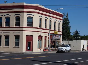
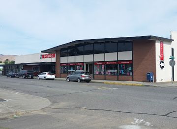
Get your free copy of our complete guide to Sherman County, delivered straight to you.
Everything on this page, from attractions and restaurants to essentials and local phrases, in one PDF you can read offline, print or share.
Already have an account? Sign in
Your Sherman County guide is ready.
We'll send it to · Not you? Sign out

Getting your guide ready…
We are putting together a fresh copy of the Sherman County guide. This can take up to a minute.
This can take a few moments. If your browser asks, choose Allow so the download can start. You'll find the guide in your Downloads folder.
Nothing happened? Download it again
Sorry, the guide is taking longer than usual. Please try again in a minute, or get it by email instead.
Sherman County essentials
Currency and Payment
Safety
Emergency Situations
Do's and Don'ts
Local Tips
From Eve
Local phrases worth knowing
You don't need to get them perfect. A few words go a long way, and locals appreciate the effort.
Basics
| English | Local | Say it |
|---|---|---|
| Hello | Howdy | [haʊ.di] |
| Goodbye | See ya | [si jə] |
| Yes | Yep | [jɛp] |
| No | Nope | [noʊp] |
| Please/You're welcome | Sure thing | [ʃʊr θɪŋ] |
| Thank you | Thanks a lot | [θæŋks ə lɑt] |
| Excuse me/Sorry | Pardon me | [ˈpɑrdən mi] |
| How are you? | How's it going? | [haʊz ɪt ˈɡoʊɪŋ] |
| Fine. And you? | Good, you? | [ɡʊd, ju] |
| Do you speak English? | You speakin' English? | [ju ˈspiːkɪn ˈɪŋɡlɪʃ] |
| I don't understand | I ain't got it | [aɪ eɪnt ɡɑt ɪt] |
Eating & Drinking
| English | Local | Say it |
|---|---|---|
| I'd like to see the menu, please | Can I see the menu? | [kæn aɪ si ðə ˈmɛn.ju] |
| I don't eat meat | I don't do meat | [aɪ doʊnt du mit] |
| Cheers! | Cheers! | [tʃɪrz] |
| I would like to pay, please | Can I get the check? | [kæn aɪ ɡɛt ðə tʃɛk] |
Emergencies
| English | Local | Say it |
|---|---|---|
| Help! | Help! | [hɛlp] |
| Go away! | Leave me alone! | [liːv mi əˈloʊn] |
| Call the Police! | Call the cops! | [kɔl ðə kɑps] |
| Call a doctor! | Get a doctor! | [ɡɛt ə ˈdɑktər] |
| I'm lost | I'm turned around | [aɪm tɜrnd əˈraʊnd] |
| I'm ill | I'm not feelin' well | [aɪm nɑt ˈfiːlɪn wɛl] |
Shopping
| English | Local | Say it |
|---|---|---|
| I'd like to buy... | I wanna buy... | [aɪ ˈwɑnə baɪ] |
| I'm just looking | Just browsing | [dʒʌst ˈbraʊzɪŋ] |
| How much is it? | What's the price? | [wʌts ðə praɪs] |
| That's too expensive | That's a bit high | [ðæts ə bɪt haɪ] |
| Can you lower the price? | Can you make it cheaper? | [kæn ju meɪk ɪt ˈtʃiːpər] |
Time & Numbers
| English | Local | Say it |
|---|---|---|
| What time is it? | What's the time? | [wʌts ðə taɪm] |
| It's one o'clock | It's one | [ɪts wʌn] |
| Half past (10) | Half past ten | [hæf pæst tɛn] |
| Morning | Mornin' | [ˈmɔrnɪn] |
| Afternoon | Afternoon | [ˌæf.tərˈnun] |
| Evening | Evenin' | [ˈivnɪn] |
| Yesterday | Yesterday | [ˈjɛstərdeɪ] |
| Today | Today | [təˈdeɪ] |
| Tomorrow | Tomorrow | [təˈmɔroʊ] |
| 1 | One | [wʌn] |
| 2 | Two | [tu] |
| 3 | Three | [θri] |
| 4 | Four | [fɔr] |
| 5 | Five | [faɪv] |
| 6 | Six | [sɪks] |
| 7 | Seven | [ˈsɛv.ən] |
| 8 | Eight | [eɪt] |
| 9 | Nine | [naɪn] |
| 10 | Ten | [tɛn] |
Transport & Directions
| English | Local | Say it |
|---|---|---|
| Where's a/the...? | Where's the...? | [wɛrz ðə] |
| What's the address? | What's the address? | [wʌts ði əˈdrɛs] |
| Can you show me (on the map)? | Can you point it out? | [kæn ju pɔɪnt ɪt aʊt] |
| When's the next (bus)? | When's the next bus? | [wɛnʌz ðə nɛkst bʌs] |
| A ticket (to....) | A ticket to... | [ə ˈtɪkɪt tu] |
History of Sherman County
Indigenous Columbia River Communities
Long before the county was established, the Columbia River and surrounding plateau were used by Indigenous peoples for fishing, trading, travel and seasonal activities. Peoples associated with the middle Columbia, including Wasco, Wishram and related communities, maintained networks along the river and its tributaries. Salmon and other river resources were fundamental, while the basalt landscape formed part of a much larger cultural geography. Indigenous history remains essential to understanding the region, even though later settlement and infrastructure transformed access to the river.
Exploration and the Columbia River Route
The Columbia was a major route for early Euro-American exploration and later migration through the Pacific Northwest. The Lewis and Clark expedition travelled the river in 1805 and 1806, passing through a landscape already known and used by Indigenous communities. During the nineteenth century, the river became an increasingly important corridor for missionaries, traders, settlers and freight. Its navigable channel connected inland communities with the lower Columbia and the regional port economy centred on the river.
Oregon Trail Migration and Settlement
The overland migration era brought increasing numbers of settlers into the interior Northwest. Routes associated with the Oregon Trail crossed the broader Columbia Plateau, while the river itself offered an alternative corridor for people and supplies. Settlement altered land use profoundly, introducing fences, homesteads, livestock and new transport patterns. The dry plateau that became Sherman County was difficult for small-scale farming, but its grasslands and fertile volcanic soils ultimately supported a commercial agricultural economy.
County Formation and Wheat Farming
Sherman County was created from parts of Wasco County in 1889 and was named for Civil War general William Tecumseh Sherman. Communities such as Moro, Wasco and Rufus developed as agricultural and river settlements, with Moro becoming the county seat. Wheat proved especially suited to the plateau's dry-farming conditions, and grain handling, storage and transport became fundamental to the local economy. Many of the roads, elevators and open fields visible today reflect this late nineteenth- and early twentieth-century transformation.
Railways, Highways and River Commerce
Transport development tied Sherman County more closely to markets beyond the plateau. Railways along the Columbia improved the movement of grain and supplies, while river navigation supported commercial traffic and links between communities. In the twentieth century, improved roads and the construction of US 30 and Interstate 84 shifted many journeys towards motor vehicles. The resulting corridor remains important to the county, although the plateau communities retain a distinct identity from the interstate and river traffic below.
Hydroelectric Development on the Columbia
The construction of major Columbia River dams changed navigation, power generation, fisheries and the appearance of the river. John Day Dam, completed in the 1970s near Rufus and extending across the Columbia to Washington, is particularly important to the county's modern landscape. Its reservoir, locks, roads and associated infrastructure brought benefits in electricity generation and navigation while also contributing to wide-ranging environmental and cultural changes. The dam is best understood as part of the region's working river rather than as an isolated monument.
Sherman County in Photos
Browse through our photo collection highlighting the charm and character of the destination.
Neighbouring regions of Sherman County
The closest regions to Sherman County, if you have time for more than one.
-

-
 Wasco County
Discover Wasco County, Oregon: A blend of natural beauty, rich history, and vibrant communities, perfect for outdoor adventures, cultural experiences, and wine tasting.
-

-
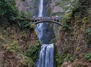
-
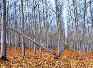


Swipe for more regions
Explore more

Explore more of Oregon
Discover Oregon's diverse landscapes, vibrant cities, and rich culture. From stunning coastlines to lush forests, this Pacific Northwest gem offers endless adventures.
Explore Oregon