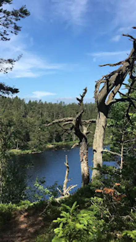
Bohusleden Travel Guide
Free Guide: Sweden’s classic long‑distance path across forests, lakes and rocky ridges — pick a stage for a daywalk or set out for a multi‑day wilderness trek.


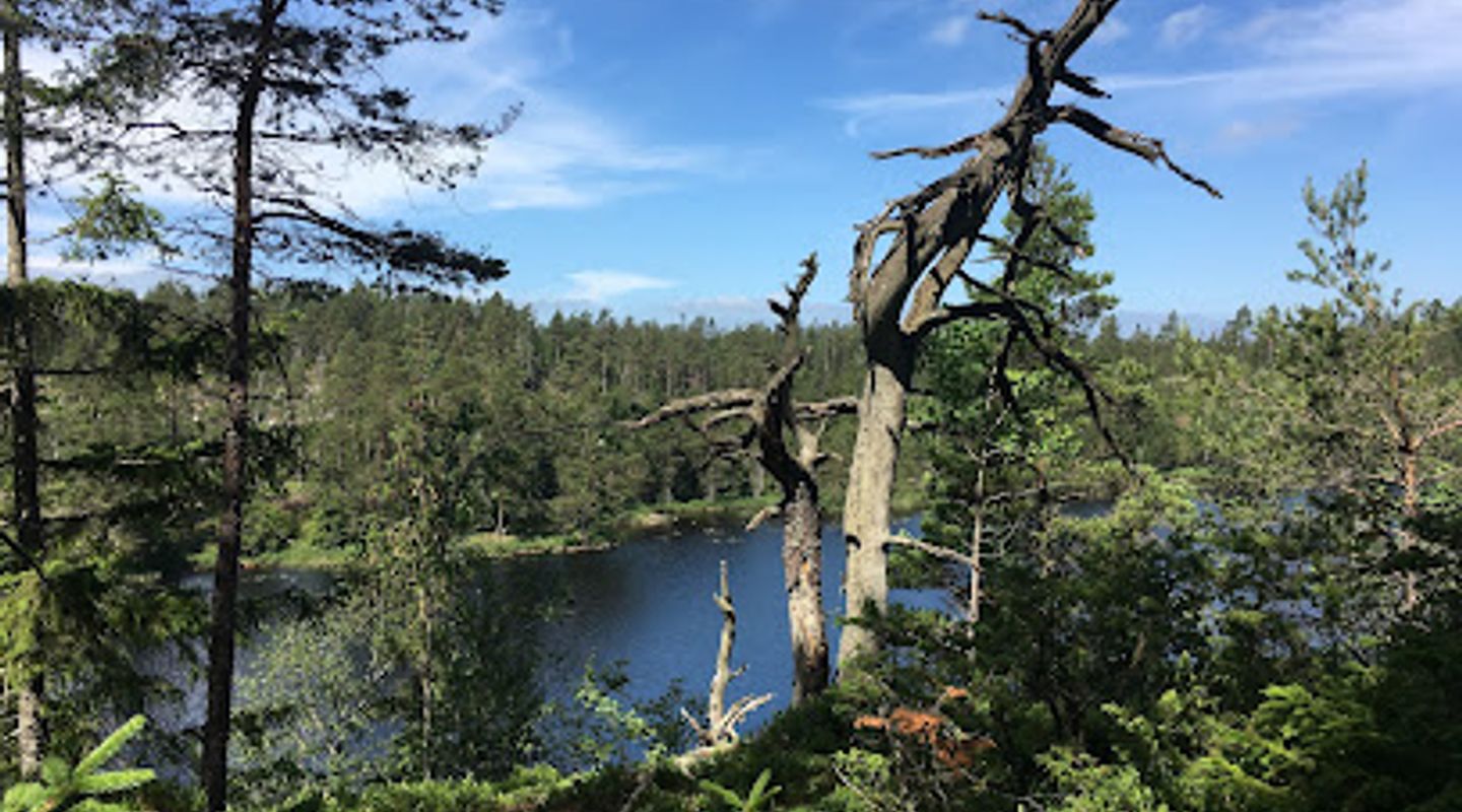
A brief summary of Bohusleden
Sweden’s classic long‑distance path across forests, lakes and rocky ridges — pick a stage for a daywalk or set out for a multi‑day wilderness trek.
Bohusleden is a classic long-distance hiking trail in western Sweden that threads forests, lakes, cliffs and open moorland from south of Gothenburg to the coast near Strömstad; the route is divided into many stages so walkers can choose short day hikes or extended multi‑day treks through varied Bohuslän landscapes and protected nature areas.
On-site amenities
 Sheltered areas
 Information boards
 Seating areas
Opening hours
- Every dayOpen 24 hours
Opening hours as listed on the venue’s Google Business Profile. Hours can change for services and special events, so check with the venue before you go.
- Address
- 450 54 Hedekas
- Website
Getting there
Public bus and local bus
Train plus local bus or taxi
Car
Discover more about Bohusleden
Landscape and route character
Bohusleden is a long-distance footpath that crosses the interior of Bohuslän and Västergötland, tracing a varied route of spruce and beech forest, bogs and glittering lakes, heather-clad ridges and bedraggled marshes. The route is split into numerous stages of differing length and difficulty so the trail alternates between easy, well-marked day-walk sections and wilder, remote stretches where rocky outcrops and steep valleys demand sustained effort. Lakes and streams punctuate the walking rhythm; on summer days the path offers frequent swimming and fishing opportunities, while in cooler months the trail’s sheltered valleys and open ridgelines present crisp, panoramic moods.
Natural and ecological highlights
The trail runs through several nature reserves and extensive woodland tracts where you’ll find mixed coniferous forest, old-growth pockets and bogland flora. Wildlife includes elk and deer, foxes and a rich birdlife that favours lakeshores and forest edges; in season the forest floor is carpeted with berries and mushrooms. Rocky outcrops expose the ancient Bohuslän bedrock and create dramatic viewpoints; low-lying wetlands along parts of the route provide valuable habitat and a contrast to the dryer ridgelines.
Walking experience and difficulty
Expect varied underfoot conditions: dirt tracks and machine‑graded forest roads, tight singletrack through spruce, occasional boggy sections, and rocky scrambles on higher hills. Southern and central stages are generally more forgiving and suited to day walkers and families, while the northern and more remote stages demand good map skills, stamina and preparation. Shelters and simple cabins appear regularly on many stages, offering the option of wild-camping rhythms for multi‑day walkers; other sections pass close to rural crofts and small villages where simple accommodation can be found.
Cultural traces and historical resonance
As the path threads the inland countryside it passes old crofts, field boundaries and traces of rural industry that tell of centuries of forest and agricultural use. Certain stretches are close to historic sites such as the medieval Bohus Fortress vistas visible from higher ground, and borderlands where Sweden and Norway once clashed. These cultural markers give the trail an added layer: it is not only a nature route but a corridor that connects human history, local livelihoods and shifting land use patterns.
Seasonal character and best times to visit
Late spring through early autumn is the main hiking season: thawed trails, long daylight and abundant wildflowers make walking comfortable and enjoyable. Summer brings swimming in lakes and easier bivvy options, while autumn offers vivid foliage and mushrooming but shorter daylight hours. Winter walking is possible on many lower sections but requires winter gear and route knowledge; deep snow can render northern and higher segments remote and physically demanding.
What to expect on the ground
On any given stage you will encounter sturdy trail waymarks, occasional bridges and wooden boardwalks across boggy ground, and simple signposted access points. Facilities are basic in remote stretches — a handful of visitor shelters, occasionally a bookable cabin and simple information boards at some trailheads — while closer to urban fringes there are more services and public-transport links. The experience is variable by stage: from quiet forest solitude to ridge-top exposures that open to broad panoramas of lakes and rocky coastline on the approaches to the sea.
Evendo Review Centre
 Google
Guest reviews
Best time to go
Quietest: Jan, Feb & Dec · before 6am or at 9pm
Busy times are Evendo estimates for a typical year, to help you plan. Actual crowds vary with events, school holidays and the weather.
Explore Bohusleden on the map
A handpicked selection of must-see spots near Bohusleden, mapped for you.
Get your free copy of our complete guide to Bohusleden, delivered straight to you.
Everything on this page, from opening hours and how to get there to Eve’s tips and the best time to go, in one PDF you can read offline, print or share.
Already have an account? Sign in
Your Bohusleden guide is ready.
We'll send it to · Not you? Sign out

Getting your guide ready…
We are putting together a fresh copy of the Bohusleden guide. This can take up to a minute.
This can take a few moments. If your browser asks, choose Allow so the download can start. You'll find the guide in your Downloads folder.
Nothing happened? Download it again
Sorry, the guide is taking longer than usual. Please try again in a minute, or get it by email instead.
Other nearby places you may find interesting
The closest places of the same kind, if this one is not quite what you had in mind.
-
-
-
-
-


Swipe for more places
More to explore near Bohusleden

 Best experiences near Bohusleden
 Best hotels near Bohusleden
 Best landmarks near Bohusleden
 Best attractions near Bohusleden
 Best shops near Bohusleden
 Best restaurants near Bohusleden
 Best bars near Bohusleden
Do you manage this location?
Take control to get all the benefits, like improved information, better appearance, and stronger visibility across AI-powered discovery.
Explore more
Explore more of Bohuslän
Explore Bohuslän, Sweden's stunning coastal region known for its picturesque islands, rich history, and delectable seafood. A paradise for nature lovers and history enthusiasts.
Explore Bohuslän
Explore more of Sweden
Discover Sweden's breathtaking landscapes, vibrant cities, and rich cultural heritage. From the Northern Lights to historic castles, experience the essence of Scandinavia.
Explore Sweden