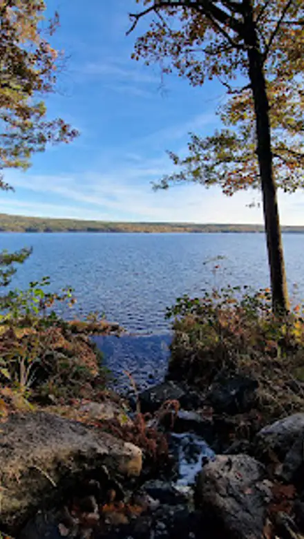
Ramhultafallet Travel Guide
Free Guide: A compact, multi-tiered forest waterfall by lake Lygnern — intimate cascades, mossy boulders and short woodland trails for all-season nature walks.


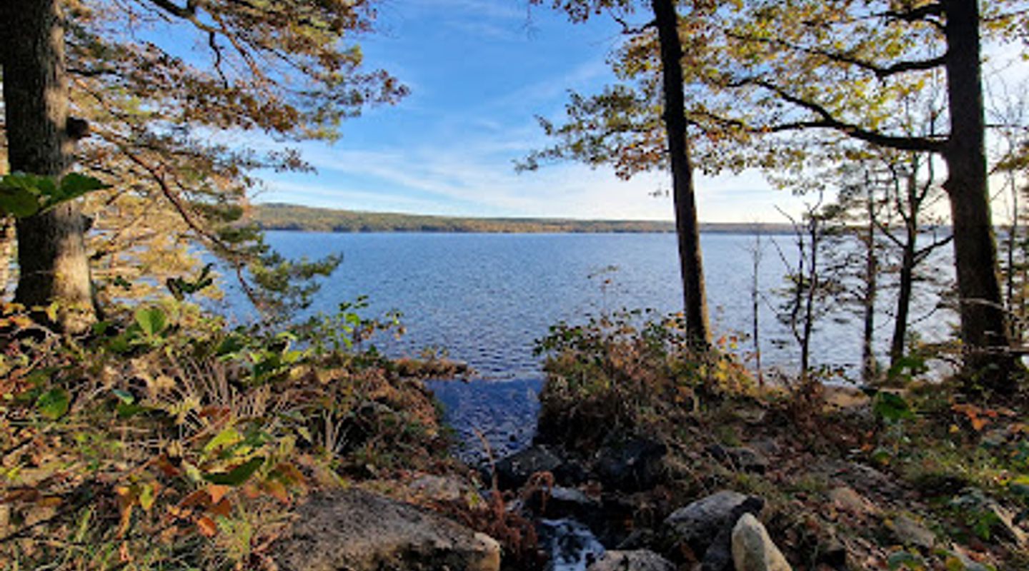
A brief summary of Ramhultafallet
A compact, multi-tiered forest waterfall by lake Lygnern — intimate cascades, mossy boulders and short woodland trails for all-season nature walks.
Ramhultafallet is a multi-step waterfall and small nature reserve near Fjärås, Sweden, where woodland trails drop toward the shores of lake Lygnern. The water cascades down a sequence of rocky ledges over a total fall of roughly fifty metres, creating shaded pools, mossy boulders and picnic clearings. Accessible paths and viewpoints at different levels make it a compact, year-round nature spot for short hikes, photography and quiet forest time.
On-site amenities
 Seating areas
 Picnic areas
 Information boards
 Trash bins
Opening hours
- Every dayOpen 24 hours
Opening hours as listed on the venue’s Google Business Profile. Hours can change for services and special events, so check with the venue before you go.
- Address
- Ramhultavägen
- Website
Getting there
Drive and short walk
Regional bus plus walk
Cycle
Discover more about Ramhultafallet
Where water meets old forest
Ramhultafallet sits tucked into mixed woodland on the northwest side of lake Lygnern; here the stream threads through boulders and bedrock left by the ice age before spilling in a series of short drops down to the lakeshore. The falls are not a single sheer cliff but a sequence of stepped cataracts and chutes, each framed by moss, ferns and mature birch and spruce. Depending on season the flow varies: strong, roaring torrents in spring and calmer, slower water in dry summer months. The setting is intimate rather than monumental — the scale invites close-up exploration rather than distant viewing.
Terrain, trails and viewpoints
A compact network of paths links several viewpoints at different heights, so visitors can experience the falls from the rim, mid-slope ledges and nearer the water. Trails alternate between firm forest soil, exposed rock slabs and short flights of steps cut into the slope; some sections are uneven and can be slippery after rain. At the top there are open glades and informal picnic spots; lower down small clearings and natural seats among boulders offer quieter vantage points. The reserve’s footprint is modest, making it suitable for short walks and loop outings that take from half an hour to a couple of hours depending on how far you explore.
Natural features and seasonal character
The falls’ stepped profile yields a pleasing variety of micro-habitats: shallow pools that warm in summer, shaded plunge pools that support moss and liverwort, and damp rock faces where lichens cling. Birdsong, the smell of resin and the metallic note of water on stone are constant companions. Spring thaw and heavy rains produce the most dramatic displays, while late summer can reduce flows to a trickle in dry years. Autumn colours intensify the contrasts between rust leaves and dark wet rock, and light frost adds silvery filigree to plants in colder months.
Historic traces and landscape context
The falls are set within a landscape shaped by glacial action and centuries of human use: the boulders and polished rock surfaces tell an ancient geological story, while scattered fieldstones and veteran trees hint at past small-scale farming and woodland management. The waterfall also sits in relation to Lygnern, a long, low-lying lake that receives the outflow; the connection between stream and lake has influenced local paths and recreational use for generations. This is a landscape read as much through rock and water as through human footprints.
Visitor experience and practical character
Expect a calm, nature-centred outing rather than an urban attraction: sounds are mostly natural — running water, wind in the trees and the occasional call of a jay. The site’s compactness means encounters with other visitors are likely but never overwhelming; picnic clearings make it a good half-day stop for families, solo walkers and photographers. Facilities are basic and low-key, and the feel is rustic; trails are best taken with sturdy footwear and an eye for wet or uneven surfaces. The falls reward a slow pace: move quietly, peer into the pools and notice the small details of bark texture, lichen colour and water patterns.
Why Ramhultafallet matters locally
Ramhultafallet is valued as a local green space that condenses woodland, water and geology into a short, accessible experience. It provides a seasonal spectacle when flows are high and a reliable pocket of forest tranquillity at other times of year. For people seeking a brief nature escape from nearby towns, the falls offer a concentrated taste of southwestern Sweden’s softer natural side: layered rock, cool ravines and the simple, enduring presence of moving water.
Evendo Review Centre
 Google
Guest reviews
Best time to go
Quietest: Jan, Feb & Dec · before 6am or at 9pm
Busy times are Evendo estimates for a typical year, to help you plan. Actual crowds vary with events, school holidays and the weather.
Explore Ramhultafallet on the map
A handpicked selection of must-see spots near Ramhultafallet, mapped for you.
Get your free copy of our complete guide to Ramhultafallet, delivered straight to you.
Everything on this page, from opening hours and how to get there to Eve’s tips and the best time to go, in one PDF you can read offline, print or share.
Already have an account? Sign in
Your Ramhultafallet guide is ready.
We'll send it to · Not you? Sign out

Getting your guide ready…
We are putting together a fresh copy of the Ramhultafallet guide. This can take up to a minute.
This can take a few moments. If your browser asks, choose Allow so the download can start. You'll find the guide in your Downloads folder.
Nothing happened? Download it again
Sorry, the guide is taking longer than usual. Please try again in a minute, or get it by email instead.
Other nearby places you may find interesting
The closest places of the same kind, if this one is not quite what you had in mind.
-
-
-
-
-


Swipe for more places
More to explore near Ramhultafallet

 Best experiences near Ramhultafallet

 Best hotels near Ramhultafallet

 Best landmarks near Ramhultafallet

 Best attractions near Ramhultafallet

 Best shops near Ramhultafallet

 Best restaurants near Ramhultafallet

 Best bars near Ramhultafallet
Do you manage this location?
Take control to get all the benefits, like improved information, better appearance, and stronger visibility across AI-powered discovery.
Explore more
Explore more of Bohuslän
Explore Bohuslän, Sweden's stunning coastal region known for its picturesque islands, rich history, and delectable seafood. A paradise for nature lovers and history enthusiasts.
Explore Bohuslän
Explore more of Sweden
Discover Sweden's breathtaking landscapes, vibrant cities, and rich cultural heritage. From the Northern Lights to historic castles, experience the essence of Scandinavia.
Explore Sweden