

Döda fallet, Norrbotten Travel Guide
A stark, theatrical valley where an 18th‑century flood left a waterfall dry—raw geology, ramps, and summer interpretation bring the story to life.
Döda fallet is a dramatic, stone-carved riverbed and nature reserve in Ragundadalen near Bispgården, Sweden, created when the great 1796 drainage emptied Ragundasjön and left a waterfall dry. The site combines stark geology, boardwalks and viewing platforms, a seasonal visitor centre and café, and theatrical events that bring the landscape’s surprising history to life. Accessible paths and interpretive panels explain the sudden channel change and its unique landforms.
A brief summary to Döda fallet
- Döda Fallet 181, Bispgården, 844 94, SE
- Click to display
- Duration: 0.5 to 2 hours
- Free
-
 Outdoor
- Mobile reception: 3 out of 5

Know before you go
Hi, I'm Eve. Here are a few practical things to know before exploring Döda fallet.
- Visit in summer for the staffed visitor centre and café (these are typically open during June–August) and to catch any staged performances held in the amphitheatre.
- Wear sturdy shoes: boardwalks and ramps are accessible but many viewpoints involve steps and uneven gravel paths.
- Bring a camera and a lens for detail shots: the rock textures, rounded boulders and light on the bedrock make for striking close-ups and panoramas.
- Respect reserve rules: stay on marked paths to protect fragile lichens and to avoid unstable rock edges.
Do you manage this location?
Take control to get all the benefits, like improved information, better appearance, and stronger visibility across AI-powered discovery. Learn more about listing your business on Evendo
Activate your presenceOther nearby places you may find interesting
The closest places of the same kind, if this one is not quite what you had in mind.
Explore Döda fallet on the Map
A handpicked selection of must-see spots near Döda fallet, mapped for you.
Getting There
-
By car
Private car from regional towns: typical drive times from nearby centres are about 25–45 minutes depending on origin; parking is available at the reserve but can be limited during summer events, and winter access is seasonal. No tolls apply; fuel costs vary by vehicle. Expect unpaved or gravel access roads close to the site and follow local parking guidance when spaces are limited.
-
Regional bus
Regional bus services connect Bispgården and Ragundadalen with the surrounding towns; travel time from a main regional hub is commonly 30–60 minutes depending on schedule. Service frequency is seasonal and limited outside summer; check local timetables in advance. Short local walks of 1–3 km over mixed surfaces may be required from the bus stop to the reserve entrance.
-
On foot from nearby village
Walking from Bispgården or adjacent hamlets is possible as a short day walk of 1–3 hours depending on route; terrain includes minor lanes, gravel tracks and boardwalks once inside the reserve. Paths can be uneven and may be snow-covered outside the snow‑free season, so plan footwear and timing accordingly.
For the on-the-go comforts that matter to you
-
 Restrooms
-
 Drink Options
-
 Food Options
-
 Seating Areas
-
 Information Boards
-
 Visitor Center
Discover more about Döda fallet
An abrupt geological event frozen in stone
Döda fallet is the visible aftermath of a single, violent episode in 1796 when Ragundasjön emptied through a newly dug channel and a torrent carved away the river’s course in hours, leaving the old Storforsen waterfall dry. The result is a short, rugged valley of exposed bedrock, strange gullies and rounded boulders that reveal how enormous, fast-moving water reshapes a landscape. The site reads like a natural textbook: ripple-marked rock, scoured channels and blocked gullies tell the story of one catastrophic flood rather than slow erosion.What you see on the ground
Stepped viewing platforms, timber ramps and gravel paths thread through the reserve so you can examine chiseled rock faces, stone terraces and remnants of the former riverbed. Wooden bridges span the dry channels and lookout points frame the raw geometry of the ravine; in places the rock is smoothed to a satiny sheen where water once rushed. Vegetation is sparse on the sun-baked bedrock, creating a stark, almost lunar scene punctuated by resilient shrubs and lichens that cling to cracks and ledges.Human traces and cultural layers
Alongside geological features are clues to human effort and consequence: canalworks from the 18th century, protective interpretation panels, and the remains of the river-engineering that precipitated the disaster. The place has been a stage for local storytelling and occasional performances that use the natural amphitheatre; a small seasonal visitor centre and café provide context, maps and local crafts in summer months. Plaques explain the decisions that led to the channel cut and the dramatic unmaking of a waterfall.Sensory character and mood
The atmosphere at Döda fallet oscillates between austere and theatrical. Wind across exposed stone carries a dry, mineral scent; on clear days the bright light makes the pale rock almost luminous, while early morning or low sun accentuates shadows in the folds of the bedrock. The sparse vegetation and open sky make the soundscape intimate: the creak of wooden walkways, distant bird calls and the murmur of the river where it now runs some distance away.Practical layout and accessibility
The reserve is compact and arranged for short walks and close-up study rather than long hikes. Ramps and hardened surfaces provide accessible viewing along much of the main route, and several lookout points are reached without steep climbs. Seasonal facilities include a summer café and a staffed visitor point during peak months; the surrounding valley offers picnic spots and interpretation boards that outline local natural-history research and protective rules for the nature reserve.Why this place matters today
Döda fallet is a concise, dramatic classroom for geomorphology and human-environment interaction: it shows how engineering decisions and extreme hydrological events can rapidly rewrite the land. Beyond science, it functions as a cultural landscape where local memory, performance and design converge; the stripped-back rockscape invites reflection on scale and time while the interpretive installations link the event to wider geological processes in the region.












Your all‑in‑one travel companion app
Explore expert travel guides, compare and book tours, experiences, hotels, and more—all from the palm of your hand. Download now for seamless trip planning wherever your wanderlust takes you.


Explore More of Norrbotten

Looking beyond Döda fallet? Discover Norrbotten for broader travel guides, local hot-spots, and regional highlights.
Explore Norrbotten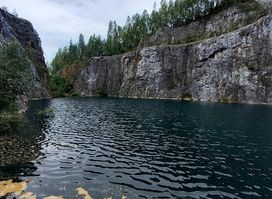
Abandoned quarry's turquoise lake gleams amid Västernorrland forests—a haunting relic of quartz mining legacy just outside Edsele.
Experience the vibrant flavors of Thailand at Thailändska Paviljongen in Bispgården, where authentic cuisine meets charming ambiance.
