

Hammarö Sydspets Travel Guide
Free Guide: A windswept headland and lighthouse on Lake Vänern—intimate trails, rich bird migration and wide inland-sea views.


A brief summary of Hammarö Sydspets
A windswept headland and lighthouse on Lake Vänern—intimate trails, rich bird migration and wide inland-sea views.
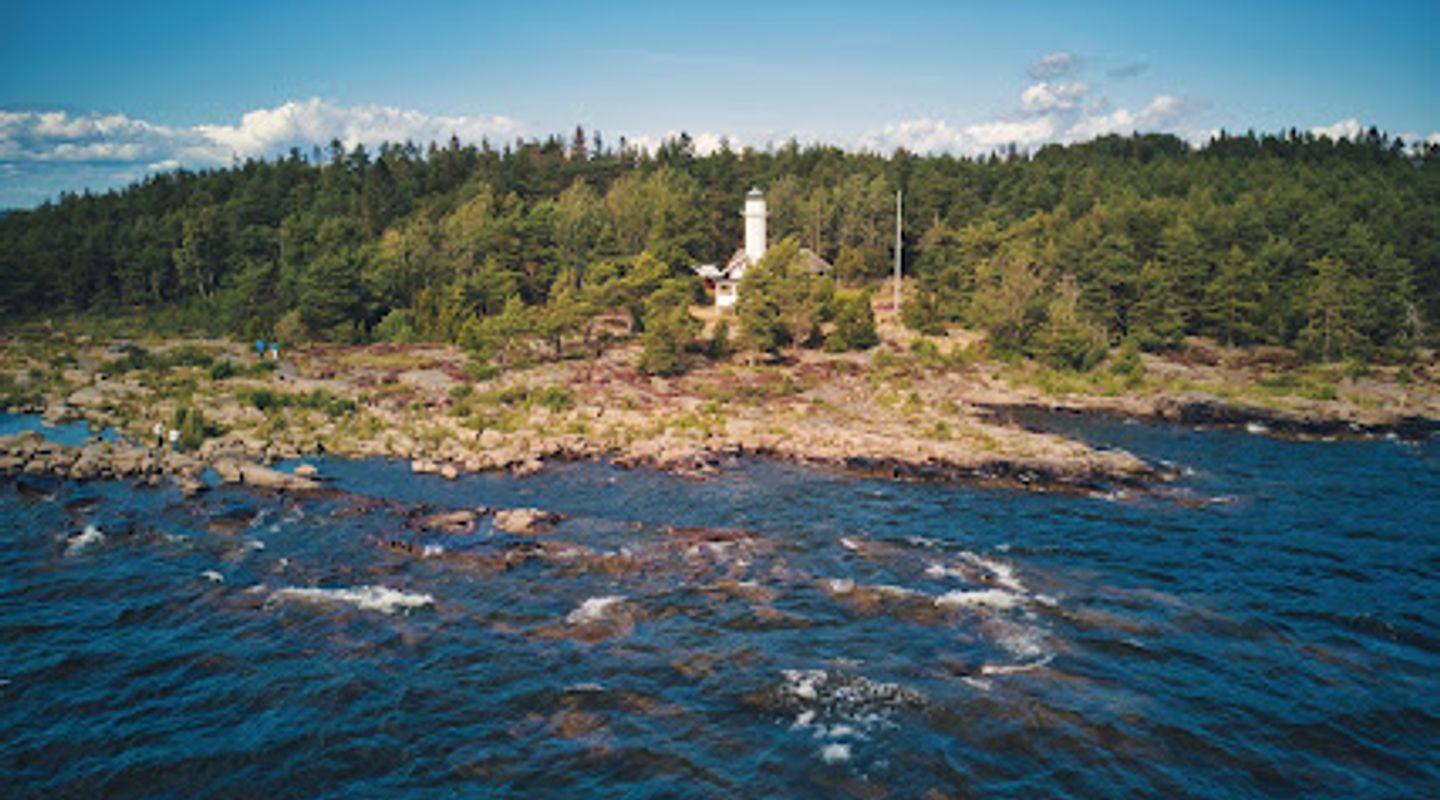
Hammarö Sydspets, the southern tip of Hammarö projecting into Lake Vänern, is a sheltered coastal reserve centred on the Skage lighthouse and a patchwork of rocky shoreline, reed bays, beach meadows and forested trails. Renowned for migration watching and varied shoreland habitats, the cape offers panoramic inland-sea views, birdwatching platforms, picnic clearings and easy trails that suit day visits and short hikes.
On-site amenities
 Seating areas
 Information boards
 Picnic areas
Opening hours
- Every dayOpen 24 hours
Opening hours as listed on the venue’s Google Business Profile. Hours can change for services and special events, so check with the venue before you go.
- Address
- Östra TAKENE 145, 663 91 Hammarö
- Website
Getting there
Car
Bicycle
Local bus plus walk
Discover more about Hammarö Sydspets
Geography where land meets Vänern
Hammarö Sydspets occupies the southernmost point of Hammarö and faces the vast inland waters of Lake Vänern, forming a pronounced headland that funnels the elements and wildlife along its shoreline. The shoreline alternates between bedrock slabs and sandy or pebbly bays, with bands of reed and sheltered coves that broaden into small meadows and mixed conifer–deciduous woodland a little inland. The landmark Skage lighthouse sits near the tip and punctuates the wide vistas; on clear days the uninterrupted sightlines across the lake give the place an open, maritime character despite being inland.
A patchwork of habitats and seasonal life
The cape’s diversity—rocky beaches, reed beds, meadows and forest—creates a sequence of habitats in a compact area. That variety supports a rich bird life throughout the year and offers seasonally changing plant communities: spring migration brings passing waterfowl and warblers, summer yields flowering meadow edges and insect life, and autumn concentrates migrating flocks moving south along the headland. Underfoot the trails reveal blueberries and mushrooms in season; near the shore you’ll notice sea-polished stones and driftwood shaped by wind and waves.
Routes, platforms and the human layer
A clear network of footpaths links the small parking and service areas with the cape’s viewing platform and the lighthouse zone, making the reserve accessible for families and less mobile visitors; short established paths thread through the woodland and along the shoreline. Midway along the southward stretch there is an information shelter and a raised birdwatching platform that provides a focused vantage point for observing passage migrants or scanning the open water. Scattered rest clearings and picnic spots give space for a brief pause and to take in the panorama.
Birding, wildlife and a sense of movement
Hammarö Sydspets functions as a natural funnel during migration: land and weather patterns concentrate birds along the cape and out over Lake Vänern, producing memorable movement when conditions align. Species lists are long and varied; raptors, divers and large waterbirds are all possibilities at different seasons, and wooded patches can hold resident passerines. Small mammals and typical Scandinavian coastal flora complete the picture, so quiet observation often rewards patience with close encounters and shifting scenes rather than single dramatic moments.
Sensory character and visitor experience
The site’s mood changes with wind and light: still, glassy water in sheltered bays contrasts with wind-scoured rock and an open, exposed tip where gusts sweep inland. Sound is elemental—lapping waves, reed whispers and seasonal bird calls—while scents range from resinous forest to brackish reedbeds and the clean, mineral smell of wet stone. The lighthouse and platforms act as focal points; photographers and sketchers favour the low, slanting light around sunrise and sunset for strong silhouettes and long shadows.
Conservation and practical note
The cape is managed as a coastal reserve with paths and modest visitor facilities designed to reduce impact while allowing people to experience the landscape. Infrastructure is intentionally low-key—information boards, a viewing platform and picnic clearings—so the place retains a natural, uncontrived character. Visitors are encouraged to respect habitats, stay on waymarked tracks, and leave the area as they found it so the complex shoreline and birding value remain intact.
Evendo Review Centre
 Google
Guest reviews
Best time to go
Quietest: Jan, Feb & Mar · before 6am or at 10pm
Busy times are Evendo estimates for a typical year, to help you plan. Actual crowds vary with events, school holidays and the weather.
Explore Hammarö Sydspets on the map
A handpicked selection of must-see spots near Hammarö Sydspets, mapped for you.
Get your free copy of our complete guide to Hammarö Sydspets, delivered straight to you.
Everything on this page, from opening hours and how to get there to Eve’s tips and the best time to go, in one PDF you can read offline, print or share.
Already have an account? Sign in
Your Hammarö Sydspets guide is ready.
We'll send it to · Not you? Sign out

Getting your guide ready…
We are putting together a fresh copy of the Hammarö Sydspets guide. This can take up to a minute.
This can take a few moments. If your browser asks, choose Allow so the download can start. You'll find the guide in your Downloads folder.
Nothing happened? Download it again
Sorry, the guide is taking longer than usual. Please try again in a minute, or get it by email instead.
Other nearby places you may find interesting
The closest places of the same kind, if this one is not quite what you had in mind.
-
-
-
-
-


Swipe for more places
More to explore near Hammarö Sydspets

 Best experiences near Hammarö Sydspets
 Best hotels near Hammarö Sydspets
 Best landmarks near Hammarö Sydspets
 Best attractions near Hammarö Sydspets
 Best shops near Hammarö Sydspets
 Best restaurants near Hammarö Sydspets
 Best bars near Hammarö Sydspets
Do you manage this location?
Take control to get all the benefits, like improved information, better appearance, and stronger visibility across AI-powered discovery.
Explore more

Explore more of Västerbotten
Discover Västerbotten: A Swedish haven of natural beauty, rich culture, and endless adventure, from the majestic Vindelfjällen Nature Reserve to the vibrant city of Umeå.
Explore Västerbotten
Explore more of Sweden
Discover Sweden's breathtaking landscapes, vibrant cities, and rich cultural heritage. From the Northern Lights to historic castles, experience the essence of Scandinavia.
Explore Sweden
