From Eve
Know before you go
Hi, I'm Eve. Here are a few practical things to know before exploring Claridenhütte.
Local know-how to help you travel smarter and make the most of every moment.

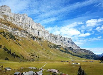
Experience the stunning Swiss Alps at Claridenhütte—a cozy mountain cabin perfect for relaxation, adventure, and delicious local cuisine.
Nestled in the Swiss Alps, Claridenhütte is a stunning mountain cabin that offers breathtaking views, delicious local cuisine, and a serene atmosphere. Ideal for nature lovers and those seeking adventure, this charming retreat is a must-visit destination for tourists exploring the Glarus region.
Opening times, essentials, and a few local tips gathered into one calmer, easier-to-scan planning section.
Hi, I'm Eve. Here are a few practical things to know before exploring Claridenhütte.
Local know-how to help you travel smarter and make the most of every moment.
Car
From Glarus, head south on the A3 highway. Follow the signs for Glarus Süd and take the exit toward Linthal. Continue on this road until you reach the village of Linthal. From Linthal, follow the signs toward the Claridenhütte, which is located near the base of the Clariden peak. Park your car at the designated parking area in Linthal if you plan to hike to the hut. Note that parking may incur a small fee, typically around CHF 5-10 per day.
Public Transportation
If you prefer to use public transport, take a train from Glarus to Linthal. The train ride takes approximately 30 minutes. Upon arriving at Linthal, transfer to a local bus heading towards the Claridenhütte. Ensure to check the bus schedule ahead of time as services may be limited. The bus fare is typically around CHF 5. Once you reach your stop, follow the hiking path signs towards Claridenhütte.
Hiking
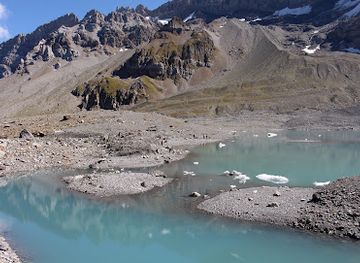
If you decide to hike from Linthal to Claridenhütte after parking your car or arriving by bus, the trail is well-marked and takes about 2-3 hours. The hike is moderately challenging, with a vertical gain of around 600 meters. Make sure to wear appropriate hiking shoes and bring water and snacks for the journey.
Use Claridenhütte as your starting point for nearby food, family ideas, nightlife, and more local discoveries.

Explore expert travel guides, compare and book tours, experiences, hotels, and more—all from the palm of your hand. Download now for seamless trip planning wherever your wanderlust takes you.

Discover Glarus, Switzerland's hidden gem, where breathtaking alpine landscapes, rich history, and delectable local cuisine await you.
Tell me more about Glarus