Dunmore Hill Fort
Iron Age fortress commanding the Trossachs landscape with ancient stone ramparts and sweeping Highland views.
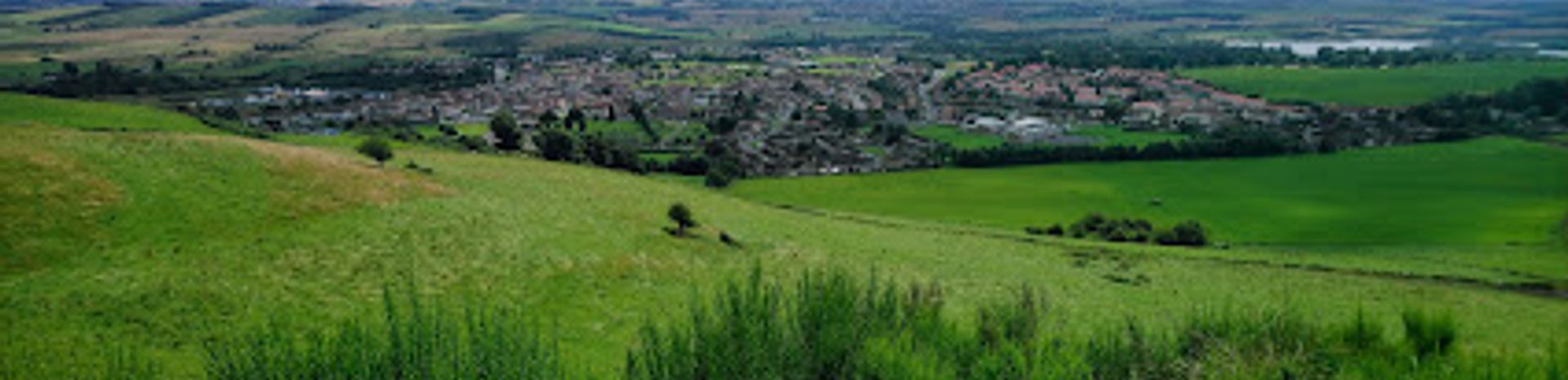
Dunmore Hill Fort is a prehistoric Iron Age hillfort perched on a prominent summit overlooking Callander in Stirling, Scotland. Defended by the remains of four substantial stone ramparts, this Pictish stronghold commands sweeping views across the Trossachs landscape. The fort's name derives from Celtic-Pictish roots—'dun' meaning fort and 'more' referring to its elevated position. A relatively accessible walk leads to this atmospheric archaeological site, offering both historical significance and panoramic vistas.
A brief summary to Dunmore Hill Fort
- Kinross, GB
- Duration: 1.5 to 3 hours
- Free
-
 Outdoor
- Mobile reception: 3 out of 5
Local tips
- Visit during autumn months when the surrounding woodland displays vibrant golden and russet colours, creating a particularly atmospheric setting for photography and exploration.
- Allow at least 1.5 to 2 hours for your visit to comfortably walk the path, explore the ramparts, and enjoy the panoramic views without rushing.
- Wear sturdy footwear with good grip, as the path can become muddy or slippery, particularly after rain or during wet weather conditions.
- Bring binoculars or a camera with a good zoom lens to appreciate the distant views across the Trossachs and to examine the stone rampart details up close.
- Consider combining your visit with nearby Bochastle Roman Fort and Samson Stone to create a comprehensive archaeological tour of the Callander area.
For the on-the-go comforts that matter to you
- Information Boards
- Trash Bins
Getting There
-
Car from Callander town centre
Drive north from Callander town centre toward the A84 direction, following local signage toward Dunmore Hill. Parking is available at a small lay-by or informal parking area near the base of the hill, approximately 2 kilometres from the town centre. The drive takes about 5 to 10 minutes. From the parking area, follow the established walking path uphill through mixed woodland to reach the fort summit, a walk of approximately 20 to 30 minutes depending on fitness and pace. No entrance fee is required.
-
Walking from Callander
From Callander town centre, it is possible to walk to Dunmore Hill Fort, though the total distance is approximately 3 to 4 kilometres each way. The walk takes 45 minutes to 1 hour to reach the base of the hill, then a further 20 to 30 minutes to ascend to the fort. The route follows local roads and paths through the town's outskirts before joining the woodland path. This option suits visitors with good fitness levels and several hours available. No fees apply.
-
Bus from Callander
Local bus services operate from Callander town centre, with some routes passing near the Dunmore Hill area. Journey times vary between 10 and 20 minutes depending on the specific route and stops. Check local transport schedules for current timetables and fares, which typically range from £2 to £5 per journey. From the bus stop, a short walk of 10 to 15 minutes leads to the base of the hill and the walking path.
-
Guided tour from Callander visitor services
Several local tour operators and visitor centres in Callander offer guided walks to Dunmore Hill Fort, often combined with visits to nearby archaeological sites such as Bochastle Roman Fort. These guided experiences typically last 2 to 3 hours and include historical interpretation. Prices generally range from £15 to £35 per person depending on group size and inclusions. Advance booking is recommended, particularly during peak tourist seasons.
Dunmore Hill Fort location weather suitability
-
 Any Weather
-
 Clear Skies
-
 Cold Weather
-
 Mild Temperatures
Discover more about Dunmore Hill Fort
An Iron Age Fortress in the Trossachs
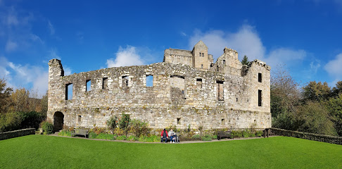
Dunmore Hill Fort stands as one of Scotland's most impressive prehistoric fortifications, occupying a commanding position on a prominent hill that overlooks the town of Callander. This Pictish Iron Age stronghold dates back over two millennia, representing a crucial period in Scottish history when powerful chieftains controlled the landscape from elevated defensive positions. The fort's strategic location places it within a network of significant early historic hillforts, positioned between Alt Clut at Dumbarton to the south and Dunadd in Argyll, making it a key settlement in the broader political geography of ancient Scotland.Stone Ramparts and Defensive Architecture
The fort's most striking feature is its system of defensive ramparts, constructed from substantial stone walls that encircle the hilltop on all sides except the eastern approach. Archaeological investigation has revealed that the main ramparts were built using stone, while an annexe area features an earthen bank, demonstrating the builders' sophisticated understanding of defensive engineering. The roughly oval-shaped fort measures approximately 50 metres from northwest to southeast by 30 metres across, creating an enclosed space that would have housed structures for habitation, storage, and administration. The preservation of these stone walls, despite their age, testifies to the skill and labour invested in their construction.Landscape and Panoramic Setting
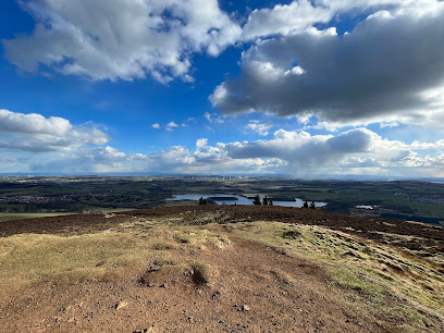
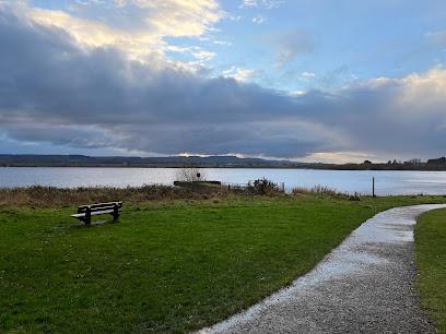
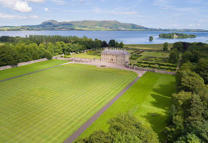
The location itself forms an integral part of the fort's character. Perched on a hilltop with unobstructed views across the surrounding countryside, the fort commands vistas of the Trossachs landscape, the River Teith valley, and the distant mountains. This elevated position would have provided early warning of approaching threats while allowing the fort's inhabitants to monitor trade routes and movement across their territory. The autumn months transform the surrounding woodland into a tapestry of golden and russet tones, creating a particularly atmospheric setting for visitors exploring the site.Archaeological Significance and Research
Dunmore Hill Fort has attracted scholarly attention from archaeologists seeking to understand Iron Age settlement patterns and Pictish society. Excavations and surveys have documented the fort's construction techniques, revealing the distinction between stone-built ramparts and earthen defences. The site's prominence in regional archaeological studies reflects its importance as a window into the lives of Iron Age communities who controlled the Stirling region. The fort's strategic positioning and robust construction suggest it served as a major power centre, possibly the seat of a local ruler or the focal point of a territorial domain.The Ascent and Walking Experience
Reaching Dunmore Hill Fort involves a moderately straightforward walk from the base of the hill, with a well-established path leading upward through mixed woodland. The ascent is neither technically demanding nor excessively steep, making it accessible to most visitors with reasonable fitness levels. As you climb, the surrounding landscape gradually opens up, and upon reaching the summit, the full extent of the fort's ramparts becomes apparent. The walk typically takes 20 to 30 minutes depending on pace and fitness, rewarding visitors with both the archaeological interest of the site and the natural beauty of the Trossachs setting.Iconic landmarks you can’t miss
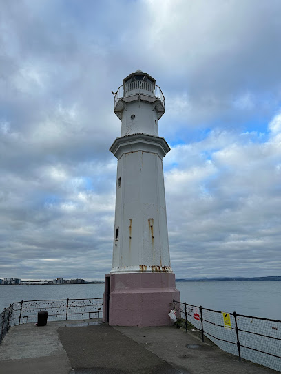
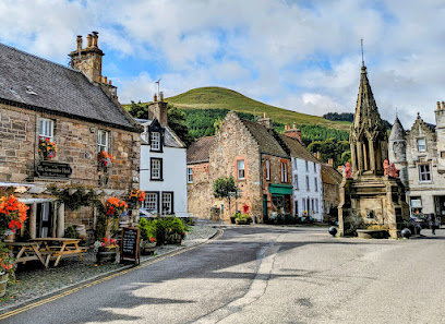
Seamark
1.7 km
Seamark in Kelty, Fife—a serene historical landmark honoring Scotland’s rich coal mining heritage and community resilience.
Caithness Place
13.2 km
Experience the vibrant connectivity of Caithness Place, your gateway to the best of Kirkcaldy's attractions and scenic spots.
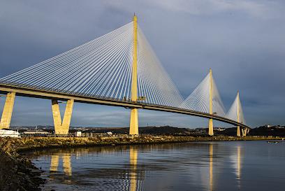
The Queensferry Crossing
19.4 km
Discover the world’s longest three-tower cable-stayed bridge, a modern marvel spanning Scotland’s iconic Firth of Forth.
Forth Rd Bridge
19.5 km
A monumental suspension bridge connecting Edinburgh and Fife, offering stunning views and a rich history spanning over six centuries.
Hawes Pier, Queensferry
20.2 km
Historic ferry pier where centuries of Scottish maritime heritage meet modern tourism beneath the iconic Forth Rail Bridge.
Dalmeny House
20.3 km
Experience the enchanting blend of history and nature at Dalmeny House, a stunning Scottish estate near Edinburgh with breathtaking views.
Eagle Rock
21.0 km
Explore Eagle Rock in Edinburgh: A breathtaking historical landmark with stunning views and rich Scottish heritage.
Castle Campbell
21.0 km
Explore Castle Campbell, a historic gem nestled in Dollar, Scotland, where stunning architecture meets breathtaking landscapes.
Hopetoun House
21.1 km
Discover Hopetoun House, a stunning historical landmark in South Queensferry, showcasing exquisite architecture, beautiful gardens, and rich Scottish heritage.
Blackness Castle
21.5 km
Explore the captivating history and stunning scenery of Blackness Castle, a unique Scottish landmark overlooking the Firth of Forth.
Culross Abbey
21.9 km
Experience the tranquil beauty and rich history of Culross Abbey, a stunning architectural gem in the heart of Scotland's picturesque landscape.
Leith East Breakwater Lighthouse
22.1 km
Historic maritime beacon guiding ships into Edinburgh’s vibrant Leith Docks since 1876, now a cherished symbol of nautical heritage.
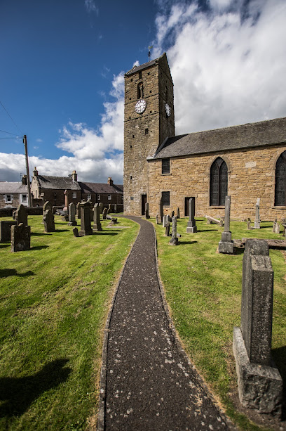
St Serf's Church & Dupplin Cross
22.1 km
Explore St Serf's Church & Dupplin Cross, a stunning medieval church in Dunning, showcasing exquisite Pictish art and a serene atmosphere steeped in history.
Lighthouse Park
22.3 km
Explore the serene landscapes and maritime history of Lighthouse Park in Leith, Edinburgh, a perfect escape for nature lovers and tourists.
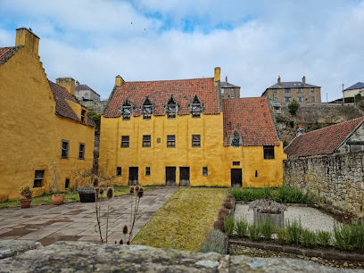
Culross Palace - The National Trust for Scotland
22.4 km
Explore the stunning Culross Palace, a 17th-century gem in Scotland, rich in history and surrounded by breathtaking gardens overlooking the Firth of Forth.
Unmissable attractions to see
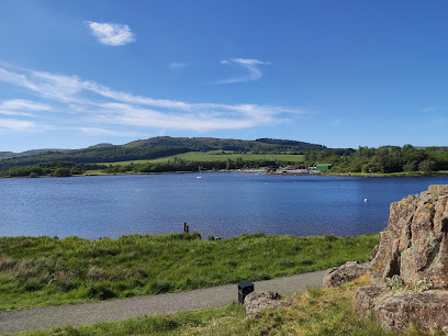
Lochore Meadows
2.3 km
Explore 1,200 acres of scenic woodlands, lochside trails, and family-friendly activities in Fife’s premier country park.
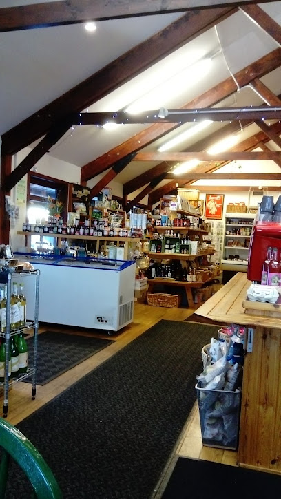
Lochend Farm Shop
2.3 km
Experience fresh farm produce, homemade café delights, and stunning Kinrossshire views at Lochend Farm Shop near Scotlandwell.
The Michael Bruce Cottage Museum
4.7 km
Discover the tranquil birthplace and legacy of Michael Bruce, Scotland’s gentle poet, in a charming 18th-century cottage museum nestled in Kinnesswood.
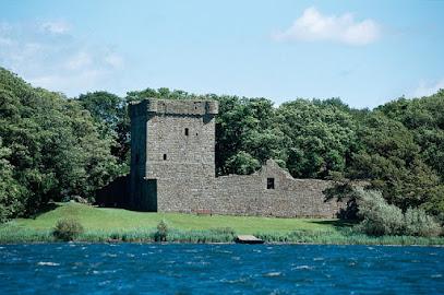
Lochleven Castle
4.8 km
Explore Lochleven Castle, a historic island fortress where Mary, Queen of Scots was imprisoned, set amid tranquil Scottish loch scenery.
Loch Leven Castle Viewpoint
5.5 km
Explore the 21km scenic Loch Leven Heritage Trail with stunning wildlife, historic Loch Leven Castle views, and accessible paths around Scotland’s largest lowland loch.
The Fife Pilgrim Way - Waymarker
5.6 km
Walk in the footsteps of medieval pilgrims along the historic and scenic Fife Pilgrim Way at Kinglassie.
Loch Leven's Larder
5.8 km
A family-run farm and food destination offering fresh local produce, scenic loch views, and artisanal dining near Kinross.
Kinross House Estate
5.8 km
Discover Scotland’s first neoclassical Palladian mansion, set amidst historic gardens and royal heritage on the shores of Loch Leven.
Kirkgate Park
5.8 km
A tranquil 7-hectare park on Loch Leven’s shore, perfect for family outings, scenic walks, and connecting with nature in Kinross.
Loch Leven National Nature Reserve - Pier Entrance
6.0 km
Explore Europe's premier wildfowl haven with scenic trails, rich history, and vibrant wildlife at Loch Leven National Nature Reserve.
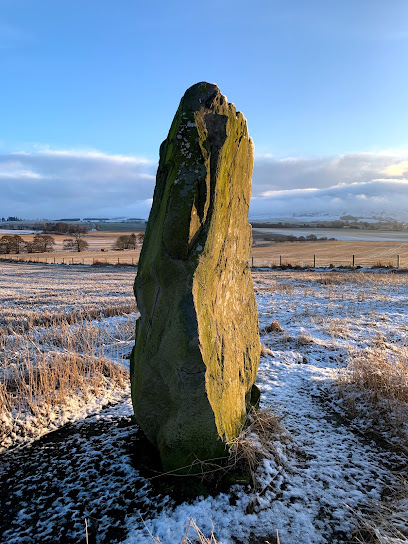
Orwell Standing Stones
6.3 km
Discover the ancient mystery and serene beauty of the Orwell Standing Stones, iconic prehistoric sentinels near Kinross, Scotland.
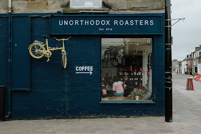
Unorthodox Roasters
6.4 km
Kinross’s artisan coffee roastery and café blending ethical sourcing, expert roasting, and a vibrant community atmosphere on High Street.
Central Chippy Takeaway
6.4 km
Kinross’s go-to spot for crispy fish and chips, kebabs, and pizzas with fast service and convenient delivery options.
La Casanova
6.4 km
Authentic Mediterranean takeaway in Kinross offering thin, tasty pizzas with fresh ingredients and friendly service on High Street.
Hunters Of Kinross
6.4 km
Kinross’s trusted butcher shop offering premium meats, friendly service, and a welcoming local atmosphere on High Street.
Essential places to dine
Balgedie Toll Tavern
5.8 km
Historic Scottish country pub with rustic charm, award-winning food, and a warm welcome amid scenic countryside near Loch Leven.
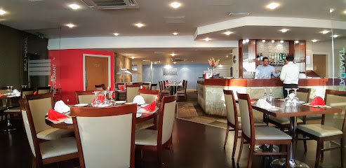
The Raj Mahal Indian Restaurant
6.4 km
Experience authentic and modern Indian flavors with a fresh buffet and warm hospitality in the heart of Kinross.
Sunrise
6.5 km
Discover authentic Chinese flavors at Sunrise in Kinross – where every dish tells a story of tradition and taste.

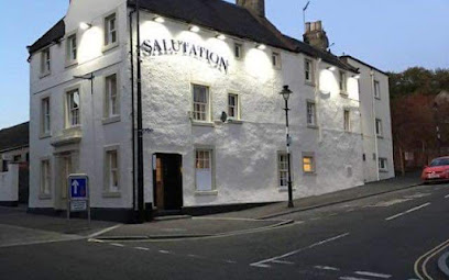
Salutation Hotel & Dewars Bar
6.5 km
A charming historic inn in Kinross with friendly service, traditional Scottish character, and a cozy bar and bistro atmosphere.
The Kirklands Hotel
6.6 km
Charming boutique hotel in Kinross offering cozy rooms, superb breakfasts, and a friendly, welcoming atmosphere in a peaceful country setting.
1567 Restaurant at the Green Hotel
6.9 km
Fine dining with historic charm and garden views in the heart of Kinross at The Green Hotel’s 1567 Restaurant.
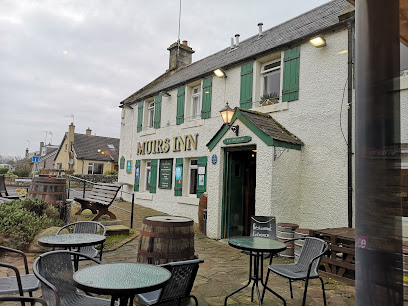
The Muirs Inn
7.1 km
Historic Kinross pub serving fresh home-cooked meals in a warm, welcoming atmosphere.
The Grouse & Claret
7.6 km
A charming countryside restaurant near Kinross serving expertly crafted Scottish dishes with warm, attentive service in a cozy setting.
Le Jardin Cafe
7.9 km
A charming garden centre cafe in Kinross offering fresh food, great coffee, and a tranquil setting for all-day dining.
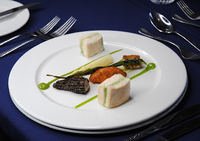
Grande Fine Dining Restaurant
8.7 km
Experience refined Scottish cuisine with a modern twist at The Grande, Kirkcaldy’s acclaimed fine dining restaurant within Dean Park Hotel.
The Fettykil Fox
9.8 km
A charming gastropub in Glenrothes blending rustic Scottish style with hearty British fare and warm hospitality.

Frankie & Benny's
11.0 km
Classic American-Italian comfort food served fresh in a lively, family-friendly setting at Dunfermline’s Fife Leisure Park.
Christies Scottish Tapas
11.0 km
Discover Scottish flavors reimagined as tapas in a lively, welcoming setting at Christies Scottish Tapas in Dunfermline.
Tony Macaroni
11.2 km
Casual Italian dining with family-friendly vibes and great pizza in Dunfermline’s lively Fife Leisure Park.
The Steadings
11.5 km
A fresh food restaurant and versatile event venue in Kirkcaldy, serving up quality meals and memorable celebrations.
Markets, malls and hidden boutiques
Todd & Duncan Ltd
6.1 km
Discover the heritage and craftsmanship of Scotland’s leading cashmere yarn mill nestled beside Loch Leven.
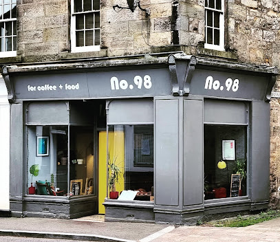
No 98
6.4 km
Discover No 98, a charming café in Kinross offering delicious breakfasts and a cozy atmosphere for an unforgettable dining experience.
You Know Who's
6.9 km
Discover top high street brands at unbeatable prices with friendly service in the heart of Cowdenbeath.

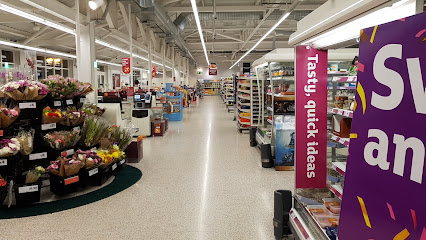
Sainsbury's
7.3 km
Your convenient and inclusive supermarket in Kinross, open daily with fresh produce, bakery delights, and modern shopping amenities.
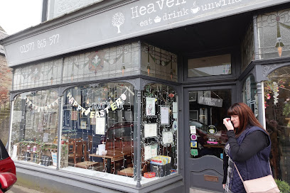
Heaven Scent Coffee Shop
8.1 km
A charming coffee shop in Milnathort offering customizable breakfasts, classic afternoon teas, and a welcoming garden setting with local flair.
The Original Factory Shop (Cowdenbeath)
8.1 km
Shop big brands for less at The Original Factory Shop Cowdenbeath, your go-to discount store for clothing, footwear, beauty, and party supplies.

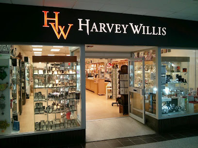
Harvey Willis
10.4 km
Discover Glenrothes’ award-winning boutique offering exquisite gifts, jewellery, watches, and personalized services in a welcoming setting.
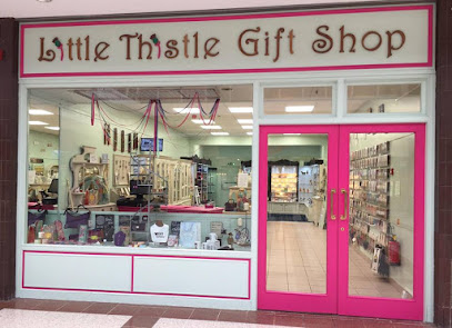
Little Thistle Gift Shop
10.4 km
Discover unique Scottish gifts and handcrafted treasures at Little Thistle, Glenrothes’ award-winning family-run boutique.
A&N Custom Gifts
10.6 km
Explore A&N Custom Gifts, your go-to destination in Glenrothes for unique souvenirs and personalized treasures that embody the spirit of your travels.

Vintage Quine
12.0 km
Discover timeless vintage fashion and unique accessories in the charming boutique of Vintage Quine, nestled in the historic village of Falkland.
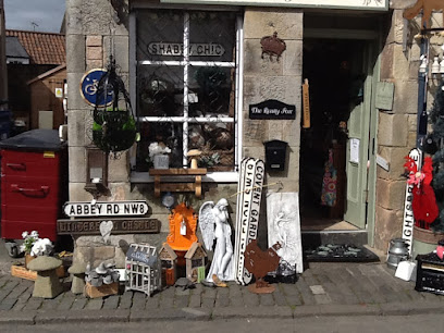
The Rusty Fox
12.0 km
Discover unique gifts, garden treasures, and plus-size fashion at The Rusty Fox, Falkland’s charming boutique on Back Wynd.
Fayre Earth
12.0 km
A charming gift shop and café in the historic village of Falkland, perfect for Scottish souvenirs, local crafts, and a warm cup of tea.
Kreative Dunfermline
12.5 km
Discover unique, handcrafted gifts and local artistry at Kreative Dunfermline, a charming boutique celebrating Fife’s creative spirit.

Fife Country
12.6 km
Heritage Scottish country clothing and footwear crafted since 1888 for enduring comfort and style in the great outdoors.
Blake's Vintage & Collectables
13.2 km
Discover timeless treasures and quirky collectibles in the heart of Aberdour’s charming vintage shop.
Essential bars & hidden hideouts
Torleys Bar
5.3 km
A friendly Lochgelly pub with pool, darts, beer garden, live sports, and a warm community atmosphere at its heart.
Jock's Bar
6.9 km
A cozy, lively bar in Kinross offering local ales, hearty meals, and live music in a historic hotel setting.
Home Farm View - Pub & Grill
8.6 km
A welcoming pub and grill near Kirkcaldy offering classic dishes, a full bar, and family-friendly comfort in a casual setting.
Spiral Weave
9.0 km
A modern pub with a traditional heart, serving daily carvery and classic pub fare in a welcoming family-friendly setting with a lively beer garden.
The Chapel Tavern
9.4 km
A classic Kirkcaldy pub offering hearty British fare, lively events, and a warm, welcoming atmosphere for all.
Eddy's Bar
9.9 km
A traditional Kirkcaldy pub blending classic charm with modern comfort, perfect for locals and visitors seeking a welcoming atmosphere.

Weavers Bar & Lounge
12.0 km
A welcoming and lively bar in Kirkcaldy offering great drinks, a cozy lounge, and a friendly atmosphere with moderate prices.
The Railway Tavern @ Strathmiglo (Formerly The Strath Tavern)
12.4 km
Historic Scottish charm meets authentic local flavors in the welcoming Railway Tavern at Strathmiglo’s heart.
Novar
12.8 km
A lively Kirkcaldy pub and restaurant famed for generous portions, fresh meals, and a welcoming local atmosphere.
Montagues
12.9 km
Lively and affordable bar with funky decor and friendly staff in the heart of Kirkcaldy's High Street.
Betty Nicols
12.9 km
Historic and welcoming Kirkcaldy bar offering hearty pub fare, guest ales, vegan options, and a cosy atmosphere with a pet-friendly spirit.
The Path Tavern
12.9 km
A cozy, family-run pub in Kirkcaldy serving hearty home-cooked meals with vintage charm and friendly, attentive service.
The Elby Inn
12.9 km
Experience the heart of Scottish hospitality at The Elby Inn, a cozy pub in Markinch offering local ales and hearty meals.
Harbour Bar
12.9 km
A friendly, traditional pub in Kirkcaldy offering affordable ales, lively events, and a welcoming atmosphere for locals and visitors alike.
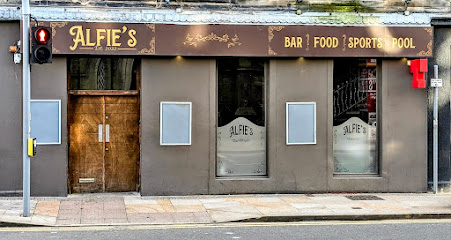
Alfie's
12.9 km
A lively and welcoming bar on Kirkcaldy's High Street, perfect for casual drinks and vibrant nightlife.
Nightclubs & after hour spots
The Schofies Residence 1
9.1 km
A lively nightclub nestled in Glenrothes, offering a vibrant social scene and memorable nights in Scotland’s welcoming town.

Republic Bar Club
12.9 km
Experience Kirkcaldy’s vibrant nightlife at Republic Bar Club, where great drinks, friendly vibes, and lively weekends come together.
LIFE
13.7 km
Experience vibrant nightlife and late-night fun at LIFE, Dunfermline’s energetic nightclub with a welcoming atmosphere and great music.

Hustlers Pool Hall
15.5 km
Affordable, lively pool hall and sports bar in Rosyth offering fun games, friendly vibes, and great social atmosphere for all ages.

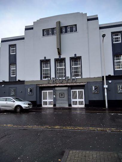
Truth
21.1 km
Experience vibrant nightlife with great music, friendly service, and a welcoming atmosphere at Truth nightclub in Leven, Fife.
Ice Factory Perth
24.7 km
Perth’s energetic nightclub and live music hotspot, blending dance, DJs, and vibrant weekend nights in a modern setting.

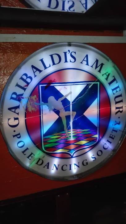
Garibaldi's
25.6 km
Edinburgh's tiniest nightclub packs the biggest late-night punch on Hanover Street, with killer margaritas and a dance floor that never quits till 3am.
Lulu Bar and Nightclub
25.6 km
Edinburgh's George Street gem: chic cocktails, thumping beats, and dance floors that ignite the night in upscale style.
Club One
25.6 km
Experience Perth’s vibrant nightlife at Club One, a lively nightclub offering late-night and daytime parties in the city center.
Opal Lounge
25.6 km
A stylish live music bar and nightclub in Edinburgh’s New Town, perfect for celebrations and vibrant nightlife.
Loft Nightclub
25.7 km
Perth’s energetic nightclub with six bars, late-night dancing, and a lively social scene on South Street.
Why Not Nightclub
25.7 km
Edinburgh's multi-award-winning late-night haven with LED immersion, garden vibes, and non-stop beats on George Street.

Shanghai Nightclub
25.7 km
Edinburgh's Oriental nightlife den: Asian decor, themed beats, VIP vibes, and non-stop energy on George Street.
El Barrio Latino
25.7 km
Edinburgh's sizzling Latin nightclub where salsa beats pulse through New Town nights, drawing dancers to its vibrant Hanover Street heart until the early hours.
The Shack Retro Bar & Club
25.7 km
Edinburgh's retro dance den blasting 60s-90s hits amid quirky decor and sweaty dance floors—pure nostalgic escapism on Rose Street.

For the vibe & atmosphere seeker
- Scenic
- Adventurous
- Unique
- Tranquil
For the design and aesthetic lover
- Rustic Designs
For the architecture buff
- Historic
- Landmarks
- Viewpoints
For the view chaser and sunset hunter
- Iconic Views
- Panoramas
For the social media creator & influencer
- Photo Spots
- Architectural Shots
For the eco-conscious traveler
- Protected Area
- Leave-No-Trace Critical
- Locally Managed
For the kind of experience you’re after
- Cultural Heritage
- Myth & Legends
- Photowalk
- Nature Escape
- Day Trip
For how adventurous you want the journey to be
- Easy Access
- Requires Hike
Location Audience
- Family Friendly
- Senior Friendly
- Solo Friendly
- Couple Friendly


