West Yorkshire, North Yorkshire, and Lancashire Tri Point
Discover the quiet meeting place of West Yorkshire, North Yorkshire, and Lancashire where history and moorland landscapes converge.
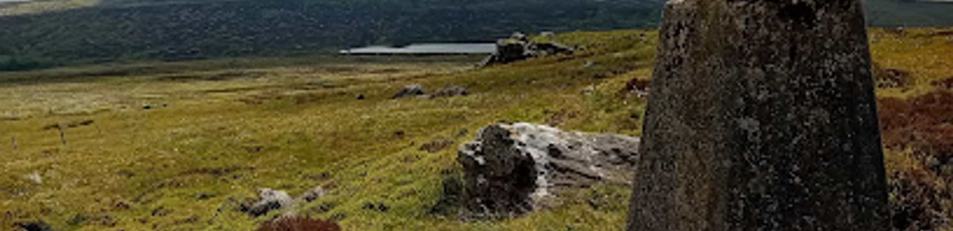
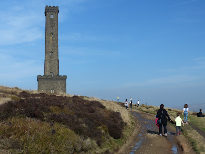
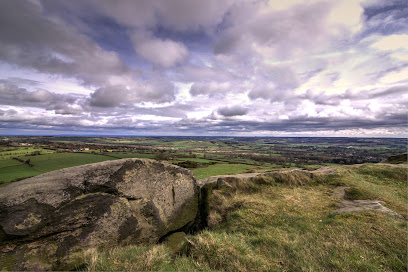
The West Yorkshire, North Yorkshire, and Lancashire Tri Point marks the unique meeting place of three historic English counties. Located near Keighley on the Pennine Way, this rural boundary spot is distinguished by a county stone and offers a peaceful setting amidst moorland landscapes. It is a subtle yet fascinating geographic landmark for walkers and geography enthusiasts exploring the Pennines.
A brief summary to West Yorkshire, North Yorkshire, and Lancashire Tri Point
- Pennine Way, Keighley, BD22, GB
- Duration: 0.5 to 2 hours
- Free
-
 Outdoor
- Mobile reception: 3 out of 5
Local tips
- Wear sturdy walking shoes as access involves moorland trails with uneven terrain.
- Visit on a clear day for the best panoramic views across the three counties.
- Bring a map or GPS device as signage is minimal around the tri point.
- Combine your visit with a walk along the nearby Pennine Way for a fuller outdoor experience.
For the on-the-go comforts that matter to you
- Information Boards
Getting There
-
Train and Bus
Travel by train to Keighley railway station from Leeds or Bradford, with journey times of 30-45 minutes. From Keighley, take a local bus towards the Pennine Way area near Watersheddles Reservoir, approximately a 20-minute ride. Bus services may be limited on weekends and public holidays. Total travel time around 1 to 1.5 hours. Expect fares between £5-£10.
-
Car
Drive to the Pennine Way near Keighley via the A629 or A6033. Parking is limited and informal near trailheads; expect a 10-15 minute walk on uneven moorland paths to reach the tri point. Suitable for standard vehicles, but narrow rural roads require cautious driving. No parking fees apply.
-
Walking
For experienced walkers, approach the tri point via the Pennine Way from Keighley or nearby villages. The walk involves moorland terrain with some steep sections and can take 2-3 hours depending on starting point. Suitable footwear and weather-appropriate clothing recommended. No special permits required.
West Yorkshire, North Yorkshire, and Lancashire Tri Point location weather suitability
-
 Any Weather
-
 Rain / Wet Weather
-
 Clear Skies
-
 Windy Conditions
-
 Mild Temperatures
Discover more about West Yorkshire, North Yorkshire, and Lancashire Tri Point
Geographic Significance of the Tri Point
The West Yorkshire, North Yorkshire, and Lancashire Tri Point is a rare and intriguing geographic landmark where the boundaries of three historic counties converge. Situated near Keighley along the Pennine Way, this tri point marks the exact spot where these counties meet, symbolized by a county stone or boundary marker. Such tripoints are important for understanding administrative borders and historic county divisions in England, offering a tangible connection to regional history and landscape demarcation.Setting and Landscape Features
This tri point lies in a tranquil upland area characterized by moorland terrain typical of the Pennines. The surroundings are dominated by rolling hills, open skies, and scattered drystone walls that delineate historic land divisions. The natural environment is peaceful and scenic, providing a quiet retreat from urban life. The location’s rural character and elevated position afford expansive views across the bordering counties, enhancing its appeal to walkers and nature lovers.Historical and Cultural Context
County tripoints like this one are steeped in history, reflecting centuries of territorial organization in England. The boundary stone at the tri point is a glacial erratic or specially placed marker that has long served as a physical testament to the meeting of county lines. Such markers often date back to times when county borders were crucial for administration, taxation, and jurisdiction. Though subtle, the tri point embodies a rich cultural heritage tied to England’s historic counties.Visitor Experience and Activities
Visitors to the tri point typically approach it as part of longer walks along the Pennine Way or nearby trails. The spot itself is understated, with the county stone and boundary walls as focal points. It offers a moment of reflection on geography and history amid natural surroundings. The area is ideal for quiet contemplation, photography of moorland vistas, and appreciating the subtle ways in which human history intersects with the landscape.Nearby Attractions and Natural Highlights
The tri point is located near other notable upland features such as Green Hill and the Wolf Stones, which also attract walkers and trig point enthusiasts. The wider region offers varied terrain including reservoirs, moorland, and panoramic viewpoints. This makes the tri point a meaningful waypoint within a network of outdoor destinations celebrated for their natural beauty and historical significance.Conservation and Accessibility
The area around the tri point is part of a natural upland environment that benefits from conservation efforts to preserve its moorland ecology and heritage features. Access is generally on foot via established trails, with no formal facilities at the site itself. Visitors should respect the fragile environment and historic markers, ensuring minimal impact while enjoying this distinctive geographic landmark.Iconic landmarks you can’t miss
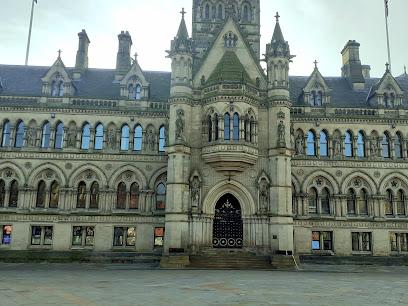
Bradford City Hall
20.3 km
A majestic Victorian landmark in Bradford, blending stunning Venetian Gothic architecture with rich civic history and vibrant cultural life.
Lumb Viaduct
26.6 km
Discover the historic Victorian Lumb Viaduct, a stunning railway landmark offering scenic walks and cycling across Lancashire’s Rossendale Valley.
National Trust - Yorkshire Dales
29.4 km
Experience the breathtaking landscapes and rich wildlife of Yorkshire Dales National Trust, a must-visit nature reserve in England's stunning countryside.
Peel Tower
29.9 km
Historic Peel Tower on Holcombe Hill offers panoramic views and a tribute to Sir Robert Peel’s legacy near Bury.
Beckett Park
30.1 km
Explore Beckett Park in Leeds: A serene urban retreat with lush landscapes, perfect for picnics, strolls, and outdoor activities.
Adel Dam Nature Reserve
30.2 km
Discover the serene beauty of Adel Dam Nature Reserve in Leeds, a perfect nature escape for walking, wildlife watching, and family outings.
Golden Acre Park
30.4 km
Explore the beauty of Golden Acre Park in Bramhope, Leeds, a perfect blend of nature, tranquility, and family-friendly activities.
The Hollies
30.6 km
Discover the tranquility of The Hollies, a beautiful park and garden in Leeds, perfect for leisurely strolls and peaceful retreats in nature's embrace.
Headingley Carnegie Pavilion
30.7 km
Discover Headingley Carnegie Pavilion, a historic landmark blending academic heritage with vibrant community life in Leeds.
AMT Headingley Rugby Stadium
30.7 km
Discover the heart of rugby culture at AMT Headingley Stadium, Leeds – where thrilling matches and community spirit unite!
Leeds Industrial Museum at Armley Mills
30.9 km
Step inside the world’s largest historic woollen mill and discover Leeds’ rich industrial heritage through authentic machinery and engaging exhibits.
Headingley Enterprise & Arts Centre
31.0 km
Discover a vibrant community hub at Headingley Enterprise & Arts Centre, where art, culture, and collaboration come together in Leeds.
Sparrow Park
31.0 km
Discover tranquility at Sparrow Park in Headingley, a picturesque green space perfect for relaxation, picnics, and community events in Leeds.
Headingley Bear Pit
31.2 km
Discover the historical allure of Headingley Bear Pit, a captivating landmark in Leeds that showcases the city's rich cultural heritage and vibrant community.
Almscliffe Crag
31.3 km
A majestic Millstone Grit outcrop near Leeds and Harrogate, famed for climbing, sweeping valley views, and rich folklore.
Unmissable attractions to see
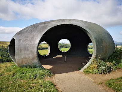
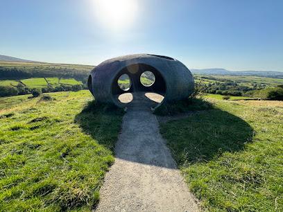
The Atom - Panopticon
3.3 km
A futuristic pavilion framing stunning panoramic views above historic Wycoller village in the heart of Lancashire’s countryside.
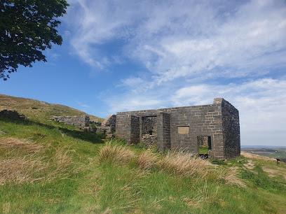
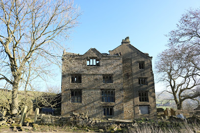
Top Withens
4.1 km
Discover the windswept moorland ruins that inspired Emily Brontë’s Wuthering Heights, a haunting symbol of literary heritage and rugged beauty.
Wycoller Country Park
4.4 km
Historic village and evocative ruins nestled in scenic Lancashire countryside, inspiring literature and offering tranquil walks.
Brontë Parsonage Museum
6.2 km
Step into the world of the Brontë sisters at their historic Haworth home, where literary masterpieces were born amidst the Yorkshire moors.

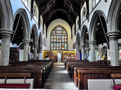
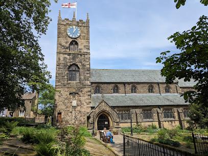
St Michael & All Angels Church, Haworth
6.3 km
Historic spiritual home of the Brontë family, blending rich literary heritage with stunning Victorian architecture in the heart of Haworth.
Haworth
6.8 km
Explore Haworth, the enchanting Yorkshire village where the Brontë sisters wrote timeless classics amid stunning moorland scenery and heritage steam trains.
Alkincoats Park
9.1 km
Discover Alkincoats Park, Colne’s historic and scenic green space offering gardens, sports, and family-friendly fun across 38 acres.
Marsden Park
9.4 km
Explore Marsden Park’s rich Tudor heritage, scenic gardens, and vibrant community spaces in the heart of Nelson, Lancashire.
Pendle Heritage Centre
10.7 km
Discover Lancashire’s heritage through historic architecture, witch trials lore, tranquil gardens, and local culture at Pendle Heritage Centre.
Extwistle Hall
10.9 km
Explore the evocative ruins of Extwistle Hall, a 16th-century Tudor manor perched on Lancashire’s scenic moorland.
Barrowford Memorial Park
10.9 km
A peaceful memorial park in Nelson blending natural beauty, historic remembrance, and family-friendly recreation.
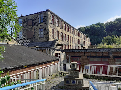
Queen Street Mill Textile Museum
11.0 km
Explore the world’s last steam-powered weaving mill and step back into Lancashire’s rich cotton industry heritage at Queen Street Mill Textile Museum.
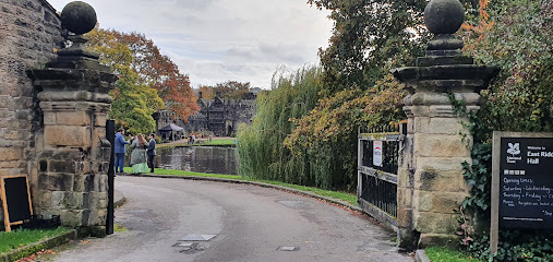
East Riddlesden Hall
11.3 km
Explore a charming 17th-century manor, historic barn, and family-friendly gardens nestled in the heart of West Yorkshire’s countryside.
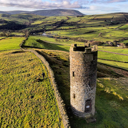
Blacko Tower
11.4 km
A Victorian folly crowning Blacko Hill, Blacko Tower offers sweeping Lancashire views wrapped in history and mystery.
Victory Park
12.3 km
Historic green space in Barnoldswick honoring WWI fallen with peaceful paths, a junior cycleway, and community spirit for all ages.
Essential places to dine
Bertram's Restaurant
14.6 km
Sophisticated adult-only dining with creative British cuisine, cocktails, and stunning countryside views near Burnley.
The Box Tree Restaurant
16.8 km
A historic fine dining gem in Ilkley, blending classical French techniques with modern European flair in a charming sandstone setting.
Gimbals Restaurant
18.1 km
Quirky, cozy Modern British dining with Mediterranean flair and warm, personalized service in the heart of Sowerby Bridge.
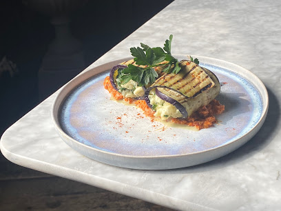
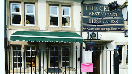
The Cellar Restaurant
18.5 km
Historic charm meets traditional English cuisine in Padiham’s beloved Cellar Restaurant, where hearty meals and warm service await.
Craven Arms Pub & Cruck Barn
22.4 km
Experience authentic Yorkshire Dales hospitality with hearty food, local ales, and rustic charm at Craven Arms Pub & Cruck Barn.
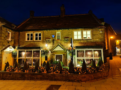
The Old Hall Inn
24.3 km
Historic charm and hearty Yorkshire hospitality await at The Old Hall Inn in the heart of Grassington village.
Restaurant Metamorphica
24.5 km
Exclusive fine dining in Haslingden offering innovative British tasting menus in an intimate, handcrafted setting by Chef Steven Halligan.
The Lister Arms
24.6 km
Historic 17th-century coaching inn in Malham offering cozy rooms, hearty local cuisine, and a welcoming pub atmosphere in the heart of the Yorkshire Dales.
The Secret Garden Bistro
24.8 km
A pioneering plant-based bistro in Malham offering innovative, sustainable dishes in a serene Yorkshire Dales setting.
Grand Cru Restaurant
25.6 km
Experience luxurious modern British dining in a beautifully restored landmark with refined cuisine and warm, attentive service in Birkenshaw.
Artisan Ribble Valley
25.7 km
Experience Modern British cuisine in a stylish setting with local flavors, scenic terraces, and a vibrant cocktail bar in Billington, Clitheroe.
Northcote Hotel & Restaurant
26.6 km
Luxury country house hotel with Michelin-starred dining, elegant rooms, and tranquil Ribble Valley views for a refined countryside escape.
The Bonny Inn
29.7 km
Contemporary British pub with fresh local cuisine, vegan options, and stunning Ribble Valley views in a welcoming, modern setting.
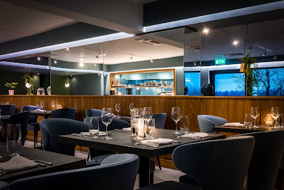
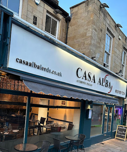
Casa Alba
30.6 km
Authentic Italian flavors and cosy ambiance await you at Casa Alba, Headingley’s beloved dining destination.
Salvo's
30.7 km
Authentic family-run Italian dining in the heart of Headingley, Leeds, serving classic pasta, wood-fired pizzas, and warm hospitality since 1976.
Markets, malls and hidden boutiques
The Old Rock Home & Gifts Shop
5.8 km
A charming village boutique offering unique gifts, homewares, and clothing with warm local hospitality in Trawden, Lancashire.
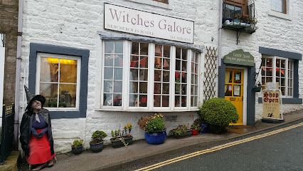
Witches Galore
14.7 km
A quirky, witch-themed gift shop in Newchurch-in-Pendle, packed with Pendle Witch memorabilia, magical curios and folklore souvenirs.
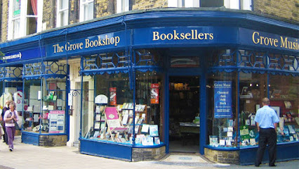
Grove Bookshop
16.8 km
A warm, independent bookshop in Ilkley’s heart, perfect for browsing new releases, children’s books, travel guides and local events.
Quirky Gifts
23.4 km
Explore Accrington's most charming gift shop for unique, whimsical treasures that capture the spirit of your travels.
All Things Quirky 4 U
26.1 km
A charming Etsy shop in a historic Huddersfield mill, filled with vintage accessories, handmade jewellery, and quirky gifts with personality.

Our Handmade Collective
26.9 km
Discover unique, handcrafted treasures from over 110 local makers in a welcoming Horsforth boutique that celebrates creativity and quality.
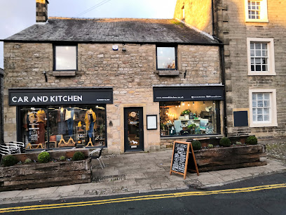
C&K
28.6 km
A charming independent lifestyle store and café in Settle’s Market Place, blending boutique shopping with local flavors and welcoming ambiance.
Hidden Wardrobe - Cashmere scarves Leeds | Jewellery Shop | Gift Shop
28.7 km
Discover luxurious cashmere scarves and exquisite jewellery in Huddersfield’s historic Shambles at The Hidden Wardrobe boutique.

Uniquely Yours / Yorkshire Melts
30.4 km
Discover handcrafted wax melts and unique Yorkshire gifts in the heart of Armley, Leeds, blending artisan charm with local warmth.
Legs&Limpy
30.7 km
Whimsical threads for Leeds' lively souls: quirky clothing that moves with Headingley's beat in a cozy crescent hideaway.
The Mall Blackburn
30.7 km
Experience the best of shopping and dining at The Mall Blackburn, where diverse stores and delightful eateries await every visitor.
Style LTT
30.8 km
Chic womenswear finds in Headingley's lively heart: soft, stylish pieces for every day, blending comfort and contemporary flair amid buzzing cafes and parks.
Flavour Like Fancy
30.9 km
Vibrant Headingley gift shop brimming with bold, handmade treasures from local UK makers—perfect for unique finds that spark joy and support indie creativity.
LW Home & Decor
31.0 km
Explore LW Home & Decor in Headingley, Leeds for unique furniture and accents that elevate your home aesthetics with local charm and style.
varelas.clothing
31.4 km
Unique fashion finds in Headingley's vibrant heart, where personal style meets eclectic Leeds suburb charm on Raven Road.
Essential bars & hidden hideouts
The Kings Wine and Cocktail Bar and Thai at the Kings
23.3 km
A chic cocktail bar and authentic Thai restaurant in Clitheroe offering fresh flavors, elegant ambiance, and warm hospitality.
White Orchid Boutique Bar
23.5 km
Stylish boutique bar in Accrington offering quality drinks, cozy ambiance, and live music for a vibrant social experience.
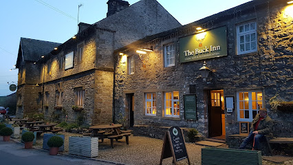
The Buck Inn Malham
24.5 km
A rustic, welcoming pub and inn in Malham offering hearty fare and cozy rooms amid the stunning Yorkshire Dales landscape.
The Gamekeeper's Inn
25.4 km
A charming countryside inn blending rustic hospitality, comfortable stays, and delicious local cuisine in the heart of the Yorkshire Dales.
Old Mill
26.4 km
A charming riverside pub in Brighouse blending rustic British tradition with scenic views and hearty cuisine.
Settle Working Mens Club
28.5 km
Authentic local bar in Settle offering affordable drinks, vibrant community spirit, and a welcoming atmosphere in a historic market town setting.
Woodies Craft Ale House
30.5 km
Savor Yorkshire craft ales amid industrial chic at Headingley's go-to pub, where hearty grub, live tunes, and Otley Run vibes create unforgettable evenings.
The Three Horseshoes
30.6 km
Lively Headingley pub fueling the Otley Run with pizzas, roasts, live music, sports screens, and student spirit—your go-to for pints and pool.
Manahatta Headingley
30.8 km
A lively Headingley cocktail bar serving shareable plates, bold drinks and an easygoing, student-friendly atmosphere.
The Headingley Taps
30.8 km
Lively sports pub near Headingley Stadium, buzzing with match-day cheers, pub grub, karaoke, and student energy in Leeds' vibrant north side.
Arcadia Ale House
30.9 km
Cozy Headingley ale house pouring premium cask beers in a calm, crawl-free haven amid Leeds' student buzz—perfect for discerning drinkers.
New Headingley Club
30.9 km
Headingley's cozy members' club: real ales, snooker, garden pints, and community vibes away from the student buzz – perfect for sports fans and relaxed gatherings.
The Head of Steam Headingley
30.9 km
Leeds' go-to pub for world-class craft beers, live tunes, epic quizzes, and upstairs games in buzzing Headingley—perfect for pints and play.
The Gin Room
31.0 km
Savor Headingley's premier gin sanctuary: vast collections, flawless pairings, and cozy vibes in the heart of Otley Road's nightlife pulse.
BOX Headingley
31.0 km
A multi-level sports bar in Headingley with rooftop beer-gardens, big screens, shareable pub food and social games for groups and match nights.
Nightclubs & after hour spots
The Redroom Burnley
14.7 km
Experience Burnley’s vibrant nightlife with The Redroom’s lively music, diverse drinks, and late-night party atmosphere in the town centre.
Rendezvous Nightclub & Resteraunt
23.7 km
Vibrant nightclub and restaurant in Whalley offering lively weekend events, diverse music, and friendly service in Ribble Valley’s heart.
New Inn
30.6 km
Traditional Headingley pub with roaring fires, cask ales, and community spirit on lively Otley Road—a cozy cornerstone of Leeds life.
The Warehouse
32.9 km
Experience the vibrant nightlife and dynamic music scene at The Warehouse, Leeds’ energetic club destination.
Popworld - Leeds
33.2 km
Relive noughties glory in Leeds' ultimate cheesy pop nightclub, where cocktails pop and dances don't stop till dawn.

Home Nightclub Leeds
33.4 km
Leeds' £2.5M superclub: VOID sound, pyrotechnic spectacles, multi-room vibes from house anthems to urban grooves—pure festival energy underground.
PRYZM
33.4 km
Leeds' multi-themed superclub where futuristic beats meet quirky rooms in the heart of Arena Quarter nightlife.
The Key Club
33.5 km
Intimate, no-frills live-music club in central Leeds where punk, indie and alternative acts play close and loud beneath Merrion Street.
ULTRA
33.7 km
Experience Leeds’ vibrant nightlife at ULTRA, where electrifying beats and dynamic dance floors create unforgettable late-night memories.
The Space
33.7 km
Dive into Leeds' basement beats at The Space, where funky house and urban rhythms fuel non-stop dancing till dawn in a sleek underground haven.
The Lab Nightclub Leeds
33.7 km
Experience Leeds' electric nightlife at The Lab Nightclub, where music flows smoothly and the party never stops in the heart of the city.
The HiFi Club
33.7 km
Leeds' underground gem for live music, comedy stardom, and late-night grooves—independent vibes since 2000.
Baracoa Luxe Bar
33.7 km
Glamorous Call Lane haven blending luxe cocktails, beer garden chills, and pulsating club nights in Leeds' vibrant heart since 2010.
The Backroom
33.8 km
A chic speakeasy-style nightclub in Leeds with handcrafted cocktails, eclectic music, and vibrant weekend nightlife beneath a historic railway bridge.
Disco Stu's
33.8 km
Pulse-pounding beats and sticky-floored euphoria on Vicar Lane—Disco Stu's delivers unfiltered Leeds nightlife with affordable drinks and all-night energy.
For the vibe & atmosphere seeker
- Tranquil
- Scenic
- Relaxing
- Unique
For the architecture buff
- Historic
For the view chaser and sunset hunter
- Panoramas
For the social media creator & influencer
- Photo Spots
- Selfie Spots
For the eco-conscious traveler
- Eco-Friendly
- Public-Transport Accessible
- Leave-No-Trace Critical
For the kind of experience you’re after
- Cultural Heritage
- Nature Escape
- Day Trip
- Photowalk
For how adventurous you want the journey to be
- Easy Access
Location Audience
- Family Friendly
- Senior Friendly
- Teen Friendly
- Solo Friendly
- Couple Friendly


