

Langbiang Mountain (Dalat) Travel Guide - Free
Explore Langbiang Mountain in Dalat with Evendo's free guide. Find the best shops, historic streets, restaurants, and gems on web or mobile.


Langbiang Mountain near Da Lat, Vietnam, combines K’Ho heritage, pine-forest trails, jeep rides and sweeping Central Highlands views for active travellers.
Mountain Country Above Da Lat
Langbiang Mountain rises north of Da Lat in Vietnam’s Lam Dong Province, forming the most recognisable highland landscape around the city. Although often described as a Da Lat attraction, the mountain is outside the urban centre, in the wider Lac Duong area, where pine forest, cultivated hills and K’Ho communities shape the setting. The approach leaves behind Da Lat’s villas and cafés for a cooler, more open landscape of winding roads, red earth and highland vegetation.Read more about Langbiang Mountain
Peaks, Forest and Far-reaching Views
K’Ho Culture and Highland Traditions
Best attractions in Langbiang Mountain
Langbiang Mountain’s principal attraction is the highland landscape itself: pine-covered slopes, cool air, open ridgelines and changing views across the plateau north of Da Lat. The popular visitor area on Radar Peak provides an accessible panorama and a straightforward introduction to the massif, while the lower tourist grounds offer space for photographs and short walks. More ambitious visitors can seek out hiking routes towards the higher summits, but these require better preparation and, for unfamiliar travellers, local guidance. Interpretive material and cultural presentations may introduce the K’Ho connection to the mountain, though availability can vary. The surrounding road journey is part of the experience, passing cultivated hills and rural settlements beyond Da Lat’s built-up centre. Langbiang is best understood as a combination of viewpoint, forest environment and cultural landscape rather than as a dense cluster of separate attractions.
-
Tourist attraction
Datanla Waterfall
Explore the breathtaking Datanla Waterfall in Dalat, Vietnam, a perfect blend of adventure and natural beauty amidst lush landscapes.
31 min drive · 11 km from neighbourhood centre
-
Scenic spot
Valley Of Love
Experience the romantic allure of the Valley of Love in Da Lat, Vietnam, a captivating destination filled with stunning landscapes, vibrant gardens, and serene lakes.
7 min drive · 2.4 km from neighbourhood centre
-
Tourist attraction
Khu Du Lịch Lang Biang
Explore Lang Biang, Vietnam's stunning mountain destination, where breathtaking views and rich cultural heritage await every traveler.
11 min drive · 3.5 km from neighbourhood centre
-
Tourist attraction
Golden Valley
Explore the breathtaking beauty of Golden Valley, Vietnam's serene tourist attraction, surrounded by lush landscapes and vibrant gardens.
23 min drive · 7.5 km from neighbourhood centre


Best landmarks in Langbiang Mountain
The Langbiang massif is itself the defining landmark, rising prominently above the northern highlands associated with Da Lat. The commonly visited Radar Peak area functions as the mountain’s principal built visitor landmark, combining an elevated viewpoint with access infrastructure and broad views towards the city and surrounding plateau. The higher summits of the massif carry greater mountaineering significance but are less accessible than the arranged tourist viewpoint. The mountain’s symbolic importance also comes from the K’Lang and H’Biang legend, which gives the name a cultural dimension beyond geography. Nearby K’Ho settlements and the rural road landscape help place Langbiang within the wider Lac Duong highlands, while the surrounding forests connect it to the conservation story of the Langbiang Biosphere Reserve rather than to Da Lat’s urban heritage alone.
-
Tourist attraction
Khu Du Lịch Lang Biang
Experience breathtaking views and outdoor adventures at Lang Biang, a top tourist attraction in Vietnam's Lam Dong Province.
11 min drive · 3.5 km from neighbourhood centre
-
Tourist attraction
Lang Biang Peak
Explore the breathtaking beauty of Lang Biang Peak, Vietnam's iconic destination for hiking, paragliding, and stunning landscapes.
16 min drive · 5.3 km from neighbourhood centre
-
Observation deck
Langbiang View Point
Discover the stunning beauty of Langbiang View Point, Vietnam's premier observation deck with breathtaking views and rich cultural experiences.
16 min drive · 5.4 km from neighbourhood centre


Explore Langbiang Mountain on the map
A handpicked selection of must-see spots in Langbiang Mountain, mapped for you.
Best hotels in Langbiang Mountain
Best restaurants in Langbiang Mountain
Dining options directly on Langbiang Mountain are limited compared with Da Lat, and visitors generally eat before the excursion, carry modest provisions or return to the city for a wider choice. The route through the northern outskirts and towards Lac Duong has local eateries and roadside food stops, but opening times and menus can be variable. The surrounding upland food culture reflects the Central Highlands, with rice, grilled dishes, vegetables, coffee and simple family-style meals common in the wider region; visitors should avoid assigning every local dish specifically to the mountain. K’Ho cultural visits may sometimes include food or refreshments arranged through community programmes, but these should be booked or organised respectfully rather than assumed. For dependable variety, Da Lat remains the main dining base before and after a Langbiang outing.
-
Italian
Primavera Italian Restaurant
Experience the true taste of Italy in Da Lat at Primavera Italian Restaurant - where every meal is a celebration of flavor.
19 min drive · 6.5 km from neighbourhood centre
-
Restaurant
Trang's Cookery Restaurant
Experience the authentic taste of Vietnam at Trang's Cookery Restaurant in Da Lat – where every dish tells a story.
18 min drive · 6.1 km from neighbourhood centre
-
Italian
Émai Italian Restaurant & Gardens
Experience authentic Italian cuisine surrounded by stunning gardens at Émai Restaurant & Gardens in Da Lat.
23 min drive · 7.6 km from neighbourhood centre
-
Modern European
Chef's Dalat
Experience exquisite modern European cuisine in the heart of Dalat at Chef's Dalat - where every meal is a celebration of flavor and artistry.
18 min drive · 6.1 km from neighbourhood centre


Best bars in Langbiang Mountain
Langbiang Mountain has no significant nightlife district and becomes quiet after daytime visitors leave. Evening entertainment is centred on Da Lat, where cafés, casual bars and live-music venues provide a broader choice than the mountain road or Lac Duong countryside. Visitors staying near Langbiang should expect dark rural roads, limited late-night transport and few places for an unplanned drink, making it sensible to arrange a return driver and finish mountain activities well before nightfall. In some cultural presentations or community-based visits, music and dance may form part of an organised evening programme, but these are cultural experiences rather than nightclubs and should be approached with respect. The mountain’s appeal lies in dawn light, forest air and open views, not after-dark entertainment.
-
Bar
Maze Bar
Discover Maze Bar in Da Lat, Vietnam – where innovative cocktails and vibrant ambiance create an unforgettable nightlife experience.
19 min drive · 6.3 km from neighbourhood centre
-
Cocktail bar
The Balcony Speakeasy Bar DaLat
Experience the vibrant nightlife at The Balcony Speakeasy Bar, DaLat's premier destination for expertly crafted cocktails and a relaxing atmosphere.
19 min drive · 6.3 km from neighbourhood centre
-
Cocktail bar
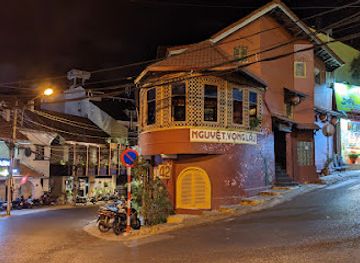
The Classic Pub - NGUYET VONG LAU
Experience the vibrant cocktail culture at The Classic Pub in Da Lat, where unique drinks and a lively atmosphere await.
19 min drive · 6.4 km from neighbourhood centre
-
Bar
100 Roof Bar
Discover 100 Roof Bar in Đà Lạt: a vibrant rooftop bar with stunning views, unique cocktails, and a lively atmosphere that captures the essence of Vietnam.
19 min drive · 6.3 km from neighbourhood centre


Best nightclubs in Langbiang Mountain
Langbiang Mountain has no significant nightlife district and becomes quiet after daytime visitors leave. Evening entertainment is centred on Da Lat, where cafés, casual bars and live-music venues provide a broader choice than the mountain road or Lac Duong countryside. Visitors staying near Langbiang should expect dark rural roads, limited late-night transport and few places for an unplanned drink, making it sensible to arrange a return driver and finish mountain activities well before nightfall. In some cultural presentations or community-based visits, music and dance may form part of an organised evening programme, but these are cultural experiences rather than nightclubs and should be approached with respect. The mountain’s appeal lies in dawn light, forest air and open views, not after-dark entertainment.
-
Bar
B21Bar
Discover the vibrant nightlife of Da Lat at B21Bar, where delicious cocktails and a lively atmosphere come together for an unforgettable experience.
19 min drive · 6.4 km from neighbourhood centre
-
Cocktail bar
The Classic Pub - NGUYET VONG LAU
Discover the vibrant nightlife at The Classic Pub - NGUYET VONG LAU, featuring signature cocktails and a lively atmosphere in Da Lat, Vietnam.
19 min drive · 6.4 km from neighbourhood centre
-
Bar
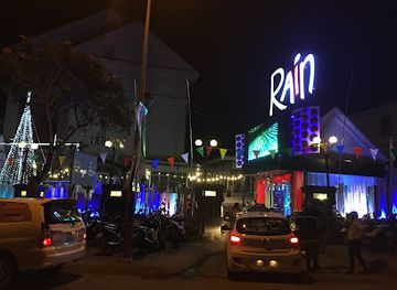
Rain Nightclub Dalat
Dive into the electric nightlife at Rain Nightclub Dalat, where pulsating beats and vibrant ambiance create unforgettable memories in Vietnam's charming city.
22 min drive · 7.5 km from neighbourhood centre
-
Bar
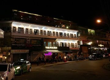
The Fog On Site
Experience the vibrant nightlife of Da Lat at The Fog On Site, a lively bar offering creative cocktails and a welcoming atmosphere.
19 min drive · 6.4 km from neighbourhood centre

Best shops in Langbiang Mountain
Shopping on Langbiang Mountain is modest and visitor-oriented rather than a destination in its own right. Small stalls or visitor facilities may offer refreshments, souvenirs and locally themed products, but stock, opening patterns and presentation can change. The more meaningful retail connection is with the wider Lac Duong and Da Lat area, where visitors may encounter K’Ho-influenced textiles, woven goods, coffee and agricultural products; buying directly from community producers or reputable social enterprises is preferable to treating ethnic designs as anonymous souvenirs. Da Lat provides a much broader selection of markets, craft shops and specialist food retailers, but those belong to the city rather than the mountain. Visitors should ask about the maker and cultural context of handicrafts, avoid bargaining aggressively with small producers and never purchase items made from protected wildlife or plants.
-
Gourmet grocery store
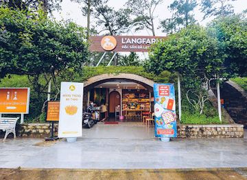
L'angfarm Store
Discover local delicacies and unique souvenirs at L'angfarm Store, Da Lat's premier gourmet grocery and gift shop.
21 min drive · 6.8 km from neighbourhood centre
-
Costume store
T7Win
Discover unique costumes and accessories at T7Win in Da Lat, Vietnam – a must-visit for tourists seeking to immerse in local culture.
17 min drive · 5.5 km from neighbourhood centre
-
 Women's clothing store
Khanh Thuy Fashion Shop
Discover unique women's fashion at Khanh Thuy Fashion Shop in Da Lat, where local style meets contemporary trends in a charming boutique setting.
17 min drive · 5.5 km from neighbourhood centre
-
Fashion accessories store
AKUBA ĐÀ LẠT Boutique
Explore the charm of Đà Lạt with unique fashion accessories at AKUBA Boutique, where style meets local culture.
19 min drive · 6.2 km from neighbourhood centre


Langbiang Mountain essentials
Getting There
Getting Around
Safety
Emergency Situations
Do's and Don'ts
Local Tips

From Eve
Local phrases worth knowing
You don't need to get them perfect. A few words go a long way, and locals appreciate the effort.
Basics
| English | Local | Say it |
|---|---|---|
| Hello | Xin chào | [sin chow] |
| Goodbye | Tạm biệt | [tam byet] |
| Yes | Có | [co] |
| No | Không | [khome] |
| Please/You're welcome | Xin vui lòng | [sin vui long] |
| Thank you | Cảm ơn | [kam un] |
| Excuse me/Sorry | Xin lỗi | [sin loy] |
| How are you? | Bạn khỏe không? | [ban kheo khom?] |
| Fine. And you? | Khỏe. Còn bạn? | [kheo. Cun ban?] |
| Do you speak English? | Bạn có nói tiếng Anh không? | [ban co noi tieng anh khom?] |
| I don't understand | Tôi không hiểu | [toy khom hee-yeu] |
Eating & Drinking
| English | Local | Say it |
|---|---|---|
| I'd like to see the menu, please | Tôi muốn xem menu, vui lòng | [toy moon sem menu, vui long] |
| I don't eat meat | Tôi không ăn thịt | [toy khom an tit] |
| Cheers! | Chúc sức khỏe! | [chuk sook kheo] |
| I would like to pay, please | Tôi muốn thanh toán, vui lòng | [toy moon thanh toan, vui long] |
Emergencies
| English | Local | Say it |
|---|---|---|
| Help! | Giúp! | [jyup] |
| Go away! | Đi đi! | [dee dee] |
| Call the Police! | Gọi cảnh sát! | [goy kenh sat] |
| Call a doctor! | Gọi bác sĩ! | [goy bak see] |
| I'm lost | Tôi lạc đường | [toy lak doong] |
| I'm ill | Tôi ốm | [toy ohm] |
Shopping
| English | Local | Say it |
|---|---|---|
| I'd like to buy... | Tôi muốn mua... | [toy moon mwa] |
| I'm just looking | Tôi chỉ xem | [toy chi sem] |
| How much is it? | Nó giá bao nhiêu? | [no zha bao nyoo?] |
| That's too expensive | Đắt quá | [dat wah] |
| Can you lower the price? | Có thể giảm giá không? | [co the zam zha khom?] |
Time & Numbers
| English | Local | Say it |
|---|---|---|
| What time is it? | Bây giờ là mấy giờ? | [bay zho la may zho?] |
| It's one o'clock | Bây giờ là một giờ | [bay zho la moot zho] |
| Half past (10) | Mười giờ rưỡi | [mooee zho roo-ee] |
| Morning | Buổi sáng | [bwowee sang] |
| Afternoon | Buổi chiều | [bwowee jee-oo] |
| Evening | Buổi tối | [bwowee toy] |
| Yesterday | Hôm qua | [home kwa] |
| Today | Hôm nay | [home nai] |
| Tomorrow | Ngày mai | [ngai mai] |
| 1 | Một | [moot] |
| 2 | Hai | [high] |
| 3 | Ba | [bah] |
| 4 | Bốn | [bon] |
| 5 | Năm | [nahm] |
| 6 | Sáu | [sow] |
| 7 | Bảy | [by] |
| 8 | Tám | [tahm] |
| 9 | Chín | [jeen] |
| 10 | Mười | [mooee] |
Transport & Directions
| English | Local | Say it |
|---|---|---|
| Where's a/the...? | Chỗ...ở đâu? | [cho oy dow?] |
| What's the address? | Địa chỉ là gì? | [dia chee la zee?] |
| Can you show me (on the map)? | Bạn có thể chỉ cho tôi (trên bản đồ) không? | [ban co te chi cho toy (tran ban do) khom?] |
| When's the next (bus)? | Khi nào là chuyến xe (bus) tiếp theo? | [khee now la chuyen se (bus) tiep theo?] |
| A ticket (to ....) | Một vé (đi...) | [moot vee (dee)] |
History of Langbiang Mountain
K’Ho Landscapes and Oral Tradition
Long before Da Lat became a hill resort, the Langbiang area formed part of the upland homeland of K’Ho communities, including groups traditionally associated with the surrounding Lac Duong region. Local knowledge, cultivation and oral traditions developed in relation to the mountain environment, and the legend of K’Lang and H’Biang gave Langbiang a powerful cultural meaning. The story is commonly presented as an explanation of the mountain’s name and as a tale of love divided by social and community differences, though versions vary. Its continuing presence distinguishes Langbiang from a purely scenic viewpoint and connects the peak with the living cultural history of the Central Highlands.
The Growth of Da Lat’s Highland Resort
French exploration and colonial development around Da Lat from the late nineteenth century brought new roads, scientific interest and a resort economy to the plateau. Langbiang became a prominent geographic reference for the emerging hill station, valued for its cooler climate, forested slopes and elevated position. The mountain was not absorbed into the compact urban fabric of Da Lat; instead, it remained a rural and wooded landscape reached by road from the town. This separation helped preserve its visual importance as the backdrop and high point of the Da Lat area while the city below developed as an administrative, agricultural and leisure centre.
Roads, Tourism and the Summit Approach
As Da Lat became an established holiday destination, Langbiang was increasingly presented as a day excursion rather than only a distant mountain landmark. Roads towards the mountain and access infrastructure on the lower and upper tourist areas made short visits, panoramic sightseeing and organised outings easier. Vehicle access to the popular Radar Peak area reduced the need for every visitor to undertake a full climb, while walking routes continued to appeal to hikers. This created two contrasting experiences: a managed viewpoint for general sightseeing and a more strenuous landscape requiring preparation, local knowledge and respect for forest conditions.
Contemporary Cultural and Environmental Significance
Today Langbiang occupies an important place in the tourism geography of Da Lat while remaining connected to the K’Ho communities and ecosystems of the Lac Duong highlands. Pine forests, steep terrain and changing weather make the mountain environmentally sensitive, and development, traffic and visitor pressure require careful management. The wider upland landscape is also associated with the conservation of the Langbiang Biosphere Reserve, recognised by UNESCO in 2015, although the reserve extends far beyond the visitor mountain itself. Contemporary visits therefore combine recreation with a need to understand the area as inhabited cultural country and protected highland habitat.
Langbiang Mountain in Photos
Browse through our photo collection highlighting the charm and character of the destination.
Neighbourhoods near Langbiang Mountain
The closest neighbourhoods to Langbiang Mountain, if you have time for more than one stop.
-

-

-
-


Swipe for more neighbourhoods
Explore more

Explore more of Dalat
Dalat blends cool highland air, French-era architecture, flower gardens, waterfalls and Vietnamese coffee culture with memorable highland sightseeing.
Explore Dalat