


California Adventure Bundle: 13 Self-Guided Audio Tours
 Shingletown, US
 100% of travellers recommend this

Highlights
- Uncover hidden gems with GPS guided tours
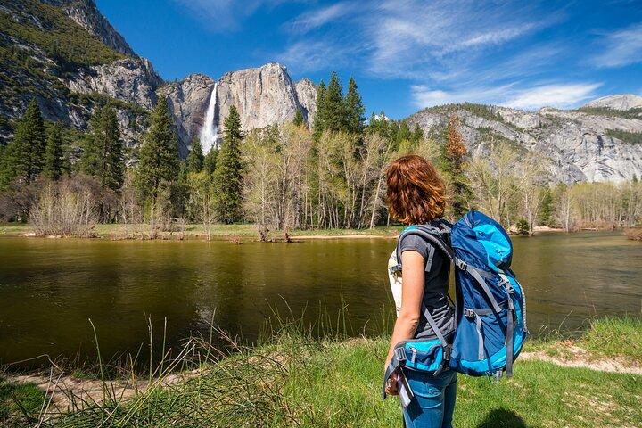
- Experience breathtaking views of iconic landscapes
- Enjoy the freedom to explore at your own pace
- Immerse in captivating stories and local history
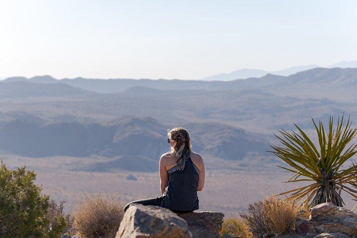
- Discover diverse ecosystems from mountains to deserts
-
192 hours of audio tours
-
Offline map included
-
Self-guided & customizable
-
Turn-by-turn GPS directions
-
Expert travel tips provided
-
Tours never expire
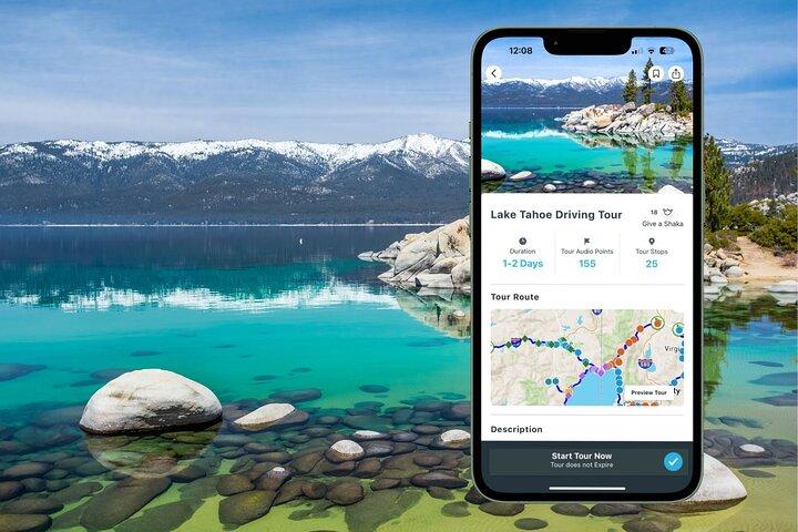
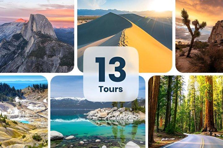
Travelers can embark on an unforgettable journey through California's breathtaking landscapes with the Ultimate California Adventure Bundle. This collection of 13 self-guided audio tours invites adventurers to explore Lake Tahoe's sparkling shores, the surreal rock formations of Joshua Tree, the majestic vistas of Yosemite, and the stark beauty of Death Valley. With GPS-activated storytelling, users will uncover hidden gems and iconic sights at their own pace. Each tour is rich with captivating narrations, travel tips, and recommendations for local dining and activities. From the serene trails of Lassen Volcanic to the towering redwoods of Redwood National Park, this bundle ensures a unique and flexible exploration of California's natural wonders, guiding travelers through a diverse tapestry of stunning scenery and rich history—perfect for any intrepid explorer seeking to create lifelong memories.
At a Glance
-
 Free cancellation
-
 8 days
-
 Instant Confirmation
-
 Available in English
-
 Wheelchair accessible
-
 Mobile voucher
-
 Audio guide
-
 Family friendly

Featured Reviews

Explore California at your own pace with Shaka Guide's self-guided audio tours. Discover hidden gems and iconic sights across stunning landscapes.
Included
-
 OtherTake the tour when you want
 -
OtherTours NEVER expire
-
OtherFreedom to explore at your own pace
-
OtherTour Start is Customizable
-
OtherOffline map (no wifi or data needed)
-
OtherTour highlights with activity and restaurant recommendations
-
OtherTurn-by-turn directions using GPS
-
OtherHours of audio narration with stories, travel tips and music
-
OtherAudio narration that plays automatically as you drive
Excluded
-
 Private transportationPrivate transportation
 -
OtherMeals and refreshment
Meeting Point
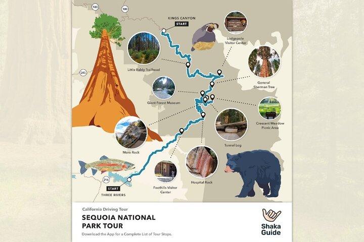
Tour Starts on Generals Highway, from Sequoia National Park, near Montecito Sequoia Lodge. Check the Shaka Guide app for optional starting points.

California , United States

End Point
Tour Starts on Generals Highway, from Sequoia National Park, near Montecito Sequoia Lodge. Check the Shaka Guide app for optional starting points.

California , United States
What to expect
Meeting Point
Crescent City on Hwy 199 just east of interchange with Hwy 101
Meeting Point
To get to Shingletown from California, take I-5 North to Redding, then follow CA-44 East for about 30 miles to reach Shingletown.
Meeting Point
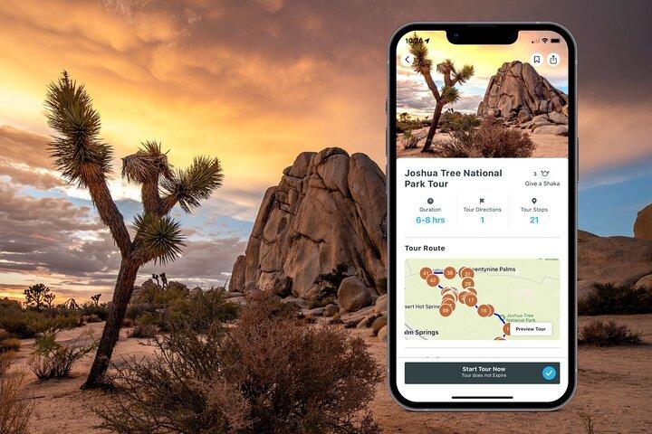
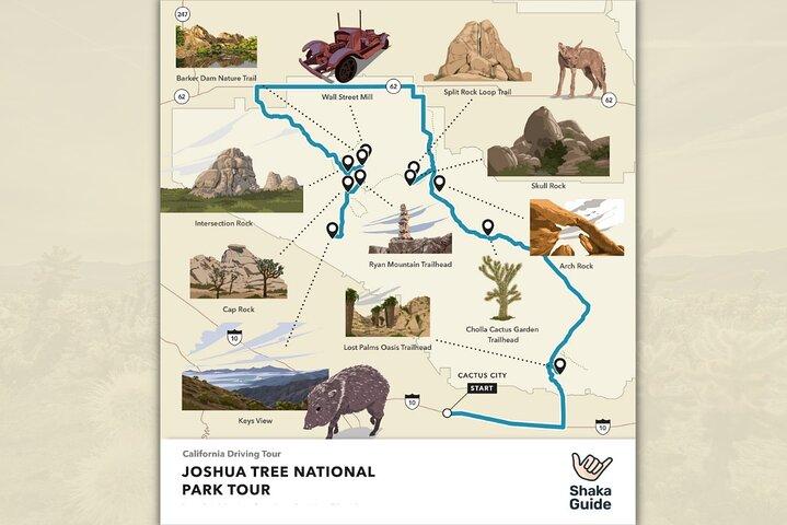
The Joshua Tree tour begins on Interstate 10 and you’ll use the park’s southern entrance.
Meeting Point
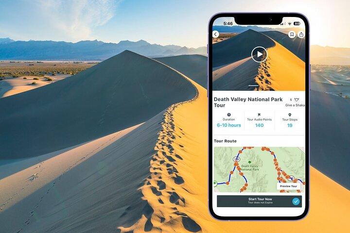
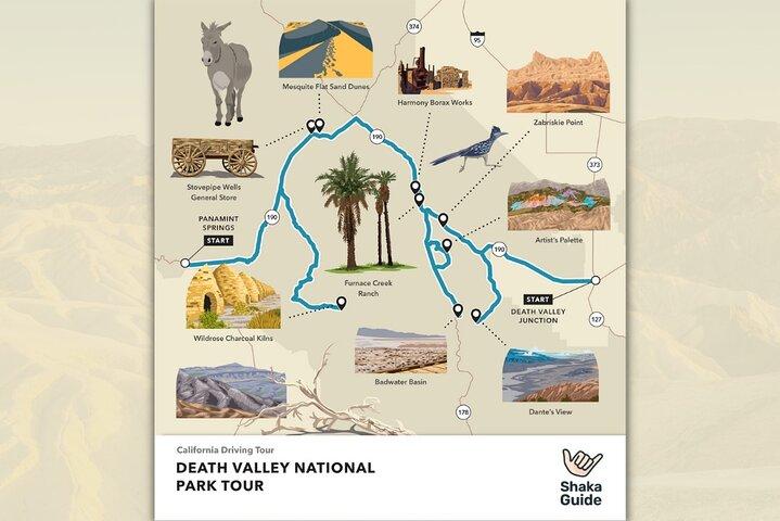
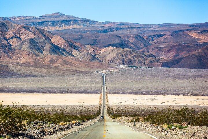
Our tour starts from two different entrances, the east entrance by Death Valley Junction, and the West Entrance near Panamint Springs.
Meeting Point
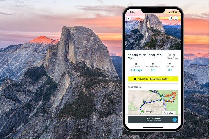
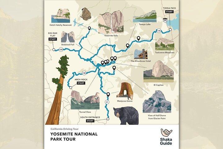
There are four entries, and tour starting points, in Yosemite National Park: - CA-41 from Oakhurst - CA-140 from Mariposa - CA-120 from Groveland - Tioga Pass from Lee Vining
Meeting Point
This is a self-guided tour — no physical meeting or pickup is required. Tour access and starting points are provided within the app upon purchase.
Memorial Point Scenic Overlook
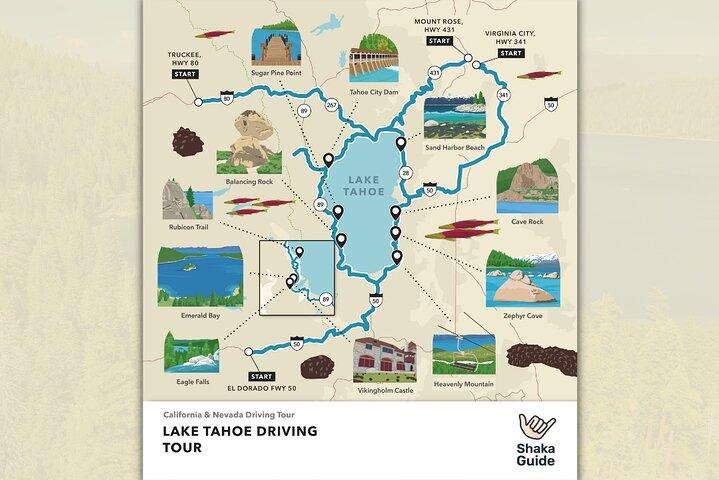
This marks the start of the leg that leads around the east side of Lake Tahoe on the Nevada side, as you head south along Highway 28 through Incline Village, with spectacular views of the lake, Sierra Nevada Mountains on the California side, and the Carson Range to your left. There is an incredible walking and biking path called the East Shore Trail that runs alongside this part of the lake, which is just brilliant to take advantage of if you’re staying around Tahoe for longer than the day. You can park at Memorial Point for about 20 minutes for free and walk down the stairs to the trail and even further if you want to touch the water or stand on some of Tahoe’s huge iconic boulders. Grab some photos and enjoy that view!
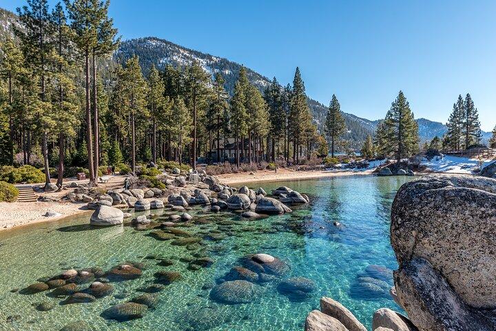
This beach is simply stunning. It’s actually got three beachfronts that all have different landscapes and views, with a nature boardwalk that is a must-do! It is a gorgeous, rambling, easy walk full of discovering wildlife creatures and water views for miles in every direction. Pay the entrance fee and park wherever you can. You can walk a path that leads to all three beaches. The beach furthest south has a sandy beach and very shallow water pretty far out into the lake, making it perfect for stand-up paddleboarding! The middle section of this park is where the Visitor Center is and a really wonderful cafe where you can dine outside overlooking the lake. The two beaches on the north side of the park have those huge boulders that make it so much fun for kids who want to climb, and add such character to your photos.
60 minutes
Logan Shoals Vista Trail
From this point, you’re heading toward South Lake Tahoe along Highway 50. And this overlook is very popular for those taking wedding and engagement photos. You’ll understand why once you park and walk up the short paved path for the views. Because at the last couple of stops you were close to lake level, and now….you’re high above Lake Tahoe. These panoramic views are just breathtaking!
Cave Rock State Park
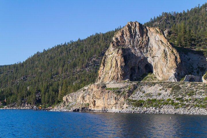
Another must-see stop! You can pay just two dollars for a 10 minute photo opp! And after approaching Cave Rock and driving through that short tunnel, you’re going to want to head down to the shoreline and look straight up at the entire rock formation and cave! It is a marvel, for sure!
Zephyr Cove
You may not want to pay another entrance fee if you’re not planning on beaching it for the day, but you can pull into the entrance, then bear left for the restaurant and general store and park there just to get out for a few minutes and see this gorgeous beach and the forest surrounding it, complete with little log cabins you can rent for lodging. But if you do want to pay the fee and spend a little while at this beach, or make a reservation on the M.S. Dixie Paddlewheeler for a boat ride out on the lake, I can’t say I blame you! There’s volleyball and water activity rentals available from here, too.
60 minutes
Nevada Beach
Oh my gosh, this is another beachfront that is a must-see. The beauty of this beach is astounding. Once you drive down the road it’s on, you’ll see a wooden fence along the side of the road. So if you don’t want to pay to park in the lot, you can turn your car around and find a parking space along the fenceline. Then you’ll see a beautiful walking path that you can take down to the shoreline of this gorgeous beach. The view from here of all the mountains in the distance that surround the lake, and the soaring trees along the shoreline make the landscape so unusual and glorious!
60 minutes
Heavenly Mountain Resort
You’ll come to Heavenly Village, full of shops and places to eat. Once you park, walk inside the main hotel lobby of Heavenly to purchase tickets if you want to take the gondola ride for heavenly views of the lake.
60 minutes
Camp Richardson
You’ll know what street to turn down for the beachfront because of the adorable log cabin General Store on the corner! Stop inside because it’s a cozy place and on a chilly day the fire will be going and you can even grab a meal from the little cafe, or shop for some souvenirs.
Tallac Historic Site
Definitely worth a walk-through. Park and take the trails through the old summer estates of the past. The Baldwin Museum, if open, is an old log cabin that you can tour. Some of the other old log cabin mansions on the water are just super cool to walk around, all in the gorgeous forest along the lake.
30 minutes
Taylor Creek Visitor Center
The next road from Tallac leads to another visitor center and some nature trails. If you’re pressed for time, this is an optional stop that I’d say isn’t a priority – unless it’s salmon spawning season, in which case you can follow the creek along the Rainbow Trail and watch the bright orange salmon swimming upstream!
15 minutes
Inspiration Point Vista
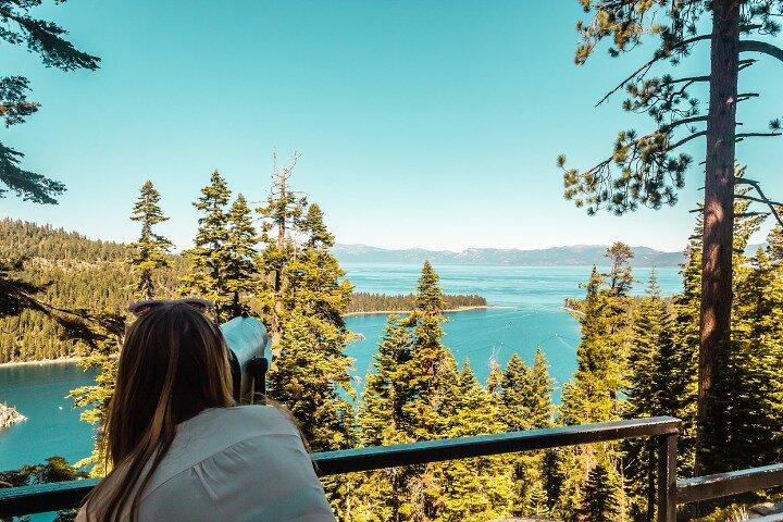
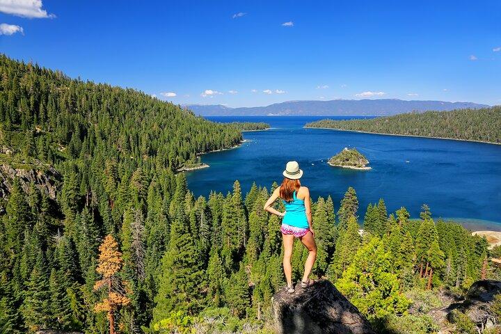
Once you leave Taylor Creek you’ll start to climb again until you’re at a good 8,000 feet or so above sea level, and – boy oh boy – keep both of your eyes on the road and your wheels on the pavement because if you look over the edge (there are no guardrails) you’ll see just how long that drop-off is with the lake way, way down below. But the payoff at the top is an overlook that beats the band! Inspiration Point will give you a jaw-dropping view of Emerald Bay, which lives up to its name – believe me! And you’ll also see Fannette Island down below, the only island in all of Lake Tahoe, that sits in the middle of Emerald Bay.
20 minutes
Eagle Falls Trail
If you’re taking this tour in the spring or early summer, you may want to take the popular Eagle Falls hike that leads up to an amazing waterfall, flowing strong due to the snow melting off of the mountains above it. But if you’re visiting toward the end of the summer or in the fall, the waterfalls will be down to a trickle – if that – since all the snow has already melted, in which case you can skip this stop unless you just want a nice hike through a forest. This is one of the few stops on the left side of the road.
20 minutes
Emerald Bay State Park
Between the emerald- green bay, the sandy shoreline, that tiny island and the castle itself, the photo opps are stupendous! And the hike to get there is pretty nice, too, full of pocket waterfalls and rugged cliffs rising out of the ground, along a well-worn and wide path.
30 minutes
D.L. Bliss State Park
There’s a sweet little Visitor Center that you should stop inside upon arriving at this park, for souvenirs or for some maps and to talk to a ranger or volunteer. Although Shaka Guide’s got you covered on directions, it always helps to have a park ranger describe the conditions of The Rubicon Trail and where to park for Balancing Rock. Once you’ve stopped inside, we’ll drive the park’s forest to three sights so worth seeing!
30 minutes
Balancing Rock Nature Trail
You’re taking what seems like a dirt trail to find the little brown signage alerting you that you’re at the short trail leading up to this unique formation that looks like it’s going to topple at any second! So see it while you can! You’ll need a selfie, of course :)
25 minutes
Lester Beach
This is a sweet shoreline that you can walk, among those iconic Tahoe boulder formations. But if you’re short on time or there’s no parking, it’s not a priority to see the beach itself.
30 minutes
Rubicon Trail
Just past Lester Beach, still inside D.L. Bliss State Park, you’ll head up a hill to the very popular Rubicon Trail. It’s super long and you don’t need to take the whole thing, but I’d recommend you take it for maybe ten minutes out and back just to see a view of the lake from high up along the cliffs of this trail. Just be careful and stick to the path! There’s also an abandoned lighthouse trail, but that’s a little more challenging and time consuming. Now if you love to hike and you have a whole day to do so, this trail leads all the way to Emerald Bay and Vikingsholm Castle!
300 minutes
Sugar Pine Point State Park
Follow the path along the lake heading south (with the lake to your left) until you see the railroad tracks that head right into the lake! An Instagram-worthy photo if ever there was one! Especially with the clarity of the water, so that you can literally see the tracks almost to the bottom of the lake floor!
30 minutes
Hellman-Ehrman Mansion
Once you pull into the main lot, look for the tall fire-lookout-type building, and if it’s open, you can stop inside this nature center to see the exhibits. But really, what you want to do is either tour the Hellman Ehrman mansion, or really just walk around the estate grounds. But certainly do at least step foot on the back porch of the mansion and check out the lake view from there before heading down that mega-lawn and walking out along the pier over Lake Tahoe!
This is an absolutely amazing valley to see, and to know that the ski slopes above it are where the Olympics once took place! In the summer or fall, when everything in the valley is green and lush, the verdant view feels like you’ve been transported to a land far, far away. And if the gondola is open, take it to the top for the Olympic museum exhibit and Washoe tribe displays!
Lake Tahoe Dam
Lake Tahoe Dam is a vital engineering marvel situated on the northwest shore of Lake Tahoe, a breathtaking freshwater lake straddling the border of California and Nevada. Built in the early 20th century, the dam serves as a crucial component of the Tahoe Regional Water System, regulating the water levels of the lake and providing various benefits to the surrounding region.
10 minutes
Commons Beach Park
Commons Beach is a charming lakeside retreat located in Tahoe City, on the north shore of Lake Tahoe. This inviting public park offers a sandy beach, picnic areas, and a playground, making it a popular spot for families and outdoor enthusiasts. With its stunning lake views and tranquil ambiance, Commons Beach provides a perfect setting for relaxation, recreation, and community gatherings.
Watson Cabin Museum
You’ll come to the Watson Log Cabin and Penny Bear! And if you head down the steps from there or down through that parking lot, you can walk out on the public pier over the lake. You can see all the way across to the opposite side for a view of Heavenly Mountain! There are also some wonderful restaurants right along the lake in this town for dining on the waterfront. On the way to our next stop, we’ll pass Carnelian Bay. Make a quick stop for a photo if the view grabs your attention, because it’s hard to ever tire of the views from every part of the lake loop!
30 minutes
Kings Beach
This is a super popular beach, but if you’ve already been to Sand Harbor, then there’s not really a need to pay to stop at Kings Beach. (And if it’s a choice between Kings Beach or Sand Harbor, I’d choose Sand Harbor any day over Kings Beach.) They’re similar in that they have gradually deepening shorelines, so the water stays shallow (and thereby warmer) longer than at some of the colder, deep-water beaches around the lake, but the view from here isn’t quite as mesmerizing as that of Sand Harbor. Still, many people love this beach and town. To me, the town is similar to Tahoe City but with less to offer. So this stop is not highest on the priority list of stops if you’re having to pick and choose for time’s sake.
30 minutes
Historic Stateline Fire Lookout
This is a wide, semi-paved path to an old fire lookout well over 7,000 feet elevation (but remember – you’re already pretty high up before you start along the trail so you’re not climbing that many feet) for a view overlooking Lake Tahoe that you won’t find anywhere else.
50 minutes
Lake Tahoe Scenic Overlook
There’s an overlook along a hairpin turn out of Incline Village for one last memorable look down at Lake Tahoe.
Tahoe Meadows Ophir Creek Trailhead
Tahoe Meadows South Trail is a scenic hiking path in Lake Tahoe. It winds through picturesque meadows, fragrant forests, and offers stunning views of the lake and mountains. With its gentle terrain and abundant wildlife, this trail provides an immersive experience for nature enthusiasts to connect with the unspoiled beauty of the region.
30 minutes
Tunnel View
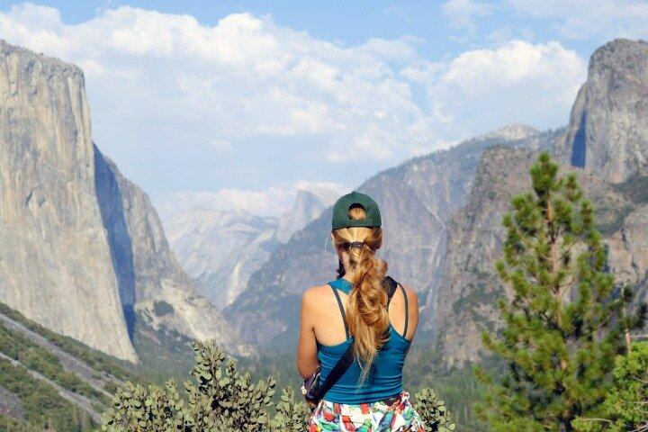
Exit the mile-long Wawona Tunnel and park at this stunning scenic viewpoint of the entire Yosemite Valley. El Capitan and Bridalveil Fall frame the view to the left and right respectively, with Half Dome hanging out in the background. This is a popular stop, so don’t be surprised if you need to wait for a parking spot, but people don’t tend to linger long.
10 minutes
Bridalveil Fall
A paved, 0.5-mile trail is all it takes to reach the base of Bridalveil Fall. This 620-ft waterfall is one of the few in Yosemite not reliant on snowmelt, so it flows reliably year-round. The trail is known to get wet, especially during the spring, so prepare to enter the splash zone and watch your step. If the parking lot by the trailhead is full, there’s additional parking along Southside Drive and additional trailheads that connect back to the main trail to the waterfall.
30 minutes
Cathedral Beach Picnic Area
A paved, 0.5-mile trail is all it takes to reach the base of Bridalveil Fall. This 620-ft waterfall is one of the few in Yosemite not reliant on snowmelt, so it flows reliably year-round. The trail is known to get wet, especially during the spring, so prepare to enter the splash zone and watch your step. If the parking lot by the trailhead is full, there’s additional parking along Southside Drive and additional trailheads that connect back to the main trail to the waterfall.
10 minutes
Swinging Bridge Picnic Area Yosemite National Park CA
Though the bridge doesn’t swing, the footbridge over the Merced River at this picnic area features a fabulous view of Yosemite Fall. Like Cathedral Beach, this is another good spot to enjoy the Merced River’s waters for a swim. Plenty of picnic tables also make this a scenic spot for a packed lunch.
10 minutes
Curry Village
It’s a handy place to park the car. Here, you can hop on the free shuttle either to Yosemite Village or over to trailheads for the Mist and Mirror Lake trails. While you’re here, you can grab a bite to eat at the Curry Village Dining Pavilion. You can even rent a bike at the kiosk by the parking lot and get around on two wheels for the next few hours.
Yosemite Village
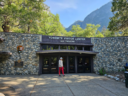
If you wanted a long break from hiking or driving, you could spend hours in Yosemite Village. The Valley Visitor Center, Yosemite Museum, and Ansel Adams Gallery provide a mix of educational and cultural amenities on this largely outdoorsy tour. You can also do some grocery or souvenir shopping at the Village Store or grab a bite to eat at Degnan’s Deli.
60 minutes
Ahwahnee Historic Building
This is one of the grandest lodges in all the national parks, and you can enjoy some of its amenities without being a guest. Browse the gift shop, select a treat at the sweets shop, grab a drink at the bar, or just wander the public spaces like the airy Great Lounge. Of course, the main attraction is the pricey but elegant Dining Room. Join for the breakfast buffet or get a bite to eat for lunch. Dinner requires reservations and a dress code that doesn’t include sweaty hiking clothes.
20 minutes
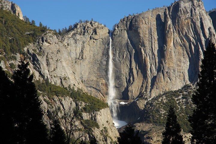
It’s only an easy, paved, half mile hike to the base of Lower Yosemite Fall, the tallest waterfall in North America. Walk the left side of the loop to get a full view of the falls as you approach. Reliant on rainfall and snowmelt, the waterfall largely dries up by mid-to-late summer.
30 minutes
Yosemite Falls Parking
You’ll likely park somewhere else and walk to Lower Yosemite Fall from there, but like Curry Village, this is a handy spot. The trailhead for Lower Yosemite Fall is about 10 minutes away, and on the way you’ll pass Yosemite Valley Lodge where you can grab a bite to eat in the Base Camp Eatery or a coffee at Starbucks. There’s also a bike rental kiosk by the pool. This parking lot is also next to the trailhead for the Upper Yosemite Fall Trail. This strenuous 7.2-mile hike takes you to the top of Yosemite Fall, and on the way, Columbia Rock for a magnificent view of the valley.
15 minutes
El Capitan Meadow
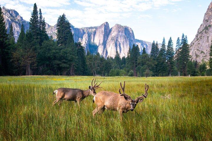
One of the most awe-inspiring spots in Yosemite is El Capitan Meadow, sandwiched between two granite monoliths: El Capitan and Cathedral Rock. Squint to find rock climbers ascending the 3,000-ft granite wall of El Capitan. Sunrise and sunset are especially good times to sit in the middle of the valley and allow yourself to become dumbstruck by nature’s craftsmanship.
20 minutes
This small pull-off on the side of Northside Drive offers a similar view of Yosemite Valley as the Tunnel View scenic overlook, but from a lower vantage point along the banks of the Merced River. Again, El Capitan and Bridalveil Fall frame the gorgeous panorama.
10 minutes
Yosemite National Park
Heading into Yosemite Valley from the north takes you to this pull-off as Southside Drive crosses the valley to reach Wawona Road. The pull-off is a good teaser look at El Capitan, as well as an important historical spot. It was here that President Theodore Roosevelt and conservationist John Muir camped and discussed the future of Yosemite.
10 minutes
Wawona Tunnel
Can’t get enough granite? Stop at this pull-off for a look at the mouth of Yosemite Valley, with tall, granite cliffs leading toward famous landmarks like El Capitan.
5 minutes
El Capitan Viewpoint
Stop at this small-pull off for a preview of Yosemite Valley, with Half Dome poking its head out far off.
5 minutes
Mariposa Grove
Take a free shuttle from the Mariposa Grove Welcome Center to Yosemite’s largest and most impressive grove of sequoia trees. Hiking trails range from easy, short and paved to long and strenuous, so you decide how long you’d like to be here. We recommend at least going as far as the Grizzly Giant, one of the largest sequoia trees in the world.
60 minutes
Wawona Hotel, National Historic Landmark
Wawona is a Victorian-era resort that predates the park itself and wasn’t added until the early 20th century. Here you’ll find the Yosemite History Center, with relocated pioneer buildings from around the park interpreting Yosemite’s history. You’ll also find the Wawona Hotel, still looking as Victorian as ever. The hotel’s dining room is a solid choice for lunch or dinner.
30 minutes
Taft Point Trailhead
There are two trails to two terrific vantage points over Yosemite Valley from this trailhead. You can take them both out and back, or do them both in a loop. Taft Point is an easy to moderate, 2.2-mile hike to a stunning look at Yosemite Valley, including El Capitan and Yosemite Fall.
60 minutes
Washburn Point
The view at this scenic overlook is a teaser for what’s coming ahead at Glacier Point. Half Dome is the main focal point, with Nevada and Vernal Falls below. Beyond, the Sierra Nevada Mountains stretch for miles.
10 minutes
Glacier Point
A brief walk from the parking lot takes you to one of the most astounding views in the United States, or even perhaps the world. Standing at Glacier Point puts you over 3,000 feet above the floor of Yosemite Valley. Wonder at Yosemite Fall, Half Dome, and its fellow granite mountains of the Sierra Nevada from this amazing scenic overlook.
30 minutes
Tuolumne Grove
It’s a 2.5-mile hike round-trip to a small grove of 25 sequoia trees. Smaller and quieter than the more impressive Mariposa Grove in the south end of the park, this grove sits at the bottom of a hill and is accessed by hiking down a disused road.
60 minutes
Olmsted Point
Another sweeping look at the Sierra Nevada, the view from Olmsted Point is an unusual angle of Yosemite Valley, with the other side of Half Dome clearly visible. There’s plenty of open granite to walk around and explore different angles. To the left is a good view of Tenaya Lake.
10 minutes
Tenaya Lake Picnic Area
We think this is the best view around crystal-clear Tenaya Lake. Stand on the granite lakeshore and enjoy the alpine view. If you decide to hike the easy Tenaya Lake Trail, which can be done as a loop or as an out and back, expect to spend another hour or two.
20 minutes
Pothole Dome
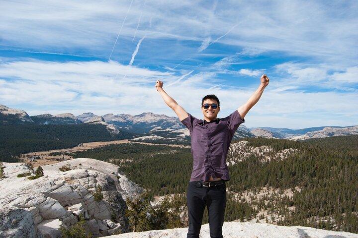
An hour at most is all it takes to get a stunning look of Tuolumne Meadows and the surrounding Sierra Nevada mountains. This granite dome on the edge of the open meadow isn’t terribly tall or steep, so it only takes a few minutes to reach the top for the panoramic view.
60 minutes
Tuolumne Meadows Visitor Center
Grab what information you need and learn about Tuolumne Meadows, one of the largest subalpine meadows in the Sierra Nevada, at Yosemite’s second largest visitor center. There’s a trailhead to tiny Soda Springs by the building. If you take this easy, flat, 1.6-mile round trip hike through the meadow, expect to spend another hour here.
15 minutes
Lembert Dome
There are two hikes to choose from at this trailhead. One 1.8-mile hike ascends Lembert Dome, another fabulous look at Tuolumne Meadows and the surrounding granite domes of the Sierra Nevada. The other is a lengthy hike through Lyell Canyon, but we recommend just going about 30 minutes in for a scenic “twin bridges” area around Tuolumne River.
60 minutes
Carlon Falls Trail
This 3-mile out-and-back trip is a mostly easy hike, minus an uphill climb to get to the falls themselves at the very end. The falls are small by Yosemite standards but you may enjoy playing in the pool at the base of the waterfall. Bonus: this trail in the woods is very shaded!
60 minutes
O'Shaughnessy Dam
Stand atop the over 400-ft tall O’Shaughnessy Dam and behold the Hetch Hetchy valley, a second Yosemite Valley to some, but with a deep reservoir of clean water. The highlight here is hiking the 5-mile trail to Wapama Falls, and getting to stand at the base of this impressive waterfall that’s over 1,000-ft tall. The spray from the falls is sublime relief from the California sun.
60 minutes
Stanislaus National Forest Sign
Quick photo-opp time! There’s a large Yosemite National Park sign just before you reach the Big Oak Flat Entrance Gate. Hop out of the car and grab a pic for grandma.
5 minutes
Big Oak Flat Information Center
Located within the park just after the Big Oak Flat Entrance Gate, this small visitor center features some restrooms (probably much-needed at this juncture of a long drive) as well as a small bookstore. Park rangers are on hand to answer questions.
10 minutes
Journigan’s Mill
This is the first stop on Emigrant Canyon Rd, the optional detour toward the Wildrose Charcoal Kilns. There’s not much left of this former processing plant from the early 20th century, but the foundations, empty tanks, and other relics may interest photographers and history buffs.
10 minutes
Wildrose Campground
The second stop on Emigrant Canyon Rd, this former campground for the Civilian Conservation Corps is a good place to stretch your legs as you make the long drive toward the charcoal kilns. Walk through the remaining campground buildings, located right off the road.
5 minutes
Charcoal Kilns
Ten unusual, beehive-shaped charcoal kilns are lined up in a row thousands of feet up in the Panamint Range. Step inside one and you may still get a whiff of that charcoal!
10 minutes
Stovepipe Wells Village
If you plan to eat a meal or buy gasoline within the park, we recommend doing it in Stovepipe Wells, a wayside with visitor services and accommodation.
30 minutes
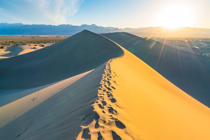
Mesquite Flat Sand Dunes
The only sand dunes you’ll see on the tour! You can view the dunes from the parking lot, but it’s more fun to explore the dunes on foot and wander among the mesquite trees for some social media-worthy pictures. This is a top pick for sunsets and stargazing, too.
15 minutes
Devils Cornfield
There’s a peculiar patch of Arrowweed near the Mesquite Flat Sand Dunes that appears like bunches of corn in a field. There’s not much to look at, but a small parking area allows visitors to safely park and get a closer look.
5 minutes
Salt Creek Interpretive Trail
A 0.5-mile boardwalk runs along the Salt Creek wetland, a critical watering hole for critters and home to the endangered Salt Creek Pupfish. The easy trail is down a dirt road.
15 minutes
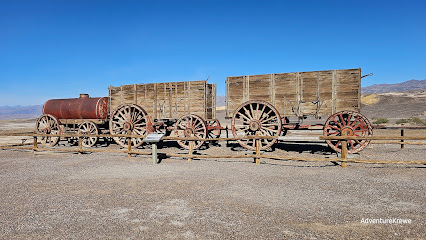
Explore what's left of the earliest mining operation in Death Valley. Placards throughout the short path interpret the various buildings and mechanisms required to process borax. You'll also see one of the wagons pulled by the famed 20-mule teams.
15 minutes
Mustard Canyon
Though there’s no actual stop, you can take a detour into a small canyon with an unusual yellow tinge. Before driving this road, check with the park for the road's current conditions. In normal circumstances, this dirt road is reasonably well-maintained but still bumpy, and not advisable for vehicles with low clearance. 10. Furnace Creek Visitor Center
5 minutes
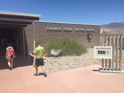
A must-stop for information, flush toilets, a water refill station, and a museum with excellent displays on the natural and human history of Death Valley.
30 minutes
The Ranch at Death Valley
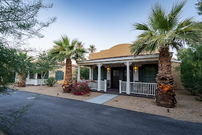
Furnace Creek is the only place to eat a meal and get gas within the park. Prices are higher here, but you’ll find an ice cream parlor, buffet-style restaurant, and Wild West-themed saloon. There’s also an excellent General Store with souvenirs and a small grocery section. And if you want to know more about the area’s mining history, you can visit the Borax Museum.
15 minutes
Enjoy the otherworldly shapes of Death Valley’s salt flat, down a short dirt road from Badwater Road. There’s no trail, and you’ll want to make sure you have sturdy shoes if you wander into the ‘golf course.’ That salt can hurt!
10 minutes
Badwater Basin
The lowest point in North America, and the highlight of a trip to Death Valley. There's a boardwalk by the parking lot, but you're welcome to wander into the valley on the Badwater Basin trail. Go as far as you'd like into the interior of Death Valley's famed salt flats, but it's about 1 mile in to reach the cool geometric shapes in the salt, making this a 2-mile round trip hike.
30 minutes
Natural Bridge Trail
The trail to the natural bridge rock formation is flat, but rocky. It's about 1 mile round-trip from the parking lot to the bridge and back.
30 minutes
Artist's Drive
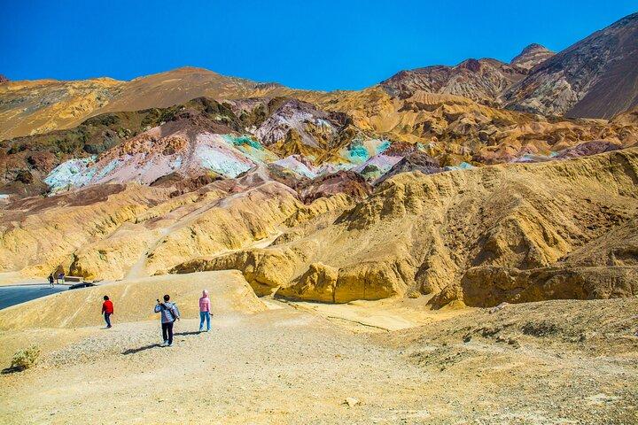
Artists Drive is a one-way road that ascends up toward the Black Mountains into a twisty canyon. The drive itself is fun, as you maneuver through a tight desert landscape. But the highlight is a stop along the road called Artists Palette, where minerals in the rock create a colorful cliff. You can explore on foot for a closer look.
30 minutes
Golden Canyon Trailhead
This is one of the most popular hikes in the park, taking hikers through a lifeless canyon. It's about 3 miles, or 5 kilometers round-trip to the Red Cathedral cliff formation.
60 minutes
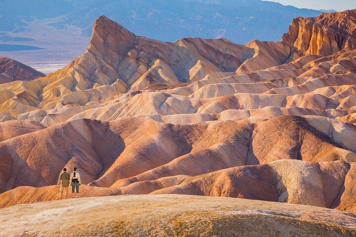
One of the most iconic views in the park, overlooking rock formations Red Cathedral and Manly Beacon. This spot is also noted for its film history and its role as the album cover for U2's Joshua Tree. The walk from the parking lot to the overlook is short and paved, but steep.
20 minutes
Twenty Mule Team Canyon
Like Mustard Canyon, this is a dirt road adventure into a tightly curving canyon. And there’s no specific stop, but it’s about a 15-minute detour from the main tour route. Before driving this road, check with the park for the road's current conditions. In normal circumstances, this dirt road is reasonably well-maintained but still bumpy, and not advisable for vehicles with low clearance.
15 minutes
Dante's View
A truly stunning sight to behold. Ascend over 5,000 feet to this overlook directly above Badwater Basin. From here, you’ll see the lowest point in North America with the dramatic Panamint Range looming over it on the other side of the valley. And on clear days, you can see the Sierra Nevada beyond, including Mt. Whitney–the highest point in the lower 48 states. This is a popular sunset and stargazing spot.
30 minutes
A short trail introduces you to the desert’s plant and animal life.
20 minutes
Lost Palms Oasis Trail
This is a long hike through Joshua Tree’s southern Colorado Desert. It’s very scenic, but there’s little to no shade and can be brutally hot from spring to fall. Bring water and sun protection, but be prepared to be wowed by the landscape and the palm oasis at the trail’s end. You can also just take a brief look at the oasis by the trailhead, and move on to the next stop.
240 minutes
Cottonwood Visitor Center
Pay the park fee here, use the restrooms, or ask the rangers questions.
10 minutes
Ocotillo Patch
Learn more about the quirky ocotillo plant in this little pull off.
10 minutes
Cholla Cactus Garden
Teddy Bear chollas look furry and cute but nothing could be further from the truth: walk carefully among thousands of mature chollas along a short nature trail. Just don’t get poked, and wear good close-toed shoes.
15 minutes
Arch Rock Nature Trail
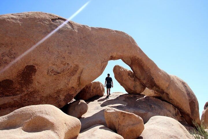
This beautiful natural arch is one of the largest in the area and is a popular spot for photographers. Have fun climbing around the rocks!
30 minutes
Skull Rock
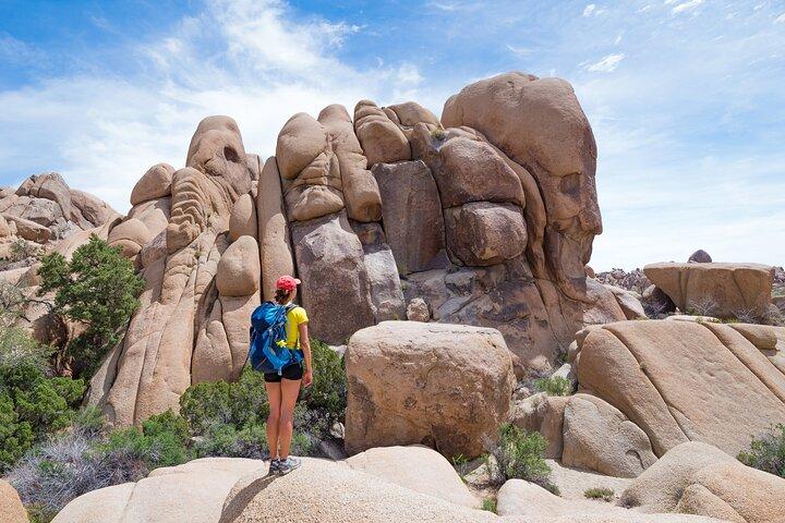
This popular boulder looks a bit like a skull that’s melted in the desert heat. Please park carefully, as the roadside plants are fragile.
15 minutes
Split Rock Loop Trail
Hike through iconic rock formations on this easy trail.
90 minutes
Oasis of Mara
Use the restroom, browse the gift shop, and enjoy a brief trail around an oasis.
30 minutes
Joshua Tree National Park Visitor Center
Ask questions, view exhibits, and maybe buy a souvenir or two at Joshua Tree’s newest visitor center.
20 minutes
Joshua Tree Visitor Center
This is the last chance to stop before re-entering the park for information, a flush toilet, or a quick bite to eat.
5 minutes
Hidden Valley Nature Trail Trailhead
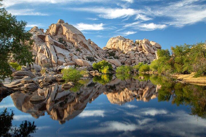
This fun little nature trail is one of the park’s most popular hikes, with rock formations to climb on and plenty of cool desert flora to take pictures of.
45 minutes
Intersection Rock
Vault toilets are available.
10 minutes
Barker Dam Trail
Note, if you take the trail counterclockwise, make sure to turn left at the fork in the trail (just before the petroglyphs) to return to the Barker Dam parking lot. If you continue straight, you'll go to the Echo T parking lot, which is further away.
45 minutes
Wall Street Mill was one of many stamp mills in the area, a part of Joshua Tree history. You can explore its ruins, as well as the remnants of a homestead.
45 minutes
Ryan Mountain is one of the park’s best hikes, and affords adventurers a 360-degree view of the valley and surrounding area.
90 minutes
Yet another cool rock formation of rounded gneiss boulders in the middle of the desert.
10 minutes
Cap Rock Trail
The site of an attempted (and ill-fated) 1970s funeral, Cap Rock is one of many iconic gneiss formations in the park.
10 minutes
This moderate-level hike will bring you out to Lost Horse Mine, where gold ore was famously mined and stolen by one of Joshua Tree’s ne'er-do-wells, Johnny Lang.
90 minutes
Keys View
This lovely overlook offers gorgeous sunset views over Palm Springs, and you can also see the San Andreas Fault.
30 minutes
Kohm Yah-mah-nee Visitor Center
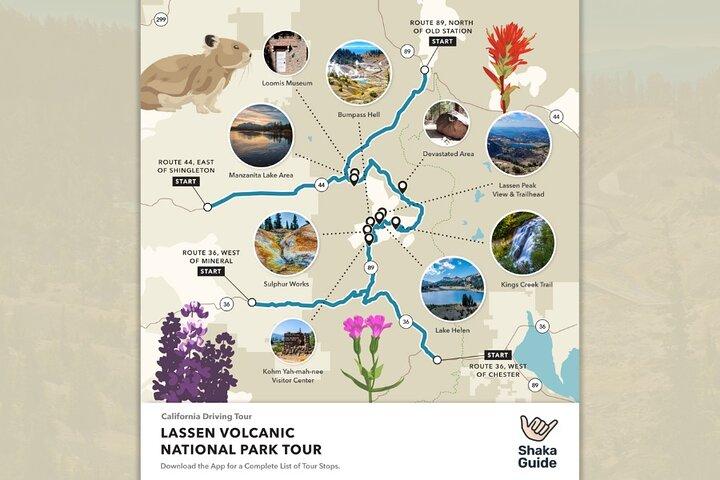
Located near the park's south entrance, the Kohm Yah-mah-nee Visitor Center features exhibits, a gift shop and cafe and restrooms. You can also grab a trail map and chat with a ranger. The name of the visitor center comes from the Mountain Maidu word Kohm Yah-mah-nee which means "snow mountain." It's the original name for the volcano we know today as Lassen Peak. Read more about - Lassen Volcanic National Park Self-Guided Audio Tour - https://www.viator.com/tours/California/Lassen-Volcanic-National-Park-Audio-Tour-Guide/d272-102020P115?mcid=56757
15 minutes
Sulphur Works
Sulphur Works is one of the park's colorful hydrothermal features that you can see right from the road. Take the paved walkway to view steam vents, a boiling mudpot and a landscape tinged yellow, orange and red from mineral deposits.
15 minutes
Diamond Peak Scenic Vista
From the small pullout beneath Diamond Peak, you can see Brokeoff Mountain to the west, Lassen Peak to the north and acres and acres of forest land burned in the 2021 Dixie Fire. The overlook is located at a bend in the road, so use caution when entering and exiting.
5 minutes
Emerald Lake
Emerald Lake gets its name from its striking green color which comes from vegetation that grows in the shallow water.
5 minutes
Bumpass Hell
The three-mile roundtrip trek to Bumpass Hell leads to the park's largest hydrothermal area, boasting16 acres of boiling springs, mud pots and roaring fumaroles!
90 minutes
Lake Helen
Lake Helen was named after Helen Brodt, the first white woman to summit Lassen Peak back in 1864. This deep blue lake is nestled at the foot of Lassen Peak and reflects the snowcapped mountain above.
5 minutes
Pull into the large parking area for a view of the world's largest plug dome volcano and namesake of this park. You can even climb to the top of this sleeping 10,500-ft volcano! With an elevation gain of almost 2,000 feet, the trail is not for the faint of heart. If you’re interested in tackling this 5 mile-round trip hike, make sure to read the safety information at the trailhead. Pay close attention to what it says about altitude sickness.
10 minutes
Kings Creek Picnic Area
The Kings Creek Picnic Area is located in a wildflower meadow and is a nice place to take a break and have some lunch. You'll find picnic tables and pit toilets.
30 minutes
Kings Creek Falls
The moderate 3-mile hike to Kings Creek Falls features a spectacular 30-foot cascades. Much of the forest was burned during the Dixie Fire, but life is already beginning to return. Keep your eyes open for wildflowers in the meadows and other evidence of rebirth. There is limited roadside parking. If you cannot find a spot, we recommend you try again later or skip this hike and do the one to Paradise Meadows instead.
120 minutes
Paradise Meadow Trailhead
Paradise Meadows is a hidden gem tucked away on the northeast side of Lassen Peak. The moderate three-mile round trip hike follows Hat Creek up through a beautiful forest to a large basin surrounded by steep cliffs. Nestled in the basin is an enchanting wildflower meadow that looks straight out of a fairytale. Along the way, you’ll pass a few waterfalls and catch glimpses of Lassen Peak through the trees. With an elevation gain of 700 feet, be prepared to do a fair bit of climbing. But the heavenly views at the end are so worth it!
120 minutes
Devastated Area Loop Trail
The blast zone from Lassen Peak's 1915 eruption is known as the Devastated Area. After the blast, this entire forest was leveled and turned into a gray desolate wasteland.
15 minutes
Hot Rock
Pull over to the side of the road and get a photo of the 30-ton boulder named Hot Rock. During one of Lassen's big eruptions, this giant lava boulder ejected out of the magma chamber and flew down the mountain in a rock avalanche to its final resting place here--five miles away! A few days later, local photographer B.F. Loomis snapped a picture of the rock. Because it was still steaming and hot to the touch, he named it Hot Rock. You can see Loomis' historic photograph of Hot Rock in the Loomis Museum.
5 minutes
Chaos Crags Trl
Turn into the pullout for a view of Chaos Crags and Chaos Jumbles--two more volcanic features that tell of the region's fiery past.
5 minutes
Manzanita Lake
The Manzanita Lake Area features the Loomis Museum, a gift shop, restrooms, a few lakeside trails and a campground.
15 minutes
Reflection Lake
Across the street from the visitor center are two short, easy trails. One circles Reflection Lake and the other loops around Lily Pond. Grab one of the interpretive brochures for the Lily Pond Trail to learn more about the unique plants that live here.
30 minutes
Loomis Museum
The Loomis Museum is where you'll find displays of volcanic rocks, B.F. Loomis' historic photographs and Selena LaMar's Atsugewi basketry. This is also where the rangers hang out, so bring your junior rangers here to earn their badges. The Loomis Museum was donated to Lassen Volcanic National Park by B.F. and Estella Loomis, two of the park's earliest advocates and supporters.
30 minutes
Jedediah Smith Redwoods State Park
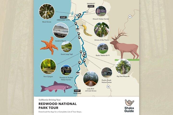
Jedediah Smith Redwoods State Park is home to some of the world's tallest trees. The park features a visitor center, campground, day use area, swimming beaches along the Smith River and the popular Stout Grove and Grove of the Titans. The scenic Howland Hill Road winds through the park's towering redwoods along an old stage coach route. The narrow, unpaved road provides trail access to Stout Grove and Grove of the Titans.
30 minutes
Hiouchi Information Center
The Hiouchi Visitor Center features exhibits, a park store, passport stamps, restrooms, a picnic area and ranger-led activities. Check with a ranger about guided kayak tours on the Smith River.
15 minutes
Myrtle Beach
Myrtle Beach is one of the best swimming holes on the Smith River! The parking area is at the intersection of Highway 199 with South Fork Road. Just look for the Myrtle Beach parking sign. Take the short (quarter-mile), steep trail down to the clear, jade-green waters. There are pit toilets halfway down the trail. This spot is perfect for swimming, sunbathing, fishing, tubing...and even cliff jumping!
15 minutes
Stout Grove
This 44-acre group of giant redwoods in Jedediah Smith Redwoods State Park was named after Frank Stout, the former president of the Del Norte Lumber Company. His widow donated this land in 1929 as a living memorial to her husband. The easy, half-mile, loop trail meanders through 300-foot tall trees with an optional trail down to the Smith River. When you walk through the grove, please stay on the designated trail to protect this fragile habitat.
15 minutes
Stout Grove
This 44-acre group of giant redwoods in Jedediah Smith Redwoods State Park was named after Frank Stout, the former president of the Del Norte Lumber Company. His widow donated this land in 1929 as a living memorial to her husband.
15 minutes
Grove of Titans Trail
The Grove of Titans is part of the National Tribute Grove in Jedediah Smith Redwoods State Park and is home to some of the tallest trees in the world. This magnificent stand of redwoods just opened to the public in 2022. The park service constructed a 1500-foot-long elevated walkway through the grove. It not only looks amazing and allows visitors to gaze up into the canopy, but it also protects the habitat for future generations to enjoy. Roadside parking for the trailhead is coming up on the left. There are vault toilets across from the trailhead.
45 minutes
Crescent Beach
Crescent Beach, located just south of Crescent City, is a lovely three-mile stretch of sand with picnic areas and restrooms.
15 minutes
Park by the trailhead at the end of the road. Then, trek down to Enderts Beach–one of the park’s hidden gems with its dramatic cliffs and fascinating tidepools. The trail’s a moderate, 1.5-mile round-trip hike that ends with a short scramble down a big boulder. At low tide, you can get face to face with colorful starfish and anemones. However, if the tide’s up, you’ll wanna save this secluded beach for another time. And whenever you visit–pay close attention to the rising tide and keep alert for dangerous sneaker waves.
60 minutes
Trees of Mystery
Conveniently located right off Hwy 101, The Trees of Mystery is a popular tourist attraction dedicated to the majesty of the coast redwoods. Meander along well-maintained interpretive trails, explore their museum of fascinating artifacts, walk on skybridges up in the redwood canopy and glide through the forest on a magical gondola ride that takes you above the tree tops. The popular tourist attraction is a bit spendy, but if you have the budget for a splurge, we highly recommend it!
120 minutes
 Admission Not Included
Klamath River
The Klamath River Overlook is situated 600 feet above sea level and offers a stunning view of the point where the Klamath River meets the sea. For a closer view, you can hike down half a mile to a second viewpoint. It's an excellent place to watch for migrating whales or return to enjoy a sunset over the ocean.
15 minutes
Yurok Country Visitor Center
Located in Klamath, the Yurok Country Visitor Center is a beautiful tribal interpretive center where you can learn more about Yurok history and culture, as well as pick up a few souvenirs.
15 minutes
Old Douglas Memorial Bridge Site
Before the turn onto Coastal Drive, you’re gonna see what’s left of the old Douglas Memorial Bridge. Built in 1926, the bridge once spanned the Klamath River but was destroyed in the Christmas Flood of 1964. All that’s left are the iconic bear statues at each end. Over on Highway 101, the new bridge pays homage to the old one, with replicas of these original grizzly bear statues.
5 minutes
High Bluff Overlook
Located on the Coastal Drive, High Bluff Overlook is another fantastic place for whale watching or enjoying a sunset. The overlook features interpretive signs, picnic tables, grills, pit toilets and an expansive view of the coastline to the south. You'll also find a short trail leading to even more stunning views below.
15 minutes
Radar Station B-71
During WWII, the Coast Guard built Radar Station B-71 along the Northern California coast near Klamath as an observation station. But instead of using camouflage to hide the buildings, the Coast Guard ingeniously disguised the radar station as a farm. Hiding in plain sight, the "farmhouse" and "barn" secretly housed a power building and operations building. The station was part of a network of 65 coastal stations stretching from Mexico to the Canadian border.
15 minutes
Corkscrew Tree
Located off the Newton B. Drury Parkway, the Corkscrew Tree is a unique example of a fairy ring or cathedral tree. These four redwoods sprouted from one parent tree, and as they grew, they twisted around each other to form one sinuous trunk.
15 minutes
Big Tree Wayside
Aptly named "Big Tree," this ginormous redwood is one of the oldest old-growth redwoods in Prairie Creek Redwoods State Park! The giant is estimated to be around 1500 years old and over 300 feet tall. The tree is located off the Newton B. Drury Parkway and can be accessed by car via the wayside or by foot from the visitor center via the Karl Knapp Trail, Foothills Trail or Cathedral Trees Trail. The wayside features interpretive signs and restrooms and a short walking path to the giant tree. Don't miss this great photo opportunity!
15 minutes
Prairie Creek Redwoods State Park
Located on the Newton B. Drury Scenic Parkway, the Prairie Creek Visitor Center features park information, exhibits, a bookstore, camp sites, restrooms and picnic area. There are a few trails that begin near the center including the short and accessible Revelation Trail as well as the popular Karl Knapp, Foothills and Cathedral Trees Trails. The historic building was constructed by the Civilian Conservation Corps in the 1930s.
30 minutes
Karl Knapp Trl
The scenic Karl Knapp/Foothill/Cathedral Trees Loop Trail begins at the Prairie Creek Visitor Center and follows Prairie Creek north. About a mile in, take the spur trail on the right and follow signs to the "Big Tree." Cross the parkway then follow the Foothill Trail south to the Big Tree Wayside. From the wayside, you can choose the shorter Foothill Trail or the longer Cathedral Trees Trail back to the visitor center to complete the 2- to 3-mile loop.
120 minutes
Elk Meadow Picnic Area
The Elk Meadow Picnic Area features restrooms, picnic tables and trails. If you are lucky, you may even spot elk in the fields! If you do, remember to keep a safe distance (at least 50 yards) when viewing them. The Trillium Falls hike is a nice option. It’s an easy, one-mile round trip walk to a small, picturesque waterfall through peaceful old-growth forests. If you brought bikes, this area also has several paved trails.
30 minutes
Gold Bluffs Beach
The name Gold Bluffs Beach came from actual gold found in the sand! The glittering sand was discovered in 1850. Although many tried mining here at Gold Bluffs Beach–few were successful. The gold was so fine–extracting and separating it from the sand turned out to be extremely costly and time-consuming.
60 minutes
Fern Canyon
A short walk will take you to the entrance of this primeval-looking world where scenes from Jurassic Park: The Lost World were filmed. You can hike through the canyon and then return through the forest on the loop trail. Or you can meander through the canyon both ways. It’s about a mile either way.
60 minutes
Lady Bird Johnson Grove
Lady Bird Johnson Grove features a family-friendly loop trail that winds through the forest and showcases a variety of ferns, colorful rhododendrons, and more tall trees. The grove is named after Lady Bird Johnson–the wife of former President Lyndon B. Johnson. The first lady championed the creation of a national park to protect the redwoods. Thanks in part to her efforts, Congress created Redwood National Park in 1968. In 1969, President Nixon dedicated this grove to Mrs. Johnson. The grove commemorates this special lady who left the world a more beautiful place.
60 minutes
Redwood Creek Overlook
Redwood Creek Overlook is located past Lady Bird Johnson Grove up in the Bald Hills. The scenic overlook stands 2,100 feet, or 640 meters above sea level. From that vantage point, you can see sweeping views of redwood forests and the sparkling Pacific Ocean in the distance. It’s an incredible spot to watch the sunset or gaze at the stars.
30 minutes
Thomas H. Kuchel Visitor Center
The Thomas Kuchel Visitor Center is the main visitor center for Redwood National Park and features exhibits, park information, a park store and restrooms. Behind the center, you’ll find trails to the beach. It’s another amazing place to look for whales or watch the sunset.
30 minutes
Big Stump Picnic Area
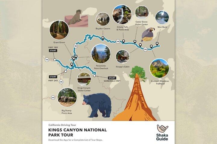
The Big Stump Picnic Area is the first stop on this tour. From the picnic area an easy two-mile loop leads to Big Stump itself, which is what’s left of the Mark Twain Tree. Before it was chopped down and put on display in the American Museum of Natural History in New York, and the British Museum in London, the tree was a whopping 16 feet in diameter, and over 300 feet tall.
45 minutes
Redwood Mountain Overlook
Pull up to Redwood Mountain Overlook to see Redwood Mountain Grove. Spanning almost 2,500 acres, it’s the biggest sequoia grove in the whole world. Below the overlook in Redwood Canyon, hikes include the Sugarbowl Loop at 6.8 miles, or 11 kilometers long, and the Hart Tree Loop at 7.3 miles, or 11.8 kilometers long. To reach the trailhead, drive about a half mile east from the overlook and follow the signs for Redwood Canyon. Then it's a 2 mile drive on a dirt road to the trailhead.
5 minutes
Kings Canyon Overlook
You don’t need long hikes to see breathtaking views in this park. And at Kings Canyon Overlook, you just have to pull up for a gorgeous panoramic view. Yup, it overlooks the park’s namesake natural wonder, Kings Canyon itself. The park’s claim to fame is that it’s almost 2,000 feet deeper than the Grand Canyon! While Kings Canyon reaches 8,200 feet, or 2,500 meters deep, the Grand Canyon’s depth maxes out at just 6,000 feet deep.
5 minutes
Kings Canyon Visitor Center
At Kings Canyon Visitor Center in Grant Grove Village, you can learn all about the park and watch a short film about it. It has a Sequoia Parks Conservancy Store that also sells maps, books, and souvenirs. Next door is the Grant Grove Market, which sells basic necessities and food. The Grant Grove Restaurant is also there, which serves breakfast, lunch, and dinner.
30 minutes
Grant Grove
Here's where you see the General Grant Tree, AKA the world’s second-largest tree. It’s also home to the Fallen Monarch, Gamlin Cabin, and the Centennial Stump. The General Grant Tree is 268 feet tall and 107 feet around. You can reach it on a third of a mile, easy, paved loop trail.
45 minutes
Panoramic Point
Here’s a great look at Kings Canyon without the need to drive into it. This high-elevation view also includes Hume Lake. The view is only a few steps away from the parking lot. If you want more alpine scenery, then check out the trail to the Park Ridge Fire Lookout. This is a 5 mile, or 8 km, moderately difficult hike to a fire lookout tower. There may even be a volunteer fire observer to say hello to.
10 minutes
McGee Vista Point
Here’s another great view! While looking down from McGee Vista Point you’ll see the damage done by the Rough Fire. During the tour, you’ll learn more about the unique relationship between wildfire and sequoia trees.
10 minutes
Junction view
At Junction View, you’ll be treated to a panoramic view of the Western Sierra all the way to Mount Whitney, which is the tallest peak in the lower 48 states. The overlook gets its name from the view of the junction of the Middle and South forks of the King River, and a view of Kings Canyon.
5 minutes
Yucca Point
The drive into the canyon is a long, twisty one, so take advantage of another scenic overlook to get out of the car and get another great look at the Sierra Nevada. This overlook sits above the Kings River.
5 minutes
Scenic Byway Viewpoint
The Scenic Byway Viewpoint offers an awesome view of the limestone vein, also known as marble, that runs through the park. Look for the gray stone in contrast to the surrounding ground cover.
5 minutes
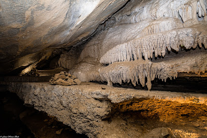
Take a guided tour of this incredible marble cavern, filled with stalactites, stalagmites, and other rock formations. Guided tours are 45 minutes to an hour long. Tours of the caverns are run by a small company and charge a small fee for entrance. Keep in mind there is a short, but steep walk from the parking lot to the cave entrance.
60 minutes
Admission Not Included
Grizzly Falls Picnic Area
At Grizzly Falls Picnic Area you can relax by the waterfall, which cascades about 80 feet down in a shaded part of the forest. The falls are a short walk from the picnic area and the parking lot, and it’s a great place to eat lunch. Restrooms make it a convenient stop, but the waterfall is a must-see.
15 minutes
Cedar Grove Visitor Center
The second and last visitor center of the day is the Cedar Grove Visitor Center. It’s located in the heart of Cedar Grove Village. It offers information about the area’s natural and cultural history, and is open seasonally, from around Memorial Day through mid-September. The Sequoia Parks Conservancy Store inside the visitor center is a good place to pick up souvenirs, clothing, and other knick-knacks.
15 minutes
Knapp's cabin
Go back in time at Knapp’s Cabin and get a gorgeous view of the canyon. This riverside cabin belonged to a man named George O. Knapp, who brought friends on fishing trips here. It’s listed on the National Register of Historic Places and is reachable via a short trail from the parking area.
10 minutes
Roaring River Falls
It doesn’t get any more peaceful than spending time by Roaring River Falls. It’s reached by an easy, nearly third-of-a-mile, out-and-back trail. From there, you can continue to Zumwalt Meadows on a four-mile, or 6 kilometer trail.
30 minutes
Zumwalt Meadow Trail
Walking to Zumwalt Meadows is a can’t-miss Kings Canyon experience. You can reach this gorgeous meadow by an easy, 0.75 mile, out-and-back trail. Keep an eye out for wildlife there.
30 minutes
Muir Beach
Muir Rock is the last stop on the tour, and the canyon naturally saved the best for last. The rock is a flat slab resting on the bank of the Kings River, and it’s a fabulous place to sit in peace. Local lore says that John Muir loved to hang out there and chat with passersby. The rock is just a short easy walk from the parking area.
15 minutes
Indian Head River Trailhead
The first stop on the tour is home to the historic Welcome to Sequoia National Park Sign and a trail that leads down to the river. If you’re not in the mood for a hike yet, the view from the parking lot is amazing on its own.
10 minutes
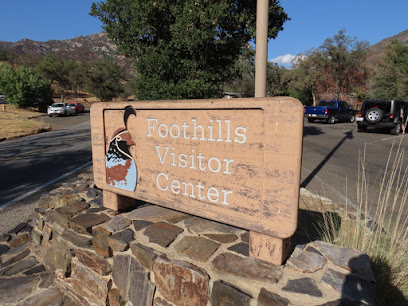
The Foothills Visitor Center is a great place to get even more of an idea about what the day ahead has in store for you. It features common visitor center finds like a souvenir shop, displays about park history and wildlife, restrooms, and a water bottle filling station.
10 minutes
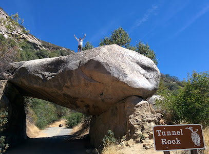
Tunnel Rock is a park highlight that you can’t miss on the left side of Generals Highway. The highway used to go right under it, but was redirected and the rock now served as a popular spot for photo ops. Visitors can climb on the rock, or walk under it.
10 minutes
Potwisha Campground
Potwisha Campground is located on the left side of Generals Highway, but it’s the overflow parking lot across the street that’s a stop on our tour today. The riverside dirt parking lot is the trailhead for the Hospital Rock Trail, which is 5 miles (8km) round trip, moderately difficult, and follows the Kaweah River to Hospital Rock. There’s also the Potwisha Riverwalk, which is an easy half-mile round trip along the river.
10 minutes
Hospital Rock
This popular stop features Potwisha Native American rock art on a huge riverside rock. Nearby are the grinding mortars, where it’s believed Potwisha women ground acorns into flour. Picnic tables and restrooms are also available for use here.
5 minutes
Amphitheater Point
This is a wonderful, panoramic scenic spot. Visitors can see Moro Rock looming on the top of a cliff, and other peaks and ridges. This is one of the best views in the park.
5 minutes
Vista Point
Another great, roadside view of Sequoia’s Beauty. Just pullover, and take a few minutes to take in the view. It kinda sneaks up on you, so keep an eye on the map on your way.
5 minutes
This isn’t exactly a stop, but you can pull over on the right side of the road if you’d like. Otherwise, slow down as you drive between the four giant sequoia trees that line up across the highway welcoming you to the Giant Forest.
5 minutes
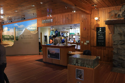
Aptly named, the Giant Forest is home to so many big beautiful, giant sequoias, including the famous General Sherman Tree. We stop at the Giant Forest Museum, which is a good launching point for area hikes. Our favorite is the Big Trees Trail, which is an easy half mile hike past a meadow and sequoias.
30 minutes
Moro Rock Trail
350 concrete and steep steps lead visitors to the top of Moro Rock, a granite dome. The trail may be short, but thanks to its incline, can be pretty tiring. The view from the top of the rock really can’t be beaten, and it feels like you’re standing on top of the world.
30 minutes
Tunnel Log
This log is another park feature that was in the way of traffic, so workers carved right through it. Today, cars eight feet tall can drive in it, while others must drive around. Another fun photo opp.
5 minutes
Crescent Meadow Picnic Area
Crescent Meadow Picnic Area is home to Crescent Meadow, dubbed “the Gem of the Sierras” by naturalist John Muir. It’s also the starting point for several trails. An easy, 1.5 mile hike loops around the meadow. It’s also about 1.5 miles to Tharp’s Log, on an easy trail. Lastly, you’ll see the trailhead for the long and strenuous High Sierra Trail. You can’t do the whole thing today, but just over a mile and a half round trip takes ya to the stunning Eagle View.
60 minutes
General Sherman Tree
This is the star of the park! The General Sherman Tree’s claim to fame is being the world’s largest living tree, by volume. An easy, paved 1-mile trail takes you there from the parking area and weaves through a giant sequoia forest, with benches and other notable trees along the way. If you have time, you can continue from the General Sherman Tree on the Congress trail. It’s also paved and easy, just under 3 miles round-trip, and takes you to two groups of mature sequoias.
45 minutes
Lodgepole Visitor Center
By the time you arrive here, you may be ready for a relaxing break browsing the visitor center’s presentations on the park’s natural and human history. Lodgepole Market is right next door as well, where you can find food and other necessities.
10 minutes
Tokopah Falls
The Tokopah Falls Trailhead is at the end of the road near the campsites. The trail is a mix of shady forest and open mountain views, all the way to a gorgeous waterfall. The hike’s almost 4 miles (6km) with an easy incline. The waterfall is a whopping 1,200 feet, or nearly 400 meters tall, and really flows heavily in early summer from glacial melt. But by late summer, it might be down to a trickle.
120 minutes
Wuksachi Lodge
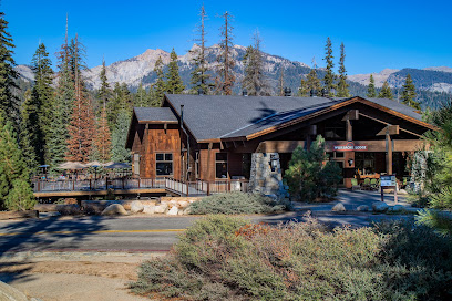
Wuksachi Lodge is the place to hang out and take it easy if you need a break from all the hiking. There are two restaurants with full menus and a wonderful outdoor deck and seating area and a souvenir shop with grab-and-go snacks.
30 minutes
Halstead Meadow
Halstead Meadow is a restored wetland that rests just off the side of Generals Highway. Its picnic tables and expansive greenery is easily accessible and is a wonderful place to relax and ponder your next steps when the tour ends.
10 minutes
Little Baldy Trail
This trail is a favorite with many visitors because of its amazing views at the top of the dome. The trail’s just over three miles, or five kilometers, round-trip climbing a couple switchbacks to the top. It’s considered moderately challenging. At the end, you’ll get to take in panoramic views of the Great Western Divide and beyond.
120 minutes
End Point
Crescent City on Hwy 199 just east of interchange with Hwy 101
End Point
To get to Shingletown from California, take I-5 North to Redding, then follow CA-44 East for about 30 miles to reach Shingletown.
End Point
The Joshua Tree tour begins on Interstate 10 and you’ll use the park’s southern entrance.
End Point
Our tour starts from two different entrances, the east entrance by Death Valley Junction, and the West Entrance near Panamint Springs.
End Point
There are four entries, and tour starting points, in Yosemite National Park: - CA-41 from Oakhurst - CA-140 from Mariposa - CA-120 from Groveland - Tioga Pass from Lee Vining
End Point
This is a self-guided tour — no physical meeting or pickup is required. Tour access and starting points are provided within the app upon purchase.
The experience can be subject to change due to bad weather or unforseen circumstances. We always endeavour to give you the best possible experience.
Additional Information
-
 Begin Your Journey: • Select Your Tour: Go to the My Stuff tab in the Shaka Guide app to launch the tour. • Start the Tour: Select the tour starting point and follow the GPS instructions. • Follow Shaka Guide: Stick to the suggested route and speed for the best experience.
 -
Get Started Easily: • Book Your Tour: Receive a confirmation and easy instructions via email. • Download the App: Follow the simple steps in your email. • Redeem the Tour: Use the redeem code in your email to redeem the tour in the app. • Prepare Ahead: Download the tour using strong Wi-Fi.
-
Infants and small children can ride in a pram or stroller
-
Private and Personalized: • Crowd-Free: Enjoy a private tour with just your group. • Customizable Stops: Pick the stops you want and skip the ones you don’t!
-
Service animals allowed
-
Suitable for all physical fitness levels
-
The Ultimate Guided Tour: • Detailed Itinerary: Includes travel tips and recommendations. • Engaging Narration: Captivating stories and history.
-
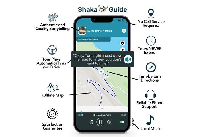
Top Features: • Hands-Free: The tour works automatically - GPS-activated stories, directions, and music play as you drive for a seamless experience. • Works Offline: No need for continuous wifi or data. • Reliable Support: Get help via call, chat, or email.
-
What Our Users Say: • “A fantastic way to explore! Easy to use and very informative.” • “Loved the flexibility to stop and go as we pleased. Highly recommend!”
-
Wheelchair accessible
-
Why Choose Our Audio Tour: • Cost-Efficient: One tour for the entire vehicle—no per-person fees! • Ultimate Flexibility: Start, pause, and resume on your schedule. • Convenience: Use the tour any day, over multiple days if needed.
What our experts say
-
 Download the app before your trip.
 -
Visit local eateries in Yosemite Village.
-
Check weather for Death Valley's extreme heat.
-
Explore Lake Tahoe beaches at sunrise.
-
Don't miss sunset views at Joshua Tree.

More About this Experience
Introduction
The California Adventure Bundle: 13 Self-Guided Audio Tours is the ultimate way to explore the breathtaking beauty of California's most iconic landscapes. With a whopping 192 hours of content, this audio tour bundle is designed for travelers who crave adventure and knowledge. From the serene shores of Lake Tahoe to the otherworldly wonders of Joshua Tree, each tour invites users to discover hidden gems and must-see sights all at their own pace. The Shaka Guide app provides easy GPS navigation, automatic audio narration, and insider tips on activities and eateries, ensuring a seamless and enriching experience. Whether you're a solo traveler, a family, or a group of friends, this product transforms a simple road trip into a captivating journey filled with history, culture, and stunning vistas. No more boring drives—it's time to embark on an unforgettable adventure through California's diverse landscapes!What to expect?
With the California Adventure Bundle, travelers can expect an immersive exploration of California’s crown jewels. The bundle includes audio tours for 13 diverse locations, such as the majestic Yosemite, the stark beauty of Death Valley, and the lush landscapes of Sequoia National Park. Each tour is packed with engaging storytelling and fascinating facts that breathe life into the stunning scenery. Adventurers can anticipate not only breathtaking views but also practical travel tips, recommendations for local dining, and fun activities tailored to each destination. The convenience of offline maps means you can venture into remote areas without worrying about data or Wi-Fi. With flexible start times and the freedom to pause and resume the journey whenever desired, this bundle offers a unique blend of adventure and leisure, allowing everyone to discover California in their own way.Who is this for?
The California Adventure Bundle is designed for anyone who has a passion for exploration and a curiosity for nature's wonders. Whether you're a solo wanderer seeking solitude among towering sequoias, a family looking for fun and educational experiences, or a group of friends eager for a scenic road trip, this bundle caters to all. It’s perfect for travelers of all fitness levels, as many tours offer various options for both short strolls and longer hikes. With the audio guide providing engaging stories and insights, it appeals to history buffs and casual tourists alike. Even locals can rediscover their own backyard in a fresh and exciting way. The flexibility and accessibility of the self-guided format make it an inclusive choice for anyone wanting to experience California's natural beauty and rich culture.Why book this?
Booking the California Adventure Bundle means investing in experiences that resonate long after the journey ends. Unlike traditional guided tours, this self-guided option allows travelers to explore at their own pace, ensuring no rush to capture the perfect photo or soak in the view. The audio narration enriches the journey, providing context and stories that enhance the breathtaking scenery. Plus, for one flat fee, the entire vehicle can enjoy the tour, making it a cost-effective option for families or groups. With no expiration date on the tours, you can revisit your favorites whenever the travel bug strikes. The combination of stunning landscapes, captivating stories, and the freedom to choose your own adventure makes this bundle an irreplaceable part of your California journey.Good to know
Before embarking on your adventure, there are a few handy tips to keep in mind. First, ensure to download the Shaka Guide app and your selected tours while connected to strong Wi-Fi, as some areas in California may have limited service. The audio tours work offline, allowing you to explore remote areas without interruptions. It’s advisable to check the weather conditions for each location in advance and pack appropriately for varying climates—from the snow-capped peaks of Yosemite to the desert heat of Death Valley. Also, make sure to bring plenty of water and snacks, especially for the hikes, as food options may be limited in some national parks. Each tour provides customizable starting points, ensuring a unique experience tailored to your travel plans. With these tips in mind, travelers can maximize their adventure and make the most of this unforgettable journey.Reviews
Feedback from users who have experienced the California Adventure Bundle has been overwhelmingly positive. Many travelers have praised the ease of use and flexibility of the tours, highlighting how the audio guide made their journeys engaging and informative. Customers appreciate the wealth of knowledge shared about each location, with many noting that the stories enriched their experience and sparked deeper appreciation for California's natural beauty. Reviewers have emphasized the joy of being able to stop and explore at their own pace without feeling rushed. Families have found the tours particularly enjoyable, as they cater to all ages, making learning fun for kids while keeping adults entertained. Overall, users express high satisfaction with the California Adventure Bundle, calling it a fantastic way to explore and discover the wonders of California.
Your all‑in‑one travel companion app
Explore expert travel guides, compare and book tours, experiences, hotels, and more—all from the palm of your hand. Download now for seamless trip planning wherever your wanderlust takes you.


This is a popular product and the date you are looking for just sold out. Next available date is
