

Free Lookout Mountain Travel Guide & Mobile App
Explore Lookout Mountain with free travel guides. Discover regional history, expert tips, proposed trips, and audio guides on web or mobile app.


Explore Lookout Mountain in Alabama for canyon overlooks, waterfalls, forest trails, Fort Payne heritage and Mentone's highland character.
Read more about Lookout Mountain
When is the best time to visit Lookout Mountain?
Best: April, September–October · 23–29°C| Month | High (°C) | Rainfall (mm) |
|---|---|---|
| January | 12 | 121 |
| February | 14 | 118 |
| March | 18 | 147 |
| April (best) | 23 | 119 |
| May | 27 | 119 |
| June | 31 | 112 |
| July | 32 | 137 |
| August | 31 | 118 |
| September (best) | 29 | 97 |
| October (best) | 23 | 91 |
| November | 18 | 107 |
| December | 13 | 127 |
Getting to and around Lookout Mountain
How to get there
Transportation
Best attractions in Lookout Mountain
Lookout Mountain's attractions are shaped by the meeting of a high sandstone plateau, steep escarpments and the Little River watershed. Little River Canyon National Preserve provides the region's most extensive outdoor experience, with scenic overlooks, walking routes, wooded habitats and opportunities for carefully managed water-based recreation. DeSoto State Park offers trails, streams, rock formations, cabins and access to DeSoto Falls, while the surrounding roads reveal smaller cascades and mountain viewpoints. Fort Payne adds historic streets, local museums and railway-related heritage, making it a useful cultural pause between outdoor excursions. Mentone contributes galleries, seasonal events and a retreat atmosphere, while Valley Head provides a lower-elevation perspective on the mountain's passes and valleys. Birdwatching, wildlife observation, photography, hiking and scenic driving are central activities, but conditions vary by season and rainfall. The region's appeal lies less in a dense collection of formal attractions than in the way protected landscapes, small communities and changing viewpoints can be combined over several days.
-
Botanical garden
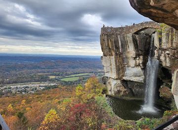
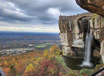
Rock City Gardens
Explore a mountaintop wonderland of natural rock formations, lush gardens, and fairytale magic at Rock City Gardens on Lookout Mountain, Georgia.
-
Tourist attraction
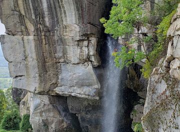
Ruby Falls
Journey into Lookout Mountain to discover America's tallest underground waterfall. Explore caverns, enjoy scenic views, and create lasting memories.
-
Museum of space history
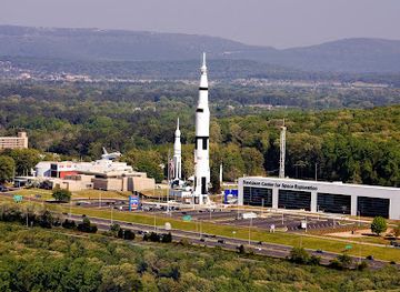
U.S. Space & Rocket Center
Explore the universe at the U.S. Space & Rocket Center in Huntsville: rockets, space exploration history, and interactive fun for all ages!
-
Lookout Mountain Incline Railway
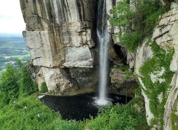
Ascend Lookout Mountain on 'America's Most Amazing Mile' for breathtaking views and a thrilling historic railway experience.
Best landmarks in Lookout Mountain
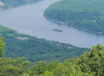
Little River Canyon is Lookout Mountain's defining geographical landmark, a deep gorge cut into the plateau by a river that runs along the mountaintop for much of its course. Its overlooks expose a sequence of cliffs, forests and valley views rather than a single central viewpoint. DeSoto Falls, where Little River descends over rock near the headwaters, is another emblematic site and an important reference point in the region's tourism history. The sandstone escarpment itself forms a recurring landmark along roads west of the plateau, particularly where it rises above Fort Payne and the surrounding valleys. Fort Payne's historic downtown and railway heritage give the mountain a human-scale landmark associated with transport, trade and settlement. Mentone's elevated position and views across the valleys express a different side of the region: an upland community shaped by seasonal visitors and retreat culture. Together, these places represent the mountain's geology, water, built history and continuing communities.
-
Botanical garden
Rock City Gardens
Discover a mountaintop wonderland of natural rock formations, lush gardens, and fairytale magic at Rock City Gardens on Lookout Mountain.
-
Tourist attraction
Ruby Falls
Explore the depths of Lookout Mountain and witness the beauty of Ruby Falls, the tallest underground waterfall open to the public.
-
Historical landmark
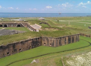
Fort Morgan State Historic Site
Explore a historic fortress, witness stunning coastal views, and discover Alabama's rich military past at Fort Morgan State Historic Site in Gulf Shores.
-
Park
Chickamauga And Chattanooga National Military Park
Explore pivotal Civil War battlefields at Chickamauga and Chattanooga National Military Park, the nation's first military park.

Explore Lookout Mountain on the map
Plan your trip on one map. See where the top cities, national parks and sights are, and book hotels and experiences in a few clicks.
Best hotels in Lookout Mountain
Best restaurants in Lookout Mountain
Dining on Alabama's Lookout Mountain is informal, locally rooted and concentrated in Fort Payne, Mentone and the communities along the main approach roads. Visitors will find Southern staples such as fried chicken, barbecue, biscuits, catfish, seasonal vegetables and generous breakfast cooking, alongside cafés, bakeries, pizza and contemporary casual restaurants. Mentone's higher elevation and retreat economy support a selection of small eateries suited to leisurely meals, while Fort Payne offers the broadest range of everyday choices and supplies. Farm stands and seasonal produce may appear along rural routes, but availability varies through the year. Regional cooking is best understood as part of north Alabama's wider food culture rather than as a wholly separate mountain cuisine. Table-service tipping follows normal United States practice, and busy weekends or event periods can put pressure on the limited number of dining rooms outside Fort Payne. Visitors staying in cabins often make use of local groceries and cook, particularly when exploring trailheads early or late in the day.
-
Seafood
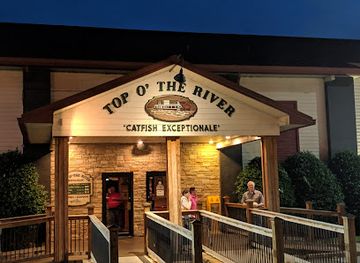
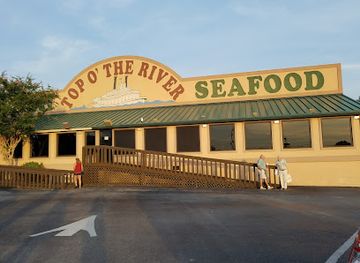
Top O' The River
Experience fresh seafood with breathtaking views at Top O' The River in Guntersville, Alabama - where every bite feels like a coastal escape.
-
Seafood
Top O' the River
Discover Top O' the River in Gadsden, AL: A seafood haven offering fresh dishes in a picturesque riverside setting perfect for all occasions.
-
American
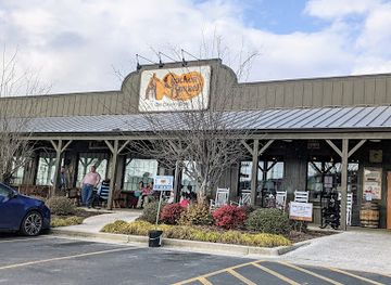
Cracker Barrel Old Country Store
Savor traditional Southern comfort food at Cracker Barrel Old Country Store in Fort Payne, AL - your perfect family dining destination.
-
Steak
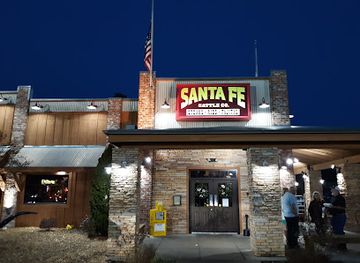
Santa Fe Cattle Company
Indulge in mouthwatering steaks and Southern hospitality at Santa Fe Cattle Company in Fort Payne - a must-visit for food lovers.
Best bars in Lookout Mountain
Evenings on Lookout Mountain centre on restaurants, cafés, traditional bars, live music and relaxed social spaces rather than a major nightclub circuit. Fort Payne has the region's broadest concentration of evening options, while Mentone's accommodation and arts scene can provide seasonal performances, small gatherings and informal night-time activity. In rural areas, the nearest public venue may involve a drive, and many visitors spend the evening around a porch, cabin or restaurant rather than moving between clubs. Local breweries and bars may be part of the wider drinking scene, but availability and opening arrangements change, so late-night plans should be checked locally. The mountain's darkness and quiet are themselves part of its appeal; responsible visitors should avoid loud behaviour near accommodation, never drink-drive on winding roads and arrange transport before drinking.
-
Steak
LongHorn Steakhouse
Experience the ultimate steakhouse dining at LongHorn Steakhouse in Gadsden, Alabama – where flavor meets tradition in a family-friendly atmosphere.
-
Restaurant
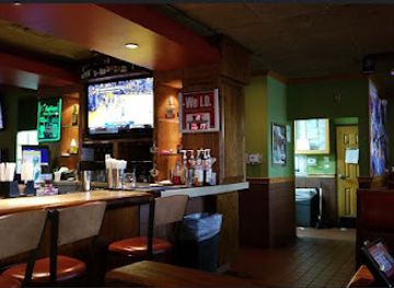
Applebee's Grill + Bar
Savor the best of American comfort food at Applebee's Grill + Bar in Gadsden, Alabama, perfect for families and friends seeking a delightful dining experience.
-
Restaurant
Bama Bucks
Experience the perfect blend of delicious dining and lively animal encounters at Bama Bucks in Sardis City, Alabama.
-
Restaurant
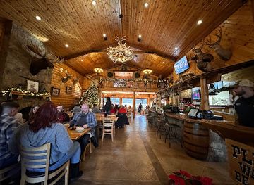
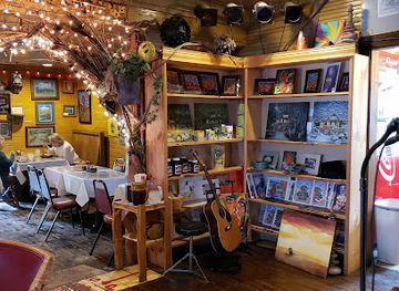
Wildflower Cafe
Discover the delightful flavors and charming ambiance of Wildflower Cafe in Mentone, Alabama, a perfect spot for travelers seeking a unique dining experience.

Best shops in Lookout Mountain
Shopping on the Alabama side of Lookout Mountain is centred on Fort Payne's practical services, independent businesses and historic-town setting, with smaller specialist and craft-oriented options in Mentone. Visitors can look for locally made art, pottery, woodwork, paintings, books, regional food products and gifts inspired by the mountain landscape, although stock varies between seasons and individual shops. Mentone is associated with galleries, studios and small boutiques more than with large-scale retail, while Fort Payne is the better place for groceries, outdoor supplies and everyday necessities. Roadside produce stands and seasonal markets may offer fruit, vegetables, preserves or baked goods when local harvests allow. The area is not a destination for extensive department-store or luxury shopping; its shopping interest lies in meeting makers, finding practical trail supplies and taking home food or craft items with a clear connection to north Alabama. Check local opening arrangements before making a special journey to a small rural business.
-
Shopping mall
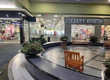
Gadsden Mall
Discover Gadsden Mall, Alabama's premier shopping destination with diverse stores, dining options, and entertainment for all ages.
-
Flea market
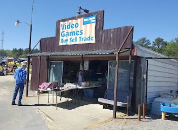
Mountain Top Flea Market
Experience the charm of local culture at Mountain Top Flea Market, where antiques, fresh produce, and unique finds await every visitor.
-
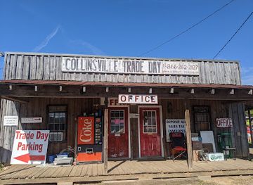
Flea market
Collinsville Trade Day Flea Market
Explore the vibrant Collinsville Trade Day Flea Market for unique treasures, delicious food, and a taste of local culture in Alabama.
-
Gift shop
Incline Gifts
Discover unique souvenirs and local crafts at Incline Gifts, a charming gift shop on Lookout Mountain, Tennessee, perfect for every traveler.

Get your free copy of our complete guide to Lookout Mountain, delivered straight to you.
Everything on this page, from attractions and restaurants to essentials and local phrases, in one PDF you can read offline, print or share.
Already have an account? Sign in
Your Lookout Mountain guide is ready.
We'll send it to · Not you? Sign out

Getting your guide ready…
We are putting together a fresh copy of the Lookout Mountain guide. This can take up to a minute.
This can take a few moments. If your browser asks, choose Allow so the download can start. You'll find the guide in your Downloads folder.
Nothing happened? Download it again
Sorry, the guide is taking longer than usual. Please try again in a minute, or get it by email instead.
Lookout Mountain essentials
Currency and Payment
Safety
Emergency Situations
Do's and Don'ts
Local Tips
From Eve
Local phrases worth knowing
You don't need to get them perfect. A few words go a long way, and locals appreciate the effort.
Basics
| English | Local | Say it |
|---|---|---|
| Hello | Howdy | [Ha-dee] |
| Goodbye | See ya later | [See ya lay-ter] |
| Yes | Yep | [Yep] |
| No | Nope | [Nope] |
| Please/You’re welcome | Please / No problem | [Pleez / No prob-lem] |
| Thank you | Thanks a lot | [Thanks a lot] |
| Excuse me/Sorry | Excuse me / Sorry 'bout that | [Ex-kyoos me / Sor-ree 'bout that] |
| How are you? | How ya doin'? | [How ya doin'?] |
| Fine. And you? | I'm good. And you? | [I'm good. And you?] |
| Do you speak English? | Ya speak English? | [Ya speak English?] |
| I don't understand | I ain't gettin' it | [I ain't gettin' it] |
Eating & Drinking
| English | Local | Say it |
|---|---|---|
| I'd like to see the menu, please | Can I see the menu, please? | [Can I see the menu, pleez?] |
| I don't eat meat | I don't eat no meat | [I don't eat no meat] |
| Cheers! | Cheers! | [Cheers!] |
| I would like to pay, please | I'd like to settle up, please | [I'd like to settle up, pleez] |
Emergencies
| English | Local | Say it |
|---|---|---|
| Help! | Help! | [Help!] |
| Go away! | Leave me be! | [Leave me be!] |
| Call the Police! | Call the cops! | [Call the cops!] |
| Call a doctor! | Get a doctor here! | [Get a doctor here!] |
| I'm lost | I'm lost | [I'm lost] |
| I'm ill | I'm feelin' sick | [I'm feelin' sick] |
Shopping
| English | Local | Say it |
|---|---|---|
| I'd like to buy... | I wanna buy... | [I wanna buy...] |
| I'm just looking | I'm just browsin' | [I'm just browsin'] |
| How much is it? | How much's this cost? | [How much's this cost?] |
| That's too expensive | That costs too much | [That costs too much] |
| Can you lower the price? | Can ya bring the price down? | [Can ya bring the price down?] |
Time & Numbers
| English | Local | Say it |
|---|---|---|
| What time is it? | What time ya got? | [What time ya got?] |
| It's one o'clock | It's one o'clock | [It's one o'clock] |
| Half past (10) | Half past ten | [Half past ten] |
| Morning | Mornin' | [Mornin'] |
| Afternoon | Afternoon | [Afternoon] |
| Evening | Evenin' | [Evenin'] |
| Yesterday | Yesterday | [Yesterday] |
| Today | Today | [Today] |
| Tomorrow | Tomorrow | [Tomorrow] |
| 1 | One | [One] |
| 2 | Two | [Two] |
| 3 | Three | [Three] |
| 4 | Four | [Four] |
| 5 | Five | [Five] |
| 6 | Six | [Six] |
| 7 | Seven | [Seven] |
| 8 | Eight | [Eight] |
| 9 | Nine | [Nine] |
| 10 | Ten | [Ten] |
Transport & Directions
| English | Local | Say it |
|---|---|---|
| Where's a/the...? | Where's the nearest...? | [Where's the nearest...?] |
| What's the address? | What's the address here? | [What's the address here?] |
| Can you show me (on the map)? | Can ya show me on the map? | [Can ya show me on the map?] |
| When's the next (bus)? | When's the next bus comin'? | [When's the next bus comin'?] |
| A ticket (to ....) | A ticket to... | [A ticket to...] |
History of Lookout Mountain
Indigenous Homelands and the Cherokee
Lookout Mountain and the valleys around it formed part of the homeland and travel networks of Indigenous peoples, including the Cherokee. Towns, farms and paths occupied the wider north-eastern Alabama landscape before the United States intensified pressure for cession and removal. The area remains connected to Cherokee history through archaeological evidence, place names and the continuing presence of Cherokee communities elsewhere in the region. Visitors should distinguish this living cultural history from the later romanticised language often used to market mountain scenery.
Hernando de Soto's 1540 Expedition
The expedition led by Hernando de Soto passed through the wider Appalachian South in 1540 during Spain's attempt to explore and claim territory in the interior. Accounts of the journey are important but should be read critically: they were produced through European observation and describe Indigenous societies from an outsider's perspective. The DeSoto name survives in Alabama through DeSoto State Park and DeSoto Falls, but these modern place names do not mean that every named site was a documented campsite of the expedition.
Removal and the Transformation of the Landscape
During the early nineteenth century, treaties, land pressure and federal removal policy displaced many Native people from Alabama. The forced removal of the Cherokee, remembered as part of the Trail of Tears, reshaped communities across the wider region, although the main documented routes did not follow every road now associated with Lookout Mountain. After removal, incoming settlers expanded farms, mills and commercial links through the valleys and mountain passes. This period created much of the settlement pattern that later supported Fort Payne, Valley Head and Mentone.
Fort Payne and Nineteenth-Century Development
Fort Payne grew from a frontier settlement into the principal town serving the Alabama side of Lookout Mountain. Its location near routes through the mountain made it useful for trade, administration and transport. The town's name recalls a United States military post established during the period of Cherokee removal, while its later growth reflected farming, timber, mining interests and commercial connections with surrounding valleys. Historic buildings and the town's museum and railway associations help explain how a mountain region became linked to wider markets.
Railways, Coal and Industrial Change
Railways and extractive industries altered north-eastern Alabama during the late nineteenth and early twentieth centuries. Tracks connected Fort Payne and other valley communities with regional markets, while coal, iron-related activity, timber and agriculture influenced employment and settlement. The mountain's steep terrain limited large-scale industrial development on the plateau, but transport routes through passes and along the valleys brought goods, workers and visitors. Fort Payne's railway heritage and surviving historic streets offer visible reminders of this transition from isolated upland communities to a connected regional economy.
Tourism, State Parks and Conservation
Scenic tourism expanded as roads, automobiles and improved public access made the waterfalls, forests and canyon edges easier to reach. DeSoto State Park was developed as a public recreation landscape, while private resorts and seasonal homes helped establish Mentone's retreat identity. Conservation later became increasingly important as concern grew over the ecological value of Little River and its gorge. Little River Canyon National Preserve, established in 1992, protects a major part of the canyon landscape while allowing visitors to experience it through overlooks, trails and designated recreational areas.
Modern Fort Payne and the Lookout Mountain Economy
The contemporary region combines outdoor recreation, heritage tourism, small-scale hospitality and established communities rather than relying on a single industry. Fort Payne has retained its role as a local commercial centre, while Mentone is associated with arts, retreats and seasonal visitors. Protected landscapes support hiking, wildlife observation and scenic travel, but conservation also sets limits on development and recreation. The area's present identity therefore reflects both the long history of settlement and industry and a newer emphasis on safeguarding its forests, waterways and canyon geology.
Lookout Mountain in Photos
Browse through our photo collection highlighting the charm and character of the destination.
Neighbouring regions of Lookout Mountain
The closest regions to Lookout Mountain, if you have time for more than one.
-

-

-

-

-


Swipe for more regions
Explore more

Explore more of Alabama
Discover Alabama: A Southern state rich in history, culture, and natural beauty, offering unforgettable experiences from vibrant cities to serene beaches and majestic mountains.
Explore Alabama