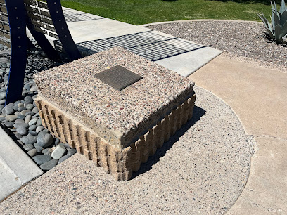
Gila and Salt River Principal Meridian: Arizona's Surveying Landmark
Explore the Gila and Salt River Principal Meridian in Avondale, AZ: a key historical site for Arizona's land surveying and development.
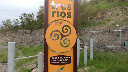
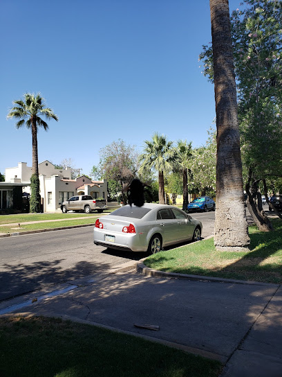
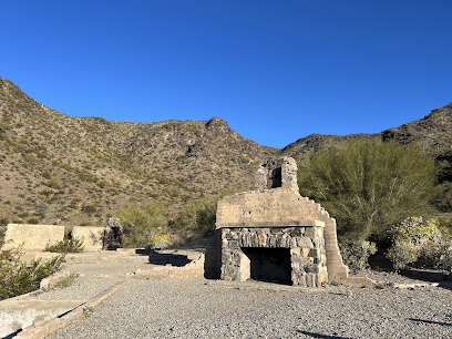
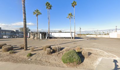
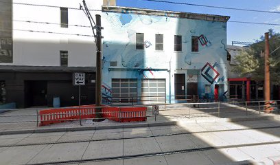
The Gila and Salt River Principal Meridian in Avondale, Arizona, is a crucial historical landmark that served as the primary reference point for land surveys across Arizona. Established in the mid-1800s, it played a vital role in shaping property boundaries and land distribution in the region.
A brief summary to Gila and Salt River Principal Meridian
- Avondale, Arizona, 85323, US
Local tips
- Bring your camera to capture the informative markers and the surrounding landscape.
- Visit during the early morning or late afternoon for the best lighting and fewer crowds.
- Consider bringing a picnic to enjoy in the serene environment.
- Check local weather conditions before your visit to ensure a comfortable experience.
Getting There
-
Driving
If driving from Phoenix, take I-10 West to Exit 131 for 107th Avenue. Head south on 107th Avenue. Turn west onto W Lower Buckeye Road. The Gila and Salt River Principal Meridian will be on the south side of the road. There is no parking fee.
-
Public Transport
To reach the Gila and Salt River Principal Meridian using public transport, take a bus towards Avondale. Disembark at the Avondale Blvd stop. From there, you can walk approximately 1 mile south on Avondale Blvd, then west on W Lower Buckeye Rd to reach 107th Ave. Alternatively, use a rideshare service like Uber or Lyft to reach 107th Ave and Lower Buckeye Rd. Transit cost is approximately $3.
Discover more about Gila and Salt River Principal Meridian
Iconic landmarks you can’t miss
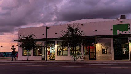
Gila and Salt River Principal Meridian
0.0 km
Explore the Gila and Salt River Principal Meridian in Avondale, AZ: a key historical site for Arizona's land surveying and development.
The Rock Church
12.9 km
Experience faith and community at The Rock Church in Goodyear, a welcoming place for spiritual growth and connection.

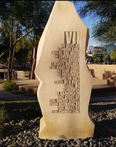
Bill of Rights Monument
21.1 km
Explore the Bill of Rights Monument in Phoenix: A tribute to American freedoms and a place for reflection on civil liberties.
Downtown Glendale, AZ
21.2 km
Explore historic charm, unique shops, and diverse dining in vibrant Downtown Glendale, Arizona. A blend of past and present!
U.S.S. Arizona Top Mast Memorial
21.2 km
A solemn memorial in Phoenix featuring the U.S.S. Arizona's top mast, honoring the lives lost at Pearl Harbor and the ship's legacy.
Historic Downtown Glendale
21.2 km
Discover unique boutiques, antique shops, and diverse eateries in Glendale's charming Historic Downtown, a blend of history and modern vibrancy.
Time Capsule
21.3 km
A solemn tribute to the heroes of Pearl Harbor, featuring artifacts from the USS Arizona, located near the Arizona State Capitol.
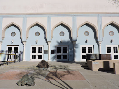
Polly Rosenbaum Building
21.4 km
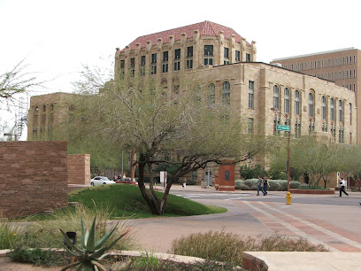
Explore Phoenix's Polly Rosenbaum Building: a historic landmark blending Exotic & Moorish Revival architecture, named after Arizona's 'First Lady of the Legislature'.
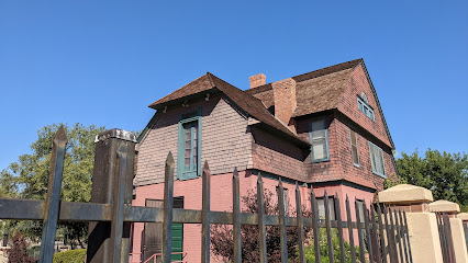
Smurthwaite House
21.5 km
Explore Phoenix's history at the Smurthwaite House, a beautifully restored 1897 Shingle Style home in the heart of Pioneer and Military Memorial Park.
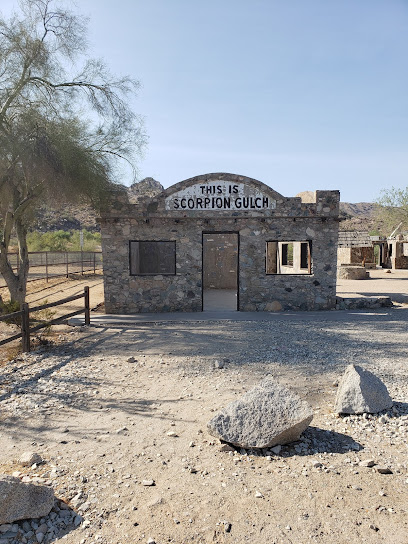
Scorpion Gulch
21.7 km
Immerse yourself in the history and beauty of Scorpion Gulch, a captivating landmark in Phoenix's South Mountain Park, perfect for adventurers and history lovers alike.
The Icehouse
22.3 km
Experience Phoenix's vibrant arts scene in a historic ice factory turned unique event space and gallery, showcasing local talent and creativity.
National Register of Historic Places Plaque
22.4 km
Discover Phoenix's past at landmarks recognized by the National Register of Historic Places.
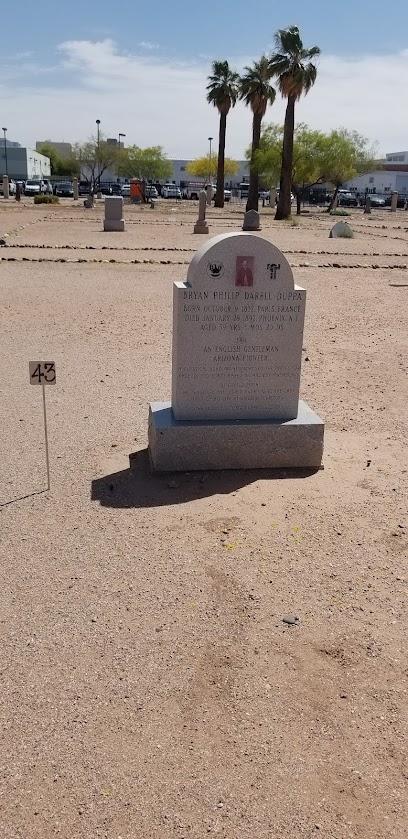
Duppa Homestead
22.5 km
Visit the oldest standing structure in Phoenix, a testament to the city's pioneering past and the vision of Lord Darrell Duppa.
Francis Quarles Story neighborhood
22.6 km
Discover historic charm and architectural beauty in Phoenix's Francis Quarles Story neighborhood, a captivating journey into the city's vibrant past.
Phoenix Historic Preservation
22.7 km
Explore Phoenix's architectural heritage and discover the stories behind its historic buildings and neighborhoods.

Unmissable attractions to see
Glendale Heroes Regional Park
17.8 km
Discover the natural beauty and recreational activities at Glendale Heroes Regional Park, a hidden gem in Glendale, Arizona.
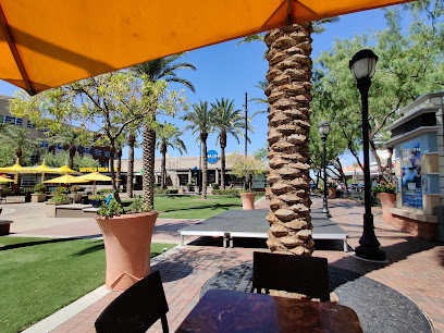
Fountain At Westgate
17.8 km
Experience the magical water displays at the Fountain at Westgate, a must-visit tourist attraction in Glendale's vibrant entertainment district.
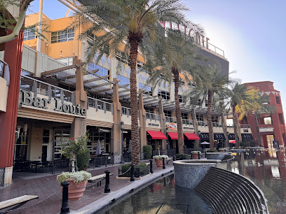
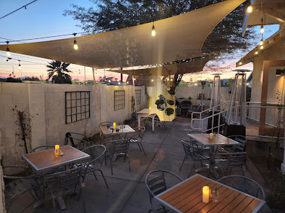
Bar Louie - Westgate Entertainment District
17.9 km
Discover the vibrant atmosphere and delicious American cuisine at Bar Louie in Glendale's Westgate Entertainment District.

Splash Pad
18.0 km
Experience the fun and excitement of the Splash Pad, a premier water park in Glendale, Arizona, perfect for families looking to cool off and create lasting memories.
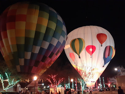
Rainbow Ryders Hot Air Balloon Co.
19.4 km
Experience the breathtaking beauty of Arizona from above with Rainbow Ryders Hot Air Balloon Co., where adventure meets stunning views.

The Lost Ranch
19.9 km
Explore The Lost Ranch in the Ahwatukee Foothills of Phoenix, Arizona, where history meets breathtaking natural beauty and adventure awaits.
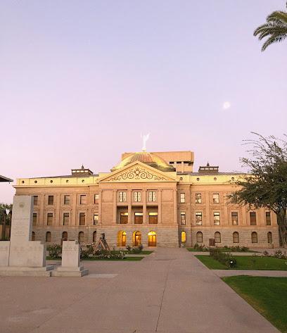
Arizona Capitol Museum
20.9 km
Explore Arizona's rich history at the Arizona Capitol Museum, where engaging exhibits and family-friendly activities await in the heart of Phoenix.
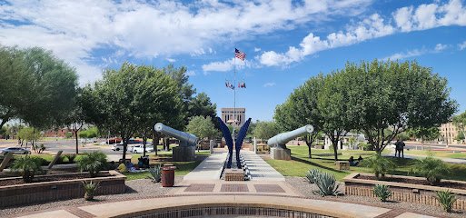
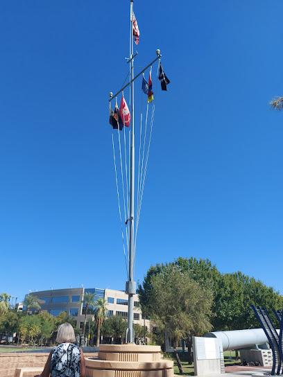
Wesley Bolin Memorial Plaza
21.2 km
Explore the serene Wesley Bolin Memorial Plaza in Phoenix, Arizona, where history, beauty, and tranquility converge in a stunning memorial park.
Glendale Glitters
21.3 km
Experience the magic of Glendale Glitters, where millions of lights illuminate the festive spirit of Glendale, Arizona, creating an unforgettable holiday atmosphere.
Pioneer & Military Memorial Park
21.4 km
Discover the rich history and serene landscapes of Pioneer & Military Memorial Park, a tranquil oasis in the heart of Phoenix, Arizona.
Northern Horizon Park
21.9 km
Explore Northern Horizon Park, a serene urban oasis in Glendale, AZ, ideal for picnics, dog walks, and outdoor fun amidst nature's beauty.
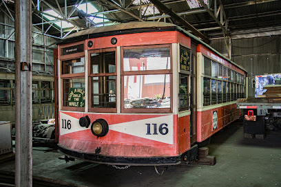
Phoenix Trolley Museum
22.0 km
Explore the rich history of rail transportation at the Phoenix Trolley Museum, where vintage trolleys and engaging exhibits come to life.
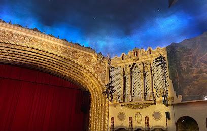
Orpheum Theatre Phoenix
22.8 km
Discover the magic of live performances at the Orpheum Theatre in Phoenix, a historic venue rich in culture and breathtaking architecture.
The Phoenix Police Museum
22.8 km
Explore the rich tapestry of law enforcement history at The Phoenix Police Museum, a unique attraction in Downtown Phoenix that engages and educates.
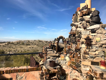
Mystery Castle
22.8 km
Discover the enchanting Mystery Castle in Phoenix, Arizona, a unique tourist attraction filled with history, artistry, and breathtaking views.
Essential places to dine
The Lola
17.9 km
Discover The Lola in Glendale: A delightful restaurant offering fresh flavors and inviting ambiance perfect for every traveler.

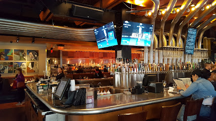
Yard House
17.9 km
Experience culinary delight at Yard House in Glendale's vibrant Sports and Entertainment District with delicious New American cuisine and extensive craft beer selections.
Olive Garden Italian Restaurant
18.2 km
Experience authentic Italian flavors at Olive Garden in Glendale – perfect for family gatherings or cozy dinners after exploring the area.

Haus Murphy's
21.2 km
Savor authentic German cuisine at Haus Murphy's - your gateway to traditional flavors and craft beers in Glendale.
Flavors In The Park
21.3 km
Discover a culinary haven at Flavors In The Park in Glendale, AZ - where every meal is a celebration of taste!
The Spicery In Our 1895 Home
21.4 km
Experience delightful lunches and exquisite teas at The Spicery in historic Glendale - where culinary traditions meet modern flavors.
A Touch of European Café
21.6 km
Discover authentic Polish cuisine at A Touch of European Café in Glendale's historic district—where every bite is a journey through Eastern Europe.
Dolce Vino Wine Bar
22.1 km
Discover the essence of Italy at Dolce Vino Wine Bar in Glendale - where authentic flavors meet warm hospitality.
Kiss the Cook Restaurant
22.1 km
Experience hearty breakfasts at Kiss the Cook Restaurant in Glendale – where delicious American classics meet cozy dining.
The Vig
22.8 km
Experience the vibrant culinary scene at The Vig in Downtown Phoenix, where great food meets exceptional cocktails in a lively atmosphere.

The Duce
22.8 km
Discover The Duce: A vibrant restaurant and event venue in Downtown Phoenix serving delicious food and craft drinks in a retro-inspired setting.
Wren & Wolf
22.9 km
Discover Wren & Wolf in Downtown Phoenix: A premier steakhouse blending American flavors with artisanal cocktails for an unforgettable dining experience.

Anhelo Restaurant
22.9 km
Discover the exquisite flavors of Anhelo Restaurant in Downtown Phoenix, where fine dining meets artistic culinary creations.
Blue Hound Kitchen & Cocktails
23.0 km
Experience the best of American cuisine at Blue Hound Kitchen & Cocktails in Downtown Phoenix – where flavors meet vibrant ambiance.

Breakfast Club
23.0 km
Experience a delightful morning at The Breakfast Club in Downtown Phoenix – where flavor meets comfort in every bite.

Markets, malls and hidden boutiques
Tanger Outlets Phoenix
17.8 km
Discover unbeatable discounts and a variety of brands at Tanger Outlets Phoenix, a premier shopping destination in Glendale, Arizona.
2 Share a Unique Boutique and The Monkey Shop Coffee
21.2 km
Explore unique gifts and savor exceptional coffee at 2 Share a Unique Boutique and The Monkey Shop Coffee in Glendale, Arizona.
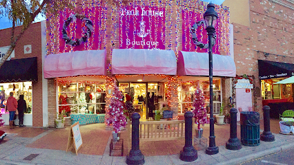
Pink House Boutique
21.3 km
Explore Pink House Boutique in Glendale, AZ, for unique vintage clothing and rustic furniture that capture the spirit of eclectic style.
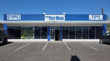
The Toy Box
21.6 km
Explore The Toy Box in Glendale, AZ - a paradise for collectors and nostalgia lovers, featuring toys, collectibles, and vintage treasures!
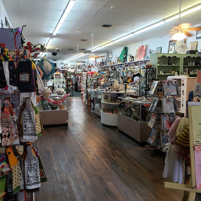
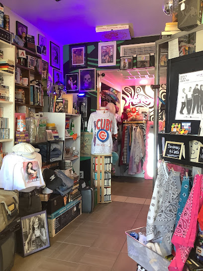
3G Vintage
21.9 km
Explore the eclectic charm of 3G Vintage in Phoenix, a collector's paradise for vintage clothing, music records, and unique memorabilia.
The Back Alley Gallery
23.0 km
Explore The Back Alley Gallery in Downtown Phoenix for unique vintage clothing and local artistry, capturing the essence of timeless fashion.

Ian Gifts
23.1 km
Explore Ian Gifts in Downtown Phoenix for unique souvenirs and artisan creations that embody the spirit of Arizona.
Travel Traders
23.1 km
Explore unique gifts and local crafts at Travel Traders in Downtown Phoenix, capturing the essence of Arizona in every purchase.
Travel Traders gift shop
23.4 km
Explore unique gifts and local crafts at Travel Traders Gift Shop in Downtown Phoenix, your destination for memorable souvenirs and Arizona treasures.
/NOW OR NEVER
23.4 km
Explore NOW OR NEVER - Your premier destination for unique men's and women's clothing in Downtown Phoenix, Arizona.
Bunky Boutique
23.4 km
Explore Bunky Boutique in Downtown Phoenix for unique gifts, fashionable clothing, and local artistry that make your shopping experience unforgettable.
State Forty Eight- Downtown Phoenix
23.5 km
Explore the vibrant State Forty Eight in Downtown Phoenix for unique clothing celebrating Arizona's culture and lifestyle.
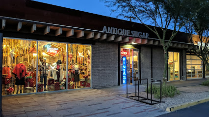
Antique Sugar
23.6 km
Explore a treasure trove of vintage clothing and unique finds at Antique Sugar in Downtown Phoenix, a must-visit for fashion lovers.
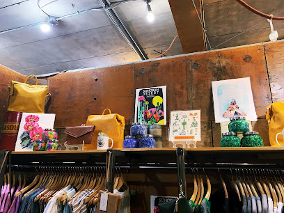
Desert Crafted
23.7 km
Explore Desert Crafted in Phoenix, AZ for unique handcrafted treasures that capture the spirit of the desert, perfect for gifts and souvenirs.
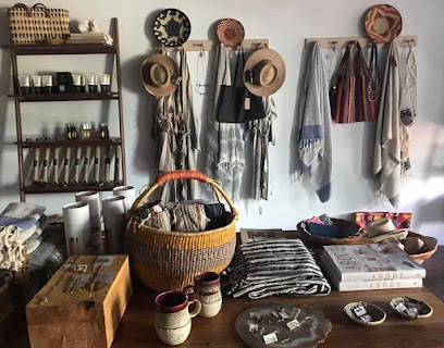
Phoenix General
23.7 km
Explore the vibrant spirit of Phoenix at Phoenix General, a boutique gift shop offering local art, fashion, and home goods that capture the essence of Arizona.
Essential bars & hidden hideouts
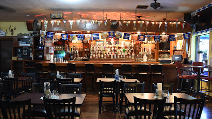
JT's Pub
16.0 km
Discover the lively atmosphere and extensive drink selection at JT's Pub, a premier bar in Glendale, Arizona, perfect for a vibrant night out.
Twin Peaks
18.1 km
Discover Twin Peaks in Glendale, Arizona, where sports, delicious American cuisine, and a lively atmosphere come together for an unforgettable experience.
Stardust Pinbar
22.6 km
Discover Stardust Pinbar, a vibrant bar in Downtown Phoenix combining craft drinks with an arcade atmosphere for an unforgettable night out.
Gracie's Tax Bar
22.6 km
Discover the lively spirit of Gracie's Tax Bar in downtown Phoenix, where creative cocktails and a welcoming atmosphere await every visitor.

Garden Bar Phx
22.7 km
Discover Garden Bar Phx in Downtown Phoenix, where premium cocktails meet a vibrant atmosphere perfect for tourists and locals alike.
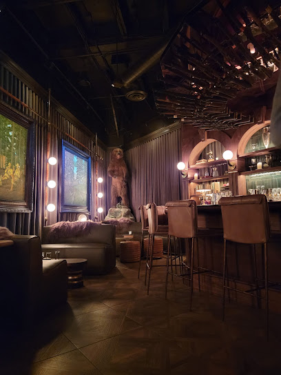
Little Rituals
22.9 km
Experience the vibrant cocktail culture at Little Rituals, where innovative drinks and a stunning skyline view await you in Downtown Phoenix.

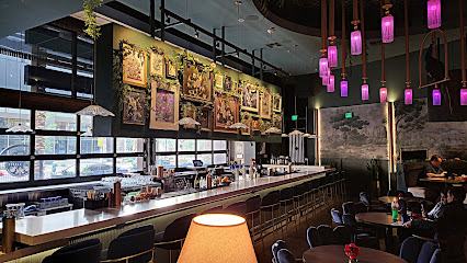
Bitter & Twisted Cocktail Parlour
22.9 km
Discover the vibrant atmosphere and innovative cocktails at Bitter & Twisted Cocktail Parlour in Downtown Phoenix, a must-visit for nightlife enthusiasts.

Trophy Room
22.9 km
Explore the Trophy Room, Phoenix's elegant cocktail bar, where artisanal drinks and a no-phone policy create an unforgettable social experience.
The Rose Garden AZ
22.9 km
Discover the charm of The Rose Garden AZ, a cocktail bar in Downtown Phoenix offering unique drinks and an inviting atmosphere for all visitors.
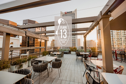
Floor 13 Rooftop Bar
23.1 km
Experience the vibrant atmosphere and stunning skyline views at Floor 13 Rooftop Bar, a top destination in Downtown Phoenix for unforgettable evenings.
The Whining Pig Downtown
23.2 km
Experience the vibrant atmosphere and unique craft beer selection at The Whining Pig Downtown, a perfect spot for relaxation in Phoenix.
The Grand
23.2 km
Experience the pulse of Downtown Phoenix at The Grand, a cocktail bar featuring innovative drinks, a lively beer garden, and a vibrant event venue.
BARCOA Agaveria
23.3 km
Discover the vibrant culture of agave spirits at BARCOA Agaveria in Downtown Phoenix, where expertly crafted cocktails await.
Hooper's Pub
23.4 km
Discover the vibrant nightlife at Hooper's Pub in Glendale, AZ, where friendly faces and great drinks create unforgettable memories.
Chambers Bohemian Whiskey Lounge & Kitchen
23.4 km
Discover the eclectic blend of flavors and spirits at Chambers Bohemian Whiskey Lounge & Kitchen in Downtown Phoenix, where culinary creativity meets a vibrant atmosphere.

Nightclubs & after hour spots
Club Classico Phoenix
16.3 km
Discover the lively atmosphere of Club Classico Phoenix, where music, dance, and culture come together for an unforgettable nightlife experience.

Xplicit Showclub
17.7 km
Experience the vibrant nightlife and thrilling performances at Xplicit Showclub, Glendale's top adult entertainment venue.

Coyote Cabaret
18.4 km
Unleash your spirit and dive into the electrifying performances at Coyote Cabaret - the top adult entertainment club in Luke AFB, Arizona.

Purple Turtle Sports Bar & Night Club
18.5 km
Discover the vibrant nightlife at Purple Turtle Sports Bar & Night Club in Phoenix, AZ, where delicious food and exhilarating entertainment collide.

El Muchacho Alegre
18.9 km
Discover the vibrant nightlife at El Muchacho Alegre, where signature cocktails and eclectic music create unforgettable experiences in Glendale, Arizona.

La Boom Night Club
19.0 km
Vibrant nightlife at La Boom Night Club in Glendale, AZ, where unforgettable music and dancing create lasting memories.
LA MALQUERIDA CANTINA
19.6 km
Discover the vibrant nightlife at La Malquerida Cantina, where delicious food meets electrifying entertainment in Glendale, Arizona.

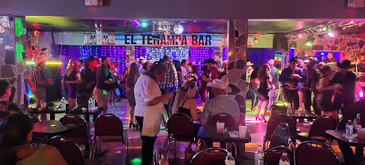
El Tenampa Bar Nightclub
19.8 km
Discover the lively El Tenampa Bar Nightclub in Phoenix, where vibrant music, delicious drinks, and a welcoming atmosphere create unforgettable nights.
Gypsy Bar Phoenix
22.9 km
Discover the lively nightlife and eclectic dining experience at Gypsy Bar Phoenix, where every visit is a celebration of flavor and fun.

The Xtra Frame Craft Cocktail Lounge
22.9 km
Experience the vibrant atmosphere and expertly crafted cocktails at The Xtra Frame Craft Cocktail Lounge in Downtown Phoenix, a must-visit for cocktail enthusiasts.
A Sunny August
23.0 km
Dive into the vibrant nightlife of Phoenix at A Sunny August, a premier night club offering music, dancing, and unforgettable experiences.
Monarch Theatre
23.1 km
Discover the electric atmosphere of Monarch Theatre, Phoenix's nightlife gem, where music, dancing, and unforgettable memories await.

Bliss&Baddies
23.1 km
Discover the vibrant nightlife of Phoenix at Bliss&Baddies – where music, dancing, and unforgettable moments collide.
Bar Smith
23.1 km
Experience the vibrant nightlife of Phoenix at Bar Smith, a premier night club offering electrifying music and expertly crafted cocktails.

Dwntwn
23.2 km
Discover the heart of Phoenix nightlife at Dwntwn, where music, drinks, and unforgettable memories await in a vibrant atmosphere.