

Uttara (Dhaka) Travel Guide - Free
Explore Uttara in Dhaka with Evendo's free guide. Find the best shops, historic streets, restaurants, and gems on web or mobile.


Uttara, Dhaka’s planned northern township, pairs leafy sectors, Uttara Lake, Diabari’s metro terminus, local markets and Bengali dining near the airport.
Planned Streets and Everyday Dhaka
Uttara occupies Dhaka’s northern edge between the airport area and Tongi, a large planned township whose numbered sectors give the neighbourhood a more ordered feel than much of the city. Broad roads, planted verges, apartment blocks, private houses and pocket parks define its residential character, while Rajlokkhi, House Building and Jasimuddin Road form busy commercial centres. The area is not a conventional historic quarter; its appeal lies in observing contemporary Dhaka at a calmer, more spacious scale.Read more about Uttara
Water, Open Space and Diabari
Markets, Food and Connections
Best attractions in Uttara
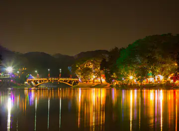
Uttara’s attractions are primarily urban and local rather than monumental. Uttara Lake provides the neighbourhood’s most characteristic landscape, appearing in fragments between residential roads and apartment developments and offering glimpses of water, vegetation and daily life. Diabari, at the northern edge, has more open space and is closely associated with the Uttara North metro station, making it a useful place to see how new transport infrastructure has reshaped the township. Sector parks, particularly around the more established residential areas, offer modest pauses from traffic, while the streets around Jasimuddin Avenue, Rajlokkhi and House Building reveal Uttara’s commercial rhythm through cafés, shops, bakeries and busy junctions. Visitors interested in contemporary Dhaka can also observe the contrast between planned avenues, informal roadside commerce, private schools, clinics and rapidly rising apartment blocks.
-
Park
Uttara, Sector 7 Park
Escape the city bustle in this green oasis: walking paths, gardens, and a playground await in Uttara Sector 7 Park, Dhaka.
6 min drive · 1.9 km from neighbourhood centre
-
Amusement park
Fantasy Island, Diabari, Uttara
Experience thrilling rides and family fun at Fantasy Island in Dhaka, a vibrant amusement park offering a perfect escape for locals and tourists alike in Uttara.
9 min walk · 0.7 km from neighbourhood centre
-
Tourist attraction
Diabari Lake
Escape to the serene beauty of Diabari Lake in Dhaka's Uttara, offering tranquil boat rides and picturesque natural scenery.
7 min drive · 2.3 km from neighbourhood centre
-
Tourist attraction
Mirpur Lake
Discover a peaceful escape in the heart of Dhaka at Mirpur Lake, a serene spot for nature lovers and those seeking tranquility.
11 min drive · 3.6 km from neighbourhood centre


Best landmarks in Uttara
Uttara’s most significant landmarks reflect planning, transport and everyday urban development rather than an old monument tradition. Uttara Lake is the defining natural feature, threading through the township and surviving as an important visual break between built-up sectors. The three MRT Line 6 stations—Uttara North at Diabari, Uttara Center and Uttara South—are contemporary transport landmarks that mark Uttara’s connection with central Dhaka. House Building and Rajlokkhi are recognisable civic-commercial reference points, although their importance comes from movement and local orientation rather than formal heritage status. The numbered sectors themselves, with broad roads, parks, institutions and mixed low-rise and apartment development, express the model-town planning idea. Hazrat Shahjalal International Airport lies immediately south and is geographically adjacent, but should not be described as a landmark within Uttara proper.
-
Park
Uttara Sector 11 No Park
Escape the city bustle at Uttara Sector 11 No Park: a green oasis for relaxation, recreation, and community connection in Dhaka.
16 min walk · 1.3 km from neighbourhood centre
-
Park
Uttara Sector 12 Park
Escape the city bustle at Uttara Sector 12 Park: a green haven for relaxation, recreation, and community in the heart of Dhaka.
6 min walk · 0.5 km from neighbourhood centre
-
Playground
Uttara Sector 4 Park & Playground
Discover a tranquil escape in Dhaka's Uttara, where lush greenery, a serene pond, and vibrant community life converge at Sector 4 Park & Playground, a refreshing retreat for all.
9 min drive · 2.9 km from neighbourhood centre
-
Amusement park
Fantasy Island, Diabari, Uttara
Experience thrilling rides and family fun at Fantasy Island in Dhaka, a vibrant amusement park offering a perfect escape for locals and tourists alike in Uttara.
9 min walk · 0.7 km from neighbourhood centre


Explore Uttara on the map
A handpicked selection of must-see spots in Uttara, mapped for you.
Best hotels in Uttara
Best restaurants in Uttara
Uttara has one of Dhaka’s broadest suburban dining scenes, shaped by residents, office workers, students and travellers staying near the airport. Around Sector 7, Jasimuddin Avenue, Rajlokkhi and House Building, visitors will find Bengali rice-and-curry restaurants, kacchi and other biryani styles, kebab houses, Chinese-Bangladeshi eateries, bakeries, cafés and casual international food. Local meals often include fish, bhorta, lentils and seasonal vegetables, while roadside tea and snacks provide a simpler way to eat between journeys. The area also contains air-conditioned family restaurants and contemporary cafés aimed at the city’s expanding middle-class market. Menus and businesses change frequently, so individual venues are best checked locally; the most revealing dining experiences are often found by comparing a busy neighbourhood restaurant with the polished cafés clustered along the main commercial roads.
-
Asian Fusion
Ajo Idea Space
Experience the essence of Asian fusion at Ajo Idea Space in Dhaka - where tradition meets innovation in every dish.
18 min walk · 1.4 km from neighbourhood centre
-
Buffet
Royal Cuisine Restaurant (Uttara)
Discover the flavors of Asia at Royal Cuisine Restaurant - A buffet haven offering Chinese, Indian & Thai delights in Uttara.
7 min drive · 2.4 km from neighbourhood centre
-
Steak
Lake Terrace
Discover exquisite steaks and continental delights at Lake Terrace, Dhaka's premier dining destination by the lake.
5 min drive · 1.6 km from neighbourhood centre
-
Chinese
XINXIAN Restaurant
Experience authentic Chinese flavors in Dhaka at XINXIAN Restaurant – where culinary traditions meet modern dining.
9 min drive · 3.0 km from neighbourhood centre


Best bars in Uttara
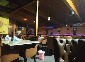
Uttara is not primarily a bar-and-club district, and evening life is more commonly expressed through restaurants, cafés, tea stalls, dessert shops and family-oriented gathering places. The busiest after-dark activity concentrates around House Building, Rajlokkhi, Jasimuddin Avenue and shopping areas in the central sectors, where traffic and dining continue into the evening. Alcohol service is regulated in Bangladesh and is not a routine feature of ordinary neighbourhood venues; licensed hotel establishments, generally associated with the airport and larger commercial properties, are the more relevant option for visitors seeking it. Live music and nightlife events may appear in hotels or restaurants, but availability changes. For most travellers, Uttara’s evening character is social, culinary and residential rather than club-focused, with quieter sector roads away from the main junctions.
-
Grill
Kingfisher Restaurant
Experience the vibrant culinary scene of Dhaka at Kingfisher Restaurant, where exceptional grilled dishes meet a warm atmosphere.
15 min walk · 1.2 km from neighbourhood centre
-
Bar
Lakeview Restaurant & Bar, Uttara
Discover serene dining at Lakeview Restaurant & Bar in Uttara, where stunning views meet delicious cuisine, perfect for unwinding after a day in Dhaka.
15 min walk · 1.2 km from neighbourhood centre
-
Bar
City Orchard Recreation Club
Discover the vibrant nightlife of Dhaka at City Orchard Recreation Club, a top bar and club where locals and tourists mingle over drinks and music.
6 min drive · 2.2 km from neighbourhood centre
-
Bar
Nest Restaurant & Bar
Discover Nest Restaurant & Bar in Dhaka: A delightful fusion of local and international cuisines in a cozy atmosphere.
13 min walk · 1.0 km from neighbourhood centre



Best nightclubs in Uttara
Uttara is not primarily a bar-and-club district, and evening life is more commonly expressed through restaurants, cafés, tea stalls, dessert shops and family-oriented gathering places. The busiest after-dark activity concentrates around House Building, Rajlokkhi, Jasimuddin Avenue and shopping areas in the central sectors, where traffic and dining continue into the evening. Alcohol service is regulated in Bangladesh and is not a routine feature of ordinary neighbourhood venues; licensed hotel establishments, generally associated with the airport and larger commercial properties, are the more relevant option for visitors seeking it. Live music and nightlife events may appear in hotels or restaurants, but availability changes. For most travellers, Uttara’s evening character is social, culinary and residential rather than club-focused, with quieter sector roads away from the main junctions.
-
Club
Uttara Club
Experience the vibrant nightlife of Dhaka at Uttara Club, a premier destination for music, dance, and unforgettable events.
9 min drive · 2.9 km from neighbourhood centre
-
Bar
Lakeview Restaurant & Bar, Uttara
Discover Lakeview Restaurant & Bar in Uttara, Dhaka for a unique dining experience blending stunning views, delightful cuisine, and vibrant nightlife.
15 min walk · 1.2 km from neighbourhood centre
-
Bar
City Orchard Recreation Club
Experience the vibrant nightlife at City Orchard Recreation Club in Dhaka, where drinks, entertainment, and a lively atmosphere await you.
6 min drive · 2.2 km from neighbourhood centre
-
Lounge
রূপসী বাংলা নির্বাহী লাউঞ্জ
Discover the luxurious Ruposhi Bangla Executive Lounge in Dhaka, where comfort meets sophistication for an unforgettable experience.
12 min drive · 3.9 km from neighbourhood centre


Best shops in Uttara
Shopping in Uttara is concentrated along Jasimuddin Avenue, Sonargaon Janapath, Rajlokkhi, House Building and the surrounding sector markets. These roads combine clothing shops, pharmacies, mobile-phone retailers, household goods, salons, bakeries, supermarkets and small specialist businesses, while local bazaars supply vegetables, fish, meat and everyday groceries. Shopping centres and market buildings provide more organised retail, but the neighbourhood’s commercial character is still best understood through the flow of roadside stalls, rickshaws and independent shops around major junctions. Fashion, cosmetics, electronics and gifts are widely represented, reflecting Uttara’s large residential population and airport-linked economy. It is not chiefly a craft or antique quarter, so visitors should look here for practical urban shopping, Bengali snacks and food-market atmosphere rather than a narrow collection of traditional souvenirs.
-
Clothing store
Aarong (Uttara Flagship Outlet)
Discover authentic Bangladeshi fashion and crafts at Aarong's flagship store in Uttara, a treasure trove of unique clothing and handmade goods.
8 min drive · 2.5 km from neighbourhood centre
-
 Gift shop
Handiz @ Kidz
Discover unique gifts and cosmetics at Handiz @ Kidz, a must-visit shop in Dhaka's Uttara neighborhood, perfect for souvenirs and local treasures.
13 min walk · 1.0 km from neighbourhood centre
-
Shopping mall
Uttara Square Shopping Complex
Discover the ultimate shopping experience at Uttara Square Shopping Complex, where fashion meets convenience in the heart of Dhaka.
14 min walk · 1.1 km from neighbourhood centre
-
Gift shop
Archies
Explore Archies in Dhaka, a premier gift shop filled with unique souvenirs and delightful treasures for every occasion.
7 min drive · 2.2 km from neighbourhood centre


Uttara essentials
Getting There
Getting Around
Safety
Emergency Situations
Do's and Don'ts
Local Tips

From Eve
Local phrases worth knowing
You don't need to get them perfect. A few words go a long way, and locals appreciate the effort.
Basics
| English | Local | Say it |
|---|---|---|
| Hello | হ্যালো | [hælo] |
| Goodbye | বিদায় | [bidae] |
| Yes | হ্যাঁ | [hæ̃] |
| No | না | [na] |
| Please/You're welcome | অনুগ্রহ করে/স্বাগতম | [onugroh kore/swagotom] |
| Thank you | ধন্যবাদ | [dhonnobad] |
| Excuse me/Sorry | দুঃখিত/দুঃখিত | [dukhit/dukhit] |
| How are you? | তুমি কেমন আছো? | [tumi kemon asho?] |
| Fine. And you? | ভালো। আর তুমি? | [bhalo. ar tumi?] |
| Do you speak English? | তুমি ইংরেজি কথা বলতে পারো? | [tumi inglizi kotha bolte paro?] |
| I don't understand | আমি বুঝিনা | [ami bujhina] |
Eating & Drinking
| English | Local | Say it |
|---|---|---|
| I'd like to see the menu, please | দয়া করে মেনুটি দেখাবেন | [doia kore menuti dekhabe] |
| I don't eat meat | আমি মাংস খাই না | [ami mangsh khai na] |
| Cheers! | চিয়ারস! | [chears!] |
| I would like to pay, please | দয়া করে আমি পরিশোধ করতে চাই | [doia kore ami porishodh kortey chai] |
Emergencies
| English | Local | Say it |
|---|---|---|
| Help! | বাঁচাও! | [bachao!] |
| Go away! | চলে যাও! | [chole jao!] |
| Call the Police! | পুলিশ কল করুন! | [polish kol korun!] |
| Call a doctor! | ডাক্তার কল করুন! | [daktar kol korun!] |
| I'm lost | আমি হারানো | [ami harano] |
| I'm ill | আমি অসুস্থ | [ami osustho] |
Shopping
| English | Local | Say it |
|---|---|---|
| I'd like to buy... | আমি ... কিনতে চাই | [ami ... kinte chai] |
| I'm just looking | আমি শুধু দেখছি | [ami shudhu dekhchhi] |
| How much is it? | এটা কত? | [eta koto?] |
| That's too expensive | এটা খুবই মহঙ্গা | [eta khuboi mohonga] |
| Can you lower the price? | তুমি দাম কমাতে পারো? | [tumi dam komate paro?] |
Time & Numbers
| English | Local | Say it |
|---|---|---|
| What time is it? | এখন কত সময়? | [ekhon koto shomoy?] |
| It's one o'clock | একটা সময় | [ekta shomoy] |
| Half past (10) | দশের পাঁচ | [dasher panch] |
| Morning | সকাল | [shokal] |
| Afternoon | দুপুর | [dupur] |
| Evening | সন্ধ্যা | [shondhya] |
| Yesterday | গতকাল | [gotkal] |
| Today | আজ | [aj] |
| Tomorrow | আগামীকাল | [agamikal] |
| 1 | ১ | [1] |
| 2 | ২ | [2] |
| 3 | ৩ | [3] |
| 4 | ৪ | [4] |
| 5 | ৫ | [5] |
| 6 | ৬ | [6] |
| 7 | ৭ | [7] |
| 8 | ৮ | [8] |
| 9 | ৯ | [9] |
| 10 | ১০ | [10] |
Transport & Directions
| English | Local | Say it |
|---|---|---|
| Where's a/the...? | ...কোথায়? | [...kothay?] |
| What's the address? | ঠিকানাটি কী? | [thikanati ki?] |
| Can you show me (on the map)? | আপনি আমাকে দেখাতে পারেন (ম্যাপে)? | [apni amake dekhate paren (map-e)?] |
| When's the next (bus)? | পরের গাড়ি কবে? | [porer gari kobe?] |
| A ticket (to ....) | টিকেট দিন (....এ) | [ticket din (....e)] |
History of Uttara
From Northern Fringe to Planned Township
Uttara developed as a planned residential expansion on Dhaka’s northern fringe rather than as an old settlement core. The area is commonly associated with the Uttara Model Town project, created through planned urban development and divided into numbered sectors. Its layout of wide avenues, residential plots, institutional land and open spaces contrasted with the denser, more irregular fabric of older Dhaka. Growth accelerated as the capital spread northwards and housing demand increased.
The Airport and Northern Corridor
The establishment and expansion of the airport zone immediately south of Uttara helped shape the neighbourhood’s modern identity and its connections to the rest of Dhaka. Roads linking the airport, Tongi and northern districts brought traffic, businesses and new housing to the township’s edges. This connectivity also encouraged hotels, offices, restaurants and short-stay accommodation, gradually making Uttara more than a purely residential development.
Sectors, Lakes and Urban Growth
As construction filled the planned sectors, Uttara acquired a mixed landscape of apartment buildings, detached houses, schools, clinics, shops and local parks. Uttara Lake and scattered green spaces remained important elements of the original planning concept, although surrounding development and traffic have altered their setting. Commercial activity became concentrated along roads such as Jasimuddin Avenue, Sonargaon Janapath and the approaches to House Building and Rajlokkhi.
Metro-Era Uttara
Uttara became the northern terminus of Dhaka’s first metro rail corridor when MRT Line 6 opened in stages, with services reaching Uttara in the early 2020s. The Uttara North, Uttara Center and Uttara South stations linked the township more directly with central Dhaka and changed the practical geography of daily travel. Around Diabari and the station approaches, transport infrastructure now sits alongside the older planned sectors, reflecting the neighbourhood’s continuing transformation.
Uttara in Photos
Browse through our photo collection highlighting the charm and character of the destination.
Neighbourhoods near Uttara
The closest neighbourhoods to Uttara, if you have time for more than one stop.
-

-

-


Swipe for more neighbourhoods
Explore more

Explore more of Dhaka
Dhaka, Bangladesh blends Mughal history, riverfront life, vibrant markets, Bengali cuisine and distinctive architecture for immersive city sightseeing.
Explore Dhaka