

Banani (Dhaka) Travel Guide - Free
Explore Banani in Dhaka with Evendo's free guide. Find the best shops, historic streets, restaurants, and gems on web or mobile.


Banani in Dhaka pairs leafy residential roads, Banani Lake, cafés, restaurants and urban nightlife with easy access to Gulshan and the city’s business districts.
Residential Origins and Urban Rhythm
Banani occupies a well-connected stretch of northern Dhaka between the commercial concentration of Gulshan and the busier corridors leading towards Mohakhali and the airport. Planned primarily as a residential area, it has developed into a mixed neighbourhood where apartment blocks, embassies, offices, private clubs, cafés and restaurants share the same grid of numbered roads. The contrast is central to Banani’s character: quiet compounds and tree-lined lanes sit close to busy thoroughfares such as Kemal Atatürk Avenue, while local life continues around small shops, schools, offices and roadside food stalls.Read more about Banani
Lake, Streets and Public Life
Dining, Culture and Everyday Dhaka
Best attractions in Banani
Banani’s attractions are primarily urban and local rather than monumental. Banani Lake provides the neighbourhood’s defining open landscape, with water, trees and changing views of the surrounding apartment buildings; it is best understood as a place for a short walk and a pause from traffic rather than a formal recreational complex. Banani Graveyard offers a quieter setting with mature planting and memorial significance, while the numbered roads reveal the district’s planned layout and everyday street life. Kemal Atatürk Avenue and the adjoining commercial roads are useful for experiencing contemporary Dhaka through cafés, restaurants, small businesses and evening activity. Visitors interested in the neighbourhood’s modern character can also observe the contrast between apartment blocks, institutional compounds, private clubs and side-street housing. Nearby Gulshan and Mohakhali provide additional attractions, but they should be treated as adjacent areas rather than folded into Banani itself.
-
Park
Banani Block C Park
Find serenity in Dhaka's bustling Banani at Block C Park: a green escape with lush gardens, walking paths & a vibrant community vibe.
8 min walk · 0.6 km from neighbourhood centre
-
Park
Banani Bidyaniketan Park
Escape the city bustle at Banani Bidyaniketan Park, a green space for relaxation and community in Dhaka's Banani.
6 min walk · 0.5 km from neighbourhood centre


Best landmarks in Banani
Banani Lake is the neighbourhood’s most recognisable geographic landmark, embodying the low-lying water landscape that influenced northern Dhaka before dense construction transformed the area. Banani Graveyard is another important local place, marked by its memorial function, mature greenery and restrained atmosphere rather than monumental architecture. The numbered-road grid is itself a characteristic feature of Banani’s planned development, while Kemal Atatürk Avenue represents the district’s later commercial and metropolitan identity. Apartment towers, walled compounds, institutional premises and private-club buildings form much of the built environment, illustrating the shift from planned residential suburb to mixed-use business and leisure quarter. Banani DOHS has a related but distinct planned identity and should be described separately when discussing its buildings and residential landscape.
-
Park
Gulshan Society Lake Park
Explore the lush landscapes and serene waters of Gulshan Society Lake Park, a perfect retreat in the heart of Dhaka, blending nature with tranquility.
17 min walk · 1.4 km from neighbourhood centre
-
Park
Gulshan Lake Park
Escape the city bustle at Gulshan Lake Park, a serene urban oasis offering lush greenery, tranquil lake views, community events, and a refreshing connection with nature in Dhaka.
17 min walk · 1.4 km from neighbourhood centre
-
Bengali
Jatra Biroti
Experience the rich flavors of Bengali cuisine at Jatra Biroti, a top dining destination in Dhaka, perfect for brunch and cultural exploration.
14 min walk · 1.1 km from neighbourhood centre
-
Mosque
Banani Chairmanbari Masjid
Discover the serene beauty and spiritual significance of Banani Chairmanbari Masjid, a cultural gem in Dhaka offering peace and community.
10 min walk · 0.8 km from neighbourhood centre


Explore Banani on the map
A handpicked selection of must-see spots in Banani, mapped for you.
Best hotels in Banani
Best restaurants in Banani
Banani is one of Dhaka’s strongest neighbourhoods for contemporary dining, with restaurants and cafés concentrated along Kemal Atatürk Avenue and the numbered roads around Road 11 and Road 12. The range reflects the area’s professional, diplomatic and internationally connected population: Bengali cooking sits alongside Indian, Chinese, Thai, Middle Eastern, European and fast-casual food. Visitors will find formal dining rooms, coffee shops, bakeries, dessert counters and informal eateries, as well as familiar Bangladeshi dishes such as biryani, kebabs, bhorta and fish preparations. Banani Super Market and small roadside businesses add a less polished layer of everyday food culture, although the neighbourhood is better known for sit-down dining than for a single specialised street-food tradition. Menus, payment methods and opening arrangements vary, so checking current information before travelling is sensible.
-
Restaurant
Star Kabab & Restaurant
Discover the vibrant flavors of Bangladesh at Star Kabab & Restaurant in Dhaka - where every dish tells a story.
6 min walk · 0.5 km from neighbourhood centre
-
Steak
Woodhouse Grill
Experience the ultimate steak dining at Woodhouse Grill in Dhaka's upscale Gulshan area - where flavor meets sophistication.
8 min walk · 0.7 km from neighbourhood centre
-
Fast Food
Chillox Banani
Discover the vibrant flavors of Chillox Banani - Dhaka's go-to destination for gourmet burgers and fast food delights.
14 min walk · 1.1 km from neighbourhood centre
-
Bengali
Jatra Biroti
Discover the essence of Bengali cuisine at Jatra Biroti - where tradition meets modern dining in Dhaka's vibrant culinary scene.
14 min walk · 1.1 km from neighbourhood centre


Best bars in Banani
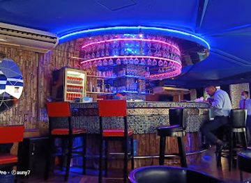
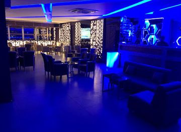
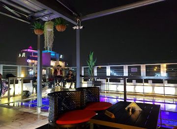
Banani’s nightlife is concentrated around restaurants, cafés, hotel lounges and licensed evening venues rather than a single club district. The main commercial roads, particularly around Kemal Atatürk Avenue and the denser restaurant areas, remain active after work as residents and office workers meet for meals, coffee and conversation. Some venues offer music, sophisticated lounge settings or late-evening socialising, while others are primarily dining establishments with a relaxed night-time atmosphere. Alcohol availability is regulated and varies considerably by venue, so visitors should not assume that every bar-style establishment serves it. Side streets become much quieter away from the commercial roads, and noise should be kept in mind because many venues share buildings with offices and residences.
-
Bar
Bluemoon Recreation Club
Discover a vibrant lifestyle at Bluemoon Recreation Club, where dining, fitness, and entertainment blend seamlessly in Dhaka's lively atmosphere.
14 min walk · 1.1 km from neighbourhood centre
-
Bar
SKYe Lounge Bar
Discover SKYe Lounge Bar, where Dhaka's vibrant nightlife meets exquisite drinks and a chic atmosphere for an unforgettable evening.
12 min walk · 0.9 km from neighbourhood centre
-
Bar
Loki Restaurant & Bar
Discover the vibrant flavors and lively atmosphere at Loki Restaurant & Bar in Dhaka, where every meal is a celebration of culinary excellence.
9 min walk · 0.7 km from neighbourhood centre
-
Lounge
32 Degree
Experience the stylish ambiance and curated drinks at 32 Degree Lounge in Dhaka's bustling Gulshan district.
15 min walk · 1.2 km from neighbourhood centre


Best nightclubs in Banani
Banani’s nightlife is concentrated around restaurants, cafés, hotel lounges and licensed evening venues rather than a single club district. The main commercial roads, particularly around Kemal Atatürk Avenue and the denser restaurant areas, remain active after work as residents and office workers meet for meals, coffee and conversation. Some venues offer music, sophisticated lounge settings or late-evening socialising, while others are primarily dining establishments with a relaxed night-time atmosphere. Alcohol availability is regulated and varies considerably by venue, so visitors should not assume that every bar-style establishment serves it. Side streets become much quieter away from the commercial roads, and noise should be kept in mind because many venues share buildings with offices and residences.
-
Bar
Bluemoon Recreation Club
Experience the vibrant nightlife and diverse recreational activities at Bluemoon Recreation Club in Dhaka, a must-visit for every tourist.
14 min walk · 1.1 km from neighbourhood centre
-
Bar
SKYe Lounge Bar
Experience Dhaka's vibrant nightlife at SKYe Lounge Bar, the perfect blend of chic ambiance, great drinks, and live sports.
12 min walk · 0.9 km from neighbourhood centre
-
Bar
Loki Restaurant & Bar
Experience the vibrant nightlife of Dhaka at Loki Restaurant & Bar, where great food meets lively entertainment in a chic setting.
9 min walk · 0.7 km from neighbourhood centre
-
Lounge
TRIBE Rooftop Lounge
Experience the vibrant nightlife at TRIBE Rooftop Lounge in Dhaka, where stunning views and delicious cocktails create unforgettable memories.
9 min walk · 0.7 km from neighbourhood centre

Best shops in Banani
Shopping in Banani combines practical local retail with the cafés, lifestyle businesses and specialist services that accompany a prosperous mixed-use district. Banani Super Market and smaller shops provide everyday goods, clothing, accessories, cosmetics and household items, while the roads around Kemal Atatürk Avenue and Road 11 contain boutiques, salons, bakeries, book and gift businesses and contemporary brands. The area is not primarily a heritage market quarter, and its retail character changes quickly as offices and restaurants replace older premises. Visitors looking for local atmosphere should browse the smaller shops and food businesses rather than expect a single traditional bazaar. Bargaining may be possible in independent shops, but it is not appropriate everywhere; ask politely, check the final price and carry some cash for smaller purchases.
-
Clothing store
Artisan Banani
Discover stylish clothing and traditional craftsmanship at Artisan Banani, a premier boutique in Dhaka's Gulshan area.
9 min walk · 0.7 km from neighbourhood centre
-
Gift shop
Archies Gallery
Discover unique gifts and souvenirs at Archies Gallery, a charming gift shop in Dhaka, perfect for capturing the essence of Bangladeshi culture.
13 min walk · 1.1 km from neighbourhood centre
-
Gift shop
Desire Islamic Store
Discover unique Islamic gifts and clothing at Desire Islamic Store in Dhaka, where tradition meets modern style.
5 min walk · 0.4 km from neighbourhood centre
-
Variety store
Gemini Shopping Center
Explore Gemini Shopping Center in Dhaka for a unique blend of shopping, dining, and local culture in a vibrant setting.
11 min walk · 0.9 km from neighbourhood centre


Banani essentials
Getting There
Getting Around
Safety
Emergency Situations
Do's and Don'ts
Local Tips

From Eve
Local phrases worth knowing
You don't need to get them perfect. A few words go a long way, and locals appreciate the effort.
Basics
| English | Local | Say it |
|---|---|---|
| Hello | হ্যালো | [hyālō] |
| Goodbye | বিদায় | [bidāẏa] |
| Yes | হ্যাঁ | [hyām̐] |
| No | না | [nā] |
| Please/You're welcome | দয়া করে | [dayā karē] |
| Thank you | ধন্যবাদ | [dhan'yabāda] |
| Excuse me/Sorry | দুঃখিত | [duḥkhita] |
| How are you? | আপনি কেমন আছেন? | [āpani kēmana āchēna?] |
| Fine. And you? | ভালো। আর তুমি? | [bhālō। āra tumi?] |
| Do you speak English? | আপনি ইংরাজি কথা বলতে পারেন? | [āpani iṅrāji kathā bōlatē pārēna?] |
| I don't understand | আমি বুঝি না | [āmi bujhi nā] |
Eating & Drinking
| English | Local | Say it |
|---|---|---|
| I'd like to see the menu, please | মেনু দেখতে চাই | [mēnū dēkhōtē chāi] |
| I don't eat meat | আমি মাংস খাই না | [āmi māṅsa khāi nā] |
| Cheers! | চিয়ার্স! | [ciẏārs!] |
| I would like to pay, please | দয়া করে টাকা দেওয়ার ইচ্ছুক | [dayā karē ṭākā dē'ōẏāra icchuka] |
Emergencies
| English | Local | Say it |
|---|---|---|
| Help! | সাহায্য! | [sāhāy'a!] |
| Go away! | চলে যাও! | [calē yā'ō!] |
| Call the Police! | পুলিশকে কল করুন! | [pulishkē kala karuna!] |
| Call a doctor! | ডাক্তারকে কল করুন! | [ḍāktārkē kala karuna!] |
| I'm lost | আমি হারাইয়া গেছি | [āmi hārāiyā gēchi] |
| I'm ill | আমি অসুস্থ | [āmi asustha] |
Shopping
| English | Local | Say it |
|---|---|---|
| I'd like to buy... | আমি ... কিনতে চাই | [āmi ... kinatē chāi] |
| I'm just looking | আমি কেবল দেখছি | [āmi kēbala dēkhachhi] |
| How much is it? | এটা কত টাকা? | [ēṭā kata ṭākā?] |
| That's too expensive | এটা খুব মহঙ্গ | [ēṭā khuba mahōṅga] |
| Can you lower the price? | দাম কমাতে পারবেন? | [dāma kamātē pārabēna?] |
Time & Numbers
| English | Local | Say it |
|---|---|---|
| What time is it? | এখন কতটা বাজে? | [ēkhana kataṭā bājē?] |
| It's one o'clock | এটা একটা বাজে | [ēṭā ēkaṭā bājē] |
| Half past (10) | দশের পাঁচে | [daśēra pām̐cē] |
| Morning | সকাল | [sakāla] |
| Afternoon | দুপুর | [dupura] |
| Evening | সন্ধ্যা | [sanh'ya] |
| Yesterday | গতকাল | [gatakāla] |
| Today | আজ | [āja] |
| Tomorrow | আগামীকাল | [āgāmīkāla] |
| 1 | এক | [ēka] |
| 2 | দুই | [du'i] |
| 3 | তিন | [tina] |
| 4 | চার | [cāra] |
| 5 | পাঁচ | [pām̐ca] |
| 6 | ছয় | [chôẏa] |
| 7 | সাত | [sāta] |
| 8 | আট | [āṭa] |
| 9 | নয় | [nôẏa] |
| 10 | দশ | [daśa] |
Transport & Directions
| English | Local | Say it |
|---|---|---|
| Where's a/the...? | এখানে ... কোথায়? | [ēkhanē ... kōthāẏa?] |
| What's the address? | ঠিকানা কি? | [ṭhikānā ki?] |
| Can you show me (on the map)? | আপনি আমাকে দেখাতে পারবেন (ম্যাপে)? | [āpani āmākē dēkhātē pārabēna (myāpē)?] |
| When's the next (bus)? | পরের (বাস) কখন? | [parēra (bāsa) kōhana?] |
| A ticket (to ....) | একটা টিকেট (.... এ) | [ēkaṭā ṭikēṭa (.... ē)] |
History of Banani
From Fringe Land to Planned Neighbourhood
Banani emerged as part of Dhaka’s northward expansion beyond the older central city. Its development followed the wider spread of planned residential areas during the twentieth century, when roads, plots and institutional compounds were laid out on land that had previously been less intensively urbanised. The numbered-road pattern remains one of the clearest physical traces of this planning. Unlike Old Dhaka, Banani was not formed around a dense historic bazaar or inherited monumental core; its identity grew from modern residential development, improving road connections and the arrival of professional and administrative households.
Residential Planning and Banani Lake
The neighbourhood’s early residential character was closely tied to its open plots, gardens and water landscape. Banani Lake, part of the low-lying wetland environment that once shaped much of Dhaka, helped distinguish the area from older, more compact districts. As the city expanded, roads and buildings increasingly encroached on open land, while drainage and flooding became persistent urban concerns. The lake therefore represents both a surviving geographic feature and a reminder of the environmental conditions that influenced northern Dhaka’s settlement. Banani’s transformation from peripheral housing area to built-up district occurred through this gradual intensification rather than a single redevelopment event.
A More Connected Northern Dhaka
The growth of nearby Gulshan, Mohakhali and the airport-side commercial corridor changed Banani’s position within Dhaka. Improved road connections brought offices, diplomatic and corporate activity, schools, restaurants and service businesses into a neighbourhood initially valued mainly for housing. Banani DOHS developed as a distinct planned residential enclave associated with defence personnel and should not be treated as identical to the wider Banani area. Together, these developments produced a layered urban landscape in which residential roads, institutional compounds and commercial avenues sit close together.
Commercial Intensification and Contemporary Identity
In recent decades, Banani has become strongly associated with Dhaka’s expanding dining, café and service economy. Apartment buildings have been joined by offices, retail premises and hospitality businesses, particularly along the larger roads, while quieter side streets retain a residential function. This shift has increased the neighbourhood’s evening activity and international visibility but has also intensified traffic, parking pressure and demand for land. Banani’s present identity is consequently modern and mixed-use: its significance lies in the meeting of planned residential form, business growth, food culture and the continuing presence of lake and garden spaces.
Banani in Photos
Browse through our photo collection highlighting the charm and character of the destination.
Neighbourhoods near Banani
The closest neighbourhoods to Banani, if you have time for more than one stop.
-

-
-


Swipe for more neighbourhoods
Explore more

Explore more of Dhaka
Dhaka, Bangladesh blends Mughal history, riverfront life, vibrant markets, Bengali cuisine and distinctive architecture for immersive city sightseeing.
Explore Dhaka