Discover the Historical Essence of Bangladesh at Shatgara
Explore the rich historical landmarks of Shatgara, Bangladesh, where culture and heritage come alive in every corner.
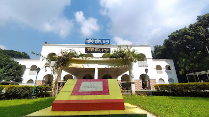
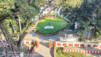
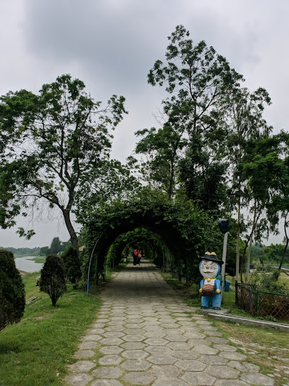
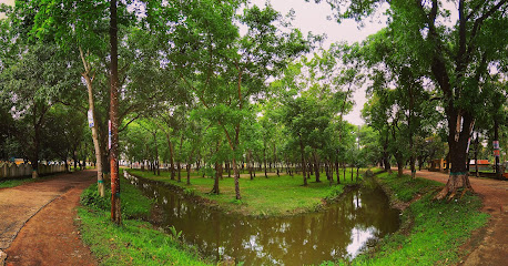
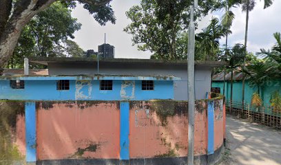
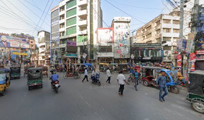
Shatgara, a serene location in Bangladesh, offers visitors a glimpse into the country's rich history with its captivating historical landmarks. It's a must-visit for history enthusiasts and casual travelers alike.
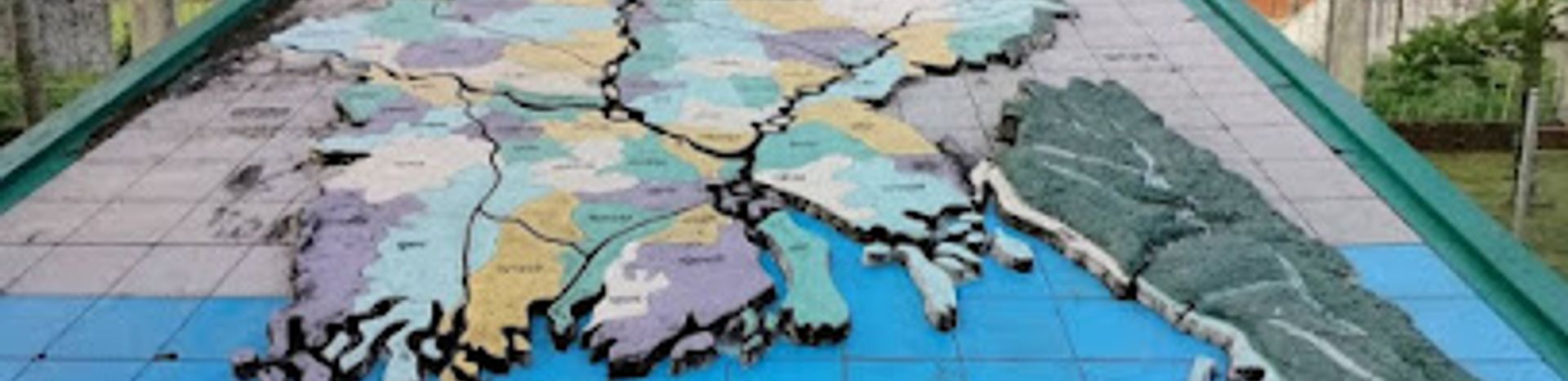
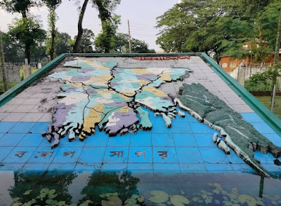
A brief summary to Map of Bangladesh
- Q66G+Q3W, Rangpur Cantonment - Ghagat Bridge Rd, Shatgara, BD
- +8801990-050795
Local tips
- Visit during the early morning or late afternoon for a more serene experience and better lighting for photography.
- Engage with local guides who can provide deeper insights into the historical significance of each landmark.
- Don't miss the local markets nearby; they offer unique handicrafts and traditional snacks.
- Wear comfortable shoes as you may need to walk a fair bit to explore the landmarks.
- Check local weather conditions before your visit to ensure a pleasant experience.
Getting There
-
Car
If you are driving, head towards Shatgara by following the main roads connecting to Rangpur. From Rangpur city center, take the Rangpur Cantonment - Ghagat Bridge Rd (also known as the Shatgara Road). Continue on this road for about 10 km until you reach the coordinates Q66G+Q3W, which is a historical landmark. Keep an eye on road signs to guide you as you approach Shatgara.
-
Public Transportation
To reach Shatgara using public transportation, take a local bus or a shared van from Rangpur to Shatgara. Buses and vans frequently leave from the Rangpur bus terminal, and the fare is typically around 30 BDT (Bangladeshi Taka). The journey takes about 30-40 minutes. Once you arrive in Shatgara, you can either walk or take a local rickshaw to the historical landmark located at the coordinates Q66G+Q3W.
-
Rickshaw
If you are already in Shatgara and need to reach the Map of Bangladesh, consider hiring a local rickshaw. The fare is generally 50-100 BDT, depending on the distance. Make sure to agree on the price before starting your journey. The rickshaw driver will be familiar with the landmark and can take you directly to Q66G+Q3W on Rangpur Cantonment - Ghagat Bridge Rd.
Discover more about Map of Bangladesh
Iconic landmarks you can’t miss
Map of Bangladesh
0.0 km
Explore the rich historical landmarks of Shatgara, Bangladesh, where culture and heritage come alive in every corner.
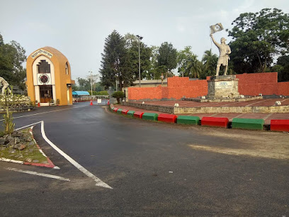
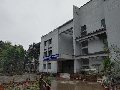
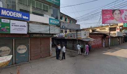
Rangpur Cantonment
0.7 km
Discover the rich military heritage and tranquil beauty of Rangpur Cantonment, a unique destination for history enthusiasts and nature lovers.
Circuit House, Rangpur
1.6 km
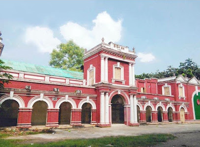
Explore the Circuit House in Rangpur, a historical gem showcasing colonial architecture and an ancient cannon set within beautiful gardens.
Caspia The Home
1.6 km
Experience the vibrant flavors of Bangladeshi cuisine at Caspia The Home, a culinary gem in Rangpur, perfect for tourists and locals alike.
Rangpur Judge Court
2.1 km
Explore the architectural beauty and historical significance of Rangpur Judge Court, a landmark of justice in Bangladesh.
Rangpur Zero Point
2.2 km
Experience the vibrant history and culture at Rangpur Zero Point, a bustling landmark in the heart of Rangpur, Bangladesh.
Divisional Passport and Visa Office, Rangpur
2.2 km
Explore Rangpur with ease by visiting the Divisional Passport and Visa Office, your essential stop for travel documentation in Bangladesh.
Rangpur Bus Terminal
2.2 km
Experience the vibrant energy of Rangpur Bus Terminal, a vital transit hub connecting you to the heart of northern Bangladesh.
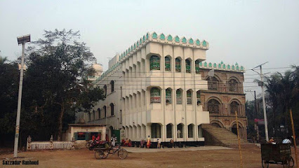
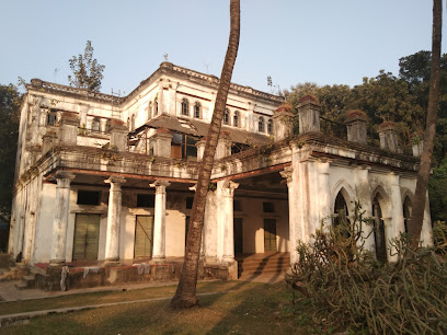
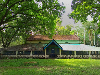
জাদু নিবাস (Jadu Nibash)
2.3 km
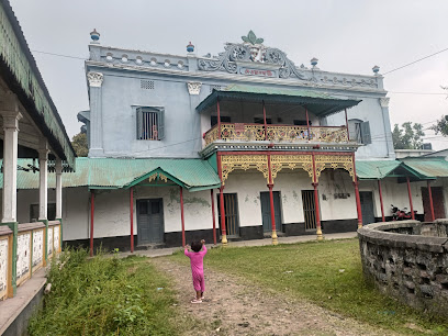
Discover the historical charm of Jadu Nibash in Rangpur, a stunning landmark that reflects Bangladesh's rich cultural heritage and architectural beauty.
Bangladesh
3.2 km
Discover the rich spiritual and cultural heritage of Rangpur, a hidden gem in Bangladesh, filled with temples, local crafts, and authentic experiences.
Rangpur Tourism
3.4 km
Explore Rangpur's rich history, vibrant culture, and stunning landscapes in the heart of Bangladesh for an unforgettable travel experience.
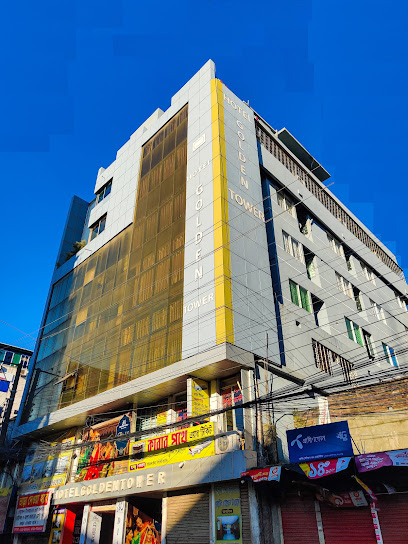
Hotel Golden Tower
3.4 km
Discover comfort and convenience at Hotel Golden Tower in Rangpur, your ideal base for exploring the rich culture and history of Bangladesh.
Grand Palace Hotel
3.7 km
Discover the elegance of Grand Palace Hotel in Rangpur, Bangladesh – a perfect blend of comfort and culture.

আলোকবর্তিকা
4.0 km
Discover the rich heritage and architectural beauty of Ālakabarṭikā in Rangpur, a historical landmark that tells the stories of Bangladesh's past.
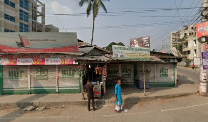
Cigarette company mor
5.4 km
Discover the rich industrial heritage of Rangpur at Cigarette Company Mor, a stunning historical landmark reflecting the city's cultural significance.

Unmissable attractions to see
Krishnochura Road/কৃষ্ণচূড়া রোড
2.3 km
Discover the vibrant beauty of Krishnochura Road, a picturesque attraction in Rangpur, adorned with stunning blossoms and local charm.
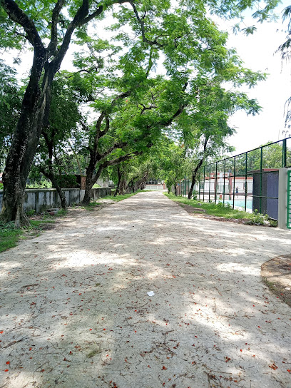
Collectorate Surovi Uddan
2.4 km
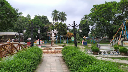
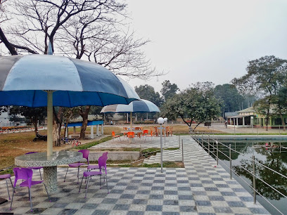
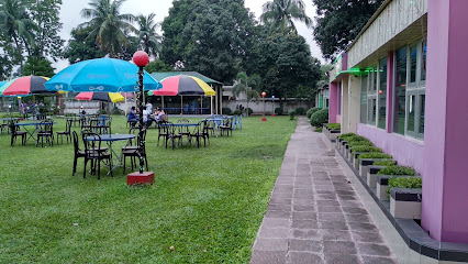
Experience tranquility at Collectorate Surovi Uddan, a lush park in Rangpur perfect for relaxation, exercise, and family outings amidst nature's beauty.

Proyash Sena Binodon Park
2.5 km
Discover the vibrant Proyash Sena Binodon Park in Rangpur, where nature meets adventure in a family-friendly atmosphere filled with fun and excitement.
Chiklee Water Park
2.5 km
Discover the joy of water adventures at Chiklee Water Park in Rangpur, a family-friendly destination filled with thrilling rides and lush relaxation areas.
চিকলী ওয়াটার পার্ক রংপুর, সেলফি জোন
2.5 km
Experience tranquility at Rangpur Park, an oasis of lush greenery and vibrant atmosphere in the heart of Rangpur, perfect for relaxation and exploration.
Chiklee Water Park, Rangpur
2.7 km
Experience the ultimate water adventure at Chiklee Water Park in Rangpur, a fun-filled destination for families and thrill-seekers alike.
Rangpur Zoo Children's Park
2.7 km
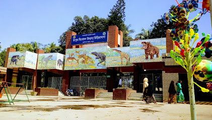
Discover the charm of Rangpur Zoo Children's Park, a delightful family destination filled with wildlife, play areas, and natural beauty in Rangpur, Bangladesh.
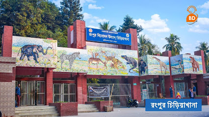
Rangpur Zoo
2.8 km
Discover Rangpur Zoo, a vibrant wildlife haven in Bangladesh showcasing diverse species and promoting conservation efforts for a memorable family outing.
Rangpur Town Hall
2.8 km
Explore the architectural beauty and vibrant culture of Rangpur Town Hall, a historical gem at the heart of Rangpur, Bangladesh.
Dewanbari
3.1 km
Explore the rich history of Rangpur at Dewanbari, a captivating museum showcasing the cultural heritage of Bangladesh.
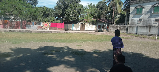
Bhāṅgani beel
5.5 km
Explore the enchanting Bhāṅgani Beel in Rajendrapur, a serene wetland perfect for nature lovers and birdwatching enthusiasts.

Brindabon
5.5 km
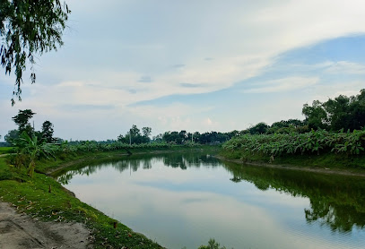
Discover the serene beauty of Brindabon, a tranquil garden in Rangpur perfect for relaxation and a taste of nature's splendor.
Tista Project Park
5.8 km
Experience the serene beauty of Tista Project Park in Rangpur, a lush green oasis perfect for relaxation and cultural immersion.
পুকুর ঘাট, কারমাইকেল কলেজ
5.9 km
Explore the serene beauty of Pukur Baat, a tranquil lake in Rangpur, perfect for relaxation, picnics, and immersing in nature.
মরা নদী
6.0 km
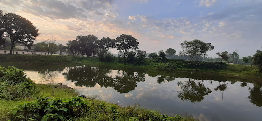
Experience the tranquil beauty of Mara Nadi, a serene tourist attraction in Shatgara, perfect for relaxation and nature exploration.
Essential places to dine
Poolside Snacks And Juice
0.5 km
Experience the perfect blend of relaxation and refreshment at Poolside Snacks and Juice in Rangpur.
Cafe 66
0.7 km
Experience delightful local flavors at Café 66 in Rangpur – where tradition meets taste in a cozy atmosphere.
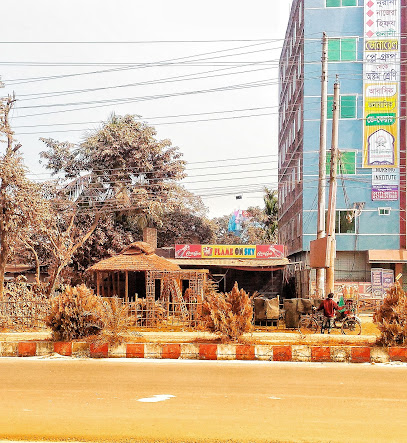
Flame On Sky
0.8 km
Experience culinary excellence at Flame On Sky in Rangpur with diverse menus blending local flavors and international cuisine.
Rangpur Kara Canteen
0.8 km
Experience authentic Bangladeshi flavors at Rangpur Kara Canteen, where local cuisine meets a vibrant atmosphere.

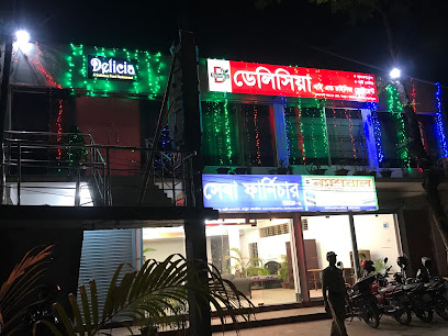
Delicia Thai And Chinese Restaurant
0.8 km
Experience the best of Asian cuisine at Delicia Thai and Chinese Restaurant in Rangpur - where flavors meet tradition.
Thikana Restaurant
0.8 km
Discover authentic Bangladeshi flavors at Thikana Restaurant in Rangpur – where tradition meets taste.

Boishakhi Hotel & Restora, Dhap
0.8 km
Experience the rich flavors of Bangladesh at Boishakhi Hotel & Restaurant in Rangpur - where tradition meets taste.

Bhinnota Hotel & Restaurant
0.9 km
Discover authentic Bangladeshi cuisine at Bhinnota Hotel & Restaurant in Rangpur – where flavor meets hospitality.

Bondhu Hotel & Restaurant
0.9 km
Experience the rich flavors of Bangladesh at Bondhu Hotel & Restaurant in Rangpur - where tradition meets taste.
Dhaka Fast Food's
0.9 km
Experience local flavors at Dhaka Fast Food's in Rangpur – where delicious meets convenience in every bite!
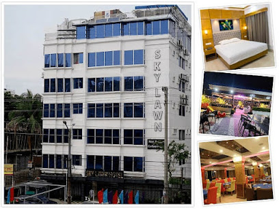
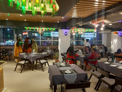
SKY LAWN Hotel & Restaurant
1.0 km
Experience exquisite dining with breathtaking views at SKY LAWN Hotel & Restaurant in Rangpur.
Sobuj Hotel & Restora
1.1 km
Experience authentic Bangladeshi flavors at Sobuj Hotel & Restora on the Rangpur-Dinajpur Highway.
Raihan Hotel & Restaura
1.1 km
Discover the rich flavors of traditional Bangladeshi cuisine at Raihan Hotel & Restaurant in Rangpur.
The Grand Castle - Restaurant & Party Center
1.2 km
Discover culinary delights at The Grand Castle in Rangpur – where tradition meets taste in an elegant setting.
Raju Hotel and Restaurant
1.2 km
Experience the essence of Bangladeshi cuisine at Raju Hotel and Restaurant in Rangpur - where every meal tells a story.
Markets, malls and hidden boutiques
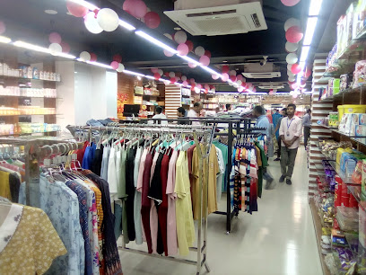
RAMC Shopping Complex
0.7 km
Experience the essence of Rangpur at RAMC Shopping Complex, where shopping meets local culture and entertainment in a vibrant atmosphere.
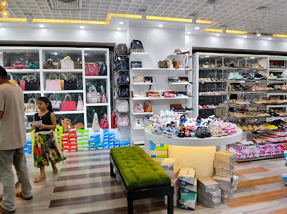
Karupannya
0.7 km
Discover a vibrant shopping experience at Karupannya in Rangpur, offering groceries, carpets, jewelry, and more in one convenient location.
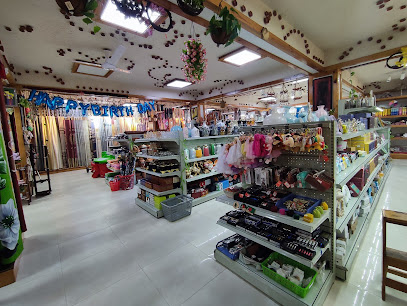
Robul Store
1.5 km
Discover unique home goods at Robul Store, a must-visit destination in Rangpur for tourists seeking local crafts and charming souvenirs.
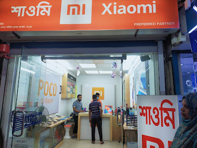
Mi authorized store
3.1 km
Explore the latest in mobile technology and accessories at the Mi Authorized Store in Rangpur's bustling market.
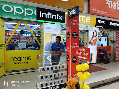
STR Mobile Gallery
3.2 km
Discover the latest mobile technology at STR Mobile Gallery in Rangpur, a vibrant hub for tech enthusiasts and savvy shoppers.
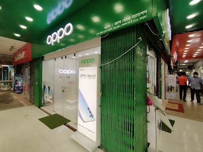
OPPO Jannat Mobile Zone (কোম্পানি কর্তৃক পরিচালিত)
3.2 km
Stay connected in Rangpur at OPPO Jannat Mobile Zone – your destination for the latest smartphones and accessories.
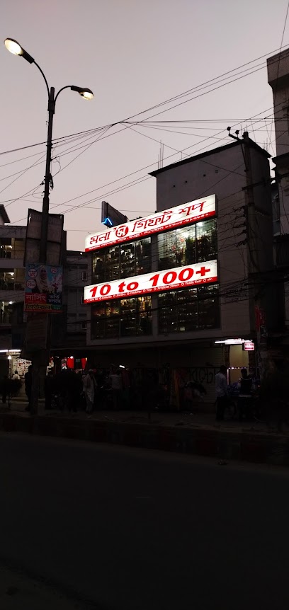
1 to 100
3.3 km
Explore a vibrant gift shop in Rangpur, offering unique Asian household goods and handcrafted treasures that embody local culture and craftsmanship.
Gift Palace
3.3 km
Explore Gift Palace in Rangpur for unique souvenirs and local crafts that capture the essence of Bangladesh, perfect for tourists and gift enthusiasts.
Saimas Collection
3.4 km
Explore Saimas Collection in Rangpur for unique gifts, stylish clothing, and exquisite glassware that capture the essence of local craftsmanship.
Asif Crocaries
3.4 km
Discover the essence of Bangladeshi culture at Asif Crocaries, a charming gift shop in Rangpur offering unique handicrafts and souvenirs.
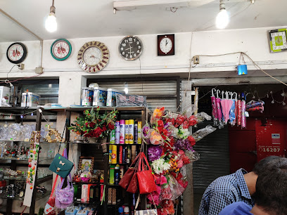
Mona Gifts Shop (10 to 100 Super shop)
3.4 km
Discover the essence of Bangladesh with unique handcrafted gifts at Mona Gifts Shop in Rangpur, a treasure trove for tourists seeking authentic souvenirs.
1 to 99 + Shop
3.4 km
Explore 1 to 99 + Shop in Rangpur for unique gifts and local handicrafts that celebrate Bangladeshi culture and craftsmanship.
Jahaz Company More
3.4 km
Discover the historical charm of Jahaz Company More in Rangpur, a landmark that reflects the rich heritage and culture of Bangladesh.
Vintage World
3.4 km
Explore Vintage World in Rangpur: A vibrant shopping mall offering local crafts, dining, and entertainment for a unique cultural experience.
Touch Gift Shop
3.5 km
Explore Touch Gift Shop in Rangpur for unique souvenirs and local handicrafts that embody the spirit of Bangladesh.

Essential bars & hidden hideouts
Sports Bd Line
0.8 km
Dive into the excitement of live sports at Sports Bd Line, a must-visit sports bar in Dhaka with great food and an electrifying atmosphere.
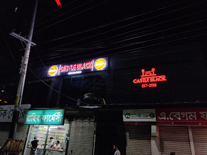
Castle Black
1.2 km
Experience the vibrant fusion of Bangladeshi and international cuisines at Castle Black, a must-visit restaurant in Dhaka.
কিংডম of তোজাম্মেল
1.5 km
Discover the vibrant nightlife at Kingdom of Tojammel, a bar in Rangpur offering local flavors and a lively atmosphere to unwind and connect.
MD Abul Hossain
3.2 km
Experience the charm of Rangpur at MD Abul Hossain, a cozy bar offering local flavors and a warm atmosphere for relaxation.
শাওন ফুড
3.6 km
Experience authentic Bangladeshi flavors at Shawon Food in Rangpur, where every dish tells a story of tradition and taste.
BD Food Hotel & Bar
3.7 km
Discover the vibrant flavors of Rangpur at BD Food Hotel & Bar, where culinary delights and a lively atmosphere await your visit.

হাবিব পান বিতান
3.7 km
Experience the heart of Rangpur's social scene at Habib Pan Bitan, a lively bar offering flavorful pan and refreshing beverages.
Samsul
4.0 km
Experience the vibrant nightlife at Samsul, a must-visit bar in Rangpur offering local drinks, delicious snacks, and live music.
Nepan hom
4.0 km
Experience the vibrant nightlife of Rangpur at Nepan Hom, a welcoming bar offering local flavors and a lively atmosphere.

AyshaLoy
4.3 km
Experience the soothing ambiance of AyshaLoy, Rangpur's premier lounge for relaxation and socializing, perfect for a casual outing or unwinding after exploring the city.
কেরাইম রোড
4.4 km
Discover the vibrant bar scene of Keraim Road in Rangpur, where local culture meets relaxation in a lively atmosphere.
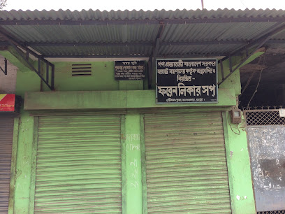
ফরেন লিকার সপ
4.5 km
Experience the vibrant atmosphere and diverse drink selection at ফরেন লিকার সপ, the go-to bar in Rangpur for both locals and tourists.
মনছূর
4.7 km
Unwind at Monchur, a vibrant bar in Rangpur offering local drinks, lively music, and a lively atmosphere perfect for tourists and locals alike.
Chinu Chatro Restroom
5.4 km
Discover comfort and cleanliness at Chinu Chatro Restroom, the perfect resting spot for travelers in Rangpur, Bangladesh.
Nur Tea
5.4 km
Experience the warm ambiance and unique beverage offerings of Nur Tea, a charming bar in Rangpur that invites relaxation and connection.