
Skyline Trail: Cape Breton's Coastal Crown Jewel
Hike Cape Breton's iconic Skyline Trail for breathtaking coastal views and unforgettable Highlands scenery. A must-see on the Cabot Trail.
The Skyline Trail in Cape Breton Highlands National Park is a renowned hiking experience, offering breathtaking views of the Cabot Trail and the Gulf of St. Lawrence from dramatic headland cliffs. This well-maintained trail is known for its accessibility and stunning coastal scenery, making it a must-visit destination within the park.
A brief summary to Skyline Trail
- Inverness County, Nova Scotia, CA
Local tips
- Arrive early or later in the day to avoid crowds, as the parking lot often fills up between 11 a.m. and 4 p.m..
- Bring layers, as the weather can change quickly, and the headland can be windy.
- Stay on the boardwalk to protect the fragile vegetation and for your safety.
- Purchase a Parks Canada pass in advance online or at the visitor centers in Chéticamp or Ingonish.
- Check the Parks Canada website for trail conditions and closures before you go.
Getting There
-
Driving
The Skyline Trail is located off the Cabot Trail, approximately 15 minutes north of Chéticamp. From Chéticamp, follow the Cabot Trail north. The trailhead is well-marked with signs. The parking lot is on the left. Be aware that parking is limited, especially during peak season. It is illegal to stop on the Cabot Trail or in emergency shelter parking lots if the Skyline Trail parking is full. There is no fee for parking, but a valid Parks Canada pass is required to access the trail. These can be purchased at the park entrance or at visitor centers in Chéticamp or Ingonish.
-
Public Transport
While there is no direct public transportation to the Skyline Trail trailhead, you can take a bus to Whycocomagh and then a taxi to the trail. Bus fares from Halifax to Whycocomagh typically range from $40 - $60. A taxi from Whycocomagh to the Skyline Trail can cost between $180 - $250. Alternatively, you can take a bus to Wagmatcook from Halifax. A taxi from Wagmatcook to the Skyline Trail also costs between $180 - $250.
Discover more about Skyline Trail
Iconic landmarks you can’t miss
Skyline Trail
0.0 km
Hike Cape Breton's iconic Skyline Trail for breathtaking coastal views and unforgettable Highlands scenery. A must-see on the Cabot Trail.

Skyline Trail Cape Breton Highland National Park
2.2 km
Hike the iconic Skyline Trail in Cape Breton Highlands National Park for breathtaking coastal views and unforgettable vistas.
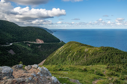
Corney Brook Trail
3.8 km
An easy, family-friendly hike through Acadian forest to a charming waterfall in Cape Breton Highlands National Park.
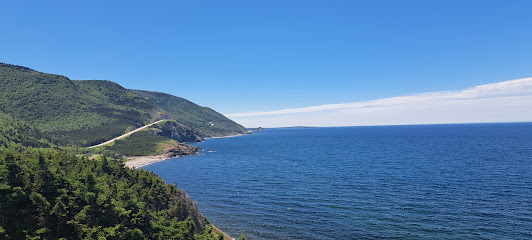
North Mountain look-off - The Aspy Fault
19.8 km
Breathtaking views of the Aspy Fault from North Mountain, a must-see stop along Cape Breton's Cabot Trail. Perfect for nature lovers and photographers.
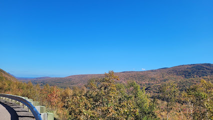
White Point Trailhead
42.9 km
Explore scenic coastal trails with historic charm at White Point Trailhead near Dingwall, Cape Breton. Breathtaking views and natural beauty await!

Kidston Island
72.7 km
Discover the serene beauty of Kidston Island, a hidden gem in Nova Scotia, perfect for nature lovers and those seeking tranquility.
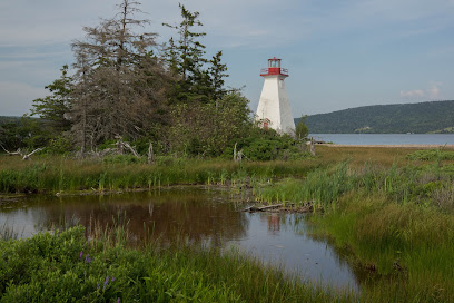
Unmissable attractions to see
French Mountain
1.0 km
Discover the breathtaking beauty of French Mountain in Nova Scotia, where panoramic views and adventure await outdoor enthusiasts and nature lovers alike.
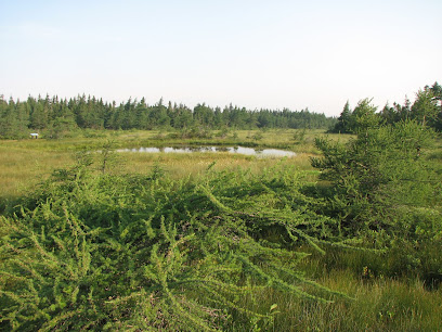
Bog Trailhead
4.1 km
Discover the serene beauty of the Bog Trailhead along the Cabot Trail, a must-visit hiking area in Nova Scotia, where nature and tranquility await.
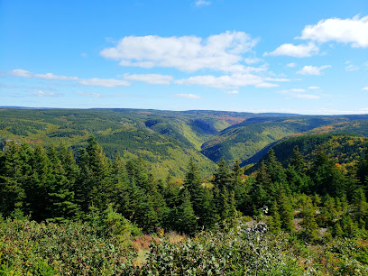
Le Vieux Chemin du Cap-Rouge Trailhead
5.0 km
Discover breathtaking views and enchanting landscapes on the Le Vieux Chemin du Cap-Rouge Trailhead along Nova Scotia's iconic Cabot Trail.
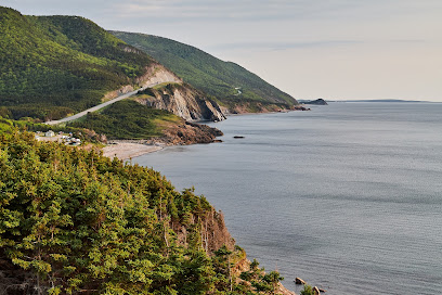
Whale Interpretive Centre
11.5 km
Explore the Whale Interpretive Centre in Pleasant Bay for an unforgettable journey into the world of whales and marine conservation.
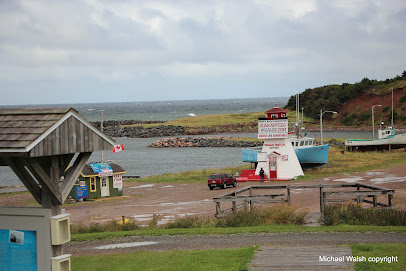
Acadian Trailhead
11.8 km
Explore the breathtaking trails of Acadian Trailhead in Cape Breton Highlands, a must-visit hiking destination for nature lovers and adventure seekers.
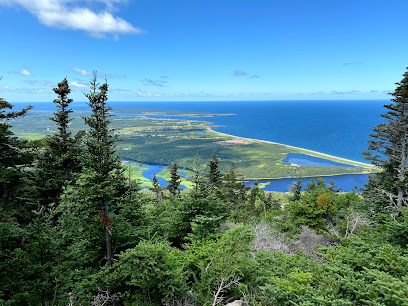
Salmon Pools Trailhead
12.1 km
Discover the natural beauty of Salmon Pools Trailhead in Nova Scotia, a stunning hiking area along the scenic Cabot Trail, perfect for outdoor adventures.
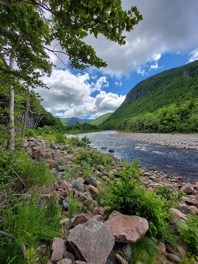
The Lone Shieling
13.6 km
Explore The Lone Shieling, a historical landmark in Nova Scotia, where nature meets rich Scottish heritage along the picturesque Cabot Trail.
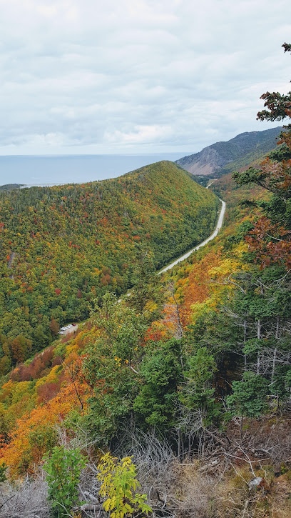
Gypsum Mine Lake, Accolade Hostel Retreat Campground
14.8 km
Experience the enchanting beauty of Gypsum Mine Lake at Accolade Hostel Retreat Campground, where adventure meets tranquility in Nova Scotia.
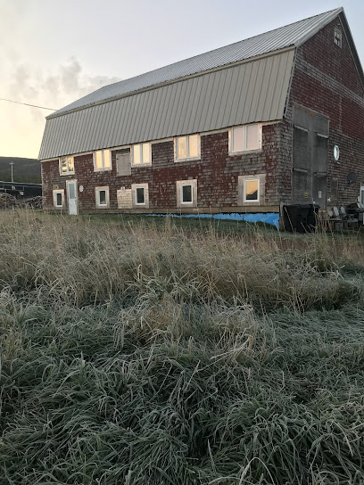
Gampo Abbey
17.1 km
Discover Gampo Abbey, a serene Buddhist temple in Nova Scotia, offering spiritual enrichment and stunning natural beauty near the Cape Breton Highlands.

Cape Breton Highlands National Park
17.5 km
Discover the natural wonders of Cape Breton Highlands National Park, where stunning views and outdoor adventures await in Nova Scotia's pristine wilderness.
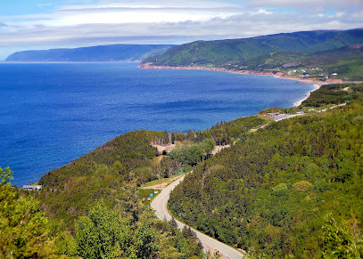
Cape Breton Highlands
21.6 km
Experience the breathtaking beauty of Cape Breton Highlands, a paradise of rugged cliffs, lush landscapes, and rich wildlife in Nova Scotia.
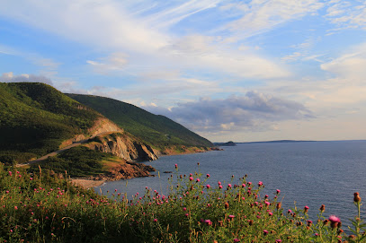
Margaree River Wilderness Area
26.9 km
Explore the Margaree River Wilderness Area, a nature preserve in Nova Scotia offering breathtaking landscapes and diverse wildlife for the adventurous traveler.
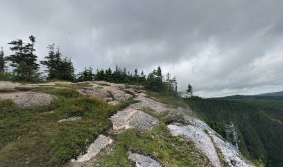
Cabot Trail
29.6 km
Discover the breathtaking Cabot Trail, a scenic route through Nova Scotia's stunning landscapes, charming towns, and vibrant culture.
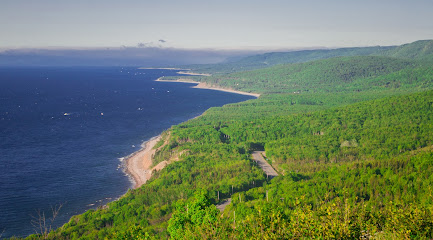
Cabots Landing Provincial Park
38.8 km
Explore the captivating Cabot's Landing Provincial Park, where natural beauty meets rich history in Nova Scotia's stunning coastline.
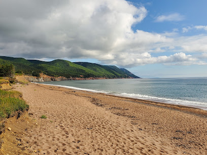
Middle Head Hiking Trail
40.8 km
Explore the breathtaking Middle Head Hiking Trail in Nova Scotia, a perfect blend of stunning coastal views and tranquil forest paths.
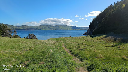
Essential places to dine
Rusty Anchor Restaurant
10.3 km
Experience fresh seafood delights at Rusty Anchor Restaurant on Nova Scotia's scenic Cabot Trail - perfect for family dining.
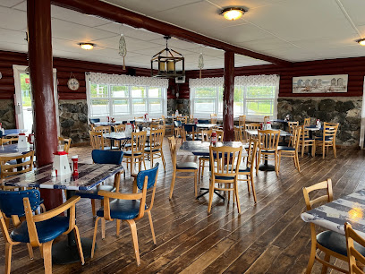
The Mountain View Restaurant
10.8 km
Experience local flavors and breathtaking views at The Mountain View Restaurant in Pleasant Bay, Nova Scotia.

Highland Breeze Bistro
10.9 km
Experience authentic Nova Scotian cuisine at Highland Breeze Bistro in Inverness County—where local flavors meet warm hospitality.
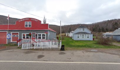
L'abri café, restaurant et bar
14.5 km
Discover L'abri Café in Chéticamp: where local flavors meet stunning views along Nova Scotia's famous Cabot Trail.

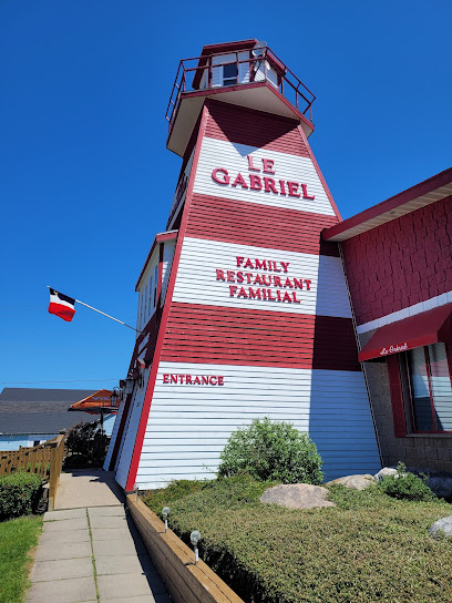
Le Gabriel Restaurant & Lounge
15.2 km
Discover authentic Nova Scotian flavors at Le Gabriel Restaurant & Lounge in Chéticamp - where fresh seafood meets warm hospitality.
Harbour Restaurant and Bar
15.7 km
Discover exquisite seafood dining at Harbour Restaurant and Bar along Nova Scotia's scenic Cabot Trail - where freshness meets flavor.

The Newland's Island cuisine
16.0 km
Experience authentic Nova Scotian cuisine at Newland's Island, where fresh local ingredients meet warm hospitality amidst breathtaking coastal views.

Morrison's Restaurant
32.6 km
Discover delicious seafood and local cuisine at Morrison's Restaurant on the scenic Cabot Trail in Cape North, Nova Scotia.

Angies Family Restaurant & Pizza
33.0 km
Discover Angies Family Restaurant & Pizza in Cape North - where delicious comfort food meets breathtaking views along the Cabot Trail.
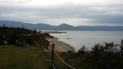
South Harbour Pines woodfired pizza
34.4 km
Experience authentic wood-fired pizza amidst the breathtaking landscapes of Cape Breton Island at South Harbour Pines.

Danena's Bakery & Bistro
34.4 km
Experience the best of Cape Breton at Danena's Bakery & Bistro—where every bite tells a story amidst stunning coastal views.
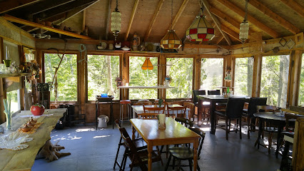
Crofter's Table Restaurant & Thirsty Hiker Pub
36.8 km
Experience authentic Cape Breton flavors at Crofter's Table Restaurant & Thirsty Hiker Pub along the scenic Cabot Trail.

Belle View Restaurant Ltd
36.8 km
Experience coastal dining at its finest with breathtaking views and locally sourced cuisine at Belle View Restaurant in Nova Scotia.

Coastal Restaurant & Pub
37.7 km
Discover Coastal Restaurant & Pub in Ingonish - where fresh seafood meets scenic views along the Cabot Trail.

Main Street Restaurant
38.0 km
Experience local flavors at Main Street Restaurant on the scenic Cabot Trail in Ingonish Beach – where great food meets stunning views.

Markets, malls and hidden boutiques
Cardinal Points Gift Shop
10.7 km
Explore the heart of Nova Scotia through unique local crafts and souvenirs at Cardinal Points Gift Shop, a gem along the Cabot Trail.

The Bargain! Shop
15.2 km
Explore The Bargain! Shop in Petit Étang for unique local products, great deals, and a welcoming shopping experience in Nova Scotia.

Lola's Hooked Rugs
15.5 km
Explore the beautiful craftsmanship of hand-hooked rugs and unique local gifts at Lola's Hooked Rugs in Chéticamp, Nova Scotia.

Marguerite boutique et provisions
15.6 km
Explore Marguerite Boutique et Provisions for a unique blend of local groceries, vintage finds, and a cozy café experience in Chéticamp.

Flora's Cabot Trail
20.3 km
Experience the best of Nova Scotia at Flora's Cabot Trail, where delicious ice cream meets unique local shopping in a stunning coastal setting.

T & R Crafts & Gifts
29.2 km
Uncover the beauty of local craftsmanship at T & R Crafts & Gifts in Cape North, Nova Scotia, where every item tells a story.
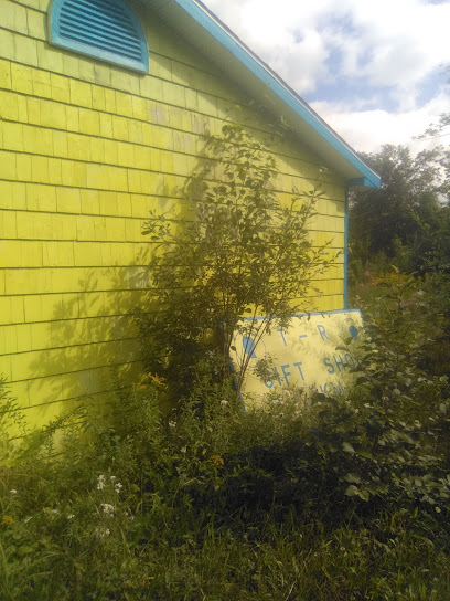
Cabot Trail Food Market Ltd
33.1 km
Explore the essence of Nova Scotia at Cabot Trail Food Market Ltd, your go-to stop for local groceries and unique regional flavors.

Courtney's Country Crafts
34.4 km
Discover unique handcrafted treasures at Courtney's Country Crafts, a charming craft store on the scenic Cabot Trail in Nova Scotia.

Tartans and Treasures
34.4 km
Explore Tartans and Treasures in Dingwall, Nova Scotia - a unique store offering authentic Scottish goods and local crafts along the scenic Cabot Trail.

Margaree Harbour Craft & Gift Shop
39.3 km
Explore the charm of Margaree Harbour Craft & Gift Shop, where local artisans showcase their unique crafts and gifts along the stunning Cabot Trail.

Sew Inclined
41.8 km
Discover unique handmade hats and local craftsmanship at Sew Inclined, the must-visit hat shop in Englishtown, Nova Scotia.

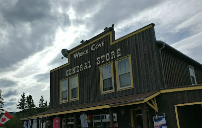
Wreck Cove General Store
42.8 km
Discover the perfect blend of convenience and local charm at Wreck Cove General Store on the stunning Cabot Trail.
Wildfire Pottery
46.9 km
Explore the beauty of handcrafted ceramics at Wildfire Pottery, a unique store along the scenic Cabot Trail in Nova Scotia.

Two Macs Gallery
47.1 km
Explore Two Macs Gallery: A treasure trove of Cape Breton crafts and art in North East Margaree, perfect for unique gifts and local souvenirs.

Myles From Nowhere
48.5 km
Explore Myles From Nowhere, where history meets charm in Inverness County's finest antique store, filled with timeless treasures.

Essential bars & hidden hideouts
The Doryman Pub and Grill
14.7 km
Experience the warmth and local flavors at The Doryman Pub and Grill, a must-visit destination on the Cabot Trail in Chéticamp, Nova Scotia.

Thirsty Hiker Pub
36.8 km
Discover the warmth of Cape Breton at Thirsty Hiker Pub, where local brews and hearty meals await after your adventure on the Cabot Trail.

Purple Thistle
39.7 km
Experience the essence of Nova Scotia at Purple Thistle, where local flavors and breathtaking views create an unforgettable dining experience.
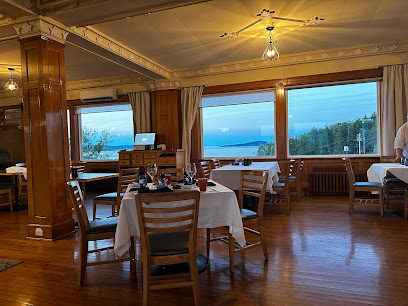
Castle Rock Country Inn
40.4 km
Discover the perfect blend of comfort and culinary delight at Castle Rock Country Inn on the iconic Cabot Trail.

Normaway Inn Music Barn
45.7 km
Discover the heart of Nova Scotia's music scene at Normaway Inn Music Barn, a cozy venue in Margaree Valley with unforgettable live performances.

Route 19 Brewing
64.4 km
Experience the vibrant craft beer culture at Route 19 Brewing in Inverness, Nova Scotia, where local flavors meet a unique dining atmosphere.

Cabot bar
64.8 km
Discover Cabot Bar in Mabou, Nova Scotia – a picturesque spot for craft drinks and breathtaking views along the Cabot Trail.

Blue Mist Dining Room and Lounge
70.7 km
Discover the warmth of Nova Scotia at Blue Mist Dining Room and Lounge, where local flavors meet a charming pub atmosphere.

The Narrows Cafe and Bar
72.4 km
Discover the flavors of Nova Scotia at The Narrows Cafe and Bar, where stunning views meet exquisite cuisine in Baddeck.

The Underground
74.7 km
Discover the lively nightlife at The Underground in Sydney Mines, where locals and tourists mingle over cocktails and live music.

The Cellar Bar
76.5 km
Discover The Cellar Bar in North Sydney, Nova Scotia, where local brews and unique appetizers create a cozy dining experience.

Island Folk Cider House
84.8 km
Experience the vibrant flavors of Nova Scotia at Island Folk Cider House, where local ciders and a welcoming atmosphere await.

The French Club
84.9 km
Discover The French Club, a cozy bar in Sydney, where exquisite drinks meet a warm ambiance for the perfect evening.

Capri Cabaret
85.1 km
Discover the vibrant nightlife at Capri Cabaret, Sydney's premier destination for live music, dancing, and unforgettable entertainment.

The Crown Cafe & Bar
85.2 km
Experience the heart of Sydney at The Crown Cafe & Bar, where great food, drinks, and local culture come together in a vibrant pub setting.

Nightclubs & after hour spots
Le Portage Golf Club
14.3 km
Discover the scenic beauty and exceptional golfing experience at Le Portage Golf Club, a must-visit destination along Nova Scotia's Cabot Trail.

Cape Breton Highlands Links
39.0 km
Discover Cape Breton Highlands Links: A breathtaking golf experience amidst stunning natural beauty in Nova Scotia’s national park.

The Pit Lounge
87.8 km
Discover The Pit Lounge in Grand Lake Road, Nova Scotia, where creative cocktails meet a cozy atmosphere for a memorable night out.

Row St Club
89.9 km
Discover the lively atmosphere of Row St Club in Glace Bay, a perfect spot for drinks and local culture.


