
Mount Sherman: A Beginner-Friendly Fourteener
Hike Colorado's Mount Sherman, one of the easiest 14ers, and explore historic mining ruins with stunning views from the summit.
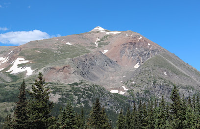
Mount Sherman, a 14,036-foot peak in Colorado's Mosquito Range, is one of the state's most accessible 14ers, attracting novice and experienced mountaineers alike. Named after General William Tecumseh Sherman, the mountain boasts a rich mining history, with remnants of old mining operations dotting its slopes.
A brief summary to Mt Sherman
- Colorado, US
Local tips
- Start your hike early to avoid afternoon thunderstorms, which are common in the area.
- Bring plenty of water, sunscreen, and layers of clothing, as the weather can change rapidly at high altitudes.
- A 4WD vehicle is recommended to reach the Fourmile Creek Trailhead, which sits at approximately 12,000 feet.
- Respect the private property by staying on marked trails and leaving all artifacts undisturbed.
- Acclimatize to the altitude before your hike to minimize the risk of altitude sickness.
Getting There
-
Driving
From Fairplay, drive south on US-285 for approximately 1 mile. Turn right onto County Road 18 (Fourmile Creek Road) and drive for 10 miles to the Leavick site. Continue on the dirt road, which may require a 4WD vehicle, for another 2 miles to reach the Fourmile Creek Trailhead at approximately 12,000 feet. Parking is free but can be limited, especially during peak season. Arrive early to secure a spot.
-
Walking
From the Fourmile Creek Trailhead, hike up the road past the gate. Follow the trail for approximately 2.6 miles to reach the summit. The trail is well-maintained but becomes steeper and rockier as you approach the summit. Be prepared for some basic scrambling.
Discover more about Mt Sherman
Iconic landmarks you can’t miss
Leadville mining district
9.7 km
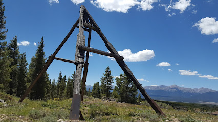
Explore the stunning landscapes and rich history of the Leadville mining district, a unique destination in Colorado's Rocky Mountains.
Inn the Clouds Hostel & Inn
10.4 km
Discover the charm of Leadville, CO, at Inn the Clouds Hostel & Inn, your cozy base for mountain adventures and cultural exploration.

Leadville Railroad
10.5 km
Discover the breathtaking scenery of Colorado aboard the historic Leadville Railroad, a unique travel experience through the Rockies.

Leadville ATV Tours
10.6 km
Experience the thrill of the Colorado Rockies with unforgettable ATV tours in Leadville, where adventure meets stunning natural beauty.

Casa Blanca Restaurant
10.6 km
Experience the vibrant flavors of Mexico at Casa Blanca Restaurant, a beloved eatery in Leadville, Colorado, serving authentic dishes in a cozy setting.

Leadville Motor Lodge (Previous known as Mountain Peaks Motel)
10.6 km
Discover the charm of Leadville Motor Lodge, your cozy base for adventure in the stunning Rocky Mountains of Colorado.

Two Mile Brewing Co
10.6 km
Experience the unique charm of Two Mile Brewing Co, where craft beer meets breathtaking mountain views in Leadville, Colorado.

Tennessee Pass Cafe
10.7 km
Explore the heart of Leadville at Tennessee Pass Cafe, where delicious meals and warm hospitality await in a picturesque mountain setting.

FREIGHT
10.7 km
Discover the perfect blend of history and modern luxury at FREIGHT, your ideal hotel in Leadville, Colorado for adventures and special events.

The Abbey
10.7 km
Discover The Abbey, your cozy inn in Leadville, Colorado, blending rustic charm with modern amenities for an unforgettable stay.
Moe's Original BBQ - Leadville
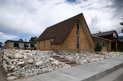
10.7 km
Experience authentic Southern barbecue in the heart of Leadville, Colorado, where mouthwatering flavors meet a cozy mountain atmosphere.

S.L.umber Yard
10.7 km
Discover the charm and comfort of S.L.umber Yard in Leadville, Colorado, your perfect base for Rocky Mountain adventures and relaxation.

The Famous
10.8 km
Discover The Famous in Leadville, CO – a pizza lover's paradise that combines local flavors, cozy ambiance, and a taste of history.

Tiny House Leadville
10.8 km
Experience the charm of Tiny House Leadville, a unique motel nestled in the heart of Colorado's stunning Rocky Mountains, perfect for your next getaway!

The Legendary Silver Dollar Saloon
10.8 km
Discover the historic charm and vibrant atmosphere of The Legendary Silver Dollar Saloon in Leadville, Colorado, where great food and drinks meet local culture.

Unmissable attractions to see
Mosquito Pass
6.4 km
Experience a thrilling off-road journey through history on Mosquito Pass, one of Colorado's highest and most scenic mountain passes. Open seasonally to 4x4 vehicles.
Matchless Mine
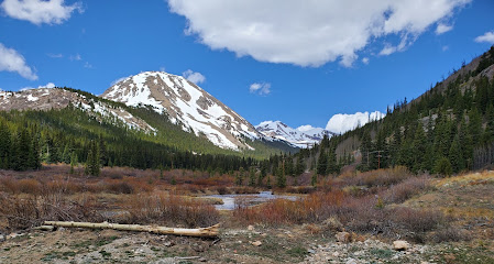
9.4 km
Explore a legendary silver mine and the poignant story of Baby Doe Tabor in Leadville, Colorado's historic mining district.
Tabor Opera House
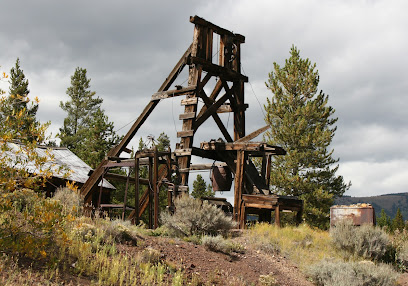
10.7 km
Experience the grandeur of the Wild West at Leadville's Tabor Opera House, a beautifully preserved landmark hosting tours and performances.

Tabor Home Museum
10.8 km
Explore the preserved home of Silver King Horace Tabor in Leadville, Colorado, and discover the captivating stories of wealth, love, and loss.

House With the Eye Museum
10.8 km
Explore Leadville's history through the all-seeing eye. A unique museum experience filled with artifacts and stories from the past.

Temple Israel Museum
10.9 km
Explore the Jewish heritage of the Wild West in a beautifully restored 1884 frontier synagogue and museum in historic Leadville, Colorado.

The Leadville Heritage Museum
11.0 km
Discover Leadville's vibrant past at the Heritage Museum: Mining history, Ice Palace replica, and 10th Mountain Division exhibits await!

Healy House Museum & Dexter Cabin
11.0 km
Explore Victorian life in a booming silver town at Leadville's Healy House Museum & Dexter Cabin. History, gardens, and stunning mountain views await.
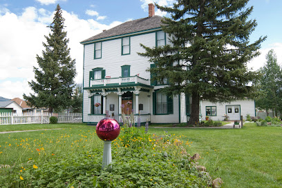
Ice Palace Park
11.1 km
Visit Ice Palace Park in Leadville, CO: a peaceful park commemorating the site of the historic, short-lived Leadville Ice Palace from 1896.

National Mining Hall of Fame and Museum
11.1 km
Explore the captivating world of mining history at Leadville's National Mining Hall of Fame, the 'Smithsonian of the Rockies'.

Dutch Henry Tubing Hill
11.7 km
Experience winter thrills at Dutch Henry Tubing Hill in Leadville, CO – free sledding, tube rentals, and stunning mountain views!

South Park
14.3 km
Explore the enchanting landscapes and rich history of South Park, Colorado - a perfect destination for adventure and relaxation in the heart of the Rockies.
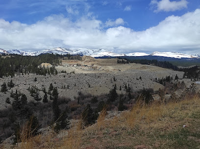
South Park City Museum
14.3 km
Experience life in a 19th-century Colorado mining town at South Park City Museum, featuring authentic buildings and artifacts from the Gold Rush era.
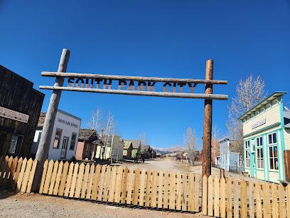
South Park Sign
14.8 km
Snap a photo with the South Park Sign in Fairplay, Colorado—a fun tribute to the iconic animated series and the real South Park basin.

Mt Lincoln
14.9 km
Conquer Colorado's majestic Mount Lincoln, the eighth-highest fourteener, for breathtaking views and a rewarding alpine adventure.
Essential places to dine
Wild Bill's Restaurant
10.6 km
Discover delicious hamburgers and American fast food at Wild Bill's Restaurant in scenic Leadville - where great taste meets local charm.

Subway
10.9 km
Experience fresh flavors at Subway in Leadville – your go-to spot for delicious sandwiches and quick meals amidst Colorado's stunning landscapes.

MTN Nutrition
11.2 km
Experience wholesome dining at MTN Nutrition in Leadville, CO - where health meets flavor amidst stunning mountain views.

El Mexicano Food Truck
11.3 km
Experience authentic Mexican flavors at El Mexicano Food Truck in Leadville—where every taco tells a story.

Isabella’s Kitchen
11.3 km
Discover Isabella's Kitchen in Leadville: where comfort food meets local charm amidst Colorado's stunning landscapes.

Sabor oaxaqueño
11.3 km
Discover authentic Oaxacan cuisine at Sabor Oaxaqueño in Leadville—where fast food meets rich cultural flavors.

Wicked Good Pizza: Leadville, CO
11.3 km
Experience the best pizza in Leadville at Wicked Good Pizza - where quality ingredients meet mountain charm.

Taco Bell
11.3 km
Experience delicious Mexican-inspired fast food at Taco Bell in Leadville – where quick bites meet vibrant flavors amidst Colorado's stunning scenery.

La Mina Tacos & Mariscos
11.4 km
Experience authentic Mexican cuisine at La Mina Tacos & Mariscos in Leadville - where every bite transports you to Mexico.

Shell
15.4 km
Experience convenience at Shell in Leadville: fuel up while enjoying friendly service and local snacks amidst Colorado's stunning scenery.

Mt. Massive Golf Course
16.2 km
Discover unparalleled golfing at Mt. Massive Golf Course in Leadville, Colorado - where breathtaking mountain views meet recreational fun.

Ridgeview Cafe
17.1 km
Experience the warmth and charm of Ridgeview Cafe in Leadville, Colorado - where delicious home-cooked meals meet breathtaking mountain views.

Tennessee Pass Cookhouse
17.5 km
Experience exquisite mountain dining at Tennessee Pass Cookhouse, where local flavors meet stunning alpine views.

The Overlook Restaurant
27.6 km
Experience breathtaking mountain views and exquisite Asian cuisine at The Overlook Restaurant in beautiful Breckenridge.

Vista Haus
28.3 km
Discover family-friendly dining at Vista Haus in Breckenridge - where breathtaking views meet delicious cuisine.

Markets, malls and hidden boutiques
Circle K
10.6 km
Discover convenience in Leadville with Circle K, your go-to spot for snacks, coffee, and essentials during your mountain adventures.

Earl's
10.7 km
Discover Earl's in Leadville for premium cannabis and a welcoming atmosphere that captures the spirit of Colorado's mountain culture.

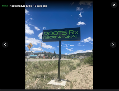
Roots Rx Leadville Dispensary
10.7 km
Discover Roots Rx Leadville Dispensary, a premier cannabis store in Colorado known for its quality products and exceptional customer service.
Leadville Outdoors and Mountain Market
10.7 km
Discover the adventure at Leadville Outdoors and Mountain Market, your one-stop-shop for outdoor gear, local beers, and authentic souvenirs.

Leadville Race Series Store
10.7 km
Discover high-quality outdoor gear and apparel at the Leadville Race Series Store, a haven for racing enthusiasts and adventure seekers in Colorado.

Cycles of Life
10.7 km
Experience the best of cycling with quality bikes and expert advice at Cycles of Life in Leadville, Colorado, your gateway to scenic adventures.

Elevation Goods
10.7 km
Explore Elevation Goods: A Boutique Destination in Leadville, CO, Offering Unique Outdoor Gear and Local Art.

Precision Peaks
10.7 km
Discover unique gifts and local craftsmanship at Precision Peaks, the charming gift shop in Leadville, Colorado, perfect for tourists seeking authentic souvenirs.

Blue Vessel Flower Shop
10.8 km
Discover the vibrant artistry of Blue Vessel Flower Shop in Leadville, where blossoms bloom in creative arrangements that capture the beauty of nature.

Iris Moon Emporium
10.8 km
Explore the Iris Moon Emporium in Leadville, Colorado—your destination for metaphysical supplies, local art, and holistic beauty products.

La Victoria Mexican Store & Snacks
10.8 km
Experience authentic Mexican flavors at La Victoria Mexican Store & Snacks, your go-to destination for fresh ingredients and delicious snacks in Leadville, Colorado.

Gigi's General Store
10.8 km
Explore Gigi's General Store in Leadville, Colorado, for unique handmade crafts and local treasures amidst stunning Rocky Mountain views.

City on a Hill Coffee & Espresso
10.8 km
Discover the charm of City on a Hill Coffee & Espresso, where artisanal brews and freshly baked treats await in the heart of Leadville, Colorado.

Zero Day Coffee
10.8 km
Experience the warmth of community and expertly crafted coffee at Zero Day Coffee in Leadville, Colorado - a perfect pitstop for adventurers.

Galena Mountain Projects
10.8 km
Discover high-quality outdoor clothing and gear at Galena Mountain Projects in Leadville, Colorado, where adventure awaits around every corner.

Essential bars & hidden hideouts
Scarlet Tavern
10.7 km
Discover the lively atmosphere of Scarlet Tavern in Leadville, Colorado, where craft cocktails and friendly faces await after your mountain adventures.

The Manhattan Bar
10.9 km
Experience the charm of Leadville at The Manhattan Bar, where friendly service meets a cozy atmosphere and affordable drinks await.

Coppertop Bar & Restaurant
29.5 km
Discover the inviting ambiance of Coppertop Bar & Restaurant in Breckenridge, where delicious food and drinks await after your mountain adventures.

Base Nine
29.5 km
Experience the best of Breckenridge at Base Nine, a premier bar with a vibrant atmosphere and an impressive drink selection.

Cecilia's Nightclub and Cocktail Bar
30.0 km
Experience Breckenridge's nightlife at Cecilia's Nightclub and Cocktail Bar, where cocktails and dancing blend for an unforgettable evening.

Burke and Riley's Irish Pub
30.0 km
Experience the lively atmosphere of Burke and Riley's Irish Pub in Breckenridge, where delicious food, drinks, and live music meet the charm of Ireland.

Brooklyn's Tavern and Billiards
30.1 km
Experience the lively atmosphere at Brooklyn's Tavern and Billiards, Breckenridge's favorite bar and pool hall, perfect for relaxation and fun.

Molly Jacks
30.1 km
Experience the lively atmosphere and diverse drink selection at Molly Jacks, a must-visit bar in the heart of Breckenridge, Colorado.

The Absinthe Bar
30.1 km
Discover the charm of The Absinthe Bar in Breckenridge, where unique cocktails and a cozy atmosphere create unforgettable memories.

Ski Town Chicken Joint
30.3 km
Discover the flavors of Breckenridge at Ski Town Chicken Joint, where delicious comfort food meets a cozy mountain atmosphere.

Fireside Lounge
30.4 km
Discover the warmth of Fireside Lounge in Breckenridge, a cozy bar perfect for relaxing after mountain adventures with great drinks and a welcoming atmosphere.

Prospector
30.4 km
Discover Prospector in Breckenridge, where expertly crafted cocktails and a welcoming atmosphere come together for an unforgettable night out.

RMU Breckenridge
30.4 km
Discover RMU Breckenridge - The ultimate destination for outdoor enthusiasts with live music, bike repairs, and a vibrant bar scene in the heart of Colorado!

Napper Tandy's Irish Pub
30.6 km
Discover the charm of Napper Tandy's Irish Pub in Breckenridge, CO, where authentic Irish food and drinks meet a lively atmosphere.

The Canteen Tap House and Tavern
30.7 km
Discover the warmth of The Canteen Tap House and Tavern in Breckenridge, where craft beers and delicious cuisine meet mountain charm and hospitality.

Nightclubs & after hour spots
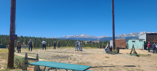
Leadville Rod & Gun Club
11.3 km
Discover the thrill of shooting sports amidst the stunning landscapes of Leadville, Colorado. Perfect for enthusiasts and novices alike.
Horse Farm
15.1 km
Explore the serene beauty of Leadville's Horse Farm, where equestrian adventure meets stunning mountain landscapes in Colorado.
Inspirato Vail Member Lounge
49.7 km
Discover tranquility and sophistication at the Inspirato Vail Member Lounge, your exclusive retreat in the heart of Vail, Colorado.

King's Club
49.7 km
King's Club in Vail, Colorado offers an elegant bar experience with live music, signature cocktails, and a cozy atmosphere for the perfect night out.

ASPENX Mountain Club
56.0 km
Discover the elite nightlife at ASPENX Mountain Club, where luxury meets excitement in the heart of Aspen's vibrant social scene.

Escobar Aspen
56.1 km
Dance the night away at Escobar Aspen, a premier night club and bar offering a vibrant atmosphere, creative cocktails, and unforgettable entertainment.

Belly Up Aspen
56.1 km
Discover the vibrant music scene at Belly Up Aspen, a premier venue offering unforgettable live performances and a lively atmosphere in the heart of Colorado.

Caribou Club
56.1 km
Experience the ultimate fine dining and vibrant nightlife at Caribou Club in Aspen, where culinary excellence meets an enchanting atmosphere.

GALA Aspen
56.1 km
Discover GALA Aspen, the ultimate lounge experience blending sophistication, great drinks, and vibrant nightlife in the heart of Colorado's ski haven.

J-Bar
56.1 km
J-Bar in Aspen: Where Upscale Dining Meets Sports Bar Vibes in a Lively Atmosphere

Hooch Craft Cocktail Bar
56.2 km
Discover Hooch Craft Cocktail Bar, a hidden speakeasy in Aspen, CO, offering unique cocktails and an intimate atmosphere for the perfect night out.

The Sterling Aspen
56.2 km
Experience the vibrant nightlife of Aspen at The Sterling Aspen, where chic cocktails and dancing come together in a stunning mountain setting.

Shadow Mountain Lounge
56.3 km
Experience the elegance and charm of Shadow Mountain Lounge, a premier bar in Aspen offering stunning mountain views and exquisite cocktails.

Hefner Lounge
57.1 km
Discover the Hefner Lounge in Aspen – a vibrant bar offering exquisite drinks and a chic ambiance, perfect for relaxation after adventure.

Last Chair
67.6 km
Discover Last Chair in Snowmass Village, a vibrant bar and grill offering delicious food and drinks after a day of adventure on the slopes.


