

Klintebakken Travel Guide
Free Guide: A billion-year geological journey where ancient granite meets younger sandstone at Bornholm's most scientifically significant fault line.


A brief summary of Klintebakken
A billion-year geological journey where ancient granite meets younger sandstone at Bornholm's most scientifically significant fault line.
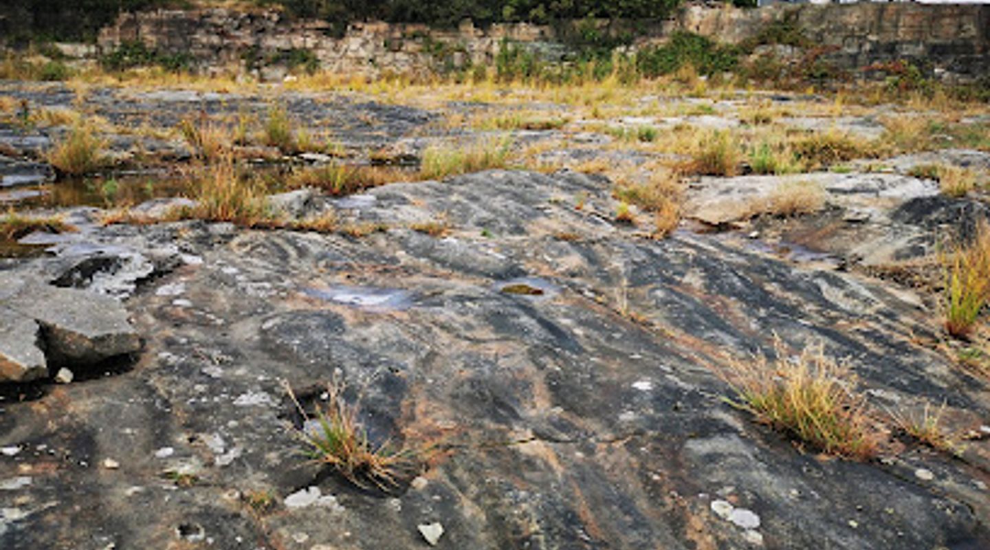
Klintebakken is a geological landmark in Aakirkeby, Bornholm, Denmark, showcasing a dramatic fault line where granite bedrock from northern Bornholm meets sandstone from the south. This natural wonder spans over a billion years of Earth's history, making it one of the island's most scientifically significant sites. Visitors can explore the striking geological formations and learn about the tectonic forces that shaped the landscape.
On-site amenities
 Parking areas
 Information boards
- Address
- 3720 Aakirkeby
Getting there
Car from Aakirkeby town centre
Bicycle from Aakirkeby
Walking from Aakirkeby
Bus from Aakirkeby
Discover more about Klintebakken
A Billion Years Written in Stone
Klintebakken stands as one of Bornholm's most geologically remarkable sites, offering a tangible window into Earth's deep history. The landscape here reveals a fault line—a boundary where two fundamentally different rock formations meet. To the north lies ancient granite bedrock, part of the Scandinavian shield that formed over a billion years ago. To the south stretches younger sandstone, creating a stark visual and geological contrast. Walking across Klintebakken means literally stepping across geological time, from the oldest rocks visible on the island to relatively younger stone formations.
The Tectonic Drama Beneath Your Feet
The fault line at Klintebakken represents far more than a simple boundary between rock types. It tells the story of immense tectonic forces that have shaped northern Europe over hundreds of millions of years. The collision and movement of continental plates created the geological structures visible today. This dramatic geological event, frozen in the landscape, makes Klintebakken essential for understanding Bornholm's unique position as a window into Scandinavian geology. The visible rock formations and terrain variations reflect the power of these ancient forces.
Landscape Design and Natural Interpretation
The site has been thoughtfully developed as part of the "Lines in the Landscape" initiative, which uses landscape architecture to help visitors understand and appreciate the geological features. Rather than obscuring the natural environment, the design enhances interpretation and access while respecting the integrity of the geological formations. Pathways and viewpoints guide visitors to the most significant features, allowing for both casual observation and deeper geological study. The integration of design with nature creates an experience that educates without overwhelming the landscape.
Bornholm's Geological Significance
Bornholm occupies a unique position in northern Europe, serving as an exposed section of the ancient Scandinavian bedrock. Klintebakken exemplifies why geologists and earth science enthusiasts consider the island invaluable for understanding continental geology. The fault line here is not merely a local curiosity but a significant feature in the broader geological narrative of the Baltic region. The visible rocks and formations provide direct evidence of processes that shaped an entire continent, making the site important for both scientific research and public education.
Evendo Review Centre
 Google
Guest reviews
Best time to go
Quietest: Jan, Feb & Dec · before 6am or at 9pm
Busy times are Evendo estimates for a typical year, to help you plan. Actual crowds vary with events, school holidays and the weather.
Explore Klintebakken on the map
A handpicked selection of must-see spots near Klintebakken, mapped for you.
Get your free copy of our complete guide to Klintebakken, delivered straight to you.
Everything on this page, from opening hours and how to get there to Eve’s tips and the best time to go, in one PDF you can read offline, print or share.
Already have an account? Sign in
Your Klintebakken guide is ready.
We'll send it to · Not you? Sign out

Getting your guide ready…
We are putting together a fresh copy of the Klintebakken guide. This can take up to a minute.
This can take a few moments. If your browser asks, choose Allow so the download can start. You'll find the guide in your Downloads folder.
Nothing happened? Download it again
Sorry, the guide is taking longer than usual. Please try again in a minute, or get it by email instead.
Other nearby places you may find interesting
The closest places of the same kind, if this one is not quite what you had in mind.
-
-
-
-
-


Swipe for more places
More to explore near Klintebakken

 Best experiences near Klintebakken

 Best hotels near Klintebakken

 Best landmarks near Klintebakken

 Best attractions near Klintebakken

 Best shops near Klintebakken

 Best restaurants near Klintebakken

 Best bars near Klintebakken
Do you manage this location?
Take control to get all the benefits, like improved information, better appearance, and stronger visibility across AI-powered discovery.
Explore more

Explore more of Bornholm
Explore Bornholm: Denmark's Baltic gem, offering stunning nature, rich history, and vibrant local culture. Perfect for nature lovers, history buffs, and food enthusiasts.
Explore Bornholm
Explore more of Denmark
Discover Denmark: A perfect blend of history, modern design, and the cozy concept of hygge. Explore vibrant cities, serene landscapes, and world-class cuisine.
Explore Denmark
