Background

Christianshavn

Cobbled streets, colorful canals and a spiral-spired church define Christianshavn, Copenhagen’s maritime quarter where historic docklands meet easygoing Nordic urban life.

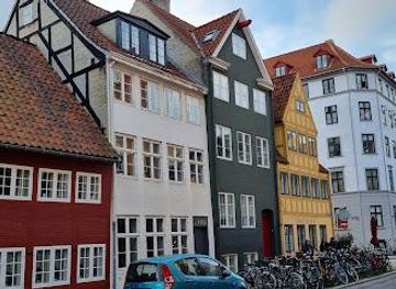
Christianshavn is Copenhagen’s maritime quarter, a former 17th‑century merchant and sailors’ district reshaped into a canalside neighborhood of cobbled streets, gabled warehouses and colorful townhouses. Between the spire of the Church of Our Saviour, the alternative enclave of Christiania and dockside cafes, it blends historic grit with relaxed Nordic hygge. It is one of the city’s most atmospheric areas for slow walks, waterfront lounging, and destination dining.

Plan your visit

A brief summary to Christianshavn

Opening times, essentials, and a few local tips gathered into one calmer, easier-to-scan planning section.

Plan your visit

📍
Copenhagen, Indre By, DK
🕒
Duration: 1.5 to 5 hours
💷
Free
🏛
Outdoor
📶
Mobile reception: 5 out of 5

Explore places near Christianshavn

    See all →

    Unlock the Best of Christianshavn

    Find tickets, tours with entry, and experiences available for this location.

    Buy tickets

    No tickets available

    Book tours with entry

    No tours with entry available

    Book tours without entry

    No tours without entry available

    Getting There

    Metro from central Copenhagen

    From central Copenhagen, take the M1 or M2 metro line to Christianshavn Station, which lies beneath the main Torvegade thoroughfare. Trains run every few minutes throughout the day and the journey from Nørreport or Kongens Nytorv usually takes 3–6 minutes. A standard two-zone ticket typically costs around 20–25 DKK and is valid across metro, buses and local trains. Elevators make the station accessible for wheelchairs and strollers, though platforms can become busy at rush hour.

    Bus from Copenhagen Central Station area

    Several city buses connect the central station and town hall area with Christianshavn via the Knippelsbro bridge in roughly 10–15 minutes, depending on traffic. Standard city bus tickets fall in the same two-zone price range of about 20–25 DKK and can usually be purchased via ticket machines or travel apps. Buses are low-floor and generally accessible, but note that at peak commuter times they may be crowded and standing room only.

    Bicycle from inner city

    Cycling from the inner city to Christianshavn typically takes 5–10 minutes along dedicated bike lanes crossing the harbor. Most major streets in Copenhagen offer marked cycle tracks, and several bike-share schemes operate in the central districts with pricing that often starts from about 10–20 DKK for short rides. Surfaces are mostly flat and paved, but be prepared to follow local cycling etiquette and be cautious in wet or icy weather.

    Harbor bus by water

    Harbor buses run along Copenhagen’s inner harbor and stop near Christianshavn, offering a scenic 10–20 minute trip from central quays depending on the route. These yellow ferries are part of the public transport system, so standard zone tickets around 20–25 DKK are typically valid. Services can be less frequent in the evening and in rough weather, and boarding is via floating pontoons which may feel unstable for those with limited mobility.

    For the on-the-go comforts that matter to you

    Restrooms
    Drink Options
    Drinking Water
    Food Options
    Seating Areas
    Sheltered Areas
    Picnic Areas
    Trash Bins
    Information Boards
    Visitor Center

    Local tips

    Plan extra time to climb the external staircase of the Church of Our Saviour on a clear day; views over Christianshavn’s canals and the harbor are some of Copenhagen’s most striking.
    Explore beyond the main canal: quiet backstreets like Wildersgade and Sankt Annæ Gade reveal well-preserved townhouses, small cafes and photogenic corners with fewer crowds.
    Bring a light jacket, even in summer; breezes off the harbor can be cool when you sit along the water with a drink or picnic.
    Consider combining a stroll in Christianshavn with a canal or harbor boat tour departing nearby to appreciate the district’s waterfront setting from the waterline.

    Christianshavn location weather suitability

    Catch the right light and the right mood, whether you want a bright city moment or a more cinematic evening visit.

    Weather icon
    Any Weather
    Weather icon
    Clear Skies
    Weather icon
    Mild Temperatures
    Weather icon
    Cold Weather

    Discover more about Christianshavn

    Canalside quarter with a character of its own

    Christianshavn stretches across man‑made islands just east of Copenhagen’s historic core, laced with broad canals, low bridges and rows of painted houses reflected in the water. Laid out in the 1600s as a fortified merchant town, its street grid and waterways were inspired by Dutch trading cities, earning it the nickname “Little Amsterdam.” Today it sits firmly within the city center yet keeps a quieter, village‑like feel, where bicycles outnumber cars and life spills gently onto the quays. Wandering along Christianshavn Canal, you pass moored wooden boats, old warehouses converted into apartments, and narrow side streets paved with cobbles. The neighborhood’s human scale and maritime setting give it a distinctive rhythm: mornings feel local and residential, while evenings draw people to restaurant terraces and wine bars beside the water.

    From royal project to working docks and counterculture

    Christianshavn was founded under King Christian IV as a strategic trading hub, complete with ramparts and bastions guarding the harbor approaches. For centuries it was a rough‑edged area of shipyards, sailors’ taverns and modest housing, closely tied to the life of the port. The remains of the old fortifications survive as green earthworks and ponds, now part of Christianshavns Vold, a leafy park tracing the former defensive line. In the 20th century, as shipping declined and the navy relocated, disused military land and industrial buildings opened the way for new uses. The nearby island group of Holmen, once a naval base, gained cultural venues and creative schools, while within Christianshavn itself derelict barracks became the cradle of the alternative community of Christiania in the 1970s. The result is a district where royal town planning, maritime heritage and countercultural experiments coexist within walking distance.

    Everyday life between bistros, bodegas and backstreets

    Despite its central position, Christianshavn feels lived‑in rather than purely scenic. Along main arteries like Torvegade you find a mix of bakeries, small supermarkets, traditional bodegas and cozy cafes where locals linger over coffee. Side streets such as Wildersgade and Sankt Annæ Gade reveal 18th‑ and 19th‑century townhouses with lanterns by the doors, flower boxes on window ledges and bicycles leaned casually against brick façades. Canal edges double as social spaces: on sunny days people sit with dangling legs over the water, sharing takeaway food or a drink as boats glide past. Benches and low quaysides become impromptu living rooms, while houseboats and converted barges add to the layered, informal charm. The neighborhood’s compact size makes it easy to meander without a plan, discovering courtyards, small squares and pocket gardens along the way.

    Icons, flavors and artistic neighbors

    Several of Copenhagen’s best‑known sights and venues sit in or just off Christianshavn. The Church of Our Saviour dominates the skyline with its baroque tower and external spiral staircase that wraps around the spire, offering one of the most memorable viewpoints over the city and harbor. Close by, the self‑declared freetown of Christiania occupies former ramparts and barracks, known for colorful murals, experimental architecture and a strong sense of communal identity. Christianshavn and the adjacent Holmen islands also host some of Denmark’s most acclaimed restaurants and cultural institutions, from inventive Nordic dining rooms in old warehouses to the modern opera house across the water. Street‑food markets, wine cellars hidden under bridges and casual canal‑side bars add layers of flavor, making the district a natural choice for an evening out that combines strolling, people‑watching and memorable meals.

    Slow explorations by foot, bike and boat

    Christianshavn is best experienced at a relaxed pace. Its flat terrain and network of bridges make it ideal for walking and cycling, with frequent glimpses of the harbor appearing between buildings. Photographers are drawn to the reflections along the main canal, the crooked rooflines and the dramatic contrast between historic brick structures and contemporary architecture on Holmen across the water. From the quays you can watch canal tours and small private boats thread through the locks and under low arches, reinforcing the district’s bond with the sea. Even short visits reward unhurried exploration: a loop along the canal, a detour onto the old ramparts, a pause in a cafe or bakery, and a final look back at the twisted church spire rising above masts and chimneys as you leave.

    A brief summary to Christianshavn

    Use Tower Bridge as your starting point for nearby food, family ideas, nightlife, and more local discoveries.

    Plan around the quieter times

    A quick look at seasonal patterns and peak visiting hours.

    Busiest months of the year

    Seasonality

    Busiest hours of the day

    Footfall
    Mobile App
    Get the app

    Your all‑in‑one travel companion app

    Explore expert travel guides, compare and book tours, experiences, hotels, and more—all from the palm of your hand. Download now for seamless trip planning wherever your wanderlust takes you.

    File:Køge Town Hall +1.jpg - Wikimedia Commons

    More about Koge

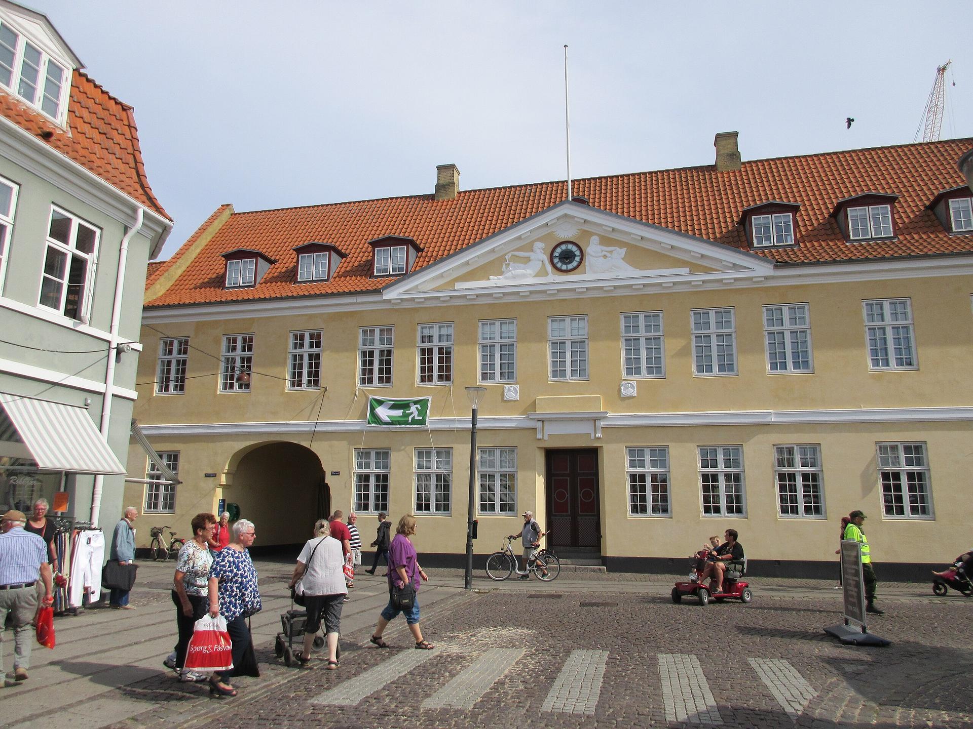
    Explore Køge, Denmark's coastal gem, with its medieval charm, beautiful marina, and close proximity to the stunning Stevns Klint UNESCO World Heritage site.

    Tell me more about Koge

    Select Currency

    Choose the currency you want prices to display in.