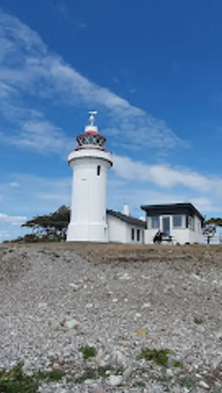
Sletterhage Fyr. Travel Guide
Free Guide: Compact white lighthouse on Helgenæs’ southern tip, offering big sea views, ship traffic, geology, birdlife and coastal walks in classic Djursland scenery.


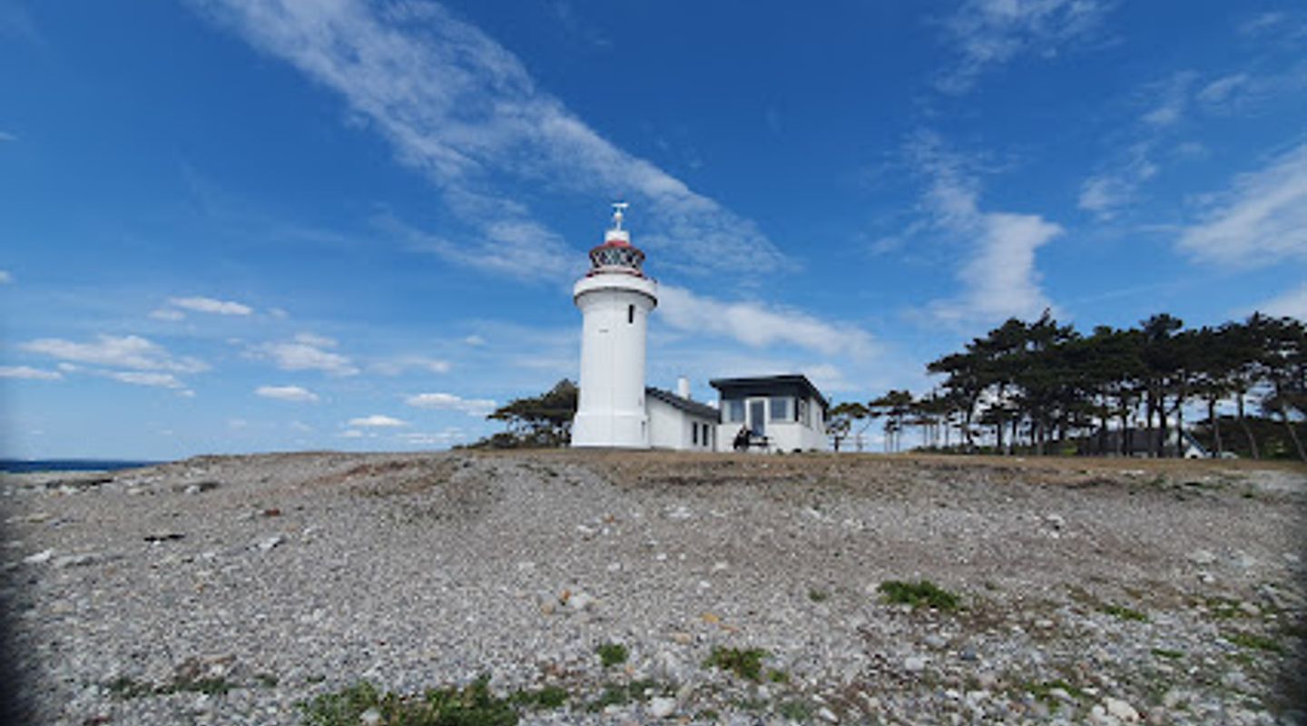
A brief summary of Sletterhage Fyr.
Compact white lighthouse on Helgenæs’ southern tip, offering big sea views, ship traffic, geology, birdlife and coastal walks in classic Djursland scenery.
Perched at the southern tip of the Helgenæs peninsula on Djursland, Sletterhage Fyr is a compact white lighthouse set amid dramatic coastal scenery and open Kattegat horizons. The active 16 m tower marks the entrance to Aarhus and offers sweeping views over Aarhus Bay, Tunø and Samsø, along with an engaging exhibition in the former keeper’s house about local maritime history, geology and wildlife. Outside, shingle beaches, coastal paths and birdlife make this a classic Danish seascape for slow walks, ship-spotting and picnic stops.
On-site amenities
 Restrooms
 Seating areas
 Sheltered areas
 Picnic areas
 Trash bins
 Information boards
 Visitor centre
 Drink options
 Food options
 Drinking water
Opening hours
- Every day11 am–5 pm
Opening hours as listed on the venue’s Google Business Profile. Hours can change for services and special events, so check with the venue before you go.
- Address
- Sletterhagevej 58, 8420 Knebel
- Website
Getting there
Car from Aarhus
Bus plus walk from Ebeltoft area
Cycling around Mols and Helgenæs
Discover more about Sletterhage Fyr.
A lighthouse at the edge of Djursland
Sletterhage Fyr stands at the very tip of Helgenæs, where the hills of Mols meet the open waters of the Kattegat. The squat, whitewashed tower rises only 16 metres, but because it sits right on the shoreline it feels dramatically exposed to wind, waves and sky. This is an active navigation light, guiding ships in and out of Aarhus Bay and marking one of the busiest stretches of water along the east coast of Jutland.The lighthouse complex is intimate in scale: the cylindrical tower, the attached keeper’s buildings and a small courtyard framed by low fences and grass. Around it spreads an unbroken coastal landscape, with shingle beaches, boulder-strewn foreshore and gently rolling slopes climbing back towards Mols Bjerge. On clear days the horizon is punctuated by the low outlines of Tunø and Samsø, while ferries and container ships glide past surprisingly close to shore.
Stories of ships, geology and coastal life
Inside the former lighthouse keeper’s residence, an exhibition explores the area’s maritime history, nature and geology. Panels and simple displays introduce you to the shipping lane that passes just off the beach, the changing technology of lighthouses and the volunteers who now care for the site. Another section focuses on the rocks under your feet, shaped by ice ages and shifting seas, and on the plants and animals that thrive in this windy, salty environment.The tower itself is open in the main season, allowing you to climb the narrow staircase to a compact viewing platform beneath the lantern. From here the geometry of the coastline becomes clear: the hook of Helgenæs, the wide entrance to Aarhus Bay and the long, low Danish shoreline stretching north and south. Ship-spotters linger to read hull names and watch the slow procession of freight and ferries, while birdwatchers scan for migrating seabirds riding the air currents.
Coastal walks and wartime relics
Beyond the lighthouse, paths and informal tracks invite you along the coast or up into the low hills. Walking north along the shore leads you through a textbook glacial landscape, with pebbly beaches rich in varied stones and occasional low cliffs where the earth reveals layers laid down by ancient ice. The sound of surf on shingle and the cries of gulls provide a constant soundtrack.One classic outing from Sletterhage is the walk to the so‑called German Tower, a concrete radar installation from the Second World War that now serves as a stark lookout over sea and land. Another is the route towards Lushage, where the coastline feels even more remote and the views back to the lighthouse place it as a tiny white marker between sea and sky. Along the way, there are chances to spot seals offshore and watch for porpoises breaking the surface on calm days.
Simple facilities and easy seaside pleasures
Practical amenities make it easy to linger. Close to the car park you will find public toilets, outdoor tables and benches and simple shelters that offer a bit of protection from wind and rain. A small packed‑lunch house provides indoor seating for those who bring their own food, and there are trash bins to help keep the area clean. In the warmer months, a modest ice cream and snack stand adds the scent of freshly made coffee and waffles to the salty air.Despite these conveniences, the atmosphere remains low‑key and close to nature. There are no large buildings or loud attractions, just the lighthouse, the sea and the ever‑changing light. Many visitors combine a short climb in the tower with a longer coastal walk, a sit on the stones watching ships and clouds, or quiet time listening to the wind. Whether you stay an hour or half a day, Sletterhage Fyr offers an unhurried slice of Danish coastal life.
Seasons of wind, light and migrating birds
Sletterhage changes character with the seasons. In summer, long days and soft breezes create a relaxed seaside feel, with more people on the paths and families exploring the rocks and shallow water. The lighthouse and exhibition are typically open then, and the ice cream stand operates on weekends, holidays and school breaks.In spring and autumn, the focus shifts slightly to migratory birds and dramatic weather. The headland becomes a fine vantage point for watching flocks of seabirds and raptors on the move, and the lower sun angle paints the sea in silvers and deep blues. Even on blustery winter days, when the wind bites and the sea throws spray across the beach, the site retains a stark beauty. With proper clothing and footwear, Sletterhage Fyr rewards visits year‑round with big skies, open horizons and a strong sense of place at the meeting line between land and water.
Evendo Review Centre
 Google
Guest reviews
Best time to go
Quietest: Jan, Feb & Nov · before 7am or from 9pm
Busy times are Evendo estimates for a typical year, to help you plan. Actual crowds vary with events, school holidays and the weather.
Explore Sletterhage Fyr. on the map
A handpicked selection of must-see spots near Sletterhage Fyr., mapped for you.
Get your free copy of our complete guide to Sletterhage Fyr., delivered straight to you.
Everything on this page, from opening hours and how to get there to Eve’s tips and the best time to go, in one PDF you can read offline, print or share.
Already have an account? Sign in
Your Sletterhage Fyr. guide is ready.
We'll send it to · Not you? Sign out

Getting your guide ready…
We are putting together a fresh copy of the Sletterhage Fyr. guide. This can take up to a minute.
This can take a few moments. If your browser asks, choose Allow so the download can start. You'll find the guide in your Downloads folder.
Nothing happened? Download it again
Sorry, the guide is taking longer than usual. Please try again in a minute, or get it by email instead.
Other nearby places you may find interesting
The closest places of the same kind, if this one is not quite what you had in mind.
-
-
-
-
-


Swipe for more places
More to explore near Sletterhage Fyr.

 Best experiences near Sletterhage Fyr.
 Best hotels near Sletterhage Fyr.
 Best landmarks near Sletterhage Fyr.
 Best attractions near Sletterhage Fyr.
 Best shops near Sletterhage Fyr.
 Best restaurants near Sletterhage Fyr.
 Best bars near Sletterhage Fyr.
Do you manage this location?
Take control to get all the benefits, like improved information, better appearance, and stronger visibility across AI-powered discovery.
Explore more
Explore more of Samsø
Samsø: Explore Denmark's eco-friendly island, rich in natural beauty, culinary delights, and cultural heritage.
Explore Samsø
Explore more of Denmark
Discover Denmark: A perfect blend of history, modern design, and the cozy concept of hygge. Explore vibrant cities, serene landscapes, and world-class cuisine.
Explore Denmark