

Civil Lines (Jabalpur) Travel Guide - Free
Explore Civil Lines in Jabalpur with Evendo's free guide. Find the best shops, historic streets, restaurants, and gems on web or mobile.


Civil Lines Jabalpur offers leafy colonial-era streets, museums, civic landmarks, local dining and easy access to the railway station and city sights.
A Planned Quarter of Central Jabalpur
Civil Lines occupies a distinguished central position in Jabalpur, close to the railway station and within easy reach of the city's older commercial areas, government offices and Cantonment. Its broad roads, mature trees and detached institutional buildings give it a more spacious character than the dense bazaars around the old city. The name reflects a familiar colonial-era urban arrangement: a civil administrative quarter distinct from military Cantonment land, though the two developed alongside one another and remain closely linked in the city's geography.Read more about Civil Lines
Institutions, Museums and Everyday Life
Access to the City
Explore Civil Lines on the map
A handpicked selection of must-see spots in Civil Lines, mapped for you.
Best hotels in Civil Lines
Civil Lines essentials
Getting There
Getting Around
Safety
Emergency Situations
Do's and Don'ts
Local Tips

From Eve
Local phrases worth knowing
You don't need to get them perfect. A few words go a long way, and locals appreciate the effort.
Basics
| English | Local | Say it |
|---|---|---|
| Hello | नमस्ते | [namaste] |
| Goodbye | अलविदा | [alvida] |
| Yes | हां | [haan] |
| No | नहीं | [nahin] |
| Please/You're welcome | कृपया | [krupaya] |
| Thank you | धन्यवाद | [dhanyavaad] |
| Excuse me/Sorry | माफ़ कीजिए | [maaf keejiye] |
| How are you? | कैसे हो आप? | [kaise ho aap?] |
| Fine. And you? | ठीक हूँ। आप? | [theek hoon. aap?] |
| Do you speak English? | क्या आप अंग्रेज़ी बोलते हैं? | [kya aap angrezi bolte hain?] |
| I don't understand | मुझे समझ नहीं आया | [mujhe samajh nahin aaya] |
Eating & Drinking
| English | Local | Say it |
|---|---|---|
| I'd like to see the menu, please | कृपया मेन्यू दिखाइए | [krupaya menu dikhaiye] |
| I don't eat meat | मुझे मांस नहीं खाना | [mujhe maans nahin khana] |
| Cheers! | चियर्स! | [cheers!] |
| I would like to pay, please | कृपया भुगतान करना है | [krupaya bhugtaan karna hai] |
Emergencies
| English | Local | Say it |
|---|---|---|
| Help! | बचाओ! | [bachao!] |
| Go away! | चले जाओ! | [chale jao!] |
| Call the Police! | पुलिस को बुलाओ! | [police ko bulaao!] |
| Call a doctor! | डॉक्टर को बुलाओ! | [doctor ko bulaao!] |
| I'm lost | मैं खो गया/गई हूँ | [main kho gaya/gayi hoon] |
| I'm ill | मुझे बीमारी है | [mujhe bimaari hai] |
Shopping
| English | Local | Say it |
|---|---|---|
| I'd like to buy... | मैं ... खरीदना चाहता/चाहती हूँ | [main ... khareedna chahta/chahti hoon] |
| I'm just looking | मैं सिर्फ देख रहा/रही हूँ | [main sirf dekh raha/rahi hoon] |
| How much is it? | यह कितने का है? | [yah kitne ka hai?] |
| That's too expensive | यह बहुत महंगा है | [yah bahut mahnga hai] |
| Can you lower the price? | क्या आप कीमत कम कर सकते हैं? | [kya aap keemat kam kar sakte hain?] |
Time & Numbers
| English | Local | Say it |
|---|---|---|
| What time is it? | अब कितने बजे हैं? | [ab kitne baje hain?] |
| It's one o'clock | एक बजे हैं | [ek baje hain] |
| Half past (10) | दस बजे तक | [das baje tak] |
| Morning | सुबह | [subah] |
| Afternoon | दोपहर | [dopahar] |
| Evening | शाम | [shaam] |
| Yesterday | कल | [kal] |
| Today | आज | [aaj] |
| Tomorrow | कल | [kal] |
| 1 | एक | [ek] |
| 2 | दो | [do] |
| 3 | तीन | [teen] |
| 4 | चार | [chaar] |
| 5 | पांच | [paanch] |
| 6 | छह | [chhah] |
| 7 | सात | [saat] |
| 8 | आठ | [aath] |
| 9 | नौ | [nau] |
| 10 | दस | [das] |
Transport & Directions
| English | Local | Say it |
|---|---|---|
| Where's a/the...? | ...कहाँ है? | [...kahan hai?] |
| What's the address? | पता क्या है? | [pata kya hai?] |
| Can you show me (on the map)? | क्या आप मुझे दिखा सकते हैं (नक्शे पर)? | [kya aap mujhe dikha sakte hain (naksha par)?] |
| When's the next (bus)? | अगली (बस) कब है? | [agli (bus) kab hai?] |
| A ticket (to ....) | एक टिकट (... के लिए) | [ek ticket (... ke liye)] |
History of Civil Lines
The Colonial Civil Station
Civil Lines developed as part of the colonial administrative landscape of Jabalpur, whose civil officials occupied a separate quarter from the military Cantonment. The term itself was used across British India for planned residential and administrative areas associated with government personnel. In Jabalpur, the distinction helped shape a spacious district of offices, institutional compounds and tree-lined roads rather than the compact lanes characteristic of older commercial settlements. Its location near the Cantonment and the principal routes through the expanding city gave the area strategic practical importance, while the separation of bureaucratic and military functions remained visible in its street pattern and land use.
Railways and Urban Expansion
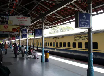
The arrival and growth of railway connections in nineteenth-century Jabalpur strengthened the importance of the central administrative quarters, including Civil Lines. Railways linked the city more closely with the wider Central Provinces and encouraged the movement of officials, traders, students and goods. The station area became an important threshold between long-distance travel and the city's civic institutions, while roads leading towards the Cantonment, Wright Town and other developing districts increased Civil Lines' role as a connector. The neighbourhood's broad plots and institutional character belong to this period of urban expansion, when Jabalpur became an important transport and administrative centre in central India.
From Government Quarter to Mixed Urban District
After Indian independence, the civil administrative landscape continued to influence Civil Lines, but its social and physical use broadened. Government departments, schools, medical institutions, professional offices and private residences occupied or grew around the older planned framework. The area became part of the everyday geography of post-independence Jabalpur rather than a district defined solely by colonial officials. Nearby commercial development in Wright Town and Napier Town brought more services, while the railway station kept the neighbourhood connected to regional movement. Surviving mature trees, institutional compounds and older buildings now sit alongside later construction, expressing the gradual layering of the modern city.
Cultural Institutions and Civic Identity
The establishment of cultural and educational institutions in and around Civil Lines added a public dimension to its administrative identity. The Rani Durgavati Museum became an important place for presenting the archaeology, history and material culture of Madhya Pradesh, linking Jabalpur's modern civic centre with the region's longer past. Today, Civil Lines remains a mixed district of public institutions, transport infrastructure, residences and businesses. Its significance lies less in a single preserved historic precinct than in the continuing relationship between planned roads, civic functions and the wider urban growth of Jabalpur.
Civil Lines in Photos
Browse through our photo collection highlighting the charm and character of the destination.
Neighbourhoods near Civil Lines
The closest neighbourhoods to Civil Lines, if you have time for more than one stop.
-
-

-


Swipe for more neighbourhoods
Explore more
Explore more of Jabalpur
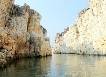
Jabalpur, India, pairs Gond heritage and Narmada landscapes with Marble Rocks, Dhuandhar Falls, forts, museums and lively local markets for visitors.
Explore Jabalpur