

West Jerusalem (Jerusalem) Travel Guide - Free
Explore West Jerusalem in Jerusalem with Evendo's free guide. Find the best shops, historic streets, restaurants, and gems on web or mobile.


West Jerusalem combines historic quarters, Mahane Yehuda Market, museums, parks, cafés and the cultural institutions of Israel’s capital today.
A City of Contrasts
West Jerusalem is a broad, informal designation rather than a single administratively defined neighbourhood, covering much of the city's western side, including the city centre, Rehavia, Talbiya, the German Colony, Nahlaot and areas around Givat Ram. Its streets move between stone-built apartment blocks, leafy institutional districts, market lanes and long-established residential quarters, with the hills giving nearly every walk a change of level and perspective. The area developed most extensively during the late Ottoman and British Mandate periods and expanded rapidly after 1948, when Jerusalem became the political centre of the newly established State of Israel.Read more about West Jerusalem
Markets, Museums and Public Life
Architecture and Everyday Experience
Best attractions in West Jerusalem
West Jerusalem's attractions range from the food stalls and compact lanes of Mahane Yehuda Market to the galleries, archaeological collections and Shrine of the Book at the Israel Museum complex near Givat Ram. Sacher Park provides a broad green setting beside the museum district, while the Jerusalem Botanical Gardens offer a quieter horticultural experience nearby. In the city centre, Jaffa Road and Ben Yehuda Street are useful for observing the city's commercial life, and the pedestrianised First Station occupies the restored terminus of the historic railway line. The YMCA and its tower, the colourful streets of Nahlaot, and the garden streets of Rehavia offer smaller-scale architectural and urban experiences. Yemin Moshe and Mishkenot Sha'ananim, near the Old City, can be included in a westward walk, although their position is best described as adjacent to rather than simply inside West Jerusalem's central districts.
-
Natural history museum
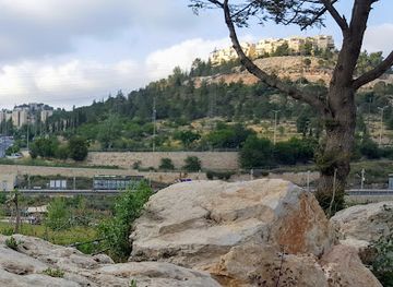
Ein Yael outdoor museum
Discover the enchanting world of nature and history at Ein Yael Outdoor Museum in Jerusalem, where culture meets the great outdoors.
17 min drive · 5.5 km from neighbourhood centre
-
Tourist attraction
Mount Zion
Discover the rich history and spiritual significance of Mount Zion, a must-visit landmark in Jerusalem with breathtaking views and revered sites.
14 min walk · 1.1 km from neighbourhood centre
-
Tourist attraction
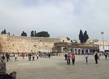
Western Wall Observation Deck
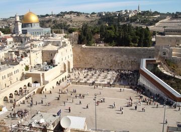
Explore the breathtaking views from the Western Wall Observation Deck and connect with the spiritual history of Jerusalem.
16 min walk · 1.3 km from neighbourhood centre
-
Tourist attraction
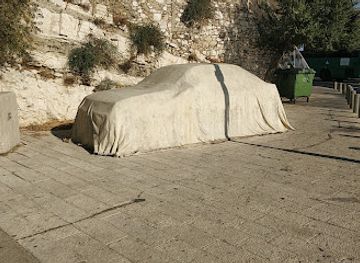
Covered car statue
Discover the Covered Car Statue in Jerusalem, a unique blend of modern art and historical context that captures the imagination of every traveler.
16 min walk · 1.3 km from neighbourhood centre

Best landmarks in West Jerusalem
West Jerusalem's landmarks express its role as both a historic urban extension and Israel's civic centre. The YMCA tower on King David Street is a prominent early twentieth-century landmark, while the nearby King David Hotel belongs to the city's Mandate-era architectural and political landscape. The Israel Museum complex and the Shrine of the Book form a major cultural ensemble near Givat Ram, and the Knesset and Supreme Court represent the modern state's governmental architecture in the wider western institutional district. In the centre, the former Jerusalem railway station, now known as the First Station, preserves a tangible link with the railway that connected Jerusalem to the coast. Mahane Yehuda Market is less monumental but equally significant, functioning as a longstanding commercial landmark whose covered lanes and surrounding streets remain central to the area's identity.
-
Shrine
Western Wall
Discover the spiritual heart of Jerusalem at the Western Wall, a historic shrine that connects visitors with centuries of faith and tradition.
17 min walk · 1.4 km from neighbourhood centre
-
Tourist attraction
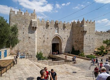
Damascus Gate
Discover the architectural beauty and historical significance of Damascus Gate, a must-visit attraction in the heart of Jerusalem's Old City.
13 min walk · 1.1 km from neighbourhood centre
-
History museum
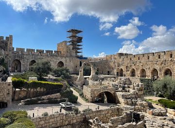
Tower of David
Discover the Tower of David, a historic museum in Jerusalem that narrates the city's fascinating journey through the ages with stunning views and engaging exhibits.
10 min walk · 0.8 km from neighbourhood centre
-
Garden
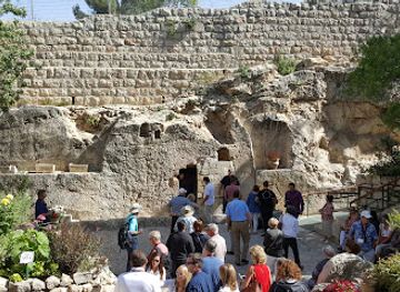
The Garden Tomb Jerusalem
Discover the serene beauty and spiritual significance of The Garden Tomb in Jerusalem, a peaceful retreat amidst historical treasures.
15 min walk · 1.2 km from neighbourhood centre

Explore West Jerusalem on the map
A handpicked selection of must-see spots in West Jerusalem, mapped for you.
Best hotels in West Jerusalem
Best restaurants in West Jerusalem
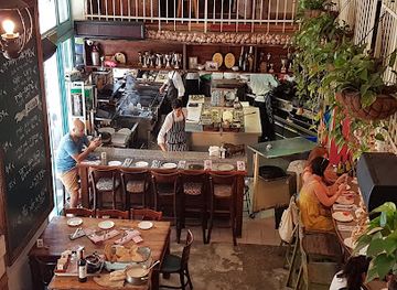
West Jerusalem's dining scene is shaped by the city's mixed population and by the produce trade of Mahane Yehuda. The market and its surrounding streets support bakeries, coffee counters, casual eateries and restaurants that draw on Middle Eastern, Mediterranean and contemporary Israeli cooking, while long-established shops sell bread, spices, cheese, olives and seasonal fruit. Around Nahlaot and the city centre, dining ranges from inexpensive falafel and hummus counters to modern cafés and sit-down restaurants, with Rehavia and the German Colony offering further concentrations of cafés and evening dining. The area's culinary identity is less about one definitive local dish than about proximity: market ingredients, Jewish and Middle Eastern traditions, immigrant influences and newer chef-led cooking meet within a walkable central area. Friday preparations bring a particular shopping rhythm, while Sabbath observance substantially changes which establishments trade from Friday afternoon into Saturday.
-
Restaurant
Machneyuda
Indulge in high-end gourmet dining at Machneyuda in Jerusalem, where local flavors meet innovative culinary artistry.
14 min walk · 1.2 km from neighbourhood centre
-
Italian
Piccolino
Experience authentic Italian cuisine at Piccolino in Jerusalem—where every meal is crafted with passion and tradition.
4 min walk · 0.3 km from neighbourhood centre
-
Kosher
Tmol Shilshom
Discover Tmol Shilshom: A charming kosher restaurant in Jerusalem offering delightful traditional and modern Israeli cuisine in a cozy setting.
5 min walk · 0.4 km from neighbourhood centre
-
French
Talbiye
Discover the elegance of French cuisine at Talbiye, Jerusalem's premier destination for exquisite dining experiences.
14 min walk · 1.1 km from neighbourhood centre


Best bars in West Jerusalem
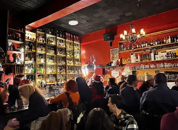
After dark, West Jerusalem's central districts are more active than many of its residential streets, with the strongest concentration of bars and informal evening venues around Mahane Yehuda, the city centre and parts of the German Colony. Market premises and nearby lanes may shift from daytime food trading towards drinks, small plates and social gatherings, while music and cultural programming can appear in venues around the First Station and central pedestrian streets. Rehavia and Talbiya are comparatively quieter and are experienced more through cafés, restaurants and cultural events than through large clubs. Nightlife is influenced by Jerusalem's religious calendar and by Sabbath observance, so the atmosphere and availability of venues can change markedly between weekday evenings, Friday night and Saturday. Visitors should avoid treating residential lanes as entertainment districts and keep noise down near homes.
-
Cocktail bar
Gatsby Cocktail Room
Experience the vibrant nightlife at Gatsby Cocktail Room in Jerusalem, where expertly crafted cocktails and a sophisticated atmosphere await.
4 min walk · 0.3 km from neighbourhood centre
-
Bar
Glen Whisk(e)y bar
Discover Glen Whisk(e)y Bar in Jerusalem, where over 150 whiskies and craft cocktails await to elevate your night out.
2 min walk · 0.1 km from neighbourhood centre
-
Pub
The Sira Pub
Experience the vibrant atmosphere and local charm at The Sira Pub in Jerusalem, where great drinks and lively entertainment await.
3 min walk · 0.2 km from neighbourhood centre
-
Bar
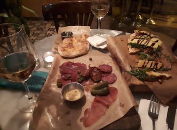
Wine Bar
Discover Jerusalem's Wine Bar: a cozy spot for exquisite wines and delightful small plates in the heart of the city.
9 min walk · 0.7 km from neighbourhood centre


Best nightclubs in West Jerusalem
After dark, West Jerusalem's central districts are more active than many of its residential streets, with the strongest concentration of bars and informal evening venues around Mahane Yehuda, the city centre and parts of the German Colony. Market premises and nearby lanes may shift from daytime food trading towards drinks, small plates and social gatherings, while music and cultural programming can appear in venues around the First Station and central pedestrian streets. Rehavia and Talbiya are comparatively quieter and are experienced more through cafés, restaurants and cultural events than through large clubs. Nightlife is influenced by Jerusalem's religious calendar and by Sabbath observance, so the atmosphere and availability of venues can change markedly between weekday evenings, Friday night and Saturday. Visitors should avoid treating residential lanes as entertainment districts and keep noise down near homes.
-
Live Music
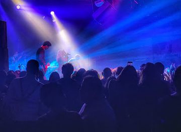
Zappa at the Lab
Experience the pulse of Jerusalem's music scene at Zappa at the Lab, where vibrant live performances create unforgettable nights.
18 min walk · 1.4 km from neighbourhood centre
-
Cocktail bar
Gatsby Cocktail Room
Discover Jerusalem's upscale nightlife at Gatsby Cocktail Room, offering exquisite cocktails and a vibrant ambiance for a memorable evening.
4 min walk · 0.3 km from neighbourhood centre
-
Sports bar
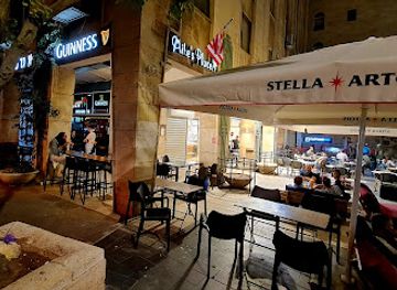
Mike's Place
Join the excitement at Mike's Place, Jerusalem's premier sports bar, offering delicious food, drinks, and a lively atmosphere for all sports fans!
5 min walk · 0.4 km from neighbourhood centre
-
Irish pub
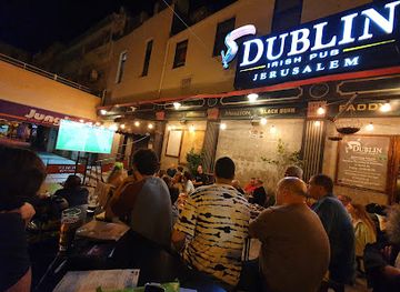
Dublin Irish Pub
Discover Dublin Irish Pub in Jerusalem - a vibrant Irish pub offering hearty cuisine, live music, and an authentic experience for all visitors.
5 min walk · 0.4 km from neighbourhood centre

Best shops in West Jerusalem
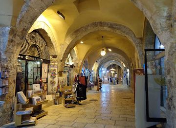
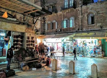
Shopping in West Jerusalem is anchored by Mahane Yehuda Market, where produce, spices, baked goods, dried fruit, cheese, olives and other foodstuffs are sold among specialist stalls and small businesses. The market is primarily a working food market rather than a conventional souvenir centre, although its surrounding streets now contain cafés, restaurants and lifestyle-oriented shops. Smaller independent retailers and bookshops appear around the city centre, Jaffa Road and Ben Yehuda Street, while Nahlaot and the German Colony offer a more scattered mix of neighbourhood businesses rather than one continuous shopping district. Visitors looking for crafts, Judaica or locally produced goods should compare specialist shops carefully and distinguish established workshops from generic souvenir retail. Friday is an important market-shopping period, but Sabbath closures mean that the area's commercial rhythm changes significantly from Friday afternoon through Saturday.
-
Shopping mall
Alrov Mamilla Avenue
Discover Alrov Mamilla Avenue, Jerusalem's premier shopping destination featuring luxury boutiques, dining, and cultural experiences all in one vibrant avenue.
5 min walk · 0.4 km from neighbourhood centre
-
Clothing store
Ha'metzi'on second-hand stores
Discover vintage treasures and unique styles at Ha'metzi'on Second-Hand Stores, a sustainable shopping haven in Jerusalem.
9 min drive · 2.9 km from neighbourhood centre
-
Antique store
Zak’s Jerusalem Gifts
Explore the essence of Jerusalem at Zak’s Jerusalem Gifts, where antiques meet authentic souvenirs in a captivating shopping experience.
11 min walk · 0.9 km from neighbourhood centre
-
Gift shop
Old City Bazaar
Explore the lively Old City Bazaar in Jerusalem, where history meets vibrant culture through unique gifts and local flavors.
12 min walk · 1.0 km from neighbourhood centre


West Jerusalem essentials
Getting There
Getting Around
Safety
Emergency Situations
Do's and Don'ts
Local Tips

From Eve
Local phrases worth knowing
You don't need to get them perfect. A few words go a long way, and locals appreciate the effort.
Basics
| English | Local | Say it |
|---|---|---|
| Hello | שָׁלוֹם | [Shalom] |
| Goodbye | לְהִתְרָאוֹת | [Lehitraot] |
| Yes | כֵּן | [Ken] |
| No | לֹא | [Lo] |
| Please/You're welcome | בְּבַקָּשָׁה | [Bevakasha] |
| Thank you | תוֹדָה | [Toda] |
| Excuse me/Sorry | סְלִיחָה | [Slicha] |
| How are you? | אֵיך אתה? | [Eich atah?] |
| Fine. And you? | טוֹב. וָאַתָּה? | [Tov. Va'atah?] |
| Do you speak English? | הֲאַתָּה מְדַבֵּר אַנְגְלִית? | [Ha'atah medaber anglit?] |
| I don't understand | אני לא מבין | [Ani lo mevin] |
Eating & Drinking
| English | Local | Say it |
|---|---|---|
| I'd like to see the menu, please | אֲנִי רוֹצֶה לִרְאוֹת אֶת הַתַּפְרִיט, בְּבַקָּשָׁה | [Ani rotze lirot et hatafrit, bevakasha] |
| I don't eat meat | אני לא אוכל בשר | [Ani lo ochel basar] |
| Cheers! | לְחַיִים! | [Lechayim!] |
| I would like to pay, please | אֲנִי רוֹצֶה לְשַׁלֵם, בְּבַקָּשָׁה | [Ani rotze leshalem, bevakasha] |
Emergencies
| English | Local | Say it |
|---|---|---|
| Help! | עזור! | [Ezor!] |
| Go away! | לְך לְך! | [Lech lech!] |
| Call the Police! | תקרא למשטרה! | [Tikra lameshara!] |
| Call a doctor! | תקרא לרופא! | [Tikra larofe!] |
| I'm lost | אני אבוד | [Ani avud] |
| I'm ill | אני חולה | [Ani choleh] |
Shopping
| English | Local | Say it |
|---|---|---|
| I'd like to buy... | אני רוצה לקנות... | [Ani rotze liknot...] |
| I'm just looking | אני רק צופה | [Ani rak tzofeh] |
| How much is it? | כמה עולה זה? | [Kama oleh ze?] |
| That's too expensive | זה יקר מדי | [Ze yakar m'dai] |
| Can you lower the price? | אתה יכול להוריד את המחיר? | [Ata yachol lehorid et hamachir?] |
Time & Numbers
| English | Local | Say it |
|---|---|---|
| What time is it? | מה השעה? | [Ma hasha'a?] |
| It's one o'clock | השעה חד | [Hasha'a chad] |
| Half past (10) | חצי (עשר) | [Chatzi (eser)] |
| Morning | בוקר | [Boker] |
| Afternoon | צהריים | [Tzohorayim] |
| Evening | ערב | [Erev] |
| Yesterday | אתמול | [Etmol] |
| Today | היום | [Hayom] |
| Tomorrow | מחר | [Machar] |
| 1 | אחד | [Echad] |
| 2 | שנים | [Shnayim] |
| 3 | שלוש | [Shlosh] |
| 4 | ארבע | [Arba] |
| 5 | חמש | [Chamesh] |
| 6 | שש | [Shesh] |
| 7 | שבע | [Sheva] |
| 8 | שמונה | [Shmoneh] |
| 9 | תשע | [Tisha] |
| 10 | עשר | [Eser] |
Transport & Directions
| English | Local | Say it |
|---|---|---|
| Where's a/the...? | איפה נמצא... | [Eifo nimtza...] |
| What's the address? | מה הכתובת? | [Ma hakatovet?] |
| Can you show me (on the map)? | אתה יכול להראות לי (על המפה)? | [Ata yachol leharot li (al hamapa)?] |
| When's the next (bus)? | מתי האוטובוס הבא? | [Matai haotobus haba?] |
| A ticket (to ....) | כרטיס (ל...) | [Kartis (le...)] |
History of West Jerusalem
Late Ottoman Expansion Westward
Until the late nineteenth century, Jerusalem's principal urban concentration lay within and immediately around the Old City, while much of the western side consisted of agricultural land, gardens and scattered buildings. As the city expanded beyond its walls, new neighbourhoods were established along roads leading west and south-west. Mishkenot Sha'ananim, founded in the 1860s just beyond the Old City, was an early landmark in this outward movement, although it is more closely associated with the area west of the Old City than with the later residential districts of West Jerusalem. The development of neighbourhoods such as Yemin Moshe, Nahlaot and later Rehavia created a suburban urban landscape of small houses, courtyards and stone streets.
Mandate Planning and New Institutions
During the British Mandate, Jerusalem's western districts grew through planned residential construction, improved roads and the arrival of public institutions. Rehavia, established in the 1920s, developed as a garden suburb with low-rise buildings and landscaped streets, while Talbiya acquired villas and apartment houses influenced by European architectural traditions. The Hebrew University and other institutions strengthened the western side's educational and civic role, and the railway terminus near what is now the First Station linked Jerusalem with the coastal plain. Mandate-era planning also helped establish the stone façades, setbacks and tree-lined streets that remain characteristic of several central western quarters.
The 1948 Division of Jerusalem
The 1948 war transformed western Jerusalem from an expanding urban sector into the centre of the western part of a divided city. Armistice lines separated West Jerusalem from the Old City and eastern parts of Jerusalem, while neighbourhoods near the former frontier experienced disruption, abandonment and military significance. The new State of Israel treated West Jerusalem as its seat of government, bringing ministries, diplomatic functions and national institutions into the western city. The division also altered everyday movement, property ownership and patterns of residence, leaving a strong imprint on the city's political geography and built environment.
A National Capital Takes Shape
From the 1950s onwards, West Jerusalem developed rapidly as Israel's governmental and cultural centre. The Knesset, Israel Museum, Hebrew University campuses and Supreme Court complex became part of a western institutional landscape, while new housing spread across the surrounding hills. Immigrant communities and long-established Jewish neighbourhoods contributed to the area's changing social character, and streets around the city centre combined government offices, small businesses and residential buildings. The older market district around Mahane Yehuda remained an important source of food and employment even as modern retail and apartment construction changed nearby streets.
Regeneration and a Changing City Centre
Since the late twentieth century, parts of West Jerusalem have experienced restoration, redevelopment and a renewed emphasis on public space. The former railway station was adapted as the First Station, central streets gained pedestrian improvements, and the Mahane Yehuda area became increasingly associated with cafés, restaurants and evening activity alongside its traditional market trade. This transformation has brought new visitors and investment but has also raised familiar questions about rising costs, commercial change and the balance between residential life and tourism. West Jerusalem today therefore combines national institutions and historic quarters with an evolving inner-city economy.
West Jerusalem in Photos
Browse through our photo collection highlighting the charm and character of the destination.
Neighbourhoods near West Jerusalem
The closest neighbourhoods to West Jerusalem, if you have time for more than one stop.
-

-

-


Swipe for more neighbourhoods
Explore more
Explore more of Jerusalem
Jerusalem blends ancient walls, sacred landmarks, vibrant markets and layered history with museums, neighbourhoods and memorable cultural experiences.
Explore Jerusalem