

Heights (Billings) Travel Guide - Free
Explore Heights in Billings with Evendo's free guide. Find the best shops, historic streets, restaurants, and gems on web or mobile.


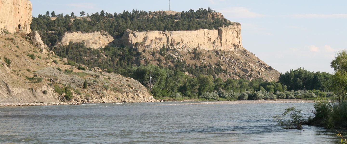


Billings Heights in Billings, Montana, pairs Yellowstone River landscapes with local parks, Main Street dining, family attractions and easy access to eastern Montana.
A High-Ground Neighbourhood
Billings Heights occupies the broad uplands north-east of central Billings, Montana, where residential streets, schools and a busy commercial corridor spread across open country above the Yellowstone River. It is commonly understood as a local area rather than a sharply defined administrative district, and its character is markedly different from the historic core: distances are greater, streets are more car-oriented and daily life centres on neighbourhood services rather than concentrated sightseeing. Main Street provides the principal commercial spine, linking the Heights with Billings's eastern approaches and carrying a mixture of restaurants, shops, practical businesses and longstanding local institutions.Read more about Heights
River Country and Open Space
Everyday Billings
Best attractions in Heights
The most characteristic attractions in Billings Heights are its open spaces and access to the Yellowstone River rather than a dense collection of galleries or monuments. Two Moon Park, near the river, provides a setting for walking, picnicking and observing the cottonwood-lined valley, while the Black Otter Trail follows the riverside corridor and offers a closer look at the landscape below the plateau. Main Street is the neighbourhood's principal urban experience, with local businesses, restaurants and everyday shopping extending along a broad road rather than a traditional pedestrian high street. Nearby MetraPark, outside the neighbourhood's central residential area, hosts major events and exhibitions and can be relevant to visitors staying in the Heights. The area also makes a practical starting point for exploring wider Billings, though downtown museums and the city's historic core lie elsewhere.
-
Tourist attraction
Swords Park
Experience the serene beauty of Swords Park in Billings, Montana, where outdoor adventures and stunning views await every visitor.
7 min walk · 0.6 km from neighbourhood centre

Best landmarks in Heights
The Yellowstone River corridor is Billings Heights' most important physical landmark, defining the lower landscape beneath the elevated residential plateau and explaining much of the area's sense of openness. Two Moon Park and the Black Otter Trail provide recognisable points of access to that setting, with paths, river vegetation and views that contrast with the commercial roads above. Main Street functions as a civic and social landmark in a less monumental sense: it is the long-established spine around which shops, services and neighbourhood movement have developed. Nearby MetraPark is a major Billings event landmark, but it should be treated geographically as close to, rather than automatically within, the Heights. The neighbourhood's other defining structures are schools, community facilities and commercial buildings that record its suburban growth rather than a preserved historic architectural style.
-
Park
Swords Park
Explore Swords Park in Billings, Montana – a serene park offering stunning views, scenic trails, and abundant opportunities for outdoor activities.
7 min walk · 0.6 km from neighbourhood centre

Explore Heights on the map
A handpicked selection of must-see spots in Heights, mapped for you.
Best hotels in Heights
Heights essentials
Getting There
Getting Around
Safety
Emergency Situations
Do's and Don'ts
Local Tips

From Eve
Local phrases worth knowing
You don't need to get them perfect. A few words go a long way, and locals appreciate the effort.
Basics
| English | Local | Say it |
|---|---|---|
| Hello | Howdy | [haw-dee] |
| Goodbye | See ya later | [see yuh lay-ter] |
| Yes | Yep | [yep] |
| No | Nope | [nohp] |
| Please/You're welcome | Please/Welcome | [pleez/welcome] |
| Thank you | Thanks a lot | [thanks uh lot] |
| Excuse me/Sorry | Pardon me/My bad | [par-dun me/my bad] |
| How are you? | How's it goin'? | [hows it go-in] |
| Fine. And you? | Good. How 'bout you? | [good. how bout yuh] |
| Do you speak English? | You speak English? | [yuh speak ing-glish] |
| I don't understand | I don't get it | [eye don't get it] |
Eating & Drinking
| English | Local | Say it |
|---|---|---|
| I'd like to see the menu, please | Can I see the menu? | [can eye see the menu] |
| I don't eat meat | I'm vegetarian | [eye'm ve-juh-tair-ee-an] |
| Cheers! | Cheers! | [cheers] |
| I would like to pay, please | Check, please | [check please] |
Emergencies
| English | Local | Say it |
|---|---|---|
| Help! | Help! | [help] |
| Go away! | Get lost! | [get lost] |
| Call the Police! | Call the cops! | [call the cops] |
| Call a doctor! | Get a doc! | [get uh doc] |
| I'm lost | I'm lost | [eye'm lost] |
| I'm ill | I'm sick | [eye'm sick] |
Shopping
| English | Local | Say it |
|---|---|---|
| I'd like to buy... | I wanna buy... | [eye wanna buy] |
| I'm just looking | Just browsing | [just brow-zing] |
| How much is it? | How much? | [how much] |
| That's too expensive | That's pricey | [thats pry-see] |
| Can you lower the price? | Can you do better? | [can yuh do bet-ter] |
Time & Numbers
| English | Local | Say it |
|---|---|---|
| What time is it? | What time is it? | [what time is it] |
| It's one o'clock | It's one | [its one] |
| Half past (10) | Half past ten | [half past ten] |
| Morning | Morning | [morning] |
| Afternoon | Afternoon | [afternoon] |
| Evening | Evening | [evening] |
| Yesterday | Yesterday | [yester-day] |
| Today | Today | [to-day] |
| Tomorrow | Tomorrow | [to-mor-row] |
| 1 | One | [wun] |
| 2 | Two | [too] |
| 3 | Three | [three] |
| 4 | Four | [four] |
| 5 | Five | [five] |
| 6 | Six | [six] |
| 7 | Seven | [seven] |
| 8 | Eight | [eight] |
| 9 | Nine | [nine] |
| 10 | Ten | [ten] |
Transport & Directions
| English | Local | Say it |
|---|---|---|
| Where's a/the...? | Where's the...? | [wheres the] |
| What's the address? | What's the address? | [whats the address] |
| Can you show me (on the map)? | Can you show me? | [can yuh show me] |
| When's the next (bus)? | When's the next bus? | [whens the next bus] |
| A ticket (to ....) | A ticket to... | [uh ticket to] |
History of Heights
Settlement Above the Yellowstone
The Heights developed on elevated ground north-east of the Yellowstone River, part of the landscape that supported the growth of Billings after the Northern Pacific Railway established the city in the late nineteenth century. Its height above the river was useful for orientation and settlement, while the valley below remained associated with transport, agriculture and flood-prone lowland. Rather than beginning as a compact historic quarter, the area emerged through the outward expansion of Billings across open land. The name Billings Heights reflects this physical setting and its relationship to the larger city.
Early Suburban Expansion
During the early twentieth century, residential development began filling the uplands beyond central Billings. Improved roads and public transport connections helped make the Heights more accessible, while schools, churches and small businesses gave the growing settlement a local identity. Main Street gradually became the principal commercial route, serving residents travelling between homes, workplaces and the city centre. The area's development was less dependent on grand civic buildings than on incremental subdivision, family housing and the arrival of everyday services that made living beyond downtown practical.
Postwar Growth and Main Street
Billings Heights expanded substantially during the postwar decades as population growth, automobile ownership and new housing pushed Billings towards its surrounding plateaus. Commercial activity spread along Main Street and adjoining roads, producing the broad, decentralised pattern visible today. Schools, shopping areas and community facilities became important markers of neighbourhood life, while newer subdivisions extended the built-up area towards the north and east. This period also strengthened the distinction between the Heights and downtown: the former developed as a spacious residential and service district rather than a dense urban centre.
A Contemporary Residential District
In recent decades the Heights has remained one of Billings's principal residential areas, combining established homes with continuing suburban development and a substantial commercial base. Its identity is shaped by practical local services, schools, recreation and access to the Yellowstone River corridor rather than by a single heritage precinct. Redevelopment and changing retail patterns have altered parts of Main Street, while parks and community institutions preserve links to the area's earlier growth. Today, the Heights is best understood as a lived-in part of Billings whose history is expressed through its street pattern, river setting and successive layers of suburban expansion.
Heights in Photos
Browse through our photo collection highlighting the charm and character of the destination.
Neighbourhoods near Heights
The closest neighbourhoods to Heights, if you have time for more than one stop.
-

-

-


Swipe for more neighbourhoods
Explore more
Explore more of Billings
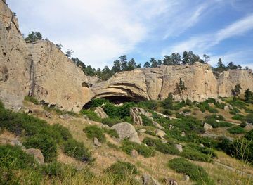
Billings, Montana blends Yellowstone River scenery, Western history, Rimrocks, museums, local dining and outdoor adventures in the state’s largest city.
Explore Billings