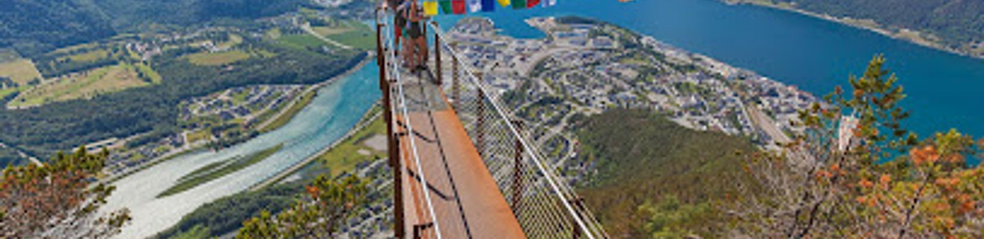
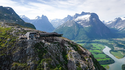
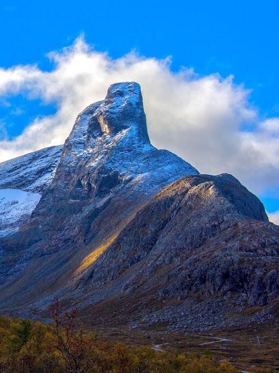
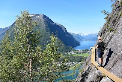
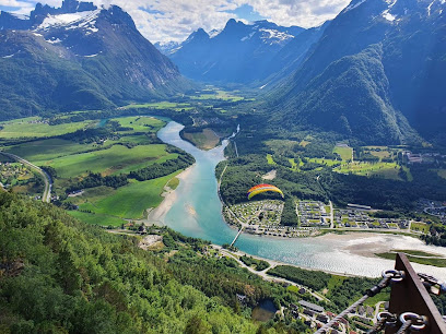
Rampestreken: The Scenic Stairway to Breathtaking Views
Explore Rampestreken: A must-visit scenic spot near Åndalsnes, showcasing breathtaking views of Norway's majestic landscapes.
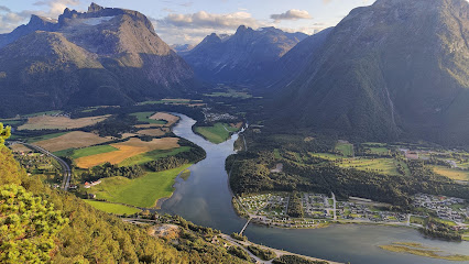
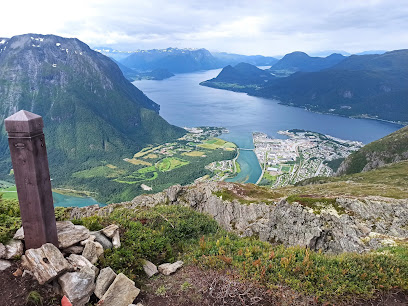
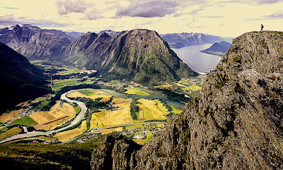
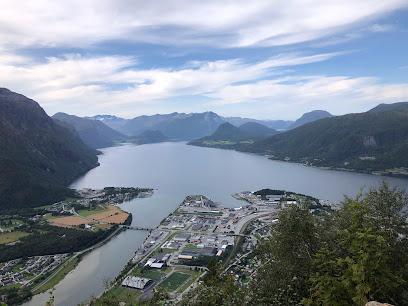
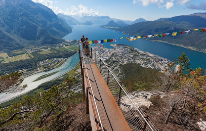
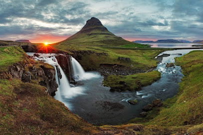
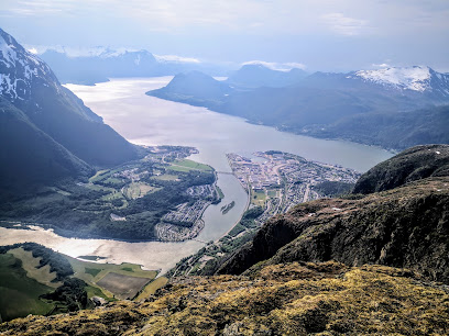
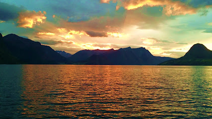
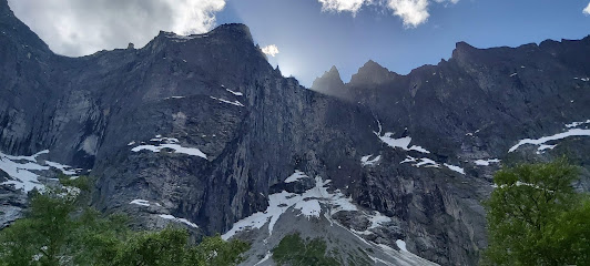
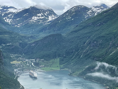
Rampestreken in Åndalsnes, Norway, offers an unforgettable hiking experience with panoramic views of the Romsdalen valley. This scenic spot is perfect for adventurous tourists seeking stunning landscapes and a taste of Norway's natural beauty.
A brief summary to Rampestreken
- Åndalsnes, 6300, NO
- +4770238800
- Visit website
Local tips
- Start your hike early in the day to avoid crowds and enjoy the tranquility of nature.
- Bring plenty of water and snacks, as there are no facilities along the trail.
- Dress in layers; weather conditions can change quickly in the mountains.
- Don’t forget your camera! The views from the top are truly breathtaking and worth capturing.
- Consider visiting in the early summer or early fall for the best weather and stunning autumn colors.
Getting There
-
Car
If you are traveling by car, start your journey towards Åndalsnes. From the E136 highway, take the exit towards Romsdalsvegen (Route 64) and continue until you reach Åndalsnes. Once in Åndalsnes, follow the signs to Rampestreken. You will find parking available at the trailhead, but note that it may have a fee depending on the season. The GPS coordinates for the parking area are approximately 62.5609, 7.7124.
-
Public Transportation
For those using public transportation, take a bus to Åndalsnes from major cities like Ålesund or Molde. The bus station in Åndalsnes is centrally located. From the bus station, it is a short walk to the Rampestreken trailhead. Follow the signs or use a map application on your smartphone to navigate the 1.5 km distance to the start of the hike. Be prepared for a steep climb as you make your way up to the viewing platform.
-
Walking
If you are already in Åndalsnes and prefer walking, head towards the Romsdalsstranda and follow the signs for Rampestreken. The walk to the trailhead from the center of Åndalsnes is approximately 20 minutes. The trail itself is well-marked and takes about 1-2 hours to reach the top, depending on your fitness level. Ensure you wear appropriate hiking shoes and bring water and snacks.
Discover more about Rampestreken
Iconic landmarks you can’t miss
Romsdalstrappa View
1.0 km
Discover the breathtaking beauty of Romsdalstrappa View in Åndalsnes, where stunning landscapes meet adventure in the heart of Norway.
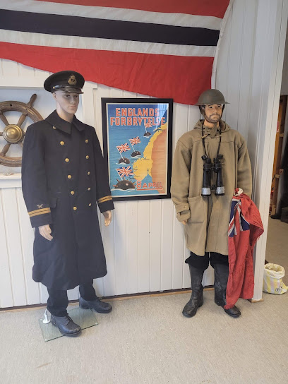
Veteranhuset Møre
1.2 km
Explore Norway's military heritage at Veteranhuset Møre, an engaging army museum in Åndalsnes, perfect for history enthusiasts and curious travelers alike.
Romsdalen AS
1.3 km
Discover the breathtaking beauty of Romsdalen with top-notch outdoor adventures in Norway's stunning landscapes, perfect for all nature lovers.
Høgaksla 981m.o.h
1.6 km
Discover the stunning views from Høgaksla, an observation deck offering breathtaking panoramas of Åndalsnes and its majestic surroundings in Norway.
Romsdalseggen
2.4 km
Discover the breathtaking trails and stunning views of Romsdalseggen, Norway's premier hiking destination, perfect for outdoor enthusiasts.
Hotel Aak
2.9 km
Discover the beauty of Åndalsnes at Hotel Aak, where comfort meets adventure in Norway's majestic landscapes.
Romsdalshorn
5.2 km
Explore Romsdalshorn, a scenic train station in Åndalsnes, and embark on unforgettable adventures in Norway's stunning landscapes.
Romsdal Lodge
6.7 km
Experience the breathtaking beauty of Norway at Romsdal Lodge, your perfect holiday home for adventure and relaxation in Isfjorden.
Romsdalshornet
8.6 km
Discover the breathtaking beauty of Romsdalshornet, a stunning mountain peak in Norway, perfect for hiking and experiencing nature's grandeur.
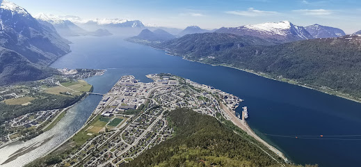
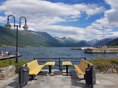
Romsdalsfjorden
13.3 km
Explore Romsdalsfjorden: A breathtaking fjord in Norway, perfect for outdoor adventures and cultural experiences amidst stunning landscapes.
Kors kyrkje
15.4 km
Discover the peaceful charm of Kors Kyrkje in Åndalsnes, where stunning architecture meets breathtaking natural beauty.
Romsdalsalpene
17.2 km
Discover the breathtaking beauty of Romsdalsalpene, Norway's majestic mountain range, offering endless adventure and stunning landscapes.

Romsdalen
17.6 km
Discover the stunning beauty and adventure of Romsdalen, Norway's breathtaking ravine, perfect for nature lovers and outdoor enthusiasts.
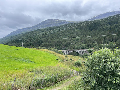
Kylling Bridge
30.5 km
Discover the breathtaking Kylling Bridge in Verma, Norway – a stunning architectural feat surrounded by nature's beauty.
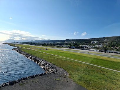
Molde Airport
30.9 km
Molde Airport: Your gateway to the picturesque fjords and breathtaking landscapes of Norway's Romsdal region.
Unmissable attractions to see
Romsdalsstigen Via Ferrata
0.5 km
Discover breathtaking views and adrenaline-pumping climbs at Romsdalsstigen Via Ferrata in Åndalsnes, Norway.
Bjørmosen
0.6 km
Experience the breathtaking landscapes and rich culture of Bjørmosen in Åndalsnes, Norway – a hidden gem for nature lovers and adventurers.
Nesaksla
0.8 km
Explore the breathtaking hiking trails of Nesaksla in Åndalsnes, Norway, where stunning views and nature's beauty await every adventurer.
Grindbygget Relax Place
0.9 km
Discover serenity and stunning views at Grindbygget Relax Place in Åndalsnes, a perfect spot for relaxation amidst Norway's majestic landscapes.
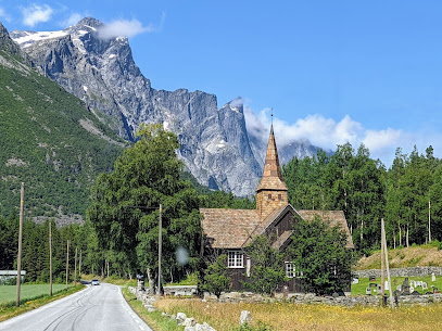
Train Chapel
1.3 km
Explore the Train Chapel in Åndalsnes, a serene blend of spirituality and stunning fjord views, perfect for reflection and photography.
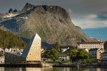
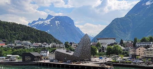
Romsdalsgondolen
1.3 km
Discover the breathtaking heights of Romsdalsgondolen in Åndalsnes, Norway, for stunning views and unforgettable mountain adventures.
Visit Romsdal
1.3 km
Explore Romsdal, Norway – a stunning destination of majestic mountains, deep fjords, and endless adventure opportunities.
Norsk Tindesenter
1.4 km
Explore the thrill of Norway's climbing heritage at Norsk Tindesenter in Åndalsnes, your starting point for mountain adventures and cultural experiences.
Åndalsnes
1.5 km
Experience the breathtaking beauty of Åndalsnes, Norway – the ideal destination for nature lovers and adventure seekers in stunning landscapes.
Nuken Viewpoint.
2.6 km
Discover the breathtaking Nuken Viewpoint in Veblungsnes, where stunning panoramic views of Norway's natural beauty await your visit.
Romsdalseggen Ridge
4.3 km
Explore Romsdalseggen Ridge, a scenic hiking paradise in Norway with stunning fjord views and a rich tapestry of nature and culture.
Romsdalhorn
9.5 km
Experience the breathtaking beauty of Romsdalhorn, a must-visit natural attraction in Norway, perfect for hiking and stunning views.
Stabbeskaret
9.7 km
Discover the breathtaking views and enchanting trails of Stabbeskaret, a premier tourist attraction in Norway's Romsdal region, perfect for nature lovers.
Innfjorden
9.9 km
Explore the stunning landscapes of Innfjorden, Norway, where majestic mountains meet tranquil waters, perfect for adventurers and nature lovers alike.
Trollstigen Foothill Viewpoint
11.0 km
Explore the breathtaking Trollstigen Foothill Viewpoint, where stunning landscapes and iconic mountain roads await in Norway's natural paradise.
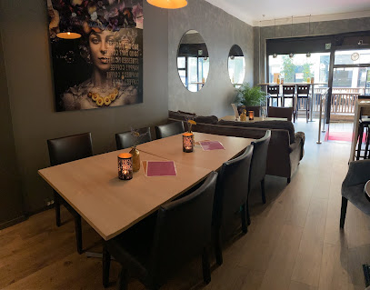
Essential places to dine
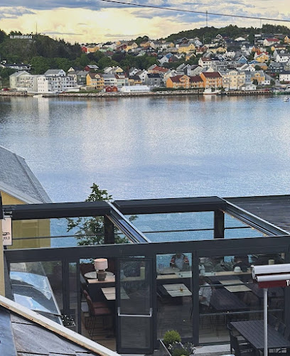
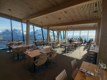
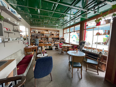
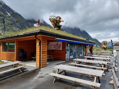
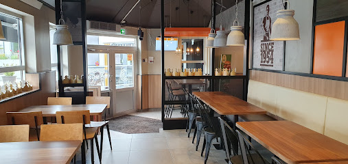
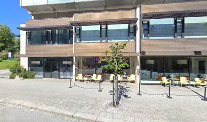
Eggen Restaurant
0.3 km
Experience exquisite dining amidst breathtaking views at Eggen Restaurant on Nesaksla Mountain.
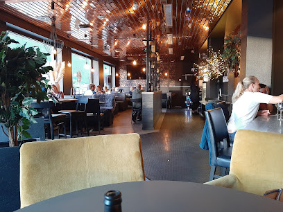
Belle Vue Restaurant
1.3 km
Experience exquisite Norwegian cuisine with breathtaking views at Belle Vue Restaurant in Åndalsnes.
Sødahlhuset
1.3 km
Discover Sødahlhuset: A delightful restaurant in Åndalsnes offering local cuisine with stunning fjord views.
Tindestua
1.4 km
Experience authentic Norwegian cuisine at Tindestua in Åndalsnes, where every dish is crafted with fresh local ingredients amidst stunning scenic views.
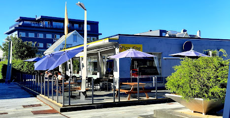
Piccola Mama Rosa
1.5 km
Experience authentic Italian flavors at Piccola Mama Rosa in Åndalsnes – where every bite transports you to Italy.
Hvelvet Bistro AS
1.5 km
Experience authentic Norwegian cuisine at Hvelvet Bistro AS in Åndalsnes, where local flavors meet breathtaking views.
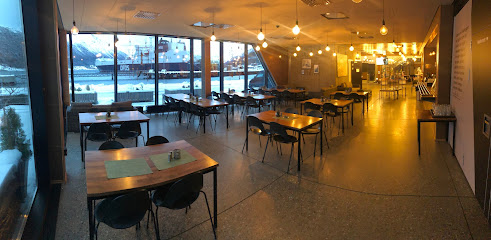
Trollstigen Drift As
7.2 km
Experience authentic Norwegian cuisine with stunning views at Trollstigen Drift As in Åndalsnes - a culinary haven for travelers.
Restaurant King
32.5 km
Discover delicious cuisine at Restaurant King in Vestnes – where local flavors meet international dishes in a cozy setting.
Amore Restaurant Vestnes AS
32.6 km
Experience exquisite Norwegian cuisine at Amore Restaurant Vestnes - where local flavors meet international flair.
Molde Klatresenter
33.4 km
Discover adventure and relaxation at Molde Klatresenter - your ultimate destination for rock climbing and dining amidst stunning scenery.
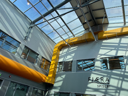
Fjæra spiseri
33.4 km
Discover Fjæra Spiseri: A Culinary Haven Offering Authentic Norwegian Cuisine with Stunning Fjord Views.
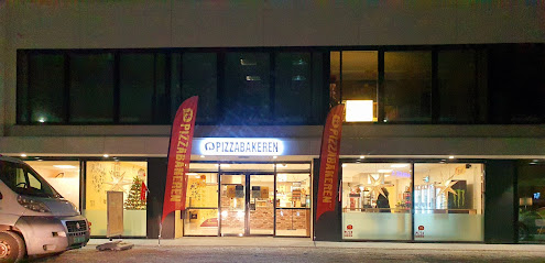
Pizzabakeren Molde
33.6 km
Discover delightful pizzas at Pizzabakeren Molde - your go-to spot for takeout and delivery in Norway's scenic coastal town.
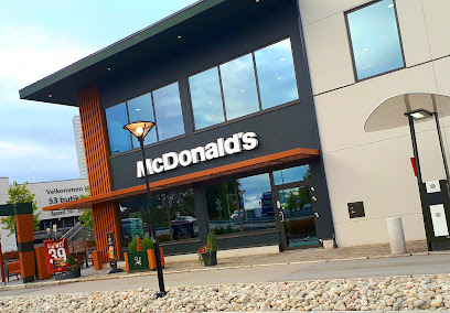
McDonald's Roseby
33.6 km
Discover delicious fast food at McDonald's Roseby in Molde - perfect for families and tourists craving a quick bite!
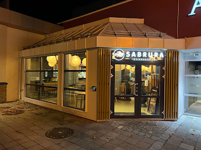
Sabrura Sticks & Sushi - Roseby
33.7 km
Savor the best sushi buffet in Molde at Sabrura Sticks & Sushi - where freshness meets flavor in every bite.
Burger King
33.7 km
Experience delicious fast food at Burger King in Molde - flame-grilled burgers and tasty sides await!
Markets, malls and hidden boutiques
Amfi Roseby Storsenter
33.4 km
Explore Amfi Roseby Storsenter, Molde's vibrant shopping mall with diverse retail, dining, and entertainment options for an unforgettable experience.
Europris Molde
33.4 km
Explore Europris Molde for budget-friendly shopping with a vast selection of groceries, home goods, and more in Norway's picturesque coastal town.
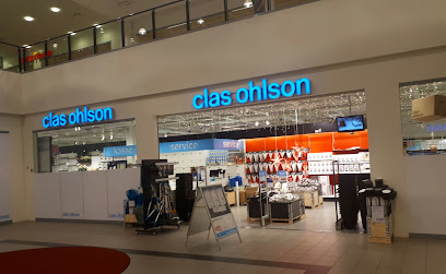
Clas Ohlson Molde
33.4 km
Explore Clas Ohlson Molde for a wide range of home improvement products, electronics, and DIY essentials in a welcoming atmosphere.
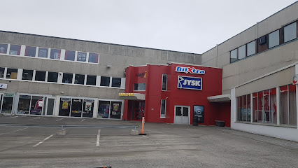
JYSK Molde
33.5 km
Discover stylish and affordable furniture at JYSK Molde, your ultimate destination for home decor in Norway.
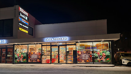
Asia Supermarket
33.5 km
Explore the vibrant world of Asian flavors and ingredients at Asia Supermarket in Molde, Norway's premier destination for authentic Asian groceries.
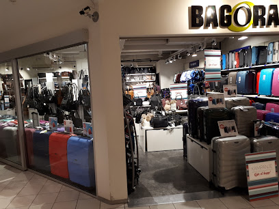
Bagorama
33.6 km
Discover stylish and functional bags at Bagorama, the top bag shop in Molde, Norway. Perfect for all your travel and fashion needs.
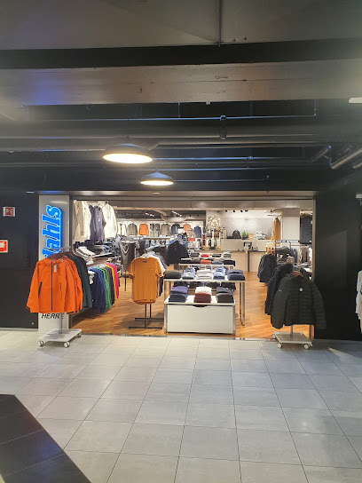
AANDAHLS HERRE
33.6 km
Discover the essence of men's fashion at Aandahls Herre in Molde, where style meets quality in a welcoming shopping environment.
KappAhl
33.7 km
Discover stylish and affordable fashion at KappAhl in Molde, Norway – perfect for families and fashion lovers alike!

Carlings
33.7 km
Explore the latest fashion trends at Carlings in Molde, where style meets comfort for every fashion enthusiast.

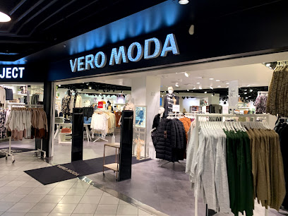
VERO MODA
33.7 km
Experience contemporary fashion at VERO MODA in Molde, where style meets affordability in a chic women's clothing store.
Front
33.7 km
Discover the best of contemporary fashion at Front Clothing Store in Molde, where style meets local charm.
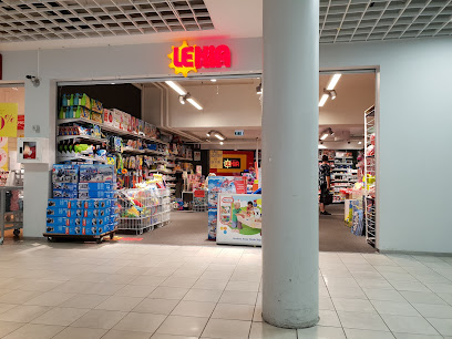
Lekia
33.7 km
Explore Lekia in Molde, Norway – a vibrant toy store offering a magical selection of toys, games, and gifts for all ages.
AMFI Roseby
33.7 km
Discover AMFI Roseby in Molde, Norway—your ultimate shopping destination with diverse brands and delightful dining options.
OBJECT
33.7 km
Explore the vibrant local fashion scene in Molde's premier clothing store, offering unique styles and sustainable options for every traveler.
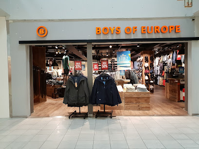
Boys of Europe
33.7 km
Explore the latest men's fashion trends at Boys of Europe in Molde, where style meets quality for the modern man.
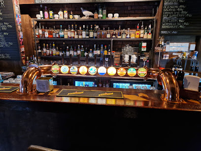
Essential bars & hidden hideouts
Baren i Bakgården
1.5 km
Discover the exquisite cocktails and cozy atmosphere at Baren i Bakgården, Åndalsnes' premier cocktail bar for an unforgettable nightlife experience.
Neighbor's Pub
1.5 km
Discover the lively atmosphere and local flavors at Neighbor's Pub in Åndalsnes, where community meets stunning scenery.
Panorama Bowling
33.0 km
Discover the perfect blend of fun and relaxation at Panorama Bowling in Molde, where bowling meets pub ambiance for an unforgettable experience.
Brygga
34.2 km
Discover Brygga, Molde's vibrant bar offering local drinks and stunning waterfront views, perfect for relaxation and socializing.
Glöd Vinbar
34.4 km
Experience the essence of fine wines in a modern setting at Glöd Vinbar, Molde's premier bar destination for wine lovers and social gatherings.
Sportspuben 1911
34.4 km
Immerse yourself in the lively atmosphere of Sportspuben 1911, Molde's ultimate sports bar, where every game is a celebration.
Bar A
34.4 km
Discover the vibrant nightlife of Molde at Bar A, where great drinks and a lively atmosphere create unforgettable experiences.
club infinity molde
34.5 km
Discover the vibrant nightlife at Club Infinity Molde, a popular bar where locals and tourists unite for an unforgettable evening of drinks and entertainment.
Valhall
36.5 km
Discover the lively Valhall Pub in Molde, a perfect blend of local charm, craft drinks, and a vibrant atmosphere for all tourists.
Rallarn Drift AS
45.3 km
Discover the charm of Rallarn Drift AS in Sunndalsøra, a cozy bar offering local drinks and a welcoming atmosphere amidst stunning Norwegian scenery.
Geiranger Bryggeri
57.7 km
Explore Geiranger Bryggeri for a taste of exceptional craft beers surrounded by Norway's stunning landscapes.
Hjørnet
61.1 km
Discover the vibrant nightlife of Kristiansund at Hjørnet, where cozy ambiance meets a diverse drink selection and live entertainment.
Bar 75
61.2 km
Discover Bar 75 in Kristiansund: a cozy bar and coffee shop offering a delightful blend of local brews and crafted cocktails in a welcoming ambiance.
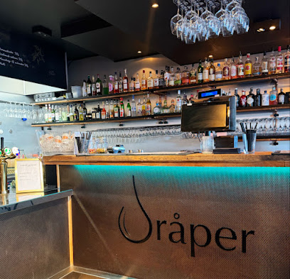
Dråper Bar
61.3 km
Experience the vibrant nightlife at Dråper Bar, where exquisite cocktails and a cozy atmosphere await you in Kristiansund.
Tordenskjold Pub og Bar
61.3 km
Discover the lively ambiance of Tordenskjold Pub og Bar, Kristiansund's premier live music venue for unforgettable nights out.