

Free Clatsop County Travel Guide & Mobile App
Explore Clatsop County with free travel guides. Discover regional history, expert tips, proposed trips, and audio guides on web or mobile app.


Clatsop County pairs Astoria's maritime history with Oregon beaches, coastal forests, wildlife, seafood and memorable Columbia River views.
Read more about Clatsop County
Getting to and around Clatsop County
How to get there
Transportation
Best landmarks in Clatsop County
The Astoria Column is Clatsop County's most recognisable civic landmark, a 1926 monument whose painted exterior panels recount episodes in the region's early American history and whose hilltop setting commands the lower Columbia. In the city below, the riverfront, Victorian architecture and working port express Astoria's long maritime identity. At Cannon Beach, Haystack Rock is the county's defining natural landmark, rising from the Pacific as a focal point for coastal views and marine life; visitors should observe access restrictions around nesting or intertidal areas. Fort Clatsop's reconstructed wooden enclosure represents the Lewis and Clark Expedition's winter quarters, although the site's significance also depends on understanding the Indigenous landscape that preceded it. Fort Stevens preserves concrete gun batteries and other military remains near the Columbia entrance, while Ecola State Park's forested headlands provide a broader geographical landmark: a meeting of ocean, cliffs, spruce forest and changing weather.
-
State park
Lewis and Clark State Recreation Site
Discover the breathtaking landscapes and rich history at Lewis and Clark State Recreation Site, a must-visit destination for outdoor enthusiasts in Oregon.
-
State park
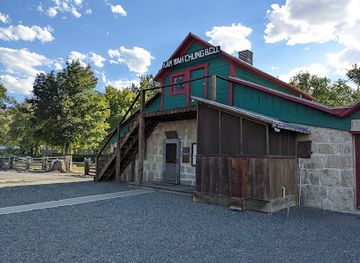
Kam Wah Chung State Heritage Site
Explore the Kam Wah Chung State Heritage Site and uncover the fascinating history of Chinese immigrants in Oregon's gold rush era.
-
State park
Fort Rock State Natural Area
Explore the ancient volcanic formations and rich history at Fort Rock State Natural Area, a stunning gem in Oregon's high desert landscape.
-
Bridge
Yale Bridge
Discover Yale Bridge in Ariel, WA: A breathtaking suspension bridge offering spectacular views, perfect for nature lovers and photography enthusiasts.



Explore Clatsop County on the map
Plan your trip on one map. See where the top cities, national parks and sights are, and book hotels and experiences in a few clicks.
Best hotels in Clatsop County
Best restaurants in Clatsop County
Dining in Clatsop County reflects its position between the Pacific and the Columbia: seafood restaurants, oyster houses, fish counters, brewpubs, cafés and traditional coastal eateries are more characteristic than a single signature cuisine. Dungeness crab, salmon, oysters, clams and other Pacific Northwest seafood appear seasonally, while chowders, fish-and-chips and smoked products reflect the area's maritime working culture. Astoria has the broadest range of restaurants, from casual riverfront meals to contemporary kitchens and bakeries, while Seaside and Cannon Beach combine family dining, cafés and more polished coastal restaurants. Local breweries and cider producers add regional drinks, and farmers' markets or farm shops may offer berries, vegetables and baked goods from northern Oregon. Menus and catches vary, so visitors should distinguish genuinely local seafood from generic coastal branding and ask about sourcing where it matters.
-
American
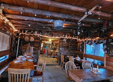
Cowboy Dinner Tree
Experience authentic American cuisine at Cowboy Dinner Tree in Silver Lake, Oregon - where hearty meals meet rustic charm amidst stunning natural beauty.
Best bars in Clatsop County
Evenings in Clatsop County are generally centred on pubs, breweries, wine bars, restaurants and live music rather than a large nightclub scene. Astoria has the county's most varied after-dark choices, with historic-feeling drinking spaces, contemporary bars and venues connected to its arts and maritime identity. Seaside offers casual resort bars and family-oriented evening activity, while Cannon Beach tends towards restaurants, breweries, wine-focused venues and quieter accommodation-based evenings. In smaller communities, closing times and transport options can be limited, particularly outside the summer season. Craft beer is prominent across the north Oregon coast, but the region's evening culture is also well suited to a meal, a harbour walk or an early night after outdoor activities. Arrange a taxi or designated driver in advance when travelling between towns.
-
Bar
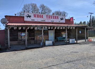
Watering Hole Of America - W.H.O.A. Tavern
Experience local charm at W.H.O.A. Tavern, Keno's renowned bar known for delicious food, craft drinks, and a welcoming atmosphere.
Get your free copy of our complete guide to Clatsop County, delivered straight to you.
Everything on this page, from attractions and restaurants to essentials and local phrases, in one PDF you can read offline, print or share.
Already have an account? Sign in
Your Clatsop County guide is ready.
We'll send it to · Not you? Sign out

Getting your guide ready…
We are putting together a fresh copy of the Clatsop County guide. This can take up to a minute.
This can take a few moments. If your browser asks, choose Allow so the download can start. You'll find the guide in your Downloads folder.
Nothing happened? Download it again
Sorry, the guide is taking longer than usual. Please try again in a minute, or get it by email instead.
Clatsop County essentials
Currency and Payment
Safety
Emergency Situations
Do's and Don'ts
Local Tips
From Eve
Local phrases worth knowing
You don't need to get them perfect. A few words go a long way, and locals appreciate the effort.
Basics
| English | Local | Say it |
|---|---|---|
| Hello | Hi | [Hai] |
| Goodbye | See ya | [See yah] |
| Yes | Yep | [Yep] |
| No | Nah | [Nah] |
| Please/You're welcome | Sure thing | [Shur thing] |
| Thank you | Thanks | [Thangs] |
| Excuse me/Sorry | Pardon me | [Pardon mee] |
| How are you? | How's it going? | [How's it goin?] |
| Fine. And you? | Good. You? | [Good. You?] |
| Do you speak English? | Do ya speak English? | [Doo yah speek English?] |
| I don't understand | I don't get it | [I don't get it] |
Eating & Drinking
| English | Local | Say it |
|---|---|---|
| I'd like to see the menu, please | Can I see the menu? | [Can I see the menu?] |
| I don't eat meat | I'm vegetarian | [I'm vegetarian] |
| Cheers! | Cheers! | [Cheers!] |
| I would like to pay, please | Can I get the check? | [Can I get the check?] |
Emergencies
| English | Local | Say it |
|---|---|---|
| Help! | Help! | [Help!] |
| Go away! | Leave me alone! | [Leave me alone!] |
| Call the Police! | Call 911! | [Call 911!] |
| Call a doctor! | Need a doctor! | [Need a doctor!] |
| I'm lost | I can't find my way | [I can't find my way] |
| I'm ill | I'm not feeling well | [I'm not feelin well] |
Shopping
| English | Local | Say it |
|---|---|---|
| I'd like to buy... | I'm looking to buy... | [I'm lookin to buy...] |
| I'm just looking | Just browsing | [Just browsin] |
| How much is it? | What’s the price? | [What's the price?] |
| That's too expensive | That's pricey | [That's pricey] |
| Can you lower the price? | Can you make it cheaper? | [Can you make it cheaper?] |
Time & Numbers
| English | Local | Say it |
|---|---|---|
| What time is it? | What time ya got? | [What time ya got?] |
| It's one o'clock | It's 1 o'clock | [It's 1 o'clock] |
| Half past (10) | Half past 10 | [Half past 10] |
| Morning | Morning | [Morning] |
| Afternoon | Afternoon | [Afternoon] |
| Evening | Evening | [Evening] |
| Yesterday | Yesterday | [Yesterday] |
| Today | Today | [Today] |
| Tomorrow | Tomorrow | [Tomorrow] |
| 1 | One | [One] |
| 2 | Two | [Two] |
| 3 | Three | [Three] |
| 4 | Four | [Four] |
| 5 | Five | [Five] |
| 6 | Six | [Six] |
| 7 | Seven | [Seven] |
| 8 | Eight | [Eight] |
| 9 | Nine | [Nine] |
| 10 | Ten | [Ten] |
Transport & Directions
| English | Local | Say it |
|---|---|---|
| Where's a/the...? | Where's the...? | [Where's the...?] |
| What's the address? | What’s the address? | [What's the address?] |
| Can you show me (on the map)? | Can you point it out? | [Can you point it out?] |
| When's the next (bus)? | When's the next bus? | [When's the next bus?] |
| A ticket (to ....) | A ticket to... | [A ticket to...] |
History of Clatsop County
Clatsop Homelands and Indigenous Continuity
The lower Columbia estuary and northern Oregon coast are ancestral homelands of the Clatsop people, closely related to neighbouring Chinookan communities. Clatsop communities relied on the river, estuaries, forests and ocean for food, travel and trade, using detailed knowledge of tides and seasonal resources. European-American settlement, disease, commercial pressure and government policy disrupted Indigenous life, but Clatsop identity and connections to the landscape continue. Visitors should understand that the county's history does not begin with the arrival of explorers or settlers; archaeological evidence and living cultural traditions reflect a far older human presence.
Fort Clatsop and the Winter of 1805–06
The Lewis and Clark Expedition reached the Pacific in late 1805 and built Fort Clatsop near the Netul River, now known as the Lewis and Clark River. The party spent the winter there before beginning its return journey in March 1806. The expedition depended on local Indigenous knowledge and trade as it dealt with rain, limited supplies and difficult terrain. A replica fort and interpretive programmes at Fort Clatsop form part of Lewis and Clark National Historical Park, while the episode remains an important but contested part of the region's wider story.
Astoria and the Fur Trade, 1811 Onwards
Astoria was established in 1811 by the Pacific Fur Company, financed by John Jacob Astor, making it one of the earliest permanent United States settlements on the Pacific coast. The outpost changed hands during the War of 1812 and later became part of the expanding American commercial network in the Pacific Northwest. Its position at the mouth of the Columbia made it important for river trade, shipping and communication. The town's early port history still shapes its streets, museums and relationship with the river.
Shipping, Fishing and the Columbia Bar
The Columbia River's entrance, where shifting sandbars meet ocean swell, became known to mariners as the Columbia Bar. Shipwrecks and difficult crossings drove the development of pilots, lifesaving services, navigational aids and specialised working communities. Fishing, canning and river shipping helped sustain Astoria and other settlements during the nineteenth and twentieth centuries. The Columbia River Maritime Museum interprets this maritime world, including the demanding work of bar pilots and the continuing importance of the river to regional commerce.
Timber, Railways and Industrial Growth
Forests of the Coast Range supported logging and wood-processing industries, while rail links and river transport connected Clatsop County with wider markets. Timber, fishing, canneries and related trades shaped employment and settlement patterns, particularly around Astoria and the lower Columbia. Industrial development brought economic opportunity but also altered rivers, forests and estuaries. Some former working landscapes now survive as museum subjects, waterfront structures or park features, while forestry and maritime activity remain part of the county's contemporary economy.
Military Defence at Fort Stevens
Fort Stevens guarded the southern side of the Columbia River entrance from the late nineteenth century through the Second World War. It grew from a coastal defence installation into a substantial military site with gun batteries, roads and supporting facilities. In 1942, a Japanese submarine shelled the area, causing limited damage and demonstrating the strategic significance of the river mouth during wartime. After the fort closed, much of the site became Fort Stevens State Park, where bunkers, batteries and other remnants remain among beaches, wetlands and forest.
Tourism and the Coastal Resort Economy
Improved roads, rail connections and growing leisure travel transformed Seaside and Cannon Beach into prominent Oregon coast destinations during the twentieth century. Seaside developed a classic resort identity around its beach and promenade, while Cannon Beach became associated with art galleries, distinctive accommodation and the landscape around Haystack Rock. Tourism did not replace the county's port and industrial traditions, but added a major economic layer. Today, visitors encounter a region where resort culture, protected landscapes, maritime history and working communities remain closely interwoven.
Clatsop County in Photos
Browse through our photo collection highlighting the charm and character of the destination.
Neighbouring regions of Clatsop County
The closest regions to Clatsop County, if you have time for more than one.
-

-

-

-

-


Swipe for more regions
Explore more

Explore more of Oregon
Discover Oregon's diverse landscapes, vibrant cities, and rich culture. From stunning coastlines to lush forests, this Pacific Northwest gem offers endless adventures.
Explore Oregon