

Saddar (Rawalpindi) Travel Guide - Free
Explore Saddar in Rawalpindi with Evendo's free guide. Find the best shops, historic streets, restaurants, and gems on web or mobile.


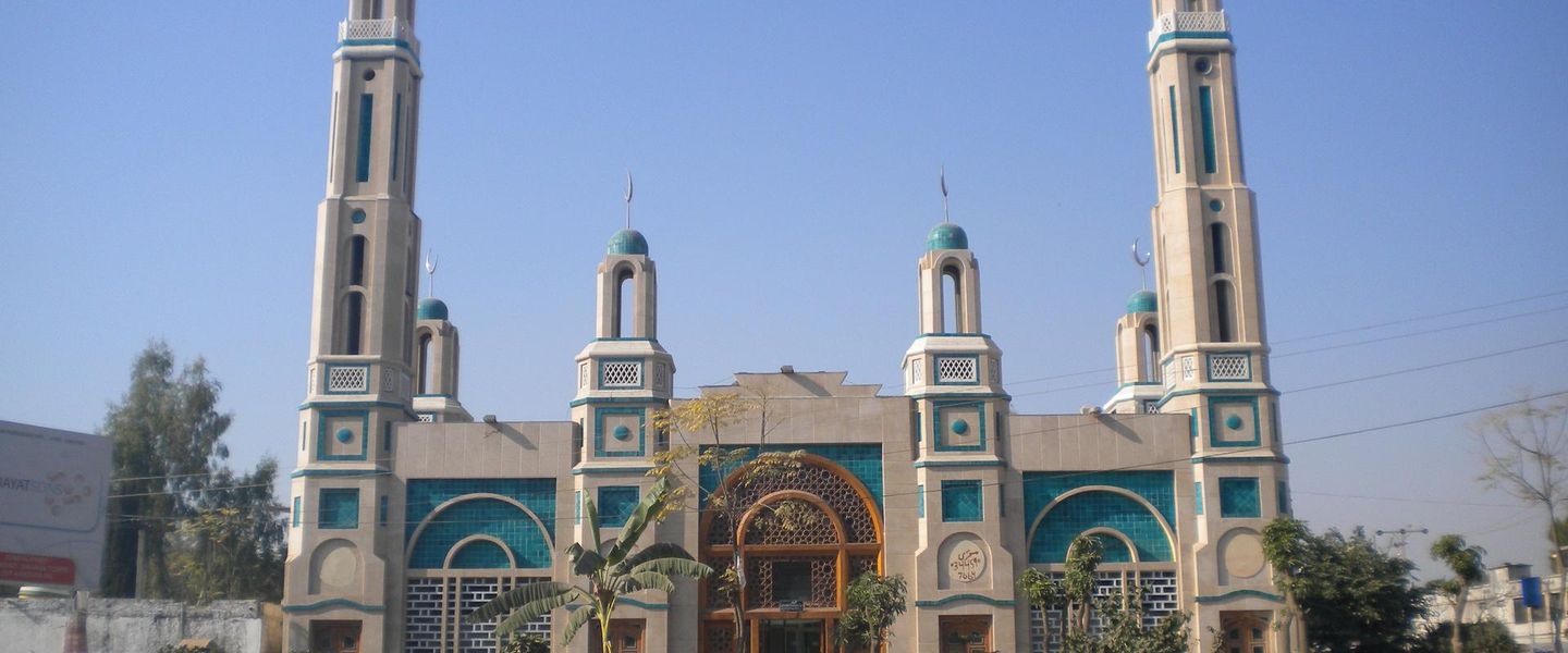


Saddar Rawalpindi brings together colonial cantonment streets, busy bazaars, railway connections, local cafés and everyday military-city history in Pakistan.
A Commercial Quarter of the Cantonment
Saddar is the commercial heart of Rawalpindi Cantonment, where broad colonial-era roads, crowded bazaars and everyday military-city life meet. The district lies south of Rawalpindi's older city centre and is shaped by the cantonment's formal avenues, including The Mall, Bank Road, Adamjee Road and Kashmir Road. Its name, derived from the Urdu word for headquarters or central place, reflects its long-standing role as the principal market area serving the cantonment.Read more about Saddar
Markets, Roads and Public Life
Colonial Memory and Contemporary Rawalpindi
Explore Saddar on the map
A handpicked selection of must-see spots in Saddar, mapped for you.
Best hotels in Saddar
Saddar essentials
Getting There
Getting Around
Safety
Emergency Situations
Do's and Don'ts
Local Tips

From Eve
Local phrases worth knowing
You don't need to get them perfect. A few words go a long way, and locals appreciate the effort.
Basics
| English | Local | Say it |
|---|---|---|
| Hello | سلام | [Salaam] |
| Goodbye | خدا حافظ | [Khuda Hafiz] |
| Yes | جی ہاں | [Jee haan] |
| No | نہیں | [Nahi] |
| Please/You're welcome | براہ کرم | [Barah-e-karam] |
| Thank you | شکریہ | [Shukriya] |
| Excuse me/Sorry | معذرت چاہتا ہوں | [Mazrat chahta hoon] |
| How are you? | آپ کیسے ہیں؟ | [Aap kaise hain?] |
| Fine. And you? | ٹھیک ہوں۔ آپ؟ | [Theek hoon. Aap?] |
| Do you speak English? | کیا آپ انگریزی بولتے ہیں؟ | [Kya aap angrezi bolte hain?] |
| I don't understand | مجھے سمجھ نہیں آیا | [Mujhe samajh nahi aya] |
Eating & Drinking
| English | Local | Say it |
|---|---|---|
| I'd like to see the menu, please | براہ کرم مینو دکھائیں | [Barah-e-karam menu dikhaiye] |
| I don't eat meat | میں گوشت نہیں کھاتا | [Main gosht nahi khata] |
| Cheers! | خوش رہیں | [Khush rahain] |
| I would like to pay, please | براہ کرم پیسہ دینا ہے | [Barah-e-karam paisa dena hai] |
Emergencies
| English | Local | Say it |
|---|---|---|
| Help! | مدد! | [Madad!] |
| Go away! | چلے جاؤ! | [Chale jao!] |
| Call the Police! | پولیس کو بلاؤ! | [Police ko bulao!] |
| Call a doctor! | ڈاکٹر کو بلاؤ! | [Doctor ko bulao!] |
| I'm lost | میں گم ہو گیا ہوں | [Main gum ho gaya hoon] |
| I'm ill | میں بیمار ہوں | [Main bimar hoon] |
Shopping
| English | Local | Say it |
|---|---|---|
| I'd like to buy... | میں خریدنا چاہتا ہوں۔۔۔ | [Main khareedna chahta hoon...] |
| I'm just looking | میں بس دیکھ رہا ہوں | [Main bas dekh raha hoon] |
| How much is it? | یہ کتنا ہے؟ | [Ye kitna hai?] |
| That's too expensive | یہ بہت مہنگا ہے | [Ye bohot mehnga hai] |
| Can you lower the price? | کیا آپ قیمت کم کر سکتے ہیں؟ | [Kya aap qeemat kam kar sakte hain?] |
Time & Numbers
| English | Local | Say it |
|---|---|---|
| What time is it? | کیا وقت ہوا ہے؟ | [Kya waqt hua hai?] |
| It's one o'clock | ایک بجے ہیں | [Ek bajay hain] |
| Half past (10) | (۱۰) دس بجے کو چھے بجے | [(10) Das bajay ko chhay bajay] |
| Morning | صبح | [Subah] |
| Afternoon | دوپہر | [Dopahar] |
| Evening | شام | [Shaam] |
| Yesterday | کل | [Kal] |
| Today | آج | [Aaj] |
| Tomorrow | کل | [Kal] |
| 1 | ایک | [Ek] |
| 2 | دو | [Do] |
| 3 | تین | [Teen] |
| 4 | چار | [Chaar] |
| 5 | پانچ | [Paanch] |
| 6 | چھے | [Chhay] |
| 7 | سات | [Saath] |
| 8 | آٹھ | [Aath] |
| 9 | نو | [No] |
| 10 | دس | [Das] |
Transport & Directions
| English | Local | Say it |
|---|---|---|
| Where's a/the...? | کہاں ہے...؟ | [Kahan hai...?] |
| What's the address? | پتہ کیا ہے؟ | [Pata kya hai?] |
| Can you show me (on the map)? | کیا آپ مجھے دکھا سکتے ہیں (نقشے پر)؟ | [Kya aap mujhe dikhha sakte hain (naqshay par)?] |
| When's the next (bus)? | اگلی (بس) کب ہے؟ | [Agli (bus) kab hai?] |
| A ticket (to ....) | ایک ٹکٹ (سے .... تک) | [Ek ticket (se .... tak)] |
History of Saddar
The Cantonment Takes Shape
Saddar developed as the principal civilian market associated with Rawalpindi Cantonment, established by the British after the annexation of Punjab in 1849. The cantonment was planned separately from the older walled and bazaar areas of Rawalpindi, with military grounds, administrative compounds and residential quarters arranged along wider roads. Saddar served the soldiers, officials and families who lived or worked in this new military settlement, becoming a place for trade, services and social exchange. Its position between the cantonment and the older city helped it grow as an intermediary district rather than as a self-contained historic town.
Railways and Commercial Expansion
The arrival of the railway in Rawalpindi in the nineteenth century strengthened Saddar's importance by improving connections with Lahore, Peshawar and other parts of the region. The station and the roads leading towards the cantonment supported the movement of people, goods and military supplies, while shops and lodging businesses expanded around the commercial core. The Mall and adjoining roads acquired the formal, tree-lined character associated with British cantonment planning, contrasting with the narrower and more intensely mixed streets of the older city. Saddar's growth was therefore tied both to military administration and to the wider transport network of northern Punjab.
Institutions, Churches and Civic Memory
During the late colonial period, Saddar and the surrounding cantonment gained churches, schools, offices, clubs and service buildings intended for a socially stratified military and civilian population. St Paul's Church on The Mall remains an important reminder of that period, while surviving institutional compounds and mature roadside trees preserve fragments of the area's planned landscape. After the creation of Pakistan in 1947, the cantonment's military role continued, but the commercial life of Saddar increasingly served a much broader population. The district consequently retained colonial-era buildings while adapting to new administrative, retail and social realities.
A Modern Commercial Centre
In the later twentieth century and after, Saddar became one of Rawalpindi's principal shopping and service districts. Older low-rise premises were joined by denser commercial buildings, specialist shops, restaurants and transport activity, especially along Bank Road, Adamjee Road and nearby market lanes. The area's identity remained connected to the cantonment, yet its daily clientele extended well beyond military households. Security requirements around military land and government facilities have also shaped movement and photography. Today Saddar is best read as a layered commercial district: a planned cantonment landscape overlaid by the intense retail, commuting and street life of contemporary Rawalpindi.
Saddar in Photos
Browse through our photo collection highlighting the charm and character of the destination.
Neighbourhoods near Saddar
The closest neighbourhoods to Saddar, if you have time for more than one stop.
-
-

-


Swipe for more neighbourhoods
Explore more

Explore more of Rawalpindi
Rawalpindi blends Mughal-era streets, colonial landmarks, lively bazaars and Punjabi flavours, with easy access to Islamabad, Taxila and the Potohar Plateau.
Explore Rawalpindi