Kvarntorpshögen, Vastmanland Travel Guide
Ascend Sweden's strangest summit: a smoldering slag heap turned art haven with epic views, bike thrills, and endless stairs.
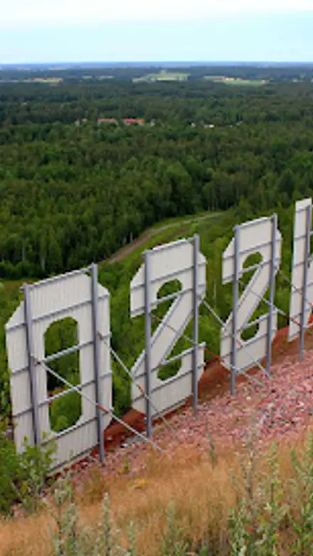
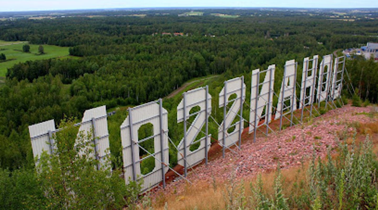
Kvarntorpshögen is a striking 100-meter-high slag heap in Kvarntorp, Sweden, born from WWII-era oil shale extraction. Crowned with 'Konst på Hög' sculptures by top artists, it offers panoramic views of Närke plain, a 427-step staircase for fitness enthusiasts, cycling trails, winter skiing, and subtle steam vents from its still-smoldering core. Sweden's strangest sight blends industrial legacy with art and recreation.
A brief summary to Kvarntorpshögen
- 251, Kumla, Kvarntorp, 692 92, SE
- Click to display
- Duration: 0.5 to 2 hours
- Free
-
 Outdoor
- Mobile reception: 4 out of 5

Know before you go
Hi, I'm Eve. Here are a few practical things to know before exploring Kvarntorpshögen.
- Respect warning signs around steam vents and hot spots—avoid venturing off paths to prevent falls into cavities.
- Climb the 427-step staircase early morning for solitude and training; pair with a descent by bike or car.
- Visit in summer for the kiosk's refreshments and full art access; bring binoculars for birdwatching.
- Winter brings ski slopes—check Kumla Skidförening for snow conditions before heading out.
Do you manage this location?
Take control to get all the benefits, like improved information, better appearance, and stronger visibility across AI-powered discovery. Learn more about listing your business on Evendo
Activate your presenceOther nearby places you may find interesting
The closest places of the same kind, if this one is not quite what you had in mind.

Explore Kvarntorpshögen on the Map
A handpicked selection of must-see spots near Kvarntorpshögen, mapped for you.
Getting There
-
Car
Drive from Kumla center via Road 51/52 toward Kvarntorp, following Konst på Hög signs; 15-minute trip, free parking at base and summit road (18% incline), available year-round.
-
Bus
Länstrafiken bus from Kumla station to Kvarntorp stop, then 20-minute walk on flat paths; 20-30 minutes total, 40-60 SEK one-way, hourly services weekdays, less frequent weekends.
-
Walking
From Kumla train station, 10 km hike along roads and trails through fields; 2-2.5 hours, flat terrain mostly paved, suitable for fit walkers in dry weather.
-
Cycling
Bike from Kumla on designated paths paralleling Road 51/52; 40-50 minutes, gentle slopes building to heap's ascent, bike racks at top, ideal for downhill return.
For the on-the-go comforts that matter to you
-
 Drink Options
-
 Food Options
-
 Seating Areas
-
 Trash Bins
-
 Information Boards
Discover more about Kvarntorpshögen
Birth of a Burning Giant
During World War II, Sweden faced an oil embargo, prompting the government to tap local oil shale reserves in Kvarntorp. In 1940, a committee formed, leading to Svenska Skifferolje Aktiebolaget (SSAB). Production began in 1942, peaking at 100,000 cubic meters of oil annually. The process generated massive slag—hot remnants up to 600°C—piled into what became Kvarntorpshögen, reaching 100 meters high and 157 meters above sea level, the tallest point on the Närke plain.The plant operated until 1966, when it closed. Efforts to extinguish the heap persist, as underground fires still burn, producing steam from underground water vaporizing on hot spots.Konst på Hög: Art Amid Ashes
In the mid-1990s, gallerist Anders Fasth and artist Olle Medin envisioned transforming the summit into an open-air gallery. 'Konst på Hög' now features large-scale sculptures by Sweden's leading artists, drawing 30,000 visitors yearly. The collection integrates with the rugged terrain, creating a surreal dialogue between industrial waste and contemporary expression.Recognized as Sweden's strangest sight in Fredrik Kullberg's 2010 book, the site merges raw earth with refined art, inviting contemplation of humanity's energy pursuits.Active Playground on the Heap
Today, Kvarntorpshögen thrives as a recreational hub in Kvarntorps friluftsområde. A renowned downhill bike park attracts cyclists, while Kumla Skidförening maintains two ski slopes for winter. The 427-step wooden staircase draws fitness trainers for its steep ascent, and hiking trails weave through the landscape.A car road climbs the 18% gradient, mimicking alpine drives, with a summer kiosk offering snacks and info. Birdwatchers flock here for ornithological interest.Hidden Dangers and Living Legacy
Beneath the surface, the heap remains alive. Warning signs mark risky zones where cavities form from combustion, posing collapse hazards. Steam occasionally rises from cracks, a reminder of unresolved subterranean fires despite decades of quenching attempts.This duality—playground atop a smoldering relic—defines the site's allure, blending adventure with caution in a landscape shaped by wartime necessity.












Your all‑in‑one travel companion app
Explore expert travel guides, compare and book tours, experiences, hotels, and more—all from the palm of your hand. Download now for seamless trip planning wherever your wanderlust takes you.


Explore More of Vastmanland
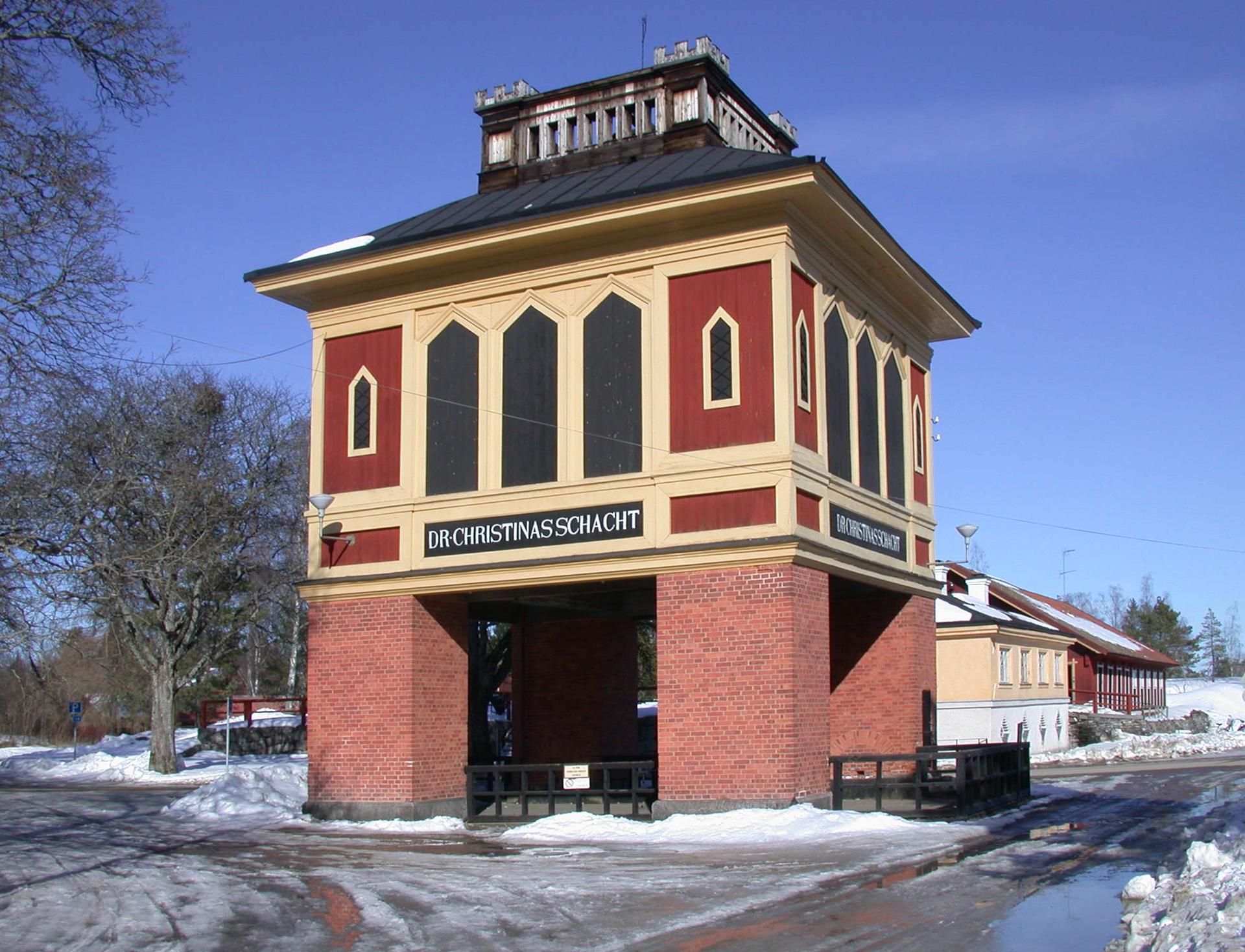
Looking beyond Kvarntorpshögen? Discover Vastmanland for broader travel guides, local hot-spots, and regional highlights.
Explore Vastmanland
Unlock Örebro's layered past in a treasure trove of history, art, and regional wonders, steps from the castle's timeless towers.
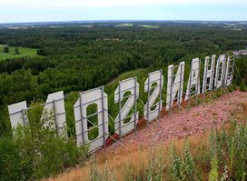
Experience breathtaking views and captivating art at Kvarntorpshögen, a unique tourist attraction in Sweden that combines nature and culture.