

Loihuno Waterfall Travel Guide - Free Web & App
Your ultimate guide to Loihuno Waterfall. Discover top landmarks, proposed trips, and local tips. Free on the web or via the Evendo companion app.


Loihuno Waterfall in Timor-Leste offers a rural Ossu escape with forest scenery, natural pools, village culture and a quiet eastern adventure near Viqueque.
A Rural Waterfall Landscape
Loihuno Waterfall lies near Loihuno village in the Ossu area of Viqueque Municipality, in the mountainous east of Timor-Leste. It is a small-scale nature destination rather than a developed resort, reached through a rural landscape of steep hills, cultivated land and tropical vegetation. The waterfall’s appeal lies in its setting and tranquillity: water descends through a green valley where visitors can pause beside natural pools and experience a part of Timor-Leste that remains closely connected to village life.Read more about Loihuno Waterfall
Ossu and the Surrounding Country
Community, Nature and Visitor Experience
When is the best time to visit Loihuno Waterfall?
Best: June–August · 29–30°C| Month | High (°C) | Rainfall (mm) |
|---|---|---|
| January | 32 | 85 |
| February | 32 | 77 |
| March | 32 | 68 |
| April | 31 | 57 |
| May | 31 | 49 |
| June (best) | 29 | 42 |
| July (best) | 29 | 45 |
| August (best) | 30 | 51 |
| September | 31 | 60 |
| October | 32 | 71 |
| November | 33 | 79 |
| December | 32 | 82 |
Getting to and around Loihuno Waterfall
How to get there
Transportation
Best attractions in Loihuno Waterfall
-
Tourist attraction
Dokomali Falls/ Bee Tudak Dokomali
Experience the breathtaking beauty of Dokomali Falls, Timor-Leste's hidden gem, where nature's tranquility meets adventure in a stunning waterfall setting.
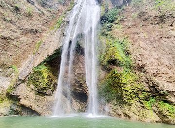
Best landmarks in Loihuno Waterfall
Loihuno Waterfall is the defining natural landmark of this small destination, distinguished less by monumental scale than by its setting among the hills and village landscapes of Ossu. Its flowing water, rock channels and surrounding vegetation illustrate the importance of freshwater in a dry-season-prone island environment, while the route to the site connects the visitor with cultivated land and local settlement. The nearby village of Loihuno is a cultural reference point rather than a formal monument, and its significance lies in the continuing life of the community around the landscape. The wider Ossu highlands provide the principal geographic backdrop. No major architectural landmark or purpose-built visitor complex should be expected at the waterfall, and unmarked natural features should be approached only with local permission and guidance.
-
Tourist attraction
Lou-Huno Waterfall
Experience the enchanting beauty of Lou-Huno Waterfall, a serene natural escape in Loihuno, perfect for nature lovers and photographers.

Explore Loihuno Waterfall on the map
Plan your trip on one map. See where the top attractions, landmarks, restaurants and hotels are, and book hotels and experiences in a few clicks.
Best hotels in Loihuno Waterfall
Get your free copy of our complete guide to Loihuno Waterfall, delivered straight to you.
Everything on this page, from attractions and restaurants to essentials and local phrases, in one PDF you can read offline, print or share.
Already have an account? Sign in
Your Loihuno Waterfall guide is ready.
We'll send it to · Not you? Sign out

Getting your guide ready…
We are putting together a fresh copy of the Loihuno Waterfall guide. This can take up to a minute.
This can take a few moments. If your browser asks, choose Allow so the download can start. You'll find the guide in your Downloads folder.
Nothing happened? Download it again
Sorry, the guide is taking longer than usual. Please try again in a minute, or get it by email instead.
Loihuno Waterfall essentials
Currency and Payment
Safety
Emergency Situations
Do's and Don'ts
Local Tips
From Eve
Local phrases worth knowing
You don't need to get them perfect. A few words go a long way, and locals appreciate the effort.
Basics
| English | Local | Say it |
|---|---|---|
| Hello | Bondia | [bon-dee-ah] |
| Goodbye | Adeus | [ah-deh-oos] |
| Yes | Sim | [seem] |
| No | Lae | [lie] |
| Please/You're welcome | Por favor | [pohr fah-vohr] |
| Thank you | Obrigadu | [oh-bree-gah-doo] |
| Excuse me/Sorry | Deskulpa | [dehs-kool-pah] |
| How are you? | O atu halo? | [oh ah-too hah-loh] |
| Fine. And you? | Diak. No ita? | [dee-ahk. noh ee-tah] |
| Do you speak English? | Ita koalia Ingles? | [ee-tah koh-ah-lee-ah een-glehs] |
| I don't understand | Hau la kompriende | [how lah kohm-pree-en-deh] |
Eating & Drinking
| English | Local | Say it |
|---|---|---|
| I'd like to see the menu, please | Hau hakarak hare menu, favor | [how hah-kah-rak hah-reh meh-noo, fah-vohr] |
| I don't eat meat | Hau la manan karne | [how lah mah-nahn kahr-nay] |
| Cheers! | Saude! | [sah-oo-deh] |
| I would like to pay, please | Hau hakarak selu, favor | [how hah-kah-rak seh-loo, fah-vohr] |
Emergencies
| English | Local | Say it |
|---|---|---|
| Help! | Ajuda! | [ah-joo-dah] |
| Go away! | Ba malu! | [bah mah-loo] |
| Call the Police! | Talia polisia! | [tah-lee-ah poh-lee-see-ah] |
| Call a doctor! | Talia doto! | [tah-lee-ah doh-toh] |
| I'm lost | Hau lakon | [how lah-kohn] |
| I'm ill | Hau dook | [how dook] |
Shopping
| English | Local | Say it |
|---|---|---|
| I'd like to buy... | Hau hakarak hola... | [how hah-kah-rak hoh-lah] |
| I'm just looking | Hau hela deit | [how heh-lah dayt] |
| How much is it? | Kuantu osan ida nee? | [kwahn-too oh-sahn ee-dah nay] |
| That's too expensive | Ida nee makosu liu | [ee-dah nay mah-koh-soo lee-oo] |
| Can you lower the price? | Ita bele hamenus tan? | [ee-tah beh-leh hah-meh-noos tahn] |
Time & Numbers
| English | Local | Say it |
|---|---|---|
| What time is it? | Oras kiik? | [oh-rahs kee-eek] |
| It's one o'clock | Ohra ida | [oh-rah ee-dah] |
| Half past (10) | Afu (10) | [ah-foo (dih-see)] |
| Morning | Manha | [mah-nyah] |
| Afternoon | Tarde | [tahr-deh] |
| Evening | Kalan | [kah-lahn] |
| Yesterday | Tersa | [tehr-sah] |
| Today | Ohin | [oh-heen] |
| Tomorrow | Fatin | [fah-teen] |
| 1 | Ida | [ee-dah] |
| 2 | Rua | [roo-ah] |
| 3 | Tolu | [toh-loo] |
| 4 | Apat | [ah-paht] |
| 5 | Lima | [lee-mah] |
| 6 | Neen | [nay-ehn] |
| 7 | Hitu | [hee-too] |
| 8 | Ualu | [wah-loo] |
| 9 | Sia | [see-ah] |
| 10 | Sanulu | [sah-noo-loo] |
Transport & Directions
| English | Local | Say it |
|---|---|---|
| Where's a/the...? | Iha neeba... | [ee-hah neh-bah] |
| What's the address? | Enderecu saida nia? | [ehn-deh-reh-soo sah-ee-dah nee-ah] |
| Can you show me (on the map)? | Ita bele hatudu hau (iha map)? | [ee-tah beh-leh hah-too-doo how (ee-hah mahp)] |
| When's the next (bus)? | Tuir loron nee nia | [too-eer loh-rohn nee nee-ah] |
| A ticket (to ....) | Bilhete (to ...) | [beel-yeh-teh (to ...)] |
History of Loihuno Waterfall
Mountain Communities of Ossu
Loihuno belongs to the wider Ossu area, where settlement and everyday life have long been shaped by the mountainous terrain, seasonal water and agricultural land. Communities in this part of Timor have maintained strong local identities expressed through customary relationships, village obligations and distinctive languages and traditions. The waterfall is therefore not an isolated natural attraction but part of a lived rural landscape. Historical information specific to the waterfall itself is limited, and its significance is best understood through the continuing relationship between Loihuno’s residents, surrounding land and water resources.
Portuguese Timor and Local Administration
For much of the colonial period, the territory formed part of Portuguese Timor, although Portuguese administrative control was uneven outside the principal settlements. Remote eastern highlands such as the Ossu area remained strongly influenced by local authority, customary practice and agricultural routines. Roads and administrative links gradually connected communities with larger centres, but the region retained a predominantly rural character. The present-day location of Loihuno within Viqueque Municipality reflects later administrative arrangements rather than a single historic boundary defining the waterfall.
Occupation and the Road to Independence
Indonesia occupied Timor-Leste from 1975 until the 1999 referendum and subsequent restoration of independence in 2002. Rural communities across Viqueque experienced the disruption, displacement and insecurity associated with that period, although the detailed history of Loihuno village is not widely documented in visitor sources. The referendum led to a United Nations-backed transition and the establishment of the independent Democratic Republic of Timor-Leste. Contemporary travel through the region takes place within this still relatively young national framework.
Rural Tourism and Environmental Care
Since independence, Timor-Leste has gradually developed community-based and nature-oriented tourism alongside its established cultural and historical attractions. Loihuno Waterfall represents the modest scale of this emerging rural tourism: the landscape itself is the principal attraction, while infrastructure and formal interpretation remain limited. Sustainable visits depend on local guidance, careful use of paths and water, and respect for customary access. Tourism can bring useful income to communities, but increased visitation also makes protection of freshwater areas, vegetation and village privacy important.
Loihuno Waterfall in Photos
Browse through our photo collection highlighting the charm and character of the destination.
Neighbouring destination travel guides
The closest destinations to Loihuno Waterfall, if you have time for more than one.
-

-

-

-

-


Swipe for more destinations
Explore more

Explore more of Viqueque
Viqueque reveals Timor-Leste through southern coastlines, rice fields, forested hills, resistance history and rural community life.
Explore Viqueque
Explore more of Timor-Leste
Discover Timor-Leste, a captivating blend of history, culture, and natural beauty in Southeast Asia, boasting pristine beaches, vibrant marine life, and lush landscapes.
Explore Timor-Leste