Pont ar Daf Car Park & Trailhead
South Wales's premier mountain gateway—where 200,000 annual walkers begin their ascent to Pen y Fan's windswept summit.
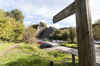
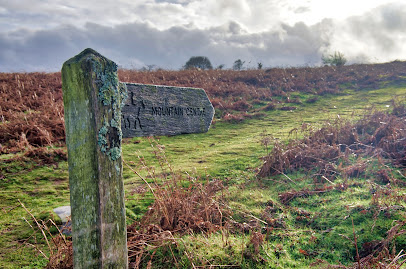
Pont ar Daf is the primary gateway to Pen y Fan, South Wales's highest peak at 886 metres, situated within Brecon Beacons National Park. This well-maintained National Trust car park serves as the starting point for some of the region's most popular walking routes, offering modern facilities including toilets, Wi-Fi, and electric vehicle charging. Located 8 miles south of Brecon on the A470, it accommodates around 200 vehicles and provides direct access to the iconic Beacons Way and circular mountain trails.
A brief summary to National Trust - Pont ar Daf
- Pont ar Daf car park (access to Pen y Fan), Near Storey Arms, Brecon, Libanus, LD3 8NL, GB
- Duration: 2.5 to 4 hours
- Mid ranged
-
 Outdoor
- Mobile reception: 4 out of 5
Local tips
- Arrive early on weekends and holidays to secure parking; the car park fills quickly despite recent expansion. Free parking is available at Storey Arms car park nearby, though it reaches capacity first.
- Bring your own water bottle—there are no public water fountains on the mountain. Fill up before departing the car park or bring supplies from nearby villages.
- Check weather conditions before ascending; the summit is exposed and wind speeds increase dramatically at altitude. The staff at the car park can provide current conditions and advice.
- Download offline maps or GPS files beforehand; mobile signal is generally good but patchy in parts of the mountain range.
- Food and drink caravans often operate alongside the A470 near the car park, but options are limited. Consider bringing snacks or visiting Brecon or Libanus for more substantial meals.
For the on-the-go comforts that matter to you
- Restrooms
- Drink Options
- Drinking Water
- Food Options
- Seating Areas
- Sheltered Areas
- Picnic Areas
- Trash Bins
- Information Boards
- Visitor Center
Getting There
-
By Car via A470
Drive to Pont ar Daf car park via the A470 road, which connects Llandudno in North Wales to Cardiff in South Wales and passes directly through Brecon Beacons National Park. The car park is located 8 miles south of Brecon town centre. Parking costs £7.50 per vehicle for non-members (National Trust members park free), payable via cash, card, or Pay By Phone. Over 180 spaces available, though capacity fills quickly during weekends and holidays. Alternative free parking exists at nearby Storey Arms car park, though it reaches capacity first. Additional informal parking is available on the A470 roadside nearby.
-
By Public Bus
Take the T4 bus service that connects Merthyr Tydfil (from the south) or Newtown (from the north) and alight at Storey Arms stop on the A470. Buses stop on either side of the A470 outside the Storey Arms centre, approximately 200 metres from Pont ar Daf car park. A footpath connects the bus stops directly to the car park and trailhead. Journey times vary depending on origin; from Merthyr Tydfil approximately 45–60 minutes; from Newtown approximately 60–90 minutes. Service frequency is limited, so check schedules in advance.
-
By Train and Bus Connection
Take a train to either Merthyr Tydfil station (southern approach) or Newtown station (northern approach), then connect with the T4 bus service to Storey Arms. Total journey time from Merthyr Tydfil approximately 90–120 minutes; from Newtown approximately 120–150 minutes. This option suits visitors without private transport or those combining multiple destinations in Mid Wales.
-
By Bicycle via National Cycle Network
Access via National Cycle Network Route 8 or the Taff Trail, both of which pass through the Brecon Beacons area. The Taff Trail runs alongside the A470 and connects to the car park and trailhead. Cycling times vary significantly based on starting point and route chosen; from Brecon town centre approximately 45–60 minutes. The car park provides bicycle parking facilities.
National Trust - Pont ar Daf location weather suitability
-
 Clear Skies
-
 Mild Temperatures
-
 Any Weather
Discover more about National Trust - Pont ar Daf
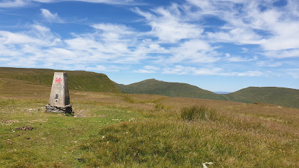
Gateway to Wales's Highest Southern Peak
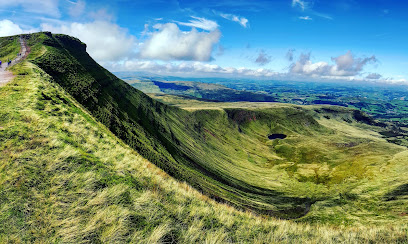
Pont ar Daf car park stands as the primary access point for Pen y Fan, the highest mountain in South Wales at 886 metres above sea level. Nestled within Brecon Beacons National Park, this strategically positioned trailhead has become the starting point for hundreds of thousands of walkers annually. The car park sits at 440 metres elevation along the A470 pass, positioned between Pen y Fan and Fan Fawr, making it an ideal launch point for mountain exploration. Its popularity stems not only from its convenient location but also from the well-maintained infrastructure that the National Trust has developed to manage the significant footfall this location receives.Modern Facilities and Accessibility
The recently expanded and upgraded car park now provides over 180 parking spaces with dedicated provision for disabled users, electric vehicle charging points, and parking for minibuses and coaches. The new amenity building includes toilets with disabled access, a Changing Places facility, and baby changing amenities, with some facilities available 24 hours daily. Composting toilet facilities and Wi-Fi connectivity enhance the visitor experience. The car park operates from dawn until dusk year-round, with portions available 24 hours. Parking charges of £7.50 per vehicle apply to non-members, payable via cash, card, or Pay By Phone, though National Trust members enjoy free parking. The site is owned by the Welsh Government and operated by the National Trust.Walking Routes and Trail Options
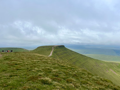
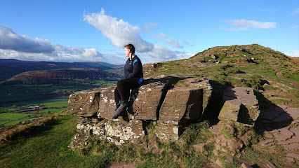
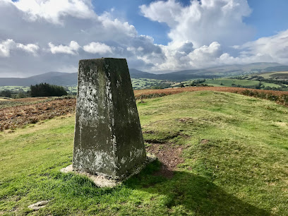
From Pont ar Daf, walkers can access multiple routes of varying difficulty. The most popular is the gentle out-and-back trail to Pen y Fan, covering approximately 4 miles with an elevation gain of around 1,762 feet, typically taking 2.5 to 3.5 hours depending on fitness level. The circular route incorporating Corn Du extends to 4.5 miles with similar duration. These well-made, evenly graded footpaths have become known colloquially as "The Motorway" due to their popularity and accessibility. The Beacons Way long-distance footpath passes through this area, offering extended trekking opportunities across the massif. A footpath connects the car park directly to the Storey Arms centre and bus stops, facilitating multi-route planning.Landscape and Summit Views
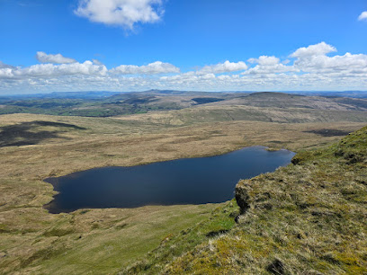
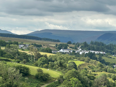
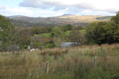
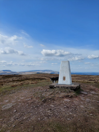
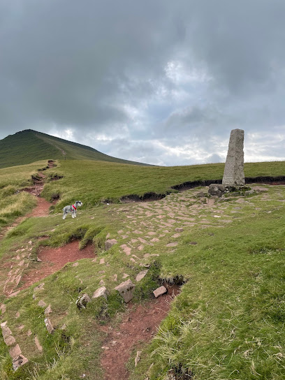
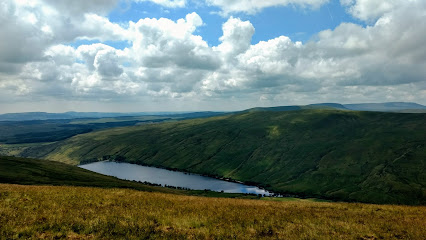
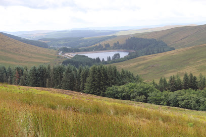
The terrain surrounding Pont ar Daf encompasses open moorland with dramatic ridge formations. From Pen y Fan's summit, accessible via these routes, clear-day panoramas extend across the Bristol Channel including Flat Holm and Steep Holm islands, Carmarthen Bay, Swansea Bay, the Gower Peninsula, the Black Mountains, and the Cambrian Mountains. Exmoor, the town of Brecon, and much of Mid Wales and the South Wales Valleys are visible, with the Clee Hills in south Shropshire discernible to the northeast. The undulating ridge stretching from Talybont Reservoir to the A470 creates a distinctive landscape shaped by glacial activity and centuries of human passage.Environmental Management and Conservation
The National Trust undertakes ongoing repair and maintenance of paths on the mountain to limit erosion caused by the passage of hundreds of thousands of walkers annually. The infrastructure development at Pont ar Daf reflects broader conservation efforts across Brecon Beacons National Park. Parking revenue supports vital conservation work and facility maintenance. The site encourages responsible use through the Countryside Code, with dogs permitted on leads and visitors advised to stay on designated paths. The car park's expansion included improved signage and information provision to help visitors better plan their activities and understand the landscape's ecological significance.Iconic landmarks you can’t miss
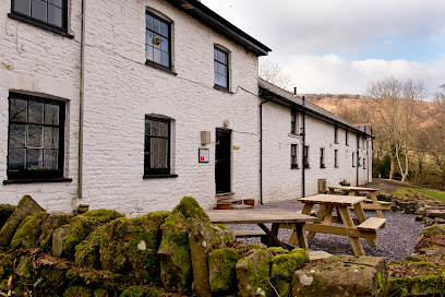
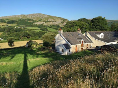
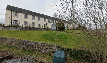
YHA Brecon Beacons
0.5 km
Rustic farmhouse hostel offering clean, cozy accommodation and a warm communal atmosphere in the heart of Brecon Beacons National Park.
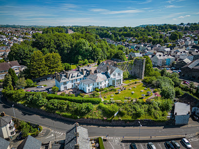
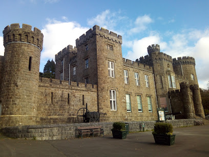
The Brecon Castle Hotel
8.9 km
Historic Wales’ oldest hotel blending timeless charm with modern comforts near Brecon Beacons National Park.
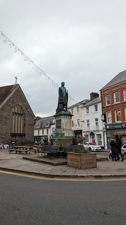
Duke of Wellington Monument
8.9 km
Historic bronze statue honoring the Duke of Wellington, a commanding presence in Brecon’s town centre and a testament to local artistry and British heritage.
Brecon Barracks
9.1 km
Historic military hub in Brecon, home to the Royal Welsh Regiment and its museum, set within the stunning Brecon Beacons National Park.
Sleeping Giant Bunkhouse
15.1 km
Experience nature's serenity at Sleeping Giant Bunkhouse, your perfect lodge retreat in Upper Swansea, ideal for adventurers and nature lovers.
Fan Brycheiniog
15.2 km
Explore the breathtaking heights of Fan Brycheiniog for stunning views and unforgettable hiking experiences in Wales' beautiful Brecon Beacons.
Brecon Mountain Railway
15.3 km
Experience the enchanting journey of the Brecon Mountain Railway, a heritage treasure in the heart of Wales, offering breathtaking views and a taste of history.
National Showcaves Centre for Wales
15.4 km
Unveil the hidden beauty of the underground world at the National Showcaves Centre for Wales, where nature's wonders await your exploration.
Craig-y-Nos Country Park
15.5 km
Explore the enchanting landscapes and rich history of Craig-y-Nos Country Park, a perfect retreat in the Brecon Beacons for nature lovers and adventure seekers.
Welsh Crannog Centre
15.5 km
Discover the ancient wonders of Wales at the Welsh Crannog Centre, a historical landmark blending culture and nature by Llangorse Lake.
Dinas Rock
16.1 km
Discover Dinas Rock, a breathtaking hiking area in South Wales, perfect for nature lovers and outdoor adventurers seeking unforgettable views.
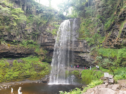
Henrhyd Falls
16.4 km
Experience the breathtaking beauty of Henrhyd Falls, the tallest waterfall in South Wales, surrounded by stunning hiking trails in the Brecon Beacons.
Cyfarthfa Castle Museum and Art Gallery
16.6 km
Explore Cyfarthfa Castle Museum and Art Gallery, where history, art, and nature converge in the heart of Merthyr Tydfil’s beautiful park.
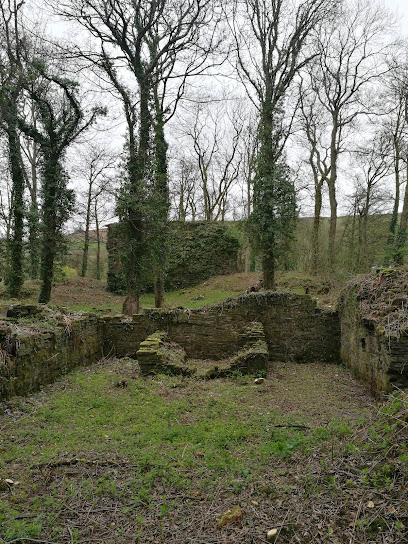
Blaenllynfi Castle
16.7 km
Explore Blaenllynfi Castle, a captivating historical landmark in Brecon, offering stunning views and rich Welsh heritage in a serene countryside setting.
Waterfall Country
16.9 km
Explore the breathtaking waterfalls and lush landscapes of Waterfall Country, a nature lover's paradise in Wales.
Unmissable attractions to see
Fan Frynych
2.0 km
Explore Fan Frynych’s rugged summit and the dramatic cliffs of Craig Cerrig Gleisiad in this rich, glacially-carved nature reserve within the Brecon Beacons.
Pen-y-Fan walk carpark
2.9 km
Primary access point for hiking Pen y Fan, South Wales’ highest peak, nestled in the scenic Brecon Beacons National Park.

National Trust - Brecon Beacons
3.0 km
Explore Pen y Fan and the Brecon Beacons from Pont ar Daf, where nature, adventure, and modern facilities meet in Wales’ iconic mountain park.
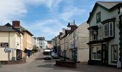
Brecon Beacons
3.3 km
Explore the breathtaking peaks, rich heritage, and star-studded skies of Wales’ iconic Brecon Beacons National Park.
Fan Fawr
3.4 km
Fan Fawr: A majestic peak in Wales’ Brecon Beacons, blending stunning glacial landscapes with rich geology and timeless Welsh legends.
Mountain Centre
3.5 km
Your gateway to the Brecon Beacons with stunning views, local crafts, family fun, and expert visitor support.
Corn Du
3.6 km
Second highest peak in South Wales with ancient cairn, panoramic views, and wild Brecon Beacons landscapes.
Pen y Fan
3.6 km
Pen y Fan, South Wales’ highest peak, offers breathtaking panoramic views and a rewarding climb through ancient geological landscapes.
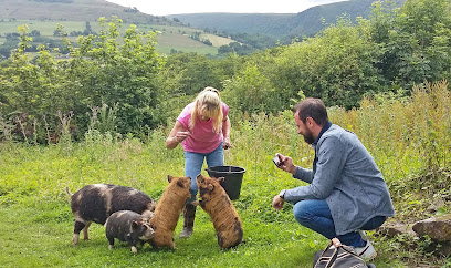
Good Day Out Pig Walking in the Brecon Beacons with KuneKune pigs
5.1 km
Walk friendly KuneKune pigs through scenic Brecon Beacons and enjoy a charming countryside 'Pignic' with tea and cakes.
Bannau Brycheiniog National Park (Brecon Beacons)
5.3 km
Explore Wales’ breathtaking Bannau Brycheiniog National Park, where majestic peaks, cascading waterfalls, and rich heritage await every adventurer.
Cefn Llechid
6.0 km
Discover the tranquil summit of Cefn Llechid, a peaceful retreat with panoramic views in the heart of Brecon Beacons National Park.
Fan y Bîg
6.2 km
Discover Fan y Big’s pointed summit, iconic 'Diving Board,' and panoramic Brecon Beacons views on this scenic mountain hike.
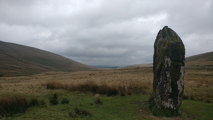
Maen Llia
6.4 km
Discover Maen Llia, a majestic Bronze Age standing stone in the Brecon Beacons, steeped in legend, celestial alignments, and prehistoric mystery.
Twyn Mwyalchod
6.7 km
A steep yet rewarding trig point summit offering panoramic ridge views and poignant memorials in the heart of the Brecon Beacons.
The Hungry Hut
7.6 km
A beloved evening takeaway spot in Sennybridge offering hearty, comforting meals in a friendly, casual setting.
Essential places to dine
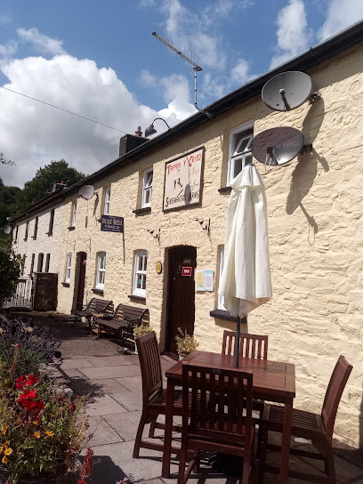
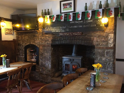
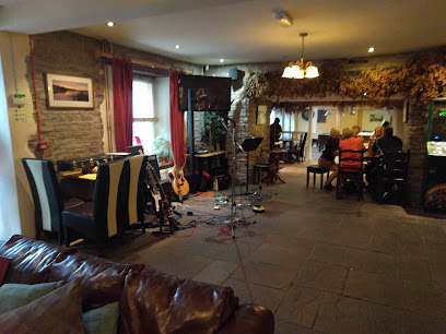
The Tai’r Bull Inn
3.8 km
A cosy Welsh country pub and B&B offering hearty fare, real ales, and warm hospitality in the heart of Brecon Beacons National Park.
The Tanners Arms
7.2 km
Rustic Welsh pub and cozy B&B nestled in scenic Defynnog, offering hearty food, local ales, and warm hospitality near the Brecon Beacons.

Gorkha & Khukuri
8.0 km
Savor authentic Nepalese cuisine in a serene Brecon setting, where tradition and flavor unite at Gorkha & Khukuri.
The White House
8.2 km
A charming country inn near Brecon Beacons offering warm hospitality, fresh local cuisine, and cozy rooms for a relaxing Welsh getaway.
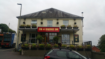
Usk & Railway Inn
8.2 km
Cozy country inn with hearty local cuisine and premium comfort near Brecon Beacons National Park.
The Gurkha Corner
8.9 km
Experience authentic Nepalese and Himalayan cuisine with warm hospitality in the heart of Brecon at The Gurkha Corner.
Brecon Tap
8.9 km
Experience authentic Welsh hospitality at Brecon Tap – a charming pub offering delicious food and drinks in the heart of Brecon.
The George Hotel - JD Wetherspoon
9.0 km
A welcoming traditional pub and hotel in Brecon, offering hearty British fare and comfortable rooms near the Brecon Beacons.
The Proper Pizza Co Ltd
9.0 km
Authentic artisan pizzas with gluten-free options in the heart of Brecon’s Lion Yard, perfect for takeaway or small group dining.

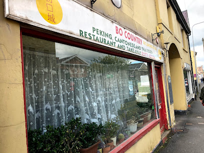
Bo Country
9.0 km
Authentic Chinese takeaway in the heart of Brecon, offering quick, flavorful meals for locals and visitors alike.
Hills
10.7 km
Contemporary burger dining with scenic Brecon Beacons views, blending creative flavors and a welcoming atmosphere in the heart of Brecon.
Three Horseshoes Inn
11.1 km
Award-winning gastropub in the Brecon Beacons serving refined seasonal British cuisine in a historic, welcoming setting.
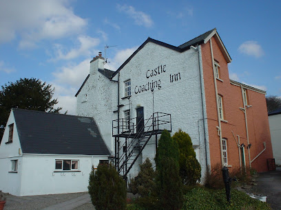
Castle Coaching Inn
11.6 km
Historic Welsh inn in Trecastle offering cozy rooms, traditional cuisine, and warm hospitality near Brecon Beacons National Park.
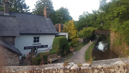
The White Hart
13.7 km
Traditional Welsh inn in Talybont-on-Usk offering hearty British fare, local ales, and warm hospitality near the Brecon Beacons.
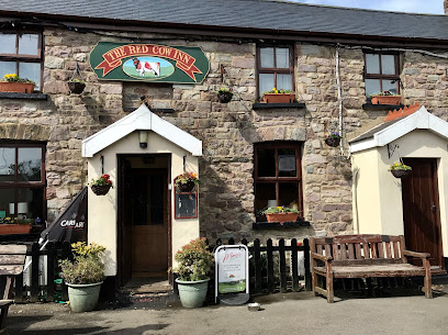
Red Cow Inn
13.8 km
A charming traditional Welsh pub in Pontsticill offering hearty home-cooked meals, award-winning ales, and a warm, welcoming atmosphere.
Markets, malls and hidden boutiques
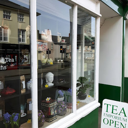
The UK Loose Leaf Tea Company Ltd
7.4 km
Discover ethically sourced, premium loose leaf teas and sustainable brewing essentials at The UK Loose Leaf Tea Company Ltd in Brecon.
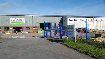
Hay & Brecon Farmers Brecon
7.6 km
Experience the best of local Welsh produce at Hay & Brecon Farmers Brecon, where freshness and quality meet a warm community spirit.
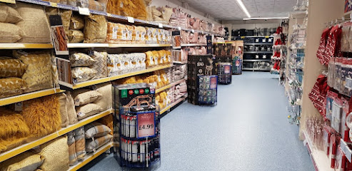
B&M Home Store with Garden Centre
7.7 km
Affordable shopping meets gardening passion at Brecon’s versatile B&M Home Store with Garden Centre.
Mind
8.0 km
Explore unique finds and support mental health initiatives at Mind Charity Shop in Brecon, where every purchase makes a difference.
CERTAS - BRECON
8.3 km
Discover convenience in Brecon with CERTAS, your one-stop shop for essentials, local treats, and friendly service.
Bi Ped Cycles
8.9 km
Biped Cycles: Your expert cycling partner in Brecon, offering quality bikes, certified e-bike servicing, and personalized care near the Brecon Beacons.
Bentley & Co Home Interiors & Coffee Shop
8.9 km
Discover stylish home interiors and savor homemade coffee and light lunches in the heart of Brecon’s charming Ship Street.
Kitty Keane's Vintage
8.9 km
Discover authentic Welsh vintage and handcrafted treasures at Kitty Keane's Vintage, a charming craft shop in the heart of Brecon.
Dressed To Impress!
8.9 km
Family-run bridal and occasion wear boutique in Brecon offering elegant dresses and personalized service for all body types.
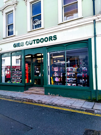
Gibb Outdoors
8.9 km
Trusted outdoor gear and expert advice in the heart of Brecon for all your Welsh adventures.
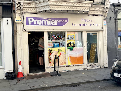
Premier
8.9 km
Your friendly, convenient stop for groceries and essentials in the heart of Brecon, open early to late every day.
Centre Of Attention
8.9 km
Award-winning florist and event decorator in Brecon, crafting bespoke floral designs and elegant venue transformations since 2011.
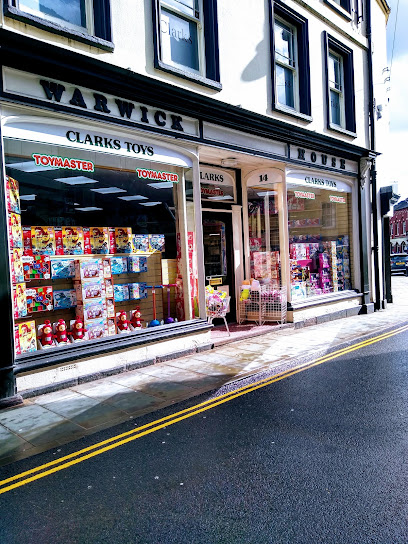
Clarks Toys
8.9 km
Discover timeless toys and local charm at Clarks Toys, Brecon’s welcoming high street treasure for families and collectors.
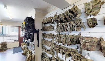
DIXIES CORNER
8.9 km
Brecon's trusted specialist in authentic military surplus and outdoor gear since establishment.
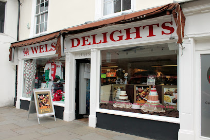
Welsh Delights
8.9 km
Discover authentic Welsh gifts and indulge in traditional clotted cream fudge at Welsh Delights, Brecon’s charming sweet and gift shop.
Essential bars & hidden hideouts
Drovers Arms
8.1 km
A welcoming Welsh village pub blending historic charm with hearty fare and friendly hospitality in the heart of Llanfaes, Brecon.
The Three Horseshoes Inn
8.4 km
A cosy Welsh village pub blending traditional charm with refined British cuisine and a warm, welcoming atmosphere.
The Rorkes Drift
8.9 km
Historic Welsh pub in Brecon offering local ales, lively music, and a warm atmosphere inspired by the legendary Rorke’s Drift battle.
The Sarah Siddons
8.9 km
Experience authentic Welsh hospitality with local ales and lively atmosphere at The Sarah Siddons, Brecon’s beloved town centre pub.
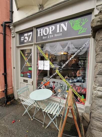
hop in beer and gin
8.9 km
Discover Brecon’s quirky bar with top-quality craft beers, artisanal gins, and delicious tapas in a cozy, historic setting.
The Lounge Bar & Cafe
9.0 km
Brecon’s pioneering bar with a modern twist, offering signature cocktails, live music, and a welcoming atmosphere in the town centre.
Markets Tavern
9.1 km
Traditional Welsh pub and welcoming hotel in Brecon offering hearty food, cozy rooms, and authentic local charm on Free Street.
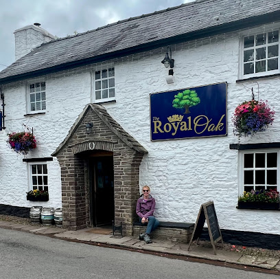
Royal Oak
11.8 km
Cozy Welsh pub in Pencelli offering traditional hospitality and local ales amidst the scenic Brecon Beacons.
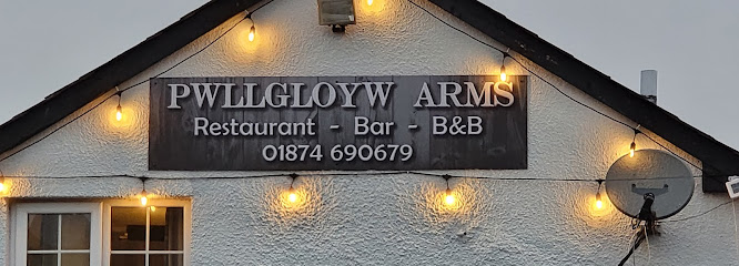
The Pwllgloyw Arms
12.2 km
A cozy mountain pub in Powys offering hearty Welsh fare, local ales, and a warm, welcoming atmosphere year-round.
Shoemakers Arms
12.4 km
Charming community-run pub in the heart of Brecon Beacons, offering warm hospitality and authentic Welsh cuisine in a rustic setting.
The Star Inn
13.6 km
A cozy and characterful pub with quality food and a sunny beer garden in the heart of Talybont-on-Usk, perfect for walkers and families alike.
Lakeside Bar
15.8 km
Relax lakeside at this friendly pub within Brecon’s scenic caravan park, perfect for unwinding after exploring the Brecon Beacons.
The Red Lion Llangorse
16.4 km
A welcoming Welsh gastropub in Llangorse offering seasonal local dishes, real fires, and a cozy atmosphere near the Brecon Beacons.
Coach & Horses
17.0 km
Historic canal-side pub and inn in Llangynidr offering hearty Welsh fare, cozy rooms, and a warm, welcoming atmosphere.

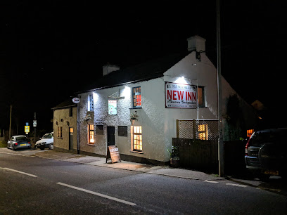
The New Inn
17.1 km
A cozy, affordable pub and backpackers’ haven in Bwlch, offering hearty food, friendly service, and a welcoming base for exploring the Brecon Beacons.
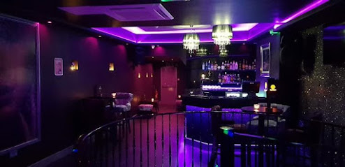
Nightclubs & after hour spots
Northcote Conservative Club
8.9 km
Discover the lively ambiance of Northcote Conservative Club, Brecon's premier destination for nightlife, music, and local culture.
The Kirkhouse Nightclub (Koolers)
17.7 km
Experience the vibrant and friendly nightlife of Merthyr Tydfil at The Kirkhouse Nightclub, known locally as Koolers.

Pure Bar & Nightclub Ltd
17.9 km
A lively nightclub and cocktail bar in Merthyr Tydfil offering vibrant music, crafted drinks, and late-night entertainment in South Wales.
Jac’s Mansion
29.2 km
Experience welcoming, vibrant LGBTQ+ nightlife at Jac’s Mansion, Builth Wells’ iconic gay nightclub with a lively, inclusive atmosphere.
The Top Club
30.5 km
Experience Blaengarw’s vibrant nightlife at The Top Club, where electrifying entertainment meets community spirit in the heart of South Wales.
Squares Night club
31.7 km
Experience Porth’s vibrant nightlife at Squares Nightclub, where music, dance, and unforgettable evenings come alive every weekend.
The Arch Bar & Nightclub
33.9 km
A lively Neath hotspot blending nightclub energy, live music, pub charm, and Thai cuisine in one vibrant venue.
Eclipse Nightclub
35.7 km
Experience Pontypridd’s vibrant midweek nightlife at Eclipse Nightclub, where music, dancing, and community come alive every Wednesday night.
Jimmy's Bar
39.0 km
Experience the vibrant nightlife and live music scene at Jimmy's Bar, Port Talbot’s lively local hotspot with a welcoming atmosphere.
Popworld - Swansea
43.6 km
Experience Swansea’s energetic retro nightclub with affordable cocktails, themed events, and a lively dance floor in the heart of the city.

PlanB
43.9 km
Swansea’s energetic two-floor nightclub with a focus on dance music, lively DJs, and great drink deals for a night to remember.

Cuba Escape
43.9 km
Experience Swansea’s vibrant nightlife at Cuba Escape, where live music, energetic crowds, and a colorful atmosphere come together for unforgettable nights.

Sin City
44.1 km
Energetic Swansea nightclub with live music, affordable drinks, and a lively atmosphere on Dillwyn Street.
The Rainbow Rooms Bar & Club
45.3 km
Experience lively nights and vibrant music at The Rainbow Rooms Bar & Club, Gorseinon’s premier destination for unforgettable nightlife.
Mojos
47.8 km
Discover the vibrant nightlife of Newport at Mojos, the go-to cocktail bar for creative drinks and nightly karaoke excitement.
For the vibe & atmosphere seeker
- Adventurous
- Scenic
- Tranquil
- Unique
For the architecture buff
- Historic
- Viewpoints
- Parks & Gardens
For the view chaser and sunset hunter
- Panoramas
- Iconic Views
- Sunrise Spots
- Sunset Spots
For the social media creator & influencer
- Photo Spots
- Instagrammable
- Architectural Shots
For the eco-conscious traveler
- Protected Area
- National Park
- Public-Transport Accessible
- Leave-No-Trace Critical
- Locally Managed
For the kind of experience you’re after
- Nature Escape
- Photowalk
- Adventure Photo Shoot
- Day Trip
- Cultural Heritage
For how adventurous you want the journey to be
- Easy Access
- Requires Hike
Location Audience
- Family Friendly
- Senior Friendly
- Child Friendly
- Wheelchair Access
- Pet Friendly
- Solo Friendly
- Couple Friendly
- Solo Female Friendly


