Background

Cotswold Way

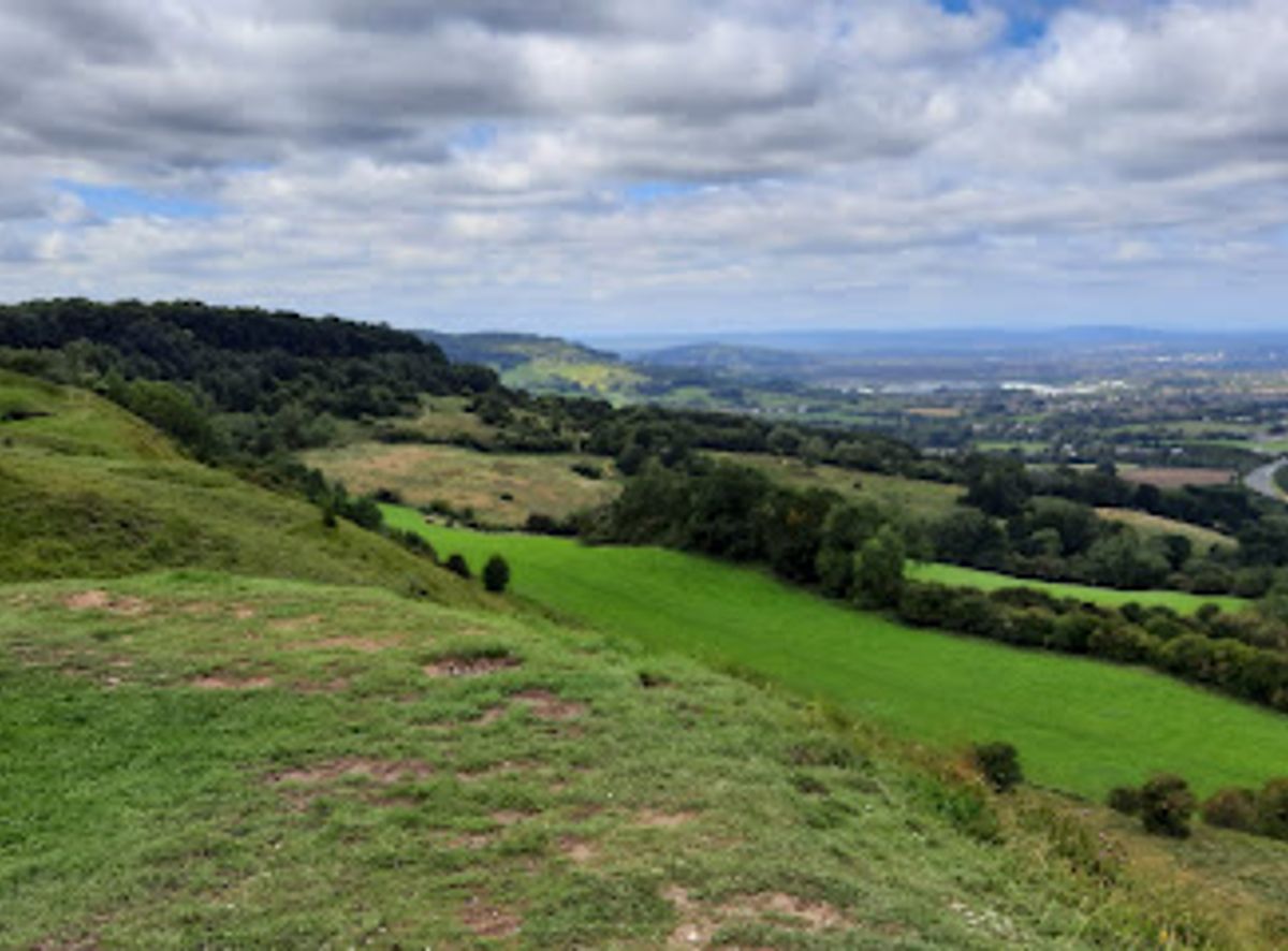
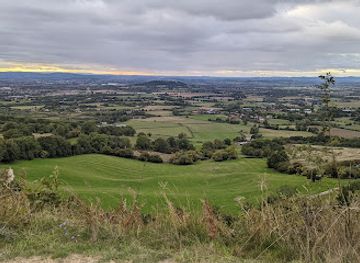
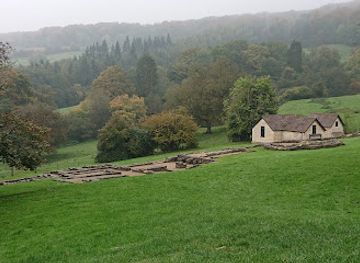
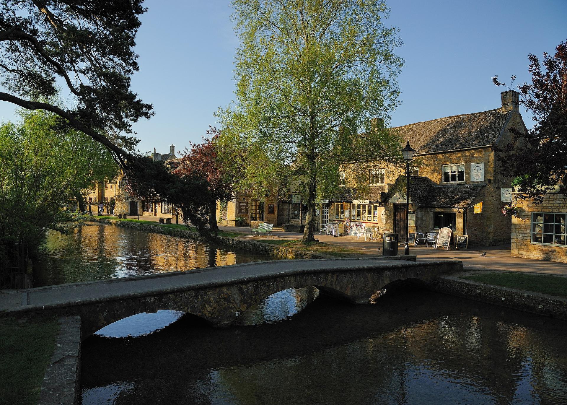
A 102-mile National Trail through quintessential English countryside, connecting picturesque Cotswold villages from Chipping Campden to Bath.

4.9

The Cotswold Way is a 102-mile National Trail stretching from Chipping Campden in the north to Bath in the south, traversing the heart of the Cotswolds in England. This scenic walking route winds through quintessential English countryside, passing picturesque villages with honey-colored stone cottages, rolling farmland, ancient woodlands, and historic landmarks. The trail offers breathtaking views across the Cotswold landscape and provides access to charming market towns, traditional pubs, and cultural attractions. Well-established accommodation options line the route, making it accessible for multi-day walking holidays of varying difficulty levels.

A brief summary to Cotswold Way

  • B4070, Gloucester, Birdlip, GL4 8JN, GB
  • Visit website
  • Duration: 1 to 12 hours
  • Budget
  • Environment icon Outdoor
  • Mobile reception: 4 out of 5
  • Monday 12 am-12 am
  • Tuesday 12 am-12 am
  • Wednesday 12 am-12 am
  • Thursday 12 am-12 am
  • Friday 12 am-12 am
  • Saturday 12 am-12 am
  • Sunday 12 am-12 am

Local tips

  • Book accommodation well in advance, especially for spring and early autumn walks, as lodging along the trail fills quickly during peak seasons.
  • Consider breaking the walk into sections rather than completing the full 102 miles; popular sections include Chipping Campden to Broadway Tower, Winchcombe to Belas Knap, and Painswick to King's Stanley.
  • Prepare for variable terrain with notable elevation changes; sturdy walking boots, weather-appropriate clothing, and a good first aid kit are essential.
  • Many accommodations offer packed lunch services and boot-drying facilities; arrange these services in advance to enhance your walking experience.
  • Visit during clear-sky days for optimal panoramic views, particularly from ridge-top sections and Cleeve Hill, the highest point in the Cotswolds.
widget icon

Getting There

  • Public Transport from London

    Train services from London Paddington to Moreton-in-Marsh (approximately 2 hours) connect to local buses serving Chipping Campden, the northern trailhead. Return from Bath via direct trains to London Paddington (approximately 1.5 hours). Journey costs vary seasonally; advance booking typically ranges from £25–£60 per person for train tickets.

  • Coach Services

    National coach operators provide services to Chipping Campden and Bath from major UK cities. Journey times to Chipping Campden from London range from 3–4 hours. Return coaches from Bath operate regularly. Budget coach fares typically range from £15–£40 per person depending on advance booking and season.

  • Self-Drive Access

    The B4070 near Birdlip provides direct road access to the trail corridor. Parking is available in villages along the route including Chipping Campden, Winchcombe, Painswick, and Wotton-Under-Edge. Many walkers arrange vehicle transfers between start and end points or use shuttle services offered by local operators. Fuel costs and parking fees vary by location and season.

  • Organized Walking Holiday Transfer Services

    Commercial walking tour operators provide comprehensive transport packages including transfers from major transport hubs to trailheads and between overnight stops. These services typically include luggage transfers and are integrated into multi-day walking packages ranging from £2,500–£4,000 for 10–12 day holidays depending on accommodation standard.

Cotswold Way location weather suitability

  • Weather icon Clear Skies
  • Weather icon Mild Temperatures
  • Weather icon Cold Weather

Unlock the Best of Cotswold Way

Buy tickets

    No tickets available

Book tours with entry

    No tours available

Book tours without entry

    No tours available

Discover more about Cotswold Way

A Journey Through England's Most Enchanting Landscape

The Cotswold Way stands as one of England's finest National Trails, a 102-mile footpath that captures the essence of the English countryside. Beginning in the charming market town of Chipping Campden, famous for its annual Olimpick Games and rose-covered thatched cottages, the trail meanders southward through some of the most picturesque villages in the Cotswolds. The route culminates in Bath, a UNESCO World Heritage city renowned for its Georgian architecture and Roman heritage. Along the way, walkers encounter a succession of enchanting settlements, each with its own character and history, connected by quiet country lanes and footpaths that reveal the region's timeless beauty. The landscape itself tells the story of centuries of human settlement and agricultural tradition. Rolling hills dotted with Cotswold stone walls, green pastures grazed by Cotswold Lions (a distinctive breed of sheep), and ancient woodlands create a patchwork of natural beauty. The trail passes through diverse terrain, from gentle valley walks to more challenging hillside sections, offering varied scenery and physical engagement throughout the journey. Elevation changes are notable in places, particularly around Cleeve Hill—the highest point in the Cotswolds—and various ridge-top sections that provide panoramic views across multiple valleys.

Historic Villages and Cultural Landmarks

The Cotswold Way connects a remarkable collection of historic villages and towns, each worthy of exploration. Stanton features rose-covered cottages and traditional architecture that exemplifies Cotswold character. Winchcombe, positioned roughly a quarter of the way along the trail, serves as a walker's haven with welcoming local pubs, tea rooms, and proximity to Sudeley Castle and ancient Neolithic sites including Belas Knap Long Barrow. Painswick, often called the "Queen of the Cotswolds," marks approximately the halfway point and is renowned for its striking Rococo Garden and distinctive churchyard with ancient yews. The trail also passes near significant historical sites including Dyrham House, a 17th-century mansion set within an ancient deer park, and numerous churches and archaeological features that span from Roman times through the medieval period.

Accessibility and Walking Options

The Cotswold Way accommodates walkers of different fitness levels and time constraints. The trail can be completed in 8 to 12 days depending on pace and chosen itinerary. An 8-day schedule covers approximately 15 miles daily with 1,700 feet of elevation gain, while a more leisurely 12-day walk reduces daily distances to around 9.5 miles with 1,100 feet of elevation. Many walkers choose to tackle individual sections rather than the complete route, using villages like Bourton-on-the-Water—known as the Venice of the Cotswolds for its picturesque bridges—as bases for exploring particular stretches. The trail's popularity means that accommodation can fill quickly during peak seasons, particularly spring and early autumn, requiring advance planning and reservations.

Accommodation and Hospitality

Accommodation along the Cotswold Way ranges from budget-friendly campsites and glamping pods to luxury hotels and charming bed-and-breakfasts. Mid-range options predominate, with historic coaching inns, family-run guesthouses, and welcoming pubs offering overnight stays. Many establishments cater specifically to walkers, providing amenities such as boot-drying facilities, packed lunch services, and laundry options. Premium accommodation can be limited in some sections, particularly in remote areas, though most lodging prioritizes en-suite facilities or private bathrooms. The trail's infrastructure reflects its status as an established National Trail, with numerous villages offering shops, cafes, and services within easy reach of the walking route.

Seasonal Considerations and Weather

The Cotswold Way experiences distinct seasonal variations that influence the walking experience. Spring and early summer offer pleasant temperatures and longer daylight hours, though accommodation availability becomes constrained. Autumn provides cooler weather and dramatic landscape colors, while winter walking is possible but brings shorter days and potentially challenging weather conditions. The rolling terrain and exposed ridge sections mean that weather can change rapidly, and walkers should be prepared for wind, rain, and variable conditions throughout the year. The trail's elevation and open countryside sections mean that clear-sky days offer exceptional visibility and photographic opportunities, while misty conditions create atmospheric but more challenging walking experiences.

Busiest months of the year

Busiest hours of the day

Popular Experiences near Cotswold Way

Popular Hotels near Cotswold Way

Select Currency