

South Roanoke (Roanoke) Travel Guide - Free
Explore South Roanoke in Roanoke with Evendo's free guide. Find the best shops, historic streets, restaurants, and gems on web or mobile.


South Roanoke in Roanoke, Virginia, pairs historic homes and village shops with Mill Mountain trails, river walks, local dining and easy access to downtown.
A Residential Neighbourhood with a Village Centre
South Roanoke occupies a leafy area south of downtown Roanoke, between the Roanoke River and the lower slopes of Mill Mountain. Its best-known commercial focus is South Roanoke Village, where Crystal Spring Avenue and nearby streets bring together cafés, restaurants, small businesses and everyday services. Beyond this compact centre, the neighbourhood is characterised by tree-lined roads, mature gardens and an appealing mixture of early twentieth-century houses, later residences and institutional buildings.Read more about South Roanoke
Architecture, Landscape and Local Life
Food, Shops and Outdoor Access
Best attractions in South Roanoke
South Roanoke’s attractions combine a compact village centre with immediate access to river and mountain landscapes. South Roanoke Village around Crystal Spring Avenue offers a walkable introduction to local shops, cafés, restaurants and neighbourhood architecture, while the surrounding residential streets reveal mature trees and a broad range of early twentieth-century homes. The Roanoke River Greenway provides an easy way to experience the district’s natural edge, with level riverside walking and cycling routes linking South Roanoke to a wider network beyond the neighbourhood. Mill Mountain lies directly nearby and brings woodland trails, overlooks and the Roanoke Star, whose illuminated form is one of the city’s most recognisable sights; because the park extends beyond South Roanoke, it is best regarded as an adjacent landscape attraction rather than a feature of the village centre itself. Together these places show how closely the neighbourhood’s daily life is connected to outdoor recreation.
-
Cultural landmark
Mill Mountain Star
Experience the breathtaking views and historical significance of the Mill Mountain Star, the world's largest illuminated star, in scenic Roanoke, Virginia.
17 min walk · 1.4 km from neighbourhood centre
-
Park
Mill Mountain Park
Explore Mill Mountain Park in Roanoke, Virginia - a nature lover's paradise with trails, scenic views, and family-friendly attractions.
17 min walk · 1.4 km from neighbourhood centre
-
Heritage museum
Virginia Museum of Transportation, Inc.
Discover the fascinating history of transportation at the Virginia Museum of Transportation in Roanoke, VA—where trains, planes, and automobiles come to life.
6 min drive · 2.0 km from neighbourhood centre
-
Local history museum
O. Winston Link & Roanoke History Museum
Explore Roanoke's rich heritage at the O. Winston Link & Roanoke History Museum, showcasing stunning photography and captivating local history.
7 min drive · 2.2 km from neighbourhood centre


Best landmarks in South Roanoke
South Roanoke’s landmarks are closely tied to its residential history and natural setting. South Roanoke Village, centred on Crystal Spring Avenue, acts as the neighbourhood’s principal civic and commercial reference point, while the surrounding streets preserve a distinctive collection of mature trees and early twentieth-century houses. The Roanoke River forms an important geographic landmark along the district’s northern side, and the greenway marks the modern public connection between the neighbourhood and the wider river corridor. Above the streets, Mill Mountain provides the most prominent visual presence; the Roanoke Star is visible from many parts of the city and can be reached from nearby mountain approaches, although the park and star extend beyond the village itself. Churches, local businesses and established streets complete a landscape whose significance comes from the relationship between community, architecture, river and mountain rather than from one isolated monument.
-
Zoo
Mill Mountain Zoo
Discover the charm of Mill Mountain Zoo in Roanoke, VA - a family-friendly destination with diverse wildlife and a commitment to conservation.
15 min walk · 1.2 km from neighbourhood centre
-
Museum
Kids Square Children's Museum
Discover creativity and play at Kids Square Children's Museum in Roanoke, a top destination for family fun and educational adventures.
6 min drive · 2.0 km from neighbourhood centre
-
Local history museum
O. Winston Link & Roanoke History Museum
Explore the captivating history of Roanoke, VA at the O. Winston Link & Roanoke History Museum, home to stunning photography and engaging exhibits.
7 min drive · 2.2 km from neighbourhood centre
-
Historical landmark
Virginian RY Roanoke Station
Discover the charm of the Virginian RY Roanoke Station, a historic landmark showcasing the rich railway heritage of Roanoke, Virginia.
10 min walk · 0.8 km from neighbourhood centre


Explore South Roanoke on the map
A handpicked selection of must-see spots in South Roanoke, mapped for you.
Best hotels in South Roanoke
Best restaurants in South Roanoke
Dining in South Roanoke is concentrated around South Roanoke Village and the Crystal Spring Avenue area, where independent restaurants, cafés and casual food businesses serve both local residents and visitors exploring Mill Mountain or the river greenway. The selection is more neighbourhood-scaled than destination-sized, with an emphasis on relaxed meals, coffee, takeaway options and social spaces rather than a large entertainment strip. Its appeal lies in being able to combine food with a walk through older residential streets or a nearby outdoor outing. Broader Roanoke dining traditions are represented through familiar American comfort food, contemporary menus and locally oriented café culture, while the village setting keeps the experience connected to everyday life. Visitors should distinguish this cluster from the larger restaurant scenes in downtown Roanoke and nearby Grandin Village, which are separate areas even when they are reached easily by car or bicycle.
-
American
BILLY’S
Discover the best of traditional American cuisine at Billy's, Roanoke's premier restaurant and event venue offering unforgettable dining experiences.
6 min drive · 2.1 km from neighbourhood centre
-
American
The Green Goat
Discover the vibrant culinary scene at The Green Goat in Roanoke - where American comfort food meets local charm.
19 min walk · 1.5 km from neighbourhood centre
-
American
Lews Restaurant SW Roanoke
Discover the flavors of America at Lews Restaurant in Roanoke - where great food meets inviting atmosphere.
11 min walk · 0.9 km from neighbourhood centre
-
American
The River and Rail Restaurant
Experience the best of American cuisine with organic ingredients at The River and Rail Restaurant in Roanoke, Virginia.
9 min walk · 0.7 km from neighbourhood centre


Best bars in South Roanoke
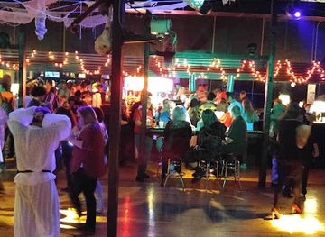
South Roanoke is not a major nightclub district, and its evening character is generally relaxed and residential. The village centre provides the neighbourhood’s principal after-dark activity, with restaurants and casual drinking spaces where people meet for dinner, conversation and an unhurried evening rather than late-night clubbing. Some venues may offer beer, wine or cocktails alongside food, but the atmosphere is shaped more by local dining than by a dense concentration of bars. Mill Mountain and the river greenway are not illuminated nightlife settings, so visitors should use them with care after dark and plan their return route in advance. Those seeking live music, a broader bar selection or late-night entertainment will usually find more choice in downtown Roanoke or other nearby commercial districts, rather than within South Roanoke itself.
-
Grill
Martin's Downtown
Discover Martin's Downtown in Roanoke, a vibrant grill offering a diverse menu of locally inspired dishes in a lively atmosphere.
5 min drive · 1.7 km from neighbourhood centre
-
Grill
Wasena City Tap Room & Grill
Discover the essence of Southern cuisine at Wasena City Tap Room & Grill, a perfect blend of delicious food and warm hospitality in Roanoke.
16 min walk · 1.3 km from neighbourhood centre
-
Pizza
Fork in the Alley
Experience the best pizza in Roanoke at Fork in the Alley, where great food meets a lively sports bar atmosphere.
8 min walk · 0.6 km from neighbourhood centre
-
American
202 Social House
Experience the vibrant atmosphere and diverse American cuisine at 202 Social House in downtown Roanoke, Virginia.
6 min drive · 2.0 km from neighbourhood centre


Best nightclubs in South Roanoke
South Roanoke is not a major nightclub district, and its evening character is generally relaxed and residential. The village centre provides the neighbourhood’s principal after-dark activity, with restaurants and casual drinking spaces where people meet for dinner, conversation and an unhurried evening rather than late-night clubbing. Some venues may offer beer, wine or cocktails alongside food, but the atmosphere is shaped more by local dining than by a dense concentration of bars. Mill Mountain and the river greenway are not illuminated nightlife settings, so visitors should use them with care after dark and plan their return route in advance. Those seeking live music, a broader bar selection or late-night entertainment will usually find more choice in downtown Roanoke or other nearby commercial districts, rather than within South Roanoke itself.
-
Grill
The Front Row
Experience the essence of Roanoke dining at The Front Row, a grill offering delicious flavors and a vibrant atmosphere.
6 min drive · 1.9 km from neighbourhood centre
-
Lounge
213 Lux Lounge
Experience the vibrant nightlife at 213 Lux Lounge in Roanoke, where exquisite flavors and energetic vibes come together for an unforgettable evening.
6 min drive · 2.0 km from neighbourhood centre
-
Night club
The Park Dance Club
Experience the vibrant nightlife of Roanoke at The Park Dance Club, where music, dance, and community come together for unforgettable nights.
6 min drive · 2.1 km from neighbourhood centre
-
Club
Shenandoah Club
Discover the Shenandoah Club, a premier private dining venue in Roanoke, Virginia, offering an exceptional blend of culinary excellence and Southern charm.
5 min drive · 1.6 km from neighbourhood centre


Best shops in South Roanoke
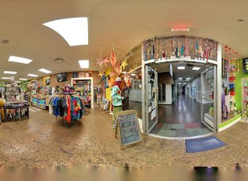
Shopping in South Roanoke is centred on local convenience, independent businesses and the small commercial cluster around South Roanoke Village rather than on a large retail centre. Crystal Spring Avenue and its adjoining streets are the natural places to browse for cafés, personal services, food, gifts and other everyday purchases, with the compact scale making it easy to combine errands with a neighbourhood walk. The area is not principally known for a large market, antiques quarter or specialist shopping street, so expectations should remain local and practical. Visitors interested in a broader range of boutiques, galleries, books, records or vintage goods will find more concentrated retail options elsewhere in Roanoke, including downtown and nearby Grandin Village. The appeal here is the continuity between small businesses and the surrounding residential community, not a dedicated shopping spectacle.
-
General store
Mast General Store Roanoke
Discover the charm of Mast General Store Roanoke, where outdoor gear meets nostalgic treasures in a vibrant shopping experience.
5 min drive · 1.8 km from neighbourhood centre
-
Clothing store
A Little Bit Hippy
Discover the charm of Roanoke at A Little Bit Hippy, where fashion meets art in a delightful boutique experience.
11 min walk · 0.9 km from neighbourhood centre
-
Gift shop
Serenity Treasures
Explore the charm of local craftsmanship at Serenity Treasures, a unique gift shop in Downtown Roanoke offering fair trade and handcrafted goods.
6 min drive · 1.9 km from neighbourhood centre
-
Boutique
Southwest Native
Explore Southwest Native in Roanoke, VA – a boutique filled with unique and trendy pieces reflecting local artistry and culture.
5 min drive · 1.8 km from neighbourhood centre



South Roanoke essentials
Getting There
Getting Around
Safety
Emergency Situations
Do's and Don'ts
Local Tips

From Eve
Local phrases worth knowing
You don't need to get them perfect. A few words go a long way, and locals appreciate the effort.
Basics
| English | Local | Say it |
|---|---|---|
| Hello | Howdy | [haʊ-di] |
| Goodbye | See ya | [siː jə] |
| Yes | Yup | [jʌp] |
| No | Nah | [nɑː] |
| Please/You're welcome | Please and thank ya | [pliːz ənd θæŋk jə] |
| Thank you | Much obliged | [mʌtʃ əˈblaɪdʒd] |
| Excuse me/Sorry | Pardon me | [ˈpɑrdn miː] |
| How are you? | How y'all doin'? | [haʊ jɔːl ˈduːɪn] |
| Fine. And you? | Fine as frog hair. How 'bout you? | [faɪn æz frɔɡ hɛr. haʊ baʊt jʊ] |
| Do you speak English? | Ya speak English? | [jə spiːk ˈɪŋɡlɪʃ] |
| I don't understand | I ain't catchin' on | [aɪ eɪnt ˈkætʃɪn ɒn] |
Eating & Drinking
| English | Local | Say it |
|---|---|---|
| I'd like to see the menu, please | Can I take a gander at the menu? | [kən aɪ teɪk ə ˈɡændər æt ðə ˈmɛnjuː] |
| I don't eat meat | I don't eat meat | [aɪ doʊnt it miːt] |
| Cheers! | Bottoms up! | [ˈbɑtəmz ʌp] |
| I would like to pay, please | I reckon I'll pay now, if you don't mind | [aɪ ˈrɛkən aɪl peɪ naʊ ˈɪf jə doʊnt maɪnd] |
Emergencies
| English | Local | Say it |
|---|---|---|
| Help! | Somebody help! | [ˈsʌmbɑdi hɛlp] |
| Go away! | Git! | [ɡɪt] |
| Call the Police! | Call the sheriff! | [kɔl ðə ˈʃɛrɪf] |
| Call a doctor! | Call the doc! | [kɔl ðə dɑk] |
| I'm lost | I'm turned around | [aɪm tɜrnd əˈraʊnd] |
| I'm ill | I'm feelin' poorly | [aɪm ˈfilɪn ˈpʊrli] |
Shopping
| English | Local | Say it |
|---|---|---|
| I'd like to buy... | I reckon I'll buy... | [aɪ ˈrɛkən aɪl baɪ] |
| I'm just looking | Jus' browsin' | [dʒʌs ˈbraʊzɪn] |
| How much is it? | What's the damage? | [wɑts ðə ˈdæmɪdʒ] |
| That's too expensive | That's highfalutin' | [ðæts ˈhaɪˈflutn] |
| Can you lower the price? | Can ya 'nounce the price? | [kæn jə naʊns ðə praɪs] |
Time & Numbers
| English | Local | Say it |
|---|---|---|
| What time is it? | What's the time? | [wɑts ðə taɪm] |
| It's one o'clock | It's one on the nose | [ɪts wʌn ɒn ðə noʊz] |
| Half past (10) | Half past (10) | [hæf pæst (10)] |
| Morning | Mornin' | [ˈmɔrnɪn] |
| Afternoon | Afternoon | [ˌæftərˈnun] |
| Evening | Evenin' | [ˈivnɪn] |
| Yesterday | Yest'day | [ˈjɛstdi] |
| Today | Today | [təˈdeɪ] |
| Tomorrow | Tomorra | [təˈmɑrə] |
| 1 | One | [wʌn] |
| 2 | Two | [tuː] |
| 3 | Three | [θriː] |
| 4 | Four | [fɔːr] |
| 5 | Five | [faɪv] |
| 6 | Six | [sɪks] |
| 7 | Seven | [ˈsɛvən] |
| 8 | Eight | [eɪt] |
| 9 | Nine | [naɪn] |
| 10 | Ten | [tɛn] |
Transport & Directions
| English | Local | Say it |
|---|---|---|
| Where's a/the...? | Where's the... at? | [wɛrz ðə at] |
| What's the address? | What's the addy? | [wɑts ðə ˈædi] |
| Can you show me (on the map)? | Can ya show me (on the map)? | [kæn jə ʃoʊ miː (ɒn ðə mæp)] |
| When's the next (bus)? | When's the next (bus)? | [wɛnz ðə nɛkst (bʌs)] |
| A ticket (to ....) | A ticket (to ....) | [ə ˈtɪkɪt (tə ....)] |
History of South Roanoke
From Rural Land to Suburb
Before urban development reached the area, the land south of the Roanoke River formed part of the rural landscape around the growing railway city. Springs, wooded slopes and the river shaped local land use, while routes connecting the city with communities to the south encouraged gradual settlement. As Roanoke expanded in the late nineteenth and early twentieth centuries, the area became increasingly attractive for residential development because it offered room for houses and gardens while remaining close to the city’s commercial core.
The Streetcar-Era Neighbourhood
South Roanoke took recognisable shape during the early twentieth century, when improved roads and streetcar-era transport made suburban living more practical. Houses appeared along a planned network of streets, and the district developed a mixture of detached residences, local shops and community institutions. The architecture visible today reflects this period of growth, with substantial early twentieth-century homes standing alongside later infill. South Roanoke’s position between downtown, the river and Mill Mountain gave it a distinct identity as a residential district with easy access to both urban amenities and open land.
Annexation and Civic Growth
South Roanoke became part of the City of Roanoke through the city’s twentieth-century expansion, bringing the neighbourhood into the same municipal framework as downtown and older districts to the north. Municipal services, paved streets and the steady growth of nearby medical and educational institutions reinforced its suburban character. Local churches, schools, shops and professional offices helped create a community whose daily life did not depend entirely on the central business district. Crystal Spring Avenue emerged as an especially important organising street for neighbourhood commerce and civic activity.
River, Mountain and Recreation
During the later twentieth century, public interest in Roanoke’s natural setting strengthened the recreational role of the area surrounding South Roanoke. Mill Mountain became one of the city’s most recognisable outdoor destinations, while improvements to riverside paths connected neighbourhoods with a wider greenway network. These changes did not transform South Roanoke into a resort district; instead, they made its existing relationship with the river and mountain more accessible to residents and visitors. The result is a neighbourhood where historic residential streets sit close to trails, overlooks and waterways.
A Changing Local Centre
In recent decades, South Roanoke Village has continued to function as a small-scale commercial centre while the surrounding residential streets have retained their established character. Independent businesses, restaurants and services occupy premises that support everyday neighbourhood life as well as visiting diners and walkers. At the same time, rising interest in central and inner-suburban living has brought continuing attention to older housing, walkability and access to outdoor recreation. South Roanoke’s contemporary identity therefore rests on continuity: a historic residential setting adapted to present-day dining, services and leisure.
South Roanoke in Photos
Browse through our photo collection highlighting the charm and character of the destination.
Neighbourhoods near South Roanoke
The closest neighbourhoods to South Roanoke, if you have time for more than one stop.
-

-


Swipe for more neighbourhoods
Explore more

Explore more of Roanoke
Roanoke, Virginia combines Blue Ridge scenery, railway heritage, museums, local food and the famous Mill Mountain Star in an Appalachian city.
Explore Roanoke