

Free Goshen County Travel Guide & Mobile App
Explore Goshen County with free travel guides. Discover regional history, expert tips, proposed trips, and audio guides on web or mobile app.


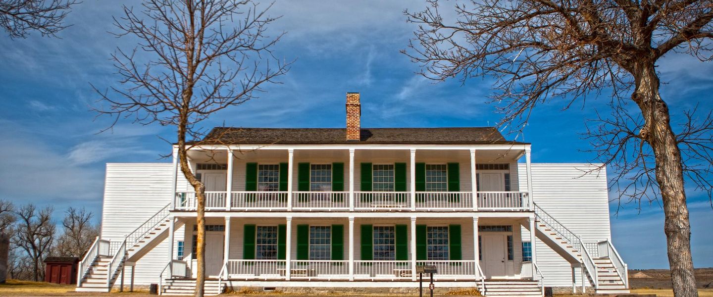


Goshen County, Wyoming combines North Platte landscapes, Fort Laramie history, emigrant trails, rural museums and wide-open High Plains scenery.
Read more about Goshen County
Getting to and around Goshen County
How to get there
Transportation
Best attractions in Goshen County
Goshen County's attractions centre on history, open landscapes and the North Platte Valley rather than a dense cluster of commercial entertainment. Fort Laramie National Historic Site is the principal destination, with restored and stabilised buildings, archaeological remains, an interpretive centre and grounds that explain the fort's roles in fur trading, military administration and overland travel. Register Cliff, a sandstone landmark bearing emigrant inscriptions, adds a direct connection with nineteenth-century trail journeys. In Torrington, the Goshen County Museum presents local history through exhibits relating to Indigenous heritage, settlement, agriculture, transport and community life. The county's irrigated farmland, river corridor and broad plains are also rewarding for scenic driving, birdwatching, wildlife observation and photography. Rural roads reveal canal systems, farmsteads and changing views of the High Plains, although many surrounding parcels are private. Fort Laramie is the strongest single focus, while Torrington functions as the cultural and practical centre. Visitors interested in geological or trail history should check boundaries carefully: well-known Guernsey State Park and several Oregon Trail features near Guernsey are in neighbouring Platte County, not Goshen County.
-
Tourist attraction
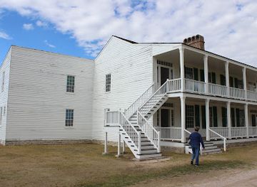
Fort Laramie National Historic Site
Explore the rich history and stunning landscapes of Fort Laramie National Historic Site, a key landmark of the American frontier.

Best landmarks in Goshen County
Fort Laramie National Historic Site is Goshen County's most important landmark, its surviving structures and archaeological footprint marking a place where Indigenous diplomacy, commerce, military power and westward migration intersected. The fort's setting beside the North Platte is as significant as its buildings, because the river explains why this otherwise exposed landscape became a major overland corridor. Register Cliff is another recognisable landmark: its pale sandstone face preserves the names and marks of emigrants who travelled west, providing tangible evidence of nineteenth-century trail movement. In Torrington, civic and historic buildings, the Goshen County Museum and the town's relationship with the railway and agricultural economy express a later phase of regional development. Beyond these sites, the county's most characteristic landmark is its landscape itself—wide irrigated fields, river bluffs, cottonwoods, canals and open High Plains horizons. These features distinguish Goshen County from the more mountainous parts of Wyoming and help explain both its Indigenous history and its modern farming economy.
-
Historical place
Fort Laramie National Historic Site
Discover the captivating historical significance and natural beauty of Fort Laramie National Historic Site in Wyoming.
-
Historical place
Guernsey Ruts
Explore the Guernsey Ruts, a remarkable historical site where the spirit of the Oregon Trail comes alive amidst stunning landscapes in Wyoming.
-
State park
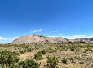
Independence Rock State Historic Site
Explore Independence Rock State Historic Site, a historic landmark in Wyoming where nature meets pioneer history amidst stunning landscapes.
-
History museum
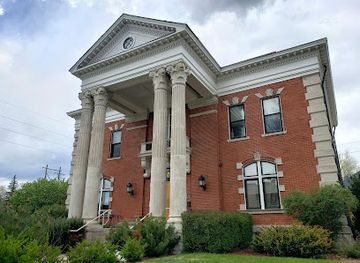
Wyoming Historic Governors' Mansion State Historic Site
Discover the Historic Governors' Mansion in Cheyenne, a beautifully preserved landmark showcasing Wyoming's political heritage and architectural elegance.

Explore Goshen County on the map
Plan your trip on one map. See where the top cities, national parks and sights are, and book hotels and experiences in a few clicks.
Best hotels in Goshen County
Best restaurants in Goshen County
Dining in Goshen County reflects its agricultural setting and small-town scale. Torrington has the broadest selection of cafés, family restaurants, casual dining and takeaway food, while smaller communities and the countryside rely more on limited local services and traditional rural eateries. Menus commonly draw on familiar American and Western staples, including beef, burgers, sandwiches, breakfast cooking and baked goods, with locally produced agricultural goods forming the background rather than a narrowly defined regional cuisine. Farm stands, seasonal produce and community events may provide opportunities to buy locally grown food, but availability varies by season. Restaurants and cafés are useful places to learn about the region's working agricultural economy, irrigation and local history through conversation, although visitors should not expect a concentrated fine-dining scene. Plan meals and provisions before driving to Fort Laramie or remote trail sites, where food services are limited or absent.
-
Grill
Broncho Grill House & Bar
Discover delicious grilled delights at Broncho Grill House & Bar in Torrington - where flavor meets hospitality!
-
Family-friendly
Deacons
Experience the best family-friendly breakfast at Deacons in Torrington - where delicious meals meet warm hospitality!
-
Fast Food
Arby's
Experience mouthwatering roast beef sandwiches and classic American deli dishes at Arby's in Torrington, Wyoming.
-
American
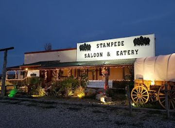
Stampede Saloon And Eatery
Discover authentic American flavors at Stampede Saloon And Eatery in Chugwater, WY - where Western hospitality meets delicious cuisine.


Best bars in Goshen County
Goshen County has a restrained evening scene shaped by rural communities rather than a major club district. Torrington is the main centre for casual bars, restaurants and social venues, while smaller towns may offer a handful of local establishments rather than a broad choice of nightlife. Evenings are more likely to involve a meal, conversation, community activity or a quiet drink than late-night dancing. Visitors should not expect regular metropolitan-style club programming, and options become particularly limited outside Torrington. Alcohol service, where available, follows Wyoming and US law, including age requirements and responsible-service rules. The county's open landscape and historic sites are best experienced during daylight; after dark, accommodation-based relaxation and arranged local events are generally more realistic than travelling between scattered venues.
-
Bar
Outlaw Saloon
Discover the Outlaw Saloon: Cheyenne's vibrant bar and grill offering delicious food, craft drinks, and live music for an unforgettable night out.
-
Grill
Broncho Grill House & Bar
Experience the essence of local dining at Broncho Grill House & Bar, where every meal is a celebration of flavor and hospitality.
-
Family-friendly
Deacons
Experience the warmth of family dining at Deacons, where delicious breakfast meets a welcoming atmosphere in Torrington, Wyoming.
-
American
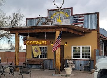
The Emporium At Hawk Springs
Discover mouthwatering American barbecue and chicken delights at The Emporium At Hawk Springs, where every meal is a celebration of flavor.
Best nightclubs in Goshen County
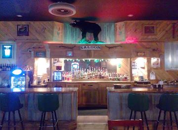
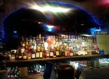
Goshen County has a restrained evening scene shaped by rural communities rather than a major club district. Torrington is the main centre for casual bars, restaurants and social venues, while smaller towns may offer a handful of local establishments rather than a broad choice of nightlife. Evenings are more likely to involve a meal, conversation, community activity or a quiet drink than late-night dancing. Visitors should not expect regular metropolitan-style club programming, and options become particularly limited outside Torrington. Alcohol service, where available, follows Wyoming and US law, including age requirements and responsible-service rules. The county's open landscape and historic sites are best experienced during daylight; after dark, accommodation-based relaxation and arranged local events are generally more realistic than travelling between scattered venues.
-
Bar
The Mint Bar
Experience the vibrant atmosphere of The Mint Bar in Torrington, Wyoming, where great drinks and lively events create unforgettable memories.
-
Cocktail bar
CZLLC
Experience the art of cocktail crafting at CZLLC in Torrington, Wyoming, where every sip tells a story of flavors and creativity.
Best shops in Goshen County
Shopping in Goshen County is concentrated in Torrington, whose local shops, practical services and food retailers serve the surrounding farming and ranching communities. Visitors can look for Western clothing, books, gifts, antiques, locally themed souvenirs and small-town independent retail, although the selection is modest compared with Wyoming's larger cities. Seasonal farm stands, community sales and occasional local markets may offer produce, baked goods or handmade items, with availability changing through the year. The most meaningful purchases are often edible or practical reminders of the agricultural setting rather than highly specialised crafts. Lingle, Fort Laramie and other small communities provide limited local services, so buy fuel, provisions and any specialist supplies in Torrington before exploring rural roads. For larger-scale shopping, visitors generally need to travel beyond the county, making Goshen County better suited to browsing local stores and buying regional food than to dedicated retail trips.
-
Grocery store
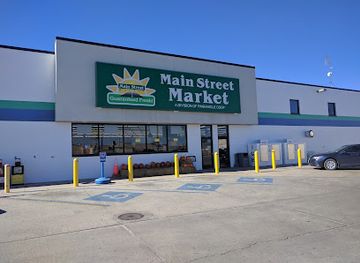
Torrington Main Street Market
Explore Torrington Main Street Market for fresh produce, delicious deli options, and a true taste of Wyoming's community spirit.
-
Soft drinks shop
AJ's Soda Shop
Experience the charm of AJ's Soda Shop in Torrington, WY, where delightful sodas, cookies, and ice cream create a sweet getaway for all.
-
Department store
Bomgaars
Explore Bomgaars in Torrington, WY – your ultimate shopping destination for tools, clothing, and pet supplies, all under one roof.
-
Coffee shop
Java Jar
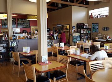
Discover Torrington's Java Jar, your perfect coffee shop for relaxing brews, light lunches, and friendly service in Wyoming.


Get your free copy of our complete guide to Goshen County, delivered straight to you.
Everything on this page, from attractions and restaurants to essentials and local phrases, in one PDF you can read offline, print or share.
Already have an account? Sign in
Your Goshen County guide is ready.
We'll send it to · Not you? Sign out

Getting your guide ready…
We are putting together a fresh copy of the Goshen County guide. This can take up to a minute.
This can take a few moments. If your browser asks, choose Allow so the download can start. You'll find the guide in your Downloads folder.
Nothing happened? Download it again
Sorry, the guide is taking longer than usual. Please try again in a minute, or get it by email instead.
Goshen County essentials
Currency and Payment
Safety
Emergency Situations
Do's and Don'ts
Local Tips
From Eve
Local phrases worth knowing
You don't need to get them perfect. A few words go a long way, and locals appreciate the effort.
Basics
| English | Local | Say it |
|---|---|---|
| Hello | Howdy | [haʊdi] |
| Goodbye | See ya | [si jə] |
| Yes | Yep | [jɛp] |
| No | Nope | [noʊp] |
| Please/You're welcome | Please / No problem | [pliz / noʊ ˈprɒbləm] |
| Thank you | Thanks a lot | [θæŋks ə lɒt] |
| Excuse me/Sorry | Excuse me / My bad | [ɪkˈskjuːz mi / maɪ bæd] |
| How are you? | How ya doin'? | [haʊ jə ˈduːɪn] |
| Fine. And you? | Good, and you? | [ɡʊd, ənd jə] |
| Do you speak English? | You speakin' English? | [ju ˈspiːkɪn ˈɪŋɡlɪʃ] |
| I don't understand | I ain't gettin' it | [aɪ eɪnt ˈɡɛtɪn ɪt] |
Eating & Drinking
| English | Local | Say it |
|---|---|---|
| I'd like to see the menu, please | Can I see the menu, please? | [kæn aɪ si ðə ˈmɛnjuː pliz] |
| I don't eat meat | I don't do meat | [aɪ doʊnt du mit] |
| Cheers! | Cheers! | [ʧɪrz] |
| I would like to pay, please | Can I pay, please? | [kæn aɪ peɪ pliz] |
Emergencies
| English | Local | Say it |
|---|---|---|
| Help! | Help! | [hɛlp] |
| Go away! | Get lost! | [ɡɛt lɔst] |
| Call the Police! | Call the cops! | [kɔl ðə kɑps] |
| Call a doctor! | Get a doctor here! | [ɡɛt ə ˈdɑktər hɪr] |
| I'm lost | I'm turned around | [aɪm tɜrnd əˈraʊnd] |
| I'm ill | I'm not feelin' well | [aɪm nɑt ˈfiːlɪn wɛl] |
Shopping
| English | Local | Say it |
|---|---|---|
| I'd like to buy... | I wanna buy... | [aɪ ˈwɒnə baɪ] |
| I'm just looking | Just browsin' | [dʒʌst ˈbraʊzɪn] |
| How much is it? | What's the price? | [wʌts ðə praɪs] |
| That's too expensive | That's a bit pricey | [ðæts ə bɪt ˈpraɪsi] |
| Can you lower the price? | Can ya bring down the price? | [kæn jə brɪŋ daʊn ðə praɪs] |
Time & Numbers
| English | Local | Say it |
|---|---|---|
| What time is it? | What time ya got? | [wʌt taɪm jə ɡɑt] |
| It's one o'clock | It's one o'clock | [ɪts wʌn əˈklɒk] |
| Half past (10) | Half past ten | [hæf pæst tɛn] |
| Morning | Mornin' | [ˈmɔrnɪn] |
| Afternoon | Afternoon | [ˌæftərˈnun] |
| Evening | Evenin' | [ˈivnɪn] |
| Yesterday | Yesterday | [ˈjɛstərdeɪ] |
| Today | Today | [təˈdeɪ] |
| Tomorrow | Tomorrow | [təˈmɔroʊ] |
| 1 | One | [wʌn] |
| 2 | Two | [tu] |
| 3 | Three | [θri] |
| 4 | Four | [fɔr] |
| 5 | Five | [faɪv] |
| 6 | Six | [sɪks] |
| 7 | Seven | [ˈsɛvən] |
| 8 | Eight | [eɪt] |
| 9 | Nine | [naɪn] |
| 10 | Ten | [tɛn] |
Transport & Directions
| English | Local | Say it |
|---|---|---|
| Where's a/the...? | Where's the...? | [wɛrz ðə...?] |
| What's the address? | What's the address? | [wʌts ði ˈædrɛs] |
| Can you show me (on the map)? | Can ya show me on the map? | [kæn jə ʃoʊ mi ɑn ðə mæp] |
| When's the next (bus)? | When's the next bus? | [wɛn z ðə nɛkst bʌs] |
| A ticket (to ....) | One ticket to... | [wʌn ˈtɪkɪt tu...] |
History of Goshen County
Indigenous North Platte Landscapes
Long before Euro-American settlement, the North Platte Valley and surrounding plains were used by Indigenous peoples, including the Cheyenne, Lakota and Arapaho, among others. The river provided water, wildlife habitat and a natural travel corridor through an otherwise dry landscape. Its location connected the Great Plains with routes towards the Rocky Mountains. The history of Goshen County therefore begins with Indigenous movement, trade, diplomacy and seasonal lifeways, not with the later forts and emigrant roads. Present-day interpretation of the area increasingly places nineteenth-century expansion within the wider context of Indigenous sovereignty and displacement.
Fort Laramie and the Overland Trails
A fur-trading post was established near the North Platte in the 1830s, and the United States acquired the site for military use in 1849. Fort Laramie became a crucial station on routes followed by emigrants travelling west on the Oregon, California and Mormon trails. It supplied travellers, protected communications and served as a meeting place between government representatives and Native nations. Nearby Register Cliff preserves emigrant names carved into sandstone. The fort's surviving buildings and archaeological remains make this period the defining historic landscape of Goshen County.
The Fort Laramie Treaties
Fort Laramie was the setting for major treaty negotiations during the era of United States expansion. The 1851 treaty attempted to define territories and relationships among several Native nations and the United States, while the 1868 treaty followed the Great Sioux War and recognised a large Great Sioux Reservation. Subsequent federal actions and pressure from settlement undermined earlier agreements. These treaties are not simply episodes in military history: they remain central to understanding Indigenous land rights, the transformation of the Great Plains and the consequences of westward expansion.
Military Communications and the Frontier Army
During the mid-nineteenth century, Fort Laramie supported military operations, stage and mail routes, emigrant traffic and telegraph communications. Its importance grew as the United States sought to control movement across the plains and protect overland infrastructure. The fort gradually lost its strategic role after railways diverted traffic away from the North Platte trails. The preserved site illustrates how frontier posts were administrative and logistical centres as well as defensive installations, and how quickly their importance could change when new transport networks appeared.
Railways, Irrigation and Agricultural Settlement
Late nineteenth- and early twentieth-century settlement brought railways, homesteads, irrigation and new commercial agriculture to the county. Water from the North Platte system helped turn sections of the dry plains into productive farmland, while rail connections linked local crops and livestock with wider markets. Torrington developed as a service and trading centre in this agricultural landscape. Irrigated fields, shelterbelts, farmsteads and canal infrastructure still reveal the long-term effect of planned water management on Goshen County's economy and appearance.
Sugar Beet Industry and Modern Rural Economy
Sugar-beet cultivation became an important part of the regional agricultural economy during the twentieth century, supported by irrigation and processing infrastructure in and around Torrington. The industry brought seasonal labour, technical change and stronger links between farms and industrial markets. Although agriculture has diversified, the county remains closely associated with farming, ranching, water management and food production. Local museums and the working landscape help visitors see how Goshen County developed from an overland corridor into a settled agricultural region while retaining its historic routes.
Goshen County in Photos
Browse through our photo collection highlighting the charm and character of the destination.
Neighbouring regions of Goshen County
The closest regions to Goshen County, if you have time for more than one.
-

-
-
-
-


Swipe for more regions
Explore more

Explore more of Wyoming
Discover Wyoming: A Land of Unspoiled Beauty, Rich History, and Boundless Outdoor Adventures in the Heart of the American West.
Explore Wyoming