

Free Converse County Travel Guide & Mobile App
Explore Converse County with free travel guides. Discover regional history, expert tips, proposed trips, and audio guides on web or mobile app.


Converse County, Wyoming combines North Platte landscapes, frontier history, small-town museums and wide-open high-plains scenery.
Read more about Converse County
Getting to and around Converse County
How to get there
Transportation
Best landmarks in Converse County
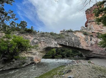
Ayres Natural Bridge is Converse County’s most distinctive natural landmark: a sandstone arch spanning La Prele Creek, formed through erosion in a landscape otherwise dominated by open grassland and sagebrush. Its setting illustrates how water has shaped the county’s dry interior terrain. Fort Fetterman State Historic Site is the county’s most important surviving frontier landmark, occupying the former military post above the North Platte and preserving a tangible connection with the era of overland travel, federal expansion and conflict on the northern plains. In Douglas, the historic railway depot and associated interpretive centre represent the transport infrastructure that brought the town into being in 1886, while the Wyoming Pioneer Museum and historic civic core reflect the county’s development as a ranching and administrative centre. The North Platte River itself is a geographical landmark, defining a corridor used for Indigenous travel, emigrant routes, military movement, railway construction and modern settlement. Glenrock’s position along the same broad corridor reinforces the relationship between water, transport and community formation. Together, these places show Converse County through three scales of history: geological time, the nineteenth-century frontier and the continuing life of small-town Wyoming.
-
State park
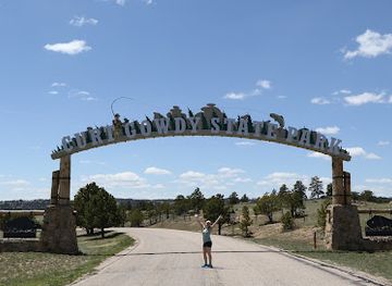
Curt Gowdy State Park
Explore the scenic beauty and outdoor adventures at Curt Gowdy State Park, Wyoming's premier destination for hiking, fishing, and camping.
-
Historical place
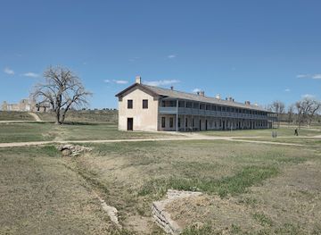
Fort Laramie National Historic Site
Discover the rich history of the American West at Fort Laramie National Historic Site, a beautifully preserved reminder of frontier life and culture.
-
State park
Glendo State Park
Explore the natural beauty of Glendo State Park, a premier destination for camping, fishing, and outdoor adventures in Wyoming.
-
History museum
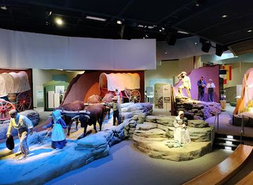
National Historic Trails Interpretive Center
Discover the legacy of America's westward expansion at the National Historic Trails Interpretive Center, a must-visit museum in Casper, Wyoming.

Explore Converse County on the map
Plan your trip on one map. See where the top cities, national parks and sights are, and book hotels and experiences in a few clicks.
Best hotels in Converse County
Best restaurants in Converse County
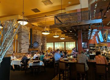
Dining in Converse County reflects Wyoming’s small-town and ranching economy rather than a specialised restaurant district. Douglas and Glenrock contain the broadest choice of cafés, family restaurants, diners, takeaway counters and traditional American grills, with menus commonly built around burgers, steaks, sandwiches, breakfast dishes and hearty portions. Pubs and casual restaurants may feature beef from the wider ranching region, while bakeries and cafés provide practical stops for travellers using Interstate 25. Local events, including the Wyoming State Fair, bring temporary food stands and fairground favourites, although the range changes from year to year. Groceries and general stores are useful for picnics at Ayres Natural Bridge or for longer drives through the county. Visitors should not expect a dense fine-dining scene, but the region offers a straightforward introduction to high-plains eating: ranch-influenced beef, familiar American comfort food, coffee, baked goods and seasonal community events. In smaller settlements and rural areas, opening days and meal hours can be limited, so planning ahead is sensible.
-
Steak
FireRock Steakhouse
Discover culinary excellence at FireRock Steakhouse in Casper - where expertly grilled steaks meet warm hospitality.
-
Barbecue
HQ Southern BBQ
Experience authentic Southern barbecue and mouth-watering burgers at HQ Southern BBQ in Evansville, Wyoming – a flavor destination for all food lovers.
-
Park
Ayres Natural Bridge Park
Explore the breathtaking beauty and rich history of Ayres Natural Bridge Park in Wyoming - a perfect destination for adventure and relaxation.
-
American
The Depot Restaurant
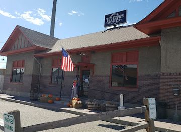
Experience the heart of American dining at The Depot Restaurant in Douglas, Wyoming—where flavor meets hospitality.
Best bars in Converse County
Evening life in Converse County is modest and centred on local pubs, bars, restaurants and community events rather than a large nightclub scene. Douglas has the widest choice of places for an informal drink or meal, with Glenrock offering a smaller selection suited to residents, travellers and people passing through the North Platte corridor. Traditional bars may show sport, host conversation and serve beer or spirits, while some restaurants and event spaces provide quieter evening options. The Wyoming State Fair brings additional temporary entertainment and late-day activity to Douglas during its annual run, but programmes and licensed venues vary. In rural areas, evenings are generally shaped by long drives, clear skies and private gatherings rather than organised nightlife. Visitors should arrange a safe journey before drinking, avoid assuming that a remote venue has late transport and remember that alcohol laws and service practices are governed by Wyoming and United States regulations. Checking current local information is advisable because small-town businesses can change their schedules or operating status.
-
Pub
Sanford's Grub & Pub
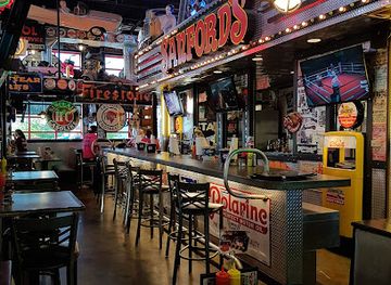
Discover the vibrant flavors of American cuisine and a welcoming atmosphere at Sanford's Grub & Pub in Casper, Wyoming.
-
Grill
The Hangar Bar & Grill
Discover The Hangar Bar & Grill in Bar Nunn, Wyoming - where delicious American cuisine meets local charm in an inviting atmosphere.
-
Breakfast
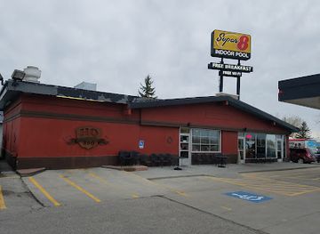
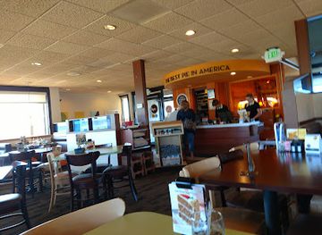
Village Inn
Village Inn in Douglas, Wyoming: Your go-to diner for hearty breakfasts, delicious pies, and a friendly family atmosphere.
-
Bar
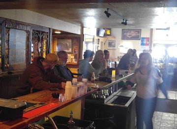
Happy Days Liquors / Butch's Bar
Discover the lively spirit of Happy Days Liquors / Butch's Bar in Evansville, Wyoming, where great drinks and entertainment await every visitor.

Best shops in Converse County
Shopping in Converse County is practical, local and closely connected with small-town life. Douglas has the broadest selection of everyday services, independent retailers, western and workwear goods, gifts, books, antiques and locally themed souvenirs, while Glenrock provides smaller-scale shops and services along its principal streets. The Wyoming Pioneer Museum and other heritage venues may offer regional books, historical material and Wyoming-themed gifts, although stock and opening arrangements vary. Farmers’ markets, craft stalls and community events can provide seasonal produce, baked goods, preserves and handmade items, but they are not necessarily available every day. Visitors looking for a memorable regional purchase should consider local food products, western-style goods, artwork, photography, books on Wyoming history or crafts made by area artists. The Wyoming State Fair also brings vendors and agricultural displays to Douglas during its annual period. There is no large luxury-shopping district, and rural settlements have limited retail provision, so buy essentials before heading into the countryside and confirm business hours when travelling outside the main towns.
-
Truck stop
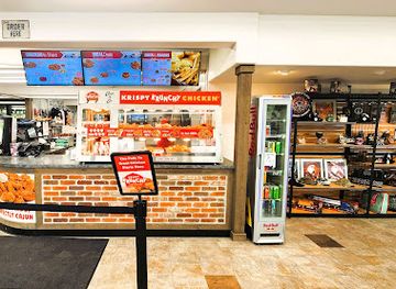
Stinker Stores
Experience the charm of Stinker Stores in Douglas, Wyoming - your essential stop for fuel, snacks, and local hospitality on the road.
-
Grocery store
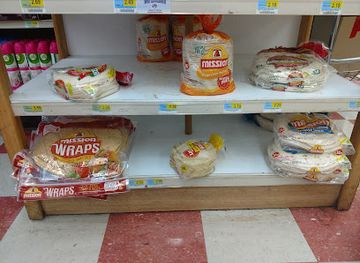
Douglas Grocery
Explore local flavors and fresh produce at Douglas Grocery, your essential stop in Douglas, Wyoming.
-
Coffee shop
Blend Coffee & Co. – mixing life with coffee
Discover Blend Coffee & Co. in Douglas, Wyoming, where exceptional coffee meets a warm, inviting atmosphere perfect for travelers and locals alike.
-
 Gift shop
Plains Motel Trading Post Gift Shop & Ice Cream Parlor
Discover unique gifts and delicious ice cream at the Plains Motel Trading Post in Douglas, Wyoming – a perfect stop for all travelers.
Get your free copy of our complete guide to Converse County, delivered straight to you.
Everything on this page, from attractions and restaurants to essentials and local phrases, in one PDF you can read offline, print or share.
Already have an account? Sign in
Your Converse County guide is ready.
We'll send it to · Not you? Sign out

Getting your guide ready…
We are putting together a fresh copy of the Converse County guide. This can take up to a minute.
This can take a few moments. If your browser asks, choose Allow so the download can start. You'll find the guide in your Downloads folder.
Nothing happened? Download it again
Sorry, the guide is taking longer than usual. Please try again in a minute, or get it by email instead.
Converse County essentials
Currency and Payment
Safety
Emergency Situations
Do's and Don'ts
Local Tips
From Eve
Local phrases worth knowing
You don't need to get them perfect. A few words go a long way, and locals appreciate the effort.
Basics
| English | Local | Say it |
|---|---|---|
| Hello | Howdy | [how-dee] |
| Goodbye | See ya | [see yah] |
| Yes | Yep | [yehp] |
| No | Nope | [nohp] |
| Please/You're welcome | Sure thing | [shoar thing] |
| Thank you | Thanks a lot | [thanks a lot] |
| Excuse me/Sorry | Pardon me | [par-dun mee] |
| How are you? | How's it going? | [how's it goin'?] |
| Fine. And you? | Good, you? | [good, you?] |
| Do you speak English? | Can ya talk English? | [can yah talk ing-glish?] |
| I don't understand | I ain't followin' | [I ain't followin'] |
Eating & Drinking
| English | Local | Say it |
|---|---|---|
| I'd like to see the menu, please | Can I see the menu? | [can I see the men-yoo?] |
| I don't eat meat | I ain't a meat eater | [I ain't a meet ee-tur] |
| Cheers! | Cheers! | [cheers] |
| I would like to pay, please | Can I get the check? | [can I get the chek?] |
Emergencies
| English | Local | Say it |
|---|---|---|
| Help! | Help! | [help] |
| Go away! | Scram! | [skram] |
| Call the Police! | Call the cops! | [call the cops] |
| Call a doctor! | Get a doc! | [get a doc] |
| I'm lost | I’m turned around | [I’m turned around] |
| I'm ill | I ain't feelin' good | [I ain't feelin' good] |
Shopping
| English | Local | Say it |
|---|---|---|
| I'd like to buy... | I wanna buy... | [I wanna buy...] |
| I'm just looking | Just browsing | [just browsing] |
| How much is it? | What’s the price? | [what's the price?] |
| That's too expensive | That's pricey | [that's pricy] |
| Can you lower the price? | Can ya drop the price? | [can yah drop the price?] |
Time & Numbers
| English | Local | Say it |
|---|---|---|
| What time is it? | What’s the time? | [what's the time?] |
| It's one o'clock | It's one | [it's one] |
| Half past (10) | Half past ten | [half past ten] |
| Morning | Mornin' | [mornin'] |
| Afternoon | Afternoon | [afternooon] |
| Evening | Evenin' | [evenin'] |
| Yesterday | Yestiddy | [yes-tiddy] |
| Today | Today | [today] |
| Tomorrow | Tomorra' | [to-morra'] |
| 1 | One | [one] |
| 2 | Two | [two] |
| 3 | Three | [three] |
| 4 | Four | [four] |
| 5 | Five | [five] |
| 6 | Six | [six] |
| 7 | Seven | [seven] |
| 8 | Eight | [eight] |
| 9 | Nine | [nine] |
| 10 | Ten | [ten] |
Transport & Directions
| English | Local | Say it |
|---|---|---|
| Where's a/the...? | Where's the ...? | [where's the ...?] |
| What's the address? | What’s the address? | [what's the address?] |
| Can you show me (on the map)? | Can ya point it out? | [can yah point it out?] |
| When's the next (bus)? | When's the next bus? | [when's the next bus?] |
| A ticket (to ....) | A ticket to ... | [a ticket to ...] |
History of Converse County
Indigenous Plains and River Corridors
Long before Euro-American settlement, the North Platte valley and surrounding plains were used by Indigenous peoples, including communities whose movements, hunting practices and trade connected the region with the wider Great Plains and Rocky Mountain West. River corridors offered water, timber and routes through otherwise dry country. The county’s later trails and military roads followed geographical advantages that earlier inhabitants already understood. Visitors should view the region’s nineteenth-century history as part of a much longer Indigenous landscape rather than as its beginning.
Overland Trails in the Nineteenth Century
The North Platte corridor became part of the network used by emigrants travelling west on the Oregon, California and Mormon trails. Wagon parties sought reliable water and manageable routes across the plains, while commercial traffic and communications followed similar lines. Much of the original trail landscape has been altered by roads, railways and ranching, but the broad river valley and open country still help explain the practical challenges faced by travellers. Trail history also links Converse County with the wider migration that transformed the American West.
Fort Fetterman and the Military Frontier
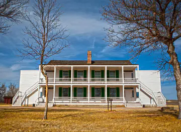
Fort Fetterman was established in 1867 on a terrace above the North Platte, north of present-day Douglas. It served as a military post and base for protecting transport routes, supporting expeditions and maintaining a United States presence during a period of conflict and rapid territorial change. The post was abandoned in the late nineteenth century, and its surviving structures and archaeological remains now form Fort Fetterman State Historic Site. Its story reflects both military logistics and the disruptive consequences of westward expansion for Indigenous nations.
Railways and the Founding of Douglas
Railway construction altered the county’s economic geography in the late nineteenth century. Douglas was founded in 1886 along the Chicago and North Western Railway, which connected local ranching and agricultural production with distant markets and supplied a dependable route for people and goods. Glenrock also developed in the North Platte corridor, benefiting from transport and access to regional resources. Historic depots, street patterns and civic buildings preserve traces of the era when railways created new towns and made large-scale settlement more practical.
Ranching, Homesteading and Resource Development
After the railway arrived, ranching and homesteading became central to the county’s economy, although success depended heavily on water, land tenure and the severe high-plains climate. Cattle operations continue to shape the countryside, while agriculture is concentrated where irrigation and river access make it viable. Coal, oil and other resource industries have also influenced employment and settlement at different times. This combination of ranch land, transport corridors and extractive development explains why Converse County has remained economically important despite its low population density.
Douglas, Public Heritage and the Wyoming State Fair
Twentieth-century Converse County developed around its established towns, transport links, ranching economy and civic institutions. Douglas became a centre for county administration, education and regional services, while the Wyoming State Fair helped give the community a statewide role in agricultural and rural life. Museums and preserved railway facilities now interpret the county’s past, including pioneer settlement, military history and everyday work on the plains. Contemporary Converse County remains shaped by the balance between small-town services, ranching traditions and a changing resource economy.
Converse County in Photos
Browse through our photo collection highlighting the charm and character of the destination.
Neighbouring regions of Converse County
The closest regions to Converse County, if you have time for more than one.
-
-

-

-

-


Swipe for more regions
Explore more

Explore more of Wyoming
Discover Wyoming: A Land of Unspoiled Beauty, Rich History, and Boundless Outdoor Adventures in the Heart of the American West.
Explore Wyoming