


Utah Mighty 5 Adventure Bundle: 8 Self-Guided Audio Tours
 New Harmony, US
 100% of travellers recommend this
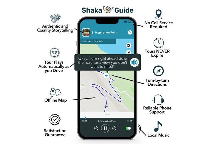

Highlights
- Explore Utah's Mighty 5 national parks
- Enjoy self-guided freedom with GPS navigation
- Experience stunning scenic drives and overlooks
- Listen to fascinating stories and travel tips
- Customize your own adventure at your pace
-
Includes 8 audio tours
-
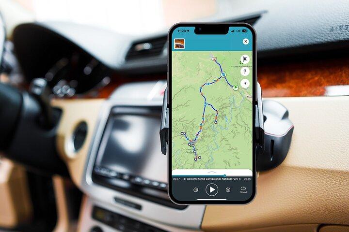
GPS turn-by-turn directions
-
Offline map available
-
Tours never expire
-
Private and customizable experience
-
Suitable for all fitness levels
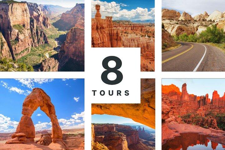
The Utah Ultimate Adventure Bundle invites explorers to journey through the breathtaking landscapes of the Mighty 5 National Parks. With eight captivating self-guided audio tours, they can roam freely through iconic wonders like Arches, Zion, and Bryce Canyon, all while receiving engaging stories and tips from their personal audio guide. This bundle includes thrilling routes like the La Sal Mountain Loop and Goblin Valley, ensuring a rich experience filled with stunning vistas, intriguing history, and unforgettable moments. With offline maps and GPS navigation, adventurers can immerse themselves in nature at their own pace, making each stop a unique adventure. The tours are designed for all fitness levels, allowing everyone to discover the magic of Utah's natural beauty in a private, flexible, and cost-effective way. Each tour offers the freedom to explore, pause, and enjoy the splendors of Utah’s remarkable landscapes.
At a Glance
-
 Free cancellation
-
 8 days
-
 Instant Confirmation
-
 Available in English
-
 Wheelchair accessible
-
 Mobile voucher
-
 Audio guide
-
 Family friendly

Featured Reviews

Explore Utah's Mighty 5 National Parks at your own pace with our self-guided audio tour bundle, featuring unique insights and stunning landscapes.
Included
-
 OtherTours NEVER expire - take the tour when you want!
 -
OtherTurn-by-turn directions using GPS and the freedom to explore at your own pace
-
OtherOffline map (map and GPS work completely offline - no wifi or data needed)
-
OtherHours of audio narration with stories, travel tips and music that plays automatically as you drive
-
Other6 Utah Self-Guided Audio Tours: Arches, Canyonlands, La Sal, Zion, Bryce & Capitol Reef
Excluded
-
 OtherRental car
 -
OtherMeals & Refreshments
Meeting Point
This tour bundle features 9 audio tours. Each tour has a variety of starting points. Start by selecting the tour of your choice, then view the starting point options in the app.

Utah 84532 , United States

End Point

Utah 84532 , United States
What to expect
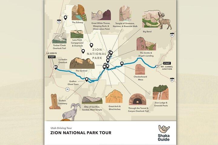
Kolob Canyons
As you pull in, be sure to check in at the Kolob Canyons Visitor Center to show your park pass.
20 minutes
Timber Creek Overlook Trail
This short, easy trail leads to a panoramic overlook of Kolob Canyons, the Pine Valley Mountains, and Red Butte. If you only have time for one short hike while in Kolob Canyons, be sure to do this one!
30 minutes
La Verkin
At La Verkin Overlook, you’ll get a beautiful panoramic view of Zion Canyon, the Virgin River Gorge, Pine Valley mountains, and, of course, La Verkin itself.
15 minutes
The Subway
We’re now passing one of the most popular canyoneering locations of Zion: The Subway. The Subway requires a Wilderness Permit from the Zion lottery, so, in order to take The Subway, you really will need a ticket. You can take The Subway two ways: from the bottom-up or the top-down. The bottom-up is less technical, requires no canyoneering, and begins at the Left Fork trailhead on our right.
Lava Point Overlook
Lava Point Overlook is a basalt cliff that overlooks a green volcanic valley filled with pinyon, juniper, and white pine trees.
15 minutes
Grafton Cemetary
Explore the most photographed ghost town in the West! This abandoned Mormon settlement still has several cabins, houses, and a town hall to explore. This well-preserved window to the past was the filming location for the Butch Cassidy and the Sundance Kid’s famous bike scene. Be sure to take lots of selfies and share them with us on social media!
40 minutes
Grafton Ghost Town
Grafton is a ghost town with a somewhat unusual history. While the majority of abandoned settlements were once mining towns—subject to the boom and bust nature of mining—Grafton is an agricultural ghost town. Visitors today can see the abandoned houses and even go inside a few.
15 minutes
Zion Canyon Visitor Center
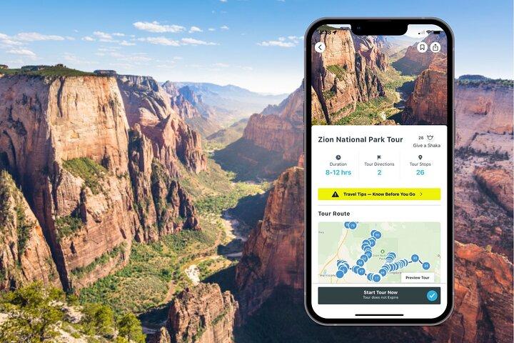
We made it to Zion Canyon! Here at our first park stop, take a moment to talk to the rangers, grab a map, use the restroom, and fill up your water bottles. If you need a wilderness permit, this is where you’ll pick one up. Be sure to check the schedule for any ranger talks or walks you might be interested in. There is also a bookstore and gift shop, but it’s probably best to save all that for after your hikes. When you’re ready, get in line for the shuttle (if it's shuttle season) and get ready for adventure!
20 minutes
Pa'rus Trail
Does the line for the park shuttle look a little daunting? Well, there is another option for those in the know. Rest assured, I am in the know. And lucky for you, you know me. You can skip the line by taking the sunny Pa’rus (pah-roos) trail to the Human History Museum and board the shuttle there. This is the only trail in Zion where you can ride bikes or walk dogs. While it is both paved and pleasant to walk, it’s also 1.7 miles long, so it may not be suitable for everyone. Follow the signs at the Visitor Center if this sounds like a good option for you.
Zion Human History Museum
If you pull into the Zion Human History Museum, you can make your way over to the back patio of the Human History Museum to enjoy a highly-recommended ranger talk. Even if you stop by when no talk is being held, the view of the Towers of The Virgin formation is truly amazing and well worth the visit.
10 minutes
Court of the Patriarchs
Your next viewpoint is the Court of the Patriarchs formation. From left to right, visitors can find Abraham Isaac, and Jacob— the patriarchs of Judaism. Take a moment to hop out and get a better view.
10 minutes
Emerald Pools
Your first must-see trail is the Lower Emerald Pools. This 2-mile hike features water drizzling from sandstone cliffs, glittering hanging gardens, and bright emerald pools. This trail is family-friendly and can be accessed across the street from the Zion Lodge.
60 minutes
Angel's Landing
Exit at The Grotto to begin your epic ascent up to Angel’s Landing—a thrilling chain-assisted climb up a narrow precipice! When you reach the top, you’ll earn both bragging rights and an incredible view. If you aren’t feeling up to the climb, simply stop at Scout’s Lookout for an equally stunning vista. If you go all the way up to Angel’s Landing it’s about 5-miles round-trip. Though Angel’s Landing itself is only an extra half-mile each way, crowding and difficulty can add a great deal of time. Please note: Angel's Landing now requires a permit. Permits are not included with entry to the park or purchase of the tour.
120 minutes
The Great White Throne
Around 800 A.D., by rain or snow, water began working its way through the layers of what we now call “Weeping Rock.” For over 1,000 years it percolated downward before encountering the impermeable Kayenta Formation. Forced to move horizontally, the water diffused out of the soft limestone, washing away the formation as it went. Since this paved trail is a mere half-mile round trip, I recommend we explore it.
Temple of Sinawava Trail
The Temple of Sinawava is the final stop along the canyon, and it’s here that you’ll disembark and undertake The Narrows.
The Great Arch
When an arch is not freestanding, we call that a “blind arch.” Zion's blind arch can be seen along the roadway, or at several pullovers along its serpentine road.
10 minutes
Canyon Overlook Trail
Canyon Overlook Trail is a short, 1-mile hike overlooking East Zion’s rugged landscape. It’s a great option for those who want to enjoy a high-elevation viewpoint, but would rather not undertake a high-elevation climb. And the views? Absolutely amazing!
30 minutes
Checkerboard Mesa
The Checkerboard Mesa bears stunning criss-cross markings across its face—the result of years of expansion and weathering. At farther viewpoints, the checkerboard pattern becomes more obvious. Pull over on your left before passing the Ranger Station for the best view of this awesome feature.
10 minutes
East Entrance Ranger Station
Interested in exploring even more of East Zion? At the Ranger station, we’ll have access to several famous hiking trails including Observation Point, the highest lookout in Zion. The main vein, known as East Mesa Trail, branches into several other trails, including Observation Point—the highest lookout in Zion. If you want to see the remnants of the Cable Mountain Pulley system, East Rim Trail will also be your starting point. These trails are long and interconnected, so be sure to check our highlights or speak to the ranger for more information before you set out.
5 minutes
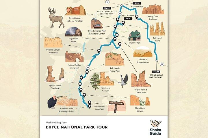
Bryce Canyon City
This is the main road into Bryce Canyon National Park, and there’s no lack of activities here!
15 minutes
Ruby's Inn
Ruby’s has several properties, a general store, three restaurants, and an “old town” mini-mall with gift shops, an ice cream parlor, and a working gem mine! They also offer many unique ways to see the park: horseback riding tours, guided ATV tours, bike rentals, and even helicopter rides.
15 minutes
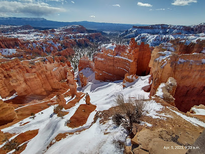
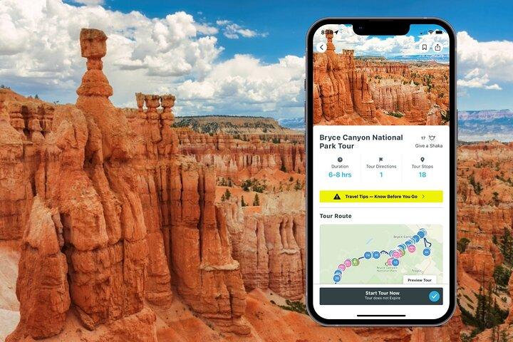
Make stops throughout the park in both the Bryce Amphitheater and Bryce Canyon Scenic Drive.
120 minutes
Fairyland Point
Here you’ll get a first look at the famous hoodoos of Bryce Canyon. You’ll learn how they’re formed, how they got their name, and the important role they play in the conservation efforts of the national park system.
10 minutes
Bryce Canyon Visitor Center
After you pass through the front gate, be sure to check out the Bryce Canyon Visitor’s Center. Here you’ll have the opportunity to explore the small museum and learn more about the geology and cultural heritage of Bryce. Be sure to check out the award winning 20-minute film “Shadows Through Time” and the large gift shop! On your way out, check in with the friendly park ranger staff about the many educational talks and tours they offer daily
15 minutes
Bryce Canyon Scenic Drive
This is a wildly popular way to see everything that Bryce Canyon has to offer. The scenic drive will take you 18 miles to Rainbow and Yovimpa Points; the southernmost but highest points of Bryce Canyon. Along the way, you’ll have the opportunity to hear more stories of the people who discovered Bryce Canyon and championed it to become a National Park. On the way back, we’ll stop at the other 7 viewpoints: Black Birch Canyon, Ponderosa Point, Agua Canyon Viewpoint, Natural Bridge Viewpoint, Farview Point, Piracy Point, and Swamp Canyon. From these viewpoints, you’ll not only see hoodoos but also other unique rock formations in brilliant colors, flora and fauna that make up the rest of Bryce Canyon. The Scenic Drive is a nature-lover’s dream!
120 minutes
Rainbow Point
Rainbow Point is actually the highest point in the park at 9,100 feet above sea level. You’ll be able to see most of Bryce Canyon from here, and on a clear day, you might be able to see all the way to the Grand Canyon, which is over 300 miles away!
5 minutes
Yovimpa Point
After taking in the breathtaking views from Rainbow Point, take a very short, paved walk over to Yovimpa Point to see even more layers of the Grand Staircase.
5 minutes
Bristlecone Loop
Bristlecone Loop Trail is one-mile long and will take you through a forest of Bristlecone Pine trees, which are some of the oldest trees in the entire world.
30 minutes
Black Birch Canyon
Stop by Black Birch Canyon Viewpoint to get a look at the spectacular Ponderosa Pine trees and the Navajo Mountains looming in the distance.
10 minutes
Ponderosa Canyon
Another great viewpoint of the forest areas of Bryce Canyon and the large, hulking Ponderosa Pine trees.
5 minutes
Agua Canyon
You’ll get a great view of some of the more well-known hoodoos at Bryce Canyon from here. Keep your eyes peeled for the Backpacker and the Rabbit, and see what other shapes your brain can come up with! This is also a great viewpoint to take photos of Thor’s Hammer, the most famous hoodoo.
10 minutes
Farview Point
At Farview Point, the air quality is so pure that you’ll be able to see clear into Arizona! Keep an eye out for the colorful rock formations and breathtaking views of the far-off Navajo Mountain.
15 minutes
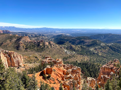
At Farview Point, the Then take an enchanted walk through the path to Piracy Point, which is unofficially known as the Hansel and Gretel trail. Weave through sun-dappled Ponderosa and Bristlecone Pines, and keep an eye out for squirrels and songbirds! Once you get to Piracy Point, take a look into the distance and see if you can spot the cliff formation that looks just like Blackbeard’s ship!air quality is so pure that you’ll be able to see clear into Arizona! Keep an eye out for the colorful rock formations and breathtaking views of the far-off Navajo Mountain.
15 minutes
Swamp Canyon
Swing by Swamp Canyon and take a look at one of the only viewpoints in the park that has its own natural water source. Because of this, the vegetation is green and lush all around the hoodoo formations here. If you’re an experienced hiker, you may want to try out the Swamp Canyon Loop Trail here; it’s a 4.5-mile hike that descends into Swamp Canyon and connects to the Under-the-Rim Trail before looping back around. If you’re not prepared to take such a strenuous hike, hang out at the top of Swamp Canyon and keep an eye out for California Condors overhead.
10 minutes
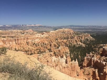
The most-visited part of the park is the Bryce Amphitheater. There are 5 viewpoints that make up the Bryce Amphitheater: Sunrise, Sunset, Bryce, Inspiration Points and Paria View. The largest concentration of hoodoos can be found here, and some of the most popular into-the-canyon hikes are located here. Photography buffs, star-gazers and hikers of all skill levels love everything that the Bryce Amphitheater has to offer!
60 minutes
Bryce Point
The first two points that make up the famous Bryce Amphitheater. Bryce Point was the favorite spot of Ebenezer Bryce, and it may just become yours, too. Here you’ll be able to see a large maze of hoodoos. For the advanced hikers, Bryce Point is the trailhead for the Peek-a-Boo Loop trail, a 5.5 mile loop trail that will take you all the way down into the canyon floor, past the Wall of Windows and around the Three Wise Men hoodoos.
15 minutes
Paria View
Paria View is a fantastic place to watch for Peregrine Falcons! Keep your eyes peeled for large birds that look like they’re wearing gray pajama pants. If you’re an active cross-country skier, Paria View is also home to the challenging Paria Loop, which is popular with winter sports enthusiasts and only open to visitors during snowfall (usually December-February).
10 minutes
Inspiration Point
Inspiration Point is often called “The Silent City,” because the rows and rows of hoodoos look like people frozen in time. There are three smaller viewpoints at Inspiration Point; the lower, mid, and high points. You have to hike up a moderate but rocky incline to get to the highest point, but beautiful views can be seen from any of the points. Take a half hour or so to hike the easy-to-moderate Rim Trail that takes you to Sunset Point.
10 minutes
Sunset Point
Some of the most iconic and photographed views are here at Sunset Point. Take a look out into the canyon and get another glimpse of the famous Thor’s Hammer and the rich reds and pinks of the iron oxide that gives the hoodoos their vibrant color. Sunset Point is the main trailhead of one of the most popular hikes at Bryce Canyon--the Navajo Loop Trail. This one is a quick 1.4 miles and is easy-to-moderate with a few slight elevation changes. This will follow some switchbacks down the canyon and into the hoodoos.
10 minutes
Mossy Cave Trail
The last official stop on the tour, this is one of the most peaceful hikes at Bryce Canyon, but it’s technically outside of the park gates. Mossy Cave Trail gives you the opportunity to walk on the canyon floor without the steep descent. This is a quick 1-mile, round-trip walk that ends at Mossy Cave; a grotto that boasts a waterfall!
30 minutes
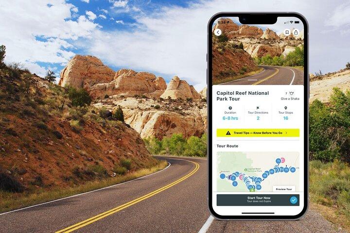
Torrey
It’s a good idea to make sure you’ve got all the supplies you need for the tour before you leave town. Torrey has the last gas stations you’ll see until you reach Hanksville. There are also several picnic opportunities inside the park so now’s the time to stock up on food and water.
20 minutes
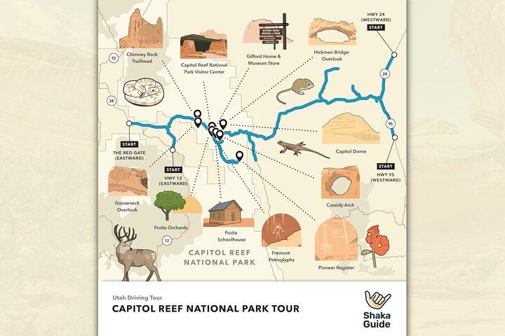
Chimney Rock is the first rock formation on the tour as well as the first hiking opportunity. Chimney Rock Loop Trail is a strenuous 3.6 mile hike that climbs 590 feet in elevation. But at the top, you’re rewarded with a stunning panoramic view from atop the Mummy Cliffs. There’s no need to wear yourself out right away, though. There will be plenty of hiking opportunities throughout the day. Consider coming back and doing this one later as the views get even better at sunset.
20 minutes
Panorama Point
If you don’t plan on doing any serious hiking today, don’t fret! There are several great viewpoints that don’t require miles of walking to enjoy. Panorama Point offers a great view just a few feet from your car.
20 minutes
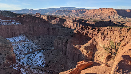
The views just don’t stop coming! A short and easy 600-foot walk from your car will take you to Goosenecks Overlook with views over Sulphur Creek and beyond. Just try to imagine a time when the creek was at the same elevation as you before it eroded the rock and dug down some 600 feet to where it is today. Once you’ve soaked in that view, there’s a second vantage point just a little further away called Sunset Point. As the name might suggest, views here at sunset are simply incredible.
20 minutes
 Admission Not Included
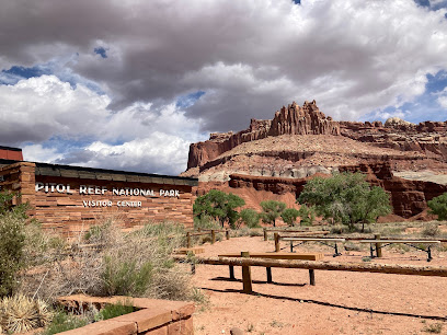
You’ll pass two more named rock formations on the way to the Visitor Center. Feel free to stop in the turnouts near each for photos or drive directly to the Visitor Center. Here you can view the exhibits and watch a brief film about the park. Don’t miss this opportunity to speak with a park ranger. Ask about any ranger-led activities for the day like a geology lesson or night sky presentation.
20 minutes
Admission Not Included
Ripple Rock Nature Center
As you leave the Visitor Center, you’ll find yourself driving through the historic Fruita Orchards. Planted well over 100 years ago by Mormon settlers, the orchards are still producing fruit which you can pick and eat today! Please be sure to follow the orchard rules and regulations. An easy place to park to enjoy the orchards is the Ripple Rock Nature Center. If you have kids and you’re visiting during the summer, the Nature Center has programs and activities your children are sure to enjoy.
20 minutes
Admission Not Included
Gifford House & Museum Store
The Gifford home offers exhibits detailing what life was like in historic Fruita. They also serve up some fresh pies, made from fruit harvested in the Fruita orchards.
20 minutes
Admission Not Included
Scenic Drive
The Scenic Drive is a 7.9 mile road showcasing fantastic sights. There are also two unpaved spur roads that branch off into canyons. Don’t worry, normal passenger cars will do just fine—unless the park has closed the roads due to weather. Flash floods are a real danger. If you see storm clouds, think twice before entering any canyons. Be mindful of the speed limit and take your time on these roads. Entry to the Scenic Drive costs $20 per car.
60 minutes
Admission Not Included
Grand Wash Road
The spur roads at Capitol Reef offer the chance to see some spectacular geology by car and on foot. Grand Wash spur road ends at the trailhead for Grand Wash trail and Cassidy Arch trail. Grand Wash is an easy hike over flat ground that passes through narrow canyon walls. Cassidy Arch is a strenuous hike that rises over 400 feet up to the top of Cassidy Arch, named for Butch Cassidy himself. A turnout along the road also offers a view of Cassidy Arch. There are additional stops at abandoned uranium mines and Echo Cliff where, you guessed it, you can hear your echo!
20 minutes
Admission Not Included
Capitol Gorge Trail
The Scenic Drive ends at the entrance to Capitol Gorge. This is a much longer and winding spur road than Grand Wash. Once again there will be hiking opportunities at the end and I highly recommend you take Capitol Gorge trail, at least a little ways in. A 5-10 minute walk will take you to ancient petroglyphs left by the Fremont culture who lived in the area hundreds of years ago. Another 10-15 minutes further and you can see the Pioneer Register where pioneers and settlers carved their names into the rocks. From there you can continue to The Tanks - large divots in the sandstone that collect water and create micro-ecosystems. You can also hike to a viewpoint of Golden Throne, an impressive mountain peak just north of the gorge.
20 minutes
Admission Not Included
Fruita Schoolhouse
A visit to Fruita isn’t complete without a stop at the Fruita schoolhouse. Peak inside while looking back in time to when a 12 year old girl was the first and only school teacher in the village!
20 minutes
Admission Not Included
Fremont Petroglyphs
Right down the road from the schoolhouse are more petroglyphs. These are in much better shape than the ones in Capitol Gorge. Walk the two short wooden walkways to see the images etched into stone. You can see human figures, animals, and geometric patterns. What kinds of animals can you make out?
20 minutes
Admission Not Included
Capitol Dome View Area
These stops are really piling up on top of each other, aren’t they? Pull into a small parking lot here for views of Capitol Dome, where half of the name Capitol Reef comes from. The other half, the “reef,”comes from the raised portion of the waterpocket fold which reminded early pioneers of impassable reefs in the ocean. From this parking lot you can also take several hikes, including Rim Overlook, Navajo Knobs, and Hickman Bridge which gives you views of two more natural arches.
20 minutes
Behunin Cabin
The Behunin cabin is a small sandstone structure that once housed a family of 15. Most of the children had to sleep outside - the girls in the wagon and the boys in a sandstone alcove behind the cabin. Talk about roughing it!
20 minutes
Admission Not Included
Waterpocket Fold
From atop a hill near some primitive camping sites, this is a terrific view of the Waterpocket Fold from the east. From here, you can really see the steep angle at which the land rose. At times, the rock layers are nearly 45 degrees to the horizon. This is a must-see view as we head east and leave the Waterpocket Fold behind.
20 minutes
Admission Not Included
Notom
This is an optional stop but recommended if you have time. There isn’t all that much left to see on the way to Hanksville but we’ve got plenty of fascinating stories to share if you’re interested. The town of Notom, now not much more than a ghost town, used to be a thriving community much like Fruita. Here you can visit a rather curious and unique historical marker as well as the grave of yet another of the Behunin children.
20 minutes
Mesa Farm Market
If you didn’t have a picnic lunch at the park, you might be pretty hungry by this point! If you started your tour at 8:00 am and you’re here on the right day, consider stopping for a bite to eat at Mesa Farm Market. It’s local and organic!
20 minutes
Admission Not Included
Factory Butte
Factory Butte stands solitary and beautiful. Don’t miss this awesome viewpoint! If you’re feeling adventurous and you’re driving an appropriate vehicle, consider driving a little further north for Moonscape Overlook. But, a word of warning: plan ahead if leaving the recommended route as many of the roads in the area, even inside the park, require high clearance 4-wheel-drive vehicles.
20 minutes
Admission Not Included
Hanksville
Many prospectors staked claims for gold, silver, copper, and more in this area. Few were as ambitious as Ewin T. Wolverton who built his mill in 1921. The Wolverton Mill, located just a half-mile of route 24, is unique in the area both for its design and its multifunction as a lumber mill and gold ore processor.
20 minutes
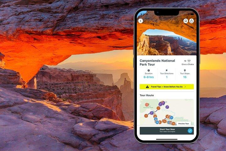
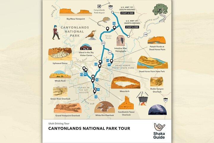
Canyonlands National Park
Discover the dramatic landscapes of Canyonlands National Park on a self-guided audio tours with Shaka Guide. On this tour we’ll guide you through the park’s Island of the Sky District. You can visit scenic spots like Dead Horse Point, Green River Overlook and the famous Mesa Arch. Plus, we’ll recommend 6 of our favorite hiking trails including Upheaval Dome.
480 minutes
Admission Not Included
Monitor and Merriamac Rock Formations
The two buttes you can see from this viewpoint, the Monitor and the Merrimac, were named for their resemblance to the first American made ironclad warships. Built during the Civil War, these ships helped usher in the modern era of Naval warfare.
20 minutes
Admission Not Included
Navajo Rocks Main Parking Lot
Mountain biking is a popular activity at Canyonlands and the surrounding area. The Navajo Rocks trail is singletrack and varies in difficulty from flowy to technical. You’ll keep driving while we tell you about this spot.
20 minutes
Admission Not Included
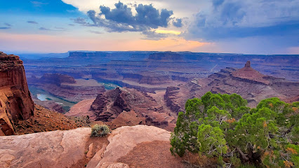
Dead Horse Point State Park lies just off the road to Canyonlands, rests on the same mesa as Island in the Sky, but offers a wholly unique view. Learn about the history, ancient and modern, of this popular state park and scenic overlook.
20 minutes
Admission Not Included
Island in the Sky
The Canyonlands Island in the Sky Visitor Center is the only place in the district to find potable water and flushing toilets. Stop here to pay your entrance fee, talk to a ranger, and visit the bookstore.
20 minutes
Admission Not Included
Shafer Canyon Overlook
From this viewpoint, you can look down on the Shafer Trail as it winds its way down the mountain via a series of narrow switchbacks. If you’re feeling adventurous and you have the right kind of vehicle, you might consider taking the Shafer Trail back to Moab after the tour.
20 minutes
Admission Not Included
Mesa Arch
The trail to Mesa Arch is an easy half-mile round trip over dirt and slickrock. The views at Mesa Arch, and the arch itself, are fantastic at sunrise. And this is a sentiment shared by many because the parking lot begins to fill up while it’s still dark outside. Get started early to make sure you get a spot! If you can’t find a spot, try stopping by in the afternoon after you complete the tour.
20 minutes
Admission Not Included
Candlestick Tower Overlook
The next stop is another iconic formation in the park called the candlestick tower. The name comes from its shape, which resembles a melting candlestick. This 450-foot tower is a popular rock climbing spot. If you visit during fall or winter, you might be able to catch a glimpse of a brave soul or two making their way up the tower.
20 minutes
Admission Not Included
Buck Canyon Overlook
Buck Canyon Overlook offers an amazing canyon view of the gorgeous geological layers in Canyonlands and the beautiful mountains in the distance.
20 minutes
Admission Not Included
White Rim Overlook Trail
At the White Rim Overlook, you can hike a relatively flat,1.8-mile round-trip trail and see a stunning 360 degree view of the canyon. But if you're not feeling up to it, there's also an overlook that requires just a short walk from the parking lot. From this overlook, you can see the handiwork of the Colorado river carving out the landscape.
20 minutes
Admission Not Included
Orange Cliffs Overlook
From this overlook, you can see the orange cliff section of Glen canyon recreational area which borders Canyonlands. You can also see the maze district, the most remote part of the park.
20 minutes
Admission Not Included
Grand View Point Overlook
Looking down from the grand viewpoint, you can see a complex network of canyons carved by the Colorado and green rivers. If you're feeling up for a two-mile round-trip hike, follow the trail to the tip of the island in the sky, mesa. This is one of the best hikes in the entire park.
20 minutes
Admission Not Included
Green River Overlook
This overlook offers yet another breathtaking view of the canyon over a thousand feet below the road, carved out by the peaceful yet powerful Green River. The river shaped much of the landscape in this part of the country, originating from Wyoming on the left side of the continental divide.
20 minutes
Admission Not Included
Aztec Butte Trail
Aztec Butte Trail is a 1.7-mile round-trip hike that leads to some ancestral Puebloan stone granary structures with some amazing views. The granary was built roughly 800 years ago, around 1200 AD.
60 minutes
Admission Not Included
Whale Rock
The name Whale Rock comes from the rock’s resemblance to a blue whale. It does take a little imagination for you to see it though. There is a one-mile round-trip hike up to the giant rock with great views on top that’s rated as easy to moderate.
20 minutes
Admission Not Included
Upheaval Dome
Known by several nicknames including Utah’s Belly Button, this structure is the biggest mystery of Canyonlands because scientists can’t agree on how it was formed. There are two ways to explore the dome. The first is to follow a one-mile round-trip trail to the overlooks (our recommendation). The second is to hike an eight-mile trail that wraps around the Ridge of the crater. It's not only challenging, but it's also where most of the rescues in the park happen.
20 minutes
Admission Not Included
Alcove Spgs Trl
This is a rough 12-mile round-trip hike with a steep descent into the canyon. There, you’ll find two 500-foot rock towers named Moses and Zeus.
Ken's Lake
This is a popular campsite with a lake set against a stunning backdrop of the La Sal Mountains. From the lake, you can hike a short distance to a small waterfall.
20 minutes
Brumley Arch
The Brumley Arch trail is only two miles round trip, but it's pretty steep and strenuous. You’ll also need to drive on an optional gravel road to get to the trail. At the end, you will be rewarded with a waterfall and the Brumley Arch rock formation.
20 minutes
Oowah Lake
Oowah Lake is a small lake popular for rainbow trout fishing. Sitting at 8,800 feet or over 2,600 meters, this Alpine lake often shows the reflection of the La Sal Mountains, which makes it truly picturesque.
20 minutes
Warner Lake
Warner Lake is slightly smaller than Oowah and is also great for rainbow trout fishing. Both lake areas are pretty serene on most days, but during holidays or summer weekends you can expect to find a small crowd. And although there are many trails in the area such as Boudreaux pass and Schuman Gulch, the most popular trail is the 1.6-mile round-trip hike that connects the two lakes together.
20 minutes
Castle Valley
This is a must stop on the drive as you'll enjoy a sweeping panoramic view of the Colorado Plateau below LaSalle. You'll also be able to see the Porcupine Rim, Castle Valley, Arches National Park, and Canyonlands National Park.
20 minutes
Bull Canyon Overlook and Dinosaur Track Site
This place is famous for dinosaur tracks left in the ground around 200 million years ago during the Jurassic period. No hiking is needed but you'll need about 30 to 40 minutes for the detour.
20 minutes
Castleton Tower
This is a series of sandstone towers with names like Castleton Tower, the Rectory, and Sister Superior, that rise as high as 1,400 feet.
20 minutes
Parriott Mesa
The summit of Parriott Mesa stands over 6,000 feet or 1800 meters in elevation. It looms over the Castle Valley like a guard. Stretching more than 1.5 miles long and a third of a mile wide, this sandstone summit is another magnet for climbers. There is a three-mile, round-trip hike there, but it's pretty challenging and you need to be very well-prepared
20 minutes
Fisher towers has a popular hiking trail that features beautiful sandstone formations like towers, spires, hoodoos, ravines, and terraces. But there's more to Fisher Towers than just scenery. In fact, there's a pretty good chance you've already seen Fisher Towers before as the backdrop to many hollywood movies, like Austin Powers 3 and 6 Underground.
20 minutes
Moab Giants
The museum is part of the Red Cliffs Lodge. Many films like Wagon Master, Rio Grande, Taza Son of Cochise, City Slickers, Thelma & Louise, and more than a hundred different television commercials were shot in the area. The museum has a great selection of memorabilia, including early pioneer artifacts and photos of Hollywood stars who worked on the motion pictures. And there's no charge to go in, either.
20 minutes
Salt Wash
This is where the Salt Wash River joins the Colorado River. If you have a kayak, you can follow the salt wash upstream and eventually pop out near Delicate Arch inside Arches National Park.
20 minutes
Take Out Beach
This is where most of the kayaking and rafting trips end along the 13-mile Moab daily section of the Colorado River.
20 minutes
Courthouse Wash
The courthouse wash pictograph was created by the Fremont people some 2,000 years ago. It does require a short hike of about 500 feet from the parking area.
20 minutes
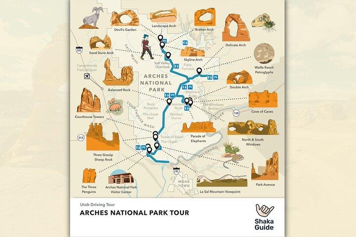
Arches National Park
The surreal beauty of Arches National Park awaits! Did you know that this one-of-a-kind park is home to the highest concentration of natural stone arches in the world? Yep! And you can experience the wonders of Arches on a self-guided audio tour with Shaka Guide. Visit famed arches like Delicate Arch, Landscape Arch, Double O Arch and more!
480 minutes
Admission Not Included
Arches National Park Visitor Center
The Visitor Center has necessities like water, snacks, and restrooms. This is a good place to fill up your water and purchase a few snacks. There is no other place in the park that sells food and the only other place that has drinking water is all the way at the end of the road at Devils Garden.
20 minutes
Admission Not Included
Moab Fault Overlook
At the Moab Fault viewpoint, you can see the result of enormous pressure that separated the area of the viewpoint with the cliff wall on the other side of the canyon.
20 minutes
Admission Not Included
Park Avenue Trail
City folks say you get the same feeling standing among the rock formations in Park Avenue that you do standing next to the towering skyscrapers in New York City.
20 minutes
Admission Not Included
La Sal Mountains Viewpoint
La Sal means the salt in Spanish. The mountains got their name in 1776 when Spanish explorers thought the snowy peaks looked like giant piles of salt. The highest peak, Mount Peale, is over 12,000 feet around 3,600 meters high
20 minutes
Admission Not Included
Courthouse Towers
Here you’ll find a series of huge sandstone rock formations like the Three Gossips, The Organ, and Sheep Rock.
20 minutes
Admission Not Included
Petrified Dunes Viewpoint
This is a vast landscape of these sort of lumpy rock formations. It may not look like it at first, but they are actually sand dunes, like on the Sahara. More specifically though, these are petrified sand dunes, meaning that the sand actually solidified into rock around 200 million years ago.
20 minutes
Admission Not Included
Balanced Rock Trail
Balanced Rock stands over 120 feet or 11 stories tall. This giant Hoodoo has a ball on top that appears to be perfectly balanced on the spire below.
20 minutes
Admission Not Included
The Windows Rd
This area features more than 30 different magnificent arches including The Windows, Turret Arch, and Double Arch, which was featured in the opening scenes of Indian Jones and the Last Crusade.
20 minutes
Garden of Eden
The Garden of Eden is a great place to wander around. This is an open terrain dotted with fins, windows, and miniature arches, or even arches still being formed. There's no designated trail so be sure you watch your step for any biocrust. You can find the owl rock just a short distance from the parking lot.
20 minutes
Pothole Arch
Pothole arch is unlike the rest of the arches you’ll see on the tour because, while those arches are vertical, this arch is horizontal.
20 minutes
Admission Not Included
Panorama Point
From this high vantage point, you can see for miles and miles in several directions. To the north is Devil's Garden and the Fiery Furnace. To the south you can see Elephant Butte, the highest point in the park at 5,600 feet.
20 minutes
Delicate Arch
This is probably the most famous Arch in Arches National Park. In fact, it’s on the Utah state license plate! While Delicate Arch is certainly not one of the tallest in the park, this iconic formation has a special charm that has attracted people from all over the world.
20 minutes
Admission Not Included
Delicate Arch Viewpoint
If you don’t have time or don’t have a reservation to make the three-mile hike to Delicate Arch, you can still see the arch from two viewpoints. The trail to the lower viewpoint is just a short 100-foot walk from the parking lot. The second trail is to the upper viewpoint, about a half mile round trip.
20 minutes
Salt Valley Overlook
The Salt Valley was once called the paradox formation because early geologists couldn’t determine how it was created. It’s a good thing you’ve got Shaka Guide to make everything clear.
20 minutes
Admission Not Included
Fiery Furnace
This place got its name because the rocks here glow as if they're on fire when the sun is at the right angle. There is a permit-only hike through the Fiery Furnace but permits are limited and must be reserved online. We don’t recommend the hike on our tour due to its difficulty, but if you really want to hike it, you can make a reservation here.
20 minutes
Admission Not Included
Sand Dune Arch Trail
Here you can walk a short distance to visit Sand Dune Arch, which includes a sort of sand pit that children of all ages like to play in. There’s a two-mile hike to Broken Arch and a rough road that will take you further to Tower Arch.
20 minutes
Admission Not Included
Skyline Arch
This large arch sits just above the horizon framing the sky as a wonderful window arch. No hiking is required, but if you want, just 10 minutes on foot will get you up close to the arch.
20 minutes
Admission Not Included
Devils Garden
Walk around and check out the arches. The hike is short - about two miles - and it's well-worth it. You'll also find picnic tables and a restroom if you want to relax for a while. The most famous formation at the Devils Garden Trail is definitely the Landscape Arch, the longest arch in North America.
20 minutes
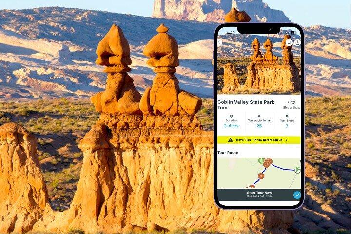
Temple Mountain Wash Pictograph Panel
The first stop on the Goblin Valley State Park Tour! These are accessible by an easy-to-reach trail, this panel depicts dogs, other animals, human figures, and symbols. Some of these pictographs are over 6 ft tall!
15 minutes
Wild Horse Window Trailhead
This 1.8-mile out-and-back trail is generally considered a moderately challenging route, it takes around an hour to complete.
60 minutes
Visitor Center: The restrooms in the Visitor Center are newly renovated and feature flushing toilets. While you’re there, don’t forget to talk to a ranger and ask about any special programs going on that day.
15 minutes
Goblin Overlook
This overlook gives you an amazing view of the first valley, and all of it's little 'goblin' inhabitants.
180 minutes
Three Sisters
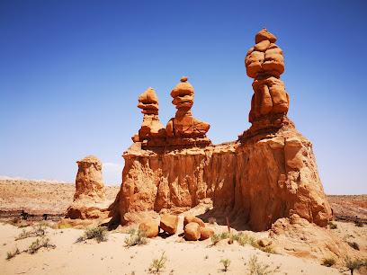
Perhaps the most iconic feature in the park, the Three Sisters features three recognizable and picturesque pillars of rock.
15 minutes
Entrada Canyon Trailhead
This 1.8-mile out-and-back trail is generally considered an easy route, it takes an average of 40 min to complete.
30 minutes
Little Wild Horse Canyon
This slot canyon hike is family friendly, despite it containing several narrows (places where you need to turn to the side to fit through).
15 minutes
Dinosaur Tracks Trailhead
A 1.5 mile round-trip hike that's considered moderate, because it inclines about 200 feet. The trailhead is at the Utah Port of Entry, 3 miles north of Kanab. Park in the lot, and the trail starts just behind the port-a-potty.
60 minutes
Sand Caves
These man-made caves were formed by miners who excavated sand in the early 20th century. The hike to the caves is short and easy; about a mile, and the terrain is mostly soft sand. There is no cost, and visitors can explore the interconnected tunnels and chambers.
60 minutes
Moqui Cave
This museum showcases artifacts and exhibits related to the Moqui Indians, who inhabited the region for centuries. Visitors can learn about the Moqui people's way of life, their traditions, and their unique culture. The museum also features displays on the geology and natural history of the area.
Peek-A-Boo Slot Canyon
The hike to the canyon is short and easy, making it accessible for most people. The trail is only about 0.7 miles round-trip, and it features a gradual elevation gain.
60 minutes
Elkheart Cliffs
Very short slot canyon along an unnamed wash draining the south end of the Elkheart Cliffs; nice passages through stripy rocks, plus a few dry falls, pothole,s and possible pools. Also known as Diana's Throne Canyon
60 minutes
Belly of the Dragon
An easy, flat,1.8 miles out-and-back trail The primary attraction is the man-made tunnel which was originally constructed as a drainage culvert under Highway 89. The water flow has eroded the sandstone walls, creating a fascinating and visually striking tunnel. You'll need to scramble down a short distance to get to the tunnel. After exiting the tunnel, you can continue along the trail for a short distance, exploring the surrounding area and enjoying the scenic views.
Mount Carmel
Founded by Jack and Fern Morrison, the town has a strong sense of community and a deep appreciation for the arts. Highlights include the Maynard Dixon art gallery, which includes Dixon's famous American Southwest landscape paintings, and the historic Rock Church.
The Rock Stop
The shop offers a diverse range of items, including: handmade crafts Native American artifacts Zion National Park souvenirs Utah-themed gifts food snacks Whether you're looking for a one-of-a-kind memento or a tasty treat, the Rock Stop is a great place to stop by during your visit to southern Utah.
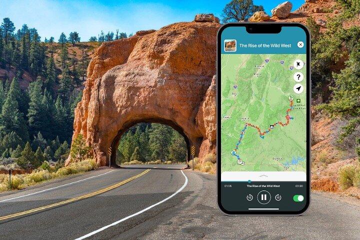
Red Canyon
Red Canyon State Park offers a variety of outdoor activities and hiking trails for visitors to enjoy. Popular hikes include the Canyon Overlook Trail, Castleton Trail, and Peekaboo Loop Trail, which offer stunning views of the park's red rock formations and surrounding landscape. In addition to hiking, visitors can enjoy biking, horseback riding, camping, and picnicking at the park. Whether you're seeking a leisurely stroll or a challenging adventure, Red Canyon State Park has something to offer for everyone.
Bryce Canyon City
Bryce Canyon City serves as a gateway to the breathtaking Bryce Canyon National Park, offering a variety of activities and attractions. Visitors can explore the park's iconic hoodoos on hiking trails, take scenic drives, stargaze, and participate in ranger-led programs. In addition to park activities, Bryce Canyon City offers shopping, dining, horseback riding, golfing, and access to nearby attractions like Dixie National Forest and Red Canyon State Park. With its combination of natural beauty, outdoor adventures, and cultural experiences, Bryce Canyon City is a popular destination for visitors seeking a memorable getaway.
Mossy Cave Trail
A flat, easy, 0.8 mile round trip trail that's technically part of Bryce Canyon National Park. The trail leads to a cool, moist cave formed by water erosion. The cave is adorned with moss and ferns, creating a peaceful and tranquil atmosphere. Along the trail, you'll enjoy views of the surrounding landscape, including towering hoodoos and pine trees. Keep an eye out for wildlife, such as deer, squirrels, and birds.
Kodachrome Basin State Park
The park offers a variety of outdoor activities for visitors to enjoy. Explore the park's unique geological formations, including towering sandstone spires and colorful rock formations. Hike along scenic trails, such as the Panorama Trail or the Lower Cathedral Trail, which offer breathtaking views of the park. Enjoy camping, picnicking, and stargazing under the park's dark skies. For a more adventurous experience, try rock climbing or canyoneering in the park's challenging terrain.
15 minutes
Admission Not Included
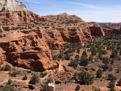
This is a unique opportunity to explore ancient fossilized trees and stunning red rock formations. Visitors can hike through the park's scenic trails, including the Whispering Sands Trail and the Petrified Forest Trail, which lead to areas with preserved petrified trees. The park also features a visitor center with exhibits on the area's geology and history. For a more adventurous experience, try rock climbing or canyoneering in the park's challenging terrain.
15 minutes
Admission Not Included
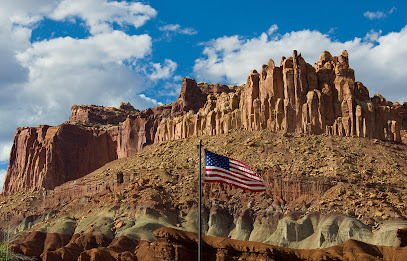
The Escalante Interagency Visitor Center is a great starting point for exploring the Escalante-Grand Staircase National Monument. The center offers informative exhibits on the area's geology, history, and wildlife. Obtain maps, permits, and recommendations for hiking, camping, and other outdoor activities. The center also has a bookstore with a variety of books, souvenirs, and educational materials. Additionally, the visitor center staff can provide information on local attractions, events, and accommodations.
Hell's Backbone Road
Hell's Backbone Scenic Byway is approximately 40 miles long and winds through the heart of southern Utah's red rock country. The road is well-maintained, but it does have some steep grades and winding curves. A passenger car is generally sufficient for driving the byway, but a vehicle with good ground clearance is recommended for exploring some of the off-road areas.
Escalante Heritage Center
The Escalante Heritage Center offers a glimpse into the rich history and culture of the Escalante area. Visitors can explore exhibits on the region's early inhabitants, including the Fremont and Anasazi cultures. The center also features artifacts, photographs, and interactive displays that showcase the area's pioneer heritage and the role of ranching and agriculture in the local economy. Additionally, the center offers educational programs, workshops, and events throughout the year.
Hole In The Rock Road
Hole in the Rock Wayside is a scenic overlook along Highway 12 in Utah, offering breathtaking views of the surrounding landscape.
Head of the Rocks Overlook

Head of the Rocks Overlook offers a breathtaking panoramic view of the Escalante River Valley. From this vantage point, you'll be captivated by the towering sandstone cliffs, vibrant red rock formations, and the meandering river below. The overlook provides a stunning glimpse into the dramatic landscape of the Escalante-Grand Staircase National Monument.
Boynton Overlook
Boynton Overlook gives visitors a bird's eye view of the riparian area along the meandering Escalante River. The overlook was named for John Boynton, a cattleman caught in a confrontation over a woman that ended with murder in 1878. Today, the overlook serves as a welcome stop to experience the sights and sounds of the Escalante River Canyon.
Kiva Koffeehouse
Built into a native American Kiva, Kiva Koffeehouse's mission is to provide a beautiful setting for guests and families to gather and connect with nature while enjoying a wholesome meal, delicious pastry, or just a great cup of coffee.
Escalante River Trailhead
The Escalante River Trail offers a scenic hike along the Escalante River. The trail is approximately 1.5 miles long and features a variety of terrain, including sandy sections, rocky outcroppings, and shaded areas. Along the trail, you'll enjoy views of the river, towering sandstone cliffs, and lush vegetation. Keep an eye out for wildlife, including deer, elk, and various bird species. The trail is suitable for hikers of all levels, but it's important to wear appropriate footwear and bring plenty of water, especially during the warmer months.
Lower Calf Creek Falls
a 6-mile round-trip hike that leads to a spectacular 126-foot waterfall. It follows a relatively flat sandy trail along Calf Creek, offering scenic views of canyon walls, native plants, and ancient rock art on the way. The waterfall at the end is a breathtaking highlight, with clear, cool waters pooling at the base, inviting hikers to wade or swim. This popular trail has minimal shade, so it’s best to hike it early or in cooler weather.
Calf Creek Viewpoint
Calf Creek Viewpoint offers a breathtaking panorama of the Escalante River Valley and Lower Calf Creek Falls. From this elevated vantage point, you'll be captivated by the towering sandstone cliffs, vibrant red rock formations, and the cascading waterfall below. The viewpoint provides a stunning glimpse into the dramatic landscape of the Escalante-Grand Staircase National Monument.
A distinctive geological feature along Scenic Byway 12 in Utah, characterized by a narrow ridge with steep slopes on either side. The Hogback formation offers stunning panoramic views of the surrounding landscape, including the Escalante River Valley, the La Sal Mountains, and the Henry Mountains. This unique landmark is a popular stopping point for visitors to admire the breathtaking scenery and capture memorable photographs.
Upper Calf Creek Falls
The Upper Calf Creek Falls Trail i is a short but steep 2-mile round-trip hike leading to a stunning 88-foot waterfall. The trail is challenging due to its steep descent over slick rock and minimal shade, making it best suited for experienced hikers. However, those who make the trek are rewarded with views of the waterfall, which cascades into a cool, clear pool perfect for wading or swimming in warmer months
Boulder
This picturesque community offers a variety of outdoor activities and attractions, including hiking, biking, fishing, and horseback riding. Explore the nearby Escalante River, hike through the towering sandstone cliffs of the monument, or visit the Escalante Interagency Visitor Center for information on the area's history and natural wonders. Boulder also features a variety of local shops, restaurants, and accommodations, providing a welcoming atmosphere for visitors.
Anasazi State Park Museum
The Anasazi State Park Museum in Boulder, Utah offers a fascinating glimpse into the ancient Anasazi civilization. The museum features exhibits showcasing the artifacts, pottery, and rock art of these prehistoric people. Visitors can learn about the Anasazi's daily life, their trade routes, and their mysterious disappearance. The museum also provides information on the area's geology and natural history. There is typically a small entrance fee to the museum, but it's a worthwhile investment to learn more about this fascinating culture.
Dixie National Forest
The forest is home to towering red rock formations, deep canyons, and lush forests. Visitors can enjoy hiking, camping, fishing, horseback riding, and other outdoor activities. The forest is also a great place for wildlife viewing, with the opportunity to spot deer, elk, and various bird species. There is no entrance fee to Dixie National Forest, making it a free and accessible destination for outdoor enthusiasts
Homestead Overlook
From this elevated vantage point, you'll be captivated by the towering sandstone cliffs, vibrant red rock formations, and the meandering river below. The overlook provides a stunning glimpse into the dramatic landscape of the Escalante-Grand Staircase National Monument. While the overlook itself is primarily a geological feature, you may be able to spot wildlife such as deer, elk, or various bird species in the surrounding area. The plant life in the region is adapted to the arid climate and includes desert shrubs, cacti, and grasses.
Wildcat Rest Area and Information Center
The rest area features picnic tables, restrooms, and interpretive signs that provide information about the area's geology and history. While there aren't any designated hiking trails directly at the rest area, you can enjoy short walks along the nearby dirt roads and explore the surrounding landscape. Keep an eye out for wildlife such as deer, elk, and various bird species. The plant life in the region is adapted to the arid climate and includes desert shrubs, cacti, and grasses.
Torrey
Torrey offers a variety of outdoor activities and attractions. Explore the nearby Escalante River, hike through the towering sandstone cliffs of the monument, or visit the Escalante Interagency Visitor Center for information on the area's history and natural wonders. Enjoy a meal at one of the local restaurants, browse the unique shops, or visit Capitol Reef National Park.
The experience can be subject to change due to bad weather or unforseen circumstances. We always endeavour to give you the best possible experience.
Additional Information
-
 Begin Your Journey: • Select Your Tour: Go to the My Stuff tab in the Shaka Guide app to launch the tour. • Start the Tour: Select the tour starting point and follow the GPS instructions. • Follow Shaka Guide: Stick to the suggested route and speed for the best experience.
 -
Get Started Easily: • Book Your Tour: Receive a confirmation and easy instructions via email. • Download the App: Follow the simple steps in your email. • Redeem the Tour: Use the redeem code in your email to redeem the tour in the app. • Prepare Ahead: Download the tour using strong Wi-Fi.
-
Infants and small children can ride in a pram or stroller
-
Private and Personalized: • Crowd-Free: Enjoy a private tour with just your group. • Customizable Stops: Pick the stops you want and skip the ones you don’t!
-
Service animals allowed
-
Suitable for all physical fitness levels
-
The Ultimate Guided Tour: • Detailed Itinerary: Includes travel tips and recommendations. • Engaging Narration: Captivating stories and history.
-
Top Features: • Hands-Free: The tour works automatically - GPS-activated stories, directions, and music play as you drive for a seamless experience. • Works Offline: No need for continuous wifi or data. • Reliable Support: Get help via call, chat, or email.
-
What Our Users Say: • “A fantastic way to explore! Easy to use and very informative.” • “Loved the flexibility to stop and go as we pleased. Highly recommend!”
-
Wheelchair accessible
-
Why Choose Our Audio Tour: • Cost-Efficient: One tour for the entire vehicle—no per-person fees! • Ultimate Flexibility: Start, pause, and resume on your schedule. • Convenience: Use the tour any day, over multiple days if needed.
What our experts say
-
 Bring snacks, few food options available.
 -
Download tours before arriving for offline access.
-
Plan hikes early to avoid the heat.
-
Check for ranger talks at visitor centers.
-
Consider visiting nearby Moab for dining options.

More About this Experience
Experience the breathtaking beauty and diverse landscapes of Utah with the Utah Mighty 5 Adventure Bundle: 8 Self-Guided Audio Tours. This incredible package invites adventurers to explore all five of Utah's iconic national parks: Arches, Canyonlands, Bryce Canyon, Capitol Reef, and Zion. Each audio tour is meticulously designed to guide you through stunning vistas and hidden gems, ensuring that you won't miss any of the remarkable sights. With turn-by-turn GPS navigation and engaging storytelling, this bundle offers the perfect blend of freedom and guidance, allowing you to explore at your own pace without the stress of planning or logistics. The tours are packed with fascinating history, local legends, and insider tips, all narrated by your personal audio guide, making this an unforgettable journey through Utah's natural wonders. What to expect? Expect an expansive adventure that takes you through the heart of Utah's wild landscapes. With eight self-guided audio tours, you'll not just see the sights but truly understand their significance. From the iconic arches of Arches National Park to the stunning vistas of Zion, every stop offers unique insights and stories that breathe life into the stunning scenery. The app ensures a seamless experience, activating audio as you drive, which means you can sit back and soak in the views while learning about the fascinating geology and history of the area. With offline maps and GPS navigation, you can explore without worrying about connectivity, making your adventure truly liberating. And the best part? You can take these tours whenever you want; they never expire! This adventure bundle is perfect for various types of travelers. Whether you are a family looking for a fun and educational experience, a couple seeking romantic getaways amidst nature, or a solo traveler on a quest for adventure, this tour bundle caters to all. Outdoor enthusiasts, history buffs, and photography lovers alike will find joy in discovering the beauty of Utah's national parks. The tours are designed to be accessible for all physical fitness levels, so even those who prefer leisurely strolls can enjoy the beauty that Utah has to offer. With the flexibility to customize your stops and explore at your own pace, this experience suits everyone from thrill-seekers to casual sightseers. Why book this? The Utah Mighty 5 Adventure Bundle is the ultimate way to experience Utah’s natural beauty and rich history without the hassle of traditional guided tours. It’s a unique blend of structured guidance and freedom, allowing you to tailor your adventure to your liking. This audio tour package stands out because it doesn’t just provide directions; it enriches your journey with engaging stories and captivating music. Plus, with the cost-effectiveness of one price for your entire vehicle, you can share these incredible experiences with friends and family without worrying about per-person fees. The tours are designed to give you the flexibility to start, pause, and resume your journey whenever you wish, making it an ideal choice for those who want to explore without constraints. Good to know: Before diving into your adventure, it’s helpful to download the Shaka Guide app using a strong Wi-Fi connection. This ensures all audio content is available offline, allowing you to navigate Utah’s parks without the need for data. The tours are ideal for all ages and accessible to those with mobility challenges. Service animals are welcome, ensuring that everyone can enjoy the experience. Always remember to pack plenty of water, snacks, and sunscreen, especially during warmer months. Given the diverse terrain and varying weather conditions, it's wise to wear comfortable, sturdy footwear and be prepared for unexpected changes in climate and elevation as you explore these magnificent parks. Reviews from satisfied adventurers highlight the flexibility and informative nature of the tours, with many praising the ease of use and the captivating stories shared throughout the journey. Customers have expressed their delight in being able to stop whenever and wherever they choose, reveling in the freedom to explore at their own pace. The audio narration has received rave reviews for its engaging storytelling, making even the longest drives enjoyable. Travelers cherish the unique experience of a private tour, feeling connected to the stunning landscapes of Utah while learning about the natural wonders that surround them. Overall, the Utah Mighty 5 Adventure Bundle is highly recommended by those who have experienced its magic firsthand.

Your all‑in‑one travel companion app
Explore expert travel guides, compare and book tours, experiences, hotels, and more—all from the palm of your hand. Download now for seamless trip planning wherever your wanderlust takes you.


This is a popular product and the date you are looking for just sold out. Next available date is
